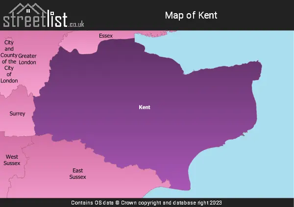
The Ceremonial County of Kent is situated in South East England.

The area of Kent is 1,509 Square Miles (3,908 Square Kilometres). Making Kent the 16th largest county in Great Britain (out of 91) and the 8th largest county in England (out of 48).
At the time of Bede, there were seven Anglo-Saxon kingdoms. One of these was the land of the Cantii, also the name of a British tribe (sometimes called the Cantiaci).
The Cantii, whose border was the River Medway, minted their own coins before the Roman conquest. From one of these coins, we know the name of an ancient King of Kent: Dubnovellaunus, whose capital likely became the Roman city Durovernum Cantiacorum, known today as Canterbury.
Canterbury's name is derived from the Brythonic Cair Ceint and Old English Cantwareburh, both meaning "Fortress of Kent" or "Fort of the People of Cent."
In the last century, Kent earned the title "the Garden of England," first mentioned in 1790 2. However, during my research, I uncovered several news sheets from around 1770 that describe Hertford (Hertfordshire) as "the Granary and Garden of England." One such example reads: "The country Hertford is called the Granary and Garden of England, and this harvest is granted, even unwilling farmers, one of the finest ever known, for all kinds of grain throughout their county." 1
These early records show that Hertfordshire held a similar reputation before Kent, particularly for its prominence in producing grain, malt, and meal, with merchants profiting significantly from their dealings in London.
In 1770, Kent, particularly East Kent, was renowned for producing high-quality wheat and barley, establishing its agricultural importance.
Kent forms a promontory into the English Channel at its narrowest point and is the part of England closest to France, only about 20 miles away.
The port of Dover (from the Celtic Dofras, meaning "Waters") has long been England's gateway to France and the wider world. The Romans built a lighthouse at Dover, still standing at Castle Hill, to guide ships into port. At Richborough, they constructed a port and a giant triumphal arch marking the start of Watling Street, leading to Canterbury, London, and the province of Britannia.
Nearby, Ebsfleet on the Isle of Thanet is the legendary landing site of Hengist and Horsa, the first Jutish kings of Kent and the beachhead of the Anglo-Saxon invasion.
Kent was also traditionally a hop-growing region, with hops used in beer fermentation.
The largest town in Kent is Maidstone, the county town, situated on the River Medway.
Sources
- Hertford Garden of England:
- Kentish Gazette - Tuesday 14 August 1770
- Oxford Journal - Saturday 18 August 1770
- Leeds Intelligencer - Tuesday 21 August 1770
- Kent Garden of England:
- Kentish Gazette - Tuesday 21 June 1791

A map showing the geology of Kent.
| Map Key | Description |
|---|---|
| 21 | MUDSTONE, SILTSTONE AND SANDSTONE |
| 28 | SAND, SILT AND CLAY |
| 30 | CHALK |
| 48 | MUDSTONE, SANDSTONE AND LIMESTONE |
| 57 | SANDSTONE AND MUDSTONE |
| 74 | GRAVEL, SAND, SILT AND CLAY |
| 76 | SANDSTONE AND SILTSTONE, INTERBEDDED |
| 79 | CLAY, SILT, SAND AND GRAVEL |

A map showing the boundary of Kent in relation to other counties.
Map of the County of Kent
| Zoom Level | Latitude | Longitude |
| 6 | 53.521968 | -2.164306 |