
Map of the SY9 Postcode District
Explore the postcode district by using our interactive map.
Circles represent recorded crime; the larger the circle, the higher the crime rates.
Your support helps keep this site running!
If you enjoy using this website, consider buying me a coffee to help cover hosting costs.
Where is the SY9 District?
To give you an idea where the district is located we have created the following table showing nearby towns.
Nearest Towns to SY9
| Town | Distance (miles) | Direction |
|---|---|---|
| Montgomery | 7.75 | WNW |
| Church Stretton | 7.80 | ENE |
| Craven Arms | 7.98 | SE |
| Knighton | 11.58 | SSW |
| Welshpool | 12.66 | NNW |
| Newtown | 13.90 | W |
| Ludlow | 14.84 | SE |
| Presteigne | 16.18 | S |
| Shrewsbury | 16.98 | NE |
| Llanfair Caereinion | 17.32 | NW |
| Much Wenlock | 19.00 | ENE |
| Kington | 21.05 | S |
| Tenbury Wells | 21.41 | SE |
| Llanfyllin | 21.60 | NW |
| Leominster | 22.00 | SSE |
| Broseley | 22.44 | ENE |
| Cleobury Mortimer | 22.99 | ESE |
| Llanidloes | 23.67 | W |
| Bridgnorth | 23.96 | E |
The post town for this district is BISHOPS CASTLE.
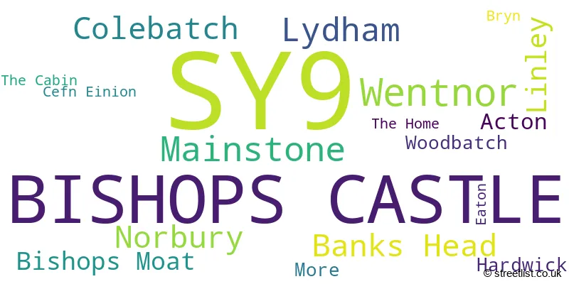
Postcode Information for District SY9 (Total Geographical Postcodes: 138)
| Location | Post Town | Sector | Number of Postcodes |
|---|---|---|---|
| BISHOPS CASTLE | BISHOPS CASTLE | SY9 5 | 72 |
| Wentnor | BISHOPS CASTLE | SY9 5 | 10 |
| Mainstone | BISHOPS CASTLE | SY9 5 | 8 |
| Lydham | BISHOPS CASTLE | SY9 5 | 7 |
| Norbury | BISHOPS CASTLE | SY9 5 | 6 |
| Banks Head | BISHOPS CASTLE | SY9 5 | 6 |
| Colebatch | BISHOPS CASTLE | SY9 5 | 6 |
| Linley | BISHOPS CASTLE | SY9 5 | 5 |
| Bishops Moat | BISHOPS CASTLE | SY9 5 | 4 |
| Acton | BISHOPS CASTLE | SY9 5 | 3 |
| Hardwick | BISHOPS CASTLE | SY9 5 | 2 |
| Woodbatch | BISHOPS CASTLE | SY9 5 | 2 |
| More | BISHOPS CASTLE | SY9 5 | 2 |
| Bryn | BISHOPS CASTLE | SY9 5 | 1 |
| The Home | BISHOPS CASTLE | SY9 5 | 1 |
| Cefn Einion | BISHOPS CASTLE | SY9 5 | 1 |
| Eaton | BISHOPS CASTLE | SY9 5 | 1 |
| The Cabin | BISHOPS CASTLE | SY9 5 | 1 |
Retail and Shopping in SY9
Street
Town
Locality
Number of Shops
Central Postcode
View on Google Maps
CHURCH STREET
BISHOPS CASTLE
16
SY9 5AD
View on Google Maps
HIGH STREET
BISHOPS CASTLE
13
SY9 5BE
View on Google Maps
MARKET SQUARE
BISHOPS CASTLE
13
SY9 5BN
View on Google Maps
| Street | Town | Locality | Number of Shops | Central Postcode | View on Google Maps |
|---|---|---|---|---|---|
| CHURCH STREET | BISHOPS CASTLE | 16 | SY9 5AD | View on Google Maps | |
| HIGH STREET | BISHOPS CASTLE | 13 | SY9 5BE | View on Google Maps | |
| MARKET SQUARE | BISHOPS CASTLE | 13 | SY9 5BN | View on Google Maps |
The primary settlement in the SY9 postcode district is Bishops Castle, located in the county of Shropshire, England. There are also other significant settlements within the district including Acton, Banks Head, Bishops Moat, Bryn, Cefn Einion, Colebatch, Eaton, Hardwick, Linley, Lydham, Mainstone, More, Norbury, The Cabin, The Home, Wentnor, and Woodbatch. The most significant postal town in the district is Bishops Castle.
When it comes to local government, postal geography often disregards political borders. However, this district intersects the following councils: the district mostly encompasses the Shropshire area with a total of 134 postal codes.
The largest settlement in the SY9 postal code is BISHOPS CASTLE followed by Wentnor, and Norbury.
The SY9 Postcode shares a border with SY5 (Minsterley, Pontesbury, Dorrington), SY15 (CHURCHSTOKE, MONTGOMERY, ABERMULE) and SY7 (CRAVEN ARMS, Leintwardine, Clun).
Postcode Sectors


Dentists in the SY9 District
| # | Name | Address | Type | Contact |
|---|---|---|---|---|
| 1 | Butler And Finnigan | DENTAL SURGERY , 2 MARKET SQUARE , BISHOPS CASTLE , SHROPSHIRE , SY9 5BN | GENERAL DENTAL PRACTICE |
Doctors in the SY9 District
| # | Name | Address | Type | Contact |
|---|---|---|---|---|
| 1 | Bishops Castle Medical Practice | , BISHOPS CASTLE , SY9 5ER | GP PRACTICE |
Chemists in the SY9 District
| # | Name | Address | Type | Contact |
|---|---|---|---|---|
| 1 | Bishops Castle Pharmacy | CHURCH STREET , BISHOPS CASTLE , SHROPSHIRE , SY9 5AE | PHARMACY |
Opticians in the SY9 District
| # | Name | Address | Type | Contact |
|---|---|---|---|---|
| 1 | THE OPTICIAN (BISHOPS CASTLE) | 29 CHURCH STREET , BISHOPS CASTLE , SY9 5AD | OPTICAL SITE |
Schools in the Sector
The Community College, Bishop's Castle
Phase: Secondary
Address: Brampton Road , Bishops Castle
Postcode: SY9 5AY
Headteacher: Mr Reuben Thorley (Headteacher)
Ofsted Rating: Good
Norbury Primary School and Nursery
Phase: Primary
Address: Norbury , Bishops Castle
Postcode: SY9 5EA
Headteacher: Mr Leslie Ball (Headteacher)
Ofsted Rating: Outstanding
Bishops Castle Primary School
Phase: Primary
Address: Oak Meadow , Bishops Castle
Postcode: SY9 5PA
Headteacher: Mr Andrew Barker (Headteacher)
Ofsted Rating: Good
Bishops Castle Primary School
Phase: Primary
Address: Oak Meadow , Bishops Castle
Postcode: SY9 5PA
Headteacher: Mrs Kate Mather (Headteacher)
Ofsted Rating: Good
Stations in the Sector
No stations found in this postcode district.
Accessable Motorway Junctions
M54 J7
Average Driving Time from within the district: 34.48
Average Driving Distance: 29.81
Number of Postcodes that can access the Motorway Junction: 136
M54 J6
Average Driving Time from within the district: 36.83
Average Driving Distance: 32.21
Number of Postcodes that can access the Motorway Junction: 136
M54 J5
Average Driving Time from within the district: 38.28
Average Driving Distance: 33.89
Number of Postcodes that can access the Motorway Junction: 136
M54 J4
Average Driving Time from within the district: 39.43
Average Driving Distance: 35.28
Number of Postcodes that can access the Motorway Junction: 133
M54 J3
Average Driving Time from within the district: 41.94
Average Driving Distance: 38.07
Number of Postcodes that can access the Motorway Junction: 44
Weather Forecast for Bishop's Castle
| Time Period | Icon | Description | Temperature | Rain Probability | Wind |
|---|---|---|---|---|---|
| 06:00 to 09:00 | Overcast | 0.0°C (feels like -2.0°C) | 11.00% | S 4 mph | |
| 09:00 to 12:00 | Cloudy | 1.0°C (feels like -3.0°C) | 16.00% | SSE 7 mph | |
| 12:00 to 15:00 | Cloudy | 3.0°C (feels like -1.0°C) | 4.00% | SSE 7 mph | |
| 15:00 to 18:00 | Partly cloudy (day) | 3.0°C (feels like 1.0°C) | 1.00% | SSE 7 mph | |
| 18:00 to 21:00 | Partly cloudy (night) | 1.0°C (feels like -2.0°C) | 5.00% | SSE 4 mph | |
| 21:00 to 00:00 | Mist | 1.0°C (feels like -2.0°C) | 15.00% | SSE 4 mph |
| Time Period | Icon | Description | Temperature | Rain Probability | Wind |
|---|---|---|---|---|---|
| 00:00 to 03:00 | Fog | 0.0°C (feels like -3.0°C) | 17.00% | SSE 7 mph | |
| 03:00 to 06:00 | Fog | 0.0°C (feels like -2.0°C) | 17.00% | S 4 mph | |
| 06:00 to 09:00 | Fog | 0.0°C (feels like -3.0°C) | 17.00% | SSW 4 mph | |
| 09:00 to 12:00 | Mist | 0.0°C (feels like -3.0°C) | 16.00% | S 4 mph | |
| 12:00 to 15:00 | Overcast | 2.0°C (feels like -1.0°C) | 9.00% | SSW 7 mph | |
| 15:00 to 18:00 | Overcast | 3.0°C (feels like 1.0°C) | 9.00% | S 7 mph | |
| 18:00 to 21:00 | Overcast | 2.0°C (feels like 0.0°C) | 10.00% | S 7 mph | |
| 21:00 to 00:00 | Overcast | 2.0°C (feels like 0.0°C) | 10.00% | S 7 mph |
| Time Period | Icon | Description | Temperature | Rain Probability | Wind |
|---|---|---|---|---|---|
| 00:00 to 03:00 | Overcast | 3.0°C (feels like 0.0°C) | 11.00% | S 4 mph | |
| 03:00 to 06:00 | Mist | 3.0°C (feels like 1.0°C) | 16.00% | S 4 mph | |
| 06:00 to 09:00 | Cloudy | 3.0°C (feels like 2.0°C) | 10.00% | SSW 4 mph | |
| 09:00 to 12:00 | Cloudy | 4.0°C (feels like 2.0°C) | 10.00% | SSW 4 mph | |
| 12:00 to 15:00 | Overcast | 6.0°C (feels like 4.0°C) | 9.00% | SSW 7 mph | |
| 15:00 to 18:00 | Cloudy | 7.0°C (feels like 5.0°C) | 6.00% | SSW 7 mph | |
| 18:00 to 21:00 | Overcast | 5.0°C (feels like 3.0°C) | 10.00% | S 4 mph | |
| 21:00 to 00:00 | Overcast | 4.0°C (feels like 2.0°C) | 10.00% | S 4 mph |
| Time Period | Icon | Description | Temperature | Rain Probability | Wind |
|---|---|---|---|---|---|
| 00:00 to 03:00 | Overcast | 3.0°C (feels like 1.0°C) | 10.00% | S 4 mph | |
| 03:00 to 06:00 | Fog | 3.0°C (feels like 0.0°C) | 16.00% | SSE 4 mph | |
| 06:00 to 09:00 | Fog | 2.0°C (feels like 0.0°C) | 17.00% | SSE 4 mph | |
| 09:00 to 12:00 | Cloudy | 2.0°C (feels like 0.0°C) | 9.00% | SSE 7 mph | |
| 12:00 to 15:00 | Cloudy | 4.0°C (feels like 1.0°C) | 10.00% | SSE 7 mph | |
| 15:00 to 18:00 | Cloudy | 4.0°C (feels like 2.0°C) | 12.00% | SE 7 mph | |
| 18:00 to 21:00 | Cloudy | 3.0°C (feels like 0.0°C) | 12.00% | SE 7 mph | |
| 21:00 to 00:00 | Cloudy | 2.0°C (feels like 0.0°C) | 12.00% | SE 4 mph |
| Postal Sector | Delivery Office |
|---|---|
| SY9 5 | Craven Arms Delivery Office |
| S | Y | 9 | - | X | X | X |
| S | Y | 9 | Space | Numeric | Letter | Letter |
Street List for the SY9 District
Current Monthly Rental Prices
| # Bedrooms | Min Price | Max Price | Avg Price |
|---|---|---|---|
| 3 | £1,000 | £1,000 | £1,000 |
Current House Prices
| # Bedrooms | Min Price | Max Price | Avg Price |
|---|---|---|---|
| £1 | £135,000 | £74,167 | |
| 1 | £140,000 | £150,500 | £145,250 |
| 2 | £225,000 | £500,000 | £318,000 |
| 3 | £195,000 | £850,000 | £372,333 |
| 4 | £300,000 | £650,000 | £475,000 |
| 6 | £600,000 | £900,000 | £750,000 |
| 7 | £550,000 | £550,000 | £550,000 |
| 9 | £695,000 | £695,000 | £695,000 |
Estate Agents
| Logo | Name | Brand Name | Address | Contact Number |
|---|---|---|---|---|
 | Bishops Castle | Halls Estate Agents | 33b Church Street, Bishops Castle, SY9 5AD | 01588 638755 |
 | Craven Arms | Samuel Wood | 10 Corvedale Road, Craven Arms, SY7 9ND | 01588 508101 |
 | Craven Arms | McCartneys LLP | Corvedale Road, Craven Arms, SY7 9NE | 01588 672385 |
 | Shrewsbury | Roger Parry & Partners | 165, Welsh Bridge, Frankwell, Shrewsbury, SY3 8LG | 01743 664106 |
 | Ludlow | Strutt & Parker | 26 Bull Ring, Ludlow, Shropshire, SY8 1AA | 01584 707605 |
Yearly House Price Averages for the District
| Type of Property | 2018 Average | 2018 Sales | 2017 Average | 2017 Sales | 2016 Average | 2016 Sales | 2015 Average | 2015 Sales |
|---|---|---|---|---|---|---|---|---|
| Detached | £330,955 | 22 | £322,498 | 20 | £309,530 | 15 | £263,767 | 15 |
| Semi-Detached | £189,000 | 9 | £151,300 | 5 | £153,000 | 6 | £157,400 | 5 |
| Terraced | £147,537 | 9 | £141,300 | 5 | £210,808 | 13 | £165,869 | 8 |
| Flats | £0 | 0 | £0 | 0 | £108,000 | 1 | £0 | 0 |