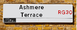
Ashmere Terrace is a street located . The street has a length of approximately 110 metres.
The street is publicly maintained which means that the road is adopted and Reading is responsible for the repair and upkeep of the highway.
The street is located within the Reading (B) Council's jurisdiction. They provide various services, like refuse collection, and manage council tax collection. It's situated in the region of the UK.
The road has been assigned the Unique Street Reference Number of 31000067 in the National Street Gazetteer.
It is located within the county of , situated in the region of the UK. It's 38.29 miles West from central London., 0.99 miles West from Reading, 13.86 miles North from Basingstoke and 21.21 miles North West from Woking.
ASHMERE TERRACE is within the Post Town of
Map of Ashmere Terrace
| Street Crime (updated 14/01/2025) | ||
|---|---|---|
| Location Note | Central Point of Street - Not Actual Location | |
| MSOA Info | For MSOA (Statistical Neighbourhood) | |
| Click Hint | Click on a Circle for a detailed breakdown below map. | |
| Crime Levels |
Green = Very Low Yellow = Low Orange = High Red = Very High |
|
| Postcodes | ||
| Icon | Postcodes for Ashmere Terrace | |
| Walking Distances | ||
| Distance Info | Green Circle = 10 Minutes Walk (800 metres) | |
Street Crime Data accessed from data.police.uk on 06/10/2024.
Moving to Ashmere Terrace?
I can help you uncover potential pitfalls and provide key questions to ask about your new property. With decades of experience as a Local Land Charges Manager, I offer confidential insights to make your move informed and stress-free.
This service is free, but you may wish to make an optional donation to support it. Please include the property name and address in your request as well as anything you wish to focus on.
Contact Me
Do you know why this road is called Ashmere Terrace?
What's it like to live here?
Share a Photo of Ashmere Terrace
Ask the community a question.
Do you have any questions, memories to share, have any photos or know any facts? We'd love to know more.
Submit Your Comment
Find Homes to Rent in Reading

Budget Friendly Hotels near Ashmere Terrace
| Budget Hotel Name | Distance (miles) |
|---|---|
|
1: Name:Premier Inn Reading Caversham Bridge Address: Richfield Avenue Telephone: Visit Hotel Page |
0.38 |
|
2: Name:Travelodge Reading Central Address: Oxthorn House, 60 Oxford Rd, Reading, RG1 7LT Telephone: 0871 984 6211 Visit Hotel Page |
0.73 |
|
3: Name:easyHotel Reading Address: 132-138, Caversham Road Telephone: Visit Hotel Page |
0.76 |
|
4: Name:Premier Inn Reading Central Address: Letcombe Street Telephone: Visit Hotel Page |
1.12 |
|
5: Name:Travelodge Reading Whitley Address: 387 Basingstoke Rd, Reading, RG2 0JE Telephone: 0871 984 6209 Visit Hotel Page |
2.41 |
Hotel Options
Your support helps keep this site running!
If you enjoy using this website, consider making a donation to help me cover hosting costs.
Nearby Estate Agents
| Name | Address | Website |
|---|---|---|
| Reading Estate Agent | 419 Oxford Road, Reading, RG30 1HA | Visit Website |
| Smart Move | 152 Oxford Road, Reading,RG1 7PJ | Visit Website |
| A1 Property Management | 525 Oxford Road, Reading, Berkshire,RG30 1HJ | Visit Website |
| You Rent | Lismore House, 28b Wilton Road, Reading,RG30 2SS | Visit Website |
| AH Lansley Residential | 111 Oxford Road, Reading, RG1 7UH | Visit Website |
Neighbourhood Policing |
| Police Force: |
| Find a Local Neighbourhood Watch Scheme |
Location Details
| Ashmere Terrace | |
|---|---|

| |
| Latitude | 51.460554 |
| Longitude | -0.992925 |
| OS Easting (X): | 469956 |
| OS Northing (Y): | 174043 |
| OS Grid Reference: | SU700740 |
Roads that have a Junction with Ashmere Terrace
| Street | Junction Type |
|---|---|
| Loverock Road | junction |
| Portman Road | junction |
Sunset and Sunrise times
| Sunrise | 07:37 |
|---|---|
| Sunset | 16:57 |
Latest Weather Conditions
| Observed at Weather Station: | Benson 2 February 2025 at 21:00 (11.89 miles away) |
|---|---|
| Current Weather: | Clear night |
| Temperature and Humidity: | 1.2°C (93.7%) |
| Wind Direction and Speed: | SSE (9 mph) |
Population Statistics
Nearest Supermarkets
| Tesco Reading W Extra |
|---|
| Portman Rd, Reading, RG30 1AW |
| 0345 026 9558 |
| Distance: 0.29 Miles |
| Directions to Tesco Reading W Extra |
| Tesco Oxford Rd Express |
|---|
| 211-221 Oxford Rd, Reading, RG1 7PX |
| 0345 610 6350 |
| Distance: 0.47 Miles |
| Directions to Tesco Oxford Rd Express |
| Tesco Reading Tilehurst Express |
|---|
| 12 Tilehurst Rd, Reading, RG1 7TN |
| 0345 610 2789 |
| Distance: 0.65 Miles |
| Directions to Tesco Reading Tilehurst Express |
| Tesco Reading Oxford Rd Express |
|---|
| 28 Oxford Rd, Reading, RG1 7LA |
| 0345 610 2847 |
| Distance: 0.77 Miles |
| Directions to Tesco Reading Oxford Rd Express |
Telephone Information
| Area Code |
|---|
| Area Code: 0118 - Reading |
| Area Code: 01491 - Henley-on-Thames |
Local Government
| Local Council Details |
|---|
| Within the area of |
| Local Member of Parliament |
|---|
| Within the Westminster Parliamentary Constituency of |
| The Member of Parliament is |
| Details for the MP on parliament.uk |
| Details for the MP on theyworkforyou.com |
| In the 2024 General Election won with a majority of 0 the result was . The total electorate was 0 |
| Wards, Parish Councils and County Councils |
|---|
| Ward: Ward |
| Parish: Unparished area |
| Ceremonial County: |
Nearest Schools
England Primary Schools
St Anne's Catholic Primary School
Address: St Anne's Catholic Primary School, Washington Road, Caversham, St Anne's School, Reading, Berkshire, RG4 5AA
Distance: 1.26 miles
Contact: 01189375537
Thameside Primary School
Address: Thameside Primary School, Harley Road, Caversham, Reading, Berkshire, RG4 8DB
Distance: 1.01 miles
Contact: 01189375551
St Mary and All Saints Church of England Voluntary Aided Primary School
Address: St Mary and All Saints Church of England Voluntary Aided Primary School, Wensley Road, Coley Park, Reading, Berkshire, RG1 6DU
Distance: 1.20 miles
Contact:
Caversham Primary School
Address: Caversham Primary School, Hemdean Road, Caversham, Reading, Berkshire, RG4 7RA
Distance: 1.15 miles
Contact: 01189375454
E P Collier Primary School
Address: E P Collier Primary School, Ross Road, Reading, Berkshire, RG1 8DZ
Distance: 0.69 miles
Contact: 01189375470
Katesgrove Primary School
Address: Katesgrove Primary School, Dorothy Street, Reading, Berkshire, RG1 2NL
Distance: 1.19 miles
Contact: 01189375490
Coley Primary School
Address: Coley Primary School, Wolseley Street, Reading, Berkshire, RG1 6AZ
Distance: 1.01 miles
Contact: 01189375461
Civitas Academy
Address: Civitas Academy, 90a Great Knollys Street, Reading, Berkshire, RG1 7HL
Distance: 0.45 miles
Contact: 01184676720
Oxford Road Community School
Address: Oxford Road Community School, 146 Oxford Road, Reading, Berkshire, RG1 7PJ
Distance: 0.39 miles
Contact: 01189375511
All Saints Junior School
Address: All Saints Junior School, August House, Brownlow Road, Reading, Berkshire, RG1 6NP
Distance: 0.65 miles
Contact: 01189393362
All Saints Church of England Aided Infant School
Address: All Saints Church of England Aided Infant School, Brownlow Road, Reading, Berkshire, RG1 6NP
Distance: 0.65 miles
Contact: 01189375413
Battle Primary Academy
Address: Battle Primary Academy, Cranbury Road, Reading, Berkshire, RG30 2TD
Distance: 0.51 miles
Contact: 01189375421
Southcote Primary School
Address: Southcote Primary School, Silchester Road, Southcote, Reading, Berkshire, RG30 3EJ
Distance: 1.31 miles
Contact: 01189375533
Wilson Primary School
Address: Wilson Primary School, Wilson Road, Reading, Berkshire, RG30 2RW
Distance: 0.63 miles
Contact: 01189375573
Ranikhet Academy
Address: Ranikhet Academy, Spey Road, Tilehurst, Reading, Berkshire, RG30 4ED
Distance: 1.07 miles
Contact: 01189375520
Ranikhet Primary School
Address: Ranikhet Primary School, Spey Road, Tilehurst, Reading, Berkshire, RG30 4ED
Distance: 1.07 miles
Contact:
English Martyrs' Catholic Primary School
Address: English Martyrs' Catholic Primary School, Dee Road, Tilehurst, Reading, Berkshire, RG30 4BE
Distance: 1.25 miles
Contact: 01189375466
Moorlands Primary School
Address: Moorlands Primary School, Church End Lane, Tilehurst, Reading, Berkshire, RG30 4UN
Distance: 1.58 miles
Contact: 01189375505
St Michael's Primary School
Address: St Michael's Primary School, Dee Road, Tilehurst, Reading, Berkshire, RG30 4AS
Distance: 1.43 miles
Contact: 01189015550
Meadow Park Academy
Address: Meadow Park Academy, Norcot Road, Tilehurst, Reading, Berkshire, RG30 6BS
Distance: 1.61 miles
Contact: 01189375562
England Secondary Schools
Kendrick School
Address: Kendrick School, London Road, Reading, Berkshire, RG1 5BN
Distance: 1.39 miles
Contact: 01189015859
Kendrick School
Address: Kendrick School, London Road, Reading, Berkshire, RG1 5BN
Distance: 1.39 miles
Contact:
The WREN School
Address: The WREN School, 61-63 Bath Road, Reading, Berkshire, RG30 2BB
Distance: 1.02 miles
Contact: 01182143888
Blessed Hugh Faringdon Catholic School
Address: Blessed Hugh Faringdon Catholic School, Fawley Road, Southcote, Reading, Berkshire, RG30 3EP
Distance: 1.20 miles
Contact: 01189574730
King's Academy Prospect
Address: King's Academy Prospect, Cockney Hill, Tilehurst, Reading, Berkshire, RG30 4EX
Distance: 1.40 miles
Contact: 01189590466
Nearest Hospitals
| Spire Dunedin Hospital |
|---|
| Address: 16 Bath Road, Reading, RG1 6NS, |
| Independent Sector |
| Spire Healthcare |
| Telephone: 0118 9587676 |
| Visit Hospital Website |
| Distance: 1.22 (miles) |
| Directions from to Spire Dunedin Hospital |
| The Berkshire Independent Hospital |
|---|
| Address: Swallowscroft, Wensley Road, Reading, RG1 6UZ, |
| Independent Sector |
| Ramsay Healthcare UK Operations Limited |
| Telephone: 0118 902 8121 |
| Visit Hospital Website |
| Distance: 1.81 (miles) |
| Directions from to The Berkshire Independent Hospital |
| Prospect Park Hospital |
|---|
| Address: Honey End Lane, Tilehurst, Reading, RG30 4EJ, |
| NHS Sector |
| Berkshire Healthcare NHS Foundation Trust |
| Telephone: 0118 960 5000 |
| Visit Hospital Website |
| Distance: 1.97 (miles) |
| Directions from to Prospect Park Hospital |
Nearest Dentists
Dentists
OXFORD ROAD (DENTAL SURGERY)
Address: 165 OXFORD ROAD, READING, BERKSHIRE, RG1 7UZ
Distance: 0.51 miles
Contact: :
LEWIS DENTAL SURGERY
Address: 124 OXFORD ROAD, READING, BERKSHIRE, RG1 7NL
Distance: 0.52 miles
Contact: :
ZENITH HOUSE
Address: CHEAPSIDE, READING, BERKSHIRE, RG1 7AQ
Distance: 0.75 miles
Contact: :
20 BRIDGE STREET (DENTAL SURGERY)
Address: 20 BRIDGE STREET, CAVERSHAM, READING, BERKSHIRE, RG4 8AA
Distance: 0.81 miles
Contact: :
FRIAR STREET DENTAL SURGERY
Address: 15 FRIAR STREET, READING, BERKSHIRE, RG1 1DB
Distance: 0.97 miles
Contact: :
CAVERSHAM HEIGHTS DENTAL PRACTICE
Address: 25A KIDMORE ROAD, CAVERSHAM, READING, RG4 7LR
Distance: 1.02 miles
Contact: :
Nearest GP Surgeries
Doctors
WESTERN ELMS & CIRCUIT LANE SURGERIES
Address: WESTERN ELMS LODGE, WESTERN ELMS AVENUE, READING, RG30 1AT
Distance: 0.33 miles
Contact: tel: 0118 9590257
CHATHAM STREET SURGERY
Address: 121 CHATHAM STREET, READING, BERKSHIRE, RG1 7JE
Distance: 0.58 miles
Contact: tel: 0118 9505121
ABBEY MEDICAL CENTRE
Address: 41 RUSSELL STREET, READING, BERKSHIRE, RG1 7XD
Distance: 0.64 miles
Contact: tel: 0118 9573752
RUSSELL STREET SURGERY
Address: 79 RUSSELL STREET, READING, RG1 7XG
Distance: 0.71 miles
Contact: tel: 0844 4778553
GROVELANDS MEDICAL CENTRE
Address: 701 OXFORD ROAD, READING, BERKSHIRE, RG30 1HG
Distance: 0.73 miles
Contact: tel: 0118 9582525
BROAD STREET HEALTH CENTRE
Address: 1ST FLOOR, BROAD ST HC, 103-105 BROAD STREET MALL, READING, RG1 7QA
Distance: 0.83 miles
Contact: tel: 0118 9028300
Nearest Dispensing Chemists
Pharmacies
TESCO INSTORE PHARMACY
Address: TESCO EXTRA, PORTMAN ROAD, READING, BERKSHIRE, RG30 1AH
Distance: 0.12 miles
Contact: tel: 03450 269558
OXFORD ROAD PHARMACY
Address: 270-274 OXFORD ROAD, READING, BERKSHIRE, RG30 1AD
Distance: 0.28 miles
Contact: tel: 01189 574999
WESTERN ELMS PHARMACY
Address: 351-353 OXFORD ROAD, READING, BERKSHIRE, RG30 1AY
Distance: 0.31 miles
Contact: tel: 01189 586502
SAOOD PHARMACY
Address: 104A OXFORD ROAD, READING, BERKSHIRE, RG1 7LL
Distance: 0.64 miles
Contact: :
GROVELANDS PHARMACY
Address: 2 GROVELANDS ROAD, READING, BERKSHIRE, RG30 2NY
Distance: 0.75 miles
Contact: tel: 0118 9572389
SUPERDRUG PHARMACY
Address: 55-59 BROAD STREET, READING, BERKSHIRE, RG1 2AF
Distance: 0.85 miles
Contact: tel: 0118 9599772
Nearest Opticians
Opticians
READING WEST EXTRA
Address: PORTMAN ROAD, READING, BERKSHIRE, RG30 1AW
Distance: 0.30 miles
Contact: :
OPTICS ZONE LIMITED
Address: 365-367 OXFORD ROAD, READING, BERKSHIRE, RG30 1HA
Distance: 0.30 miles
Contact: :
EYESITE (READING)
Address: 142 FRIAR STREET, READING, BERKSHIRE, RG1 1EX
Distance: 0.91 miles
Contact: :
SPECSAVERS (BROAD ST, READING)
Address: 45 BROAD STREET, READING, BERKSHIRE, RG1 2AA
Distance: 0.92 miles
Contact: :
ROBIN JAMES OPTICIANS
Address: 44 CHURCH STREET, CAVERSHAM, READING, BERKSHIRE, RG4 8AU
Distance: 0.95 miles
Contact: :
LEIGHTONS OPTICIANS (QV ST, READING)
Address: 12-14 QUEEN VICTORIA STREET, READING, RG1 1TG
Distance: 0.95 miles
Contact: :
Transport
Nearest Rail Stations
Reading West Station is 0.37 miles away.
Address: Reading West station, Oxford Road, Reading, Berkshire, RG1 7PY
Reading West is situated on the Reading to Basingstoke Line|Reading to Taunton Line and is managed by Great Western Railway.
Reading West Station is staffed on a part time basis.
Reading Station is 0.92 miles away.
Address: Reading station, Station Hill, Reading, Berkshire, RG1 1LZ
Reading is situated on the Reading to Basingstoke Line|North Downs Line|Reading to Taunton Line|Waterloo to Reading Line (Windsor Lines)|Great Western Main Line.
Reading Station is staffed on a full time basis.