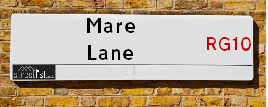
Mare Lane is a street located . The street has a length of approximately 122 metres.
The street is located within the Windsor and Maidenhead (B) and Bracknell Forest (B) Council's jurisdiction. They provide various services, like refuse collection, and manage council tax collection. It's situated in the region of the UK.
The road has been assigned the Unique Street Reference Number of 44401021 and 3800812 in the National Street Gazetteer.
It is located within the county of , situated in the region of the UK. It's 28.94 miles West from central London., 8.47 miles East from Reading, 14.01 miles North West from Woking and 18.39 miles North West from Guildford.
Map of Mare Lane
| Street Crime (updated 14/01/2025) | ||
|---|---|---|
| Location Note | Central Point of Street - Not Actual Location | |
| MSOA Info | For MSOA (Statistical Neighbourhood) | |
| Click Hint | Click on a Circle for a detailed breakdown below map. | |
| Crime Levels |
Green = Very Low Yellow = Low Orange = High Red = Very High |
|
| Postcodes | ||
| Icon | Postcodes for Mare Lane | |
| Walking Distances | ||
| Distance Info | Green Circle = 10 Minutes Walk (800 metres) | |
Street Crime Data accessed from data.police.uk on 06/10/2024.
Moving to Mare Lane?
I can help you uncover potential pitfalls and provide key questions to ask about your new property. With decades of experience as a Local Land Charges Manager, I offer confidential insights to make your move informed and stress-free.
This service is free, but you may wish to make an optional donation to support it. Please include the property name and address in your request as well as anything you wish to focus on.
Contact Me
Do you know why this road is called Mare Lane?
What's it like to live here?
Share a Photo of Mare Lane
Ask the community a question.
Do you have any questions, memories to share, have any photos or know any facts? We'd love to know more.
Submit Your Comment

Budget Friendly Hotels near Mare Lane
| Budget Hotel Name | Distance (miles) |
|---|---|
|
1: Name:Travelodge Bracknell Address: London Rd, Binfield, Popeswood, Bracknell, RG42 4AA Telephone: 0871 984 6015 Visit Hotel Page |
3.45 |
|
2: Name:Premier Inn Bracknell Central Address: Wokingham Road Telephone: Visit Hotel Page |
3.62 |
|
3: Name:Travelodge Bracknell Central Address: London Rd, Bracknell, RG12 2UT Telephone: 0371 984 6367 Visit Hotel Page |
3.97 |
|
4: Name:Premier Inn Bracknell Twin Bridges Address: Downshire Way Telephone: Visit Hotel Page |
3.98 |
|
5: Name:Travelodge Maidenhead Central Address: 99 King St, Maidenhead, SL6 1DP Telephone: 0871 984 6456 Visit Hotel Page |
4.24 |
Hotel Options
Your support helps keep this site running!
If you enjoy using this website, consider making a donation to help me cover hosting costs.
Nearby Estate Agents
| Name | Address | Website |
|---|---|---|
| Keith Gibbs Estate Agents | Providence House, Forest Road, Binfield, Bracknell, Berkshire, RG42 4HP | Visit Website |
| David Cliff | Ashleigh Terrace Road South, Binfield, Bracknell, RG42 4DS | Visit Website |
| Bloor Homes | Temple Way, Binfield, Bracknell, RG42 4EX | Visit Website |
| Millgate Homes | Winkfield Lane, Windsor, Berkshire, SL4 4SR | Visit Website |
| Prospect Estate Agency | 11 County Lane Warfield RG42 3JP | Visit Website |
Neighbourhood Policing |
| Police Force: |
| Find a Local Neighbourhood Watch Scheme |
Location Details
| Mare Lane | |
|---|---|

| |
| Latitude | 51.468745 |
| Longitude | -0.776539 |
| OS Easting (X): | 484972 |
| OS Northing (Y): | 175183 |
| OS Grid Reference: | SU850752 |
Roads that have a Junction with Mare Lane
| Street | Junction Type |
|---|
Sunset and Sunrise times
| Sunrise | 07:35 |
|---|---|
| Sunset | 16:58 |
Latest Weather Conditions
| Observed at Weather Station: | Heathrow 3 February 2025 at 07:00 (14.11 miles away) |
|---|---|
| Current Weather: | Overcast |
| Temperature and Humidity: | 4.0°C (91.8%) |
| Wind Direction and Speed: | S (7 mph) |
Population Statistics
Nearest Supermarkets
| Tesco Bracknell North Superstore |
|---|
| County Ln, Warfield, Bracknell, RG42 3JP |
| 0345 677 9064 |
| Distance: 3.49 Miles |
| Directions to Tesco Bracknell North Superstore |
| Sainsburys Maidenhead Wootton Way Local |
|---|
| 43-45 Wootton Way, Maidenhead, England, SL6 4QZ |
| 01628 625 347 |
| Distance: 3.6 Miles |
| Directions to Sainsburys Maidenhead Wootton Way Local |
| Waitrose Bracknell |
|---|
| Bond Way, Bracknell, Berkshire, RG12 1RQ |
| 01344 862374 |
| Distance: 3.63 Miles |
| Directions to Waitrose Bracknell |
| Morrisons Bracknell |
|---|
| The Peel Centre, Skimped Hill Lane, Bracknell RG12 1EN |
| 01344 862188 |
| Distance: 3.85 Miles |
| Directions to Morrisons Bracknell |
Telephone Information
| Area Code |
|---|
| Area Code: 01628 - Maidenhead |
| Area Code: 01344 - Bracknell |
| Area Code: 01491 - Henley-on-Thames |
| Area Code: 0118 - Reading |
Local Government
| Local Council Details |
|---|
| Within the area of |
| Local Member of Parliament |
|---|
| Within the Westminster Parliamentary Constituency of |
| The Member of Parliament is |
| Details for the MP on parliament.uk |
| Details for the MP on theyworkforyou.com |
| In the 2024 General Election won with a majority of 0 the result was . The total electorate was 0 |
| Wards, Parish Councils and County Councils |
|---|
| Ward: Ward |
| Parish: Unparished area |
| Ceremonial County: |
Nearest Schools
England Secondary Schools
Holyport College
Address: Holyport College, Ascot Road, Holyport, Berkshire, SL6 3LE
Distance: 2.33 miles
Contact: 01628640150
England Primary Schools
Woodlands Park Primary School
Address: Woodlands Park Primary School, Heywood Avenue, Woodlands Park, Maidenhead, Berkshire, SL6 3JB
Distance: 2.12 miles
Contact:
White Waltham CofE Academy
Address: White Waltham CofE Academy, Waltham Road, White Waltham, Maidenhead, Berkshire, SL6 3SG
Distance: 1.40 miles
Contact: 01628822533
White Waltham CofE School
Address: White Waltham CofE School, Waltham Road, White Waltham, Maidenhead, Berkshire, SL6 3SG
Distance: 1.40 miles
Contact:
Waltham St Lawrence Primary School
Address: Waltham St Lawrence Primary School, School Road, Waltham St Lawrence, Reading, Berkshire, RG10 0NU
Distance: 1.52 miles
Contact: 01189343248
Nearest Hospitals
Nearest Dentists
Dentists
WOODLANDS DENTAL PRACTICE
Address: CANNON LANE, MAIDENHEAD, BERKSHIRE, SL6 3NR
Distance: 2.48 miles
Contact: :
WARWICK HOUSE DENTAL SURGERY
Address: 104 MOORDALE AVENUE, BRACKNELL, BERKSHIRE, RG42 1SY
Distance: 3.19 miles
Contact: :
ROUNDS HILL DENTAL PRACTICE
Address: 8 WOKINGHAM ROAD, BRACKNELL, BERKSHIRE, RG42 1PD
Distance: 3.49 miles
Contact: :
COMMUNITY DENTAL CLINIC
Address: SKIMPED HILL HEALTH CENTRE, SKIMPED HILL LANE, BRACKNELL, BERKSHIRE, RG12 1LH
Distance: 3.70 miles
Contact: :
DENTAL SURGERY
Address: 11-13 HIGH STREET, BRACKNELL, BERKSHIRE, RG12 1DL
Distance: 3.82 miles
Contact: :
PARK HOUSE DENTAL SURGERY
Address: 20 PARK ROAD, BRACKNELL, BERKSHIRE, RG12 2LU
Distance: 3.83 miles
Contact: :
Nearest GP Surgeries
Doctors
DR. S. SWAN
Address: NEVILLE HALL, WALTHAM ST. LAWRENCE, READING, BERKSHIRE, RG10 0JP
Distance: 2.07 miles
Contact: tel: 0118 9403939
WOODLANDS PARK SURGERY
Address: 15 WOODLANDS PARK ROAD, WOODLANDS PARK, MAIDENHEAD, BERKSHIRE, SL6 3NW
Distance: 2.42 miles
Contact: tel: 01628 825523
REDWOOD HOUSE SURGERY
Address: REDWOOD HOUSE, CANNON LANE, MAIDENHEAD, BERKSHIRE, SL6 3PH
Distance: 3.03 miles
Contact: tel: 01628 826227
BINFIELD SURGERY
Address: BINFIELD HEALTH & COMMUNITY CENTRE, WOOD LANE, BINFIELD, BRACKNELL, RG42 4EX
Distance: 3.18 miles
Contact: tel: 01344 286264
DR. S. SWAN
Address: 14 THE TERRACE, KNOWL HILL, READING, BERKSHIRE, RG10 9XB
Distance: 3.23 miles
Contact: tel: 0118 9403939
HOLYPORT SURGERY
Address: STROUD FARM ROAD, HOLYPORT, MAIDENHEAD, BERKSHIRE, SL6 2LP
Distance: 3.33 miles
Contact: :
Nearest Dispensing Chemists
Pharmacies
WOODLAND PARK PHARMACY
Address: WALTHAM ROAD, WOODLANDS PARK, MAIDENHEAD, BERKSHIRE, SL6 3NH
Distance: 2.35 miles
Contact: :
BINFIELD VILLAGE PHARMACY
Address: TERRACE ROAD NORTH, BINFIELD, BRACKNELL, RG42 5HR
Distance: 2.60 miles
Contact: tel: 01344 868486
WESSEX PHARMACY
Address: 114 WESSEX WAY, MAIDENHEAD, BERKSHIRE, SL6 3DL
Distance: 3.00 miles
Contact: tel: 01628 631384
PRIESTWOOD PHARMACY
Address: 7 PRIESTWOOD SQUARE, BRACKNELL, RG42 1UD
Distance: 3.30 miles
Contact: tel: 01344 306357
DAY LEWIS PHARMACY
Address: 3 STOMPITS ROAD, HOLYPORT, MAIDENHEAD, BERKSHIRE, SL6 2LA
Distance: 3.39 miles
Contact: tel: 01628 629216
KAYS CHEMIST
Address: 24 ROSS ROAD, MAIDENHEAD, BERKSHIRE, SL6 2SZ
Distance: 3.49 miles
Contact: tel: 01628 770687
Nearest Opticians
Opticians
BOOTS OPTICIANS - BRACKNELL
Address: 19-23 BRACCAN WALK, BRACKNELL, BERKSHIRE, RG12 1BE
Distance: 3.78 miles
Contact: :
BRACKNELL V.E LTD
Address: THE LEXICON CENTRE, 26 BRACCAN WALK, BRACKNELL, BERKSHIRE, RG12 1BE
Distance: 3.78 miles
Contact: :
LONDON 4 DOMICILIARY SPECSAVERS LIMITED
Address: VENTURE HOUSE, 2 ARLINGTON SQUARE, DOWNSHIRE WAY, BRACKNELL, RG12 1WA
Distance: 3.78 miles
Contact: :
INSIGHT OPTICIANS (BRACKNELL)
Address: 15B PRINCESS SQUARE, BRACKNELL, BERKSHIRE, RG12 1LS
Distance: 3.85 miles
Contact: :
SPECSAVERS (BRACKNELL)
Address: 18 PRINCESS SQUARE, BRACKNELL, BERKSHIRE, RG12 1LS
Distance: 3.85 miles
Contact: :
VISION EXPRESS (TWYFORD)
Address: 7 CHURCH STREET, TWYFORD, READING, BERKSHIRE, RG10 9DN
Distance: 3.90 miles
Contact: :
Transport
Nearest Rail Stations
Twyford Station is 3.76 miles away.
Address: Twyford station, Station Road, Twyford, Berkshire, RG10 9NA
Twyford is situated on the Great Western Main Line|Henley Branch Line and is managed by Great Western Railway.
Twyford Station is staffed on a part time basis.
Bracknell Station is 3.99 miles away.
Address: Bracknell station, Market Street, Bracknell, Berkshire, RG12 1HX
Bracknell is situated on the Waterloo to Reading Line (Windsor Lines) and is managed by South Western Railway.
Bracknell Station is staffed on a part time basis.