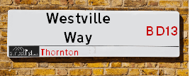
Westville Way is a street located . The street has a length of approximately 109 metres.
The street is located within the Bradford District (B) Council's jurisdiction. They provide various services, like refuse collection, and manage council tax collection. It's situated in the region of the UK.
The road has been assigned the Unique Street Reference Number of 7782275 in the National Street Gazetteer.
It is located within the county of , situated in the region of the UK. It's 174.53 miles North West from central London., 12.69 miles West from Leeds, 26.92 miles North East from Manchester and 32.45 miles North West from Sheffield.
Map of Westville Way
| Street Crime (updated 03/12/2024) | ||
|---|---|---|
| Location Note | Central Point of Street - Not Actual Location | |
| MSOA Info | For MSOA (Statistical Neighbourhood) | |
| Click Hint | Click on a Circle for a detailed breakdown below map. | |
| Crime Levels |
Green = Very Low Yellow = Low Orange = High Red = Very High |
|
| Postcodes | ||
| Icon | Postcodes for Westville Way | |
| Walking Distances | ||
| Distance Info | Green Circle = 10 Minutes Walk (800 metres) | |
Street Crime Data accessed from data.police.uk on 06/10/2024.
Moving to Westville Way?
I can help you uncover potential pitfalls and provide key questions to ask about your new property. With decades of experience as a Local Land Charges Manager, I offer confidential insights to make your move informed and stress-free.
This service is free, but you may wish to make an optional donation to support it. Please include the property name and address in your request as well as anything you wish to focus on.
Contact Me
Do you know why this road is called Westville Way?
What's it like to live here?
Share a Photo of Westville Way
Ask the community a question.
Do you have any questions, memories to share, have any photos or know any facts? We'd love to know more.
Submit Your Comment
Budget Friendly Hotels near Westville Way
| Budget Hotel Name | Distance (miles) |
|---|---|
|
1: Name:Travelodge Bradford Central Address: 2 Valley Rd, Bradford, BD1 4AF Telephone: 0871 984 6171 Visit Hotel Page |
4.18 |
|
2: Name:ibis budget Bradford Address: 6 Prince Court, Canal Road Telephone: Visit Hotel Page |
4.19 |
|
3: Name:Premier Inn Bradford Central Address: Vicar Lane Telephone: Visit Hotel Page |
4.28 |
|
4: Name:Holiday Inn Express Bradford City Centre Address: The Leisure Exchange, Vicar Lane Telephone: Visit Hotel Page |
4.29 |
|
5: Name:Travelodge Halifax Address: Dean Clough, Halifax, HX3 5AY Telephone: 0871 984 6144 Visit Hotel Page |
4.34 |
Hotel Options
Your support helps keep this site running!
If you enjoy using this website, consider making a donation to help me cover hosting costs.
Nearby Estate Agents
| Name | Address | Website |
|---|---|---|
| Whitney's | 11 Green End Clayton Bradford BD14 6BA | |
| Sugdens | 44 High Street, Queensbury, Bradford, BD13 2PA | Visit Website |
| Bronte Estate Agents | 11 High Street, Queensbury, BD13 2PE | Visit Website |
| Property Ladder Nationwide | 47 Wilsden Road, Bradford,BD15 9AD | |
| Patchett Homes | Ryefield House, 180 Highgate Road, Queensbury, Bradford, BD13 1DS | Visit Website |
Neighbourhood Policing |
| Police Force: |
| Find a Local Neighbourhood Watch Scheme |
Location Details
| Westville Way | |
|---|---|

| |
| Latitude | 53.791498 |
| Longitude | -1.852330 |
| OS Easting (X): | 409727 |
| OS Northing (Y): | 432832 |
| OS Grid Reference: | SE097328 |
Roads that have a Junction with Westville Way
| Street | Junction Type |
|---|---|
| Firth Street | pseudo node |
| Mary Street | junction |
| Henry Street | junction |
| Chapel Terrace | junction |
Sunset and Sunrise times
| Sunrise | 08:22 |
|---|---|
| Sunset | 15:58 |
Latest Weather Conditions
| Observed at Weather Station: | Bingley Samos 31 December 2024 at 18:00 (1.44 miles away) |
|---|---|
| Current Weather: | Light rain |
| Temperature and Humidity: | 8.9°C (94.7%) |
| Wind Direction and Speed: | SW (24 mph) |
Population Statistics
Nearest Supermarkets
| Tesco Leaventhorpe Esso Express |
|---|
| Thornton Rd, Thornton, Bradford, BD13 3DG |
| 0345 674 6387 |
| Distance: 0.95 Miles |
| Directions to Tesco Leaventhorpe Esso Express |
| Tesco Queensbury Superstore |
|---|
| 3 Brighouse Rd, Queensbury, BD13 1QD |
| 0345 026 9667 |
| Distance: 1.67 Miles |
| Directions to Tesco Queensbury Superstore |
| Tesco Heaton Haworth Rd Express |
|---|
| 204-206 Haworth Rd, Heaton, Bradford, BD9 6NJ |
| 0345 671 9259 |
| Distance: 2.27 Miles |
| Directions to Tesco Heaton Haworth Rd Express |
| Asda Bradford Cemetery Road |
|---|
| Cemetery Road, Lidget Green, Bradford, BD7 2QX |
| 01274 476230 |
| Distance: 2.57 Miles |
| Directions to Asda Bradford Cemetery Road |
Telephone Information
| Area Code |
|---|
| Area Code: 01274 - Bradford |
| Area Code: 01422 - Halifax |
| Area Code: 01535 - Keighley |
| Area Code: 01943 - Guiseley |
Local Government
| Local Council Details |
|---|
| Within the area of |
| Local Member of Parliament |
|---|
| Within the Westminster Parliamentary Constituency of |
| The Member of Parliament is |
| Details for the MP on parliament.uk |
| Details for the MP on theyworkforyou.com |
| In the 2024 General Election won with a majority of 0 the result was . The total electorate was 0 |
| Wards, Parish Councils and County Councils |
|---|
| Ward: Ward |
| Parish: Unparished area |
| Ceremonial County: |
Nearest Schools
England Secondary Schools
Dixons Allerton Academy
Address: Dixons Allerton Academy, Rhodesway, Bradford, West Yorkshire, BD8 0DH
Distance: 1.85 miles
Contact: 01274089890
Beckfoot Thornton
Address: Beckfoot Thornton, Leaventhorpe Lane, Thornton, Bradford, West Yorkshire, BD13 3BH
Distance: 1.25 miles
Contact: 01274881082
Thornton Grammar School
Address: Thornton Grammar School, Leaventhorpe Lane, Thornton, Bradford, West Yorkshire, BD13 3BH
Distance: 1.25 miles
Contact:
England Primary Schools
St Matthew's Catholic Primary School
Address: St Matthew's Catholic Primary School, Saffron Drive, Allerton, Bradford, West Yorkshire, BD15 7NE
Distance: 1.40 miles
Contact:
The Academy At St. James
Address: The Academy At St. James, Chelwood Drive, Allerton, Bradford, West Yorkshire, BD15 7YD
Distance: 1.11 miles
Contact: 01274777095
St James' Church Primary School
Address: St James' Church Primary School, Chelwood Drive, Allerton, Bradford, West Yorkshire, BD15 7YD
Distance: 1.11 miles
Contact:
Ley Top Primary School
Address: Ley Top Primary School, Avenel Road, Allerton, Bradford, West Yorkshire, BD15 7PQ
Distance: 1.37 miles
Contact: 01274541554
Thornton Primary School
Address: Thornton Primary School, Thornton Road, Thornton, Bradford, West Yorkshire, BD13 3NN
Distance: 0.14 miles
Contact: 01274833839
Thornton Primary School
Address: Thornton Primary School, Thornton Road, Thornton, Bradford, West Yorkshire, BD13 3NN
Distance: 0.14 miles
Contact:
Keelham Primary School
Address: Keelham Primary School, Well Heads, Denholme Gate, Bradford, West Yorkshire, BD13 4HH
Distance: 1.43 miles
Contact: 01274832491
Nearest Hospitals
Nearest Dentists
Dentists
DENTAL SURGERY
Address: 90A MARKET STREET, THORNTON, BRADFORD, WEST YORKSHIRE, BD13 3EY
Distance: 0.12 miles
Contact: :
DENTAL SURGERY
Address: 1 CAMBRIDGE STREET, CLAYTON, BRADFORD, WEST YORKSHIRE, BD14 6RH
Distance: 1.37 miles
Contact: :
DENTAL SURGERY
Address: 78 HIGH STREET, QUEENSBURY, BRADFORD, WEST YORKSHIRE, BD13 2PA
Distance: 1.62 miles
Contact: :
ALLERTON DENTAL PRACTICE
Address: 254-256 ALLERTON ROAD, ALLERTON, BRADFORD, WEST YORKSHIRE, BD15 7RA
Distance: 1.67 miles
Contact: :
DENTAL SURGERY
Address: 11A WEST END, QUEENSBURY, BRADFORD, WEST YORKSHIRE, BD13 2BD
Distance: 1.79 miles
Contact: :
OASIS DENTAL CARE
Address: 136 MAIN STREET, WILSDEN, BRADFORD, WEST YORKSHIRE, BD15 0AS
Distance: 2.15 miles
Contact: :
Nearest GP Surgeries
Doctors
THORNTON MEDICAL PRACTICE
Address: 4 CRAVEN AVENUE, THORNTON, BRADFORD, BD13 3LG
Distance: 0.22 miles
Contact: :
THORNTON & DENHOLME MEDICAL PRACTICE
Address: 4 CRAVEN AVENUE, OFF MARKET STREET, THORNTON, BRADFORD, WEST YORKSHIRE, BD13 3LG
Distance: 0.22 miles
Contact: tel: 01274 832110
HOLLINS HEALTH & WELLBEING - ALLERTON
Address: ALLERTON HEALTH CENTRE, BELL DEAN ROAD, ALLERTON, BRADFORD, WEST YORKSHIRE, BD15 7WA
Distance: 1.18 miles
Contact: :
PHOENIX MEDICAL PRACTICE
Address: ALLERTON HEALTH CENTRE, BELL DEAN ROAD, ALLERTON, BRADFORD, WEST YORKSHIRE, BD15 7WA
Distance: 1.18 miles
Contact: tel: 08444 773615
THE WILLOWS MEDICAL PRACTICE
Address: 8 OSBOURNE DRIVE, QUEENSBURY, BRADFORD, BD13 2GD
Distance: 1.58 miles
Contact: tel: 01274 888350
DR VE WILSON
Address: LOWER GRANGE MEDICAL CENTRE, 33 BARNBY AVENUE, BRADFORD, WEST YORKSHIRE, BD8 0QN
Distance: 1.64 miles
Contact: tel: 01274 881646
Nearest Dispensing Chemists
Pharmacies
BOOTS
Address: THORNTON MEDICAL CENTRE, 2 CRAVEN AVENUE, THORNTON, BRADFORD, WEST YORKSHIRE, BD13 3LF
Distance: 0.21 miles
Contact: tel: 01274 832216
ALLERTON PHARMACY
Address: BELL DEAN ROAD, ALLERTON, BRADFORD, BD15 7WA
Distance: 1.18 miles
Contact: tel: 01274 880589
STATION ROAD PHARMACY
Address: 26 STATION ROAD, CLAYTON, BRADFORD, BD14 6AN
Distance: 1.49 miles
Contact: tel: 01274 880132
PRECINCT PHARMACY
Address: ALLERTON SHOPPING CENTRE, 350 ALLERTON ROAD, ALLERTON, BRADFORD, BD15 7BN
Distance: 1.58 miles
Contact: tel: 01274 491247
COHENS CHEMIST
Address: THE WILLOWS MEDICAL CENTRE, OSBOURNE DRIVE, QUEENSBURY, BRADFORD, WEST YORKSHIRE, BD13 2GD
Distance: 1.58 miles
Contact: tel: 01274 883511
RAJ'S CHEMIST
Address: 7 THE SQUARE, BRADFORD, WEST YORKSHIRE, BD8 0QB
Distance: 1.60 miles
Contact: tel: 01274 884751
Nearest Opticians
Opticians
MYVISION OPTICIANS LTD
Address: 336 ALLERTON ROAD, ALLERTON, BRADFORD, BD15 7BN
Distance: 1.58 miles
Contact: :
VICTORIA GORE OPTOMETRIST
Address: 72-74 HIGH STREET, QUEENSBURY, BRADFORD, WEST YORKSHIRE, BD13 2PA
Distance: 1.62 miles
Contact: :
SARAH FARRAR LTD
Address: 160 MAIN STREET, WILSDEN, BRADFORD, WEST YORKSHIRE, BD15 0HX
Distance: 2.03 miles
Contact: :
K S OPTICIAN
Address: 35 BECKSIDE ROAD, LIDGET GREEN, BRADFORD, WEST YORKSHIRE, BD7 2JL
Distance: 2.62 miles
Contact: :
SPECSAVERS (GIRLINGTON, BRADFORD)
Address: UNIT 12, MORRISONS SUPERMARKET, VICTORIA SHOPPING CENTRE, THORNTON ROAD, BRADFORD, WEST YORKSHIRE, BD8 9BN
Distance: 2.65 miles
Contact: :
PREMIER VISION VICTORIA
Address: INSIDE MORRISONS SUPERMARKET, VICTORIA CENTRE, THORNTON ROAD, BRADFORD, BD8 9BN
Distance: 2.65 miles
Contact: :
Transport
Nearest Rail Stations
Frizinghall Station is 3.93 miles away.
Address: Frizinghall station, Frizinghall Road, Frizinghall, West Yorkshire, BD9 4LD
Frizinghall is situated on the Wharfedale Line|Leeds to Bradford lines and is managed by Northern.
Frizinghall Station is an unstaffed station.
Bingley Station is 3.98 miles away.
Address: Bingley station, Wellington Street, Bingley, West Yorkshire, BD16 2NA
Bingley is situated on the Leeds to Morecambe line and is managed by Northern.
Bingley Station is staffed on a full time basis.