West Church Street in the village of Fordyce
About West Church Street
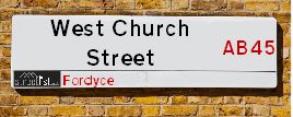
West Church Street is a street located in the village of Fordyce. It uses the postcode AB45 2SG. The street has a length of approximately 310 metres.
The street is located within the Aberdeenshire Council's jurisdiction. They provide various services, like refuse collection, and manage council tax collection. It's situated in the nation of Scotland.
It is located within the county of Banffshire, which is a part of the nation of Scotland. It's 438.86 miles North from central London., 43.27 miles North West from Aberdeen, 56.21 miles East from Inverness and 83.55 miles North from Dundee.
WEST CHURCH STREET is within the Post Town of BANFF

Do you know why this road is called West Church Street?
What's it like to live here?
Ask the community a question.
Do you have any questions, memories to share or know any facts? We'd love to know more.
Map of West Church Street
| Postcodes | ||
|---|---|---|
| Icon | Postcodes for West Church Street | |
| Walking Distances | ||
| Distance Info | Green Circle = 10 Minutes Walk (800 metres) | |
Street Crime Data accessed from data.police.uk on 06/10/2024.
Budget Friendly Hotels near West Church Street
| Budget Hotel Name | Distance (miles) |
|---|---|
|
1: Name:Premier Inn Elgin Address: 15 Linkwood Way Telephone: Visit Hotel Page |
19.99 |
|
2: Name:Travelodge Peterhead Address: 16-24 Chapel Street, Peterhead, AB42 1TL Telephone: 0871 559 1885 Visit Hotel Page |
37.45 |
|
3: Name:Holiday Inn Express Aberdeen Airport Address: 2 International Gate, Dyce Telephone: Visit Hotel Page |
37.80 |
|
4: Name:Premier Inn Aberdeen Airport - Dyce Address: Aberdeen Airport, Main Terminal, Argyll Way Telephone: Visit Hotel Page |
37.81 |
|
5: Name:Travelodge Aberdeen Airport Address: Burnside Dr, Dyce, Aberdeen, AB21 0HW Telephone: 0871 984 6309 Visit Hotel Page |
38.26 |
Your support helps keep this site running!
If you enjoy using this website, consider buying me a coffee to help cover hosting costs.
Nearby Estate Agents
| Name | Address | Website |
|---|---|---|
| Stewart & Watson | 42-44 East Church Street, Buckie,AB56 1AB | Visit Website |
| Grant Smith Law Practice Ltd | 16 East Church Street, Buckie,AB56 1AE | Visit Website |
| Springfield - North Scotland, Inchgower | Seafield Circle, off Barhill Road, Buckie, AB56 5AD | Visit Website |
| Stewart & Watson | 65 High Street, Banff,AB45 1AN | Visit Website |
| Peterkins Solicitors | 186 Mid St, Keith,AB55 5BQ | Visit Website |
We have found 1 postcode
Neighbourhood Policing |
| Police Force: Scotland |
| Find a Local Neighbourhood Watch Scheme |
Location Details
| West Church Street | |
|---|---|

| |
| Latitude | 57.660863 |
| Longitude | -2.747233 |
| OS Easting (X): | 355419 |
| OS Northing (Y): | 863659 |
| OS Grid Reference: | NJ554637 |
Roads that have a Junction with West Church Street
| Street | Junction Type |
|---|---|
| St Tarquins Place | junction |
| Back Street | junction |
Sunset and Sunrise times
| Sunrise | 07:58 |
|---|---|
| Sunset | 15:53 |
Latest Weather Conditions
| Observed at Weather Station: | Lossiemouth 17 November 2024 at 20:00 (21.52 miles away) |
|---|---|
| Current Weather: | Cloudy |
| Temperature and Humidity: | 3.0°C (78.8%) |
| Wind Direction and Speed: | WNW (17 mph) |
Population Statistics
| ONS Area Code | S00092484 |
|---|---|
| ONS Area Name | Older Farming Communities |
| LSOA Code: | S01007024 |
|---|---|
| LSOA Name: | Portsoy &Fordyce and Cornhill - 02 |
| SOA Code: | 2c |
| SOA Name: | |
| MSOA Code: | S02001324 |
| MSOA Name: | Portsoy &Fordyce and Cornhill |
Nearest Supermarkets
| Tesco Buckie Superstore |
|---|
| Highstreet, Buckie, AB56 4AB |
| 0345 026 9628 |
| Distance: 7.84 Miles |
| Directions to Tesco Buckie Superstore |
| Tesco Banff Metro |
|---|
| Carmelite St, Banff, AB45 1AF |
| 0345 677 9028 |
| Distance: 8.41 Miles |
| Directions to Tesco Banff Metro |
| Tesco Keith Moss St Superstore |
|---|
| Moss St, Keith, AB55 5HB |
| 0345 671 9357 |
| Distance: 11 Miles |
| Directions to Tesco Keith Moss St Superstore |
| Tesco Turriff Superstore |
|---|
| 32 High Steet, Turriff, AB53 4EN |
| 0345 675 7122 |
| Distance: 13.55 Miles |
| Directions to Tesco Turriff Superstore |
Telephone Information
| Area Code |
|---|
| Area Code: 01261 - Banff |
Local Government
| Local Council Details |
|---|
| Within the area of Aberdeenshire |
| Visit the Council's Website |
| Woodhill House, Westburn Road, Aberdeen, Aberdeenshire &AB16 5GB |
| Telephone Number: 0845 608 1207 |
| Local Member of Parliament |
|---|
| Within the Westminster Parliamentary Constituency of Banff and Buchan |
| The Member of Parliament is |
| Details for the MP on parliament.uk |
| Details for the MP on theyworkforyou.com |
| In the 2024 General Election won with a majority of 0 the result was . The total electorate was 0 |
| Wards, Parish Councils and County Councils |
|---|
| Ward: Banff and District Ward |
| Ceremonial County: Banffshire |
Nearest Schools
Scotland Primary Schools
Fordyce School
Address: Fordyce School, School Road, Fordyce, BANFF, AB45 2SJ
Distance: 0.06 miles
Contact: 01261 455770
Nearest Hospitals
| Name | Address | Postcode | Distance | Map |
|---|---|---|---|---|
| Jubilee Hospital | Bleachfield Street, Huntly | AB54 8EX | 24.32 Km | View Directions |
Nearest Dentists
Dentists
| Name | Address | Postcode | Distance | Map |
|---|---|---|---|---|
| HUNTLY DENTAL PRACTICE | 41 Duke Street, Huntly | AB548DT | 23.89 Km | View Directions |
| DEVERON DENTAL CENTRE | Ogilivie Avenue, Huntly | AB548AT | 24.43 Km | View Directions |
Nearest GP Surgeries
Doctors
AN CAORANN MEDICAL PRACTICE
Address: PORTSOY SURGERY, 16 SEAFIELD TERRACE, PORTSOY, BANFF, BANFFSHIRE, AB45 2GB
Distance: 2.30 miles
Contact: tel: 03453 379966
ARDACH HEALTH CENTRE
Address: HIGHFIELD ROAD, BUCKIE, BANFFSHIRE, AB56 1JE
Distance: 8.13 miles
Contact: tel: 03450 997200
MACDUFF MEDICAL PRACTICE
Address: MACDUFF HEALTH CLINIC, FIFE STREET, BANFF, BANFFSHIRE, AB45 1JD
Distance: 8.20 miles
Contact: tel: 03453 379933
SEAFIELD & CULLEN MEDICAL GROUP
Address: BARHILL ROAD, BUCKIE, AB56 1FP
Distance: 8.72 miles
Contact: tel: 01542 835577
KEITH MEDICAL GROUP
Address: TURNER STREET, KEITH, BANFFSHIRE, AB55 5DJ
Distance: 11.24 miles
Contact: tel: 03453 379944
FOCHABERS MEDICAL PRACTICE
Address: 12 HIGH STREET, FOCHABERS, IV32 7EP
Distance: 13.20 miles
Contact: tel: 01343 820247
Nearest Dispensing Chemists
Pharmacies
| Name | Address | Postcode | Telephone | Map | Distance in Km |
|---|---|---|---|---|---|
| V V & T Ruparelia | 1 Seafield Street, Portsoy | AB45 2QL | 01261 842284 | View Directions | |
| Cullen Pharmacy | 28-30 Seafield Street, Cullen, Moray, | AB56 4RS | 01542 840220 | View Directions | |
| Floriage Ltd | 3 Union Street, Portnockie | AB56 4LF | 01542 840268 | View Directions |
Nearest Opticians
Opticians
Transport
Nearest Rail Stations
Keith Station is 10.79 miles away.
Address: Keith station, Station Road, Keith, Moray, AB55 3DR
Keith is situated on the Aberdeen to Inverness line and is managed by ScotRail.
Keith Station is staffed on a part time basis.
Huntly Station is 15.00 miles away.
Address: Huntly station, off Bogie St, Huntly, Aberdeenshire, AB54 5HS
Huntly is situated on the Aberdeen to Inverness line and is managed by ScotRail.
Huntly Station is staffed on a part time basis.