Springdale Park in the village of Bieldside
About Springdale Park
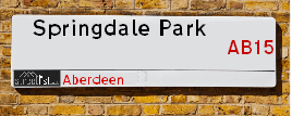
Springdale Park is a street located in Bieldside. It uses the postcode AB15 9FB. The street has a length of approximately 57 metres.
The street is located within the Aberdeen City Council's jurisdiction. They provide various services, like refuse collection, and manage council tax collection. It's situated in the nation of Scotland.
It is located within the county of City of Aberdeen, which is a part of the nation of Scotland. It's 397.39 miles North from central London., 4.65 miles South West from Aberdeen, 53.94 miles North East from Dundee and 79.5 miles East from Inverness.
SPRINGDALE PARK is within the Post Town of ABERDEEN

Do you know why this road is called Springdale Park?
What's it like to live here?
Ask the community a question.
Do you have any questions, memories to share or know any facts? We'd love to know more.
Map of Springdale Park
| Postcodes | ||
|---|---|---|
| Icon | Postcodes for Springdale Park | |
| Walking Distances | ||
| Distance Info | Green Circle = 10 Minutes Walk (800 metres) | |
Street Crime Data accessed from data.police.uk on 06/10/2024.
Budget Friendly Hotels near Springdale Park
| Budget Hotel Name | Distance (miles) |
|---|---|
|
1: Name:Premier Inn Aberdeen Anderson Drive Address: North Anderson Drive Telephone: Visit Hotel Page |
3.21 |
|
2: Name:Premier Inn Aberdeen Westhill Address: 10 Straik Road Telephone: Visit Hotel Page |
3.43 |
|
3: Name:Travelodge Aberdeen Central Justice Mill Lane Address: 21-23 Justice Mill Ln, Aberdeen, AB11 6EQ Telephone: 0871 984 6459 Visit Hotel Page |
4.05 |
|
4: Name:Premier Inn Aberdeen South Portlethen Address: Mains Of Balquharn Telephone: Visit Hotel Page |
4.34 |
|
5: Name:Travelodge Aberdeen Central Address: 9 Bridge Street, Aberdeen, AB11 6JL Telephone: 0871 984 6117 Visit Hotel Page |
4.45 |
Your support helps keep this site running!
If you enjoy using this website, consider buying me a coffee to help cover hosting costs.
Nearby Estate Agents
| Name | Address | Website |
|---|---|---|
| Thistles Estate Agents | 179 Cairngorm Drive, ABERDEEN,AB12 5PN | Visit Website |
| Savills | 37 Albyn Place Aberdeen AB10 1YN | Visit Website |
| Stonehouse Lettings | Osborne House 27-30 Carden Place Aberdeen AB10 1UP | Visit Website |
| Savills Rural Lettings | 5 Queens Terrace, Aberdeen, AB10 1XL | Visit Website |
| McEwan Fraser Legal | 38 Holburn Street, Aberdeen, AB10 6BT | Visit Website |
We have found 1 postcode
Neighbourhood Policing |
| Police Force: Scotland |
| Find a Local Neighbourhood Watch Scheme |
Location Details
| Springdale Park | |
|---|---|

| |
| Latitude | 57.115999 |
| Longitude | -2.207272 |
| OS Easting (X): | 387449 |
| OS Northing (Y): | 802782 |
| OS Grid Reference: | NJ874028 |
Roads that have a Junction with Springdale Park
| Street | Junction Type |
|---|---|
| Springdale Road | junction |
Sunset and Sunrise times
| Sunrise | 07:51 |
|---|---|
| Sunset | 15:55 |
Latest Weather Conditions
| Observed at Weather Station: | Aberdeen Airport 16 November 2024 at 15:00 (6.22 miles away) |
|---|---|
| Current Weather: | Light rain |
| Temperature and Humidity: | 6.7°C (65.8%) |
| Wind Direction and Speed: | W (16 mph) |
Population Statistics
| ONS Area Code | S00090428 |
|---|---|
| ONS Area Name | Comfortable Suburbia |
| LSOA Code: | S01006520 |
|---|---|
| LSOA Name: | Cults &Bieldside and Milltimber East - 03 |
| SOA Code: | 8a |
| SOA Name: | |
| MSOA Code: | S02001238 |
| MSOA Name: | Cults &Bieldside and Milltimber East |
Nearest Supermarkets
| Tesco Aberdeen North Dees Express |
|---|
| 393 North Deeside Rd, Cults, Aberdeen, AB15 9SX |
| 0345 671 9314 |
| Distance: 1.12 Miles |
| Directions to Tesco Aberdeen North Dees Express |
| Sainsburys Aberdeen North Deeside Road Local |
|---|
| 345 North Deeside Road, Cults, Aberdeen, Scotland, AB15 9SX |
| Distance: 1.18 Miles |
| Directions to Sainsburys Aberdeen North Deeside Road Local |
| Sainsburys Aberdeen North Deeside Road Local |
|---|
| 345 North Deeside Road, Cults, Aberdeen, Scotland, AB15 9SX |
| 01224 862 659 |
| Distance: 1.18 Miles |
| Directions to Sainsburys Aberdeen North Deeside Road Local |
| Tesco Aberdeen Woodend Superstore |
|---|
| Rousay Dr, Aberdeen, AB15 6LT |
| 0345 671 9557 |
| Distance: 2.72 Miles |
| Directions to Tesco Aberdeen Woodend Superstore |
Telephone Information
| Area Code |
|---|
| Area Code: 01224 - Aberdeen |
Broadband Information
| Speed | Average Speed | Median Speed | Maximum Speed | Next-generation access (NGA) | Number of Connections |
|---|---|---|---|---|---|
| Greater than 2 Mbps | 7.5 | 7.6 | 9.3 | N | 7 |
Local Government
| Local Council Details |
|---|
| Within the area of Aberdeen City |
| Visit the Council's Website |
| Aberdeen City Council Customer Service Centre, Ground Floor, Marischal College, Broad Street, Aberdeen &AB10 1AB |
| Telephone Number: 0845 608 0910 |
| Local Member of Parliament |
|---|
| Within the Westminster Parliamentary Constituency of Aberdeen South |
| The Member of Parliament is |
| Details for the MP on parliament.uk |
| Details for the MP on theyworkforyou.com |
| In the 2024 General Election won with a majority of 0 the result was . The total electorate was 0 |
| Wards, Parish Councils and County Councils |
|---|
| Ward: Lower Deeside Ward |
| Ceremonial County: City of Aberdeen |
Nearest Schools
Scotland Primary Schools
Cults Primary School
Address: Cults Primary School, Earlswells Road, Cults, ABERDEEN, AB15 9RG
Distance: 0.49 miles
Contact: 01224 869221
Milltimber School
Address: Milltimber School, Agricola Street, Milltimber, ABERDEEN, AB13 0BF
Distance: 0.86 miles
Contact: 01224 764848
Scotland Secondary Schools
Cults Academy
Address: Cults Academy, Quarry Road, Cults, ABERDEEN, AB15 9TP
Distance: 0.60 miles
Contact: 01224 868801
Nearest Hospitals
| Name | Address | Postcode | Distance | Map |
|---|---|---|---|---|
| Woodend General Hospital | Aberdeen | AB15 6XS | 4.09 Km | View Directions |
| Maidencraig House | Woodend Hospital, Eday Road | AB15 6XS | 4.09 Km | View Directions |
| 375 Great Western Lodge | 375 Great Western Road, Aberdeen | AB10 6NU | 5.17 Km | View Directions |
Nearest Dentists
Dentists
| Name | Address | Postcode | Distance | Map |
|---|---|---|---|---|
| CULTS DENTAL PRACTICE | 383 North Deeside Road, Cults Aberdeen | AB159SX | 1.82 Km | View Directions |
| DENTAL INSPIRATIONS | 395 North Deeside Road, Cults, Aberdeen | AB159SX | 1.82 Km | View Directions |
| MYDENTIST | 21 Springfield Road, Aberdeen | AB157RJ | 3.94 Km | View Directions |
Nearest GP Surgeries
Doctors
CAMPHILL MEDICAL PRACTICE
Address: CAMPHILL MED PRACTICE (RIVER DEE), MURTLE ESTATE, BIELDSIDE, ABERDEEN, AB15 9EP
Distance: 0.86 miles
Contact: :
CULTS MEDICAL GROUP
Address: SOUTH AVENUE, CULTS, ABERDEEN, ABERDEENSHIRE, AB15 9LQ
Distance: 0.97 miles
Contact: tel: 03453 371140
PETERCULTER MEDICAL PRACTICE
Address: PETERCULTER HEALTH CENTRE, CORONATION ROAD, PETERCULTER, ABERDEENSHIRE, AB14 0RP
Distance: 2.25 miles
Contact: tel: 01224 733535
HOSPITAL AT HOME
Address: DAY HOSPITAL, WOODEND HOSPITAL, ABERDEEN, AB15 6XS
Distance: 2.54 miles
Contact: tel: 01224 556055
OPHTHALMIC PRESCRIBING
Address: PRIMARY CARE CONTRACTS TEAM, WESTHOLME, WOODEND HOSPITAL, EDAY ROAD, ABERDEEN, AB15 6LS
Distance: 2.54 miles
Contact: tel: 01224 556502
GARTHDEE MEDICAL GROUP
Address: HEALTH CENTRE, GARTHDEE ROAD, ABERDEEN, AB10 7QQ
Distance: 2.77 miles
Contact: tel: 01224 208312
Nearest Dispensing Chemists
Pharmacies
| Name | Address | Postcode | Telephone | Map | Distance in Km |
|---|---|---|---|---|---|
| L Rowlands & Co (Retail) Ltd | 381a North Deeside Road, Cults, Aberdeen, | AB15 9SX | 01224 861624 | View Directions | |
| Lloyds Pharmacy Ltd | 359 North Deeside Road, Cults, Aberdeen, | AB15 9SX | 01224 867566 | View Directions | |
| Kemnay Pharmacy Ltd | 187 North Deeside Road, Peterculter, Aberdeen, | AB14 0UJ | 01224 732 214 | View Directions |
Nearest Opticians
Opticians
Transport
Nearest Rail Stations
Aberdeen Station is 4.52 miles away.
Address: Aberdeen station, Guild Street, Union Square, Aberdeen, AB11 6LX
Aberdeen is situated on the Aberdeen to Inverness line|Glasgow to Aberdeen line|Edinburgh to Aberdeen line and is managed by ScotRail.
Aberdeen Station is staffed on a part time basis.
Portlethen Station is 4.84 miles away.
Address: Portlethen station, Bruntland Road, Portlethen, Aberdeenshire, AB12 4JS
Portlethen is situated on the Glasgow to Aberdeen line|Edinburgh to Aberdeen line and is managed by ScotRail.
Portlethen Station is an unstaffed station.