A wide range of spatial data has been analysed to present this overview of the WR5 2 Postcode sector. If you would like anything added, please contact us.
The WR5 2 postcode sector is within the county of Worcestershire.
Did you know? According to the 2021 Census, the WR5 2 postcode sector is home to a bustling 9,854 residents!
Given that each sector allows for 400 unique postcode combinations. Letters C, I, K, M, O and V are not allowed in the last two letters of a postcode. With 235 postcodes already in use, this leaves 165 units available.
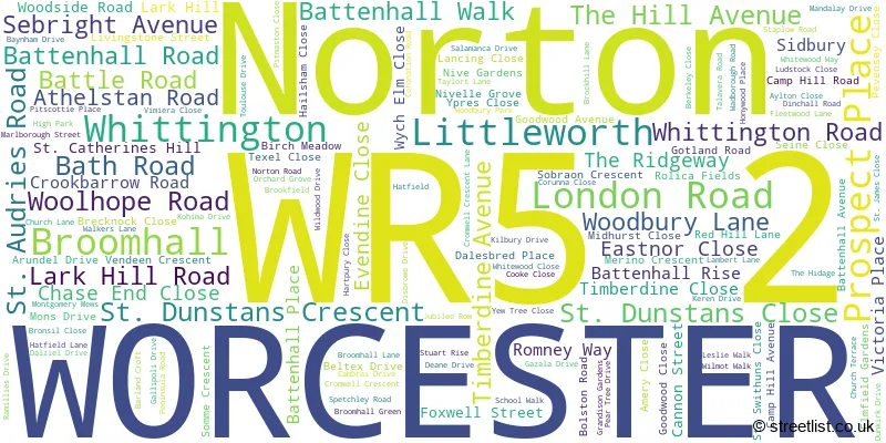
The largest settlement in the WR5 2 postal code is WORCESTER followed by Norton, and Whittington.
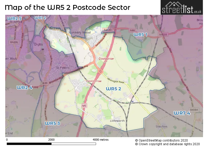
The WR5 2 Postcode shares a border with WR7 4 (Inkberrow, Crowle, Upton Snodsbury), WR1 2 (WORCESTER), WR5 1 (WORCESTER, Whittington, Spetchley) and WR5 3 (WORCESTER, Kempsey, Broomhall).
Map of the WR5 2 Postcode Sector
Explore the WR5 2 postcode sector by using our interactive map.
The sector is within the post town of WORCESTER.
WR5 2 is a postcode sector within the WR5 postcode district which is within the WR Worcester postcode area.
The Royal Mail delivery office for the WR5 2 postal sector is the Worcester City Delivery Office and Worcester Apc.
The area of the WR5 2 postcode sector is 6.35 square miles which is 16.45 square kilometres or 4,064.70 square acres.
The WR5 2 postcode sector is crossed by the M5 motorway.
Your support helps keep this site running!
If you enjoy using this website, consider buying me a coffee to help cover hosting costs.


| W | R | 5 | - | 2 | X | X |
| W | R | 5 | Space | 2 | Letter | Letter |
Official List of Streets
WORCESTER (72 Streets)
Broomhall (11 Streets)
Whittington (18 Streets)
(15 Streets)
Norton (30 Streets)
Unofficial Streets or Alternative Spellings
Littleworth
JUBILEE ROW ARRAN PEDWAY CLEWS CLOSE CORONATION COTTAGES CROOKBARROW INTERCHANGE DEER PEDWAY EVENDINE CLOSE STEPS FAR FIELD FOX LANE GILMOUR DRIVE GREEN HILL BATH ROAD GREEN HILL LONDON ROAD GREEN HILL PLACE HATFIELD BANK HERON END LAMBS LEA MAYFIELD MOLLYS RUN NORTON ROUNDABOUT OAK TURN OLD MEADOWS OTTER WALK SAXON FIELDS SHREW PEDWAY SKYLARK RISE ST MODWEN PARK ST PETERS DRIVE ST. CATHERINES HILL THE RIDGEWAY STEPS THE TARA WHITTINGTON GATE WILLOW BANK WOODPECKERS LANE WYCHELM CLOSE WYLDS LANE YEW TREE COURTWhittington
SWINESHERD LANEWORCESTER
FORT ROYAL HILL NUNNERY WAY ROSE HILL UPPER PARK STREET VICTORIA AVENUEKempsey
HOLDINGS LANE WADBOROUGH ROADPirton
WORCESTER ROADBroomhall
BATH ROADSpetchley
SPETCHLEY ROADStoulton
MUCKNELL FARM LANEWeather Forecast for WR5 2
Weather Forecast for Spetchley Park
| Time Period | Icon | Description | Temperature | Rain Probability | Wind |
|---|---|---|---|---|---|
| 03:00 to 06:00 | Hail shower (night) | 4.0°C (feels like -1.0°C) | 36.00% | W 18 mph | |
| 06:00 to 09:00 | Partly cloudy (night) | 3.0°C (feels like -2.0°C) | 11.00% | W 18 mph | |
| 09:00 to 12:00 | Sleet | 3.0°C (feels like -2.0°C) | 47.00% | W 16 mph | |
| 12:00 to 15:00 | Cloudy | 5.0°C (feels like -1.0°C) | 34.00% | WNW 20 mph | |
| 15:00 to 18:00 | Sunny day | 6.0°C (feels like 1.0°C) | 3.00% | WNW 20 mph | |
| 18:00 to 21:00 | Cloudy | 5.0°C (feels like 0.0°C) | 4.00% | WNW 18 mph | |
| 21:00 to 00:00 | Cloudy | 5.0°C (feels like 0.0°C) | 9.00% | NW 18 mph |
| Time Period | Icon | Description | Temperature | Rain Probability | Wind |
|---|---|---|---|---|---|
| 00:00 to 03:00 | Partly cloudy (night) | 5.0°C (feels like 0.0°C) | 1.00% | NW 18 mph | |
| 03:00 to 06:00 | Clear night | 5.0°C (feels like 0.0°C) | 1.00% | NW 16 mph | |
| 06:00 to 09:00 | Clear night | 5.0°C (feels like 1.0°C) | 1.00% | NW 13 mph | |
| 09:00 to 12:00 | Sunny day | 5.0°C (feels like 1.0°C) | 1.00% | WNW 11 mph | |
| 12:00 to 15:00 | Partly cloudy (day) | 7.0°C (feels like 4.0°C) | 2.00% | WNW 9 mph | |
| 15:00 to 18:00 | Cloudy | 7.0°C (feels like 5.0°C) | 6.00% | W 7 mph | |
| 18:00 to 21:00 | Overcast | 6.0°C (feels like 4.0°C) | 15.00% | SW 7 mph | |
| 21:00 to 00:00 | Overcast | 6.0°C (feels like 4.0°C) | 15.00% | SW 7 mph |
| Time Period | Icon | Description | Temperature | Rain Probability | Wind |
|---|---|---|---|---|---|
| 00:00 to 03:00 | Overcast | 8.0°C (feels like 6.0°C) | 15.00% | SW 7 mph | |
| 03:00 to 06:00 | Cloudy | 9.0°C (feels like 8.0°C) | 9.00% | WSW 7 mph | |
| 06:00 to 09:00 | Cloudy | 10.0°C (feels like 8.0°C) | 7.00% | WSW 7 mph | |
| 09:00 to 12:00 | Cloudy | 10.0°C (feels like 9.0°C) | 5.00% | WSW 7 mph | |
| 12:00 to 15:00 | Overcast | 12.0°C (feels like 11.0°C) | 7.00% | W 9 mph | |
| 15:00 to 18:00 | Overcast | 12.0°C (feels like 11.0°C) | 8.00% | W 9 mph | |
| 18:00 to 21:00 | Overcast | 11.0°C (feels like 9.0°C) | 8.00% | W 7 mph | |
| 21:00 to 00:00 | Overcast | 10.0°C (feels like 9.0°C) | 8.00% | WSW 7 mph |
| Time Period | Icon | Description | Temperature | Rain Probability | Wind |
|---|---|---|---|---|---|
| 00:00 to 03:00 | Overcast | 10.0°C (feels like 8.0°C) | 8.00% | WSW 7 mph | |
| 03:00 to 06:00 | Overcast | 10.0°C (feels like 8.0°C) | 8.00% | WSW 7 mph | |
| 06:00 to 09:00 | Overcast | 9.0°C (feels like 8.0°C) | 9.00% | SW 7 mph | |
| 09:00 to 12:00 | Overcast | 9.0°C (feels like 8.0°C) | 9.00% | SW 7 mph | |
| 12:00 to 15:00 | Overcast | 11.0°C (feels like 10.0°C) | 8.00% | SW 7 mph | |
| 15:00 to 18:00 | Cloudy | 11.0°C (feels like 10.0°C) | 6.00% | SW 7 mph | |
| 18:00 to 21:00 | Cloudy | 10.0°C (feels like 8.0°C) | 6.00% | SSW 4 mph | |
| 21:00 to 00:00 | Cloudy | 9.0°C (feels like 8.0°C) | 6.00% | SSW 4 mph |
Schools and Places of Education Within the WR5 2 Postcode Sector
Blessed Edward Oldcorne Catholic College
Voluntary aided school
Timberdine Avenue, Worcester, Worcestershire, WR5 2XD
Head: Mr Greg McClarey
Ofsted Rating: Good
Inspection: 2022-03-23 (1005 days ago)
Website: Visit Blessed Edward Oldcorne Catholic College Website
Phone: 01905352615
Number of Pupils: 1045
New College Worcester (NMSS)
Non-maintained special school
Whittington Road, Worcester, Worcestershire, WR5 2JX
Head: Mrs Rachel Perks
Ofsted Rating: Serious Weaknesses
Inspection: 2022-04-28 (969 days ago)
Website: Visit New College Worcester (NMSS) Website
Phone: 01905763933
Number of Pupils: 70
Norton College
Other independent special school
Woodbury Lane, Norton, Worcestershire, WR5 2BA
Head: Mr Rodney Goold
Ofsted Rating: Good
Inspection: 2022-06-23 (913 days ago)
Website: Visit Norton College Website
Phone: 01905359257
Number of Pupils: 80
Norton Juxta Kempsey CofE Primary School
Academy converter
Wadborough Road, Worcester, Worcestershire, WR5 2QJ
Head: Mrs Julia Dean
Ofsted Rating: Good
Inspection: 2021-11-11 (1137 days ago)
Website: Visit Norton Juxta Kempsey CofE Primary School Website
Phone: 01905820420
Number of Pupils: 199
Nunnery Wood High School
Academy converter
Spetchley Road, Worcester, Worcestershire, WR5 2LT
Head: Mr Stephen Powell
Ofsted Rating: Good
Inspection: 2022-03-10 (1018 days ago)
Website: Visit Nunnery Wood High School Website
Phone: 01905363636
Number of Pupils: 1483
Red Hill CofE Primary School
Voluntary controlled school
Midhurst Close, Worcester, Worcestershire, WR5 2HX
Head: Ms Jolanda Simmonds
Ofsted Rating: Good
Inspection: 2023-03-14 (649 days ago)
Website: Visit Red Hill CofE Primary School Website
Phone: 01905352524
Number of Pupils: 368
Whittington CofE Primary School
Voluntary controlled school
Whittington, Worcester, Worcestershire, WR5 2QZ
Head: Mr Gary Richards
Ofsted Rating: Good
Inspection: 2020-01-22 (1796 days ago)
Website: Visit Whittington CofE Primary School Website
Phone: 01905354844
Number of Pupils: 211
Worcester Sixth Form College
Academy 16-19 converter
Spetchley Road, Worcester, Worcestershire, WR5 2LU
Head: Edward Senior
Ofsted Rating: Good
Inspection: 2023-01-31 (691 days ago)
Website: Visit Worcester Sixth Form College Website
Phone: 01905362600
Number of Pupils: 0

House Prices in the WR5 2 Postcode Sector
| Type of Property | 2018 Average | 2018 Sales | 2017 Average | 2017 Sales | 2016 Average | 2016 Sales | 2015 Average | 2015 Sales |
|---|---|---|---|---|---|---|---|---|
| Detached | £362,079 | 65 | £346,417 | 114 | £344,271 | 91 | £314,273 | 97 |
| Semi-Detached | £259,995 | 80 | £251,033 | 74 | £234,517 | 61 | £238,472 | 61 |
| Terraced | £210,198 | 32 | £188,279 | 55 | £213,291 | 53 | £193,640 | 47 |
| Flats | £131,083 | 18 | £129,648 | 21 | £123,652 | 23 | £126,289 | 19 |
Important Postcodes WR5 2 in the Postcode Sector
WR5 2DD is the postcode for WORCESTER CITY INPATIENT UNIT, TIMBERDINE CLOSE, Timberdine Home for Older People, 1 Timberdine Close, Cherry Orchard Primary School, Timberdine Close, and Timberdine Home Residential Care, Timberdine Close
WR5 2HX is the postcode for Red Hill C of E Primary School, Midhurst Close
WR5 2JX is the postcode for New College Worcester, Whittington Road, BROWN HOUSE, R N I B New College, Whittington Road, MAIN SCHOOL BUILDING, R N I B New College, Whittington Road, DINING AND LEISURE BLOCK, R N I B New College, Whittington Road, R N I B New College, Whittington Road, SWIMMING POOL, R N I B New College, Whittington Road, and 6TH FORM HOSTEL, R N I B New College, Whittington Road
WR5 2LE is the postcode for MAIN SPURS, H M Revenue & Customs, Block A Government Buildings, Whittington Road, and H M Revenue & Customs, Block A Government Buildings, Whittington Road
WR5 2LG is the postcode for Wildwood Office, County Hall, and Worcester Countryside Centre, Wild Wood Drive
WR5 2LQ is the postcode for Department for Environment Food & Rural Affairs (D E F R A), Block B Government Buildings, Whittington Road
WR5 2LT is the postcode for ENGLISH DEPARTMENT, Nunnery Wood High School, Spetchley Road, MAIN BUILDING, Nunnery Wood High School, Spetchley Road, and Nunnery Wood High School, Spetchley Road
WR5 2LU is the postcode for Worcester Sixth Form College, Spetchley Road
WR5 2NL is the postcode for Nunnery Wood Sport Centre, Spetchley Road
WR5 2NP is the postcode for ARCHIVES BUILDING, County Hall, Spetchley Road, Worcestershire County Council, Wildwood Building, and County Hall, Spetchley Road
WR5 2QJ is the postcode for Norton Juxta School, Wadborough Road
WR5 2QT is the postcode for Wildwood Drive Offices, Wildwood Drive
WR5 2QZ is the postcode for Whittington C of E School, Whittington
WR5 2XD is the postcode for SPORTS HALL, Blessed Edward Oldcorne RC High School, Timberdine Avenue, SANCTUARY, Blessed Edward Oldcorne RC High School, Timberdine Avenue, ADMIN BLOCK, Blessed Edward Oldcorne RC High School, Timberdine Avenue, Blessed Edward Oldcorne RC High School, Timberdine Avenue, and Blessed Edward Oldcorne Catholic College, Timberdine Avenue
WR5 2ZX is the postcode for Mainstay Group Ltd, Whittington Hall, and 1ST AND 2ND FLOORS, Evesham House, Whittington Hall
| The WR5 2 Sector is within these Local Authorities |
|
|---|---|
| The WR5 2 Sector is within these Counties |
|
| The WR5 2 Sector is within these Water Company Areas |
|