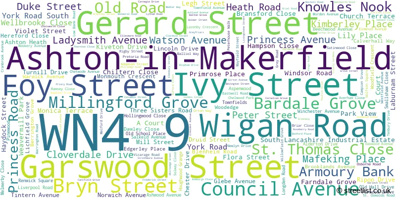
A wide range of spatial data has been analysed to present this overview of the WN4 9 Postcode sector. If you would like anything added, please contact us.
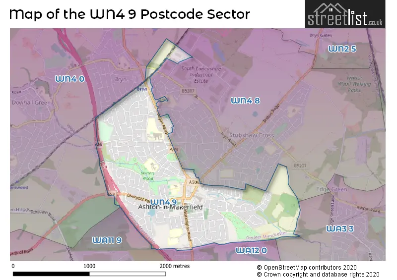
The WN4 9 postcode sector stands on the Greater Manchester and Merseyside border.
Did you know? According to the 2021 Census, the WN4 9 postcode sector is home to a bustling 10,308 residents!
Given that each sector allows for 400 unique postcode combinations. Letters C, I, K, M, O and V are not allowed in the last two letters of a postcode. With 231 postcodes already in use, this leaves 169 units available.
The WN4 9 postal code covers the settlement of Ashton-in-Makerfield.
The WN4 9 Postcode shares a border with WA3 3 (Golborne), WA12 0 (NEWTON-LE-WILLOWS), WA11 9 (ST. HELENS, Haydock), WN4 8 (Ashton-in-Makerfield) and WN4 0 (Ashton-in-Makerfield).
Map of the WN4 9 Postcode Sector
Explore the WN4 9 postcode sector by using our interactive map.
The sector is within the post town of WIGAN.
WN4 9 is a postcode sector within the WN4 postcode district which is within the WN Wigan postcode area.
The Royal Mail delivery office for the WN4 9 postal sector is the Wigan Delivery Office.
The area of the WN4 9 postcode sector is 1.17 square miles which is 3.03 square kilometres or 748.99 square acres.
The WN4 9 postcode sector is crossed by the M6 motorway.
Your support helps keep this site running!
If you enjoy using this website, consider buying me a coffee to help cover hosting costs.


| W | N | 4 | - | 9 | X | X |
| W | N | 4 | Space | 9 | Letter | Letter |
Official List of Streets
Ashton-in-Makerfield (170 Streets)
Unofficial Streets or Alternative Spellings
Ashton-in-Makerfield
ALEXANDRA ROAD ALLSCOTT WAY ANTLER COURT BOLTON ROAD BRYN ROAD CHAPEL STREET CHELMARSH AVENUE FAIRHOLME AVENUE KINGFISHER COURT LOCKETT ROAD NICOL ROAD ASHTON INTERCHANGE CAPTAINS LANE HEATH STREET LINCOLN DR MARKET APPROACH QUEENS ROAD SKITTERS WOOD TRAIL ST THOMAS CL TYRERS LANE WATSON AVEUENEWTON-LE-WILLOWS
LODGE LANE THE PARKSWeather Forecast for WN4 9
Weather Forecast for Ashton-In-Makerfield
| Time Period | Icon | Description | Temperature | Rain Probability | Wind |
|---|---|---|---|---|---|
| 09:00 to 12:00 | Cloudy | 5.0°C (feels like 2.0°C) | 4.00% | S 7 mph | |
| 12:00 to 15:00 | Cloudy | 9.0°C (feels like 6.0°C) | 5.00% | SSW 9 mph | |
| 15:00 to 18:00 | Cloudy | 10.0°C (feels like 7.0°C) | 5.00% | S 9 mph | |
| 18:00 to 21:00 | Cloudy | 8.0°C (feels like 5.0°C) | 5.00% | S 9 mph | |
| 21:00 to 00:00 | Overcast | 7.0°C (feels like 4.0°C) | 8.00% | S 11 mph |
| Time Period | Icon | Description | Temperature | Rain Probability | Wind |
|---|---|---|---|---|---|
| 00:00 to 03:00 | Cloudy | 7.0°C (feels like 4.0°C) | 9.00% | S 11 mph | |
| 03:00 to 06:00 | Cloudy | 7.0°C (feels like 4.0°C) | 9.00% | SSE 11 mph | |
| 06:00 to 09:00 | Cloudy | 8.0°C (feels like 5.0°C) | 11.00% | SSE 13 mph | |
| 09:00 to 12:00 | Overcast | 8.0°C (feels like 5.0°C) | 15.00% | S 13 mph | |
| 12:00 to 15:00 | Cloudy | 9.0°C (feels like 6.0°C) | 21.00% | S 16 mph | |
| 15:00 to 18:00 | Heavy rain | 9.0°C (feels like 7.0°C) | 82.00% | WSW 11 mph | |
| 18:00 to 21:00 | Partly cloudy (night) | 8.0°C (feels like 5.0°C) | 6.00% | SW 11 mph | |
| 21:00 to 00:00 | Clear night | 6.0°C (feels like 3.0°C) | 2.00% | WSW 11 mph |
| Time Period | Icon | Description | Temperature | Rain Probability | Wind |
|---|---|---|---|---|---|
| 00:00 to 03:00 | Clear night | 5.0°C (feels like 2.0°C) | 2.00% | WSW 11 mph | |
| 03:00 to 06:00 | Clear night | 5.0°C (feels like 2.0°C) | 5.00% | WSW 9 mph | |
| 06:00 to 09:00 | Cloudy | 5.0°C (feels like 2.0°C) | 5.00% | WSW 9 mph | |
| 09:00 to 12:00 | Cloudy | 5.0°C (feels like 3.0°C) | 4.00% | W 7 mph | |
| 12:00 to 15:00 | Cloudy | 7.0°C (feels like 4.0°C) | 6.00% | W 9 mph | |
| 15:00 to 18:00 | Sunny day | 7.0°C (feels like 5.0°C) | 1.00% | WNW 9 mph | |
| 18:00 to 21:00 | Clear night | 4.0°C (feels like 3.0°C) | 1.00% | WNW 4 mph | |
| 21:00 to 00:00 | Clear night | 3.0°C (feels like 2.0°C) | 1.00% | WSW 2 mph |
| Time Period | Icon | Description | Temperature | Rain Probability | Wind |
|---|---|---|---|---|---|
| 00:00 to 03:00 | Clear night | 2.0°C (feels like 0.0°C) | 1.00% | ESE 2 mph | |
| 03:00 to 06:00 | Clear night | 1.0°C (feels like -1.0°C) | 2.00% | ESE 2 mph | |
| 06:00 to 09:00 | Clear night | 0.0°C (feels like -2.0°C) | 3.00% | ESE 4 mph | |
| 09:00 to 12:00 | Sunny day | 0.0°C (feels like -2.0°C) | 3.00% | ESE 4 mph | |
| 12:00 to 15:00 | Sunny day | 5.0°C (feels like 3.0°C) | 0.00% | SE 4 mph | |
| 15:00 to 18:00 | Sunny day | 7.0°C (feels like 5.0°C) | 0.00% | ESE 7 mph | |
| 18:00 to 21:00 | Clear night | 4.0°C (feels like 2.0°C) | 0.00% | ESE 7 mph | |
| 21:00 to 00:00 | Clear night | 3.0°C (feels like 0.0°C) | 0.00% | ESE 7 mph |
| Time Period | Icon | Description | Temperature | Rain Probability | Wind |
|---|---|---|---|---|---|
| 00:00 to 03:00 | Clear night | 2.0°C (feels like -1.0°C) | 0.00% | ESE 7 mph | |
| 03:00 to 06:00 | Clear night | 1.0°C (feels like -2.0°C) | 1.00% | ESE 7 mph | |
| 06:00 to 09:00 | Clear night | 0.0°C (feels like -2.0°C) | 2.00% | E 4 mph | |
| 09:00 to 12:00 | Sunny day | 1.0°C (feels like -2.0°C) | 3.00% | E 7 mph | |
| 12:00 to 15:00 | Sunny day | 5.0°C (feels like 2.0°C) | 1.00% | ESE 7 mph | |
| 15:00 to 18:00 | Sunny day | 6.0°C (feels like 3.0°C) | 1.00% | ESE 7 mph | |
| 18:00 to 21:00 | Clear night | 3.0°C (feels like 1.0°C) | 1.00% | E 7 mph | |
| 21:00 to 00:00 | Clear night | 2.0°C (feels like -1.0°C) | 1.00% | E 7 mph |
Schools and Places of Education Within the WN4 9 Postcode Sector
Cansfield High School
Community school
Old Road, Wigan, Lancashire, WN4 9TP
Head: Mrs Nicola Daniels
Ofsted Rating: Good
Inspection: 2019-01-24 (2202 days ago)
Website: Visit Cansfield High School Website
Phone: 01942727391
Number of Pupils: 1040
R L Hughes Primary School
Community school
Mayfield Street, Wigan, Lancashire, WN4 9QL
Head: Monica Middlehurst
Ofsted Rating: Good
Inspection: 2023-02-03 (731 days ago)
Website: Visit R L Hughes Primary School Website
Phone: 01942701147
Number of Pupils: 428
St Edmund Arrowsmith Catholic High School, Ashton-in-Makerfield
Voluntary aided school
Rookery Avenue, Wigan, Lancashire, WN4 9PF
Head: Mr Mark Dumican
Ofsted Rating: Good
Inspection: 2021-11-17 (1174 days ago)
Website: Visit St Edmund Arrowsmith Catholic High School, Ashton-in-Makerfield Website
Phone: 01942728651
Number of Pupils: 1208
St Oswald's Catholic Primary School
Voluntary aided school
Council Avenue, Wigan, Lancashire, WN4 9AZ
Head: Mrs Julie Hassan
Ofsted Rating: Good
Inspection: 2022-11-03 (823 days ago)
Website: Visit St Oswald's Catholic Primary School Website
Phone: 01942724820
Number of Pupils: 294
The Byrchall High School
Academy converter
Warrington Road, Wigan, Lancashire, WN4 9PQ
Head: Mr Alan Birchall
Ofsted Rating: Good
Inspection: 2022-09-14 (873 days ago)
Website: Visit The Byrchall High School Website
Phone: 01942728221
Number of Pupils: 1001

House Prices in the WN4 9 Postcode Sector
| Type of Property | 2018 Average | 2018 Sales | 2017 Average | 2017 Sales | 2016 Average | 2016 Sales | 2015 Average | 2015 Sales |
|---|---|---|---|---|---|---|---|---|
| Detached | £253,455 | 22 | £215,325 | 26 | £230,625 | 36 | £218,523 | 20 |
| Semi-Detached | £131,720 | 78 | £127,275 | 63 | £132,204 | 59 | £129,872 | 67 |
| Terraced | £95,610 | 59 | £92,254 | 57 | £94,225 | 74 | £91,118 | 64 |
| Flats | £91,750 | 4 | £77,083 | 6 | £65,333 | 3 | £138,800 | 5 |
Important Postcodes WN4 9 in the Postcode Sector
WN4 9AB is the postcode for Jobcentre Plus, 17-19 Gerard Street
WN4 9AY is the postcode for Citizens Advice Bureau, The Old Town Hall, Bryn Street
WN4 9AZ is the postcode for St. Oswalds Primary School, Council Avenue
WN4 9BH is the postcode for Ashton Library, Wigan Road
WN4 9PF is the postcode for St. Edmund Arrowsmith Catholic High School, Rookery Avenue, MAIN SCHOOL BUILDING, St. Edmund Arrowsmith Catholic High School, Rookery Avenue, HUMANITIES, SCIENCE, MATHS & CRAFT BLOCK, St. Edmund Arrowsmith Catholic High School, Rookery Avenue, MAIN BUILDING, St. Edmund Arrowsmith Catholic High School, Rookery Avenue, and SCIENCE BLOCK, St. Edmund Arrowsmith Catholic High School, Rookery Avenue
WN4 9PQ is the postcode for GERARD BUILDING, Byrchall High School, Warrington Road, ALLAN BUILDING, Byrchall High School, Warrington Road, Byrchall High School, Warrington Road, SPORTS HALL, Byrchall High School, Warrington Road, and TEAGUE BUILDING, Byrchall High School, Warrington Road
WN4 9QL is the postcode for INFANTS BLOCK, R L Hughes County Junior & Infant School, Mayfield Street, R L Hughes County Junior & Infant School, Mayfield Street, and JUNIOR BLOCK, R L Hughes County Junior & Infant School, Mayfield Street
WN4 9TP is the postcode for TECHNOLOGY & DINING BLOCK, Cansfield High Specialist Language College, Old Road, Cansfield High School, Old Road, Ashton-in-Makerfield, LEISURE CENTRE, Cansfield High Specialist Language College, Old Road, MAIN BUILDING, Cansfield High Specialist Language College, Old Road, and Cansfield High Specialist Language College, Old Road
| The WN4 9 Sector is within these Local Authorities |
|
|---|---|
| The WN4 9 Sector is within these Counties |
|
| The WN4 9 Sector is within these Water Company Areas |
|