WF4 2ND is a postal code used within the United Kingdom for delivering mail.
Postcodes are made up of two parts. The part before the space (WF4) is called the outward code. The part after the space (2ND) is called the inward code. The letters C, I, K, M, O and V are not allowed in the inward code. In addition to the inward and outward code, the postcode can be broken up into four parts:
- Postal Area. In our case WF which means Wakefield.
- Postal District. In our case WF4.
- Postal Sector. In our case WF4 2.
- Postcode Unit. The last two letters. In our case ND.
The regional mail center for the post area WF is the Yorkshire Distribution Centre, which is located at Silkstone House, Express Way, Wakefield Europort, NORMANTON, WF6 2XX.
The final port of call for any post addressed to the WF4 2ND postcode is the local delivery office (DO) which is . Here the post will be sorted ready for delivery.
The properties in the WF4 2ND postcode have the street address of George Lane
Did you know? According to the 2021 Census, the WF4 2ND postcode is home to a bustling 42 residents!
WF4 2ND is within the village of Notton.
The WF4 2ND postcode area is composed of 100% residential properties, 0% commercial properties, and 0% public properties.
According to our data. Most dwellings in WF4 2ND are houses. The remainder of residential properties consist of bungalows. Of these houses, most are detached. The remainder are semi-detached. Of these bungalows, most are detached.
Most properties in WF4 2ND are owned by the occupiers with the rest being privately rented.

Interactive Mapping Showing UPRNs within the boundary of the postcode
Use the search box to search for other postcodes or places.
Your support helps keep this site running!
If you enjoy using this website, consider making a donation to help me cover hosting costs.
Moving to WF4 2ND?
I can help you uncover potential pitfalls and provide key questions to ask about your new property. With decades of experience as a Local Land Charges Manager, I offer confidential insights to make your move informed and stress-free.
This service is free, but you may make wish to make an optional donation to support it. Please include the property name and address in your request as well as anything you wish to focus on.
Contact Me| Property Type | Percentage |
|---|---|
| Residential | 100% |
| Commercial | 0% |
| Public | 0% |
Telephone Area Code for WF4 2ND
The telephone area code for WF4 2ND is 01226 Barnsley.
Map Coordinates
| Latitude | 53.6129750539 |
|---|---|
| Longitude | -1.47503468365 |
Retail and Shopping near WF4 2ND
Street
Town
Locality
Distance (Miles)
Central Postcode
Directions on Google Maps
STATION ROAD
BARNSLEY
ROYSTON
1.19
S71 4ET
View on Google Maps
HIGH STREET
BARNSLEY
ROYSTON
1.32
S71 4RA
View on Google Maps
CHURCH STREET
BARNSLEY
ROYSTON
1.36
S71 4QU
View on Google Maps
MIDLAND ROAD
BARNSLEY
ROYSTON
1.41
S71 4PX
View on Google Maps
Nearest Town
Distance (Miles)
Direction
Bearing
Royston
1.31
SE
140.36
Barnsley
4.12
S
184.32
Horbury
4.68
NW
315.32
Wakefield
4.98
N
349.04
Hemsworth
5.00
E
89.37
Featherstone
6.39
NE
48.03
Normanton
6.49
NNE
22.08
South Kirkby
6.55
ESE
101.62
Wombwell
7.05
SSE
153.20
Penistone
8.81
SW
226.73
Weather Forecast
Weather Forecast for Royston (South Yorkshire)
Time Period Icon Description Temperature Rain Probability Wind 21:00 to 00:00 
Cloudy 3.0°C (feels like 0.0°C) 3.00% WSW 7 mph
Time Period Icon Description Temperature Rain Probability Wind 00:00 to 03:00 Cloudy 3.0°C (feels like 0.0°C) 48.00% SSW 7 mph 03:00 to 06:00 
Heavy rain 3.0°C (feels like -1.0°C) 84.00% S 9 mph 06:00 to 09:00 
Overcast 3.0°C (feels like 1.0°C) 16.00% S 7 mph 09:00 to 12:00 Overcast 4.0°C (feels like 2.0°C) 11.00% SW 4 mph 12:00 to 15:00 Overcast 5.0°C (feels like 3.0°C) 9.00% NNE 4 mph 15:00 to 18:00 Overcast 6.0°C (feels like 5.0°C) 9.00% NE 4 mph 18:00 to 21:00 Overcast 5.0°C (feels like 4.0°C) 10.00% ESE 2 mph 21:00 to 00:00 Overcast 5.0°C (feels like 3.0°C) 9.00% S 2 mph
Time Period Icon Description Temperature Rain Probability Wind 00:00 to 03:00 Overcast 4.0°C (feels like 3.0°C) 9.00% SSW 2 mph 03:00 to 06:00 Overcast 4.0°C (feels like 2.0°C) 10.00% S 4 mph 06:00 to 09:00 Overcast 4.0°C (feels like 2.0°C) 10.00% S 4 mph 09:00 to 12:00 Overcast 4.0°C (feels like 1.0°C) 9.00% S 7 mph 12:00 to 15:00 Overcast 5.0°C (feels like 2.0°C) 10.00% S 9 mph 15:00 to 18:00 Overcast 6.0°C (feels like 3.0°C) 9.00% S 9 mph 18:00 to 21:00 Overcast 5.0°C (feels like 2.0°C) 9.00% S 9 mph 21:00 to 00:00 Cloudy 5.0°C (feels like 1.0°C) 5.00% S 9 mph
Time Period Icon Description Temperature Rain Probability Wind 00:00 to 03:00 Cloudy 4.0°C (feels like 0.0°C) 5.00% S 11 mph 03:00 to 06:00 Cloudy 3.0°C (feels like -1.0°C) 7.00% S 11 mph 06:00 to 09:00 Cloudy 3.0°C (feels like -1.0°C) 8.00% S 9 mph 09:00 to 12:00 Cloudy 3.0°C (feels like 0.0°C) 10.00% SSW 9 mph 12:00 to 15:00 Cloudy 6.0°C (feels like 3.0°C) 11.00% SW 9 mph 15:00 to 18:00 Cloudy 7.0°C (feels like 5.0°C) 9.00% SW 7 mph 18:00 to 21:00 Cloudy 5.0°C (feels like 3.0°C) 6.00% SW 7 mph 21:00 to 00:00 Cloudy 4.0°C (feels like 2.0°C) 6.00% SW 7 mph
Time Period Icon Description Temperature Rain Probability Wind 00:00 to 03:00 
Clear night 4.0°C (feels like 1.0°C) 3.00% SW 7 mph 03:00 to 06:00 Cloudy 3.0°C (feels like 1.0°C) 6.00% SSW 7 mph 06:00 to 09:00 Cloudy 3.0°C (feels like 1.0°C) 5.00% SSW 7 mph 09:00 to 12:00 Cloudy 4.0°C (feels like 1.0°C) 5.00% SSW 7 mph 12:00 to 15:00 Cloudy 7.0°C (feels like 4.0°C) 4.00% SSW 9 mph 15:00 to 18:00 Cloudy 7.0°C (feels like 5.0°C) 5.00% S 9 mph 18:00 to 21:00 Cloudy 6.0°C (feels like 3.0°C) 5.00% S 9 mph 21:00 to 00:00 Cloudy 6.0°C (feels like 2.0°C) 5.00% S 11 mph
What are the Broadband Speeds like?
Download Speeds

Average Mbps 49.400 Median Mbps 49.600 Maximum Mbps 79.670
WF4 2ND has an average download speed of 49.4 Megabits per second (Mbps).
1,428 other postcode units have the same broadband speed.
25% of postcodes (301,231) have slower broadband speeds.
74% of postcodes (881,982) have faster broadband speeds.
Upload Speeds

Average Mbps 12.800 Median Mbps 11.500 Maximum Mbps 20.000
WF4 2ND has an average upload speed of 12.8 Megabits per second (Mbps).
10,617 other postcode units have the same upload speed.
43% of postcodes (514,122) have slower upload speeds.
56% of postcodes (659,902) have faster upload speeds.
Schools within a five minute Drive
England Primary Schools
Royston St John the Baptist Church of England Voluntary Aided Primary School
Address: Royston St John the Baptist Church of England Voluntary Aided Primary School, Vicarage Lane, Royston, Barnsley, South Yorkshire, S71 4QY
Distance: 1.44 miles
Contact:
Royston St John Baptist CE Primary
Address: Royston St John Baptist CE Primary, Vicarage Lane, Royston, Barnsley, South Yorkshire, S71 4QY
Distance: 1.44 miles
Contact: 01226722011
Summerfields Primary Academy
Address: Summerfields Primary Academy, Haigh Croft Summer Lane, Royston, Barnsley, South Yorkshire, S71 4SF
Distance: 0.89 miles
Contact: 01226722480
Parkside Primary Academy
Address: Parkside Primary Academy, Midland Road, Royston, Barnsley, South Yorkshire, S71 4QP
Distance: 1.32 miles
Contact: 01226722416
Meadstead Primary Academy
Address: Meadstead Primary Academy, Meadstead Drive, Royston, Barnsley, South Yorkshire, S71 4JS
Distance: 1.18 miles
Contact: 01226722153
Wellgate Primary School
Address: Wellgate Primary School, George Street, Mapplewell, Barnsley, South Yorkshire, S75 6HR
Distance: 2.10 miles
Contact: 01226383739
Wellgate Primary School
Address: Wellgate Primary School, George Street, Mapplewell, Barnsley, South Yorkshire, S75 6HR
Distance: 2.10 miles
Contact:
Mapplewell Primary School
Address: Mapplewell Primary School, Greenside Avenue, Staincross, Barnsley, South Yorkshire, S75 6BB
Distance: 2.02 miles
Contact:
England Secondary Schools
Outwood Academy Carlton
Address: Outwood Academy Carlton, Royston Lane, Carlton, Barnsley, South Yorkshire, S71 3EW
Distance: 2.08 miles
Contact: 01226728494
Carlton Community College
Address: Carlton Community College, Royston Lane, Carlton, Barnsley, South Yorkshire, S71 3EW
Distance: 2.08 miles
Contact:
Nearest Dentists
DENTAL SURGERY
Address: 157 MIDLAND ROAD, ROYSTON, BARNSLEY, SOUTH YORKSHIRE, S71 4BY
Distance: 1.46 miles
Contact: :
R S NICHOLSON DENTAL SURGERY
Address: 1 LAITHES LANE, BARNSLEY, SOUTH YORKSHIRE, S71 3AA
Distance: 2.31 miles
Contact: :
DENTAL SURGERY
Address: STRATFORD HOUSE, 25 MILL LANE, RYHILL, WAKEFIELD, WEST YORKSHIRE, WF4 2AL
Distance: 2.48 miles
Contact: :
SANDAL DENTAL CARE
Address: SANDAL HEALTH CENTRE, ASDALE ROAD, WAKEFIELD, WEST YORKSHIRE, WF2 7JE
Distance: 2.68 miles
Contact: :
DENTAL SURGERY
Address: 102 HIGH STREET, CRIGGLESTONE, WAKEFIELD, WEST YORKSHIRE, WF4 3EF
Distance: 2.99 miles
Contact: :
DENTAL SURGERY
Address: 48 CHURCH STREET, DARTON, BARNSLEY, SOUTH YORKSHIRE, S75 5HG
Distance: 3.00 miles
Contact: :
Nearest Chemists
WELDRICKS PHARMACY
Address: 48A HIGH STREET, ROYSTON, BARNSLEY, SOUTH YORKSHIRE, S71 4RF
Distance: 1.25 miles
Contact: tel: 01226 722581
WELDRICKS PHARMACY
Address: 65C MIDLAND ROAD, ROYSTON, BARNSLEY, SOUTH YORKSHIRE, S71 4QW
Distance: 1.33 miles
Contact: tel: 01226 725631
GATEHOUSE PHARMACY
Address: THE GATE HOUSE, LONGCROFT, MAPPLEWELL, BARNSLEY, SOUTH YORKSHIRE, S75 6FH
Distance: 2.26 miles
Contact: tel: 01226 382422
SKF. LO (CHEMISTS) LIMITED
Address: UNIT 1, 393 DARTON LANE, MAPPLEWELL, BARNSLEY, S75 6AL
Distance: 2.31 miles
Contact: tel: 01226 382297
WELL
Address: WAKEFIELD ROAD, BARNSLEY, SOUTH YORKSHIRE, S71 1TH
Distance: 2.41 miles
Contact: tel: 01226 203928
LO'S PHARMACY
Address: CHAPELTHORPE MEDICAL CENTRE, STANDBRIDGE LANE, WAKEFIELD, WF2 7GP
Distance: 2.55 miles
Contact: tel: 01924 254129
Nearest Opticians
SADLER OPTICIANS
Address: 102 MIDLAND ROAD, ROYSTON, BARNSLEY, SOUTH YORKSHIRE, S71 4QT
Distance: 1.36 miles
Contact: :
SHEFFIELD 2 DOMICILIARY SPECSAVERS LIMITED
Address: 55 ST. ANDREWS DRIVE, DARTON, BARNSLEY, S75 5LX
Distance: 2.41 miles
Contact: :
4620 WAKEFIELD
Address: ASDA STORES LTD, ASDALE ROAD, DURKAR, WAKEFIELD, WEST YORKSHIRE, WF2 7EQ
Distance: 2.78 miles
Contact: :
MCCORMACK OPTICIANS LTD (WAKEFIELD)
Address: RYECROFT PRIMARY CARE CENTRE, MADELEY ROAD, HAVERCROFT, WAKEFIELD, WEST YORKSHIRE, WF4 2QG
Distance: 2.86 miles
Contact: :
J R MORTON (DARTON)
Address: 38 CHURCH STREET, DARTON, BARNSLEY, SOUTH YORKSHIRE, S75 5HG
Distance: 3.00 miles
Contact: :
NORWOOD & PERRIN (CUDWORTH)
Address: 235 BARNSLEY ROAD, CUDWORTH, BARNSLEY, S72 8JN
Distance: 3.42 miles
Contact: :
Nearest GP Surgeries
HIGH STREET PRACTICE
Address: 48 HIGH STREET, ROYSTON, BARNSLEY, SOUTH YORKSHIRE, S71 4RF
Distance: 1.25 miles
Contact: tel: 01226 722314
ROYSTON GROUP PRACTICE
Address: THE SURGERY, 65D MIDLAND ROAD, ROYSTON, BARNSLEY, SOUTH YORKSHIRE, S71 4QW
Distance: 1.33 miles
Contact: tel: 01226 700400
HILL BROW SURGERY PMS PRACTICE
Address: HILL BROW SURGERY, LONGCROFT, MAPPLEWELL, BARNSLEY, SOUTH YORKSHIRE, S75 6FH
Distance: 2.26 miles
Contact: tel: 01226 383131
ST GEORGE'S MEDICAL CENTRE PMS PRACTICE
Address: ROUNDHOUSE MEDICAL CENTRE, LANGSETT COURT, NEW LODGE, BARNSLEY, SOUTH YORKSHIRE, S71 1RY
Distance: 2.37 miles
Contact: tel: 01226 720207
THE ROUNDHOUSE MEDICAL CENTRE
Address: MEDICAL CENTRE, WAKEFIELD ROAD, BARNSLEY, SOUTH YORKSHIRE, S71 1TH
Distance: 2.41 miles
Contact: tel: 01226 292187
ALI A
Address: ROUNDHOUSE MEDICAL CENTRE, WAKEFIELD ROAD, BARNSLEY, SOUTH YORKSHIRE, S71 1TH
Distance: 2.41 miles
Contact: tel: 01226 296475
Transport Links
Train Stations
Darton
Address: Darton station, Station Road, Darton, South Yorkshire, S75 5HX
Postcode: S75 5HX
Line: Hallam Line
Company: Northern
Time: within ten minutes drive
Distance: 2.88 miles
Fitzwilliam
Address: Fitzwilliam station, Railway Terrace, Fitzwilliam, West Yorkshire, WF9 5DA
Postcode: WF9 5DA
Line: Wakefield line
Company: Northern
Time: within ten minutes drive
Distance: 4.37 miles
Sandal & Agbrigg
Address: Sandl & Agbrigg station, Agbrigg Road, Sandal, West Yorkshire, WF2 6AB
Postcode: WF2 6AB
Line: Wakefield line
Company: Northern
Time: within ten minutes drive
Distance: 3.48 miles
Barnsley
Address: Barnsley station, Schwabisch Gmund Way, Barnsley, South Yorkshire, S71 1BP
Postcode: S71 1BP
Line: Penistone Line|Hallam Line
Company: Northern
Time: within ten minutes drive
Distance: 4.03 miles
Streethouse
Address: Streethouse station, Whinney Lane, Streethouse, West Yorkshire, WF7 6UJ
Postcode: WF7 6UJ
Line: Pontefract line
Company: Northern
Time: within fifteen minutes drive
Distance: 5.35 miles
Wakefield Kirkgate
Address: Wakefield Kirkgate station, Monk Street, Wakefield, West Yorkshire, WF1 4EL
Postcode: WF1 4EL
Line: Hallam Line|Pontefract line
Company: Northern
Time: within fifteen minutes drive
Distance: 4.59 miles
Wakefield Westgate
Address: Wakefield Westgate station, Mulberry Way, Wakefield, West Yorkshire, WF1 2QN
Postcode: WF1 2QN
Line: Pontefract line|Wakefield line
Company: London North Eastern Railway
Time: within fifteen minutes drive
Distance: 4.91 miles
Dodworth
Address: Dodworth station, Station Road, Dodworth, South Yorkshire, S75 3JX
Postcode: S75 3JX
Line: Penistone Line
Company: Northern
Time: within fifteen minutes drive
Distance: 5.28 miles
Moorthorpe
Address: Moorthorpe station, Barnsley Road, Moorthorpe, West Yorkshire, WF9 3AT
Postcode: WF9 3AT
Line: Dearne Valley line|Wakefield line
Company: Northern
Time: within fifteen minutes drive
Distance: 7.09 miles
Featherstone
Address: Featherstone station, Featherstone, Featherstone, West Yorkshire, WF7 7HJ
Postcode: WF7 7HJ
Line: Pontefract line
Company: Northern
Time: within fifteen minutes drive
Distance: 6.56 miles
Normanton
Address: Normanton station, Lower Station Road, Normanton, West Yorkshire, WF6 2BG
Postcode: WF6 2BG
Line: Hallam Line
Company: Northern
Time: within fifteen minutes drive
Distance: 6.37 miles
Wombwell
Address: Wombwell station, Hough Lane, Wombwell, South Yorkshire, S73 0LU
Postcode: S73 0LU
Line: Penistone Line|Hallam Line
Company: Northern
Time: within fifteen minutes drive
Distance: 7.02 miles
Distances are as the crow flies.
Motorway Junctions
M1 J38Distance: 4.48 milesDriving Time: 7.82 minutesM1 J39Distance: 4.83 milesDriving Time: 8.41 minutesM1 J37Distance: 6.66 milesDriving Time: 11.37 minutesM1 J40Distance: 7.41 milesDriving Time: 11.03 minutesM62 J31Distance: 10.34 milesDriving Time: 16.29 minutes Distances represent the quickest route by car.
Who are my Elected Representatives?
Westminster Constituency Normanton and Hemsworth Member or Parliament 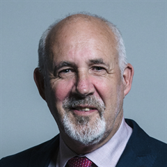
Jon Trickett Contact Details Contact Jon Trickett Political Party Labour
Where can I find out where the nearest Library is?
Libraries are the responsibility of Wakefield council
Visit the link for more information. Please note that some councils outsource library services to private companies and community groups ran by volunteers.
Libraries and local history
House Sales
Yearly House Sales
Year High Low Average Sales 2018 £490,000 £490,000 £490,000 1 2019 £475,000 £475,000 £475,000 1 2020 £490,000 £490,000 £490,000 1 2021 £750,000 £750,000 £750,000 1 2023 £400,000 £400,000 £400,000 1
Contains HM Land Registry data © Crown copyright and database right 2025. This data is licensed under the Open Government Licence v3.0.
Local Postcodes
What Popular Supermarkets are near?
Popular Supermarkets near WF4 2ND Supermarket Distance Directions Aldi, High Street, Royston, BARNSLEY, S71 4RF 2.00 miles Directions to Aldi Asda, Midland Road, Royston, BARNSLEY, S71 4BP 2.40 miles Directions to Asda Aldi, Sandal Castle Centre, Asdale Road, WAKEFIELD, WF2 7JE 4.31 miles Directions to Aldi Asda, Asdale Road, WAKEFIELD, WF2 7EQ 4.47 miles Directions to Asda Aldi, Barnsley Road, Cudworth, BARNSLEY, S72 8SU 5.47 miles Directions to Aldi
What Popular Restaurants are near?
Burger King Restaurants near WF4 2ND Burger King Distance Directions Woolley Edge M1(sth), Wakefield, WF4 4LQ 2.95 miles Directions to Woolley Edge M1(sth) Woolley Edge M1 (nth), Wakefield, WF4 4LQ 3.14 miles Directions to Woolley Edge M1 (nth) Calder Park, Wakefield, WF2 7BL 3.36 miles Directions to Calder Park Wakefield Trinity Walk Sm, Wakefield, WF1 1QR 5.01 miles Directions to Wakefield Trinity Walk Sm
Mcdonald's Restaurants near WF4 2ND Mcdonald's Distance Directions McDonald's, Old Mill Lane, BARNSLEY, S71 1LN 3.61 miles Directions to McDonald's, Old Mill Lane, BARNSLEY, S71 1LN McDonald's, Lower Thomas Street, BARNSLEY, S70 1LQ 4.38 miles Directions to McDonald's, Lower Thomas Street, BARNSLEY, S70 1LQ McDonald's, Cathedral Retail Park, Charlesworth Way, WAKEFIELD, WF2 9SE 4.63 miles Directions to McDonald's, Cathedral Retail Park, Charlesworth Way, WAKEFIELD, WF2 9SE McDonald's, Dewsbury Road, WAKEFIELD, WF2 9BY 4.96 miles Directions to McDonald's, Dewsbury Road, WAKEFIELD, WF2 9BY
KFC Restaurants near WF4 2ND Restaurant Distance Directions KFC, Wakefield Road, BARNSLEY, S71 1NG 3.10 miles Directions to KFC Barnsley - Wakefield Road KFC, Peel Avenue, WAKEFIELD, WF2 7BL 3.36 miles Directions to KFC Wakefield - Calder Park KFC, Peel Street, BARNSLEY, S70 2RL 4.20 miles Directions to KFC Barnsley - Peel Street KFC, Westgate Retail & Leisure Park, Ings Road, WAKEFIELD, WF2 9SD 4.72 miles Directions to KFC Wakefield - Westgate Retail Park KFC, Rockingham Row, Birdwell, BARNSLEY, S70 5TW 7.69 miles Directions to KFC Rockingham - Dearne Valley
| Street | Town | Locality | Distance (Miles) | Central Postcode | Directions on Google Maps |
|---|---|---|---|---|---|
| STATION ROAD | BARNSLEY | ROYSTON | 1.19 | S71 4ET | View on Google Maps |
| HIGH STREET | BARNSLEY | ROYSTON | 1.32 | S71 4RA | View on Google Maps |
| CHURCH STREET | BARNSLEY | ROYSTON | 1.36 | S71 4QU | View on Google Maps |
| MIDLAND ROAD | BARNSLEY | ROYSTON | 1.41 | S71 4PX | View on Google Maps |
| Nearest Town | Distance (Miles) | Direction | Bearing |
|---|---|---|---|
| Royston | 1.31 | SE | 140.36 |
| Barnsley | 4.12 | S | 184.32 |
| Horbury | 4.68 | NW | 315.32 |
| Wakefield | 4.98 | N | 349.04 |
| Hemsworth | 5.00 | E | 89.37 |
| Featherstone | 6.39 | NE | 48.03 |
| Normanton | 6.49 | NNE | 22.08 |
| South Kirkby | 6.55 | ESE | 101.62 |
| Wombwell | 7.05 | SSE | 153.20 |
| Penistone | 8.81 | SW | 226.73 |
Weather Forecast
Weather Forecast for Royston (South Yorkshire)
| Time Period | Icon | Description | Temperature | Rain Probability | Wind |
|---|---|---|---|---|---|
| 21:00 to 00:00 | Cloudy | 3.0°C (feels like 0.0°C) | 3.00% | WSW 7 mph |
| Time Period | Icon | Description | Temperature | Rain Probability | Wind |
|---|---|---|---|---|---|
| 00:00 to 03:00 | Cloudy | 3.0°C (feels like 0.0°C) | 48.00% | SSW 7 mph | |
| 03:00 to 06:00 | Heavy rain | 3.0°C (feels like -1.0°C) | 84.00% | S 9 mph | |
| 06:00 to 09:00 | Overcast | 3.0°C (feels like 1.0°C) | 16.00% | S 7 mph | |
| 09:00 to 12:00 | Overcast | 4.0°C (feels like 2.0°C) | 11.00% | SW 4 mph | |
| 12:00 to 15:00 | Overcast | 5.0°C (feels like 3.0°C) | 9.00% | NNE 4 mph | |
| 15:00 to 18:00 | Overcast | 6.0°C (feels like 5.0°C) | 9.00% | NE 4 mph | |
| 18:00 to 21:00 | Overcast | 5.0°C (feels like 4.0°C) | 10.00% | ESE 2 mph | |
| 21:00 to 00:00 | Overcast | 5.0°C (feels like 3.0°C) | 9.00% | S 2 mph |
| Time Period | Icon | Description | Temperature | Rain Probability | Wind |
|---|---|---|---|---|---|
| 00:00 to 03:00 | Overcast | 4.0°C (feels like 3.0°C) | 9.00% | SSW 2 mph | |
| 03:00 to 06:00 | Overcast | 4.0°C (feels like 2.0°C) | 10.00% | S 4 mph | |
| 06:00 to 09:00 | Overcast | 4.0°C (feels like 2.0°C) | 10.00% | S 4 mph | |
| 09:00 to 12:00 | Overcast | 4.0°C (feels like 1.0°C) | 9.00% | S 7 mph | |
| 12:00 to 15:00 | Overcast | 5.0°C (feels like 2.0°C) | 10.00% | S 9 mph | |
| 15:00 to 18:00 | Overcast | 6.0°C (feels like 3.0°C) | 9.00% | S 9 mph | |
| 18:00 to 21:00 | Overcast | 5.0°C (feels like 2.0°C) | 9.00% | S 9 mph | |
| 21:00 to 00:00 | Cloudy | 5.0°C (feels like 1.0°C) | 5.00% | S 9 mph |
| Time Period | Icon | Description | Temperature | Rain Probability | Wind |
|---|---|---|---|---|---|
| 00:00 to 03:00 | Cloudy | 4.0°C (feels like 0.0°C) | 5.00% | S 11 mph | |
| 03:00 to 06:00 | Cloudy | 3.0°C (feels like -1.0°C) | 7.00% | S 11 mph | |
| 06:00 to 09:00 | Cloudy | 3.0°C (feels like -1.0°C) | 8.00% | S 9 mph | |
| 09:00 to 12:00 | Cloudy | 3.0°C (feels like 0.0°C) | 10.00% | SSW 9 mph | |
| 12:00 to 15:00 | Cloudy | 6.0°C (feels like 3.0°C) | 11.00% | SW 9 mph | |
| 15:00 to 18:00 | Cloudy | 7.0°C (feels like 5.0°C) | 9.00% | SW 7 mph | |
| 18:00 to 21:00 | Cloudy | 5.0°C (feels like 3.0°C) | 6.00% | SW 7 mph | |
| 21:00 to 00:00 | Cloudy | 4.0°C (feels like 2.0°C) | 6.00% | SW 7 mph |
| Time Period | Icon | Description | Temperature | Rain Probability | Wind |
|---|---|---|---|---|---|
| 00:00 to 03:00 | Clear night | 4.0°C (feels like 1.0°C) | 3.00% | SW 7 mph | |
| 03:00 to 06:00 | Cloudy | 3.0°C (feels like 1.0°C) | 6.00% | SSW 7 mph | |
| 06:00 to 09:00 | Cloudy | 3.0°C (feels like 1.0°C) | 5.00% | SSW 7 mph | |
| 09:00 to 12:00 | Cloudy | 4.0°C (feels like 1.0°C) | 5.00% | SSW 7 mph | |
| 12:00 to 15:00 | Cloudy | 7.0°C (feels like 4.0°C) | 4.00% | SSW 9 mph | |
| 15:00 to 18:00 | Cloudy | 7.0°C (feels like 5.0°C) | 5.00% | S 9 mph | |
| 18:00 to 21:00 | Cloudy | 6.0°C (feels like 3.0°C) | 5.00% | S 9 mph | |
| 21:00 to 00:00 | Cloudy | 6.0°C (feels like 2.0°C) | 5.00% | S 11 mph |
What are the Broadband Speeds like?
Download Speeds
| Average Mbps | 49.400 |
|---|---|
| Median Mbps | 49.600 |
| Maximum Mbps | 79.670 |
WF4 2ND has an average download speed of 49.4 Megabits per second (Mbps).
1,428 other postcode units have the same broadband speed.
25% of postcodes (301,231) have slower broadband speeds.
74% of postcodes (881,982) have faster broadband speeds.
Upload Speeds
| Average Mbps | 12.800 |
|---|---|
| Median Mbps | 11.500 |
| Maximum Mbps | 20.000 |
WF4 2ND has an average upload speed of 12.8 Megabits per second (Mbps).
10,617 other postcode units have the same upload speed.
43% of postcodes (514,122) have slower upload speeds.
56% of postcodes (659,902) have faster upload speeds.
Schools within a five minute Drive
England Primary Schools
Royston St John the Baptist Church of England Voluntary Aided Primary School
Address: Royston St John the Baptist Church of England Voluntary Aided Primary School, Vicarage Lane, Royston, Barnsley, South Yorkshire, S71 4QY
Distance: 1.44 miles
Contact:
Royston St John Baptist CE Primary
Address: Royston St John Baptist CE Primary, Vicarage Lane, Royston, Barnsley, South Yorkshire, S71 4QY
Distance: 1.44 miles
Contact: 01226722011
Summerfields Primary Academy
Address: Summerfields Primary Academy, Haigh Croft Summer Lane, Royston, Barnsley, South Yorkshire, S71 4SF
Distance: 0.89 miles
Contact: 01226722480
Parkside Primary Academy
Address: Parkside Primary Academy, Midland Road, Royston, Barnsley, South Yorkshire, S71 4QP
Distance: 1.32 miles
Contact: 01226722416
Meadstead Primary Academy
Address: Meadstead Primary Academy, Meadstead Drive, Royston, Barnsley, South Yorkshire, S71 4JS
Distance: 1.18 miles
Contact: 01226722153
Wellgate Primary School
Address: Wellgate Primary School, George Street, Mapplewell, Barnsley, South Yorkshire, S75 6HR
Distance: 2.10 miles
Contact: 01226383739
Wellgate Primary School
Address: Wellgate Primary School, George Street, Mapplewell, Barnsley, South Yorkshire, S75 6HR
Distance: 2.10 miles
Contact:
Mapplewell Primary School
Address: Mapplewell Primary School, Greenside Avenue, Staincross, Barnsley, South Yorkshire, S75 6BB
Distance: 2.02 miles
Contact:
England Secondary Schools
Outwood Academy Carlton
Address: Outwood Academy Carlton, Royston Lane, Carlton, Barnsley, South Yorkshire, S71 3EW
Distance: 2.08 miles
Contact: 01226728494
Carlton Community College
Address: Carlton Community College, Royston Lane, Carlton, Barnsley, South Yorkshire, S71 3EW
Distance: 2.08 miles
Contact:
Nearest Dentists
DENTAL SURGERY
Address: 157 MIDLAND ROAD, ROYSTON, BARNSLEY, SOUTH YORKSHIRE, S71 4BY
Distance: 1.46 miles
Contact: :
R S NICHOLSON DENTAL SURGERY
Address: 1 LAITHES LANE, BARNSLEY, SOUTH YORKSHIRE, S71 3AA
Distance: 2.31 miles
Contact: :
DENTAL SURGERY
Address: STRATFORD HOUSE, 25 MILL LANE, RYHILL, WAKEFIELD, WEST YORKSHIRE, WF4 2AL
Distance: 2.48 miles
Contact: :
SANDAL DENTAL CARE
Address: SANDAL HEALTH CENTRE, ASDALE ROAD, WAKEFIELD, WEST YORKSHIRE, WF2 7JE
Distance: 2.68 miles
Contact: :
DENTAL SURGERY
Address: 102 HIGH STREET, CRIGGLESTONE, WAKEFIELD, WEST YORKSHIRE, WF4 3EF
Distance: 2.99 miles
Contact: :
DENTAL SURGERY
Address: 48 CHURCH STREET, DARTON, BARNSLEY, SOUTH YORKSHIRE, S75 5HG
Distance: 3.00 miles
Contact: :
Nearest Chemists
WELDRICKS PHARMACY
Address: 48A HIGH STREET, ROYSTON, BARNSLEY, SOUTH YORKSHIRE, S71 4RF
Distance: 1.25 miles
Contact: tel: 01226 722581
WELDRICKS PHARMACY
Address: 65C MIDLAND ROAD, ROYSTON, BARNSLEY, SOUTH YORKSHIRE, S71 4QW
Distance: 1.33 miles
Contact: tel: 01226 725631
GATEHOUSE PHARMACY
Address: THE GATE HOUSE, LONGCROFT, MAPPLEWELL, BARNSLEY, SOUTH YORKSHIRE, S75 6FH
Distance: 2.26 miles
Contact: tel: 01226 382422
SKF. LO (CHEMISTS) LIMITED
Address: UNIT 1, 393 DARTON LANE, MAPPLEWELL, BARNSLEY, S75 6AL
Distance: 2.31 miles
Contact: tel: 01226 382297
WELL
Address: WAKEFIELD ROAD, BARNSLEY, SOUTH YORKSHIRE, S71 1TH
Distance: 2.41 miles
Contact: tel: 01226 203928
LO'S PHARMACY
Address: CHAPELTHORPE MEDICAL CENTRE, STANDBRIDGE LANE, WAKEFIELD, WF2 7GP
Distance: 2.55 miles
Contact: tel: 01924 254129
Nearest Opticians
SADLER OPTICIANS
Address: 102 MIDLAND ROAD, ROYSTON, BARNSLEY, SOUTH YORKSHIRE, S71 4QT
Distance: 1.36 miles
Contact: :
SHEFFIELD 2 DOMICILIARY SPECSAVERS LIMITED
Address: 55 ST. ANDREWS DRIVE, DARTON, BARNSLEY, S75 5LX
Distance: 2.41 miles
Contact: :
4620 WAKEFIELD
Address: ASDA STORES LTD, ASDALE ROAD, DURKAR, WAKEFIELD, WEST YORKSHIRE, WF2 7EQ
Distance: 2.78 miles
Contact: :
MCCORMACK OPTICIANS LTD (WAKEFIELD)
Address: RYECROFT PRIMARY CARE CENTRE, MADELEY ROAD, HAVERCROFT, WAKEFIELD, WEST YORKSHIRE, WF4 2QG
Distance: 2.86 miles
Contact: :
J R MORTON (DARTON)
Address: 38 CHURCH STREET, DARTON, BARNSLEY, SOUTH YORKSHIRE, S75 5HG
Distance: 3.00 miles
Contact: :
NORWOOD & PERRIN (CUDWORTH)
Address: 235 BARNSLEY ROAD, CUDWORTH, BARNSLEY, S72 8JN
Distance: 3.42 miles
Contact: :
Nearest GP Surgeries
HIGH STREET PRACTICE
Address: 48 HIGH STREET, ROYSTON, BARNSLEY, SOUTH YORKSHIRE, S71 4RF
Distance: 1.25 miles
Contact: tel: 01226 722314
ROYSTON GROUP PRACTICE
Address: THE SURGERY, 65D MIDLAND ROAD, ROYSTON, BARNSLEY, SOUTH YORKSHIRE, S71 4QW
Distance: 1.33 miles
Contact: tel: 01226 700400
HILL BROW SURGERY PMS PRACTICE
Address: HILL BROW SURGERY, LONGCROFT, MAPPLEWELL, BARNSLEY, SOUTH YORKSHIRE, S75 6FH
Distance: 2.26 miles
Contact: tel: 01226 383131
ST GEORGE'S MEDICAL CENTRE PMS PRACTICE
Address: ROUNDHOUSE MEDICAL CENTRE, LANGSETT COURT, NEW LODGE, BARNSLEY, SOUTH YORKSHIRE, S71 1RY
Distance: 2.37 miles
Contact: tel: 01226 720207
THE ROUNDHOUSE MEDICAL CENTRE
Address: MEDICAL CENTRE, WAKEFIELD ROAD, BARNSLEY, SOUTH YORKSHIRE, S71 1TH
Distance: 2.41 miles
Contact: tel: 01226 292187
ALI A
Address: ROUNDHOUSE MEDICAL CENTRE, WAKEFIELD ROAD, BARNSLEY, SOUTH YORKSHIRE, S71 1TH
Distance: 2.41 miles
Contact: tel: 01226 296475
Transport Links
Train Stations
Darton
Address: Darton station, Station Road, Darton, South Yorkshire, S75 5HX
Postcode: S75 5HX
Line: Hallam Line
Company: Northern
Time: within ten minutes drive
Distance: 2.88 miles
Fitzwilliam
Address: Fitzwilliam station, Railway Terrace, Fitzwilliam, West Yorkshire, WF9 5DA
Postcode: WF9 5DA
Line: Wakefield line
Company: Northern
Time: within ten minutes drive
Distance: 4.37 miles
Sandal & Agbrigg
Address: Sandl & Agbrigg station, Agbrigg Road, Sandal, West Yorkshire, WF2 6AB
Postcode: WF2 6AB
Line: Wakefield line
Company: Northern
Time: within ten minutes drive
Distance: 3.48 miles
Barnsley
Address: Barnsley station, Schwabisch Gmund Way, Barnsley, South Yorkshire, S71 1BP
Postcode: S71 1BP
Line: Penistone Line|Hallam Line
Company: Northern
Time: within ten minutes drive
Distance: 4.03 miles
Streethouse
Address: Streethouse station, Whinney Lane, Streethouse, West Yorkshire, WF7 6UJ
Postcode: WF7 6UJ
Line: Pontefract line
Company: Northern
Time: within fifteen minutes drive
Distance: 5.35 miles
Wakefield Kirkgate
Address: Wakefield Kirkgate station, Monk Street, Wakefield, West Yorkshire, WF1 4EL
Postcode: WF1 4EL
Line: Hallam Line|Pontefract line
Company: Northern
Time: within fifteen minutes drive
Distance: 4.59 miles
Wakefield Westgate
Address: Wakefield Westgate station, Mulberry Way, Wakefield, West Yorkshire, WF1 2QN
Postcode: WF1 2QN
Line: Pontefract line|Wakefield line
Company: London North Eastern Railway
Time: within fifteen minutes drive
Distance: 4.91 miles
Dodworth
Address: Dodworth station, Station Road, Dodworth, South Yorkshire, S75 3JX
Postcode: S75 3JX
Line: Penistone Line
Company: Northern
Time: within fifteen minutes drive
Distance: 5.28 miles
Moorthorpe
Address: Moorthorpe station, Barnsley Road, Moorthorpe, West Yorkshire, WF9 3AT
Postcode: WF9 3AT
Line: Dearne Valley line|Wakefield line
Company: Northern
Time: within fifteen minutes drive
Distance: 7.09 miles
Featherstone
Address: Featherstone station, Featherstone, Featherstone, West Yorkshire, WF7 7HJ
Postcode: WF7 7HJ
Line: Pontefract line
Company: Northern
Time: within fifteen minutes drive
Distance: 6.56 miles
Normanton
Address: Normanton station, Lower Station Road, Normanton, West Yorkshire, WF6 2BG
Postcode: WF6 2BG
Line: Hallam Line
Company: Northern
Time: within fifteen minutes drive
Distance: 6.37 miles
Wombwell
Address: Wombwell station, Hough Lane, Wombwell, South Yorkshire, S73 0LU
Postcode: S73 0LU
Line: Penistone Line|Hallam Line
Company: Northern
Time: within fifteen minutes drive
Distance: 7.02 miles
Distances are as the crow flies.
Motorway Junctions
Distances represent the quickest route by car.
Who are my Elected Representatives?
| Westminster Constituency | Normanton and Hemsworth |
|---|---|
| Member or Parliament | |
| Contact Details | Contact Jon Trickett |
| Political Party | Labour |
Where can I find out where the nearest Library is?
Libraries are the responsibility of Wakefield council
Visit the link for more information. Please note that some councils outsource library services to private companies and community groups ran by volunteers.
Libraries and local historyHouse Sales
| Year | High | Low | Average | Sales |
|---|---|---|---|---|
| 2018 | £490,000 | £490,000 | £490,000 | 1 |
| 2019 | £475,000 | £475,000 | £475,000 | 1 |
| 2020 | £490,000 | £490,000 | £490,000 | 1 |
| 2021 | £750,000 | £750,000 | £750,000 | 1 |
| 2023 | £400,000 | £400,000 | £400,000 | 1 |
Contains HM Land Registry data © Crown copyright and database right 2025. This data is licensed under the Open Government Licence v3.0.
Local Postcodes
What Popular Supermarkets are near?
| Supermarket | Distance | Directions |
|---|---|---|
| Aldi, High Street, Royston, BARNSLEY, S71 4RF | 2.00 miles | Directions to Aldi |
| Asda, Midland Road, Royston, BARNSLEY, S71 4BP | 2.40 miles | Directions to Asda |
| Aldi, Sandal Castle Centre, Asdale Road, WAKEFIELD, WF2 7JE | 4.31 miles | Directions to Aldi |
| Asda, Asdale Road, WAKEFIELD, WF2 7EQ | 4.47 miles | Directions to Asda |
| Aldi, Barnsley Road, Cudworth, BARNSLEY, S72 8SU | 5.47 miles | Directions to Aldi |
What Popular Restaurants are near?
| Burger King | Distance | Directions |
|---|---|---|
| Woolley Edge M1(sth), Wakefield, WF4 4LQ | 2.95 miles | Directions to Woolley Edge M1(sth) |
| Woolley Edge M1 (nth), Wakefield, WF4 4LQ | 3.14 miles | Directions to Woolley Edge M1 (nth) |
| Calder Park, Wakefield, WF2 7BL | 3.36 miles | Directions to Calder Park |
| Wakefield Trinity Walk Sm, Wakefield, WF1 1QR | 5.01 miles | Directions to Wakefield Trinity Walk Sm |
| Mcdonald's | Distance | Directions |
|---|---|---|
| McDonald's, Old Mill Lane, BARNSLEY, S71 1LN | 3.61 miles | Directions to McDonald's, Old Mill Lane, BARNSLEY, S71 1LN |
| McDonald's, Lower Thomas Street, BARNSLEY, S70 1LQ | 4.38 miles | Directions to McDonald's, Lower Thomas Street, BARNSLEY, S70 1LQ |
| McDonald's, Cathedral Retail Park, Charlesworth Way, WAKEFIELD, WF2 9SE | 4.63 miles | Directions to McDonald's, Cathedral Retail Park, Charlesworth Way, WAKEFIELD, WF2 9SE |
| McDonald's, Dewsbury Road, WAKEFIELD, WF2 9BY | 4.96 miles | Directions to McDonald's, Dewsbury Road, WAKEFIELD, WF2 9BY |
| Restaurant | Distance | Directions |
|---|---|---|
| KFC, Wakefield Road, BARNSLEY, S71 1NG | 3.10 miles | Directions to KFC Barnsley - Wakefield Road |
| KFC, Peel Avenue, WAKEFIELD, WF2 7BL | 3.36 miles | Directions to KFC Wakefield - Calder Park |
| KFC, Peel Street, BARNSLEY, S70 2RL | 4.20 miles | Directions to KFC Barnsley - Peel Street |
| KFC, Westgate Retail & Leisure Park, Ings Road, WAKEFIELD, WF2 9SD | 4.72 miles | Directions to KFC Wakefield - Westgate Retail Park |
| KFC, Rockingham Row, Birdwell, BARNSLEY, S70 5TW | 7.69 miles | Directions to KFC Rockingham - Dearne Valley |