A wide range of spatial data has been analysed to present this overview of the W1C 1 Postcode sector. If you would like anything added, please contact us.
The W1C 1 postcode sector is within the county of Greater London.
Given that each sector allows for 400 unique postcode combinations. Letters C, I, K, M, O and V are not allowed in the last two letters of a postcode. With 62 postcodes already in use, this leaves 338 units available.
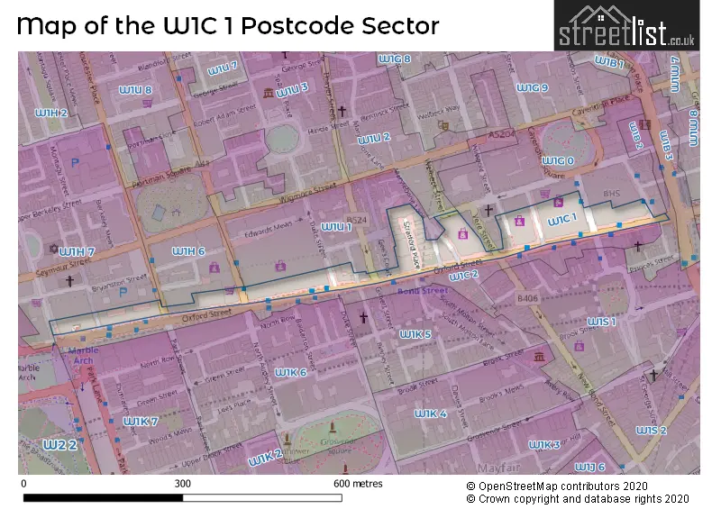
Map of the W1C 1 Postcode Sector
Explore the W1C 1 postcode sector by using our interactive map.
The sector is within the post town of LONDON.
W1C 1 is a postcode sector within the W1C postcode district which is within the W West London postcode area.
The Royal Mail delivery office for the W1C 1 postal sector is the Wdelivery Office.
The area of the W1C 1 postcode sector is 0.02 square miles which is 0.06 square kilometres or 14.01 square acres.
Your support helps keep this site running!
If you enjoy using this website, consider buying me a coffee to help cover hosting costs.


| W | 1 | C | - | 1 | X | X |
| W | 1 | C | Space | 1 | Letter | Letter |
Official List of Streets
Westminster (2 Streets)
Unofficial Streets or Alternative Spellings
Westminster
BINNEY STREET BIRD STREET CHAPEL PLACE DAVIES STREET DERING STREET DUKE STREET GILBERT STREET GREAT CUMBERLAND PLACE HAREWOOD PLACE HENRIETTA PLACE HOLLES STREET JAMES STREET MARYLEBONE LANE NEW BOND STREET OLD CAVENDISH STREET OLD QUEBEC STREET ORCHARD STREET PORTMAN STREET SWALLOW PLACE VERE STREET GEES COURT GEES PLACE JOHN PRINCES STREETWeather Forecast for W1C 1
Weather Forecast for Oxford Street Youth Hostel
| Time Period | Icon | Description | Temperature | Rain Probability | Wind |
|---|---|---|---|---|---|
| 09:00 to 12:00 | Overcast | 3.0°C (feels like 2.0°C) | 24.00% | NNE 2 mph | |
| 12:00 to 15:00 | Overcast | 4.0°C (feels like 3.0°C) | 12.00% | NW 4 mph | |
| 15:00 to 18:00 | Overcast | 5.0°C (feels like 3.0°C) | 11.00% | NW 4 mph | |
| 18:00 to 21:00 | Overcast | 5.0°C (feels like 3.0°C) | 10.00% | NW 4 mph | |
| 21:00 to 00:00 | Cloudy | 4.0°C (feels like 2.0°C) | 6.00% | WNW 4 mph |
| Time Period | Icon | Description | Temperature | Rain Probability | Wind |
|---|---|---|---|---|---|
| 00:00 to 03:00 | Cloudy | 3.0°C (feels like 1.0°C) | 4.00% | W 4 mph | |
| 03:00 to 06:00 | Overcast | 3.0°C (feels like 0.0°C) | 8.00% | WSW 7 mph | |
| 06:00 to 09:00 | Overcast | 3.0°C (feels like 0.0°C) | 8.00% | SW 7 mph | |
| 09:00 to 12:00 | Cloudy | 4.0°C (feels like 2.0°C) | 6.00% | SSW 7 mph | |
| 12:00 to 15:00 | Heavy rain | 7.0°C (feels like 4.0°C) | 92.00% | SSW 11 mph | |
| 15:00 to 18:00 | Heavy rain | 7.0°C (feels like 4.0°C) | 91.00% | SW 16 mph | |
| 18:00 to 21:00 | Partly cloudy (night) | 6.0°C (feels like 2.0°C) | 4.00% | WSW 13 mph | |
| 21:00 to 00:00 | Partly cloudy (night) | 5.0°C (feels like 2.0°C) | 3.00% | WSW 9 mph |
| Time Period | Icon | Description | Temperature | Rain Probability | Wind |
|---|---|---|---|---|---|
| 00:00 to 03:00 | Cloudy | 5.0°C (feels like 2.0°C) | 5.00% | SW 7 mph | |
| 03:00 to 06:00 | Cloudy | 6.0°C (feels like 3.0°C) | 56.00% | S 9 mph | |
| 06:00 to 09:00 | Heavy rain | 9.0°C (feels like 5.0°C) | 90.00% | S 18 mph | |
| 09:00 to 12:00 | Heavy rain | 9.0°C (feels like 6.0°C) | 93.00% | SSW 20 mph | |
| 12:00 to 15:00 | Light rain | 11.0°C (feels like 8.0°C) | 60.00% | SW 18 mph | |
| 15:00 to 18:00 | Cloudy | 11.0°C (feels like 8.0°C) | 14.00% | SW 13 mph | |
| 18:00 to 21:00 | Cloudy | 9.0°C (feels like 7.0°C) | 7.00% | SW 11 mph | |
| 21:00 to 00:00 | Cloudy | 8.0°C (feels like 5.0°C) | 5.00% | SW 9 mph |
| Time Period | Icon | Description | Temperature | Rain Probability | Wind |
|---|---|---|---|---|---|
| 00:00 to 03:00 | Cloudy | 7.0°C (feels like 4.0°C) | 7.00% | SW 7 mph | |
| 03:00 to 06:00 | Cloudy | 6.0°C (feels like 4.0°C) | 11.00% | SW 4 mph | |
| 06:00 to 09:00 | Cloudy | 5.0°C (feels like 3.0°C) | 18.00% | SSW 4 mph | |
| 09:00 to 12:00 | Cloudy | 4.0°C (feels like 3.0°C) | 18.00% | SW 4 mph | |
| 12:00 to 15:00 | Cloudy | 5.0°C (feels like 4.0°C) | 23.00% | SSW 4 mph | |
| 15:00 to 18:00 | Cloudy | 6.0°C (feels like 5.0°C) | 17.00% | SSW 4 mph | |
| 18:00 to 21:00 | Cloudy | 5.0°C (feels like 3.0°C) | 14.00% | SSW 4 mph | |
| 21:00 to 00:00 | Partly cloudy (night) | 4.0°C (feels like 2.0°C) | 8.00% | SSW 4 mph |
| Time Period | Icon | Description | Temperature | Rain Probability | Wind |
|---|---|---|---|---|---|
| 00:00 to 03:00 | Cloudy | 4.0°C (feels like 1.0°C) | 12.00% | SSW 7 mph | |
| 03:00 to 06:00 | Clear night | 4.0°C (feels like 1.0°C) | 7.00% | SSW 7 mph | |
| 06:00 to 09:00 | Clear night | 4.0°C (feels like 2.0°C) | 3.00% | S 7 mph | |
| 09:00 to 12:00 | Cloudy | 5.0°C (feels like 2.0°C) | 6.00% | S 9 mph | |
| 12:00 to 15:00 | Cloudy | 7.0°C (feels like 4.0°C) | 10.00% | SSE 11 mph | |
| 15:00 to 18:00 | Light rain | 8.0°C (feels like 4.0°C) | 53.00% | SSE 16 mph | |
| 18:00 to 21:00 | Heavy rain | 8.0°C (feels like 4.0°C) | 90.00% | SSE 18 mph | |
| 21:00 to 00:00 | Heavy rain | 8.0°C (feels like 5.0°C) | 86.00% | S 16 mph |
House Prices in the W1C 1 Postcode Sector
| Type of Property | 2018 Average | 2018 Sales | 2017 Average | 2017 Sales | 2016 Average | 2016 Sales | 2015 Average | 2015 Sales |
|---|---|---|---|---|---|---|---|---|
| Detached | £0 | 0 | £0 | 0 | £0 | 0 | £0 | 0 |
| Semi-Detached | £0 | 0 | £0 | 0 | £0 | 0 | £0 | 0 |
| Terraced | £0 | 0 | £0 | 0 | £0 | 0 | £0 | 0 |
| Flats | £0 | 0 | £0 | 0 | £0 | 0 | £0 | 0 |
| The W1C 1 Sector is within these Local Authorities |
|
|---|---|
| The W1C 1 Sector is within these Counties |
|
| The W1C 1 Sector is within these Water Company Areas |
|