A wide range of spatial data has been analysed to present this overview of the TS6 9 Postcode sector. If you would like anything added, please contact us.
The TS6 9 postcode sector is within the county of North Yorkshire.
Did you know? According to the 2021 Census, the TS6 9 postcode sector is home to a bustling 9,189 residents!
Given that each sector allows for 400 unique postcode combinations. Letters C, I, K, M, O and V are not allowed in the last two letters of a postcode. With 252 postcodes already in use, this leaves 148 units available.
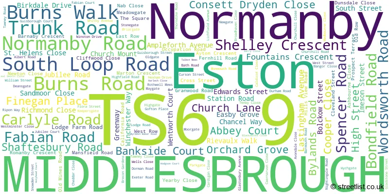
The largest settlement in the TS6 9 postal code is MIDDLESBROUGH followed by Eston, and Normanby.
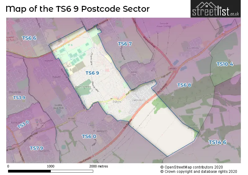
The TS6 9 Postcode shares a border with TS6 7 (MIDDLESBROUGH, Grangetown, Eston), TS14 6 (GUISBOROUGH, Dunsdale), TS6 0 (MIDDLESBROUGH, Normanby, Eston), TS6 6 (MIDDLESBROUGH, South Bank, Skippers Lane Industrial Estate) and TS6 8 (MIDDLESBROUGH, Eston, Lazenby).
Map of the TS6 9 Postcode Sector
Explore the TS6 9 postcode sector by using our interactive map.
The sector is within the post town of MIDDLESBROUGH.
TS6 9 is a postcode sector within the TS6 postcode district which is within the TS Teeside postcode area.
The Royal Mail delivery office for the TS6 9 postal sector is the South Bank Delivery Office.
The area of the TS6 9 postcode sector is 1.48 square miles which is 3.83 square kilometres or 946.30 square acres.
The TS6 9 postcode sector is crossed by the A174 Major A road.
Your support helps keep this site running!
If you enjoy using this website, consider buying me a coffee to help cover hosting costs.


| T | S | 6 | - | 9 | X | X |
| T | S | 6 | Space | 9 | Letter | Letter |
Official List of Streets
Normanby (3 Streets)
Eston (33 Streets)
MIDDLESBROUGH (99 Streets)
Unofficial Streets or Alternative Spellings
MIDDLESBROUGH
AMBLESIDE ROAD BANKFIELDS ROAD BIRCHINGTON AVENUE ESSEX AVENUE EVANS STREET GRANGE FARM ROAD LOCKWOOD COURT RAVENSWORTH AVENUE SOUTHGATE SUNNYGATEEston
CLIVE ROAD AVON CLOSE ESTON PRECINCT LINDRICK COURT MYRDDIN-BAKER ROAD NIGHTINGDALE ROAD SUNNINGDALE COURT THE PARKWAY WOOLGARTHSouth Bank
NORMANBY ROADWeather Forecast for TS6 9
Weather Forecast for Teesport
| Time Period | Icon | Description | Temperature | Rain Probability | Wind |
|---|---|---|---|---|---|
| 00:00 to 03:00 | Clear night | 3.0°C (feels like -1.0°C) | 1.00% | WNW 11 mph | |
| 03:00 to 06:00 | Clear night | 2.0°C (feels like -1.0°C) | 0.00% | W 9 mph | |
| 06:00 to 09:00 | Clear night | 2.0°C (feels like -2.0°C) | 0.00% | W 9 mph | |
| 09:00 to 12:00 | Sunny day | 2.0°C (feels like -1.0°C) | 0.00% | W 9 mph | |
| 12:00 to 15:00 | Sunny day | 5.0°C (feels like 2.0°C) | 0.00% | WNW 9 mph | |
| 15:00 to 18:00 | Sunny day | 6.0°C (feels like 3.0°C) | 0.00% | WNW 9 mph | |
| 18:00 to 21:00 | Clear night | 4.0°C (feels like 1.0°C) | 0.00% | WSW 7 mph | |
| 21:00 to 00:00 | Cloudy | 3.0°C (feels like 0.0°C) | 5.00% | SW 7 mph |
| Time Period | Icon | Description | Temperature | Rain Probability | Wind |
|---|---|---|---|---|---|
| 00:00 to 03:00 | Cloudy | 3.0°C (feels like 0.0°C) | 6.00% | SSW 7 mph | |
| 03:00 to 06:00 | Cloudy | 3.0°C (feels like 0.0°C) | 15.00% | SSW 9 mph | |
| 06:00 to 09:00 | Light rain | 3.0°C (feels like 0.0°C) | 47.00% | SSW 7 mph | |
| 09:00 to 12:00 | Cloudy | 3.0°C (feels like 0.0°C) | 9.00% | SW 7 mph | |
| 12:00 to 15:00 | Partly cloudy (day) | 5.0°C (feels like 3.0°C) | 2.00% | W 7 mph | |
| 15:00 to 18:00 | Cloudy | 6.0°C (feels like 4.0°C) | 5.00% | SW 7 mph | |
| 18:00 to 21:00 | Cloudy | 5.0°C (feels like 3.0°C) | 5.00% | SE 4 mph | |
| 21:00 to 00:00 | Cloudy | 4.0°C (feels like 2.0°C) | 5.00% | WSW 4 mph |
| Time Period | Icon | Description | Temperature | Rain Probability | Wind |
|---|---|---|---|---|---|
| 00:00 to 03:00 | Cloudy | 4.0°C (feels like 1.0°C) | 6.00% | SSE 4 mph | |
| 03:00 to 06:00 | Overcast | 3.0°C (feels like 1.0°C) | 8.00% | SSW 7 mph | |
| 06:00 to 09:00 | Cloudy | 3.0°C (feels like 0.0°C) | 6.00% | S 7 mph | |
| 09:00 to 12:00 | Overcast | 3.0°C (feels like -1.0°C) | 9.00% | S 9 mph | |
| 12:00 to 15:00 | Overcast | 5.0°C (feels like 1.0°C) | 9.00% | S 13 mph | |
| 15:00 to 18:00 | Overcast | 6.0°C (feels like 2.0°C) | 9.00% | S 13 mph | |
| 18:00 to 21:00 | Overcast | 5.0°C (feels like 1.0°C) | 9.00% | S 13 mph | |
| 21:00 to 00:00 | Cloudy | 5.0°C (feels like 1.0°C) | 7.00% | S 16 mph |
| Time Period | Icon | Description | Temperature | Rain Probability | Wind |
|---|---|---|---|---|---|
| 00:00 to 03:00 | Cloudy | 5.0°C (feels like 0.0°C) | 8.00% | S 16 mph | |
| 03:00 to 06:00 | Cloudy | 4.0°C (feels like 0.0°C) | 8.00% | S 16 mph | |
| 06:00 to 09:00 | Cloudy | 4.0°C (feels like 0.0°C) | 9.00% | SSW 13 mph | |
| 09:00 to 12:00 | Cloudy | 4.0°C (feels like 0.0°C) | 13.00% | SSW 13 mph | |
| 12:00 to 15:00 | Cloudy | 6.0°C (feels like 2.0°C) | 13.00% | SW 11 mph | |
| 15:00 to 18:00 | Cloudy | 7.0°C (feels like 4.0°C) | 11.00% | SW 11 mph | |
| 18:00 to 21:00 | Cloudy | 5.0°C (feels like 2.0°C) | 9.00% | WSW 9 mph | |
| 21:00 to 00:00 | Partly cloudy (night) | 4.0°C (feels like 1.0°C) | 5.00% | SW 9 mph |
Schools and Places of Education Within the TS6 9 Postcode Sector
Outwood Alternative Provision Eston
Other independent school
Burns Road, , , TS6 9AW
Head: Mrs Rachel Conway
Ofsted Rating: Good
Inspection: 2022-11-17 (805 days ago)
Website: Visit Outwood Alternative Provision Eston Website
Phone: 01642056440
Number of Pupils: 35
Progress Schools - Tees Valley
Other independent school
114 Fabian Road, , , TS6 9RQ
Head: Mr Graham Lancaster
Ofsted Rating: Inadequate
Inspection: 2023-06-22 (588 days ago)
Website: Visit Progress Schools - Tees Valley Website
Phone: 01642573919
Number of Pupils: 6

House Prices in the TS6 9 Postcode Sector
| Type of Property | 2018 Average | 2018 Sales | 2017 Average | 2017 Sales | 2016 Average | 2016 Sales | 2015 Average | 2015 Sales |
|---|---|---|---|---|---|---|---|---|
| Detached | £166,094 | 34 | £178,026 | 18 | £149,882 | 11 | £148,227 | 13 |
| Semi-Detached | £105,317 | 76 | £99,712 | 90 | £102,617 | 55 | £110,855 | 53 |
| Terraced | £74,588 | 35 | £79,761 | 33 | £76,911 | 28 | £70,881 | 36 |
| Flats | £40,667 | 3 | £52,000 | 2 | £45,000 | 2 | £47,500 | 2 |
Important Postcodes TS6 9 in the Postcode Sector
TS6 9AA is the postcode for Cleveland Fire Brigade, Fire Training School, South Loop Road, Cleveland Fire Brigade, Fire Station, South Loop Road, and CLEVELAND POLICE, LEARNING & DEVELOPMENT CENTRE, GRANGETOWN
TS6 9AD is the postcode for Archway, Eston Centre
TS6 9AE is the postcode for Inspire 2 Learn, Normanby Road, Eston Sports Academy, Normanby Road, and Eston Leisure Centre, Normanby Road
TS6 9AG is the postcode for Outwood Academy Normanby, Normanby Road, Gillbrook Academy, Normanby Road, and Hillsview Academy Sixth Form, Normanby Road
TS6 9AR is the postcode for James Finegan Municipal Hall, Fabian Road
TS6 9AW is the postcode for Normanby Collaborative Centre, Burns Road, Outwood Academy Eston, Burns Road, and Eston Park Academy, Burns Road
TS6 9EH is the postcode for Hadrian House, 81 High Street, and Hadrian House, 81 High Street, Eston
TS6 9LA is the postcode for Eston & California Youth Centre, Guisborough Street
TS6 9QG is the postcode for South Grange Medical Centre, Trunk Road
TS6 9RQ is the postcode for Eston Health Clinic, 114 Fabian Road
| The TS6 9 Sector is within these Local Authorities |
|
|---|---|
| The TS6 9 Sector is within these Counties |
|
| The TS6 9 Sector is within these Water Company Areas |
|