
Map of the TN25 Postcode District
Explore the postcode district by using our interactive map.
Circles represent recorded crime; the larger the circle, the higher the crime rates.
Your support helps keep this site running!
If you enjoy using this website, consider buying me a coffee to help cover hosting costs.
Where is the TN25 District?
To give you an idea where the district is located we have created the following table showing nearby towns.
Nearest Towns to TN25
| Town | Distance (miles) | Direction |
|---|---|---|
| Ashford | 3.07 | W |
| Hythe | 8.09 | SE |
| Canterbury | 10.90 | NNE |
| New Romney | 11.19 | S |
| Folkestone | 11.34 | ESE |
| Faversham | 11.79 | N |
| Tenterden | 12.50 | WSW |
| Fordwich | 12.97 | NE |
| Lydd | 13.69 | S |
| Whitstable | 15.01 | NNE |
| Dover | 16.01 | E |
| Sittingbourne | 16.02 | NNW |
| Rye | 16.33 | SSW |
| Herne Bay | 17.41 | NNE |
| Sandwich | 19.39 | ENE |
| Minster | 19.78 | NNW |
| Maidstone | 20.23 | WNW |
| Queenborough | 20.27 | NNW |
| Deal | 20.58 | ENE |
| Sheerness | 21.65 | NNW |
The post town for this district is ASHFORD.
Postcode Information for District TN25 (Total Geographical Postcodes: 804)
| Location | Post Town | Sector | Number of Postcodes |
|---|---|---|---|
| Sellindge | ASHFORD | TN25 6 | 102 |
| Wye | ASHFORD | TN25 5 | 79 |
| Aldington | ASHFORD | TN25 7 | 66 |
| Smeeth | ASHFORD | TN25 6 | 58 |
| ASHFORD | ASHFORD | TN25 4 | 55 |
| Challock | ASHFORD | TN25 4 | 39 |
| Mersham | ASHFORD | TN25 6 | 34 |
| Kennington | ASHFORD | TN25 4 | 34 |
| Brabourne Lees | ASHFORD | TN25 6 | 30 |
| Finberry | ASHFORD | TN25 7 | 29 |
| Kingsnorth | ASHFORD | TN25 7 | 25 |
| Mersham | ASHFORD | TN25 7 | 23 |
| Hastingleigh | ASHFORD | TN25 5 | 23 |
| Boughton Aluph | ASHFORD | TN25 4 | 22 |
| East Brabourne | ASHFORD | TN25 5 | 20 |
| Westwell | ASHFORD | TN25 4 | 20 |
| Bilsington | ASHFORD | TN25 7 | 19 |
| Brook | ASHFORD | TN25 5 | 16 |
| Boughton Lees | ASHFORD | TN25 4 | 16 |
| Stowting | ASHFORD | TN25 6 | 14 |
| Monks Horton | ASHFORD | TN25 6 | 12 |
| Stanford | ASHFORD | TN25 6 | 11 |
| Elmsted | ASHFORD | TN25 5 | 11 |
| West Brabourne | ASHFORD | TN25 5 | 8 |
| Bonnington | ASHFORD | TN25 7 | 8 |
| Bilting | ASHFORD | TN25 4 | 7 |
| Hinxhill | ASHFORD | TN25 5 | 6 |
| Hothfield | ASHFORD | TN25 4 | 5 |
| Stowting Common | ASHFORD | TN25 6 | 4 |
| Bodsham | ASHFORD | TN25 5 | 2 |
| Eastwell | ASHFORD | TN25 4 | 2 |
| East Brabourne | ASHFORD | TN25 6 | 2 |
| ASHFORD | ASHFORD | TN25 7 | 1 |
| ASHFORD | ASHFORD | TN25 5 | 1 |
Retail and Shopping in TN25
Street
Town
Locality
Number of Shops
Central Postcode
View on Google Maps
STATION ROAD
ASHFORD
SMEETH
18
TN25 6SX
View on Google Maps
TRINITY ROAD
ASHFORD
BOUGHTON ALUPH
10
TN25 4BY
View on Google Maps
HYTHE ROAD
ASHFORD
MERSHAM
8
TN25 6NH
View on Google Maps
MAIN ROAD
ASHFORD
SELLINDGE
8
TN25 6EQ
View on Google Maps
RUTHERFORD ROAD
ASHFORD
8
TN25 4BN
View on Google Maps
CHURCH STREET
ASHFORD
WYE
7
TN25 5BN
View on Google Maps
| Street | Town | Locality | Number of Shops | Central Postcode | View on Google Maps |
|---|---|---|---|---|---|
| STATION ROAD | ASHFORD | SMEETH | 18 | TN25 6SX | View on Google Maps |
| TRINITY ROAD | ASHFORD | BOUGHTON ALUPH | 10 | TN25 4BY | View on Google Maps |
| HYTHE ROAD | ASHFORD | MERSHAM | 8 | TN25 6NH | View on Google Maps |
| MAIN ROAD | ASHFORD | SELLINDGE | 8 | TN25 6EQ | View on Google Maps |
| RUTHERFORD ROAD | ASHFORD | 8 | TN25 4BN | View on Google Maps | |
| CHURCH STREET | ASHFORD | WYE | 7 | TN25 5BN | View on Google Maps |
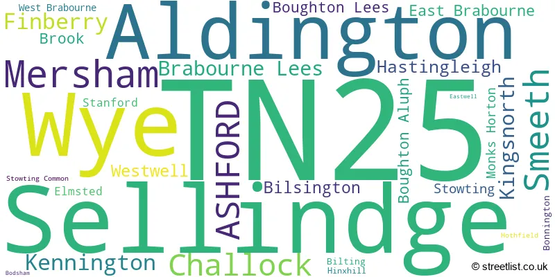
In the TN25 postcode district, the primary settlement is Ashford, located in Kent, the county of Kent in England. Other significant settlements in this district include Challock, Kennington, Westwell, Boughton Aluph, Boughton Lees, Bilting, Hothfield, Eastwell, Bodsham, Brook, East Brabourne, Elmsted, Hastingleigh, Hinxhill, West Brabourne, Wye, Brabourne Lees, Mersham, Monks Horton, Sellindge, Smeeth, Stanford, Stowting, Stowting Common, Aldington, Bilsington, Bonnington, Finberry and Kingsnorth. The primary post town associated with this district is also Ashford.
When it comes to local government, postal geography often disregards political borders. However, this district intersects the following councils: the district mostly encompasses the Ashford District (B) (602 postal codes), and finally, the Folkestone and Hythe District area (149 postal codes).
The largest settlement in the TN25 postal code is Wye followed by Sellindge, and ASHFORD.
The TN25 Postcode shares a border with TN26 (Bethersden, Woodchurch, High Halden), TN27 (Headcorn, Biddenden, Charing), CT4 (Chartham, Bridge, Barham), TN23 (ASHFORD, Kingsnorth, Great Chart), TN24 (ASHFORD, Willesborough, Kennington), CT21 (HYTHE, Lympne, Saltwood) and ME13 (FAVERSHAM, Boughton-under-Blean, Dunkirk).


Dentists in the TN25 District
| # | Name | Address | Type | Contact |
|---|---|---|---|---|
| 1 | Easy Smile (eureka Place) | EUREKA PLACE , TRINITY ROAD , ASHFORD , KENT , TN25 4BY | GENERAL DENTAL PRACTICE | |
| 2 | Wye Dental Surgery | STONE HAVEN , LITTLE CHEQUERS , WYE , ASHFORD , TN25 5DX | GENERAL DENTAL PRACTICE | |
| 3 | Starlight Dental Finberry | 37 AVOCET WAY , FINBERRY , ASHFORD , TN25 7FR | GENERAL DENTAL PRACTICE | |
| 4 | Trinity House | 110-120 EUREKA PARK , UPPER PEMBERTON , KENNINGTON , ASHFORD , KENT , TN25 4AZ | GENERAL DENTAL PRACTICE |
Doctors in the TN25 District
| # | Name | Address | Type | Contact |
|---|---|---|---|---|
| 1 | Wye Surgery | , WYE , ASHFORD , KENT , TN25 5AY | GP PRACTICE | |
| 2 | Sellindge Surgery | , SELLINDGE , ASHFORD , KENT , TN25 6JX | GP PRACTICE |
Chemists in the TN25 District
| # | Name | Address | Type | Contact |
|---|---|---|---|---|
| 1 | Well | 126 BRIDGE STREET , WYE , ASHFORD , KENT , TN25 5EA | PHARMACY | |
| 2 | Delmergate Limited | UNIT 3, EUREKA PLACE , TRINITY ROAD , ASHFORD , KENT , TN25 4BY | PHARMACY |
Opticians in the TN25 District
No Opticians found in this district.
Schools in the Sector
Challock Primary School
Phase: Primary
Address: Church Lane , Challock , Ashford
Postcode: TN25 4BU
Headteacher: Mrs Susan Sweet (Headteacher)
Ofsted Rating: Outstanding
Downs View Infant School
Phase: Primary
Address: Ball Lane , Kennington , Ashford
Postcode: TN25 4PJ
Headteacher: Mrs Tracy Kent Mrs Sarah Collins (Headteacher)
Ofsted Rating: Good
Lady Joanna Thornhill Endowed Primary School
Phase: Primary
Address: Bridge Street , Wye , Ashford
Postcode: TN25 5EA
Headteacher: Mrs Rachael Foster (Headteacher)
Ofsted Rating: Outstanding
Wye School
Phase: Secondary
Address: Olantigh Road , Wye
Postcode: TN25 5EJ
Headteacher: Mr Luke Magee (Principal)
Ofsted Rating: Good
Bodsham Church of England Primary School
Phase: Primary
Address: School Hill , Bodsham , Ashford
Postcode: TN25 5JQ
Headteacher: Mr Paul Newton (Executive Headteacher)
Ofsted Rating: Good
Brabourne Church of England Primary School
Phase: Primary
Address: School Lane , Brabourne , Ashford
Postcode: TN25 5LQ
Headteacher: Mr Andrew Stapley (Acting Headteacher)
Ofsted Rating: Good
Brook Community Primary School
Phase: Primary
Address: Spelders Hill , Brook , Ashford
Postcode: TN25 5PB
Headteacher: Mrs Ellen Ranson-McCabe (Headteacher)
Ofsted Rating: Good
Stowting Church of England Primary School
Phase: Primary
Address: Stowting , Stowting Hill , Ashford
Postcode: TN25 6BE
Headteacher: Mrs Sarah Uden (Headteacher)
Ofsted Rating: Good
Sellindge Primary School
Phase: Primary
Address: Main Road , Sellindge , Ashford
Postcode: TN25 6JY
Headteacher: Miss Joanne Wren (Headteacher)
Ofsted Rating: Good
Mersham Primary School
Phase: Primary
Address: Church Road , Mersham , Ashford
Postcode: TN25 6NU
Headteacher: Mrs Cheryl Chalkley (Headteacher)
Ofsted Rating: Good
Caldecott Foundation School
Phase: Not applicable
Address: Station Road , Smeeth , Ashford
Postcode: TN25 6PW
Headteacher: Miss Stacey McShane (Headteacher)
Ofsted Rating: Good
Smeeth Community Primary School
Phase: Primary
Address: Caroland Close , Smeeth , Ashford
Postcode: TN25 6RX
Headteacher: Ms Jennifer Payne (Headteacher)
Ofsted Rating: Good
Aldington Primary School
Phase: Primary
Address: Roman Road , Aldington , Ashford
Postcode: TN25 7EE
Headteacher: Mr Ben Dawson. (Headteacher)
Ofsted Rating: Good
Finberry Primary School
Phase: Primary
Address: Avocet Way , Finberry , Ashford
Postcode: TN25 7GS
Headteacher: Headteacher Stella Scharinger (Headteacher)
Ofsted Rating: Good
Stations in the Sector
Westenhanger
CRS Code: WHA
Operator: SE
Line: South Eastern Main Line
Company: Southeastern
Wye
CRS Code: WYE
Operator: SE
Line: Ashford to Ramsgate Line
Company: Southeastern
Accessable Motorway Junctions
M20 J10A
Average Driving Time from within the district: 5.79
Average Driving Distance: 4.51
Number of Postcodes that can access the Motorway Junction: 728
M20 J10
Average Driving Time from within the district: 6.37
Average Driving Distance: 4.86
Number of Postcodes that can access the Motorway Junction: 715
M20 J13
Average Driving Time from within the district: 6.57
Average Driving Distance: 6.17
Number of Postcodes that can access the Motorway Junction: 13
M20 J9
Average Driving Time from within the district: 6.84
Average Driving Distance: 5.24
Number of Postcodes that can access the Motorway Junction: 601
M20 J12
Average Driving Time from within the district: 7.60
Average Driving Distance: 6.88
Number of Postcodes that can access the Motorway Junction: 127
M20 J11
Average Driving Time from within the district: 8.19
Average Driving Distance: 6.94
Number of Postcodes that can access the Motorway Junction: 591
M20 J11A
Average Driving Time from within the district: 9.76
Average Driving Distance: 8.54
Number of Postcodes that can access the Motorway Junction: 480
M2 J7
Average Driving Time from within the district: 12.21
Average Driving Distance: 9.97
Number of Postcodes that can access the Motorway Junction: 202
M2 J6
Average Driving Time from within the district: 12.84
Average Driving Distance: 9.42
Number of Postcodes that can access the Motorway Junction: 182
M20 J8
Average Driving Time from within the district: 16.58
Average Driving Distance: 12.03
Number of Postcodes that can access the Motorway Junction: 1
Weather Forecast for Wye
| Time Period | Icon | Description | Temperature | Rain Probability | Wind |
|---|---|---|---|---|---|
| 00:00 to 03:00 | Clear night | 2.0°C (feels like -1.0°C) | 0.00% | SSE 7 mph | |
| 03:00 to 06:00 | Clear night | 1.0°C (feels like -2.0°C) | 0.00% | SSE 4 mph | |
| 06:00 to 09:00 | Clear night | 1.0°C (feels like -2.0°C) | 0.00% | SE 4 mph | |
| 09:00 to 12:00 | Sunny day | 3.0°C (feels like 0.0°C) | 0.00% | SE 4 mph | |
| 12:00 to 15:00 | Sunny day | 5.0°C (feels like 3.0°C) | 0.00% | SSE 7 mph | |
| 15:00 to 18:00 | Sunny day | 5.0°C (feels like 3.0°C) | 0.00% | S 4 mph | |
| 18:00 to 21:00 | Clear night | 1.0°C (feels like -1.0°C) | 0.00% | SSE 4 mph | |
| 21:00 to 00:00 | Clear night | 0.0°C (feels like -2.0°C) | 1.00% | E 2 mph |
| Time Period | Icon | Description | Temperature | Rain Probability | Wind |
|---|---|---|---|---|---|
| 00:00 to 03:00 | Clear night | 0.0°C (feels like -2.0°C) | 1.00% | S 4 mph | |
| 03:00 to 06:00 | Clear night | 0.0°C (feels like -2.0°C) | 1.00% | WSW 4 mph | |
| 06:00 to 09:00 | Cloudy | 0.0°C (feels like -2.0°C) | 13.00% | W 4 mph | |
| 09:00 to 12:00 | Cloudy | 3.0°C (feels like 0.0°C) | 6.00% | SSW 7 mph | |
| 12:00 to 15:00 | Partly cloudy (day) | 6.0°C (feels like 4.0°C) | 2.00% | SSW 9 mph | |
| 15:00 to 18:00 | Partly cloudy (day) | 7.0°C (feels like 4.0°C) | 2.00% | SSW 9 mph | |
| 18:00 to 21:00 | Clear night | 4.0°C (feels like 1.0°C) | 2.00% | SSW 9 mph | |
| 21:00 to 00:00 | Clear night | 4.0°C (feels like 0.0°C) | 2.00% | SSW 9 mph |
| Time Period | Icon | Description | Temperature | Rain Probability | Wind |
|---|---|---|---|---|---|
| 00:00 to 03:00 | Clear night | 4.0°C (feels like 0.0°C) | 1.00% | SSW 9 mph | |
| 03:00 to 06:00 | Clear night | 4.0°C (feels like 0.0°C) | 1.00% | SSW 9 mph | |
| 06:00 to 09:00 | Clear night | 4.0°C (feels like 1.0°C) | 1.00% | SSW 11 mph | |
| 09:00 to 12:00 | Sunny day | 6.0°C (feels like 2.0°C) | 2.00% | SSW 13 mph | |
| 12:00 to 15:00 | Partly cloudy (day) | 8.0°C (feels like 4.0°C) | 2.00% | SSW 16 mph | |
| 15:00 to 18:00 | Sunny day | 8.0°C (feels like 5.0°C) | 2.00% | SSW 16 mph | |
| 18:00 to 21:00 | Cloudy | 7.0°C (feels like 4.0°C) | 9.00% | SSW 13 mph | |
| 21:00 to 00:00 | Overcast | 8.0°C (feels like 4.0°C) | 18.00% | SW 13 mph |
| Time Period | Icon | Description | Temperature | Rain Probability | Wind |
|---|---|---|---|---|---|
| 00:00 to 03:00 | Cloudy | 7.0°C (feels like 4.0°C) | 11.00% | WSW 9 mph | |
| 03:00 to 06:00 | Clear night | 6.0°C (feels like 3.0°C) | 4.00% | W 9 mph | |
| 06:00 to 09:00 | Clear night | 4.0°C (feels like 2.0°C) | 4.00% | NW 7 mph | |
| 09:00 to 12:00 | Partly cloudy (day) | 5.0°C (feels like 2.0°C) | 3.00% | NW 7 mph | |
| 12:00 to 15:00 | Sunny day | 7.0°C (feels like 5.0°C) | 1.00% | NNW 7 mph | |
| 15:00 to 18:00 | Cloudy | 8.0°C (feels like 6.0°C) | 4.00% | N 7 mph | |
| 18:00 to 21:00 | Cloudy | 5.0°C (feels like 3.0°C) | 5.00% | N 7 mph | |
| 21:00 to 00:00 | Cloudy | 4.0°C (feels like 2.0°C) | 4.00% | NNE 7 mph |
| Postal Sector | Delivery Office |
|---|---|
| TN25 4 | Ashford (tn) Delivery Office |
| TN25 5 | Ashford (tn) Delivery Office |
| TN25 5 | Brabourne Lees Scale Payment Delivery Office |
| TN25 6 | Ashford (tn) Delivery Office |
| TN25 6 | Brabourne Lees Scale Payment Delivery Office |
| TN25 7 | Ashford (tn) Delivery Office |
| T | N | 2 | 5 | - | X | X | X |
| T | N | 2 | 5 | Space | Numeric | Letter | Letter |
Tourist Attractions
We found 1 visitor attractions.
| Agricultural Museum, Brook |
|---|
| Museums & Art Galleries |
| Museum and / or Art Gallery |
| View Agricultural Museum, Brook on Google Maps |
Street List for the TN25 District
Current Monthly Rental Prices
| # Bedrooms | Min Price | Max Price | Avg Price |
|---|---|---|---|
| 2 | £950 | £1,100 | £1,040 |
| 3 | £1,200 | £1,750 | £1,500 |
| 4 | £1,950 | £1,950 | £1,950 |
Current House Prices
| # Bedrooms | Min Price | Max Price | Avg Price |
|---|---|---|---|
| £150,000 | £645,000 | £388,000 | |
| 1 | £220,000 | £250,000 | £230,000 |
| 2 | £115,000 | £700,000 | £302,878 |
| 3 | £325,000 | £895,000 | £477,464 |
| 4 | £275,000 | £1,575,000 | £711,895 |
| 5 | £380,000 | £1,875,000 | £931,110 |
| 6 | £750,000 | £1,500,000 | £1,074,000 |
| 7 | £1,250,000 | £1,350,000 | £1,300,000 |
Estate Agents
| Logo | Name | Brand Name | Address | Contact Number |
|---|---|---|---|---|
 | Ashford | Hobbs Parker Estate Agents | Romney House Monument Way, Orbital Park, Ashford, TN24 0HB | 01233 542521 |
 | Ashford | Gould & Harrison Estate Agents | 1 Middle Row, Ashford, TN24 8SQ | 01233 660077 |
 | Ashford | Andrew & Co Estate Agents | 5 Kings Parade, Ashford, Kent, TN24 8TA | 01233 632383 |
 | Ashford | Steven J Moore Estate Agents | Lees Road Brabourne Lees Nr Ashford, Kent TN25 6QB | 01233 542398 |
 | Canterbury | Finn's | 82 Castle Street, Canterbury, Kent, CT1 2QD | 01227 532491 |
Yearly House Price Averages for the District
| Type of Property | 2018 Average | 2018 Sales | 2017 Average | 2017 Sales | 2016 Average | 2016 Sales | 2015 Average | 2015 Sales |
|---|---|---|---|---|---|---|---|---|
| Detached | £478,727 | 188 | £464,829 | 239 | £426,606 | 230 | £402,688 | 194 |
| Semi-Detached | £337,495 | 95 | £297,137 | 83 | £273,953 | 100 | £272,226 | 119 |
| Terraced | £269,721 | 78 | £269,257 | 83 | £257,360 | 108 | £231,842 | 79 |
| Flats | £195,427 | 24 | £180,461 | 42 | £155,934 | 25 | £172,704 | 45 |