
Map of the TA22 Postcode District
Explore the postcode district by using our interactive map.
Circles represent recorded crime; the larger the circle, the higher the crime rates.
Your support helps keep this site running!
If you enjoy using this website, consider buying me a coffee to help cover hosting costs.
Where is the TA22 District?
To give you an idea where the district is located we have created the following table showing nearby towns.
Nearest Towns to TA22
| Town | Distance (miles) | Direction |
|---|---|---|
| Wiveliscombe | 10.61 | E |
| Minehead | 10.85 | NNE |
| Tiverton | 11.05 | SSE |
| South Molton | 12.43 | WSW |
| Watchet | 13.07 | NE |
| Wellington | 15.28 | ESE |
| Cullompton | 15.62 | SSE |
| Lynton | 17.02 | NW |
| Crediton | 18.93 | SSW |
| Taunton | 19.71 | E |
| Barnstaple | 21.98 | W |
| Exeter | 23.11 | S |
| North Tawton | 23.21 | SW |
| North Petherton | 23.56 | E |
| Honiton | 23.90 | SE |
| Ottery St Mary | 24.32 | SSE |
| Bridgwater | 24.39 | ENE |
| Llantwit Major | 24.51 | N |
| Topsham | 26.08 | S |
The post town for this district is DULVERTON.
Postcode Information for District TA22 (Total Geographical Postcodes: 180)
| Location | Post Town | Sector | Number of Postcodes |
|---|---|---|---|
| DULVERTON | DULVERTON | TA22 9 | 87 |
| Brushford | DULVERTON | TA22 9 | 25 |
| Brompton Regis | DULVERTON | TA22 9 | 22 |
| Exebridge | DULVERTON | TA22 9 | 14 |
| Bridgetown | DULVERTON | TA22 9 | 9 |
| Hawkridge | DULVERTON | TA22 9 | 8 |
| Exton | DULVERTON | TA22 9 | 7 |
| Bury | DULVERTON | TA22 9 | 2 |
| Waddicombe | DULVERTON | TA22 9 | 2 |
| Ashwick | DULVERTON | TA22 9 | 1 |
| Jury | DULVERTON | TA22 9 | 1 |
| Pixton Park | DULVERTON | TA22 9 | 1 |
| Highercombe | DULVERTON | TA22 9 | 1 |
Retail and Shopping in TA22
Street
Town
Locality
Number of Shops
Central Postcode
View on Google Maps
HIGH STREET
DULVERTON
24
TA22 9HB
View on Google Maps
FORE STREET
DULVERTON
11
TA22 9EX
View on Google Maps
| Street | Town | Locality | Number of Shops | Central Postcode | View on Google Maps |
|---|---|---|---|---|---|
| HIGH STREET | DULVERTON | 24 | TA22 9HB | View on Google Maps | |
| FORE STREET | DULVERTON | 11 | TA22 9EX | View on Google Maps |
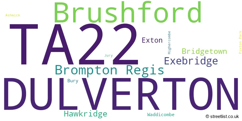
The primary settlement in the TA22 postcode district is Dulverton, located in Somerset, England. Other significant settlements in the district include Ashwick, Bridgetown, Brompton Regis, Brushford, Bury, Exebridge, Exton, Hawkridge, Highercombe, Jury, Pixton Park, and Waddicombe. The most significant post town in the district is also Dulverton.
When it comes to local government, postal geography often disregards political borders. However, this district intersects the following councils: the district mostly encompasses the Somerset (158 postal codes), followed by the Mid Devon District area (9 postal codes), and finally, the North Devon District area (4 postal codes).
The largest settlement in the TA22 postal code is DULVERTON followed by Brushford, and Brompton Regis.
The TA22 Postcode shares a border with EX16 (TIVERTON, Bampton, Witheridge), EX36 (SOUTH MOLTON, North Molton, Bishops Nympton), TA24 (MINEHEAD, Porlock, Dunster) and TA4 (Wiveliscombe, Williton, Bishops Lydeard).
Postcode Sectors


Dentists in the TA22 District
| # | Name | Address | Type | Contact |
|---|---|---|---|---|
| 1 | Dulverton Dental Practice | OLDBERRY HOUSE , FISHERS MEAD , DULVERTON , SOMERSET , TA22 9EN | GENERAL DENTAL PRACTICE |
Doctors in the TA22 District
| # | Name | Address | Type | Contact |
|---|---|---|---|---|
| 1 | Exmoor Medical Centre | , FISHERS MEAD , DULVERTON , SOMERSET , TA22 9EN | GP PRACTICE |
Chemists in the TA22 District
| # | Name | Address | Type | Contact |
|---|---|---|---|---|
| 1 | Dulverton Pharmacy | 21 HIGH STREET , DULVERTON , SOMERSET , TA22 9HB | PHARMACY |
Opticians in the TA22 District
No Opticians found in this district.
Schools in the Sector
Dulverton Junior School
Phase: Primary
Address: Barns Close West , Dulverton
Postcode: TA22 9EE
Headteacher: Mrs Naomi Philp (Interim Headteacher)
Ofsted Rating: Requires improvement
All Saints CofE VC Infants School
Phase: Primary
Address: Fishers Mead , Dulverton
Postcode: TA22 9EN
Headteacher: Mrs Naomi Philp (Headteacher)
Ofsted Rating: Requires improvement
Stations in the Sector
No stations found in this postcode district.
Accessable Motorway Junctions
M5 J27
Average Driving Time from within the district: 25.71
Average Driving Distance: 18.92
Number of Postcodes that can access the Motorway Junction: 172
M5 J28
Average Driving Time from within the district: 30.05
Average Driving Distance: 23.22
Number of Postcodes that can access the Motorway Junction: 172
M5 J26
Average Driving Time from within the district: 33.23
Average Driving Distance: 26.50
Number of Postcodes that can access the Motorway Junction: 172
M5 J29
Average Driving Time from within the district: 38.66
Average Driving Distance: 32.55
Number of Postcodes that can access the Motorway Junction: 137
M5 J25
Average Driving Time from within the district: 39.00
Average Driving Distance: 31.41
Number of Postcodes that can access the Motorway Junction: 160
M5 J30
Average Driving Time from within the district: 43.82
Average Driving Distance: 35.45
Number of Postcodes that can access the Motorway Junction: 12
M5 J24
Average Driving Time from within the district: 44.90
Average Driving Distance: 31.45
Number of Postcodes that can access the Motorway Junction: 35
Weather Forecast for Dulverton
| Time Period | Icon | Description | Temperature | Rain Probability | Wind |
|---|---|---|---|---|---|
| 18:00 to 21:00 | Cloudy | 8.0°C (feels like 7.0°C) | 8.00% | SW 4 mph | |
| 21:00 to 00:00 | Cloudy | 8.0°C (feels like 6.0°C) | 8.00% | SW 4 mph |
| Time Period | Icon | Description | Temperature | Rain Probability | Wind |
|---|---|---|---|---|---|
| 00:00 to 03:00 | Cloudy | 8.0°C (feels like 6.0°C) | 6.00% | SW 7 mph | |
| 03:00 to 06:00 | Cloudy | 7.0°C (feels like 5.0°C) | 8.00% | SSW 7 mph | |
| 06:00 to 09:00 | Cloudy | 8.0°C (feels like 5.0°C) | 7.00% | SW 11 mph | |
| 09:00 to 12:00 | Cloudy | 9.0°C (feels like 6.0°C) | 5.00% | SW 11 mph | |
| 12:00 to 15:00 | Cloudy | 11.0°C (feels like 7.0°C) | 7.00% | SW 16 mph | |
| 15:00 to 18:00 | Overcast | 11.0°C (feels like 7.0°C) | 13.00% | SW 16 mph | |
| 18:00 to 21:00 | Overcast | 10.0°C (feels like 7.0°C) | 18.00% | SW 16 mph | |
| 21:00 to 00:00 | Overcast | 10.0°C (feels like 7.0°C) | 23.00% | SW 18 mph |
| Time Period | Icon | Description | Temperature | Rain Probability | Wind |
|---|---|---|---|---|---|
| 00:00 to 03:00 | Overcast | 10.0°C (feels like 7.0°C) | 23.00% | SW 18 mph | |
| 03:00 to 06:00 | Overcast | 10.0°C (feels like 7.0°C) | 23.00% | SW 18 mph | |
| 06:00 to 09:00 | Light rain | 10.0°C (feels like 7.0°C) | 56.00% | SW 18 mph | |
| 09:00 to 12:00 | Heavy rain | 10.0°C (feels like 6.0°C) | 78.00% | SW 22 mph | |
| 12:00 to 15:00 | Heavy rain | 10.0°C (feels like 6.0°C) | 88.00% | SW 25 mph | |
| 15:00 to 18:00 | Heavy rain | 9.0°C (feels like 5.0°C) | 92.00% | WSW 25 mph | |
| 18:00 to 21:00 | Heavy rain | 7.0°C (feels like 3.0°C) | 80.00% | WNW 20 mph | |
| 21:00 to 00:00 | Cloudy | 5.0°C (feels like 1.0°C) | 20.00% | NW 16 mph |
| Time Period | Icon | Description | Temperature | Rain Probability | Wind |
|---|---|---|---|---|---|
| 00:00 to 03:00 | Cloudy | 4.0°C (feels like 0.0°C) | 12.00% | NNW 11 mph | |
| 03:00 to 06:00 | Cloudy | 3.0°C (feels like 0.0°C) | 8.00% | NNW 9 mph | |
| 06:00 to 09:00 | Cloudy | 3.0°C (feels like -1.0°C) | 6.00% | N 9 mph | |
| 09:00 to 12:00 | Cloudy | 2.0°C (feels like -1.0°C) | 4.00% | N 9 mph | |
| 12:00 to 15:00 | Partly cloudy (day) | 4.0°C (feels like 0.0°C) | 2.00% | NNE 11 mph | |
| 15:00 to 18:00 | Partly cloudy (day) | 3.0°C (feels like 0.0°C) | 2.00% | NNE 9 mph | |
| 18:00 to 21:00 | Partly cloudy (night) | 2.0°C (feels like -2.0°C) | 1.00% | NNE 9 mph | |
| 21:00 to 00:00 | Partly cloudy (night) | 1.0°C (feels like -3.0°C) | 1.00% | NNE 9 mph |
| Time Period | Icon | Description | Temperature | Rain Probability | Wind |
|---|---|---|---|---|---|
| 00:00 to 03:00 | Clear night | -1.0°C (feels like -4.0°C) | 1.00% | NNE 7 mph | |
| 03:00 to 06:00 | Clear night | -1.0°C (feels like -5.0°C) | 1.00% | NNE 7 mph | |
| 06:00 to 09:00 | Clear night | -1.0°C (feels like -5.0°C) | 2.00% | N 7 mph | |
| 09:00 to 12:00 | Sunny day | -1.0°C (feels like -4.0°C) | 2.00% | NNW 7 mph | |
| 12:00 to 15:00 | Sunny day | 3.0°C (feels like 0.0°C) | 1.00% | NNW 7 mph | |
| 15:00 to 18:00 | Sunny day | 3.0°C (feels like 0.0°C) | 1.00% | NNW 7 mph | |
| 18:00 to 21:00 | Clear night | 0.0°C (feels like -3.0°C) | 2.00% | NW 7 mph | |
| 21:00 to 00:00 | Partly cloudy (night) | 0.0°C (feels like -3.0°C) | 2.00% | W 7 mph |
| Postal Sector | Delivery Office |
|---|---|
| TA22 9 | Dulverton Scale Payment Delivery Office |
| T | A | 2 | 2 | - | X | X | X |
| T | A | 2 | 2 | Space | Numeric | Letter | Letter |
Tourist Attractions
We found 1 visitor attractions.
| Dulverton Guildhall Heritage and Arts |
|---|
| Visitor Centres |
| Heritage / Visitor Centre |
| View Dulverton Guildhall Heritage and Arts on Google Maps |
Street List for the TA22 District
Current Monthly Rental Prices
| # Bedrooms | Min Price | Max Price | Avg Price |
|---|---|---|---|
| 3 | £1,100 | £1,100 | £1,100 |
| 4 | £1,100 | £1,100 | £1,100 |
Current House Prices
| # Bedrooms | Min Price | Max Price | Avg Price |
|---|---|---|---|
| £25,000 | £225,000 | £125,000 | |
| 1 | £135,000 | £135,000 | £135,000 |
| 2 | £175,000 | £499,950 | £292,495 |
| 3 | £150,000 | £820,000 | £371,875 |
| 4 | £445,000 | £775,000 | £553,000 |
Estate Agents
| Logo | Name | Brand Name | Address | Contact Number |
|---|---|---|---|---|
 | Dulverton | Webbers Property Services | Woodton Lodge, Dulverton, Somerset, TA22 9DW | 01398 315962 |
 | Bampton | Seddons | 4 Fore Street, Bampton, EX16 9ND | 01884 210953 |
 | Dulverton | Fine & Country | Woodton Lodge, Dulverton, Somerset, TA22 9DW | 01398 315963 |
 | Dulverton | Stags | 13 Fore Street, Dulverton, TA22 9EX | 01398 315959 |
 | Tiverton | Stags | 19 Bampton Street, Tiverton, EX16 6AA | 01884 211011 |
Yearly House Price Averages for the District
| Type of Property | 2018 Average | 2018 Sales | 2017 Average | 2017 Sales | 2016 Average | 2016 Sales | 2015 Average | 2015 Sales |
|---|---|---|---|---|---|---|---|---|
| Detached | £412,163 | 20 | £406,683 | 21 | £383,222 | 27 | £346,977 | 24 |
| Semi-Detached | £246,795 | 10 | £221,808 | 13 | £262,611 | 9 | £231,150 | 10 |
| Terraced | £238,500 | 8 | £255,636 | 11 | £180,542 | 12 | £225,571 | 7 |
| Flats | £160,167 | 3 | £218,000 | 3 | £163,333 | 3 | £126,750 | 2 |