
Map of the SW10 Postcode District
Explore the postcode district by using our interactive map.
Circles represent recorded crime; the larger the circle, the higher the crime rates.
Your support helps keep this site running!
If you enjoy using this website, consider buying me a coffee to help cover hosting costs.
Where is the SW10 District?
To give you an idea where the district is located we have created the following table showing nearby towns.
Nearest Towns to SW10
| Town | Distance (miles) | Direction |
|---|---|---|
| City of Westminster | 2.76 | ENE |
| City of London | 4.49 | ENE |
| Ewell | 9.69 | SSW |
| Epsom | 11.01 | SSW |
| Sunbury-on-Thames | 11.08 | WSW |
| Esher | 11.14 | SW |
| Banstead | 11.22 | S |
| Walton-on-Thames | 12.21 | SW |
| Ashford | 12.52 | WSW |
| Borehamwood | 12.69 | NNW |
| Warlingham | 13.22 | SSE |
| Bushey | 13.58 | NW |
| Weybridge | 14.16 | WSW |
| Leatherhead | 14.44 | SSW |
| Staines-upon-Thames | 14.58 | WSW |
| Chigwell | 14.61 | NE |
| Potters Bar | 14.62 | N |
| Caterham | 14.67 | SSE |
| Watford | 14.96 | NW |
| Radlett | 15.02 | NNW |
The post town for this district is LONDON.
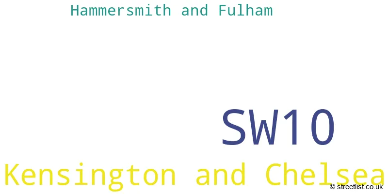
Postcode Information for District SW10 (Total Geographical Postcodes: 450)
| Location | Post Town | Sector | Number of Postcodes |
|---|---|---|---|
| Kensington and Chelsea | LONDON | SW10 9 | 218 |
| Kensington and Chelsea | LONDON | SW10 0 | 211 |
| Hammersmith and Fulham | LONDON | SW10 0 | 21 |
Retail and Shopping in SW10
Street
Town
Locality
Number of Shops
Central Postcode
View on Google Maps
FULHAM ROAD
LONDON
110
SW10 9TW
View on Google Maps
KINGS ROAD
LONDON
89
SW10 0LF
View on Google Maps
CHELSEA HARBOUR
LONDON
30
SW10 0XE
View on Google Maps
LOTS ROAD
LONDON
15
SW10 0RJ
View on Google Maps
PARK WALK
LONDON
12
SW10 0AJ
View on Google Maps
HOLLYWOOD ROAD
LONDON
11
SW10 9HY
View on Google Maps
LANGTON STREET
LONDON
8
SW10 0JL
View on Google Maps
| Street | Town | Locality | Number of Shops | Central Postcode | View on Google Maps |
|---|---|---|---|---|---|
| FULHAM ROAD | LONDON | 110 | SW10 9TW | View on Google Maps | |
| KINGS ROAD | LONDON | 89 | SW10 0LF | View on Google Maps | |
| CHELSEA HARBOUR | LONDON | 30 | SW10 0XE | View on Google Maps | |
| LOTS ROAD | LONDON | 15 | SW10 0RJ | View on Google Maps | |
| PARK WALK | LONDON | 12 | SW10 0AJ | View on Google Maps | |
| HOLLYWOOD ROAD | LONDON | 11 | SW10 9HY | View on Google Maps | |
| LANGTON STREET | LONDON | 8 | SW10 0JL | View on Google Maps |
The primary settlement in the SW10 postcode district is Kensington and Chelsea, located in the boroughs of Hammersmith and Fulham, and Greater London. The most significant post town in this district is London, which is in the county of Greater London.
When it comes to local government, postal geography often disregards political borders. However, this district intersects the following councils: the district mostly encompasses the Kensington and Chelsea London Boro (445 postal codes), and finally, the Hammersmith and Fulham London Boro area (23 postal codes).
The SW10 postal code covers the settlement of LONDON.
The postcode area has a boundary with Tidal Thames.
The SW10 Postcode shares a border with SW3 (LONDON), SW6 (LONDON), SW5 (LONDON) and SW7 (LONDON).


Dentists in the SW10 District
| # | Name | Address | Type | Contact |
|---|---|---|---|---|
| 1 | Chelsea Dental Practice | 4 WORLD'S END PLACE , LONDON , GREATER LONDON , SW10 0HE | GENERAL DENTAL PRACTICE | |
| 2 | V K Patel And Associates | THE DENTAL CLINIC , 407 KINGS ROAD , LONDON , GREATER LONDON , SW10 0LR | GENERAL DENTAL PRACTICE | |
| 3 | Chelsea Dental Clinic | 298 FULHAM ROAD , LONDON , SW10 9EP | GENERAL DENTAL PRACTICE |
Doctors in the SW10 District
| # | Name | Address | Type | Contact |
|---|---|---|---|---|
| 1 | Kings Road Medical Centre | , CHELSEA , LONDON , GREATER LONDON , SW10 0UD | GP PRACTICE | |
| 2 | The Good Practice | , LONDON , GREATER LONDON , SW10 0LR | GP PRACTICE |
Chemists in the SW10 District
| # | Name | Address | Type | Contact |
|---|---|---|---|---|
| 1 | Medicine Chest | 413-415 KINGS ROAD , LONDON , GREATER LONDON , SW10 0LR | PHARMACY | |
| 2 | Worlds End Pharmacy | 469 KINGS ROAD , LONDON , GREATER LONDON , SW10 0LU | PHARMACY | |
| 3 | Boots | 228-230 FULHAM ROAD , LONDON , GREATER LONDON , SW10 9NB | PHARMACY | |
| 4 | Jhoots Pharmacy | 513 KINGS ROAD , LONDON , GREATER LONDON , SW10 0TX | PHARMACY |
Opticians in the SW10 District
No Opticians found in this district.
Schools in the Sector
Chelsea Academy
Phase: Secondary
Address: Lots Road , Chelsea , London
Postcode: SW10 0AB
Headteacher: Mrs Mariella Ardron (Principal)
Ofsted Rating: Good
Park Walk Primary School
Phase: Primary
Address: Park Walk , King's Road , Chelsea , London
Postcode: SW10 0AY
Headteacher: Miss Emily Caldwell (Headteacher)
Ofsted Rating: Good
Ashburnham Community School
Phase: Primary
Address: 17 Blantyre Street , London
Postcode: SW10 0DT
Headteacher: Ms Kate Webster (Headteacher)
Ofsted Rating: Outstanding
Servite RC Primary School
Phase: Primary
Address: 252 Fulham Road , London
Postcode: SW10 9NA
Headteacher: Ms Kathleen Williams (Executive Headteacher)
Ofsted Rating: Outstanding
Chelsea Community Hospital School
Phase: Not applicable
Address: 369 Fulham Road , London
Postcode: SW10 9NH
Headteacher: Mrs Janette Steel (Headteacher)
Ofsted Rating: Outstanding
Stations in the Sector
No stations found in this postcode district.
Accessable Motorway Junctions
M4 J2
Average Driving Time from within the district: 10.23
Average Driving Distance: 5.41
Number of Postcodes that can access the Motorway Junction: 457
M4 J3
Average Driving Time from within the district: 16.64
Average Driving Distance: 10.84
Number of Postcodes that can access the Motorway Junction: 457
M1 J1
Average Driving Time from within the district: 17.42
Average Driving Distance: 8.69
Number of Postcodes that can access the Motorway Junction: 457
Weather Forecast for Chelsea
| Time Period | Icon | Description | Temperature | Rain Probability | Wind |
|---|---|---|---|---|---|
| 21:00 to 00:00 | Clear night | 5.0°C (feels like 2.0°C) | 1.00% | SE 7 mph |
| Time Period | Icon | Description | Temperature | Rain Probability | Wind |
|---|---|---|---|---|---|
| 00:00 to 03:00 | Partly cloudy (night) | 4.0°C (feels like 2.0°C) | 0.00% | SE 4 mph | |
| 03:00 to 06:00 | Partly cloudy (night) | 4.0°C (feels like 2.0°C) | 0.00% | SE 4 mph | |
| 06:00 to 09:00 | Clear night | 3.0°C (feels like 1.0°C) | 0.00% | SE 4 mph | |
| 09:00 to 12:00 | Sunny day | 3.0°C (feels like 1.0°C) | 0.00% | ESE 4 mph | |
| 12:00 to 15:00 | Sunny day | 6.0°C (feels like 5.0°C) | 0.00% | SSE 4 mph | |
| 15:00 to 18:00 | Sunny day | 7.0°C (feels like 6.0°C) | 0.00% | S 4 mph | |
| 18:00 to 21:00 | Clear night | 5.0°C (feels like 4.0°C) | 0.00% | S 4 mph | |
| 21:00 to 00:00 | Clear night | 4.0°C (feels like 2.0°C) | 1.00% | SSW 2 mph |
| Time Period | Icon | Description | Temperature | Rain Probability | Wind |
|---|---|---|---|---|---|
| 00:00 to 03:00 | Clear night | 2.0°C (feels like 1.0°C) | 1.00% | S 4 mph | |
| 03:00 to 06:00 | Partly cloudy (night) | 1.0°C (feels like -1.0°C) | 2.00% | SSW 2 mph | |
| 06:00 to 09:00 | Cloudy | 1.0°C (feels like -1.0°C) | 9.00% | SW 2 mph | |
| 09:00 to 12:00 | Overcast | 3.0°C (feels like 1.0°C) | 9.00% | SSW 4 mph | |
| 12:00 to 15:00 | Overcast | 6.0°C (feels like 4.0°C) | 8.00% | SSW 4 mph | |
| 15:00 to 18:00 | Sunny day | 8.0°C (feels like 6.0°C) | 2.00% | SSW 7 mph | |
| 18:00 to 21:00 | Partly cloudy (night) | 6.0°C (feels like 4.0°C) | 2.00% | SSW 7 mph | |
| 21:00 to 00:00 | Partly cloudy (night) | 5.0°C (feels like 2.0°C) | 2.00% | SSW 7 mph |
| Time Period | Icon | Description | Temperature | Rain Probability | Wind |
|---|---|---|---|---|---|
| 00:00 to 03:00 | Cloudy | 5.0°C (feels like 2.0°C) | 5.00% | SSW 7 mph | |
| 03:00 to 06:00 | Clear night | 5.0°C (feels like 2.0°C) | 3.00% | S 7 mph | |
| 06:00 to 09:00 | Partly cloudy (night) | 5.0°C (feels like 2.0°C) | 3.00% | SSW 7 mph | |
| 09:00 to 12:00 | Cloudy | 6.0°C (feels like 3.0°C) | 5.00% | SSW 9 mph | |
| 12:00 to 15:00 | Cloudy | 9.0°C (feels like 6.0°C) | 6.00% | SSW 11 mph | |
| 15:00 to 18:00 | Cloudy | 10.0°C (feels like 8.0°C) | 10.00% | SSW 11 mph | |
| 18:00 to 21:00 | Overcast | 9.0°C (feels like 7.0°C) | 20.00% | SSW 9 mph | |
| 21:00 to 00:00 | Light rain | 9.0°C (feels like 7.0°C) | 45.00% | SW 7 mph |
| Time Period | Icon | Description | Temperature | Rain Probability | Wind |
|---|---|---|---|---|---|
| 00:00 to 03:00 | Clear night | 7.0°C (feels like 5.0°C) | 7.00% | WSW 7 mph | |
| 03:00 to 06:00 | Clear night | 6.0°C (feels like 4.0°C) | 5.00% | W 4 mph | |
| 06:00 to 09:00 | Clear night | 4.0°C (feels like 3.0°C) | 2.00% | WNW 4 mph | |
| 09:00 to 12:00 | Partly cloudy (day) | 4.0°C (feels like 3.0°C) | 2.00% | NW 4 mph | |
| 12:00 to 15:00 | Cloudy | 7.0°C (feels like 6.0°C) | 4.00% | NW 4 mph | |
| 15:00 to 18:00 | Cloudy | 8.0°C (feels like 7.0°C) | 5.00% | N 4 mph | |
| 18:00 to 21:00 | Cloudy | 7.0°C (feels like 6.0°C) | 5.00% | N 4 mph | |
| 21:00 to 00:00 | Cloudy | 6.0°C (feels like 4.0°C) | 5.00% | N 4 mph |
| Postal Sector | Delivery Office |
|---|---|
| SW10 0 | West Brompton Sdelivery Office |
| SW10 9 | West Brompton Sdelivery Office |
| S | W | 1 | 0 | - | X | X | X |
| S | W | 1 | 0 | Space | Numeric | Letter | Letter |
Street List for the SW10 District
Current Monthly Rental Prices
| # Bedrooms | Min Price | Max Price | Avg Price |
|---|---|---|---|
| £250 | £4,500 | £2,163 | |
| 1 | £1,950 | £5,850 | £2,804 |
| 2 | £2,350 | £15,167 | £4,813 |
| 3 | £3,358 | £30,333 | £7,464 |
| 4 | £3,950 | £23,833 | £13,916 |
| 5 | £8,017 | £86,667 | £31,785 |
| 6 | £16,900 | £16,900 | £16,900 |
Current House Prices
| # Bedrooms | Min Price | Max Price | Avg Price |
|---|---|---|---|
| £215,000 | £6,350,000 | £1,282,300 | |
| 1 | £375,000 | £1,595,000 | £735,476 |
| 2 | £130,000 | £3,600,000 | £1,128,437 |
| 3 | £350,000 | £6,150,000 | £2,172,322 |
| 4 | £1,250,000 | £6,300,000 | £3,456,484 |
| 5 | £2,300,000 | £20,000,000 | £6,972,250 |
| 6 | £4,950,000 | £7,350,000 | £6,750,000 |
| 7 | £2,700,000 | £2,700,000 | £2,700,000 |
| 8 | £10,000,000 | £32,500,000 | £21,250,000 |
Estate Agents
| Logo | Name | Brand Name | Address | Contact Number |
|---|---|---|---|---|
 | Earls Court | Foxtons | 239 Old Brompton Road, London, SW5 9HP | 020 3889 9040 |
 | Chelsea - Sales | Farrar & Co | 152 Fulham Road, London, SW10 9PR | 020 3195 8621 |
 | Chelsea | Martin & Co | 1 Cremorne Road, London, SW10 0NA | 020 3910 6685 |
 | Chelsea | Savills | 196-200 Fulham Road London SW10 9PN | 020 3840 3730 |
 | South Kensington | Foxtons | 94 Old Brompton Road, London, SW7 3RD | 020 3840 3425 |
Yearly House Price Averages for the District
| Type of Property | 2018 Average | 2018 Sales | 2017 Average | 2017 Sales | 2016 Average | 2016 Sales | 2015 Average | 2015 Sales |
|---|---|---|---|---|---|---|---|---|
| Detached | £2,525,000 | 3 | £0 | 0 | £0 | 0 | £0 | 0 |
| Semi-Detached | £7,921,429 | 7 | £14,000,000 | 1 | £8,512,500 | 2 | £6,393,333 | 3 |
| Terraced | £4,902,778 | 36 | £2,720,096 | 41 | £2,855,623 | 27 | £3,085,750 | 30 |
| Flats | £1,479,844 | 215 | £1,202,861 | 194 | £1,154,805 | 181 | £1,017,330 | 263 |