
Map of the SO24 Postcode District
Explore the postcode district by using our interactive map.
Circles represent recorded crime; the larger the circle, the higher the crime rates.
Your support helps keep this site running!
If you enjoy using this website, consider buying me a coffee to help cover hosting costs.
Where is the SO24 District?
To give you an idea where the district is located we have created the following table showing nearby towns.
Nearest Towns to SO24
| Town | Distance (miles) | Direction |
|---|---|---|
| Winchester | 7.68 | WSW |
| Alton | 8.17 | ENE |
| Bishop's Waltham | 10.06 | SSW |
| Petersfield | 10.85 | SE |
| Bordon | 12.25 | E |
| Basingstoke | 12.27 | N |
| Eastleigh | 12.59 | SW |
| Whitchurch | 12.74 | NW |
| Wickham | 13.51 | S |
| Horndean | 14.07 | SSE |
| Hedge End | 14.30 | SSW |
| Andover | 16.64 | WNW |
| Fareham | 16.74 | S |
| Farnham | 17.12 | ENE |
| Romsey | 17.18 | WSW |
| Southampton | 17.35 | SW |
| Havant | 17.73 | SSE |
| Tadley | 18.19 | N |
| Fleet | 18.31 | NE |
The post town for this district is ALRESFORD.
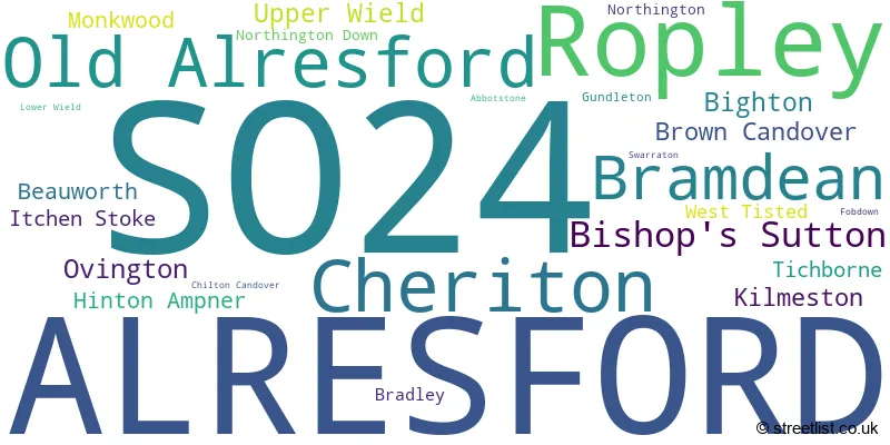
Postcode Information for District SO24 (Total Geographical Postcodes: 448)
| Location | Post Town | Sector | Number of Postcodes |
|---|---|---|---|
| ALRESFORD | ALRESFORD | SO24 9 | 176 |
| Ropley | ALRESFORD | SO24 0 | 56 |
| Cheriton | ALRESFORD | SO24 0 | 32 |
| Old Alresford | ALRESFORD | SO24 9 | 27 |
| Bramdean | ALRESFORD | SO24 0 | 22 |
| Bishop's Sutton | ALRESFORD | SO24 0 | 20 |
| Kilmeston | ALRESFORD | SO24 0 | 12 |
| Ovington | ALRESFORD | SO24 0 | 11 |
| Bighton | ALRESFORD | SO24 9 | 10 |
| Upper Wield | ALRESFORD | SO24 9 | 10 |
| Brown Candover | ALRESFORD | SO24 9 | 9 |
| Monkwood | ALRESFORD | SO24 0 | 7 |
| Hinton Ampner | ALRESFORD | SO24 0 | 7 |
| Beauworth | ALRESFORD | SO24 0 | 7 |
| Tichborne | ALRESFORD | SO24 0 | 6 |
| ALRESFORD | ALRESFORD | SO24 0 | 5 |
| Itchen Stoke | ALRESFORD | SO24 0 | 5 |
| West Tisted | ALRESFORD | SO24 0 | 5 |
| Bradley | ALRESFORD | SO24 9 | 4 |
| Northington Down | ALRESFORD | SO24 9 | 3 |
| Northington | ALRESFORD | SO24 9 | 3 |
| Ropley | ALRESFORD | SO24 9 | 2 |
| Gundleton | ALRESFORD | SO24 9 | 2 |
| Lower Wield | ALRESFORD | SO24 9 | 1 |
| Fobdown | ALRESFORD | SO24 9 | 1 |
| Swarraton | ALRESFORD | SO24 9 | 1 |
| Abbotstone | ALRESFORD | SO24 9 | 1 |
| Chilton Candover | ALRESFORD | SO24 9 | 1 |
| Itchen Stoke | ALRESFORD | SO24 9 | 1 |
| Bishop's Sutton | ALRESFORD | SO24 9 | 1 |
Retail and Shopping in SO24
Street
Town
Locality
Number of Shops
Central Postcode
View on Google Maps
WEST STREET
ALRESFORD
40
SO24 9AU
View on Google Maps
BROAD STREET
ALRESFORD
21
SO24 9AR
View on Google Maps
EAST STREET
ALRESFORD
9
SO24 9EE
View on Google Maps
| Street | Town | Locality | Number of Shops | Central Postcode | View on Google Maps |
|---|---|---|---|---|---|
| WEST STREET | ALRESFORD | 40 | SO24 9AU | View on Google Maps | |
| BROAD STREET | ALRESFORD | 21 | SO24 9AR | View on Google Maps | |
| EAST STREET | ALRESFORD | 9 | SO24 9EE | View on Google Maps |
In the SO24 postcode district in Hampshire, the primary settlement is Alresford. Other significant settlements in this district include Beauworth, Bishop's Sutton, Bramdean, Cheriton, Hinton Ampner, Itchen Stoke, Kilmeston, Monkwood, Ovington, Ropley, Tichborne, and West Tisted. The most significant post town is Alresford.
When it comes to local government, postal geography often disregards political borders. However, this district intersects the following councils: the district mostly encompasses the Winchester District (B) (362 postal codes), followed by the East Hampshire District area (75 postal codes), and finally, the Basingstoke and Deane District (B) area (15 postal codes).
The largest settlement in the SO24 postal code is ALRESFORD followed by Ropley, and Cheriton.
The SO24 Postcode shares a border with SO21 (Colden Common, Sutton Scotney, Twyford), SO32 (Bishops Waltham, Botley, Swanmore), GU34 (ALTON, Four Marks, Medstead), RG25 (Overton, North Waltham, Upton Grey) and GU32 (PETERSFIELD, East Meon, West Meon).


Dentists in the SO24 District
| # | Name | Address | Type | Contact |
|---|---|---|---|---|
| 1 | Berukin Dental Surgery | 38 WEST STREET , ALRESFORD , HAMPSHIRE , SO24 9AU | GENERAL DENTAL PRACTICE |
Doctors in the SO24 District
| # | Name | Address | Type | Contact |
|---|---|---|---|---|
| 1 | Alresford Surgery | , STATION ROAD , ALRESFORD , HAMPSHIRE , SO24 9JL | GP PRACTICE |
Chemists in the SO24 District
| # | Name | Address | Type | Contact |
|---|---|---|---|---|
| 1 | Wessex Pharmacy | 1 BROAD STREET , ALRESFORD , HAMPSHIRE , SO24 9AR | PHARMACY |
Opticians in the SO24 District
| # | Name | Address | Type | Contact |
|---|---|---|---|---|
| 1 | RAWLINGS OPTICIANS (ALRESFORD) | BAY TREE HOUSE , 26 WEST STREET , ALRESFORD , HAMPSHIRE , SO24 9AT | OPTICAL SITE | |
| 2 | MATHESON OPTOMETRISTS | 3 WEST STREET , ALRESFORD , HAMPSHIRE , SO24 9AG | OPTICAL SITE |
Schools in the Sector
Ropley CofE Primary School
Phase: Primary
Address: Church Street , Ropley , Alresford
Postcode: SO24 0DS
Headteacher: Miss Samantha Kirby (Headteacher)
Ofsted Rating: Good
Cheriton Primary School
Phase: Primary
Address: Cheriton , Alresford
Postcode: SO24 0QA
Headteacher: Mr Andrew Goldsworthy (Headteacher)
Ofsted Rating: Requires improvement
Perins School
Phase: Secondary
Address: Pound Hill , Alresford
Postcode: SO24 9BS
Headteacher: Mr Steven Jones (Headteacher)
Ofsted Rating: Good
Sun Hill Junior School
Phase: Primary
Address: Sun Lane , Alresford
Postcode: SO24 9NB
Headteacher: Mrs Sue Griffiths (Headteacher)
Ofsted Rating: Special Measures
Sun Hill Infant and Preschool
Phase: Primary
Address: Sun Lane , Alresford
Postcode: SO24 9NB
Headteacher: Mrs Kim Owen-Jones (Headteacher)
Ofsted Rating: Good
Sun Hill Junior School
Phase: Primary
Address: Sun Lane , Alresford
Postcode: SO24 9NB
Headteacher: Mrs Susan Griffiths ()
Ofsted Rating: Good
Stations in the Sector
No stations found in this postcode district.
Accessable Motorway Junctions
M3 J10
Average Driving Time from within the district: 9.66
Average Driving Distance: 8.35
Number of Postcodes that can access the Motorway Junction: 433
M3 J9
Average Driving Time from within the district: 10.11
Average Driving Distance: 8.65
Number of Postcodes that can access the Motorway Junction: 446
M3 J11
Average Driving Time from within the district: 10.59
Average Driving Distance: 9.43
Number of Postcodes that can access the Motorway Junction: 398
M3 J12
Average Driving Time from within the district: 13.06
Average Driving Distance: 12.14
Number of Postcodes that can access the Motorway Junction: 78
M3 J13
Average Driving Time from within the district: 14.39
Average Driving Distance: 13.63
Number of Postcodes that can access the Motorway Junction: 44
M3 J6
Average Driving Time from within the district: 14.59
Average Driving Distance: 11.48
Number of Postcodes that can access the Motorway Junction: 35
M27 J7
Average Driving Time from within the district: 15.22
Average Driving Distance: 11.37
Number of Postcodes that can access the Motorway Junction: 1
M3 J7
Average Driving Time from within the district: 16.06
Average Driving Distance: 13.00
Number of Postcodes that can access the Motorway Junction: 346
M3 J5
Average Driving Time from within the district: 16.75
Average Driving Distance: 11.55
Number of Postcodes that can access the Motorway Junction: 12
A3(M) J1
Average Driving Time from within the district: 17.49
Average Driving Distance: 13.33
Number of Postcodes that can access the Motorway Junction: 47
A3(M) J2
Average Driving Time from within the district: 18.00
Average Driving Distance: 14.73
Number of Postcodes that can access the Motorway Junction: 19
Weather Forecast for New Alresford
| Time Period | Icon | Description | Temperature | Rain Probability | Wind |
|---|---|---|---|---|---|
| 00:00 to 03:00 | Overcast | 5.0°C (feels like 3.0°C) | 9.00% | E 4 mph | |
| 03:00 to 06:00 | Overcast | 4.0°C (feels like 2.0°C) | 9.00% | E 4 mph | |
| 06:00 to 09:00 | Overcast | 4.0°C (feels like 2.0°C) | 9.00% | ESE 4 mph | |
| 09:00 to 12:00 | Overcast | 5.0°C (feels like 3.0°C) | 10.00% | ESE 4 mph | |
| 12:00 to 15:00 | Overcast | 6.0°C (feels like 4.0°C) | 9.00% | SSE 9 mph | |
| 15:00 to 18:00 | Overcast | 6.0°C (feels like 3.0°C) | 9.00% | SSE 9 mph | |
| 18:00 to 21:00 | Cloudy | 4.0°C (feels like 2.0°C) | 5.00% | SSE 7 mph | |
| 21:00 to 00:00 | Partly cloudy (night) | 3.0°C (feels like 0.0°C) | 2.00% | SE 7 mph |
| Time Period | Icon | Description | Temperature | Rain Probability | Wind |
|---|---|---|---|---|---|
| 00:00 to 03:00 | Clear night | 3.0°C (feels like 0.0°C) | 1.00% | SSE 7 mph | |
| 03:00 to 06:00 | Clear night | 2.0°C (feels like -1.0°C) | 1.00% | SSE 7 mph | |
| 06:00 to 09:00 | Clear night | 2.0°C (feels like -1.0°C) | 2.00% | SE 7 mph | |
| 09:00 to 12:00 | Sunny day | 3.0°C (feels like 1.0°C) | 4.00% | SSE 7 mph | |
| 12:00 to 15:00 | Sunny day | 6.0°C (feels like 4.0°C) | 3.00% | SSE 9 mph | |
| 15:00 to 18:00 | Sunny day | 6.0°C (feels like 4.0°C) | 3.00% | S 7 mph | |
| 18:00 to 21:00 | Clear night | 3.0°C (feels like 1.0°C) | 3.00% | S 4 mph | |
| 21:00 to 00:00 | Clear night | 2.0°C (feels like 0.0°C) | 2.00% | SSE 4 mph |
| Time Period | Icon | Description | Temperature | Rain Probability | Wind |
|---|---|---|---|---|---|
| 00:00 to 03:00 | Clear night | 1.0°C (feels like -1.0°C) | 2.00% | S 4 mph | |
| 03:00 to 06:00 | Clear night | 1.0°C (feels like -1.0°C) | 3.00% | ESE 4 mph | |
| 06:00 to 09:00 | Partly cloudy (night) | 2.0°C (feels like 0.0°C) | 4.00% | SSE 4 mph | |
| 09:00 to 12:00 | Mist | 3.0°C (feels like 1.0°C) | 14.00% | S 4 mph | |
| 12:00 to 15:00 | Cloudy | 7.0°C (feels like 4.0°C) | 6.00% | S 9 mph | |
| 15:00 to 18:00 | Cloudy | 8.0°C (feels like 6.0°C) | 5.00% | SSW 9 mph | |
| 18:00 to 21:00 | Cloudy | 6.0°C (feels like 3.0°C) | 6.00% | S 9 mph | |
| 21:00 to 00:00 | Partly cloudy (night) | 5.0°C (feels like 3.0°C) | 4.00% | S 9 mph |
| Time Period | Icon | Description | Temperature | Rain Probability | Wind |
|---|---|---|---|---|---|
| 00:00 to 03:00 | Partly cloudy (night) | 6.0°C (feels like 2.0°C) | 4.00% | S 9 mph | |
| 03:00 to 06:00 | Partly cloudy (night) | 6.0°C (feels like 3.0°C) | 5.00% | S 11 mph | |
| 06:00 to 09:00 | Partly cloudy (night) | 6.0°C (feels like 3.0°C) | 8.00% | S 11 mph | |
| 09:00 to 12:00 | Cloudy | 7.0°C (feels like 4.0°C) | 14.00% | S 11 mph | |
| 12:00 to 15:00 | Cloudy | 9.0°C (feels like 6.0°C) | 20.00% | SSW 13 mph | |
| 15:00 to 18:00 | Overcast | 9.0°C (feels like 7.0°C) | 26.00% | SW 11 mph | |
| 18:00 to 21:00 | Heavy rain | 8.0°C (feels like 6.0°C) | 69.00% | SW 9 mph | |
| 21:00 to 00:00 | Light rain shower (night) | 7.0°C (feels like 5.0°C) | 37.00% | WSW 7 mph |
| Postal Sector | Delivery Office |
|---|---|
| SO24 0 | Alresford (so) Delivery Office |
| SO24 9 | Alresford (so) Delivery Office |
| S | O | 2 | 4 | - | X | X | X |
| S | O | 2 | 4 | Space | Numeric | Letter | Letter |
Tourist Attractions
We found 1 visitor attractions.
| Hinton Ampner Garden |
|---|
| Historic Properties |
| Historic House / House and Garden / Palace |
| View Hinton Ampner Garden on Google Maps |
Street List for the SO24 District
Current Monthly Rental Prices
| # Bedrooms | Min Price | Max Price | Avg Price |
|---|---|---|---|
| 1 | £900 | £1,420 | £1,247 |
| 2 | £1,200 | £2,950 | £2,075 |
| 3 | £1,300 | £3,500 | £2,400 |
| 4 | £1,850 | £4,500 | £3,400 |
| 5 | £3,250 | £4,500 | £3,667 |
Current House Prices
| # Bedrooms | Min Price | Max Price | Avg Price |
|---|---|---|---|
| £655,000 | £1,165,500 | £867,625 | |
| 1 | £112,000 | £350,000 | £260,744 |
| 2 | £160,000 | £645,000 | £381,192 |
| 3 | £399,000 | £1,650,000 | £643,320 |
| 4 | £500,000 | £1,600,000 | £769,543 |
| 5 | £950,000 | £2,450,000 | £1,478,458 |
| 6 | £1,450,000 | £1,950,000 | £1,750,000 |
| 7 | £2,750,000 | £6,250,000 | £5,083,333 |
| 9 | £15,000,000 | £15,000,000 | £15,000,000 |
Estate Agents
| Logo | Name | Brand Name | Address | Contact Number |
|---|---|---|---|---|
 | Alresford | Hellards Estate Agents | 11 Broad Street, Alresford, SO24 9AR | 01962 587340 |
 | Alresford | Charters | The Old Post Office, 17 West Street, Alresford SO24 9AB | 01962 571569 |
 | Alton | Homes Estate Agents | 53 High Street, Alton, GU34 1AB | 01420 557613 |
 | Winchester | Savills | 1 Jewry Street Winchester SO23 8RZ | 01962 571562 |
 | Alresford | Hellards Estate Agents | 11 Broad Street, Alresford, SO24 9AR | 01962 571570 |
Yearly House Price Averages for the District
| Type of Property | 2018 Average | 2018 Sales | 2017 Average | 2017 Sales | 2016 Average | 2016 Sales | 2015 Average | 2015 Sales |
|---|---|---|---|---|---|---|---|---|
| Detached | £863,068 | 50 | £714,180 | 96 | £663,112 | 83 | £689,901 | 76 |
| Semi-Detached | £460,636 | 33 | £445,267 | 33 | £487,580 | 44 | £366,972 | 38 |
| Terraced | £367,190 | 31 | £383,724 | 38 | £434,438 | 40 | £368,789 | 64 |
| Flats | £225,454 | 12 | £230,000 | 12 | £239,000 | 16 | £162,850 | 10 |