The Ceremonial County of Shropshire in England
The Ceremonial County of Shropshire is situated in The West Midlands region of England.

The area of Shropshire is 1,347 Square Miles (3,488 Square Kilometres). Making Shropshire the 20th largest county in Great Britain (out of 91) and the 12th largest county in England (out of 48).

A map showing the geology of Shropshire.
| Map Key | Description |
|---|---|
| 1 | SILTSTONE AND SANDSTONE WITH SUBORDINATE MUDSTONE |
| 2 | MUDSTONE, SANDSTONE AND CONGLOMERATE |
| 4 | METALIMESTONE |
| 9 | FELSIC-ROCK |
| 18 | MUDSTONE, SILTSTONE, LIMESTONE AND SANDSTONE |
| 20 | MAFIC IGNEOUS-ROCK |
| 21 | MUDSTONE, SILTSTONE AND SANDSTONE |
| 24 | MAFIC LAVA AND MAFIC TUFF |
| 27 | SANDSTONE AND CONGLOMERATE, INTERBEDDED |
| 37 | MUDSTONE, SILTSTONE, SANDSTONE, COAL, IRONSTONE AND FERRICRETE |
| 41 | LIMESTONE WITH SUBORDINATE SANDSTONE AND ARGILLACEOUS ROCKS |
| 42 | MAFIC TUFF |
| 43 | SANDSTONE, LIMESTONE AND ARGILLACEOUS ROCKS |
| 45 | FELSIC LAVA |
| 51 | FELSIC TUFF |
| 60 | MAFIC LAVA |
| 65 | LIMESTONE, MUDSTONE AND CALCAREOUS MUDSTONE |
| 70 | LAVA AND TUFF |
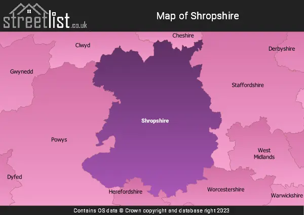
A map showing the boundary of Shropshire in relation to other counties.
Advertisement
Map of the County of Shropshire
| Zoom Level | Latitude | Longitude |
| 6 | 53.521968 | -2.164306 |


Cities, Towns and Villages in Shropshire