A wide range of spatial data has been analysed to present this overview of the SE9 3 Postcode sector. If you would like anything added, please contact us.
The SE9 3 postcode sector is within the county of Greater London.
Did you know? According to the 2021 Census, the SE9 3 postcode sector is home to a bustling 13,145 residents!
Given that each sector allows for 400 unique postcode combinations. Letters C, I, K, M, O and V are not allowed in the last two letters of a postcode. With 220 postcodes already in use, this leaves 180 units available.
The largest settlement in the SE9 3 postal code is ELTHAM followed by LONDON , and NEW ELTHAM .
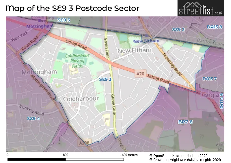
The SE9 3 Postcode shares a border with SE9 5 (ELTHAM , MOTTINGHAM ), BR7 5 (CHISLEHURST ), BR7 6 (CHISLEHURST , ORPINGTON ), DA15 8 (SIDCUP ), SE9 2 (ELTHAM , AVERY HILL , LONDON ), SE9 4 (MOTTINGHAM , GROVE PARK , ELTHAM ), DA14 6 (SIDCUP ) and DA15 7 (SIDCUP ).
Map of the SE9 3 Postcode Sector
Explore the SE9 3 postcode sector by using our interactive map.
The sector is within the post town of LONDON.
SE9 3 is a postcode sector within the SE9 postcode district which is within the SE South Eastern London postcode area.
The Royal Mail delivery office for the SE9 3 postal sector is the Eltham Sdelivery Office.
The area of the SE9 3 postcode sector is 0.96 square miles which is 2.48 square kilometres or 613.49 square acres.
Waterways within the SE9 3 postcode sector include the Wyncham Stream.
Your support helps keep this site running!
If you enjoy using this website, consider buying me a coffee to help cover hosting costs.

| S | E | 9 | - | 3 | X | X |
| S | E | 9 | Space | 3 | Letter | Letter |
Official List of Streets
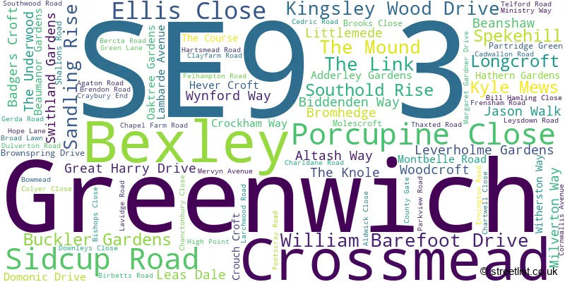
Greenwich (78 Streets)
Bexley (12 Streets)
Unofficial Streets or Alternative Spellings
Weather Forecast for SE9 3
Weather Forecast for Bromley (Greater London)
| Time Period | Icon | Description | Temperature | Rain Probability | Wind |
|---|---|---|---|---|---|
| 21:00 to 00:00 | Clear night | 3.0°C (feels like 1.0°C) | 1.00% | SE 7 mph |
| Time Period | Icon | Description | Temperature | Rain Probability | Wind |
|---|---|---|---|---|---|
| 00:00 to 03:00 | Clear night | 3.0°C (feels like 0.0°C) | 0.00% | SE 4 mph | |
| 03:00 to 06:00 | Clear night | 2.0°C (feels like 0.0°C) | 0.00% | SE 4 mph | |
| 06:00 to 09:00 | Clear night | 1.0°C (feels like -1.0°C) | 0.00% | SE 4 mph | |
| 09:00 to 12:00 | Sunny day | 2.0°C (feels like 0.0°C) | 0.00% | SE 4 mph | |
| 12:00 to 15:00 | Sunny day | 5.0°C (feels like 3.0°C) | 0.00% | SSE 4 mph | |
| 15:00 to 18:00 | Sunny day | 6.0°C (feels like 5.0°C) | 0.00% | SSE 4 mph | |
| 18:00 to 21:00 | Clear night | 4.0°C (feels like 3.0°C) | 0.00% | S 4 mph | |
| 21:00 to 00:00 | Clear night | 2.0°C (feels like 1.0°C) | 1.00% | S 4 mph |
| Time Period | Icon | Description | Temperature | Rain Probability | Wind |
|---|---|---|---|---|---|
| 00:00 to 03:00 | Clear night | 2.0°C (feels like -1.0°C) | 2.00% | S 4 mph | |
| 03:00 to 06:00 | Clear night | 1.0°C (feels like -1.0°C) | 3.00% | SSW 4 mph | |
| 06:00 to 09:00 | Cloudy | 1.0°C (feels like -1.0°C) | 6.00% | SW 4 mph | |
| 09:00 to 12:00 | Overcast | 2.0°C (feels like 0.0°C) | 9.00% | SSW 4 mph | |
| 12:00 to 15:00 | Overcast | 6.0°C (feels like 4.0°C) | 8.00% | SSW 4 mph | |
| 15:00 to 18:00 | Sunny day | 7.0°C (feels like 5.0°C) | 2.00% | SSW 7 mph | |
| 18:00 to 21:00 | Clear night | 5.0°C (feels like 3.0°C) | 1.00% | SSW 7 mph | |
| 21:00 to 00:00 | Partly cloudy (night) | 4.0°C (feels like 2.0°C) | 2.00% | SSW 7 mph |
| Time Period | Icon | Description | Temperature | Rain Probability | Wind |
|---|---|---|---|---|---|
| 00:00 to 03:00 | Cloudy | 4.0°C (feels like 1.0°C) | 5.00% | SSW 7 mph | |
| 03:00 to 06:00 | Partly cloudy (night) | 4.0°C (feels like 1.0°C) | 2.00% | SSW 7 mph | |
| 06:00 to 09:00 | Clear night | 4.0°C (feels like 1.0°C) | 2.00% | SSW 7 mph | |
| 09:00 to 12:00 | Sunny day | 5.0°C (feels like 2.0°C) | 2.00% | SSW 9 mph | |
| 12:00 to 15:00 | Cloudy | 8.0°C (feels like 6.0°C) | 5.00% | SSW 11 mph | |
| 15:00 to 18:00 | Cloudy | 9.0°C (feels like 7.0°C) | 7.00% | SSW 11 mph | |
| 18:00 to 21:00 | Overcast | 8.0°C (feels like 6.0°C) | 17.00% | SSW 9 mph | |
| 21:00 to 00:00 | Cloudy | 8.0°C (feels like 6.0°C) | 15.00% | SW 9 mph |
| Time Period | Icon | Description | Temperature | Rain Probability | Wind |
|---|---|---|---|---|---|
| 00:00 to 03:00 | Clear night | 7.0°C (feels like 5.0°C) | 8.00% | WSW 7 mph | |
| 03:00 to 06:00 | Clear night | 5.0°C (feels like 3.0°C) | 5.00% | W 7 mph | |
| 06:00 to 09:00 | Clear night | 4.0°C (feels like 2.0°C) | 2.00% | WNW 4 mph | |
| 09:00 to 12:00 | Partly cloudy (day) | 4.0°C (feels like 2.0°C) | 1.00% | WNW 4 mph | |
| 12:00 to 15:00 | Cloudy | 7.0°C (feels like 5.0°C) | 4.00% | NW 4 mph | |
| 15:00 to 18:00 | Cloudy | 8.0°C (feels like 7.0°C) | 5.00% | NNW 4 mph | |
| 18:00 to 21:00 | Cloudy | 6.0°C (feels like 5.0°C) | 5.00% | N 4 mph | |
| 21:00 to 00:00 | Cloudy | 5.0°C (feels like 3.0°C) | 4.00% | N 4 mph |
Schools and Places of Education Within the SE9 3 Postcode Sector
Dulverton Primary School
Community school
Dulverton Road, London, , SE9 3RH
Head: Mrs Karen Herbert
Ofsted Rating: Good
Inspection: 2023-03-08 (696 days ago)
Website: Visit Dulverton Primary School Website
Phone: 02083023573
Number of Pupils: 442
Greenacres Primary School and Language Impairment Unit
Academy converter
Witherston Way, London, , SE9 3JN
Head: Joanne Wilkinson-Tabi
Ofsted Rating: Good
Inspection: 2022-02-23 (1074 days ago)
Website: Visit Greenacres Primary School and Language Impairment Unit Website
Phone: 02088574965
Number of Pupils: 276
Montbelle Primary School
Community school
Milverton Way, London, , SE9 3EY
Head: Mrs E Geden
Ofsted Rating: Good
Inspection: 2023-03-09 (695 days ago)
Website: Visit Montbelle Primary School Website
Phone: 02088573909
Number of Pupils: 438
House Prices in the SE9 3 Postcode Sector
| Type of Property | 2018 Average | 2018 Sales | 2017 Average | 2017 Sales | 2016 Average | 2016 Sales | 2015 Average | 2015 Sales |
|---|---|---|---|---|---|---|---|---|
| Detached | £562,010 | 12 | £642,000 | 5 | £415,591 | 11 | £441,600 | 5 |
| Semi-Detached | £487,979 | 71 | £486,309 | 80 | £485,453 | 59 | £420,895 | 103 |
| Terraced | £407,316 | 38 | £414,287 | 40 | £444,342 | 38 | £353,906 | 46 |
| Flats | £257,784 | 32 | £288,606 | 28 | £251,273 | 33 | £221,963 | 34 |
Important Postcodes SE9 3 in the Postcode Sector
SE9 3EY is the postcode for Montbelle School, Milverton Way
SE9 3JN is the postcode for GREENACRES PRIMARY SCHOOL, WITHERSTON WAY, ELTHAM, and Greenacres Primary School, Witherston Way
SE9 3LX is the postcode for Coldharbour Leisure Centre, Chapel Farm Road
SE9 3QT is the postcode for New Eltham Library, Southwood Road
SE9 3RH is the postcode for Dulverton School, Dulverton Road
| The SE9 3 Sector is within these Local Authorities |
|
|---|---|
| The SE9 3 Sector is within these Counties |
|
| The SE9 3 Sector is within these Water Company Areas |
|