
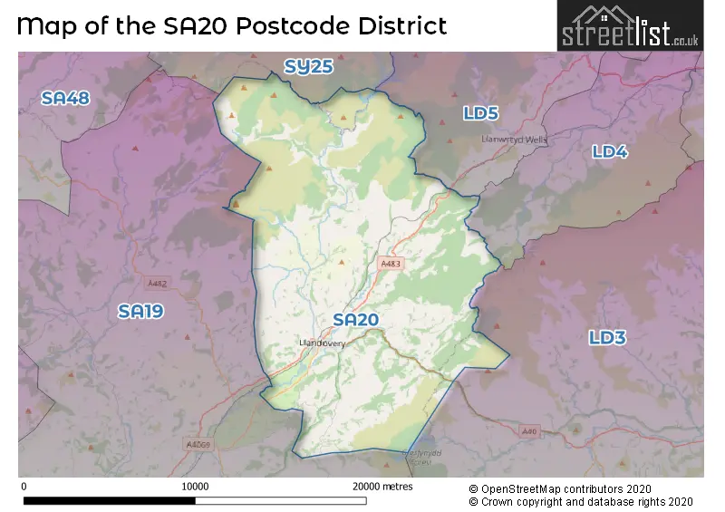
Map of the SA20 Postcode District
Explore the postcode district by using our interactive map.
Circles represent recorded crime; the larger the circle, the higher the crime rates.
Your support helps keep this site running!
If you enjoy using this website, consider buying me a coffee to help cover hosting costs.
Where is the SA20 District?
To give you an idea where the district is located we have created the following table showing nearby towns.
Nearest Towns to SA20
| Town | Distance (miles) | Direction |
|---|---|---|
| Llanwrtyd Wells | 7.44 | NE |
| Lampeter | 14.10 | WNW |
| Llandeilo | 14.22 | SW |
| Tregaron | 14.38 | NNW |
| Llanybydder | 16.63 | W |
| Brecon | 17.38 | ESE |
| Builth Wells | 17.59 | ENE |
| Ystradgynlais | 17.92 | S |
| Ammanford | 19.21 | SSW |
| Glyn-neath | 21.08 | SSE |
| Rhayader | 21.38 | NNE |
| Llandrindod Wells | 21.96 | NE |
| Pontardawe | 22.05 | S |
| Llandysul | 22.88 | W |
| Talgarth | 23.19 | E |
| Pontarddulais | 25.07 | SSW |
| Aberaeron | 25.12 | NW |
| Neath | 25.78 | S |
| Carmarthen | 25.96 | WSW |
The post town for this district is LLANDOVERY.
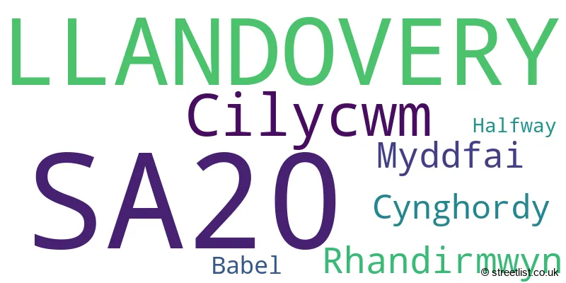
Postcode Information for District SA20 (Total Geographical Postcodes: 237)
| Location | Post Town | Sector | Number of Postcodes |
|---|---|---|---|
| LLANDOVERY | LLANDOVERY | SA20 0 | 123 |
| Cilycwm | LLANDOVERY | SA20 0 | 32 |
| Rhandirmwyn | LLANDOVERY | SA20 0 | 24 |
| Myddfai | LLANDOVERY | SA20 0 | 23 |
| Cynghordy | LLANDOVERY | SA20 0 | 20 |
| Babel | LLANDOVERY | SA20 0 | 9 |
| Halfway | LLANDOVERY | SA20 0 | 6 |
Retail and Shopping in SA20
Street
Town
Locality
Number of Shops
Central Postcode
View on Google Maps
STONE STREET
LLANDOVERY
22
SA20 0JR
View on Google Maps
KINGS ROAD
LLANDOVERY
12
SA20 0AW
View on Google Maps
HIGH STREET
LLANDOVERY
11
SA20 0PU
View on Google Maps
MARKET SQUARE
LLANDOVERY
11
SA20 0AB
View on Google Maps
BROAD STREET
LLANDOVERY
7
SA20 0AR
View on Google Maps
| Street | Town | Locality | Number of Shops | Central Postcode | View on Google Maps |
|---|---|---|---|---|---|
| STONE STREET | LLANDOVERY | 22 | SA20 0JR | View on Google Maps | |
| KINGS ROAD | LLANDOVERY | 12 | SA20 0AW | View on Google Maps | |
| HIGH STREET | LLANDOVERY | 11 | SA20 0PU | View on Google Maps | |
| MARKET SQUARE | LLANDOVERY | 11 | SA20 0AB | View on Google Maps | |
| BROAD STREET | LLANDOVERY | 7 | SA20 0AR | View on Google Maps |
The primary settlement in the SA20 postcode district is Llandovery, which is located in the county of Dyfed in Wales. Other significant settlements in the district, in order of importance, include Babel, Cilycwm, Cynghordy, Halfway, Myddfai, and Rhandirmwyn. The main post town in the district is also Llandovery.
When it comes to local government, postal geography often disregards political borders. However, this district intersects the following councils: the district mostly encompasses the Sir Gaerfyrddin - Carmarthenshire area with a total of 237 postal codes.
The largest settlement in the SA20 postal code is LLANDOVERY followed by RHANDIRMWYN, and CYNGHORDY.
The SA20 Postcode shares a border with SY25 (TREGARON, PONTRHYDFENDIGAID, LLANDDEWI BREFI), LD3 (BRECON, TALGARTH, LLAN-FAES), LD4 (LLANGAMMARCH WELLS, GARTH, TIRABAD), LD5 (LLANWRTYD WELLS, BEULAH, ABERGWESYN) and SA19 (LLANDEILO, LLANGADOG, FFAIRFACH).
Postcode Sectors


Dentists in the SA20 District
| # | Name | Address | Type | Contact |
|---|---|---|---|---|
| 1 | Dental Surgery | 22 STONE STREET , LLANDOVERY , DYFED , SA20 0JP | GENERAL DENTAL PRACTICE |
Doctors in the SA20 District
| # | Name | Address | Type | Contact |
|---|---|---|---|---|
| 1 | Llanfair Surgery | , LLANDOVERY , DYFED , SA20 0HY | GP PRACTICE |
Chemists in the SA20 District
| # | Name | Address | Type | Contact |
|---|---|---|---|---|
| 1 | Ar & H Davies | 4 KINGS ROAD , LLANDOVERY , SA20 0AW | PHARMACY |
Opticians in the SA20 District
| # | Name | Address | Type | Contact |
|---|---|---|---|---|
| 1 | EVANS AND HUGHES (LLANDOVERY) | 8 STONE STREET , LLANDOVERY , SA20 0JR | OPTICAL SITE | |
| 2 | INSIGHT EYECARE | 8 STONE STREET , LLANDOVERY , SA20 0JR | OPTICAL SITE |
Stations in the Sector
Cynghordy
CRS Code: CYN
Operator: AW
Line: Heart of Wales Line
Company: Transport for Wales
Llandovery
CRS Code: LLV
Operator: AW
Line: Heart of Wales Line
Company: Transport for Wales
Accessable Motorway Junctions
M4 J48
Average Driving Time from within the district: 42.66
Average Driving Distance: 28.80
Number of Postcodes that can access the Motorway Junction: 227
M4 J46
Average Driving Time from within the district: 48.58
Average Driving Distance: 34.20
Number of Postcodes that can access the Motorway Junction: 237
M4 J45
Average Driving Time from within the district: 49.94
Average Driving Distance: 35.63
Number of Postcodes that can access the Motorway Junction: 237
M4 J44
Average Driving Time from within the district: 51.28
Average Driving Distance: 37.36
Number of Postcodes that can access the Motorway Junction: 219
M4 J47
Average Driving Time from within the district: 51.95
Average Driving Distance: 33.97
Number of Postcodes that can access the Motorway Junction: 17
M4 J43
Average Driving Time from within the district: 56.43
Average Driving Distance: 38.25
Number of Postcodes that can access the Motorway Junction: 10
Weather Forecast for Llandovery
| Time Period | Icon | Description | Temperature | Rain Probability | Wind |
|---|---|---|---|---|---|
| 03:00 to 06:00 | Overcast | 6.0°C (feels like 5.0°C) | 11.00% | SW 2 mph | |
| 06:00 to 09:00 | Mist | 5.0°C (feels like 4.0°C) | 16.00% | SW 2 mph | |
| 09:00 to 12:00 | Cloudy | 5.0°C (feels like 3.0°C) | 10.00% | SW 2 mph | |
| 12:00 to 15:00 | Cloudy | 9.0°C (feels like 6.0°C) | 5.00% | SSW 11 mph | |
| 15:00 to 18:00 | Cloudy | 9.0°C (feels like 7.0°C) | 6.00% | SSW 11 mph | |
| 18:00 to 21:00 | Cloudy | 8.0°C (feels like 5.0°C) | 5.00% | SSW 9 mph | |
| 21:00 to 00:00 | Cloudy | 8.0°C (feels like 5.0°C) | 6.00% | SSW 11 mph |
| Time Period | Icon | Description | Temperature | Rain Probability | Wind |
|---|---|---|---|---|---|
| 00:00 to 03:00 | Overcast | 8.0°C (feels like 5.0°C) | 9.00% | SSW 13 mph | |
| 03:00 to 06:00 | Overcast | 9.0°C (feels like 5.0°C) | 11.00% | S 16 mph | |
| 06:00 to 09:00 | Overcast | 9.0°C (feels like 6.0°C) | 59.00% | S 16 mph | |
| 09:00 to 12:00 | Heavy rain | 9.0°C (feels like 5.0°C) | 86.00% | S 18 mph | |
| 12:00 to 15:00 | Heavy rain | 10.0°C (feels like 6.0°C) | 95.00% | SSW 16 mph | |
| 15:00 to 18:00 | Heavy rain | 9.0°C (feels like 7.0°C) | 80.00% | WSW 11 mph | |
| 18:00 to 21:00 | Light rain shower (night) | 8.0°C (feels like 5.0°C) | 32.00% | WSW 11 mph | |
| 21:00 to 00:00 | Clear night | 7.0°C (feels like 3.0°C) | 6.00% | WSW 11 mph |
| Time Period | Icon | Description | Temperature | Rain Probability | Wind |
|---|---|---|---|---|---|
| 00:00 to 03:00 | Clear night | 5.0°C (feels like 2.0°C) | 1.00% | W 9 mph | |
| 03:00 to 06:00 | Clear night | 4.0°C (feels like 1.0°C) | 1.00% | W 7 mph | |
| 06:00 to 09:00 | Cloudy | 3.0°C (feels like 1.0°C) | 4.00% | WNW 4 mph | |
| 09:00 to 12:00 | Cloudy | 4.0°C (feels like 3.0°C) | 4.00% | W 2 mph | |
| 12:00 to 15:00 | Cloudy | 8.0°C (feels like 6.0°C) | 4.00% | WNW 4 mph | |
| 15:00 to 18:00 | Cloudy | 8.0°C (feels like 7.0°C) | 4.00% | WNW 7 mph | |
| 18:00 to 21:00 | Clear night | 3.0°C (feels like 2.0°C) | 1.00% | N 2 mph | |
| 21:00 to 00:00 | Clear night | 2.0°C (feels like 0.0°C) | 1.00% | NE 2 mph |
| Time Period | Icon | Description | Temperature | Rain Probability | Wind |
|---|---|---|---|---|---|
| 00:00 to 03:00 | Clear night | 1.0°C (feels like -1.0°C) | 1.00% | ENE 4 mph | |
| 03:00 to 06:00 | Clear night | 1.0°C (feels like -2.0°C) | 1.00% | ENE 4 mph | |
| 06:00 to 09:00 | Clear night | 1.0°C (feels like -2.0°C) | 1.00% | ENE 7 mph | |
| 09:00 to 12:00 | Sunny day | 3.0°C (feels like 0.0°C) | 1.00% | E 7 mph | |
| 12:00 to 15:00 | Sunny day | 7.0°C (feels like 5.0°C) | 1.00% | ESE 9 mph | |
| 15:00 to 18:00 | Sunny day | 8.0°C (feels like 5.0°C) | 1.00% | ESE 9 mph | |
| 18:00 to 21:00 | Clear night | 4.0°C (feels like 1.0°C) | 1.00% | E 7 mph | |
| 21:00 to 00:00 | Clear night | 3.0°C (feels like 0.0°C) | 1.00% | E 9 mph |
| Postal Sector | Delivery Office |
|---|---|
| SA20 0 | Llandovery Delivery Office |
| S | A | 2 | 0 | - | X | X | X |
| S | A | 2 | 0 | Space | Numeric | Letter | Letter |
Tourist Attractions
We found 1 visitor attractions.
| Myddfai Community Hall and Visitor Centre |
|---|
| View Myddfai Community Hall and Visitor Centre on Google Maps |
Street List for the SA20 District
Current Monthly Rental Prices
| # Bedrooms | Min Price | Max Price | Avg Price |
|---|
Current House Prices
| # Bedrooms | Min Price | Max Price | Avg Price |
|---|---|---|---|
| £145,000 | £681,000 | £336,100 | |
| 2 | £119,000 | £220,000 | £166,000 |
| 3 | £142,000 | £1,100,000 | £390,744 |
| 4 | £289,000 | £625,000 | £432,994 |
| 5 | £335,000 | £360,000 | £347,500 |
| 7 | £950,000 | £950,000 | £950,000 |
Estate Agents
| Logo | Name | Brand Name | Address | Contact Number |
|---|---|---|---|---|
 | Llandovery | Clee Tompkinson & Francis | 3 Kings Road, Llandovery, SA20 0AW | 01550 912275 |
 | Lampeter | Morgan & Davies | 12 Harford Square, Lampeter, SA48 7DT | 01570 940145 |
 | Brecon | Fine & Country | 40 High Street, Brecon, LD3 7AP | 01874 641300 |
 | Lampeter | Evans Bros | 39 High Street, Lampeter, SA48 7BB | 01570 940421 |
 | Llanwrda | Davies Morgan and Partners | Gelli Newydd Llanwrda Carmarthenshire SA19 8HD | 01558 611161 |
Yearly House Price Averages for the District
| Type of Property | 2018 Average | 2018 Sales | 2017 Average | 2017 Sales | 2016 Average | 2016 Sales | 2015 Average | 2015 Sales |
|---|---|---|---|---|---|---|---|---|
| Detached | £282,532 | 22 | £217,454 | 23 | £251,168 | 28 | £226,955 | 11 |
| Semi-Detached | £106,283 | 9 | £125,818 | 11 | £152,571 | 7 | £167,100 | 5 |
| Terraced | £106,646 | 12 | £105,615 | 13 | £121,381 | 21 | £94,470 | 17 |
| Flats | £55,000 | 1 | £0 | 0 | £0 | 0 | £0 | 0 |