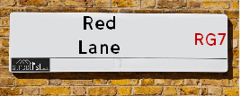
Red Lane in the village of Aldermaston
About Red Lane
Red Lane is a street located near AWE Aldermaston. It uses the postcode RG7 4PA. The street has a length of approximately 1,175 metres.
The street is publicly maintained which means that the road is adopted and West Berkshire is responsible for the repair and upkeep of the highway.
Crime & Historic Map of Red Lane
This interactive map displays both historic mapping and street crime data. Click on a circle to view crime statistics, and use the button above to toggle the 1900s historic map.
This interactive map allows you to **zoom and pan** for a better view of the data.
- Use the + and - buttons on the map to zoom in and out.
- Scroll with your **middle mouse wheel** to zoom in and out.
- On a **mobile device**, use **pinch and zoom gestures** to navigate the map.
- Click on crime markers for more details.


| Street Crime (updated 07/02/2025) | ||
|---|---|---|
| Location Note | Central Point of Street - Not Actual Location | |
| MSOA Info | For MSOA E02003377 (Statistical Neighbourhood) | |
| Click Hint | Click on a Circle for a detailed breakdown below map. | |
| Crime Levels |
Green = Very Low Yellow = Low Orange = High Red = Very High |
|
| Postcodes | ||
| Icon | Postcodes for Red Lane | |
| Walking Distances | ||
| Distance Info | Green Circle = 10 Minutes Walk (800 metres) | |
Street Crime Data accessed from data.police.uk on 07/02/2025.
The street is located within the West Berkshire Council's jurisdiction. They provide various services, like refuse collection, and manage council tax collection. It's situated in the South East region of the UK.
The road has been assigned the Unique Street Reference Numbers of 26901566, 26910132 and 26910092 in the National Street Gazetteer.
It is located within the county of Berkshire, situated in the South East region of the UK. It's 44.93 miles West from central London., 7.68 miles North from Basingstoke, 8.77 miles South West from Reading and 19.05 miles North East from Andover.
RED LANE is within the Post Town of READING
Moving to Red Lane?
I can help you uncover potential pitfalls and provide key questions to ask about your new property. With decades of experience as a Local Land Charges Manager, I offer confidential insights to make your move informed and stress-free.
This service is free, but you may wish to make an optional donation to support it. Please include the property name and address in your request as well as anything you wish to focus on.
Contact Me
Do you know why this road is called Red Lane?
What's it like to live here?
Share a Photo of Red Lane
Ask the community a question.
Do you have any questions, memories to share, have any photos or know any facts? We'd love to know more.
Submit Your Comment

Budget Friendly Hotels near Red Lane
| Budget Hotel Name | Distance (miles) |
|---|---|
|
1: Name:Premier Inn Reading South Grazeley Green Address: Goring Lane Telephone: Visit Hotel Page |
4.84 |
|
2: Name:Premier Inn Reading South Address: Goring Lane Telephone: Visit Hotel Page |
4.84 |
|
3: Name:Travelodge Reading M4 Westbound Address: Moto Service Area, M4, Reading, RG30 3UQ Telephone: 0871 984 6242 Visit Hotel Page |
5.19 |
|
4: Name:Travelodge Reading M4 Eastbound Address: Burghfield, Reading, RG30 3UQ Telephone: 0871 984 6267 Visit Hotel Page |
5.36 |
|
5: Name:Premier Inn Reading Gateway M4 J11 Address: Reading Gateway Telephone: Visit Hotel Page |
7.35 |
Hotel Options
Your support helps keep this site running!
If you enjoy using this website, consider making a donation to help me cover hosting costs.

EPC (Energy Performance Certificate) Information for Red Lane
UPRN: 100081245789
EPC Current: E
EPC Potential: D
Habitable Rooms: 6
Property Type: House
Tenure: Owner-occupied
Built Form: Detached
Age Band: 1950-1966
Mains Gas: No
UPRN: 100081025134
EPC Current: C
EPC Potential: B
Habitable Rooms: 8
Property Type: House
Tenure: Owner-occupied
Built Form: Detached
Age Band: 1950-1966
Mains Gas: No
UPRN: 10090885341
EPC Current: B
EPC Potential: A
Habitable Rooms: N/A
Property Type: House
Tenure: Not defined - use in the case of a new dwelling fo
Built Form: Detached
Age Band: 2021
Mains Gas: Unknown
UPRN: 100081025135
EPC Current: C
EPC Potential: A
Habitable Rooms: 2
Property Type: Bungalow
Tenure: Owner-occupied
Built Form: Detached
Age Band: 2007 onwards
Mains Gas: Yes
UPRN: 100081025136
EPC Current: C
EPC Potential: B
Habitable Rooms: 7
Property Type: Bungalow
Tenure: Owner-occupied
Built Form: Detached
Age Band: 1950-1966
Mains Gas: Yes
House Sales
| Year | High | Low | Average | Sales |
|---|---|---|---|---|
| 2014 | £42,500 | £42,500 | £42,500 | 1 |
| 2017 | £580,000 | £580,000 | £580,000 | 1 |
| 2021 | £430,000 | £430,000 | £430,000 | 1 |
Contains HM Land Registry data © Crown copyright and database right 2025. This data is licensed under the Open Government Licence v3.0.
Nearby Estate Agents
| Name | Address | Website |
|---|---|---|
| Gascoigne-Pees | 20 Mulfords Hill Tadley Hampshire RG26 3JE | Visit Website |
| Belvoir | Redwoods House 14/16 Mulfords Hill, Tadley, RG26 3JA | Visit Website |
| Sansome & George | 1 The Parade Franklin Avenue, Tadley, RG26 4ET | Visit Website |
| Parkers Estate Agents | 2B Olympus House, Calleva Park, Baughurst, RG7 8UA | |
| Greene Knight | 1 Minerva House, Calleva Park, Aldermaston,,RG7 8NA | Visit Website |
We have found 1 postcode
Neighbourhood Policing |
| Police Force: Thames Valley |
 View Neighbourhood Crime and Policing View Neighbourhood Crime and Policing |
| Find a Local Neighbourhood Watch Scheme |
Location Details
| Red Lane | |
|---|---|

| |
| Latitude | 51.374556 |
| Longitude | -1.128402 |
| OS Easting (X): | 460659 |
| OS Northing (Y): | 164360 |
| OS Grid Reference: | SU607644 |
Known Residential Addresses for Red Lane
- NAINI-TAL
- SILVERTREES
Roads that have a Junction with Red Lane
| Street | Junction Type |
|---|---|
| Redlane Hill | pseudo node |
| Raghill | junction |
| Reading Road | junction |
Sunset and Sunrise times
| Sunrise | 07:09 |
|---|---|
| Sunset | 17:27 |
Latest Weather Conditions
| Observed at Weather Station: | Odiham 18 February 2025 at 18:00 (12.35 miles away) |
|---|---|
| Current Weather: | Partly cloudy (night) |
| Temperature and Humidity: | 4.0°C (56.3%) |
| Wind Direction and Speed: | E (10 mph) |
Population Statistics
| ONS Area Code | E00082124 |
|---|---|
| ONS Area Name | Established Farming Communities |
| Average Age | 45.38 |
| Area Population | 1341.00 |
| Male Population | 655.00 (49%) |
| Female Population | 686.00 (51%) |
| Benefit Claimants | 3 (0%) |
| LSOA Code: | E01016254 |
|---|---|
| LSOA Name: | West Berkshire 011A |
| SOA Code: | 2b |
| SOA Name: | |
| MSOA Code: | E02003377 |
| MSOA Name: | West Berkshire 011 |
Nearest Supermarkets
| Sainsburys Tadley |
|---|
| 30a Mulfords Hill, Tadley, England, RG26 3JE |
| 0118 981 9489 |
| Distance: 1.41 Miles |
| Directions to Sainsburys Tadley |
| Tesco Baughurst Express |
|---|
| Heath End Rd, Baughurst, Tadley, RG26 5LZ |
| 0345 026 9242 |
| Distance: 2.06 Miles |
| Directions to Tesco Baughurst Express |
| Tesco Burghfield Common Express |
|---|
| Reading Rd, Burghfield Common, RG7 3JB |
| 0345 610 2711 |
| Distance: 2.97 Miles |
| Directions to Tesco Burghfield Common Express |
| Sainsburys Calcot |
|---|
| Bath Road, Calcot, Reading, England, RG31 7SA |
| 0118 3623956 |
| Distance: 5.54 Miles |
| Directions to Sainsburys Calcot |
Telephone Information
| Area Code |
|---|
| Area Code: 01256 - Basingstoke |
| Area Code: 01635 - Newbury |
| Area Code: 0118 - Reading |
Broadband Information
| Speed | Average Speed | Median Speed | Maximum Speed | Next-generation access (NGA) | Number of Connections |
|---|---|---|---|---|---|
| Greater than 2 Mbps | 8 | 8.8 | 11.8 | N | 6 |
Local Government
| Local Council Details |
|---|
| Within the area of West Berkshire |
| Visit the Council's Website |
| Council Offices, Market Street, Newbury, West Berkshire &RG14 5LD |
| Send email |
| Telephone Number: 01635 424 00 |
| Local Member of Parliament |
|---|
| Within the Westminster Parliamentary Constituency of Newbury |
| The Member of Parliament is Olivia Bailey |
| Details for the MP Olivia Bailey on parliament.uk |
| Details for the MP Olivia Bailey on theyworkforyou.com |
| In the 2024 General Election Olivia Bailey won with a majority of 1,361 the result was Lab gain from Con. The total electorate was 68,781 |
| Wards, Parish Councils and County Councils |
|---|
| Ward: Aldermaston Ward |
| Parish: Aldermaston Parish Council |
| Ceremonial County: Berkshire |
Nearest Schools
England Primary Schools
Mortimer St. John's C.E. Infant School
Address: Mortimer St. John's C.E. Infant School, The Street, Mortimer Common, Reading, Berkshire, RG7 3RD
Distance: 2.95 miles
Contact: 01189332242
Silchester Church of England Primary School
Address: Silchester Church of England Primary School, School Lane, Silchester, Reading, Berkshire, RG7 2NJ
Distance: 1.71 miles
Contact: 01189700256
Bishopswood Infant School
Address: Bishopswood Infant School, Barlows Road, Tadley, Hampshire, RG26 3NA
Distance: 1.87 miles
Contact: 01189812836
Bishopswood Junior School
Address: Bishopswood Junior School, Barlows Road, Tadley, Hampshire, RG26 3NA
Distance: 1.87 miles
Contact: 01189812738
Burnham Copse Primary School
Address: Burnham Copse Primary School, Newchurch Road, Tadley, Hampshire, RG26 4HN
Distance: 1.71 miles
Contact: 01189814498
Aldermaston C.E. Primary School
Address: Aldermaston C.E. Primary School, Wasing Lane, Aldermaston, Reading, RG7 4LX
Distance: 1.29 miles
Contact: 01189713362
Nearest Hospitals
| Parklands Hospital |
|---|
| Address: Aldermaston Road, Basingstoke, RG24 9RH, |
| NHS Sector |
| Southern Health NHS Foundation Trust |
| Telephone: 01256 817718 |
| Distance: 10.26 (miles) |
| Directions from to Parklands Hospital |
| Basingstoke and North Hampshire Hospital |
|---|
| Address: Aldermaston Road, Basingstoke, RG24 9NA, |
| NHS Sector |
| Hampshire Hospitals NHS Foundation Trust |
| Telephone: 01256 473 202 |
| Visit Hospital Website |
| Distance: 10.51 (miles) |
| Directions from to Basingstoke and North Hampshire Hospital |
| Prospect Park Hospital |
|---|
| Address: Honey End Lane, Tilehurst, Reading, RG30 4EJ, |
| NHS Sector |
| Berkshire Healthcare NHS Foundation Trust |
| Telephone: 0118 960 5000 |
| Visit Hospital Website |
| Distance: 11.43 (miles) |
| Directions from to Prospect Park Hospital |
Nearest Dentists
Dentists
HARRISON DENTAL TADLEY LTD
Address: UNIT 1, BRICK KILN INDUSTRIAL ESTATE, SILCHESTER ROAD, TADLEY, RG26 3PX
Distance: 1.25 miles
Contact: :
NEWCHURCH ROAD DENTAL SURGERY
Address: NEWCHURCH ROAD, TADLEY, HAMPSHIRE, RG26 4HN
Distance: 1.71 miles
Contact: :
OAKTREE DENTAL PRACTICE
Address: 8 WEST END ROAD, MORTIMER COMMON, READING, RG7 3SY
Distance: 2.84 miles
Contact: :
DENTAL SURGERY
Address: TARRAGON WAY, BURGHFIELD COMMON, READING, BERKSHIRE, RG7 3YU
Distance: 3.63 miles
Contact: :
1-3
Address: CHURCH STREET, THEALE, READING, BERKSHIRE, RG7 5BU
Distance: 4.81 miles
Contact: :
THEALE DENTAL SURGERY
Address: 25A HIGH STREET, THEALE, READING, BERKSHIRE, RG7 5AH
Distance: 4.93 miles
Contact: :
Nearest GP Surgeries
Doctors
TADLEY MEDICAL P'SHIP
Address: HOLMWOOD HEALTH CENTRE, FRANKLIN AVENUE, TADLEY, HAMPSHIRE, RG26 4ER
Distance: 1.42 miles
Contact: tel: 0118 9814166
TADLEY MEDICAL PARTNERSHIP
Address: MORLAND SURGERY, 40 NEW ROAD, TADLEY, HAMPSHIRE, RG26 3AN
Distance: 1.97 miles
Contact: tel: 0118 9816661
MORTIMER SURGERY
Address: 72 VICTORIA ROAD, MORTIMER COMMON, MORTIMER, READING, BERKSHIRE, RG7 3SQ
Distance: 2.59 miles
Contact: tel: 0118 9332436
DR. M. L. SWAMI
Address: BURGHFIELD HEALTH CENTRE, READING ROAD, BURGHFIELD COMMON, READING, BERKSHIRE, RG7 3YJ
Distance: 3.53 miles
Contact: tel: 0118 9835222
CLIFT SURGERY
Address: MINCHENS LANE, BRAMLEY, TADLEY, HAMPSHIRE, RG26 5BH
Distance: 3.99 miles
Contact: tel: 01256 881228
CHAPEL ROW SURGERY
Address: THE AVENUE, BUCKLEBURY, READING, BERKSHIRE, RG7 6NS
Distance: 3.99 miles
Contact: tel: 0118 9713252
Nearest Dispensing Chemists
Pharmacies
HOLMWOOD PHARMACY
Address: FRANKLIN AVENUE, TADLEY, HAMPSHIRE, RG26 4ER
Distance: 1.42 miles
Contact: tel: 0118 9811984
MORLAND PHARMACY
Address: 40 NEW ROAD, TADLEY, HAMPSHIRE, RG26 3AN
Distance: 1.97 miles
Contact: tel: 0118 9820157
MORTIMER PHARMACY
Address: 72 VICTORIA ROAD, MORTIMER COMMON, READING, BERKSHIRE, RG7 3SQ
Distance: 2.59 miles
Contact: tel: 01189 333161
THE LITTLE VILLAGE PHARMACY
Address: 24 WEST END ROAD, MORTIMER COMMON, READING, RG7 3TF
Distance: 2.74 miles
Contact: tel: 01189 574999
BURGHFIELD PHARMACY
Address: READING ROAD, BURGHFIELD COMMON, READING, BERKSHIRE, RG7 3YJ
Distance: 3.53 miles
Contact: tel: 0118 9831145
KAMSONS PHARMACY
Address: 27 HIGH STREET, THEALE, READING, BERKSHIRE, RG7 5AH
Distance: 4.93 miles
Contact: tel: 01189 302542
Nearest Opticians
Opticians
OPTIMUM VISION CLINIC - TADLEY
Address: THE FALCON GARAGE, BURGHFIELD ROAD, TADLEY, HAMPSHIRE, RG26 4QY
Distance: 1.29 miles
Contact: :
LEIGHTONS OPTICIANS (TADLEY)
Address: 74-76 FRANKLIN AVENUE, TADLEY, RG26 4ET
Distance: 1.48 miles
Contact: :
BUYS SPECS DIRECT (THATCHAM)
Address: UNIT 9 PIPERS COURT, BERKSHIRE DRIVE, THATCHAM, RG19 4ER
Distance: 5.00 miles
Contact: :
THE OPTICIAN ODIHAM
Address: WATERSIDE, 1650 ARLINGTON BUSINESS PARK, THEALE, READING, RG7 4SA
Distance: 5.07 miles
Contact: :
CALCOT SPECSAVERS LIMITED
Address: SAVACENTRE, BATH ROAD, CALCOT, READING, RG31 7SA
Distance: 5.50 miles
Contact: :
LEIGHTONS OPTICIANS (THATCHAM)
Address: 12 KINGSLAND CENTRE, THE BROADWAY, THATCHAM, BERKSHIRE, RG19 3HN
Distance: 5.87 miles
Contact: :
Transport
Nearest Rail Stations
Aldermaston Station is 1.95 miles away.
Address: Aldermaston station, Bath Road, Aldermaston, Berkshire, RG7 4LB
Aldermaston is situated on the Reading to Taunton Line and is managed by Great Western Railway.
Aldermaston Station is an unstaffed station.
Midgham Station is 2.59 miles away.
Address: Midgham station, Station Road, Woolhampton, Berkshire, RG7 5SE
Midgham is situated on the Reading to Taunton Line and is managed by Great Western Railway.
Midgham Station is an unstaffed station.