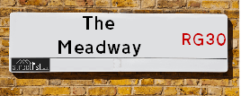
The Meadway is a street located in the town of Reading. The street has a length of approximately 1,671 metres.
The street is located within the Reading (B) Council's jurisdiction. They provide various services, like refuse collection, and manage council tax collection. It's situated in the South East region of the UK.
The road has been assigned the Unique Street Reference Numbers of 31001320, 31010212, 31001319 and 31010211 in the National Street Gazetteer.
The street has the postcodes of RG30 4PQ, RG30 4PL, RG30 4PJ, RG30 4PH, RG30 4PG, RG30 4PE, RG30 4PD, RG30 4PB, RG30 4NY, RG30 4NX, RG30 4NU, RG30 4NT, RG30 4NS, RG30 4NN, RG30 4AP, RG30 4AN, RG30 4AJ, RG30 4AH, RG30 4AG, RG30 4AQ and RG30 4AL.
It is located within the county of Berkshire, situated in the South East region of the UK. It's 39.79 miles West from central London., 2.38 miles West from Reading, 12.96 miles North from Basingstoke and 22.27 miles North West from Woking.
THE MEADWAY is within the Post Town of READING
Map of The Meadway
| Street Crime (updated 14/01/2025) | ||
|---|---|---|
| Location Note | Central Point of Street - Not Actual Location | |
| MSOA Info | For MSOAs E02003397, E02003396, E02003372 (Statistical Neighbourhood) | |
| Click Hint | Click on a Circle for a detailed breakdown below map. | |
| Crime Levels |
Green = Very Low Yellow = Low Orange = High Red = Very High |
|
| Postcodes | ||
| Icon | Postcodes for The Meadway | |
| Walking Distances | ||
| Distance Info | Green Circle = 10 Minutes Walk (800 metres) | |
Street Crime Data accessed from data.police.uk on 06/10/2024.
Moving to The Meadway?
I can help you uncover potential pitfalls and provide key questions to ask about your new property. With decades of experience as a Local Land Charges Manager, I offer confidential insights to make your move informed and stress-free.
This service is free, but you may wish to make an optional donation to support it. Please include the property name and address in your request as well as anything you wish to focus on.
Contact Me
Do you know why this road is called The Meadway?
What's it like to live here?
Share a Photo of The Meadway
Ask the community a question.
Do you have any questions, memories to share, have any photos or know any facts? We'd love to know more.
Submit Your Comment
Find Homes to Rent in Reading

Budget Friendly Hotels near The Meadway
| Budget Hotel Name | Distance (miles) |
|---|---|
|
1: Name:Travelodge Reading M4 Eastbound Address: Burghfield, Reading, RG30 3UQ Telephone: 0871 984 6267 Visit Hotel Page |
1.83 |
|
2: Name:Premier Inn Reading Caversham Bridge Address: Richfield Avenue Telephone: Visit Hotel Page |
1.93 |
|
3: Name:Travelodge Reading M4 Westbound Address: Moto Service Area, M4, Reading, RG30 3UQ Telephone: 0871 984 6242 Visit Hotel Page |
1.99 |
|
4: Name:Travelodge Reading Central Address: Oxthorn House, 60 Oxford Rd, Reading, RG1 7LT Telephone: 0871 984 6211 Visit Hotel Page |
2.10 |
|
5: Name:easyHotel Reading Address: 132-138, Caversham Road Telephone: Visit Hotel Page |
2.32 |
Hotel Options
Your support helps keep this site running!
If you enjoy using this website, consider making a donation to help me cover hosting costs.
Flats and Apartments in The Meadway
FLAT 70
FLAT 72
FLAT 74
FLAT 78
FLAT 84
FLAT 86
FLAT 90
FLAT 92
FLAT 46
FLAT 48
FLAT 50
FLAT 52
FLAT 58
FLAT 60
FLAT 62
FLAT 66
FLAT 68
FLAT 22
FLAT 24
FLAT 26
FLAT 28
FLAT 30
FLAT 32
FLAT 36
FLAT 40
FLAT 44
EPC (Energy Performance Certificate) Information for The Meadway
UPRN: 310011922
EPC Current: D
EPC Potential: C
Habitable Rooms: 3
Property Type: Flat
Tenure: rental (social)
Built Form: Detached
Age Band: 1950-1966
Mains Gas: Yes
UPRN: 310006940
EPC Current: C
EPC Potential: C
Habitable Rooms: 3
Property Type: Flat
Tenure: unknown
Built Form: Detached
Age Band: 1950-1966
Mains Gas: Yes
UPRN: 310045933
EPC Current: C
EPC Potential: B
Habitable Rooms: 3
Property Type: Bungalow
Tenure: rental (private)
Built Form: End-Terrace
Age Band: 1996-2002
Mains Gas: Yes
UPRN: 310002508
EPC Current: D
EPC Potential: B
Habitable Rooms: 2
Property Type: Bungalow
Tenure: rental (social)
Built Form: Semi-Detached
Age Band: 1976-1982
Mains Gas: Yes
UPRN: 310007455
EPC Current: D
EPC Potential: B
Habitable Rooms: 4
Property Type: House
Tenure: rental (social)
Built Form: Semi-Detached
Age Band: 1950-1966
Mains Gas: Yes
UPRN: 310011923
EPC Current: C
EPC Potential: C
Habitable Rooms: 3
Property Type: Flat
Tenure: rental (social)
Built Form: Semi-Detached
Age Band: 1930-1949
Mains Gas: Yes
UPRN: 310006941
EPC Current: C
EPC Potential: C
Habitable Rooms: 3
Property Type: Flat
Tenure: rental (social)
Built Form: End-Terrace
Age Band: 1950-1966
Mains Gas: Yes
UPRN: 310045934
EPC Current: C
EPC Potential: B
Habitable Rooms: 3
Property Type: Bungalow
Tenure: rental (private)
Built Form: Mid-Terrace
Age Band: 1996-2002
Mains Gas: Yes
UPRN: 310011924
EPC Current: C
EPC Potential: C
Habitable Rooms: 3
Property Type: Flat
Tenure: unknown
Built Form: NO DATA!
Age Band: 1950-1966
Mains Gas: Yes
UPRN: 310006942
EPC Current: C
EPC Potential: C
Habitable Rooms: 3
Property Type: Flat
Tenure: rental (social)
Built Form: Semi-Detached
Age Band: 1930-1949
Mains Gas: Yes
UPRN: 310045935
EPC Current: C
EPC Potential: B
Habitable Rooms: 3
Property Type: Bungalow
Tenure: rental (private)
Built Form: End-Terrace
Age Band: 1996-2002
Mains Gas: Yes
UPRN: 310042881
EPC Current: C
EPC Potential: B
Habitable Rooms: 2
Property Type: Bungalow
Tenure: rental (social)
Built Form: Mid-Terrace
Age Band: 1976-1982
Mains Gas: Yes
UPRN: 310011917
EPC Current: C
EPC Potential: B
Habitable Rooms: 3
Property Type: Flat
Tenure: Rented (social)
Built Form: Mid-Terrace
Age Band: 1950-1966
Mains Gas: Yes
UPRN: 310006936
EPC Current: C
EPC Potential: C
Habitable Rooms: 3
Property Type: Flat
Tenure: rental (social)
Built Form: Mid-Terrace
Age Band: 1930-1949
Mains Gas: Yes
UPRN: 310005514
EPC Current: D
EPC Potential: C
Habitable Rooms: 2
Property Type: Bungalow
Tenure: rental (social)
Built Form: End-Terrace
Age Band: 1983-1990
Mains Gas: Yes
UPRN: 310011918
EPC Current: D
EPC Potential: C
Habitable Rooms: 3
Property Type: Flat
Tenure: rental (social)
Built Form: Detached
Age Band: 1950-1966
Mains Gas: Yes
UPRN: 310006937
EPC Current: C
EPC Potential: C
Habitable Rooms: 3
Property Type: Flat
Tenure: unknown
Built Form: NO DATA!
Age Band: 1950-1966
Mains Gas: Yes
UPRN: 310045930
EPC Current: C
EPC Potential: B
Habitable Rooms: 3
Property Type: Bungalow
Tenure: rental (private)
Built Form: End-Terrace
Age Band: 1996-2002
Mains Gas: Yes
UPRN: 310008711
EPC Current: C
EPC Potential: C
Habitable Rooms: 2
Property Type: Bungalow
Tenure: unknown
Built Form: End-Terrace
Age Band: 1983-1990
Mains Gas: Yes
UPRN: 310053552
EPC Current: C
EPC Potential: B
Habitable Rooms: 5
Property Type: House
Tenure: Owner-occupied
Built Form: Semi-Detached
Age Band: 1967-1975
Mains Gas: Yes
UPRN: 310011919
EPC Current: C
EPC Potential: C
Habitable Rooms: 3
Property Type: Flat
Tenure: Rented (social)
Built Form: Mid-Terrace
Age Band: 1950-1966
Mains Gas: Yes
UPRN: 310006938
EPC Current: C
EPC Potential: B
Habitable Rooms: 3
Property Type: Flat
Tenure: unknown
Built Form: Detached
Age Band: 1950-1966
Mains Gas: Yes
UPRN: 310045931
EPC Current: C
EPC Potential: B
Habitable Rooms: 3
Property Type: Bungalow
Tenure: rental (private)
Built Form: Mid-Terrace
Age Band: 1996-2002
Mains Gas: Yes
UPRN: 310045299
EPC Current: D
EPC Potential: C
Habitable Rooms: 2
Property Type: Bungalow
Tenure: rental (social)
Built Form: Mid-Terrace
Age Band: 1976-1982
Mains Gas: Yes
UPRN: 310006939
EPC Current: D
EPC Potential: C
Habitable Rooms: 3
Property Type: Flat
Tenure: rental (social)
Built Form: Semi-Detached
Age Band: 1950-1966
Mains Gas: Yes
UPRN: 310045932
EPC Current: C
EPC Potential: B
Habitable Rooms: 3
Property Type: Bungalow
Tenure: rental (private)
Built Form: End-Terrace
Age Band: 1996-2002
Mains Gas: Yes
UPRN: 310030261
EPC Current: C
EPC Potential: C
Habitable Rooms: 2
Property Type: Bungalow
Tenure: unknown
Built Form: Mid-Terrace
Age Band: 1976-1982
Mains Gas: Yes
UPRN: 310027335
EPC Current: D
EPC Potential: B
Habitable Rooms: 4
Property Type: House
Tenure: rental (social)
Built Form: Semi-Detached
Age Band: 1950-1966
Mains Gas: Yes
UPRN: 310011926
EPC Current: D
EPC Potential: C
Habitable Rooms: 3
Property Type: Flat
Tenure: rental (social)
Built Form: Detached
Age Band: 1950-1966
Mains Gas: Yes
UPRN: 310006944
EPC Current: D
EPC Potential: C
Habitable Rooms: 3
Property Type: Flat
Tenure: rental (social)
Built Form: Detached
Age Band: 1950-1966
Mains Gas: Yes
UPRN: 310006945
EPC Current: C
EPC Potential: C
Habitable Rooms: 3
Property Type: Flat
Tenure: Rented (social)
Built Form: Mid-Terrace
Age Band: 1950-1966
Mains Gas: Yes
UPRN: 310036110
EPC Current: E
EPC Potential: C
Habitable Rooms: 4
Property Type: House
Tenure: Owner-occupied
Built Form: Semi-Detached
Age Band: 1950-1966
Mains Gas: Yes
UPRN: 310011928
EPC Current: C
EPC Potential: C
Habitable Rooms: 3
Property Type: Flat
Tenure: unknown
Built Form: NO DATA!
Age Band: 1950-1966
Mains Gas: Yes
UPRN: 310006946
EPC Current: D
EPC Potential: C
Habitable Rooms: 3
Property Type: Flat
Tenure: rental (social)
Built Form: Detached
Age Band: 1950-1966
Mains Gas: Yes
UPRN: 310011929
EPC Current: C
EPC Potential: C
Habitable Rooms: 3
Property Type: Flat
Tenure: rental (private)
Built Form: Mid-Terrace
Age Band: 1950-1966
Mains Gas: Yes
UPRN: 310020705
EPC Current: C
EPC Potential: B
Habitable Rooms: 2
Property Type: Bungalow
Tenure: Rented (social)
Built Form: Mid-Terrace
Age Band: 1976-1982
Mains Gas: Yes
UPRN: 310011925
EPC Current: C
EPC Potential: C
Habitable Rooms: 3
Property Type: Flat
Tenure: unknown
Built Form: NO DATA!
Age Band: 1950-1966
Mains Gas: Yes
UPRN: 310027755
EPC Current: C
EPC Potential: B
Habitable Rooms: 6
Property Type: House
Tenure: Owner-occupied
Built Form: Semi-Detached
Age Band: 1950-1966
Mains Gas: Yes
UPRN: 310003484
EPC Current: D
EPC Potential: B
Habitable Rooms: 5
Property Type: House
Tenure: rental (social)
Built Form: Semi-Detached
Age Band: 1950-1966
Mains Gas: Yes
UPRN: 310008232
EPC Current: D
EPC Potential: B
Habitable Rooms: 4
Property Type: House
Tenure: rental (social)
Built Form: Semi-Detached
Age Band: 1950-1966
Mains Gas: Yes
UPRN: 310012358
EPC Current: C
EPC Potential: B
Habitable Rooms: 5
Property Type: House
Tenure: Owner-occupied
Built Form: Semi-Detached
Age Band: 1950-1966
Mains Gas: Yes
UPRN: 310031423
EPC Current: D
EPC Potential: B
Habitable Rooms: 5
Property Type: House
Tenure: Rented (private)
Built Form: Semi-Detached
Age Band: 1950-1966
Mains Gas: Yes
UPRN: 310007589
EPC Current: D
EPC Potential: B
Habitable Rooms: 4
Property Type: House
Tenure: rental (social)
Built Form: Semi-Detached
Age Band: 1967-1975
Mains Gas: Yes
UPRN: 310022618
EPC Current: C
EPC Potential: C
Habitable Rooms: 5
Property Type: House
Tenure: Owner-occupied
Built Form: Semi-Detached
Age Band: 1950-1966
Mains Gas: Yes
UPRN: 310061075
EPC Current: C
EPC Potential: B
Habitable Rooms: 4
Property Type: House
Tenure: rental (social)
Built Form: Semi-Detached
Age Band: 1967-1975
Mains Gas: Yes
UPRN: 310000569
EPC Current: C
EPC Potential: C
Habitable Rooms: 7
Property Type: House
Tenure: Rented (private)
Built Form: Semi-Detached
Age Band: 1950-1966
Mains Gas: Yes
UPRN: 310053074
EPC Current: G
EPC Potential: B
Habitable Rooms: 4
Property Type: House
Tenure: Owner-occupied
Built Form: Semi-Detached
Age Band: 1930-1949
Mains Gas: No
UPRN: 310011144
EPC Current: C
EPC Potential: B
Habitable Rooms: 7
Property Type: House
Tenure: Owner-occupied
Built Form: Semi-Detached
Age Band: 1950-1966
Mains Gas: Yes
UPRN: 310006775
EPC Current: B
EPC Potential: B
Habitable Rooms: 4
Property Type: House
Tenure: rental (social)
Built Form: Semi-Detached
Age Band: 1950-1966
Mains Gas: Yes
UPRN: 310043448
EPC Current: D
EPC Potential: B
Habitable Rooms: 5
Property Type: House
Tenure: Owner-occupied
Built Form: Semi-Detached
Age Band: 1950-1966
Mains Gas: Yes
UPRN: 310060760
EPC Current: D
EPC Potential: B
Habitable Rooms: 4
Property Type: House
Tenure: rental (social)
Built Form: Semi-Detached
Age Band: 1950-1966
Mains Gas: Yes
UPRN: 310013211
EPC Current: D
EPC Potential: D
Habitable Rooms: 4
Property Type: House
Tenure: Owner-occupied
Built Form: End-Terrace
Age Band: 2003-2006
Mains Gas: Yes
UPRN: 310050190
EPC Current: D
EPC Potential: B
Habitable Rooms: 4
Property Type: House
Tenure: rental (social)
Built Form: Mid-Terrace
Age Band: 1950-1966
Mains Gas: Yes
UPRN: 310048546
EPC Current: D
EPC Potential: C
Habitable Rooms: 4
Property Type: House
Tenure: rental (social)
Built Form: Semi-Detached
Age Band: 1950-1966
Mains Gas: Yes
UPRN: 310023989
EPC Current: C
EPC Potential: B
Habitable Rooms: 4
Property Type: House
Tenure: rental (social)
Built Form: Mid-Terrace
Age Band: 1950-1966
Mains Gas: Yes
UPRN: 310017721
EPC Current: B
EPC Potential: B
Habitable Rooms: 5
Property Type: House
Tenure: Owner-occupied
Built Form: Semi-Detached
Age Band: 1950-1966
Mains Gas: Yes
UPRN: 310035020
EPC Current: D
EPC Potential: B
Habitable Rooms: 4
Property Type: House
Tenure: Owner-occupied
Built Form: End-Terrace
Age Band: 1950-1966
Mains Gas: Yes
UPRN: 310024330
EPC Current: C
EPC Potential: B
Habitable Rooms: 4
Property Type: House
Tenure: rental (social)
Built Form: Semi-Detached
Age Band: 1950-1966
Mains Gas: Yes
UPRN: 310012089
EPC Current: C
EPC Potential: B
Habitable Rooms: 4
Property Type: House
Tenure: rental (social)
Built Form: Mid-Terrace
Age Band: 1950-1966
Mains Gas: Yes
UPRN: 310053323
EPC Current: C
EPC Potential: B
Habitable Rooms: 4
Property Type: House
Tenure: Owner-occupied
Built Form: Mid-Terrace
Age Band: 1950-1966
Mains Gas: Yes
UPRN: 310040231
EPC Current: C
EPC Potential: B
Habitable Rooms: 2
Property Type: Bungalow
Tenure: rental (social)
Built Form: End-Terrace
Age Band: 1950-1966
Mains Gas: Yes
UPRN: 310027443
EPC Current: C
EPC Potential: B
Habitable Rooms: 2
Property Type: Bungalow
Tenure: rental (social)
Built Form: Mid-Terrace
Age Band: 1950-1966
Mains Gas: Yes
UPRN: 310044781
EPC Current: C
EPC Potential: B
Habitable Rooms: 3
Property Type: House
Tenure: Rented (social)
Built Form: Semi-Detached
Age Band: 1950-1966
Mains Gas: Yes
UPRN: 310023430
EPC Current: D
EPC Potential: B
Habitable Rooms: 4
Property Type: House
Tenure: Owner-occupied
Built Form: Semi-Detached
Age Band: 1950-1966
Mains Gas: Yes
UPRN: 310052879
EPC Current: C
EPC Potential: B
Habitable Rooms: 2
Property Type: Bungalow
Tenure: rental (social)
Built Form: End-Terrace
Age Band: 1950-1966
Mains Gas: Yes
UPRN: 310050049
EPC Current: D
EPC Potential: B
Habitable Rooms: 3
Property Type: House
Tenure: Owner-occupied
Built Form: Semi-Detached
Age Band: 1950-1966
Mains Gas: Yes
UPRN: 310054859
EPC Current: C
EPC Potential: B
Habitable Rooms: 3
Property Type: House
Tenure: Owner-occupied
Built Form: Semi-Detached
Age Band: 1950-1966
Mains Gas: Yes
UPRN: 310042000
EPC Current: C
EPC Potential: B
Habitable Rooms: 3
Property Type: House
Tenure: Owner-occupied
Built Form: Semi-Detached
Age Band: 1950-1966
Mains Gas: Yes
UPRN: 310001367
EPC Current: C
EPC Potential: B
Habitable Rooms: 5
Property Type: House
Tenure: Owner-occupied
Built Form: Semi-Detached
Age Band: 1967-1975
Mains Gas: Yes
UPRN: 310042645
EPC Current: D
EPC Potential: B
Habitable Rooms: 4
Property Type: House
Tenure: rental (private)
Built Form: Mid-Terrace
Age Band: 1950-1966
Mains Gas: Yes
UPRN: 310021450
EPC Current: C
EPC Potential: B
Habitable Rooms: 5
Property Type: House
Tenure: Owner-occupied
Built Form: Mid-Terrace
Age Band: 1950-1966
Mains Gas: Yes
UPRN: 310006014
EPC Current: C
EPC Potential: B
Habitable Rooms: 4
Property Type: House
Tenure: rental (social)
Built Form: End-Terrace
Age Band: 1950-1966
Mains Gas: Yes
UPRN: 310031803
EPC Current: D
EPC Potential: C
Habitable Rooms: 4
Property Type: Maisonette
Tenure: Owner-occupied
Built Form: End-Terrace
Age Band: 1950-1966
Mains Gas: Yes
UPRN: 310038896
EPC Current: D
EPC Potential: D
Habitable Rooms: 4
Property Type: House
Tenure: Owner-occupied
Built Form: End-Terrace
Age Band: 1950-1966
Mains Gas: Yes
UPRN: 310057863
EPC Current: E
EPC Potential: B
Habitable Rooms: 4
Property Type: House
Tenure: Owner-occupied
Built Form: Mid-Terrace
Age Band: 1950-1966
Mains Gas: Yes
UPRN: 310062133
EPC Current: D
EPC Potential: C
Habitable Rooms: 4
Property Type: Maisonette
Tenure: Owner-occupied
Built Form: Mid-Terrace
Age Band: 1950-1966
Mains Gas: Yes
UPRN: 310045300
EPC Current: D
EPC Potential: B
Habitable Rooms: 4
Property Type: House
Tenure: Owner-occupied
Built Form: Mid-Terrace
Age Band: 1950-1966
Mains Gas: Yes
UPRN: 310038641
EPC Current: C
EPC Potential: B
Habitable Rooms: 4
Property Type: House
Tenure: Rented (social)
Built Form: Semi-Detached
Age Band: 1950-1966
Mains Gas: Yes
UPRN: 310018710
EPC Current: D
EPC Potential: B
Habitable Rooms: 3
Property Type: Bungalow
Tenure: rental (social)
Built Form: End-Terrace
Age Band: 1950-1966
Mains Gas: Yes
UPRN: 310036685
EPC Current: C
EPC Potential: C
Habitable Rooms: 3
Property Type: Bungalow
Tenure: rental (social)
Built Form: Mid-Terrace
Age Band: 1950-1966
Mains Gas: Yes
UPRN: 310005006
EPC Current: C
EPC Potential: C
Habitable Rooms: 4
Property Type: House
Tenure: rental (social)
Built Form: Mid-Terrace
Age Band: 1950-1966
Mains Gas: Yes
UPRN: 310035604
EPC Current: D
EPC Potential: B
Habitable Rooms: 2
Property Type: Bungalow
Tenure: rental (social)
Built Form: End-Terrace
Age Band: 1950-1966
Mains Gas: Yes
UPRN: 310051170
EPC Current: C
EPC Potential: B
Habitable Rooms: 4
Property Type: House
Tenure: rental (social)
Built Form: Mid-Terrace
Age Band: 1950-1966
Mains Gas: Yes
UPRN: 310029506
EPC Current: D
EPC Potential: B
Habitable Rooms: 5
Property Type: House
Tenure: Owner-occupied
Built Form: End-Terrace
Age Band: 1950-1966
Mains Gas: Yes
UPRN: 310000430
EPC Current: E
EPC Potential: B
Habitable Rooms: 4
Property Type: House
Tenure: Owner-occupied
Built Form: Semi-Detached
Age Band: 1950-1966
Mains Gas: Yes
UPRN: 310036777
EPC Current: C
EPC Potential: B
Habitable Rooms: 4
Property Type: House
Tenure: Owner-occupied
Built Form: Mid-Terrace
Age Band: 1950-1966
Mains Gas: Yes
UPRN: 310020561
EPC Current: D
EPC Potential: B
Habitable Rooms: 4
Property Type: House
Tenure: rental (social)
Built Form: Mid-Terrace
Age Band: 1950-1966
Mains Gas: Yes
UPRN: 310001126
EPC Current: D
EPC Potential: B
Habitable Rooms: 4
Property Type: House
Tenure: rental (private)
Built Form: Mid-Terrace
Age Band: 1930-1949
Mains Gas: Yes
UPRN: 310010244
EPC Current: C
EPC Potential: B
Habitable Rooms: 4
Property Type: House
Tenure: rental (social)
Built Form: End-Terrace
Age Band: 1950-1966
Mains Gas: Yes
UPRN: 310011344
EPC Current: D
EPC Potential: B
Habitable Rooms: 4
Property Type: House
Tenure: Owner-occupied
Built Form: Semi-Detached
Age Band: 1950-1966
Mains Gas: Yes
UPRN: 310031411
EPC Current: C
EPC Potential: B
Habitable Rooms: 4
Property Type: House
Tenure: rental (social)
Built Form: End-Terrace
Age Band: 1950-1966
Mains Gas: Yes
UPRN: 310012340
EPC Current: D
EPC Potential: B
Habitable Rooms: 5
Property Type: House
Tenure: Owner-occupied
Built Form: Mid-Terrace
Age Band: 1950-1966
Mains Gas: Yes
UPRN: 310006416
EPC Current: C
EPC Potential: B
Habitable Rooms: 5
Property Type: House
Tenure: Rented (social)
Built Form: Semi-Detached
Age Band: 1950-1966
Mains Gas: Yes
UPRN: 310051434
EPC Current: C
EPC Potential: B
Habitable Rooms: 5
Property Type: House
Tenure: unknown
Built Form: Mid-Terrace
Age Band: 1950-1966
Mains Gas: Yes
UPRN: 310025835
EPC Current: C
EPC Potential: B
Habitable Rooms: 4
Property Type: House
Tenure: rental (social)
Built Form: Mid-Terrace
Age Band: 1950-1966
Mains Gas: Yes
UPRN: 310001832
EPC Current: E
EPC Potential: B
Habitable Rooms: 4
Property Type: House
Tenure: Owner-occupied
Built Form: Mid-Terrace
Age Band: 1950-1966
Mains Gas: Yes
UPRN: 310034173
EPC Current: C
EPC Potential: B
Habitable Rooms: 4
Property Type: House
Tenure: Owner-occupied
Built Form: Mid-Terrace
Age Band: 1950-1966
Mains Gas: Yes
UPRN: 310043575
EPC Current: D
EPC Potential: C
Habitable Rooms: 4
Property Type: House
Tenure: Rented (social)
Built Form: Semi-Detached
Age Band: 1950-1966
Mains Gas: Yes
UPRN: 310014622
EPC Current: D
EPC Potential: B
Habitable Rooms: 5
Property Type: House
Tenure: Owner-occupied
Built Form: End-Terrace
Age Band: 1950-1966
Mains Gas: Yes
UPRN: 310038144
EPC Current: C
EPC Potential: B
Habitable Rooms: 5
Property Type: House
Tenure: rental (private)
Built Form: Mid-Terrace
Age Band: 1930-1949
Mains Gas: Yes
UPRN: 310046726
EPC Current: E
EPC Potential: B
Habitable Rooms: 5
Property Type: House
Tenure: Owner-occupied
Built Form: End-Terrace
Age Band: 1950-1966
Mains Gas: Yes
UPRN: 310038143
EPC Current: C
EPC Potential: B
Habitable Rooms: 5
Property Type: House
Tenure: Owner-occupied
Built Form: Semi-Detached
Age Band: 1950-1966
Mains Gas: Yes
UPRN: 310014422
EPC Current: C
EPC Potential: B
Habitable Rooms: 5
Property Type: House
Tenure: Owner-occupied
Built Form: Detached
Age Band: 1996-2002
Mains Gas: Yes
UPRN: 310014394
EPC Current: D
EPC Potential: C
Habitable Rooms: 5
Property Type: House
Tenure: Owner-occupied
Built Form: Semi-Detached
Age Band: 1950-1966
Mains Gas: Yes
UPRN: 310005687
EPC Current: E
EPC Potential: B
Habitable Rooms: 5
Property Type: House
Tenure: Owner-occupied
Built Form: Detached
Age Band: 1967-1975
Mains Gas: Yes
UPRN: 310050647
EPC Current: C
EPC Potential: B
Habitable Rooms: 5
Property Type: House
Tenure: Owner-occupied
Built Form: Semi-Detached
Age Band: 1950-1966
Mains Gas: Yes
UPRN: 310046932
EPC Current: D
EPC Potential: B
Habitable Rooms: 5
Property Type: House
Tenure: rental (private)
Built Form: Detached
Age Band: 1967-1975
Mains Gas: Yes
UPRN: 310054495
EPC Current: C
EPC Potential: C
Habitable Rooms: 2
Property Type: Flat
Tenure: rental (social)
Built Form: Semi-Detached
Age Band: 1950-1966
Mains Gas: Yes
UPRN: 310054510
EPC Current: D
EPC Potential: C
Habitable Rooms: 2
Property Type: Maisonette
Tenure: rental (private)
Built Form: Semi-Detached
Age Band: 1950-1966
Mains Gas: Yes
UPRN: 310019669
EPC Current: C
EPC Potential: C
Habitable Rooms: 2
Property Type: Flat
Tenure: rental (social)
Built Form: Semi-Detached
Age Band: 1950-1966
Mains Gas: Yes
UPRN: 310019692
EPC Current: C
EPC Potential: C
Habitable Rooms: 2
Property Type: Flat
Tenure: Rented (social)
Built Form: Semi-Detached
Age Band: 1950-1966
Mains Gas: Yes
UPRN: 310055426
EPC Current: E
EPC Potential: C
Habitable Rooms: 5
Property Type: House
Tenure: Owner-occupied
Built Form: Detached
Age Band: 1950-1966
Mains Gas: Yes
UPRN: 310054255
EPC Current: C
EPC Potential: C
Habitable Rooms: 2
Property Type: Flat
Tenure: rental (social)
Built Form: Semi-Detached
Age Band: 1950-1966
Mains Gas: Yes
UPRN: 310014291
EPC Current: C
EPC Potential: B
Habitable Rooms: 5
Property Type: House
Tenure: Owner-occupied
Built Form: Detached
Age Band: 1930-1949
Mains Gas: Yes
UPRN: 310023610
EPC Current: C
EPC Potential: C
Habitable Rooms: 2
Property Type: Flat
Tenure: rental (social)
Built Form: Semi-Detached
Age Band: 1950-1966
Mains Gas: Yes
UPRN: 310023634
EPC Current: C
EPC Potential: C
Habitable Rooms: 2
Property Type: Flat
Tenure: rental (social)
Built Form: Detached
Age Band: 1950-1966
Mains Gas: Yes
UPRN: 310041428
EPC Current: C
EPC Potential: C
Habitable Rooms: 9
Property Type: House
Tenure: Owner-occupied
Built Form: Detached
Age Band: 1967-1975
Mains Gas: Yes
UPRN: 310015573
EPC Current: D
EPC Potential: B
Habitable Rooms: 5
Property Type: House
Tenure: Owner-occupied
Built Form: End-Terrace
Age Band: 1950-1966
Mains Gas: Yes
UPRN: 310072880
EPC Current: C
EPC Potential: B
Habitable Rooms: 5
Property Type: House
Tenure: rental (private)
Built Form: Detached
Age Band: 2007 onwards
Mains Gas: Yes
UPRN: 310072881
EPC Current: B
EPC Potential: B
Habitable Rooms: N/A
Property Type: House
Tenure: U
Built Form: Detached
Age Band: U
Mains Gas: Unknown
UPRN: 310050040
EPC Current: D
EPC Potential: B
Habitable Rooms: 5
Property Type: House
Tenure: Owner-occupied
Built Form: Mid-Terrace
Age Band: 1950-1966
Mains Gas: Yes
UPRN: 100080247145
EPC Current: D
EPC Potential: D
Habitable Rooms: 7
Property Type: House
Tenure: rental (private)
Built Form: Detached
Age Band: 1930-1949
Mains Gas: Yes
UPRN: 310004050
EPC Current: B
EPC Potential: A
Habitable Rooms: 5
Property Type: House
Tenure: unknown
Built Form: End-Terrace
Age Band: 1950-1966
Mains Gas: Yes
UPRN: 100080247146
EPC Current: D
EPC Potential: C
Habitable Rooms: 7
Property Type: House
Tenure: Owner-occupied
Built Form: Semi-Detached
Age Band: 1930-1949
Mains Gas: Yes
UPRN: 310012595
EPC Current: C
EPC Potential: C
Habitable Rooms: 2
Property Type: Flat
Tenure: rental (social)
Built Form: Detached
Age Band: 1950-1966
Mains Gas: Yes
UPRN: 310012611
EPC Current: C
EPC Potential: C
Habitable Rooms: 2
Property Type: Flat
Tenure: rental (social)
Built Form: Detached
Age Band: 1950-1966
Mains Gas: Yes
UPRN: 100080247147
EPC Current: D
EPC Potential: D
Habitable Rooms: 7
Property Type: House
Tenure: Owner-occupied
Built Form: Semi-Detached
Age Band: 1930-1949
Mains Gas: Yes
UPRN: 310044467
EPC Current: C
EPC Potential: C
Habitable Rooms: 2
Property Type: Flat
Tenure: rental (social)
Built Form: Semi-Detached
Age Band: 1950-1966
Mains Gas: Yes
UPRN: 310044481
EPC Current: C
EPC Potential: C
Habitable Rooms: 3
Property Type: Flat
Tenure: Owner-occupied
Built Form: Semi-Detached
Age Band: 1983-1990
Mains Gas: Yes
UPRN: 310012471
EPC Current: C
EPC Potential: C
Habitable Rooms: 2
Property Type: Flat
Tenure: rental (social)
Built Form: Semi-Detached
Age Band: 1950-1966
Mains Gas: Yes
UPRN: 310012497
EPC Current: C
EPC Potential: C
Habitable Rooms: 2
Property Type: Flat
Tenure: rental (social)
Built Form: Semi-Detached
Age Band: 1950-1966
Mains Gas: Yes
UPRN: 310044673
EPC Current: C
EPC Potential: C
Habitable Rooms: 2
Property Type: Flat
Tenure: unknown
Built Form: Detached
Age Band: 1950-1966
Mains Gas: Yes
UPRN: 100080247150
EPC Current: D
EPC Potential: C
Habitable Rooms: 8
Property Type: House
Tenure: Owner-occupied
Built Form: Detached
Age Band: 1930-1949
Mains Gas: Yes
UPRN: 100080247151
EPC Current: C
EPC Potential: B
Habitable Rooms: 5
Property Type: Bungalow
Tenure: Owner-occupied
Built Form: Detached
Age Band: 1930-1949
Mains Gas: Yes
UPRN: 100080247153
EPC Current: D
EPC Potential: C
Habitable Rooms: 6
Property Type: House
Tenure: Owner-occupied
Built Form: Semi-Detached
Age Band: 1930-1949
Mains Gas: Yes
UPRN: 100080247155
EPC Current: E
EPC Potential: D
Habitable Rooms: 6
Property Type: House
Tenure: Owner-occupied
Built Form: Detached
Age Band: 1930-1949
Mains Gas: Yes
UPRN: 100080247157
EPC Current: D
EPC Potential: C
Habitable Rooms: 6
Property Type: House
Tenure: Owner-occupied
Built Form: Detached
Age Band: 1930-1949
Mains Gas: Yes
UPRN: 100080247159
EPC Current: E
EPC Potential: C
Habitable Rooms: 10
Property Type: Bungalow
Tenure: Owner-occupied
Built Form: Detached
Age Band: 1950-1966
Mains Gas: Yes
UPRN: 310019039
EPC Current: C
EPC Potential: B
Habitable Rooms: 7
Property Type: House
Tenure: Owner-occupied
Built Form: Semi-Detached
Age Band: 1950-1966
Mains Gas: Yes
UPRN: 100080247160
EPC Current: B
EPC Potential: B
Habitable Rooms: N/A
Property Type: House
Tenure: Not defined - use in the case of a new dwelling fo
Built Form: Detached
Age Band: 2024
Mains Gas: Unknown
UPRN: 310044073
EPC Current: D
EPC Potential: B
Habitable Rooms: 5
Property Type: House
Tenure: Rented (private)
Built Form: Detached
Age Band: 1930-1949
Mains Gas: Yes
UPRN: 100080247161
EPC Current: C
EPC Potential: B
Habitable Rooms: 4
Property Type: Bungalow
Tenure: Owner-occupied
Built Form: Detached
Age Band: 1950-1966
Mains Gas: Yes
UPRN: 100080247162
EPC Current: B
EPC Potential: B
Habitable Rooms: 7
Property Type: House
Tenure: Owner-occupied
Built Form: Detached
Age Band: 1950-1966
Mains Gas: Yes
UPRN: 100080247163
EPC Current: E
EPC Potential: D
Habitable Rooms: 8
Property Type: House
Tenure: Owner-occupied
Built Form: Detached
Age Band: 1950-1966
Mains Gas: Yes
UPRN: 100080247164
EPC Current: D
EPC Potential: C
Habitable Rooms: 10
Property Type: House
Tenure: Owner-occupied
Built Form: Detached
Age Band: 1950-1966
Mains Gas: Yes
UPRN: 310035348
EPC Current: C
EPC Potential: B
Habitable Rooms: 7
Property Type: House
Tenure: Owner-occupied
Built Form: Semi-Detached
Age Band: 1930-1949
Mains Gas: Yes
UPRN: 310018343
EPC Current: C
EPC Potential: B
Habitable Rooms: 5
Property Type: House
Tenure: Owner-occupied
Built Form: Semi-Detached
Age Band: 1930-1949
Mains Gas: Yes
UPRN: 310049785
EPC Current: E
EPC Potential: C
Habitable Rooms: 6
Property Type: House
Tenure: Owner-occupied
Built Form: Semi-Detached
Age Band: 1930-1949
Mains Gas: Yes
UPRN: 310012971
EPC Current: D
EPC Potential: C
Habitable Rooms: 7
Property Type: House
Tenure: Owner-occupied
Built Form: Detached
Age Band: 1930-1949
Mains Gas: Yes
UPRN: 310028098
EPC Current: C
EPC Potential: B
Habitable Rooms: 6
Property Type: House
Tenure: Owner-occupied
Built Form: Semi-Detached
Age Band: 1950-1966
Mains Gas: Yes
UPRN: 310008460
EPC Current: C
EPC Potential: B
Habitable Rooms: 6
Property Type: House
Tenure: Rented (private)
Built Form: Semi-Detached
Age Band: 1930-1949
Mains Gas: Yes
UPRN: 310032454
EPC Current: E
EPC Potential: C
Habitable Rooms: 5
Property Type: House
Tenure: Owner-occupied
Built Form: Detached
Age Band: 1930-1949
Mains Gas: Yes
UPRN: 310035512
EPC Current: C
EPC Potential: C
Habitable Rooms: 3
Property Type: Flat
Tenure: Rented (social)
Built Form: Detached
Age Band: 1950-1966
Mains Gas: Yes
UPRN: 310035513
EPC Current: C
EPC Potential: C
Habitable Rooms: 3
Property Type: Flat
Tenure: rental (social)
Built Form: Semi-Detached
Age Band: 1950-1966
Mains Gas: Yes
UPRN: 310035514
EPC Current: C
EPC Potential: C
Habitable Rooms: 3
Property Type: Flat
Tenure: rental (social)
Built Form: End-Terrace
Age Band: 1950-1966
Mains Gas: Yes
UPRN: 310035508
EPC Current: D
EPC Potential: C
Habitable Rooms: 3
Property Type: Flat
Tenure: rental (social)
Built Form: Mid-Terrace
Age Band: 1950-1966
Mains Gas: Yes
UPRN: 310035509
EPC Current: D
EPC Potential: D
Habitable Rooms: 3
Property Type: Flat
Tenure: unknown
Built Form: Detached
Age Band: 1950-1966
Mains Gas: Yes
UPRN: 310035510
EPC Current: C
EPC Potential: C
Habitable Rooms: 3
Property Type: Flat
Tenure: Rented (social)
Built Form: Mid-Terrace
Age Band: 1950-1966
Mains Gas: Yes
UPRN: 310035520
EPC Current: D
EPC Potential: C
Habitable Rooms: 3
Property Type: Flat
Tenure: rental (social)
Built Form: Detached
Age Band: 1950-1966
Mains Gas: Yes
UPRN: 310035522
EPC Current: C
EPC Potential: C
Habitable Rooms: 3
Property Type: Flat
Tenure: rental (social)
Built Form: Semi-Detached
Age Band: 1950-1966
Mains Gas: Yes
UPRN: 310035515
EPC Current: C
EPC Potential: C
Habitable Rooms: 3
Property Type: Flat
Tenure: Rented (social)
Built Form: End-Terrace
Age Band: 1950-1966
Mains Gas: Yes
UPRN: 310035517
EPC Current: D
EPC Potential: C
Habitable Rooms: 3
Property Type: Flat
Tenure: rental (social)
Built Form: Detached
Age Band: 1950-1966
Mains Gas: Yes
UPRN: 310035518
EPC Current: C
EPC Potential: C
Habitable Rooms: 3
Property Type: Flat
Tenure: rental (social)
Built Form: NO DATA!
Age Band: 1950-1966
Mains Gas: Yes
UPRN: 310035519
EPC Current: C
EPC Potential: C
Habitable Rooms: 3
Property Type: Flat
Tenure: rental (social)
Built Form: Detached
Age Band: 1950-1966
Mains Gas: Yes
UPRN: 310035528
EPC Current: C
EPC Potential: B
Habitable Rooms: 3
Property Type: Flat
Tenure: unknown
Built Form: Detached
Age Band: 1950-1966
Mains Gas: Yes
UPRN: 310035531
EPC Current: C
EPC Potential: C
Habitable Rooms: 3
Property Type: Flat
Tenure: unknown
Built Form: Detached
Age Band: 1950-1966
Mains Gas: Yes
UPRN: 310035524
EPC Current: D
EPC Potential: C
Habitable Rooms: 3
Property Type: Flat
Tenure: rental (social)
Built Form: Detached
Age Band: 1950-1966
Mains Gas: Yes
UPRN: 310035525
EPC Current: C
EPC Potential: C
Habitable Rooms: 3
Property Type: Flat
Tenure: rental (social)
Built Form: Mid-Terrace
Age Band: 1950-1966
Mains Gas: Yes
UPRN: 310035527
EPC Current: C
EPC Potential: C
Habitable Rooms: 3
Property Type: Flat
Tenure: rental (social)
Built Form: Semi-Detached
Age Band: 1950-1966
Mains Gas: Yes
UPRN: 310035537
EPC Current: C
EPC Potential: C
Habitable Rooms: 3
Property Type: Flat
Tenure: rental (social)
Built Form: Detached
Age Band: 1950-1966
Mains Gas: Yes
UPRN: 310035538
EPC Current: D
EPC Potential: C
Habitable Rooms: 3
Property Type: Flat
Tenure: rental (social)
Built Form: Detached
Age Band: 1950-1966
Mains Gas: Yes
UPRN: 310035539
EPC Current: C
EPC Potential: C
Habitable Rooms: 3
Property Type: Flat
Tenure: rental (social)
Built Form: Semi-Detached
Age Band: 1930-1949
Mains Gas: Yes
UPRN: 310035540
EPC Current: C
EPC Potential: C
Habitable Rooms: 3
Property Type: Flat
Tenure: rental (social)
Built Form: Detached
Age Band: 1950-1966
Mains Gas: Yes
UPRN: 310035534
EPC Current: D
EPC Potential: C
Habitable Rooms: 3
Property Type: Flat
Tenure: unknown
Built Form: Detached
Age Band: 1950-1966
Mains Gas: Yes
UPRN: 310035542
EPC Current: D
EPC Potential: C
Habitable Rooms: 3
Property Type: Flat
Tenure: rental (social)
Built Form: Detached
Age Band: 1950-1966
Mains Gas: Yes
UPRN: 310035543
EPC Current: C
EPC Potential: C
Habitable Rooms: 3
Property Type: Flat
Tenure: rental (social)
Built Form: Mid-Terrace
Age Band: 1950-1966
Mains Gas: Yes
UPRN: 310035545
EPC Current: C
EPC Potential: B
Habitable Rooms: 3
Property Type: Flat
Tenure: rental (social)
Built Form: Detached
Age Band: 1950-1966
Mains Gas: Yes
UPRN: 310035541
EPC Current: E
EPC Potential: D
Habitable Rooms: 3
Property Type: Flat
Tenure: rental (private)
Built Form: End-Terrace
Age Band: 1950-1966
Mains Gas: Yes
House Sales
| Year | High | Low | Average | Sales |
|---|---|---|---|---|
| 2014 | £250,000 | £145,000 | £233,279 | 7 |
| 2015 | £240,000 | £400,000 | £308,889 | 9 |
| 2016 | £236,000 | £220,000 | £273,714 | 7 |
| 2017 | £324,950 | £320,000 | £324,983 | 3 |
| 2018 | £300,000 | £675,000 | £310,000 | 5 |
| 2019 | £300,000 | £615,000 | £351,400 | 5 |
| 2020 | £295,000 | £295,000 | £295,000 | 1 |
| 2021 | £352,500 | £355,000 | £361,667 | 6 |
| 2022 | £360,000 | £660,000 | £379,167 | 6 |
| 2023 | £375,000 | £625,000 | £577,000 | 5 |
Contains HM Land Registry data © Crown copyright and database right 2025. This data is licensed under the Open Government Licence v3.0.
Nearby Estate Agents
| Name | Address | Website |
|---|---|---|
| Vanderpump Property Agents | 5 School Road Tilehurst Reading RG31 5AR | |
| Romans | 30 - 30a School Road, Tilehurst, RG31 5AN | Visit Website |
| Parkers Estate Agents | 68 School Road Tilehurst RG31 5AW | |
| Sansome & George Residential Sales Ltd | 84 School Road, Tilehurst, Reading, RG31 5AW | Visit Website |
| Village Properties | 92 School Road, Tilehurst, RG31 5AU | Visit Website |
We have found 21 postcodes
Neighbourhood Policing |
| Police Force: Thames Valley |
 View Neighbourhood Crime and Policing View Neighbourhood Crime and Policing |
| Find a Local Neighbourhood Watch Scheme |
Location Details
| The Meadway | |
|---|---|

| |
| Latitude | 51.452109 |
| Longitude | -1.026597 |
| OS Easting (X): | 467630 |
| OS Northing (Y): | 173073 |
| OS Grid Reference: | SU676731 |
Known Residential Addresses for The Meadway
- 311
- 327
- 351
- 357
- 341
- 355
- 378
- 358
- 159
- 304A
- 151
- 10
- 6
- 98
- 96
- 102
- 138
- 136
- 110
- 307
- 301
- 319
- 360
- 380
- 362
- 346
- 302
- 298
- 296
- 126
- 148
- 150
- 142
- 193
- 219
- 201
- 312
- 314
- 292
- 294
- 290
- 12
- 176
Roads that have a Junction with The Meadway
| Street | Junction Type |
|---|---|
| Mayfair | junction |
| St Michael's Road | junction |
| Hollicombe Close | junction |
| New Lane Hill | junction |
| Corwen Road | junction |
| Routh Lane | junction |
| Dunsfold Road | junction |
| Church End Lane | junction |
| Conwy Close | junction |
| Dee Road | junction |
| Usk Road | junction |
| Honey End Lane | junction |
| Park Grove | junction |
Sunset and Sunrise times
| Sunrise | 07:39 |
|---|---|
| Sunset | 16:55 |
Latest Weather Conditions
| Observed at Weather Station: | Benson 1 February 2025 at 13:00 (11.99 miles away) |
|---|---|
| Current Weather: | Overcast |
| Temperature and Humidity: | 5.3°C (89.9%) |
| Wind Direction and Speed: | SSE (8 mph) |
Population Statistics
| ONS Area Code | E00082826, E00174537, E00082824, E00082823, E00082825, E00083013, E00082164, E00082992 & E00083006 |
|---|---|
| ONS Area Name | Private Renting Young Families, Hard-Pressed Ethnic Mix, Multi-Ethnic Hardship, Commuters with Young Families, Multi-Ethnic Suburbia & Industrious Transitions |
| Average Age | 40.60, 44.79, 41.79, 40.77 & 39.09 |
| Area Population | 1355.00, 1388.00, 1410.00, 1710.00 & 1770.00 |
| Male Population | 625.00, 664.00, 670.00, 857.00 & 841.00 (48%) |
| Female Population | 730.00, 724.00, 740.00, 853.00 & 929.00 (52%) |
| Benefit Claimants | 38, 16, 20 & 8 (1%) |
| LSOA Code: | E01016394, E01016395, E01016435, E01016260 &E01016434 |
|---|---|
| LSOA Name: | Reading 009A, Reading 008C, Reading 009D, West Berkshire 006B &Reading 009C |
| SOA Code: | 4c, 3d, 8c &3b |
| SOA Name: | |
| MSOA Code: | E02003397, E02003396 &E02003372 |
| MSOA Name: | Reading 009, Reading 008 &West Berkshire 006 |
Nearest Supermarkets
| Asda Tilehurst |
|---|
| Honey End Lane, Tilehurst, RG30 4EL |
| 0118 959 8748 |
| Distance: 0.47 Miles |
| Directions to Asda Tilehurst |
| Tesco Reading Southcote Esso Express |
|---|
| Southcote Service Station, 108 Bath Rd, Reading, RG30 2EU |
| 0345 677 9663 |
| Distance: 0.65 Miles |
| Directions to Tesco Reading Southcote Esso Express |
| Waitrose Reading |
|---|
| 980 Oxford Road, Reading, Berkshire, RG30 6WR |
| 0118 9422444 |
| Distance: 0.99 Miles |
| Directions to Waitrose Reading |
| Tesco Reading W Extra |
|---|
| Portman Rd, Reading, RG30 1AW |
| 0345 026 9558 |
| Distance: 1.28 Miles |
| Directions to Tesco Reading W Extra |
Telephone Information
| Dialling Code | Telephone Exchange | Telephone Cabinet | Fibre to the Cabinet or Fibre to the Premises |
|---|---|---|---|
| 0118 | TILEHURST - THTT | P6 | FTTC |
Broadband Information
| Speed | Average Speed | Median Speed | Maximum Speed | Next-generation access (NGA) | Number of Connections |
|---|---|---|---|---|---|
| Less than 2 Mbps | 27.8 | 15.7 | >=30 | Y | 16 |
Local Government
| Local Council Details |
|---|
| Within the area of Reading &West Berkshire |
| Visit the Council's Website |
| Visit the Council's Website |
| Civic Centre, Reading, RG1 7AE, Council Offices, Market Street, Newbury, West Berkshire &RG14 5LD |
| Send email |
| Telephone Number: 0118 937 3737 &01635 424 00 |
| Local Member of Parliament |
|---|
| Within the Westminster Parliamentary Constituency of Reading West |
| The Member of Parliament is Olivia Bailey |
| Details for the MP Olivia Bailey on parliament.uk |
| Details for the MP Olivia Bailey on theyworkforyou.com |
| In the 2024 General Election Olivia Bailey won with a majority of 1,361 the result was Lab gain from Con. The total electorate was 68,781 |
| Wards, Parish Councils and County Councils |
|---|
| Ward: Norcot, Tilehurst &Tilehurst Birch Copse Ward |
| Parish: Tilehurst Parish Council |
| Ceremonial County: Berkshire |
Nearest Schools
England Primary Schools
Oxford Road Community School
Address: Oxford Road Community School, 146 Oxford Road, Reading, Berkshire, RG1 7PJ
Distance: 1.68 miles
Contact: 01189375511
All Saints Junior School
Address: All Saints Junior School, August House, Brownlow Road, Reading, Berkshire, RG1 6NP
Distance: 1.62 miles
Contact: 01189393362
All Saints Church of England Aided Infant School
Address: All Saints Church of England Aided Infant School, Brownlow Road, Reading, Berkshire, RG1 6NP
Distance: 1.62 miles
Contact: 01189375413
Battle Primary Academy
Address: Battle Primary Academy, Cranbury Road, Reading, Berkshire, RG30 2TD
Distance: 1.22 miles
Contact: 01189375421
Wilson Primary School
Address: Wilson Primary School, Wilson Road, Reading, Berkshire, RG30 2RW
Distance: 0.98 miles
Contact: 01189375573
Ranikhet Academy
Address: Ranikhet Academy, Spey Road, Tilehurst, Reading, Berkshire, RG30 4ED
Distance: 0.54 miles
Contact: 01189375520
Ranikhet Primary School
Address: Ranikhet Primary School, Spey Road, Tilehurst, Reading, Berkshire, RG30 4ED
Distance: 0.54 miles
Contact:
English Martyrs' Catholic Primary School
Address: English Martyrs' Catholic Primary School, Dee Road, Tilehurst, Reading, Berkshire, RG30 4BE
Distance: 0.31 miles
Contact: 01189375466
Churchend Primary Academy
Address: Churchend Primary Academy, Usk Road, Tilehurst, Reading, Berkshire, RG30 4HP
Distance: 0.15 miles
Contact: 01189375450
Churchend Primary School
Address: Churchend Primary School, Usk Road, Tilehurst, Reading, Berkshire, RG30 4HP
Distance: 0.15 miles
Contact:
Moorlands Primary School
Address: Moorlands Primary School, Church End Lane, Tilehurst, Reading, Berkshire, RG30 4UN
Distance: 0.27 miles
Contact: 01189375505
St Michael's Primary School
Address: St Michael's Primary School, Dee Road, Tilehurst, Reading, Berkshire, RG30 4AS
Distance: 0.16 miles
Contact: 01189015550
Manor Primary School
Address: Manor Primary School, 110 Ashampstead Road, Reading, Berkshire, RG30 3LJ
Distance: 0.83 miles
Contact: 01189375494
Meadow Park Academy
Address: Meadow Park Academy, Norcot Road, Tilehurst, Reading, Berkshire, RG30 6BS
Distance: 0.54 miles
Contact: 01189375562
Springfield Primary School
Address: Springfield Primary School, Barton Road, Tilehurst, Reading, Berkshire, RG31 5NJ
Distance: 1.27 miles
Contact: 01189421797
St Paul's Catholic Primary School
Address: St Paul's Catholic Primary School, City Road, Tilehurst, Reading, Berkshire, RG31 4SZ
Distance: 1.02 miles
Contact: 01189422003
Kennet Valley Primary School
Address: Kennet Valley Primary School, Carters Rise, Calcot, Reading, Berkshire, RG31 7YT
Distance: 0.96 miles
Contact: 01189414410
Birch Copse Primary School
Address: Birch Copse Primary School, Wittenham Avenue, Tilehurst, Reading, Berkshire, RG31 5LN
Distance: 1.17 miles
Contact: 01189427442
Park Lane Primary School
Address: Park Lane Primary School, School Road, Tilehurst, Reading, Berkshire, RG31 5BD
Distance: 0.81 miles
Contact: 01189375515
Calcot Junior School
Address: Calcot Junior School, Curtis Road, Calcot, Reading, Berkshire, RG31 4XG
Distance: 1.19 miles
Contact: 01189428727
Calcot Infant School and Nursery
Address: Calcot Infant School and Nursery, Curtis Road, Calcot, Reading, Berkshire, RG31 4XG
Distance: 1.19 miles
Contact: 01189418189
England Secondary Schools
King's Academy Prospect
Address: King's Academy Prospect, Cockney Hill, Tilehurst, Reading, Berkshire, RG30 4EX
Distance: 0.47 miles
Contact: 01189590466
Little Heath School
Address: Little Heath School, Little Heath Road, Tilehurst, Reading, Berkshire, RG31 5TY
Distance: 1.36 miles
Contact: 01189427337
Nearest Hospitals
| Prospect Park Hospital |
|---|
| Address: Honey End Lane, Tilehurst, Reading, RG30 4EJ, |
| NHS Sector |
| Berkshire Healthcare NHS Foundation Trust |
| Telephone: 0118 960 5000 |
| Visit Hospital Website |
| Distance: 0.88 (miles) |
| Directions from to Prospect Park Hospital |
| Spire Dunedin Hospital |
|---|
| Address: 16 Bath Road, Reading, RG1 6NS, |
| Independent Sector |
| Spire Healthcare |
| Telephone: 0118 9587676 |
| Visit Hospital Website |
| Distance: 2.76 (miles) |
| Directions from to Spire Dunedin Hospital |
| The Berkshire Independent Hospital |
|---|
| Address: Swallowscroft, Wensley Road, Reading, RG1 6UZ, |
| Independent Sector |
| Ramsay Healthcare UK Operations Limited |
| Telephone: 0118 902 8121 |
| Visit Hospital Website |
| Distance: 2.78 (miles) |
| Directions from to The Berkshire Independent Hospital |
Nearest Dentists
Dentists
COMMUNITY DENTAL CLINIC
Address: TILEHURST HEALTH CLINIC, CORWEN ROAD, TILEHURST, READING, BERKSHIRE, RG30 4SH
Distance: 0.31 miles
Contact: :
READING DENTAL ACCESS CENTRE
Address: TILEHURST HEALTH CLINIC, CORWEN ROAD, TILEHURST, READING, BERKSHIRE, RG30 4SH
Distance: 0.31 miles
Contact: :
ADP DENTAL CO LTD DENTAL SURGERY
Address: 17-18 MEADWAY PRECINT, HONEY END LANE, TILEHURST, READING, BERKSHIRE, RG30 4AA
Distance: 0.44 miles
Contact: :
THE TRIANGLE DENTAL PRACTICE
Address: 79 SCHOOL ROAD, TILEHURST, READING, BERKSHIRE, RG31 5AT
Distance: 0.72 miles
Contact: :
ELMS DENTAL SURGERY
Address: 256 NORCOT ROAD, TILEHURST, READING, BERKSHIRE, RG30 6AD
Distance: 0.75 miles
Contact: :
CHAPEL HILL (DENTAL SURGERY)
Address: 6 CHAPEL HILL, TILEHURST, READING, BERKSHIRE, RG31 5DG
Distance: 0.90 miles
Contact: :
Nearest GP Surgeries
Doctors
THE POTTERIES
Address: TYLERS PLACE, TILEHURST, READING, BERKSHIRE, RG30 6BW
Distance: 0.57 miles
Contact: tel: 0118 9427528
WESTWOOD ROAD SURGERY
Address: 66 WESTWOOD ROAD, TILEHURST, READING, BERKSHIRE, RG31 5PR
Distance: 0.88 miles
Contact: tel: 0118 9427421
GROVELANDS MEDICAL CENTRE
Address: 701 OXFORD ROAD, READING, BERKSHIRE, RG30 1HG
Distance: 0.92 miles
Contact: tel: 0118 9582525
DR. S. E. WILLIAMS
Address: SOUTHCOTE CLINIC, CORONATION SQUARE, SOUTHCOTE, READING, BERKSHIRE, RG30 3QP
Distance: 0.92 miles
Contact: tel: 0118 9508640
TILEHURST VILLAGE SURGERY - COVID LOCAL VACCINATION SERVICE 2
Address: 92 WESTWOOD ROAD, TILEHURST, READING, RG31 5PP
Distance: 0.92 miles
Contact: :
TILEHURST VILLAGE SURGERY
Address: 92 WESTWOOD ROAD, TILEHURST, READING, BERKSHIRE, RG31 5PP
Distance: 0.92 miles
Contact: tel: 0118 9452612
Nearest Dispensing Chemists
Pharmacies
MEDWAY PHARMACY
Address: 32 MEADWAY PRECINCT, TILEHURST, READING, RG30 4AA
Distance: 0.44 miles
Contact: tel: 01189 580477
POTTERY ROAD PHARMACY
Address: 2A TYLERS PLACE, TILEHURST, READING, RG30 6BW
Distance: 0.57 miles
Contact: tel: 01189 964203
ASDA PHARMACY
Address: HONEY END LANE, READING, BERKSHIRE, RG30 4EL
Distance: 0.60 miles
Contact: tel: 0118 9514710
TILEHURST PHARMACY
Address: 7 SCHOOL ROAD, TILEHURST, READING, BERKSHIRE, RG31 5AR
Distance: 0.72 miles
Contact: tel: 0118 9427353
TRIANGLE PHARMACY
Address: 90 SCHOOL ROAD, TILEHURST, READING, BERKSHIRE, RG31 5AW
Distance: 0.75 miles
Contact: tel: 0118 9427523
GROVELANDS PHARMACY
Address: 2 GROVELANDS ROAD, READING, BERKSHIRE, RG30 2NY
Distance: 0.84 miles
Contact: tel: 0118 9572389
Nearest Opticians
Opticians
SCRIVENS OPTICIANS (TILEHURST)
Address: 11 SCHOOL ROAD, TILEHURST, READING, BERKSHIRE, RG31 5AR
Distance: 0.72 miles
Contact: :
READING WEST EXTRA
Address: PORTMAN ROAD, READING, BERKSHIRE, RG30 1AW
Distance: 1.27 miles
Contact: :
OPTICS ZONE LIMITED
Address: 365-367 OXFORD ROAD, READING, BERKSHIRE, RG30 1HA
Distance: 1.36 miles
Contact: :
CALCOT SPECSAVERS LIMITED
Address: SAVACENTRE, BATH ROAD, CALCOT, READING, RG31 7SA
Distance: 1.67 miles
Contact: :
THE OPTICIAN ODIHAM
Address: WATERSIDE, 1650 ARLINGTON BUSINESS PARK, THEALE, READING, RG7 4SA
Distance: 1.95 miles
Contact: :
SPECSAVERS (BROAD ST, READING)
Address: 45 BROAD STREET, READING, BERKSHIRE, RG1 2AA
Distance: 2.32 miles
Contact: :
Transport
Nearest Rail Stations
Tilehurst Station is 1.35 miles away.
Address: Tilehurst station, Oxford Road, Tilehurst, Berkshire, RG31 6TH
Tilehurst is situated on the Great Western Main Line and is managed by Great Western Railway.
Tilehurst Station is staffed on a part time basis.
Reading West Station is 1.58 miles away.
Address: Reading West station, Oxford Road, Reading, Berkshire, RG1 7PY
Reading West is situated on the Reading to Basingstoke Line|Reading to Taunton Line and is managed by Great Western Railway.
Reading West Station is staffed on a part time basis.