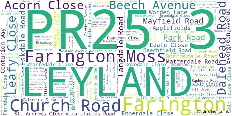
A wide range of spatial data has been analysed to present this overview of the PR25 3 Postcode sector. If you would like anything added, please contact us.
The PR25 3 postcode sector is within the county of Lancashire.
Did you know? According to the 2021 Census, the PR25 3 postcode sector is home to a bustling 8,760 residents!
Given that each sector allows for 400 unique postcode combinations. Letters C, I, K, M, O and V are not allowed in the last two letters of a postcode. With 187 postcodes already in use, this leaves 213 units available.
The largest settlements in the PR25 3 postal code are LEYLAND and Farington.
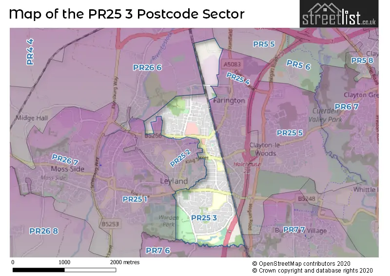
The PR25 3 Postcode shares a border with PR5 5 (Lostock Hall), PR25 2 (LEYLAND), PR25 4 (LEYLAND, Farington), PR26 6 (Farington Moss, LEYLAND, Midge Hall), PR7 6 (Euxton, Eccleston), PR7 7 (Buckshaw Village), PR25 1 (LEYLAND) and PR25 5 (LEYLAND).
Map of the PR25 3 Postcode Sector
Explore the PR25 3 postcode sector by using our interactive map.
The sector is within the post town of LEYLAND.
PR25 3 is a postcode sector within the PR25 postcode district which is within the PR Preston postcode area.
The Royal Mail delivery office for the PR25 3 postal sector is the Leyland Delivery Office.
The area of the PR25 3 postcode sector is 1.15 square miles which is 2.99 square kilometres or 738.63 square acres.
The PR25 3 postcode sector is crossed by the M6 motorway.
Your support helps keep this site running!
If you enjoy using this website, consider buying me a coffee to help cover hosting costs.


| P | R | 2 | 5 | - | 3 | X | X |
| P | R | 2 | 5 | Space | 3 | Letter | Letter |
Official List of Streets
LEYLAND (118 Streets)
Farington (21 Streets)
Farington Moss (1 Streets)
(3 Streets)
Unofficial Streets or Alternative Spellings
Weather Forecast for PR25 3
Weather Forecast for
Schools and Places of Education Within the PR25 3 Postcode Sector
Balshaw's Church of England High School
Voluntary controlled school
Church Road, Leyland, Lancashire, PR25 3AH
Head: Mr Steven Haycocks
Ofsted Rating: Good
Inspection: 2023-02-03 (718 days ago)
Website: Visit Balshaw's Church of England High School Website
Phone: 01772421009
Number of Pupils: 916
Runshaw College
Further education
Langdale Road, Leyland, Lancashire, PR25 3DQ
Head: Mrs Clare Russell
Ofsted Rating: Good
Inspection: 2022-03-10 (1048 days ago)
Website: Visit Runshaw College Website
Phone: 01772622677
Number of Pupils: 0

House Prices in the PR25 3 Postcode Sector
| Type of Property | 2018 Average | 2018 Sales | 2017 Average | 2017 Sales | 2016 Average | 2016 Sales | 2015 Average | 2015 Sales |
|---|---|---|---|---|---|---|---|---|
| Detached | £231,610 | 68 | £230,868 | 56 | £244,141 | 58 | £238,504 | 67 |
| Semi-Detached | £159,850 | 97 | £154,578 | 99 | £148,966 | 92 | £151,530 | 62 |
| Terraced | £132,684 | 67 | £122,130 | 42 | £108,251 | 32 | £121,077 | 54 |
| Flats | £94,320 | 10 | £85,731 | 13 | £95,028 | 18 | £77,521 | 12 |
Important Postcodes PR25 3 in the Postcode Sector
PR25 3AH is the postcode for Balshaws C of E High School, Church Road
PR25 3DQ is the postcode for Runshaw College, Langdale Road, HAWKSHEAD CLASSROOM ANNEX, LANGDALE ROAD, Hawkshead Building, Runshaw College, Dalehead Building, Runshaw College, ESKDALE BUILDING, LANGDALE ROAD, HAWKSHEAD BUILDING, LANGDALE ROAD, FERNDALE & TYNDALE BUILDING, LANGDALE ROAD, PATTERDALE BUILDING, LANGDALE ROAD, Dalehead Building, Langdale Road, HAWKSHEAD CLASSROOM ANNEX, Runshaw College, Langdale Road, GRIZEDALE & RYDAL BUILDING, LANGDALE ROAD, Eskdale Building, Runshaw College, SILVERDALE IT, LANGDALE ROAD, DALEHEAD BUILDING, LANGDALE ROAD, LEYLAND, PATTERDALE, Runshaw College, Langdale Road, LANGDALE, MARDALE & SILVERDALE SPORT, LANGDALE ROAD, SILVERDALE IT, Runshaw College, Langdale Road, Ferndale/Tyndale Building, Runshaw College, and Grizedale Building, Runshaw College
PR25 3ED is the postcode for Shawbrook House, Balcarres Road, Broadoak Child Development Centre, Lancashire Teaching Hospitals NHS Foundation Trust, Balcarres Road, and Broadoak Child Development Centre, Balcarres Road
PR25 3ET is the postcode for Leyland Methodist Infant School, Canberra Road, MAIN BUILDING, Leyland Methodist Infant School, Canberra Road, Leyland Methodist Junior School, Canberra Road, and MAIN BUILDING, Leyland Methodist Junior School, Canberra Road
PR25 3UQ is the postcode for 5, Centurion Court, Farington
| The PR25 3 Sector is within these Local Authorities |
|
|---|---|
| The PR25 3 Sector is within these Counties |
|
| The PR25 3 Sector is within these Water Company Areas |
|
Tourist Attractions within the PR25 3 Postcode Area
We found 2 visitor attractions within the PR25 postcode area
| Worden Park |
|---|
| Country Parks |
| Country Park |
| View Worden Park on Google Maps |
| South Ribble Museum and Exhibition Centre |
| Museums & Art Galleries |
| Museum and / or Art Gallery |
| View South Ribble Museum and Exhibition Centre on Google Maps |