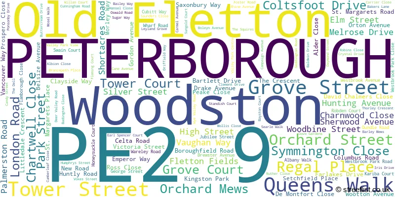
A wide range of spatial data has been analysed to present this overview of the PE2 9 Postcode sector. If you would like anything added, please contact us.
The PE2 9 postcode sector is within the county of Cambridgeshire.
Did you know? According to the 2021 Census, the PE2 9 postcode sector is home to a bustling 11,492 residents!
Given that each sector allows for 400 unique postcode combinations. Letters C, I, K, M, O and V are not allowed in the last two letters of a postcode. With 190 postcodes already in use, this leaves 210 units available.
The largest settlements in the PE2 9 postal code are PETERBOROUGH and Woodston.
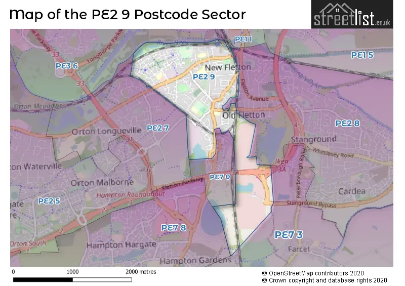
The PE2 9 Postcode shares a border with PE1 1 (PETERBOROUGH), PE7 8 (Hampton Vale, Hampton Hargate, Hampton Centre), PE2 7 (Orton Longueville, PETERBOROUGH), PE2 8 (PETERBOROUGH, Stanground, Fletton Quays), PE7 0 (PETERBOROUGH), PE7 3 (Yaxley, Farcet, Stilton) and PE3 6 (PETERBOROUGH, Bretton, Longthorpe).
Map of the PE2 9 Postcode Sector
Explore the PE2 9 postcode sector by using our interactive map.
The sector is within the post town of PETERBOROUGH.
PE2 9 is a postcode sector within the PE2 postcode district which is within the PE Peterborough postcode area.
The Royal Mail delivery office for the PE2 9 postal sector is the Peterborough South Postal Delivery Office.
The area of the PE2 9 postcode sector is 1.30 square miles which is 3.36 square kilometres or 829.81 square acres.
Waterways within the PE2 9 postcode sector include the River Nene.
Your support helps keep this site running!
If you enjoy using this website, consider buying me a coffee to help cover hosting costs.


| P | E | 2 | - | 9 | X | X |
| P | E | 2 | Space | 9 | Letter | Letter |
Official List of Streets
PETERBOROUGH (111 Streets)
Woodston (9 Streets)
(18 Streets)
Old Fletton (1 Streets)
Unofficial Streets or Alternative Spellings
PETERBOROUGH
ABBEYFIELDS COOK AVENUE LANGFORD ROAD MARKHAM AVENUE MONARCH AVENUE BAKERS LANE CYCLE PATH BOTOLPH BRIDGE DAYMOND FAIR VIEW GEOFFREY STEELS RIVER NENE BRIDGE GROVE STREET CYCLE PATH IKEA JUNCTION KELSEY PLACE LAKESIDE COURT OUNDLE ROAD CYCLE PATH PHORPRES HOUSE SOUTH VIEW ST AUGUSTINES WALK STANHAM WAY THOROUGHFIELD ROAD WELLINGTONIA CYCLEWAYHampton Vale
LONDON ROADAlwalton
OUNDLE ROADWeather Forecast for PE2 9
Weather Forecast for Peterborough United F.C.
| Time Period | Icon | Description | Temperature | Rain Probability | Wind |
|---|---|---|---|---|---|
| 15:00 to 18:00 | Sunny day | 6.0°C (feels like 3.0°C) | 0.00% | S 9 mph | |
| 18:00 to 21:00 | Partly cloudy (night) | 4.0°C (feels like 2.0°C) | 1.00% | S 4 mph | |
| 21:00 to 00:00 | Clear night | 2.0°C (feels like -1.0°C) | 0.00% | S 7 mph |
| Time Period | Icon | Description | Temperature | Rain Probability | Wind |
|---|---|---|---|---|---|
| 00:00 to 03:00 | Clear night | 2.0°C (feels like -2.0°C) | 1.00% | SSW 7 mph | |
| 03:00 to 06:00 | Overcast | 3.0°C (feels like 0.0°C) | 7.00% | SSW 7 mph | |
| 06:00 to 09:00 | Cloudy | 3.0°C (feels like 1.0°C) | 8.00% | SSW 7 mph | |
| 09:00 to 12:00 | Overcast | 5.0°C (feels like 2.0°C) | 9.00% | SSW 7 mph | |
| 12:00 to 15:00 | Overcast | 7.0°C (feels like 5.0°C) | 9.00% | SSW 9 mph | |
| 15:00 to 18:00 | Cloudy | 9.0°C (feels like 7.0°C) | 5.00% | SSW 9 mph | |
| 18:00 to 21:00 | Cloudy | 7.0°C (feels like 4.0°C) | 5.00% | S 9 mph | |
| 21:00 to 00:00 | Cloudy | 7.0°C (feels like 4.0°C) | 5.00% | S 9 mph |
| Time Period | Icon | Description | Temperature | Rain Probability | Wind |
|---|---|---|---|---|---|
| 00:00 to 03:00 | Cloudy | 6.0°C (feels like 3.0°C) | 4.00% | SSW 11 mph | |
| 03:00 to 06:00 | Partly cloudy (night) | 6.0°C (feels like 3.0°C) | 1.00% | SSW 11 mph | |
| 06:00 to 09:00 | Partly cloudy (night) | 6.0°C (feels like 3.0°C) | 2.00% | SSW 13 mph | |
| 09:00 to 12:00 | Cloudy | 7.0°C (feels like 4.0°C) | 4.00% | SSW 13 mph | |
| 12:00 to 15:00 | Cloudy | 10.0°C (feels like 7.0°C) | 6.00% | SSW 18 mph | |
| 15:00 to 18:00 | Overcast | 10.0°C (feels like 7.0°C) | 15.00% | SSW 16 mph | |
| 18:00 to 21:00 | Heavy rain | 9.0°C (feels like 6.0°C) | 74.00% | SSW 13 mph | |
| 21:00 to 00:00 | Clear night | 8.0°C (feels like 5.0°C) | 13.00% | SW 11 mph |
| Time Period | Icon | Description | Temperature | Rain Probability | Wind |
|---|---|---|---|---|---|
| 00:00 to 03:00 | Clear night | 6.0°C (feels like 3.0°C) | 1.00% | WSW 11 mph | |
| 03:00 to 06:00 | Clear night | 5.0°C (feels like 2.0°C) | 0.00% | WSW 9 mph | |
| 06:00 to 09:00 | Clear night | 4.0°C (feels like 0.0°C) | 1.00% | WSW 9 mph | |
| 09:00 to 12:00 | Cloudy | 4.0°C (feels like 1.0°C) | 4.00% | W 9 mph | |
| 12:00 to 15:00 | Cloudy | 7.0°C (feels like 5.0°C) | 4.00% | W 9 mph | |
| 15:00 to 18:00 | Cloudy | 8.0°C (feels like 6.0°C) | 4.00% | WNW 7 mph | |
| 18:00 to 21:00 | Partly cloudy (night) | 4.0°C (feels like 2.0°C) | 1.00% | WNW 4 mph | |
| 21:00 to 00:00 | Clear night | 3.0°C (feels like 0.0°C) | 1.00% | WNW 4 mph |
| Time Period | Icon | Description | Temperature | Rain Probability | Wind |
|---|---|---|---|---|---|
| 00:00 to 03:00 | Clear night | 1.0°C (feels like -1.0°C) | 1.00% | NW 4 mph | |
| 03:00 to 06:00 | Clear night | 0.0°C (feels like -2.0°C) | 1.00% | NNW 4 mph | |
| 06:00 to 09:00 | Clear night | -1.0°C (feels like -3.0°C) | 2.00% | N 4 mph | |
| 09:00 to 12:00 | Sunny day | 1.0°C (feels like -1.0°C) | 3.00% | NNE 4 mph | |
| 12:00 to 15:00 | Sunny day | 6.0°C (feels like 5.0°C) | 1.00% | NE 4 mph | |
| 15:00 to 18:00 | Sunny day | 8.0°C (feels like 6.0°C) | 1.00% | ENE 7 mph | |
| 18:00 to 21:00 | Clear night | 4.0°C (feels like 1.0°C) | 1.00% | NE 7 mph | |
| 21:00 to 00:00 | Clear night | 2.0°C (feels like 0.0°C) | 1.00% | NE 7 mph |
Schools and Places of Education Within the PE2 9 Postcode Sector
Brewster Avenue Infant School
Community school
Brewster Avenue, Peterborough, Cambridgeshire, PE2 9PN
Head: Miss Rebecca Thompson
Ofsted Rating: Good
Inspection: 2023-07-19 (564 days ago)
Website: Visit Brewster Avenue Infant School Website
Phone: 01733565092
Number of Pupils: 196
Nene Valley Primary School
Academy converter
Sugar Way, Peterborough, Cambridgeshire, PE2 9RT
Head: Mr Neil Reilly
Ofsted Rating: Good
Inspection: 2023-06-28 (585 days ago)
Website: Visit Nene Valley Primary School Website
Phone: 01733897517
Number of Pupils: 315
Old Fletton Primary School
Community school
London Road, Peterborough, Cambridgeshire, PE2 9DR
Head: Mrs Sarah Levy
Ofsted Rating: Good
Inspection: 2021-07-14 (1299 days ago)
Website: Visit Old Fletton Primary School Website
Phone: 01733554457
Number of Pupils: 440
St Augustine's CofE (Voluntary Aided) Junior School
Voluntary aided school
Palmerston Road, Peterborough, Cambridgeshire, PE2 9DH
Head: Mr Sam Brunt
Ofsted Rating: Good
Inspection: 2023-03-03 (702 days ago)
Website: Visit St Augustine's CofE (Voluntary Aided) Junior School Website
Phone: 01733563566
Number of Pupils: 228
Woodston Primary School
Academy converter
Celta Road, Peterborough, Cambridgeshire, PE2 9ER
Head: Mrs Becky Ford
Ofsted Rating: Good
Inspection: 2023-07-04 (579 days ago)
Website: Visit Woodston Primary School Website
Phone: 01733562784
Number of Pupils: 584

House Prices in the PE2 9 Postcode Sector
| Type of Property | 2018 Average | 2018 Sales | 2017 Average | 2017 Sales | 2016 Average | 2016 Sales | 2015 Average | 2015 Sales |
|---|---|---|---|---|---|---|---|---|
| Detached | £283,097 | 37 | £261,192 | 48 | £236,626 | 79 | £218,939 | 42 |
| Semi-Detached | £186,972 | 47 | £187,718 | 64 | £175,037 | 116 | £163,289 | 90 |
| Terraced | £154,768 | 70 | £139,192 | 83 | £142,787 | 109 | £137,450 | 136 |
| Flats | £113,185 | 43 | £107,283 | 38 | £100,983 | 36 | £100,519 | 26 |
Important Postcodes PE2 9 in the Postcode Sector
PE2 9BB is the postcode for C A F C A S S, 71 London Road
PE2 9DH is the postcode for St Augustines Voluntary Aided Junior School, Palmerston Road, and St. Augustines Junior School, Palmerston Road
PE2 9DR is the postcode for Old Fletton Primary School, London Road
PE2 9ER is the postcode for Woodston Primary School, Celta Road
PE2 9PN is the postcode for Brewster Avenue Infant School, Brewster Avenue
PE2 9PW is the postcode for FACULTY OF HEALTH & SOCIAL CARE, Guild House, Oundle Road
PE2 9QB is the postcode for Botolph Bridge Community Health Centre, Unit C
PE2 9RT is the postcode for NENE VALLEY PRIMARY SCHOOL, SUGAR WAY, WOODSTON, and Nene Valley Primary School, Sugar Way
| The PE2 9 Sector is within these Local Authorities |
|
|---|---|
| The PE2 9 Sector is within these Counties |
|
| The PE2 9 Sector is within these Water Company Areas |
|