A wide range of spatial data has been analysed to present this overview of the NR32 1 Postcode sector. If you would like anything added, please contact us.
The NR32 1 postcode sector is within the county of Suffolk.
Did you know? According to the 2021 Census, the NR32 1 postcode sector is home to a bustling 4,520 residents!
Given that each sector allows for 400 unique postcode combinations. Letters C, I, K, M, O and V are not allowed in the last two letters of a postcode. With 183 postcodes already in use, this leaves 217 units available.
The NR32 1 postal code covers the settlement of LOWESTOFT.
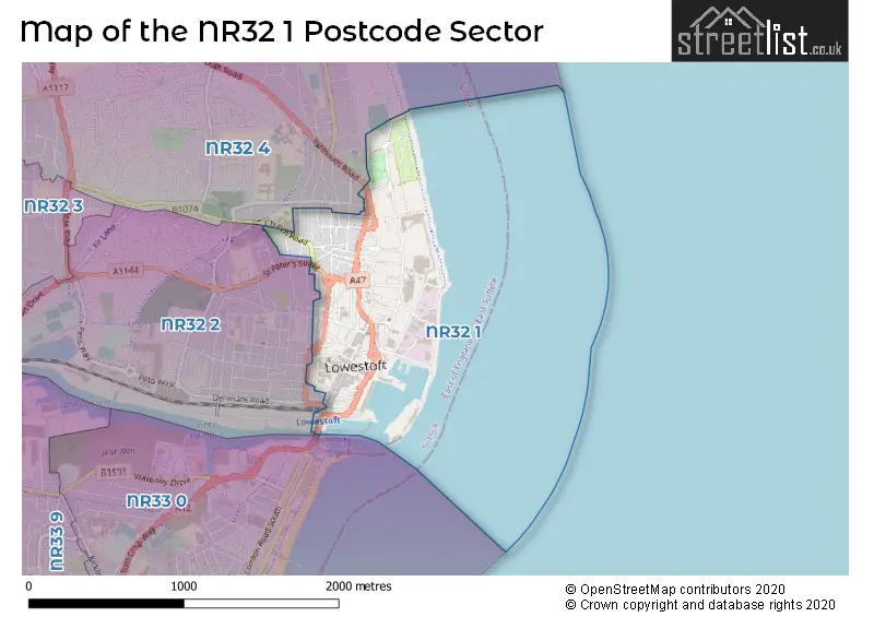
The NR32 1 Postcode shares a border with NR32 2 (LOWESTOFT), NR32 4 (LOWESTOFT) and NR33 0 (LOWESTOFT).
Map of the NR32 1 Postcode Sector
Explore the NR32 1 postcode sector by using our interactive map.
The sector is within the post town of LOWESTOFT.
NR32 1 is a postcode sector within the NR32 postcode district which is within the NR Norwich postcode area.
The Royal Mail delivery office for the NR32 1 postal sector is the Lowestoft Delivery Office.
The area of the NR32 1 postcode sector is 0.50 square miles which is 1.29 square kilometres or 319.01 square acres.
The NR32 1 postcode sector is crossed by the A12 Major A road.
Your support helps keep this site running!
If you enjoy using this website, consider buying me a coffee to help cover hosting costs.


| N | R | 3 | 2 | - | 1 | X | X |
| N | R | 3 | 2 | Space | 1 | Letter | Letter |
Official List of Streets
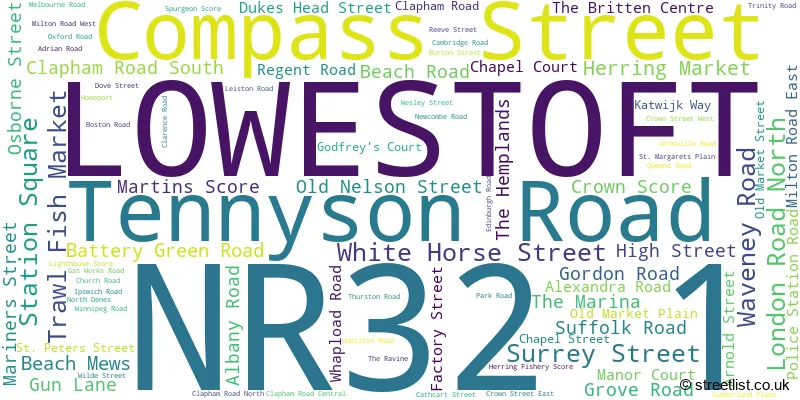
LOWESTOFT (75 Streets)
Unofficial Streets or Alternative Spellings
Weather Forecast for NR32 1
Weather Forecast for Lowestoft
| Time Period | Icon | Description | Temperature | Rain Probability | Wind |
|---|---|---|---|---|---|
| 09:00 to 12:00 | Overcast | 3.0°C (feels like 0.0°C) | 9.00% | SW 7 mph | |
| 12:00 to 15:00 | Cloudy | 5.0°C (feels like 3.0°C) | 6.00% | SSW 7 mph | |
| 15:00 to 18:00 | Cloudy | 5.0°C (feels like 3.0°C) | 6.00% | S 7 mph | |
| 18:00 to 21:00 | Cloudy | 3.0°C (feels like 1.0°C) | 5.00% | SSE 7 mph | |
| 21:00 to 00:00 | Cloudy | 3.0°C (feels like 0.0°C) | 6.00% | SSE 7 mph |
| Time Period | Icon | Description | Temperature | Rain Probability | Wind |
|---|---|---|---|---|---|
| 00:00 to 03:00 | Cloudy | 3.0°C (feels like 0.0°C) | 6.00% | S 7 mph | |
| 03:00 to 06:00 | Cloudy | 3.0°C (feels like 1.0°C) | 7.00% | SSE 7 mph | |
| 06:00 to 09:00 | Cloudy | 3.0°C (feels like 1.0°C) | 7.00% | ESE 7 mph | |
| 09:00 to 12:00 | Cloudy | 4.0°C (feels like 2.0°C) | 7.00% | ESE 7 mph | |
| 12:00 to 15:00 | Cloudy | 6.0°C (feels like 3.0°C) | 7.00% | SE 7 mph | |
| 15:00 to 18:00 | Cloudy | 6.0°C (feels like 3.0°C) | 10.00% | SSE 7 mph | |
| 18:00 to 21:00 | Cloudy | 5.0°C (feels like 3.0°C) | 11.00% | SE 7 mph | |
| 21:00 to 00:00 | Cloudy | 5.0°C (feels like 2.0°C) | 15.00% | SSE 7 mph |
| Time Period | Icon | Description | Temperature | Rain Probability | Wind |
|---|---|---|---|---|---|
| 00:00 to 03:00 | Light rain | 5.0°C (feels like 2.0°C) | 45.00% | SW 7 mph | |
| 03:00 to 06:00 | Light rain | 5.0°C (feels like 2.0°C) | 46.00% | SW 7 mph | |
| 06:00 to 09:00 | Overcast | 5.0°C (feels like 1.0°C) | 23.00% | WSW 9 mph | |
| 09:00 to 12:00 | Overcast | 4.0°C (feels like 1.0°C) | 20.00% | W 9 mph | |
| 12:00 to 15:00 | Overcast | 5.0°C (feels like 2.0°C) | 16.00% | WSW 11 mph | |
| 15:00 to 18:00 | Overcast | 6.0°C (feels like 3.0°C) | 15.00% | WSW 11 mph | |
| 18:00 to 21:00 | Cloudy | 5.0°C (feels like 2.0°C) | 12.00% | WSW 9 mph | |
| 21:00 to 00:00 | Cloudy | 4.0°C (feels like 1.0°C) | 9.00% | WSW 9 mph |
Schools and Places of Education Within the NR32 1 Postcode Sector
Ness Point School
Other independent special school
32/34 Gordon Road, , , NR32 1NL
Head: Mr Gary Corbett
Ofsted Rating: Good
Inspection: 2022-11-10 (803 days ago)
Website: Visit Ness Point School Website
Phone: 01502218220
Number of Pupils: 18

House Prices in the NR32 1 Postcode Sector
| Type of Property | 2018 Average | 2018 Sales | 2017 Average | 2017 Sales | 2016 Average | 2016 Sales | 2015 Average | 2015 Sales |
|---|---|---|---|---|---|---|---|---|
| Detached | £205,000 | 2 | £170,000 | 1 | £102,667 | 3 | £210,000 | 2 |
| Semi-Detached | £122,125 | 4 | £96,665 | 3 | £0 | 0 | £155,000 | 1 |
| Terraced | £113,749 | 64 | £107,001 | 54 | £105,695 | 74 | £95,343 | 75 |
| Flats | £82,536 | 7 | £86,750 | 4 | £65,917 | 6 | £89,071 | 7 |
Important Postcodes NR32 1 in the Postcode Sector
NR32 1AA is the postcode for Post Office, 51 London Road North
NR32 1DR is the postcode for Lowestoft Central Library, Clapham Road South, and Suffolk County Council, Lowestoft Central Library, Clapham Road South
NR32 1HH is the postcode for The Marina, The Marina, The Marina Customer Service Centre, Marina, and Marina Customer Services Centre, The Marina
NR32 1HJ is the postcode for Clerk to the Justices, The Court House, Old Nelson Street
NR32 1HS is the postcode for Waveney District Council, Town Hall, High Street
NR32 1JE is the postcode for The Surgery, High Street
NR32 1JQ is the postcode for Registrar of Births Deaths & Marriages, St. Margaret's House, Gordon Road
NR32 1JT is the postcode for Waveney District Council, Mariners Street
NR32 1PA is the postcode for Regent Road Family Health Centre, 6 Regent Road
NR32 1PE is the postcode for Lowestoft Police Station, Old Nelson Street, and Suffolk Constabulary, Old Nelson Street
NR32 1PH is the postcode for The Community Mental Health Team, Victoria House, 28 Alexandra Road
NR32 1PL is the postcode for Alexandra Road Surgery, Alexandra Road, and Suffolk County Council, Adrian House, Alexandra Road
NR32 1PT is the postcode for Lowestoft Hospital, Tennyson Road, and James Paget University Hospitals NHS Foundation Trust, Lowestoft Hospital
NR32 1QX is the postcode for Department of Social Services, Clapham House, Clapham Road South
NR32 1RW is the postcode for Benefits Agency, Entrance B, Rishton House, Clapham Road South, and Rishton House, Clapham Road South
NR32 1TS is the postcode for St. Margarets Cp School, Ipswich Road
NR32 1XH is the postcode for Orbis Energy, Wilde Street
| The NR32 1 Sector is within these Local Authorities |
|
|---|---|
| The NR32 1 Sector is within these Counties |
|
| The NR32 1 Sector is within these Water Company Areas |
|