A wide range of spatial data has been analysed to present this overview of the NN16 8 Postcode sector. If you would like anything added, please contact us.
The NN16 8 postcode sector is within the county of Northamptonshire.
Did you know? According to the 2021 Census, the NN16 8 postcode sector is home to a bustling 8,652 residents!
Given that each sector allows for 400 unique postcode combinations. Letters C, I, K, M, O and V are not allowed in the last two letters of a postcode. With 244 postcodes already in use, this leaves 156 units available.
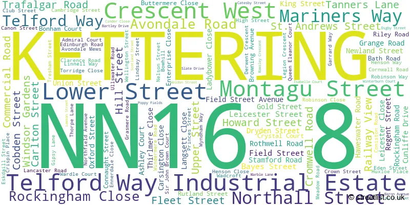
The largest settlements in the NN16 8 postal code are KETTERING and Telford Way Industrial Estate.
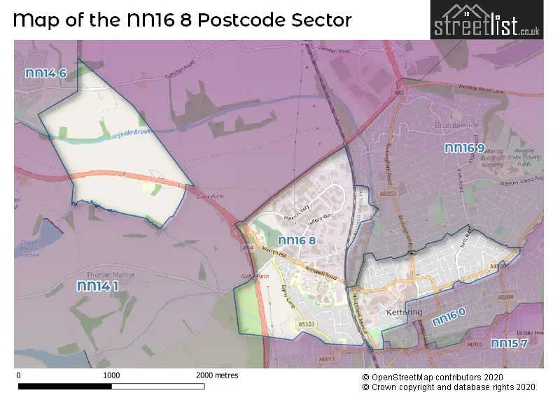
The NN16 8 Postcode shares a border with NN14 6 (Rothwell), NN15 7 (KETTERING), NN16 0 (KETTERING), NN16 9 (KETTERING, Warkton, Weekley) and NN14 1 (Broughton, Mawsley, Geddington).
Map of the NN16 8 Postcode Sector
Explore the NN16 8 postcode sector by using our interactive map.
The sector is within the post town of KETTERING.
NN16 8 is a postcode sector within the NN16 postcode district which is within the NN Northampton postcode area.
The Royal Mail delivery office for the NN16 8 postal sector is the Kettering Delivery Office.
The area of the NN16 8 postcode sector is 1.79 square miles which is 4.63 square kilometres or 1,144.40 square acres.
The NN16 8 postcode sector is crossed by the A14 Major A road.
Waterways within the NN16 8 postcode sector include the Slade.
Your support helps keep this site running!
If you enjoy using this website, consider buying me a coffee to help cover hosting costs.


| N | N | 1 | 6 | - | 8 | X | X |
| N | N | 1 | 6 | Space | 8 | Letter | Letter |
Official List of Streets
KETTERING (96 Streets)
Telford Way Industrial Estate (13 Streets)
Unofficial Streets or Alternative Spellings
KETTERING
BARNWELL STREET BELLWAY CLOSE BUCCLEUCH STREET CAREY STREET DRYLAND STREET DYSON DRIVE EDMUND STREET ELIZABETH ROAD FORD STREET FOSTER WAY FULLER STREET HAVELOCK STREET MEETING LANE NASEBY ROAD NORTHAMPTON ROAD PRINTERS YARD SILVER STREET THORNGATE STREET TORDOFF PLACE VICTORIA STREET WATER STREET WESTHILL DRIVE ENTERPRISE COURT GLEBE FARM INTERCHANGE GLEN BAULK ROAD MARTHA WALLIS COURT SAINT ANDREWS STREET SPENSERS YARD VIOLET LANEWeekley
STAMFORD ROADGlendon
ROCKINGHAM ROADRothwell
GLENDON ROAD KETTERING ROADWeather Forecast for NN16 8
Weather Forecast for Kettering
| Time Period | Icon | Description | Temperature | Rain Probability | Wind |
|---|---|---|---|---|---|
| 00:00 to 03:00 | Fog | 1.0°C (feels like -1.0°C) | 17.00% | SE 4 mph | |
| 03:00 to 06:00 | Fog | 1.0°C (feels like -1.0°C) | 18.00% | SE 4 mph | |
| 06:00 to 09:00 | Fog | 1.0°C (feels like -1.0°C) | 18.00% | E 4 mph | |
| 09:00 to 12:00 | Fog | 2.0°C (feels like -1.0°C) | 17.00% | ENE 4 mph | |
| 12:00 to 15:00 | Overcast | 3.0°C (feels like 1.0°C) | 13.00% | ENE 4 mph | |
| 15:00 to 18:00 | Overcast | 4.0°C (feels like 2.0°C) | 14.00% | NE 4 mph | |
| 18:00 to 21:00 | Overcast | 3.0°C (feels like 1.0°C) | 17.00% | NE 4 mph | |
| 21:00 to 00:00 | Overcast | 3.0°C (feels like 1.0°C) | 20.00% | NNE 4 mph |
| Time Period | Icon | Description | Temperature | Rain Probability | Wind |
|---|---|---|---|---|---|
| 00:00 to 03:00 | Overcast | 3.0°C (feels like 0.0°C) | 20.00% | N 7 mph | |
| 03:00 to 06:00 | Overcast | 3.0°C (feels like 0.0°C) | 22.00% | NW 7 mph | |
| 06:00 to 09:00 | Mist | 2.0°C (feels like -1.0°C) | 27.00% | NW 7 mph | |
| 09:00 to 12:00 | Overcast | 3.0°C (feels like -1.0°C) | 18.00% | WSW 9 mph | |
| 12:00 to 15:00 | Overcast | 4.0°C (feels like 1.0°C) | 16.00% | WSW 9 mph | |
| 15:00 to 18:00 | Overcast | 5.0°C (feels like 2.0°C) | 13.00% | SW 9 mph | |
| 18:00 to 21:00 | Overcast | 4.0°C (feels like 1.0°C) | 13.00% | SW 7 mph | |
| 21:00 to 00:00 | Cloudy | 4.0°C (feels like 1.0°C) | 9.00% | SW 7 mph |

House Prices in the NN16 8 Postcode Sector
| Type of Property | 2018 Average | 2018 Sales | 2017 Average | 2017 Sales | 2016 Average | 2016 Sales | 2015 Average | 2015 Sales |
|---|---|---|---|---|---|---|---|---|
| Detached | £259,291 | 12 | £283,850 | 10 | £222,330 | 15 | £240,361 | 18 |
| Semi-Detached | £180,389 | 23 | £175,468 | 34 | £171,612 | 26 | £142,095 | 36 |
| Terraced | £146,069 | 84 | £127,537 | 120 | £121,161 | 110 | £113,188 | 118 |
| Flats | £98,203 | 28 | £108,599 | 47 | £95,693 | 59 | £73,281 | 42 |
Important Postcodes NN16 8 in the Postcode Sector
NN16 8AA is the postcode for Post Office, 17 Lower Street, and Royal Mail, Kettering Delivery Office, 17 Lower Street
NN16 8AE is the postcode for William Knibb Centre, Montagu Street, Kettering, and Northamptonshire County Council, William Knibbs Centre, Montagu Street
NN16 8AJ is the postcode for Cytringan House, Robinson Way
NN16 8BG is the postcode for Jobcentre Plus, Lower Street
NN16 8DN is the postcode for Prospect House, 121 Lower Street
NN16 8NN is the postcode for Northamptonshire Teaching Pct, Forest House, 2 Riley Road
NN16 8RX is the postcode for Montagu Street Surestart Childrens Centre, Montagu Street
NN16 8SU is the postcode for 45-49 High Street
NN16 8TD is the postcode for Romic House, Unit 4, and Romic House, Unit 4 A1-M1 Centre, Garrard Way
NN16 8UZ is the postcode for Ashton Ward, Rothwell Road, AMBULANCE STATION, Kettering General Hospital N H S Trust, Rothwell Road, Front Block, Kettering General Hospital, Block 47 Caradiac Cath Lab, BLOCK 48 - NORTHFIELD HOUSE, Kettering General Hospital N H S Trust, Rothwell Road, BLOCK 2 - NIGHTINGALE, Kettering General Hospital N H S Trust, Rothwell Road, FRONT BLOCK KETTERING GENERAL HOSPITAL N H S TRUST, Kettering General Hospital N H S Trust, Rothwell Road, BLOCK 47, Kettering General Hospital N H S Trust, Rothwell Road, Centenary Ward, Rothwell Road, BLOCK 23 - GLEBE HOUSE, Kettering General Hospital N H S Trust, Rothwell Road, Block 79 IM&T Training Suite, Rothwell Road, Warren Hill House, Rothwell Road, PWEC, Rothwell Road, Block 65 Treatment Centre, Rothwell Road, Main Block, Rothwell Road, PWEC, Rothwell Road, Kettering, Foundation Wing, Rothwell Road, MATERNITY BLOCK KETTERING GENERAL HOSPITAL N H S TRUST, Kettering General Hospital N H S Trust, Rothwell Road, Glebe House, BLOCK 67 - NASEBY AND LINK CORRIDOR, Kettering General Hospital N H S Trust, Rothwell Road, BLOCK 57 - CENTENARY WING, Kettering General Hospital N H S Trust, Rothwell Road, TREATMENT CENTRE KETTERING GENERAL HOSPITAL N H S TRUST, Kettering General Hospital N H S Trust, Rothwell Road, BLOCK 13 - HSDU, Kettering General Hospital N H S Trust, Rothwell Road, WARREN HILL HOUSE KETTERING GENERAL HOSPITAL N H S TRUST, Kettering General Hospital N H S Trust, Rothwell Road, Kettering General Hospital N H S Trust, Rothwell Road, BLOCK 4 - DAY CASE UNIT, Kettering General Hospital N H S Trust, Rothwell Road, Maternity, Rothwell Road, MAIN BLOCK KETTERING GENERAL HOSPITAL N H S TRUST, Kettering General Hospital N H S Trust, Rothwell Road, Warren Hill House, Rothwell Road, Kettering, Latimer House, Rothwell Road, Northfield House, Rothwell Road, BLOCK 40 - POSTGRADUATE MEDICAL CENTRE, Kettering General Hospital N H S Trust, Rothwell Road, Diabetic Centre, Rothwell Road, Block 67 Naseby Ward, Kettering General Hospital, NHS Trust, BLOCK 62 - INTEGRATED DERMATOLOGY, Kettering General Hospital N H S Trust, Rothwell Road, and BLOCK 22 - EDUCATION CENTRE, Kettering General Hospital N H S Trust, Rothwell Road
NN16 8XE is the postcode for Kettering Crematorium, Rothwell Road
| The NN16 8 Sector is within these Local Authorities |
|
|---|---|
| The NN16 8 Sector is within these Counties |
|
| The NN16 8 Sector is within these Water Company Areas |
|