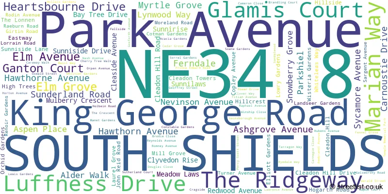
A wide range of spatial data has been analysed to present this overview of the NE34 8 Postcode sector. If you would like anything added, please contact us.
The NE34 8 postcode sector is within the county of Tyne & Wear.
Did you know? According to the 2021 Census, the NE34 8 postcode sector is home to a bustling 10,808 residents!
Given that each sector allows for 400 unique postcode combinations. Letters C, I, K, M, O and V are not allowed in the last two letters of a postcode. With 212 postcodes already in use, this leaves 188 units available.
The NE34 8 postal code covers the settlement of SOUTH SHIELDS.
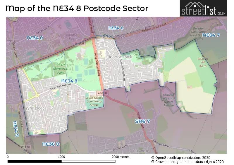
The NE34 8 Postcode shares a border with NE34 7 (SOUTH SHIELDS), NE34 9 (SOUTH SHIELDS), NE34 0 (SOUTH SHIELDS), NE34 6 (SOUTH SHIELDS), NE36 0 (EAST BOLDON, West Boldon) and SR6 7 (SUNDERLAND, Cleadon, Whitburn).
Map of the NE34 8 Postcode Sector
Explore the NE34 8 postcode sector by using our interactive map.
The sector is within the post town of SOUTH SHIELDS.
NE34 8 is a postcode sector within the NE34 postcode district which is within the NE Newcastle upon Tyne postcode area.
The Royal Mail delivery office for the NE34 8 postal sector is the South Shields Delivery Office.
The area of the NE34 8 postcode sector is 1.47 square miles which is 3.80 square kilometres or 939.21 square acres.
Your support helps keep this site running!
If you enjoy using this website, consider buying me a coffee to help cover hosting costs.


| N | E | 3 | 4 | - | 8 | X | X |
| N | E | 3 | 4 | Space | 8 | Letter | Letter |
Official List of Streets
SOUTH SHIELDS (111 Streets)
(3 Streets)
Unofficial Streets or Alternative Spellings
Weather Forecast for NE34 8
Weather Forecast for Boldon
| Time Period | Icon | Description | Temperature | Rain Probability | Wind |
|---|---|---|---|---|---|
| 03:00 to 06:00 | Cloudy | 2.0°C (feels like 0.0°C) | 7.00% | SW 4 mph | |
| 06:00 to 09:00 | Cloudy | 2.0°C (feels like 0.0°C) | 7.00% | SW 4 mph | |
| 09:00 to 12:00 | Cloudy | 2.0°C (feels like 0.0°C) | 8.00% | SW 4 mph | |
| 12:00 to 15:00 | Cloudy | 4.0°C (feels like 2.0°C) | 9.00% | WSW 4 mph | |
| 15:00 to 18:00 | Cloudy | 4.0°C (feels like 3.0°C) | 10.00% | NNW 4 mph | |
| 18:00 to 21:00 | Cloudy | 4.0°C (feels like 2.0°C) | 11.00% | NNW 4 mph | |
| 21:00 to 00:00 | Cloudy | 4.0°C (feels like 2.0°C) | 12.00% | WSW 4 mph |
| Time Period | Icon | Description | Temperature | Rain Probability | Wind |
|---|---|---|---|---|---|
| 00:00 to 03:00 | Cloudy | 4.0°C (feels like 1.0°C) | 13.00% | WNW 7 mph | |
| 03:00 to 06:00 | Overcast | 4.0°C (feels like 1.0°C) | 14.00% | WNW 9 mph | |
| 06:00 to 09:00 | Overcast | 4.0°C (feels like 0.0°C) | 15.00% | WNW 9 mph | |
| 09:00 to 12:00 | Cloudy | 4.0°C (feels like 1.0°C) | 16.00% | W 9 mph | |
| 12:00 to 15:00 | Cloudy | 5.0°C (feels like 2.0°C) | 15.00% | W 9 mph | |
| 15:00 to 18:00 | Cloudy | 5.0°C (feels like 3.0°C) | 11.00% | W 9 mph | |
| 18:00 to 21:00 | Cloudy | 4.0°C (feels like 2.0°C) | 11.00% | WSW 9 mph | |
| 21:00 to 00:00 | Cloudy | 4.0°C (feels like 1.0°C) | 7.00% | WSW 9 mph |
Schools and Places of Education Within the NE34 8 Postcode Sector
Epinay Business and Enterprise School
Foundation special school
Nevinson Avenue, South Shields, , NE34 8BT
Head: Mr Chris Rue
Ofsted Rating: Outstanding
Inspection: 2023-06-21 (581 days ago)
Website: Visit Epinay Business and Enterprise School Website
Phone: 01914898949
Number of Pupils: 201
Forest View Primary
Community school
Rembrandt Avenue, South Shields, Tyne and Wear, NE34 8RZ
Head: Mrs Emma Cook
Ofsted Rating: Good
Inspection: 2019-03-21 (2134 days ago)
Website: Visit Forest View Primary Website
Phone: 01915191990
Number of Pupils: 245
Ridgeway Primary Academy
Academy sponsor led
Park Avenue, South Shields, Tyne and Wear, NE34 8AB
Head: Mr Alex Golden
Ofsted Rating: Good
Inspection: 2021-09-23 (1217 days ago)
Website: Visit Ridgeway Primary Academy Website
Phone: 01914552865
Number of Pupils: 448

House Prices in the NE34 8 Postcode Sector
| Type of Property | 2018 Average | 2018 Sales | 2017 Average | 2017 Sales | 2016 Average | 2016 Sales | 2015 Average | 2015 Sales |
|---|---|---|---|---|---|---|---|---|
| Detached | £269,643 | 7 | £263,373 | 12 | £240,565 | 14 | £234,059 | 16 |
| Semi-Detached | £140,928 | 57 | £141,132 | 65 | £146,176 | 71 | £149,373 | 86 |
| Terraced | £102,139 | 49 | £94,726 | 64 | £107,248 | 83 | £92,318 | 52 |
| Flats | £94,500 | 6 | £103,415 | 16 | £91,620 | 32 | £104,299 | 5 |
Important Postcodes NE34 8 in the Postcode Sector
NE34 8AB is the postcode for Ridgeway Primary School, Park Avenue
NE34 8BT is the postcode for South Shields Community School, Nevison Avenue, Epinary Business and Enterprise School, Nevison Avenue, and South Shields Community School, Nevinson Avenue
NE34 8BW is the postcode for Cleadon Park Community Association, Sunderland Road
NE34 8FS is the postcode for Tyne & Wear Fire & Rescue Service, Fire Station, John Reid Road
NE34 8JP is the postcode for Connolly House Residential Home, Reynolds Avenue
NE34 8JU is the postcode for Temple Park County Infant School, Rubens Avenue
NE34 8LU is the postcode for Temple Park County Junior Mixed School, Manet Gardens
NE34 8NS is the postcode for St. Oswalds RC Primary School, Nash Avenue, and St. Oswalds RC Jmi Aided School, Nash Avenue
NE34 8PS is the postcode for Cleadon Park Primary Care Centre, 10 Prince Edward Road
NE34 8QN is the postcode for Temple Park Leisure Centre, Memorial Park, and Temple Park Leisure Centre, Memorial Park, John Reid Road
NE34 8RG is the postcode for Gerald Street House, Gerald Street
NE34 8RZ is the postcode for Albert Elliott County Junior Mixed School, Rembrandt Avenue, and Forest View Primary School, Rembrandt Avenue
| The NE34 8 Sector is within these Local Authorities |
|
|---|---|
| The NE34 8 Sector is within these Counties |
|
| The NE34 8 Sector is within these Water Company Areas |
|