A wide range of spatial data has been analysed to present this overview of the LA8 9 Postcode sector. If you would like anything added, please contact us.
The LA8 9 postcode sector is within the county of Cumbria.
Did you know? According to the 2021 Census, the LA8 9 postcode sector is home to a bustling 3,258 residents!
Given that each sector allows for 400 unique postcode combinations. Letters C, I, K, M, O and V are not allowed in the last two letters of a postcode. With 176 postcodes already in use, this leaves 224 units available.
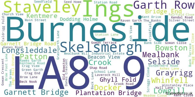
The largest settlement in the LA8 9 postal code is Staveley followed by Selside, and Burneside.
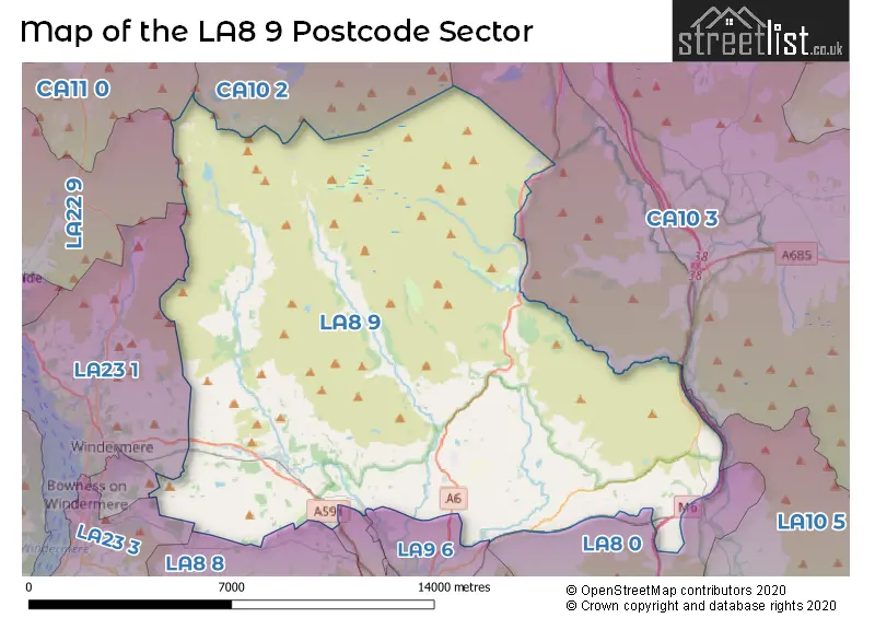
The LA8 9 Postcode shares a border with CA11 0 (Stainton, Greystoke, Glenridding), LA22 9 (AMBLESIDE, Grasmere, Chapel Stile), LA23 1 (WINDERMERE, Troutbeck Bridge, Troutbeck), LA10 5 (SEDBERGH, Dent, Garsdale), CA10 3 (Shap, Tebay, Orton), CA10 2 (Whinfell, Clifton, Eamont Bridge), LA23 2 (WINDERMERE, Droomer), LA23 3 (Bowness-on-Windermere, WINDERMERE, Winster), LA8 0 (Endmoor, Old Hutton, New Hutton), LA8 8 (Levens, Crosthwaite, Underbarrow), LA9 5 (KENDAL) and LA9 6 (KENDAL, Burneside).
Map of the LA8 9 Postcode Sector
Explore the LA8 9 postcode sector by using our interactive map.
The sector is within the post town of KENDAL.
LA8 9 is a postcode sector within the LA8 postcode district which is within the LA Lancaster postcode area.
The Royal Mail delivery office for the LA8 9 postal sector is the Kendal Delivery Office.
The area of the LA8 9 postcode sector is 79.78 square miles which is 206.62 square kilometres or 51,057.75 square acres.
The LA8 9 postcode sector is crossed by the M6 motorway.
Waterways within the LA8 9 postcode sector include the River Kent, River Gowan, River Mint, River Sprint.
Your support helps keep this site running!
If you enjoy using this website, consider buying me a coffee to help cover hosting costs.


| L | A | 8 | - | 9 | X | X |
| L | A | 8 | Space | 9 | Letter | Letter |
Official List of Streets
Mealbank (4 Streets)
Plantation Bridge (1 Streets)
Staveley (36 Streets)
Grayrigg (1 Streets)
(34 Streets)
Burneside (1 Streets)
Bowston (4 Streets)
Unofficial Streets or Alternative Spellings
KENDAL
APPLEBY ROAD SHAP ROADWeather Forecast for LA8 9
Weather Forecast for Ill Bell
| Time Period | Icon | Description | Temperature | Rain Probability | Wind |
|---|---|---|---|---|---|
| 15:00 to 18:00 | Fog | 0.0°C (feels like -7.0°C) | 18.00% | S 29 mph | |
| 18:00 to 21:00 | Fog | 0.0°C (feels like -8.0°C) | 20.00% | S 34 mph | |
| 21:00 to 00:00 | Fog | 0.0°C (feels like -9.0°C) | 20.00% | S 36 mph |
| Time Period | Icon | Description | Temperature | Rain Probability | Wind |
|---|---|---|---|---|---|
| 00:00 to 03:00 | Fog | 0.0°C (feels like -8.0°C) | 22.00% | S 34 mph | |
| 03:00 to 06:00 | Fog | 0.0°C (feels like -8.0°C) | 23.00% | S 31 mph | |
| 06:00 to 09:00 | Fog | -1.0°C (feels like -9.0°C) | 26.00% | S 29 mph | |
| 09:00 to 12:00 | Light snow | -1.0°C (feels like -8.0°C) | 54.00% | S 25 mph | |
| 12:00 to 15:00 | Mist | 0.0°C (feels like -7.0°C) | 27.00% | S 20 mph | |
| 15:00 to 18:00 | Sleet | 1.0°C (feels like -5.0°C) | 51.00% | S 18 mph | |
| 18:00 to 21:00 | Cloudy | 1.0°C (feels like -5.0°C) | 22.00% | S 18 mph | |
| 21:00 to 00:00 | Cloudy | 1.0°C (feels like -5.0°C) | 20.00% | S 18 mph |
| Time Period | Icon | Description | Temperature | Rain Probability | Wind |
|---|---|---|---|---|---|
| 00:00 to 03:00 | Overcast | 1.0°C (feels like -5.0°C) | 20.00% | SSW 18 mph | |
| 03:00 to 06:00 | Cloudy | 1.0°C (feels like -5.0°C) | 11.00% | SSW 20 mph | |
| 06:00 to 09:00 | Overcast | 0.0°C (feels like -6.0°C) | 10.00% | SSW 20 mph | |
| 09:00 to 12:00 | Overcast | 0.0°C (feels like -6.0°C) | 8.00% | SSW 22 mph | |
| 12:00 to 15:00 | Overcast | 2.0°C (feels like -4.0°C) | 10.00% | SSW 25 mph | |
| 15:00 to 18:00 | Overcast | 3.0°C (feels like -3.0°C) | 9.00% | SSW 27 mph | |
| 18:00 to 21:00 | Cloudy | 2.0°C (feels like -4.0°C) | 10.00% | SSW 29 mph | |
| 21:00 to 00:00 | Overcast | 2.0°C (feels like -5.0°C) | 14.00% | SSW 31 mph |
| Time Period | Icon | Description | Temperature | Rain Probability | Wind |
|---|---|---|---|---|---|
| 00:00 to 03:00 | Overcast | 2.0°C (feels like -5.0°C) | 21.00% | SSW 31 mph | |
| 03:00 to 06:00 | Light rain | 3.0°C (feels like -4.0°C) | 52.00% | SSW 31 mph | |
| 06:00 to 09:00 | Light rain | 3.0°C (feels like -4.0°C) | 62.00% | SSW 31 mph | |
| 09:00 to 12:00 | Heavy rain | 3.0°C (feels like -4.0°C) | 90.00% | SSW 31 mph | |
| 12:00 to 15:00 | Heavy rain | 4.0°C (feels like -3.0°C) | 85.00% | SSW 29 mph | |
| 15:00 to 18:00 | Light rain | 3.0°C (feels like -3.0°C) | 54.00% | SW 25 mph | |
| 18:00 to 21:00 | Cloudy | 2.0°C (feels like -4.0°C) | 20.00% | SW 22 mph | |
| 21:00 to 00:00 | Light snow shower (night) | 1.0°C (feels like -5.0°C) | 36.00% | WSW 22 mph |
| Time Period | Icon | Description | Temperature | Rain Probability | Wind |
|---|---|---|---|---|---|
| 00:00 to 03:00 | Partly cloudy (night) | 0.0°C (feels like -7.0°C) | 10.00% | WSW 22 mph | |
| 03:00 to 06:00 | Clear night | -1.0°C (feels like -8.0°C) | 8.00% | WSW 20 mph | |
| 06:00 to 09:00 | Partly cloudy (night) | -2.0°C (feels like -8.0°C) | 4.00% | WSW 18 mph | |
| 09:00 to 12:00 | Partly cloudy (day) | -1.0°C (feels like -7.0°C) | 4.00% | SW 16 mph | |
| 12:00 to 15:00 | Partly cloudy (day) | 1.0°C (feels like -4.0°C) | 5.00% | WSW 13 mph | |
| 15:00 to 18:00 | Cloudy | 2.0°C (feels like -3.0°C) | 5.00% | SW 13 mph | |
| 18:00 to 21:00 | Clear night | -2.0°C (feels like -7.0°C) | 2.00% | SSW 13 mph | |
| 21:00 to 00:00 | Clear night | -3.0°C (feels like -7.0°C) | 2.00% | S 11 mph |
Schools and Places of Education Within the LA8 9 Postcode Sector
Cairn Education CIC
Other independent special school
The Tavern, Cumbria, , LA8 9LN
Head: Miss Rachael Thompson
Ofsted Rating: Good
Inspection: 2023-02-15 (717 days ago)
Website: Visit Cairn Education CIC Website
Phone: 01539822304
Number of Pupils: 6
Grayrigg CofE School
Voluntary aided school
Grayrigg, Kendal, Cumbria, LA8 9BU
Head: Mrs Kirsty Cooper
Ofsted Rating: Good
Inspection: 2020-02-12 (1816 days ago)
Website: Visit Grayrigg CofE School Website
Phone: 01539824676
Number of Pupils: 91
Selside Endowed CofE Primary School
Voluntary aided school
Selside, Kendal, Cumbria, LA8 9LB
Head: Miss June Lowther
Ofsted Rating: Good
Inspection: 2019-02-13 (2180 days ago)
Website: Visit Selside Endowed CofE Primary School Website
Phone: 01539823649
Number of Pupils: 38
Staveley CofE School
Voluntary controlled school
Brow Lane, Kendal, Cumbria, LA8 9PH
Head: Miss Lisa Strange
Ofsted Rating: Good
Inspection: 2019-04-17 (2117 days ago)
Website: Visit Staveley CofE School Website
Phone: 01539821218
Number of Pupils: 97

House Prices in the LA8 9 Postcode Sector
| Type of Property | 2018 Average | 2018 Sales | 2017 Average | 2017 Sales | 2016 Average | 2016 Sales | 2015 Average | 2015 Sales |
|---|---|---|---|---|---|---|---|---|
| Detached | £411,167 | 15 | £412,875 | 16 | £394,421 | 19 | £350,769 | 13 |
| Semi-Detached | £270,181 | 12 | £338,988 | 14 | £361,000 | 3 | £268,354 | 14 |
| Terraced | £255,292 | 19 | £280,632 | 21 | £192,714 | 14 | £220,308 | 13 |
| Flats | £315,250 | 6 | £263,500 | 5 | £0 | 0 | £218,057 | 5 |
Important Postcodes LA8 9 in the Postcode Sector
LA8 9LU is the postcode for The Abbey Residential Home, Main Street
LA8 9PH is the postcode for INFANTS' BLOCK, Staveley C of E School, Brow Lane, and JUNIORS' BLOCK, Staveley C of E School, Brow Lane
| The LA8 9 Sector is within these Local Authorities |
|
|---|---|
| The LA8 9 Sector is within these Counties |
|
| The LA8 9 Sector is within these Water Company Areas |
|