A wide range of spatial data has been analysed to present this overview of the L22 7 Postcode sector. If you would like anything added, please contact us.
The L22 7 Liverpool (Waterloo) Postcode Sector
The L22 7 postcode sector is within the county of Merseyside.
Did you know? According to the 2021 Census, the L22 7 postcode sector is home to a bustling 1,223 residents!
Given that each sector allows for 400 unique postcode combinations. Letters C, I, K, M, O and V are not allowed in the last two letters of a postcode. With 23 postcodes already in use, this leaves 377 units available.
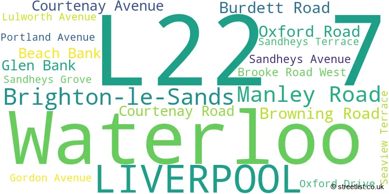
The largest settlement in the L22 7 postal code is Waterloo followed by LIVERPOOL, and Brighton-le-Sands.
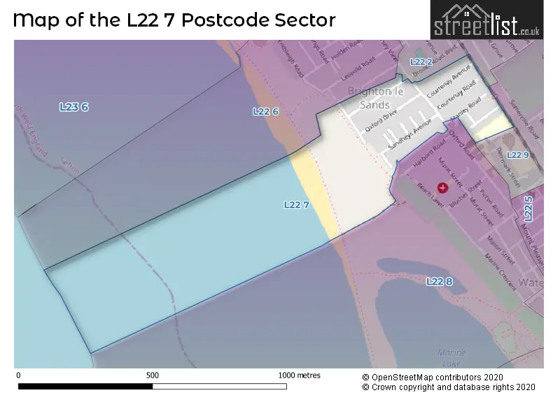
The L22 7 Postcode shares a border with L22 2 (Brighton-le-Sands, LIVERPOOL, Waterloo), L22 6 (Brighton-le-Sands), L22 8 (LIVERPOOL, Waterloo) and L22 9 (Waterloo, LIVERPOOL).
Map of the L22 7 Postcode Sector
Explore the L22 7 postcode sector by using our interactive map.
The sector is within the post town of LIVERPOOL.
L22 7 is a postcode sector within the L22 postcode district which is within the L Liverpool postcode area.
The Royal Mail delivery office for the L22 7 postal sector is the Crosby Delivery Office.
The area of the L22 7 postcode sector is 0.10 square miles which is 0.25 square kilometres or 61.71 square acres.
Your support helps keep this site running!
If you enjoy using this website, consider buying me a coffee to help cover hosting costs.

| L | 2 | 2 | - | 7 | X | X |
| L | 2 | 2 | Space | 7 | Letter | Letter |
Official List of Streets
LIVERPOOL (9 Streets)
Brighton-le-Sands (2 Streets)
Unofficial Streets or Alternative Spellings
Weather Forecast for L22 7
Weather Forecast for Waterloo (Merseyside)
| Time Period | Icon | Description | Temperature | Rain Probability | Wind |
|---|---|---|---|---|---|
| 21:00 to 00:00 | Light rain | 7.0°C (feels like 4.0°C) | 78.00% | SE 16 mph |
| Time Period | Icon | Description | Temperature | Rain Probability | Wind |
|---|---|---|---|---|---|
| 00:00 to 03:00 | Heavy rain | 8.0°C (feels like 5.0°C) | 82.00% | SSE 13 mph | |
| 03:00 to 06:00 | Overcast | 9.0°C (feels like 6.0°C) | 20.00% | SSE 16 mph | |
| 06:00 to 09:00 | Heavy rain | 10.0°C (feels like 7.0°C) | 77.00% | SSE 16 mph | |
| 09:00 to 12:00 | Light rain | 11.0°C (feels like 8.0°C) | 59.00% | SSE 16 mph | |
| 12:00 to 15:00 | Heavy rain | 13.0°C (feels like 10.0°C) | 81.00% | SSW 18 mph | |
| 15:00 to 18:00 | Partly cloudy (day) | 12.0°C (feels like 9.0°C) | 31.00% | SW 18 mph | |
| 18:00 to 21:00 | Clear night | 11.0°C (feels like 8.0°C) | 3.00% | SSW 16 mph | |
| 21:00 to 00:00 | Cloudy | 10.0°C (feels like 7.0°C) | 6.00% | SSE 11 mph |
| Time Period | Icon | Description | Temperature | Rain Probability | Wind |
|---|---|---|---|---|---|
| 00:00 to 03:00 | Cloudy | 10.0°C (feels like 7.0°C) | 5.00% | SSE 13 mph | |
| 03:00 to 06:00 | Overcast | 10.0°C (feels like 7.0°C) | 11.00% | SSE 18 mph | |
| 06:00 to 09:00 | Cloudy | 11.0°C (feels like 8.0°C) | 17.00% | SSE 20 mph | |
| 09:00 to 12:00 | Light rain | 12.0°C (feels like 8.0°C) | 46.00% | SSE 22 mph | |
| 12:00 to 15:00 | Cloudy | 12.0°C (feels like 8.0°C) | 13.00% | SSE 25 mph | |
| 15:00 to 18:00 | Light rain shower (day) | 12.0°C (feels like 9.0°C) | 32.00% | S 20 mph | |
| 18:00 to 21:00 | Cloudy | 11.0°C (feels like 8.0°C) | 16.00% | SSW 16 mph | |
| 21:00 to 00:00 | Cloudy | 9.0°C (feels like 7.0°C) | 8.00% | SSW 13 mph |
| Time Period | Icon | Description | Temperature | Rain Probability | Wind |
|---|---|---|---|---|---|
| 00:00 to 03:00 | Cloudy | 9.0°C (feels like 6.0°C) | 6.00% | S 11 mph | |
| 03:00 to 06:00 | Cloudy | 8.0°C (feels like 5.0°C) | 7.00% | S 11 mph | |
| 06:00 to 09:00 | Cloudy | 8.0°C (feels like 5.0°C) | 6.00% | S 9 mph | |
| 09:00 to 12:00 | Partly cloudy (day) | 8.0°C (feels like 6.0°C) | 2.00% | SSW 9 mph | |
| 12:00 to 15:00 | Sunny day | 10.0°C (feels like 8.0°C) | 3.00% | SW 11 mph | |
| 15:00 to 18:00 | Sunny day | 10.0°C (feels like 8.0°C) | 6.00% | WSW 9 mph | |
| 18:00 to 21:00 | Clear night | 9.0°C (feels like 7.0°C) | 1.00% | SSW 9 mph | |
| 21:00 to 00:00 | Clear night | 8.0°C (feels like 5.0°C) | 1.00% | S 11 mph |
| Time Period | Icon | Description | Temperature | Rain Probability | Wind |
|---|---|---|---|---|---|
| 00:00 to 03:00 | Cloudy | 8.0°C (feels like 5.0°C) | 6.00% | S 13 mph | |
| 03:00 to 06:00 | Cloudy | 8.0°C (feels like 4.0°C) | 10.00% | SSE 18 mph | |
| 06:00 to 09:00 | Cloudy | 9.0°C (feels like 5.0°C) | 13.00% | SSE 22 mph | |
| 09:00 to 12:00 | Cloudy | 10.0°C (feels like 6.0°C) | 20.00% | S 25 mph | |
| 12:00 to 15:00 | Light rain | 11.0°C (feels like 7.0°C) | 52.00% | S 27 mph | |
| 15:00 to 18:00 | Light rain shower (day) | 12.0°C (feels like 8.0°C) | 43.00% | SSW 27 mph | |
| 18:00 to 21:00 | Light rain shower (night) | 11.0°C (feels like 7.0°C) | 36.00% | SW 25 mph | |
| 21:00 to 00:00 | Clear night | 11.0°C (feels like 7.0°C) | 11.00% | SW 25 mph |
House Prices in the L22 7 Postcode Sector
| Type of Property | 2018 Average | 2018 Sales | 2017 Average | 2017 Sales | 2016 Average | 2016 Sales | 2015 Average | 2015 Sales |
|---|---|---|---|---|---|---|---|---|
| Detached | £0 | 0 | £0 | 0 | £288,975 | 2 | £0 | 0 |
| Semi-Detached | £224,667 | 6 | £190,083 | 6 | £208,917 | 6 | £192,425 | 14 |
| Terraced | £194,705 | 11 | £128,250 | 2 | £175,190 | 5 | £156,214 | 7 |
| Flats | £107,500 | 2 | £86,125 | 4 | £74,690 | 1 | £81,300 | 5 |
| The L22 7 Sector is within these Local Authorities |
|
|---|---|
| The L22 7 Sector is within these Counties |
|
| The L22 7 Sector is within these Water Company Areas |
|