A wide range of spatial data has been analysed to present this overview of the L21 8 Postcode sector. If you would like anything added, please contact us.
The L21 8 postcode sector is within the county of Merseyside.
Did you know? According to the 2021 Census, the L21 8 postcode sector is home to a bustling 3,521 residents!
Given that each sector allows for 400 unique postcode combinations. Letters C, I, K, M, O and V are not allowed in the last two letters of a postcode. With 85 postcodes already in use, this leaves 315 units available.
The largest settlements in the L21 8 postal code are LIVERPOOL and Litherland.
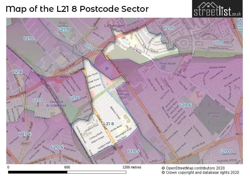
The L21 8 Postcode shares a border with L21 6 (LIVERPOOL, Litherland), L20 5 (BOOTLE), L20 4 (BOOTLE), L20 6 (BOOTLE), L21 2 (LIVERPOOL, Litherland), L21 5 (LIVERPOOL, Litherland), L21 7 (LIVERPOOL, Litherland) and L30 9 (BOOTLE).
Map of the L21 8 Postcode Sector
Explore the L21 8 postcode sector by using our interactive map.
The sector is within the post town of LIVERPOOL.
L21 8 is a postcode sector within the L21 postcode district which is within the L Liverpool postcode area.
The Royal Mail delivery office for the L21 8 postal sector is the Seaforth Delivery Office.
The area of the L21 8 postcode sector is 0.20 square miles which is 0.52 square kilometres or 128.38 square acres.
The L21 8 postcode sector is crossed by the A5036 Major A road.
Waterways within the L21 8 postcode sector include the Leeds and Liverpool Canal.
Your support helps keep this site running!
If you enjoy using this website, consider buying me a coffee to help cover hosting costs.

| L | 2 | 1 | - | 8 | X | X |
| L | 2 | 1 | Space | 8 | Letter | Letter |
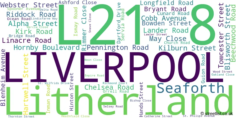
Official List of Streets
LIVERPOOL (42 Streets)
Litherland (9 Streets)
(2 Streets)
Seaforth (1 Streets)
Unofficial Streets or Alternative Spellings
BOOTLE,
HORNBY BOULEVARD ORRELL ROADLIVERPOOL
LILY ROAD SCARISBRICK AVENUE SEFTON AVENUE VIOLET ROADLitherland
HAWTHORNE ROAD SCHOOL LANE DAISY MEWS SNOWDROP MEWS ST MATTHEWS AVENUEBOOTLE
AKENSIDE STREET LITHERLAND ROADKirkdale
STANLEY ROADWeather Forecast for L21 8
Weather Forecast for Litherland
| Time Period | Icon | Description | Temperature | Rain Probability | Wind |
|---|---|---|---|---|---|
| 03:00 to 06:00 | Clear night | 2.0°C (feels like 0.0°C) | 0.00% | SE 4 mph | |
| 06:00 to 09:00 | Mist | 1.0°C (feels like -1.0°C) | 13.00% | ESE 4 mph | |
| 09:00 to 12:00 | Sunny day | 1.0°C (feels like -2.0°C) | 0.00% | SE 4 mph | |
| 12:00 to 15:00 | Sunny day | 4.0°C (feels like 2.0°C) | 0.00% | SE 7 mph | |
| 15:00 to 18:00 | Sunny day | 7.0°C (feels like 5.0°C) | 0.00% | ESE 7 mph | |
| 18:00 to 21:00 | Clear night | 5.0°C (feels like 3.0°C) | 0.00% | ESE 7 mph | |
| 21:00 to 00:00 | Clear night | 4.0°C (feels like 1.0°C) | 0.00% | E 7 mph |
| Time Period | Icon | Description | Temperature | Rain Probability | Wind |
|---|---|---|---|---|---|
| 00:00 to 03:00 | Clear night | 3.0°C (feels like 0.0°C) | 0.00% | ENE 7 mph | |
| 03:00 to 06:00 | Clear night | 2.0°C (feels like -1.0°C) | 0.00% | NE 7 mph | |
| 06:00 to 09:00 | Clear night | 1.0°C (feels like -2.0°C) | 0.00% | NE 7 mph | |
| 09:00 to 12:00 | Sunny day | 2.0°C (feels like -1.0°C) | 1.00% | ENE 9 mph | |
| 12:00 to 15:00 | Sunny day | 5.0°C (feels like 1.0°C) | 0.00% | ENE 11 mph | |
| 15:00 to 18:00 | Partly cloudy (day) | 6.0°C (feels like 2.0°C) | 1.00% | ENE 11 mph | |
| 18:00 to 21:00 | Partly cloudy (night) | 4.0°C (feels like 1.0°C) | 1.00% | ENE 11 mph | |
| 21:00 to 00:00 | Cloudy | 3.0°C (feels like 0.0°C) | 4.00% | ENE 9 mph |
| Time Period | Icon | Description | Temperature | Rain Probability | Wind |
|---|---|---|---|---|---|
| 00:00 to 03:00 | Overcast | 3.0°C (feels like -1.0°C) | 7.00% | ENE 9 mph | |
| 03:00 to 06:00 | Cloudy | 2.0°C (feels like -1.0°C) | 4.00% | ENE 9 mph | |
| 06:00 to 09:00 | Partly cloudy (night) | 2.0°C (feels like -1.0°C) | 2.00% | NE 7 mph | |
| 09:00 to 12:00 | Cloudy | 2.0°C (feels like -1.0°C) | 5.00% | NE 7 mph | |
| 12:00 to 15:00 | Cloudy | 4.0°C (feels like 1.0°C) | 4.00% | NE 9 mph | |
| 15:00 to 18:00 | Overcast | 5.0°C (feels like 2.0°C) | 9.00% | NE 9 mph | |
| 18:00 to 21:00 | Overcast | 4.0°C (feels like 2.0°C) | 9.00% | ENE 7 mph | |
| 21:00 to 00:00 | Cloudy | 3.0°C (feels like 1.0°C) | 5.00% | NE 7 mph |
| Time Period | Icon | Description | Temperature | Rain Probability | Wind |
|---|---|---|---|---|---|
| 00:00 to 03:00 | Cloudy | 3.0°C (feels like 0.0°C) | 6.00% | NE 7 mph | |
| 03:00 to 06:00 | Cloudy | 3.0°C (feels like 0.0°C) | 6.00% | NE 7 mph | |
| 06:00 to 09:00 | Overcast | 3.0°C (feels like 0.0°C) | 10.00% | ENE 7 mph | |
| 09:00 to 12:00 | Cloudy | 4.0°C (feels like 1.0°C) | 7.00% | ENE 7 mph | |
| 12:00 to 15:00 | Overcast | 5.0°C (feels like 3.0°C) | 9.00% | ENE 9 mph | |
| 15:00 to 18:00 | Overcast | 6.0°C (feels like 3.0°C) | 11.00% | ENE 9 mph | |
| 18:00 to 21:00 | Overcast | 5.0°C (feels like 2.0°C) | 8.00% | NE 9 mph | |
| 21:00 to 00:00 | Overcast | 5.0°C (feels like 1.0°C) | 8.00% | NE 9 mph |
Schools and Places of Education Within the L21 8 Postcode Sector
Lander Road Primary School
Community school
Pennington Road, Liverpool, Merseyside, L21 8HY
Head: Mr Jeffrey Taylor
Ofsted Rating: Good
Inspection: 2023-06-23 (594 days ago)
Website: Visit Lander Road Primary School Website
Phone: 01519225760
Number of Pupils: 257
St Elizabeth's Catholic Primary School
Voluntary aided school
Webster Street, Liverpool, Merseyside, L21 8JH
Head: Mr Liam Daniels
Ofsted Rating: Good
Inspection: 2023-03-29 (680 days ago)
Website: Visit St Elizabeth's Catholic Primary School Website
Phone: 01519225752
Number of Pupils: 436
St Philip's Church of England Controlled Primary School
Voluntary controlled school
Church Road, Liverpool, Merseyside, L21 8NZ
Head: Ms Susan Sullivan
Ofsted Rating: Good
Inspection: 2022-07-06 (946 days ago)
Website: Visit St Philip's Church of England Controlled Primary School Website
Phone: 01519281483
Number of Pupils: 201
House Prices in the L21 8 Postcode Sector
| Type of Property | 2018 Average | 2018 Sales | 2017 Average | 2017 Sales | 2016 Average | 2016 Sales | 2015 Average | 2015 Sales |
|---|---|---|---|---|---|---|---|---|
| Detached | £200,000 | 1 | £186,500 | 2 | £174,956 | 5 | £187,047 | 9 |
| Semi-Detached | £137,875 | 4 | £148,500 | 6 | £130,425 | 10 | £151,966 | 26 |
| Terraced | £60,432 | 49 | £55,819 | 47 | £51,263 | 44 | £50,768 | 45 |
| Flats | £50,333 | 3 | £51,496 | 2 | £54,500 | 4 | £28,500 | 2 |
Important Postcodes L21 8 in the Postcode Sector
L21 8HY is the postcode for Lander Road Primary School, Pennington Road
L21 8JD is the postcode for Lander Road Primary School, Lander Road
L21 8JH is the postcode for St. Elizabeths RC Primary, Webster Street
L21 8NU is the postcode for MAIN BUILDING, St. Wilfrids Catholic High School, Orrell Road, and DRAMA AND MUSIC BLOCK, St. Wilfrids Catholic High School, Orrell Road
L21 8NZ is the postcode for St. Philips (Controlled) C of E Primary School, Church Road
| The L21 8 Sector is within these Local Authorities |
|
|---|---|
| The L21 8 Sector is within these Counties |
|
| The L21 8 Sector is within these Water Company Areas |
|