A wide range of spatial data has been analysed to present this overview of the IV55 8 Postcode sector. If you would like anything added, please contact us.
The IV55 8 Dunvegan Postcode Sector
Given that each sector allows for 400 unique postcode combinations. Letters C, I, K, M, O and V are not allowed in the last two letters of a postcode. With 56 postcodes already in use, this leaves 344 units available.
The largest settlement in the IV55 8 postal code is Dunvegan followed by Glendale, and Hallin.
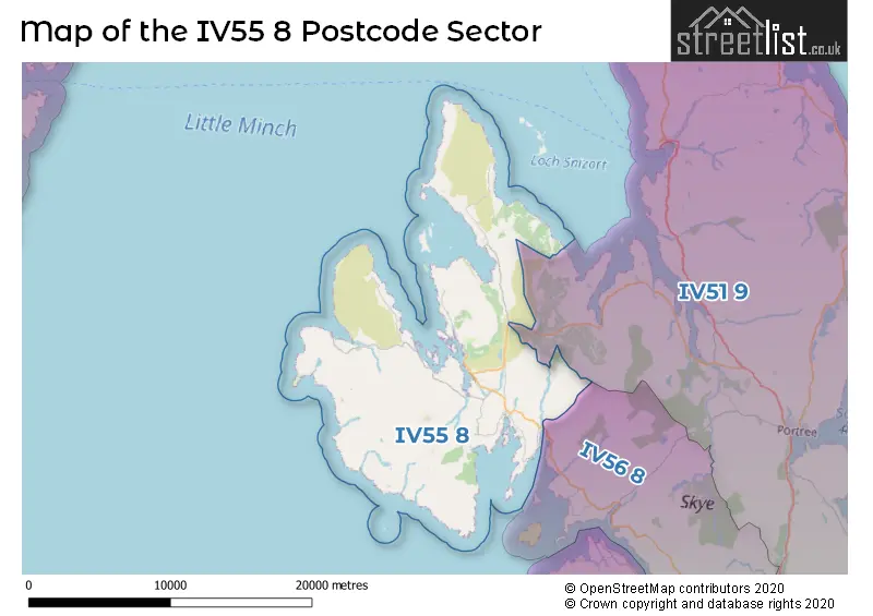
The IV55 8 Postcode shares a border with IV56 8 (Struan, Ose) and IV51 9 (PORTREE, Edinbane, Staffin).
Map of the IV55 8 Postcode Sector
Explore the IV55 8 postcode sector by using our interactive map.
The sector is within the post town of ISLE OF SKYE.
IV55 8 is a postcode sector within the IV55 postcode district which is within the IV Inverness postcode area.
The Royal Mail delivery office for the IV55 8 postal sector is the Dunvegan Scale Payment Delivery Office.
The area of the IV55 8 postcode sector is 99.34 square miles which is 257.28 square kilometres or 63,575.10 square acres.
Your support helps keep this site running!
If you enjoy using this website, consider buying me a coffee to help cover hosting costs.


| I | V | 5 | 5 | - | 8 | X | X |
| I | V | 5 | 5 | Space | 8 | Letter | Letter |
Official List of Streets
Dunvegan (11 Streets)
Waternish (3 Streets)
Unofficial Streets or Alternative Spellings
Weather Forecast for IV55 8
Weather Forecast for Loch Dunvegan
| The IV55 8 Sector is within these Local Authorities | |
|---|---|
| The IV55 8 Sector is within these Counties | |
| The IV55 8 Sector is within these Water Company Areas |