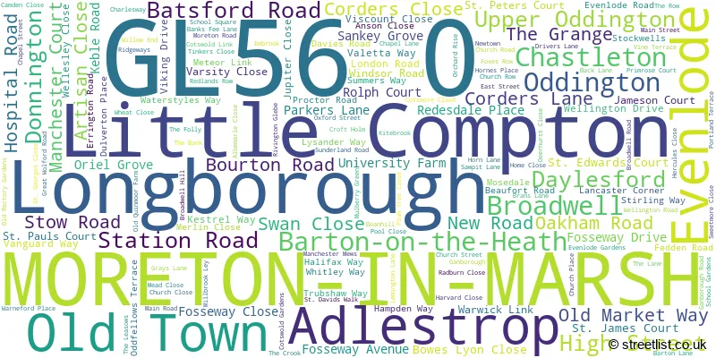
A wide range of spatial data has been analysed to present this overview of the GL56 0 Postcode sector. If you would like anything added, please contact us.
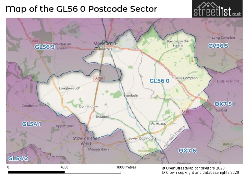
The GL56 0 postcode sector lies where the three counties of Gloucestershire, Warwickshire, and Oxfordshire meet.
Did you know? According to the 2021 Census, the GL56 0 postcode sector is home to a bustling 6,343 residents!
Given that each sector allows for 400 unique postcode combinations. Letters C, I, K, M, O and V are not allowed in the last two letters of a postcode. With 317 postcodes already in use, this leaves 83 units available.
The largest settlement in the GL56 0 postal code is MORETON-IN-MARSH followed by Longborough, and Broadwell.
The GL56 0 Postcode shares a border with OX7 5 (CHIPPING NORTON, Great Rollright, Over Norton), OX7 6 (Milton-under-Wychwood, Shipton-under-Wychwood, Kingham), GL56 9 (Blockley, MORETON-IN-MARSH, Stretton On Fosse), CV36 5 (Long Compton, Halford, Cherington) and GL54 1 (Stow On The Wold, Lower Swell, Maugersbury).
Map of the GL56 0 Postcode Sector
Explore the GL56 0 postcode sector by using our interactive map.
The sector is within the post town of MORETON-IN-MARSH.
GL56 0 is a postcode sector within the GL56 postcode district which is within the GL Gloucester postcode area.
The Royal Mail delivery office for the GL56 0 postal sector is the Moreton In Marsh Scale Payment Delivery Office.
The area of the GL56 0 postcode sector is 25.54 square miles which is 66.16 square kilometres or 16,348.36 square acres.
Your support helps keep this site running!
If you enjoy using this website, consider buying me a coffee to help cover hosting costs.


| G | L | 5 | 6 | - | 0 | X | X |
| G | L | 5 | 6 | Space | 0 | Letter | Letter |
Official List of Streets
(36 Streets)
MORETON-IN-MARSH (87 Streets)
Oddington (10 Streets)
Longborough (17 Streets)
Little Compton (11 Streets)
Broadwell (10 Streets)
Barton-on-the-Heath (1 Streets)
Evenlode (4 Streets)
Adlestrop (1 Streets)
Upper Oddington (1 Streets)
Old Town (1 Streets)
Unofficial Streets or Alternative Spellings
Chesterton
FOSSE WAYMORETON-IN-MARSH
BLENHEIM WAY CORNFLOWER ROAD MEADOW SWEET DRIVELong Compton
BARTON ROADWeather Forecast for GL56 0
Weather Forecast for Chastleton House
| Time Period | Icon | Description | Temperature | Rain Probability | Wind |
|---|---|---|---|---|---|
| 15:00 to 18:00 | Sunny day | 6.0°C (feels like 3.0°C) | 1.00% | WNW 9 mph | |
| 18:00 to 21:00 | Clear night | 3.0°C (feels like 1.0°C) | 0.00% | WSW 7 mph | |
| 21:00 to 00:00 | Cloudy | 2.0°C (feels like -1.0°C) | 3.00% | SW 7 mph |
| Time Period | Icon | Description | Temperature | Rain Probability | Wind |
|---|---|---|---|---|---|
| 00:00 to 03:00 | Cloudy | 2.0°C (feels like -2.0°C) | 8.00% | SSW 9 mph | |
| 03:00 to 06:00 | Heavy rain | 3.0°C (feels like -2.0°C) | 92.00% | SSW 11 mph | |
| 06:00 to 09:00 | Heavy rain | 3.0°C (feels like -1.0°C) | 88.00% | SSW 11 mph | |
| 09:00 to 12:00 | Light rain | 4.0°C (feels like 1.0°C) | 48.00% | WSW 9 mph | |
| 12:00 to 15:00 | Overcast | 6.0°C (feels like 3.0°C) | 12.00% | NW 9 mph | |
| 15:00 to 18:00 | Overcast | 6.0°C (feels like 4.0°C) | 10.00% | NNE 7 mph | |
| 18:00 to 21:00 | Cloudy | 5.0°C (feels like 3.0°C) | 7.00% | NNE 4 mph | |
| 21:00 to 00:00 | Cloudy | 4.0°C (feels like 3.0°C) | 7.00% | SSE 4 mph |
| Time Period | Icon | Description | Temperature | Rain Probability | Wind |
|---|---|---|---|---|---|
| 00:00 to 03:00 | Overcast | 4.0°C (feels like 2.0°C) | 10.00% | SSW 4 mph | |
| 03:00 to 06:00 | Overcast | 3.0°C (feels like 1.0°C) | 10.00% | SSE 4 mph | |
| 06:00 to 09:00 | Overcast | 3.0°C (feels like 0.0°C) | 11.00% | SSE 7 mph | |
| 09:00 to 12:00 | Overcast | 3.0°C (feels like 0.0°C) | 10.00% | SSE 7 mph | |
| 12:00 to 15:00 | Overcast | 5.0°C (feels like 1.0°C) | 10.00% | S 11 mph | |
| 15:00 to 18:00 | Overcast | 6.0°C (feels like 2.0°C) | 9.00% | S 11 mph | |
| 18:00 to 21:00 | Overcast | 4.0°C (feels like 0.0°C) | 8.00% | S 9 mph | |
| 21:00 to 00:00 | Cloudy | 2.0°C (feels like -2.0°C) | 6.00% | S 11 mph |
| Time Period | Icon | Description | Temperature | Rain Probability | Wind |
|---|---|---|---|---|---|
| 00:00 to 03:00 | Cloudy | 2.0°C (feels like -2.0°C) | 7.00% | S 11 mph | |
| 03:00 to 06:00 | Cloudy | 2.0°C (feels like -2.0°C) | 8.00% | S 11 mph | |
| 06:00 to 09:00 | Cloudy | 2.0°C (feels like -2.0°C) | 11.00% | S 11 mph | |
| 09:00 to 12:00 | Partly cloudy (day) | 3.0°C (feels like -1.0°C) | 14.00% | S 9 mph | |
| 12:00 to 15:00 | Sunny day | 5.0°C (feels like 2.0°C) | 12.00% | SSW 9 mph | |
| 15:00 to 18:00 | Cloudy | 6.0°C (feels like 4.0°C) | 12.00% | SW 7 mph | |
| 18:00 to 21:00 | Partly cloudy (night) | 3.0°C (feels like 1.0°C) | 6.00% | SW 7 mph | |
| 21:00 to 00:00 | Clear night | 2.0°C (feels like -1.0°C) | 3.00% | SSW 7 mph |
| Time Period | Icon | Description | Temperature | Rain Probability | Wind |
|---|---|---|---|---|---|
| 00:00 to 03:00 | Clear night | 2.0°C (feels like -1.0°C) | 4.00% | SSW 7 mph | |
| 03:00 to 06:00 | Overcast | 2.0°C (feels like -1.0°C) | 8.00% | SSW 7 mph | |
| 06:00 to 09:00 | Overcast | 2.0°C (feels like -1.0°C) | 8.00% | SSW 7 mph | |
| 09:00 to 12:00 | Overcast | 3.0°C (feels like 0.0°C) | 9.00% | S 7 mph | |
| 12:00 to 15:00 | Overcast | 6.0°C (feels like 3.0°C) | 8.00% | S 9 mph | |
| 15:00 to 18:00 | Cloudy | 6.0°C (feels like 3.0°C) | 5.00% | S 11 mph | |
| 18:00 to 21:00 | Cloudy | 5.0°C (feels like 1.0°C) | 5.00% | S 11 mph | |
| 21:00 to 00:00 | Cloudy | 4.0°C (feels like 0.0°C) | 6.00% | S 11 mph |
Schools and Places of Education Within the GL56 0 Postcode Sector
St David's Church of England Primary School
Academy converter
East Street, Moreton-in-Marsh, Gloucestershire, GL56 0LQ
Head: Mrs Jennifer Walker
Ofsted Rating: Good
Inspection: 2022-03-02 (1065 days ago)
Website: Visit St David's Church of England Primary School Website
Phone: 01608650521
Number of Pupils: 269

House Prices in the GL56 0 Postcode Sector
| Type of Property | 2018 Average | 2018 Sales | 2017 Average | 2017 Sales | 2016 Average | 2016 Sales | 2015 Average | 2015 Sales |
|---|---|---|---|---|---|---|---|---|
| Detached | £548,976 | 44 | £644,289 | 40 | £523,408 | 44 | £412,448 | 58 |
| Semi-Detached | £294,025 | 55 | £316,518 | 44 | £287,916 | 35 | £290,670 | 42 |
| Terraced | £287,019 | 30 | £297,967 | 36 | £293,768 | 40 | £247,832 | 48 |
| Flats | £209,583 | 18 | £219,155 | 52 | £169,595 | 21 | £180,813 | 19 |
Important Postcodes GL56 0 in the Postcode Sector
GL56 0AZ is the postcode for Council Offices, High Street
GL56 0BS is the postcode for Moreton-in-Marsh District Hospital, and Gloucestershire PCT, Moreton In Marsh District Hospital
GL56 0DP is the postcode for Gloucestershire Fire & Rescue Service, Fire Station, Parkers Lane
GL56 0DS is the postcode for Gloucestershire Health and Care NHS Foundation Trust, Stow Road, Gloucestershire Care Services NHS Trust, Stow Road, Four Shires Medical Centre, Stow Road, and Gloucestershire Health and Care NHS Foundation Trust, North Cotswold Hospital, Stow Road
GL56 0LQ is the postcode for St. Davids Primary School, East Street
GL56 0QD is the postcode for Longborough C of E Primary School, School Square
GL56 0RH is the postcode for LIBRARY AND CHAPEL, The Fire Service College, London Road, FEU OFFICES, The Fire Service College, London Road, BREATHING APPARATUS SCHOOL, The Fire Service College, London Road, FEU FIRE STATION, The Fire Service College, London Road, FOUR SHIRES MESS, The Fire Service College, London Road, L BLOCK, The Fire Service College, London Road, STORES & WORKSHOP, The Fire Service College, London Road, BRAIDWOOD HOUSE, The Fire Service College, London Road, The Fire Service College, London Road, WOODLANDS NURSERY & STAFF ACCOMMODATION, The Fire Service College, London Road, USAR DEMONSTRATION BUILDING, The Fire Service College, London Road, SPORTS COMPLEX, The Fire Service College, London Road, TANNER HOUSE, The Fire Service College, London Road, USAR, The Fire Service College, London Road, BOWLES HOUSE, The Fire Service College, London Road, BRIDGES 2, The Fire Service College, London Road, and ADMIN A AND DEMONSTRATION BLOCK, The Fire Service College, London Road
| The GL56 0 Sector is within these Local Authorities |
|
|---|---|
| The GL56 0 Sector is within these Counties |
|
| The GL56 0 Sector is within these Water Company Areas |
|
Tourist Attractions within the GL56 0 Postcode Area
We found 2 visitor attractions within the GL56 postcode area
| Wellington Aviation Museum |
|---|
| Museums & Art Galleries |
| Museum and / or Art Gallery |
| View Wellington Aviation Museum on Google Maps |
| Chastleton House |
| Historic Properties |
| Historic House / House and Garden / Palace |
| View Chastleton House on Google Maps |