A wide range of spatial data has been analysed to present this overview of the GL53 9 Postcode sector. If you would like anything added, please contact us.
The GL53 9 postcode sector is within the county of Gloucestershire.
Did you know? According to the 2021 Census, the GL53 9 postcode sector is home to a bustling 4,829 residents!
Given that each sector allows for 400 unique postcode combinations. Letters C, I, K, M, O and V are not allowed in the last two letters of a postcode. With 176 postcodes already in use, this leaves 224 units available.
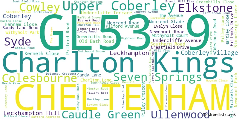
The largest settlement in the GL53 9 postal code is CHELTENHAM followed by Charlton Kings, and Elkstone.
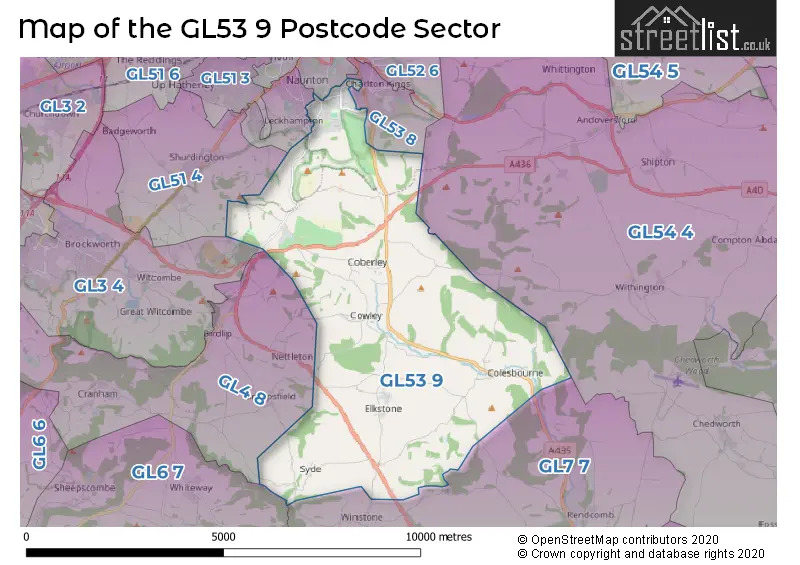
The GL53 9 Postcode shares a border with GL4 8 (Upton St. Leonards, Cranham, Birdlip), GL6 7 (Bisley, Eastcombe, Sheepscombe), GL53 8 (Charlton Kings), GL54 4 (Andoversford, Chedworth, Withington), GL3 4 (Brockworth, Witcombe), GL7 7 (Baunton, Rendcomb, Daglingworth), GL53 7 (CHELTENHAM), GL51 4 (Shurdington, Badgeworth, Bentham) and GL53 0 (CHELTENHAM, Leckhampton, Charlton Kings).
Map of the GL53 9 Postcode Sector
Explore the GL53 9 postcode sector by using our interactive map.
The sector is within the post town of CHELTENHAM.
GL53 9 is a postcode sector within the GL53 postcode district which is within the GL Gloucester postcode area.
The Royal Mail delivery office for the GL53 9 postal sector is the Cheltenham Delivery Office.
The area of the GL53 9 postcode sector is 17.92 square miles which is 46.40 square kilometres or 11,465.83 square acres.
The GL53 9 postcode sector is crossed by the A417 Major A road.
Waterways within the GL53 9 postcode sector include the Lilley Brook, Churn, Hilcot Brook.
Your support helps keep this site running!
If you enjoy using this website, consider buying me a coffee to help cover hosting costs.


| G | L | 5 | 3 | - | 9 | X | X |
| G | L | 5 | 3 | Space | 9 | Letter | Letter |
Official List of Streets
Charlton Kings (25 Streets)
Elkstone (3 Streets)
CHELTENHAM (31 Streets)
(6 Streets)
Coberley (1 Streets)
Cowley (2 Streets)
Leckhampton (1 Streets)
Ullenwood (2 Streets)
Leckhampton Hill (1 Streets)
Unofficial Streets or Alternative Spellings
Charlton Kings
CIRENCESTER ROAD LYEFIELD ROAD WESTCHELTENHAM
CHARLTON PARK GATE KING WILLIAM DRIVE LECKHAMPTON ROAD BEECHPIKE COCKLEFORD ROAD COWLEY JUNCTION COWLEY LANE DAISYBANK ROAD GLOUCESTER ROAD GRANNYS PUMPS HIGH CROSS MAIN STREET PIKE ROAD PILFORD COURT PINETREES SALT WAY SOUTHFIELD MANOR PARK ULLENWOOD MANOR LANEShurdington
GREENWAY LANEBagendon
CHELTENHAM ROADDuntisbourne Abbotts
GLOUCESTER ROADWeather Forecast for GL53 9
Weather Forecast for Miserden Park Gardens
| Time Period | Icon | Description | Temperature | Rain Probability | Wind |
|---|---|---|---|---|---|
| 03:00 to 06:00 | Mist | 1.0°C (feels like -1.0°C) | 17.00% | S 4 mph | |
| 06:00 to 09:00 | Fog | 0.0°C (feels like -2.0°C) | 16.00% | SSE 4 mph | |
| 09:00 to 12:00 | Fog | 0.0°C (feels like -2.0°C) | 17.00% | SE 4 mph | |
| 12:00 to 15:00 | Overcast | 2.0°C (feels like -1.0°C) | 10.00% | SE 7 mph | |
| 15:00 to 18:00 | Overcast | 3.0°C (feels like 0.0°C) | 10.00% | SE 7 mph | |
| 18:00 to 21:00 | Overcast | 1.0°C (feels like -2.0°C) | 10.00% | ESE 7 mph | |
| 21:00 to 00:00 | Cloudy | 1.0°C (feels like -3.0°C) | 8.00% | ESE 7 mph |
| Time Period | Icon | Description | Temperature | Rain Probability | Wind |
|---|---|---|---|---|---|
| 00:00 to 03:00 | Cloudy | 1.0°C (feels like -3.0°C) | 8.00% | E 7 mph | |
| 03:00 to 06:00 | Fog | 0.0°C (feels like -3.0°C) | 16.00% | E 7 mph | |
| 06:00 to 09:00 | Fog | 0.0°C (feels like -3.0°C) | 17.00% | ENE 7 mph | |
| 09:00 to 12:00 | Fog | 0.0°C (feels like -3.0°C) | 20.00% | ENE 7 mph | |
| 12:00 to 15:00 | Overcast | 2.0°C (feels like -1.0°C) | 13.00% | ENE 7 mph | |
| 15:00 to 18:00 | Overcast | 3.0°C (feels like 0.0°C) | 16.00% | NE 7 mph | |
| 18:00 to 21:00 | Overcast | 2.0°C (feels like -1.0°C) | 19.00% | NE 7 mph | |
| 21:00 to 00:00 | Overcast | 2.0°C (feels like -1.0°C) | 19.00% | NNE 7 mph |
| Time Period | Icon | Description | Temperature | Rain Probability | Wind |
|---|---|---|---|---|---|
| 00:00 to 03:00 | Mist | 2.0°C (feels like -2.0°C) | 26.00% | NNW 9 mph | |
| 03:00 to 06:00 | Fog | 1.0°C (feels like -2.0°C) | 26.00% | NNW 9 mph | |
| 06:00 to 09:00 | Fog | 1.0°C (feels like -3.0°C) | 23.00% | NW 9 mph | |
| 09:00 to 12:00 | Fog | 1.0°C (feels like -2.0°C) | 22.00% | WSW 9 mph | |
| 12:00 to 15:00 | Overcast | 4.0°C (feels like 0.0°C) | 14.00% | SW 11 mph | |
| 15:00 to 18:00 | Overcast | 5.0°C (feels like 2.0°C) | 16.00% | SW 11 mph | |
| 18:00 to 21:00 | Cloudy | 3.0°C (feels like 0.0°C) | 13.00% | SW 9 mph | |
| 21:00 to 00:00 | Cloudy | 3.0°C (feels like 0.0°C) | 11.00% | SSW 9 mph |
Schools and Places of Education Within the GL53 9 Postcode Sector
Coberley Church of England Primary School
Voluntary controlled school
Coberley, Cheltenham, Gloucestershire, GL53 9QZ
Head: Mrs Elizabeth Black
Ofsted Rating: Good
Inspection: 2023-10-04 (475 days ago)
Website: Visit Coberley Church of England Primary School Website
Phone: 01242870366
Number of Pupils: 64
National Star College
Special post 16 institution
Ullenwood Manor, Cheltenham, , GL53 9QU
Head: Mr Simon Welch
Ofsted Rating: Good
Inspection: 2023-02-02 (719 days ago)
Website: Visit National Star College Website
Phone: 01242527631
Number of Pupils: 0

House Prices in the GL53 9 Postcode Sector
| Type of Property | 2018 Average | 2018 Sales | 2017 Average | 2017 Sales | 2016 Average | 2016 Sales | 2015 Average | 2015 Sales |
|---|---|---|---|---|---|---|---|---|
| Detached | £655,917 | 41 | £737,986 | 37 | £731,440 | 46 | £543,078 | 44 |
| Semi-Detached | £458,550 | 20 | £420,481 | 29 | £355,342 | 29 | £316,945 | 28 |
| Terraced | £392,739 | 16 | £393,667 | 3 | £313,120 | 10 | £329,818 | 14 |
| Flats | £197,152 | 12 | £160,483 | 9 | £241,917 | 6 | £152,663 | 8 |
Important Postcodes GL53 9 in the Postcode Sector
GL53 9DT is the postcode for Gloucestershire Hospitals NHS Foundation Trust, Delancey Hospital
GL53 9DU is the postcode for Delancey Assessment and Rehabilitation Hospital, Charlton Lane
GL53 9DZ is the postcode for Evergreen House, Charlton Lane, Gloucestershire Health and Care NHS Foundation Trust, Charlton Lane, Leckhampton Lodge, Charlton Lane, 2gether NHS Foundation Trust, Charlton Lane, Gloucestershire Health and Care NHS Foundation Trust, The Fritchie Centre, Charlton Lane, and Gloucestershire Health and Care NHS Foundation Trust, Sherborne House, Charlton Lane
GL53 9NG is the postcode for Sandford School, Seven Springs
GL53 9QU is the postcode for NEW COURT, Natstar, Ullenwood, WILSON COURT, Natstar, Ullenwood, and THEATRE & SPORTS COMPLEX, Natstar, Ullenwood
GL53 9QZ is the postcode for Coberley School, Coberley Village
| The GL53 9 Sector is within these Local Authorities |
|
|---|---|
| The GL53 9 Sector is within these Counties |
|
| The GL53 9 Sector is within these Water Company Areas |
|