A wide range of spatial data has been analysed to present this overview of the DT1 1 Postcode sector. If you would like anything added, please contact us.
The DT1 1 postcode sector is within the county of Dorset.
Did you know? According to the 2021 Census, the DT1 1 postcode sector is home to a bustling 6,404 residents!
Given that each sector allows for 400 unique postcode combinations. Letters C, I, K, M, O and V are not allowed in the last two letters of a postcode. With 285 postcodes already in use, this leaves 115 units available.
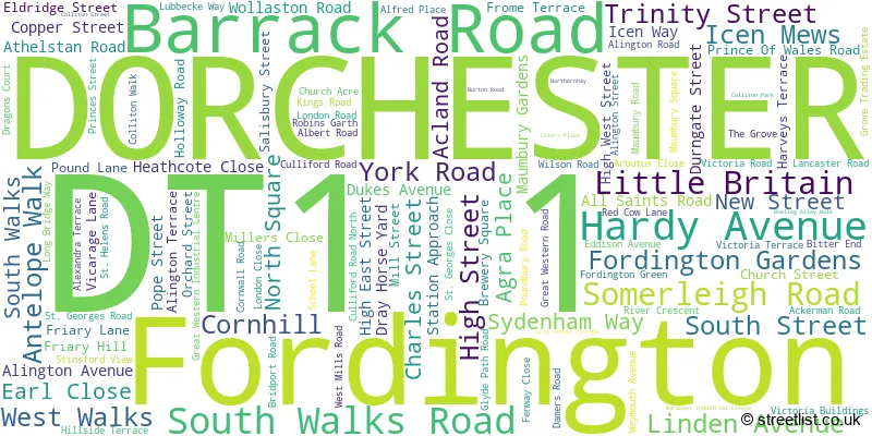
The largest settlements in the DT1 1 postal code are DORCHESTER and Fordington.
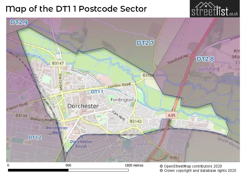
The DT1 1 Postcode shares a border with DT1 2 (DORCHESTER), DT2 7 (Cerne Abbas, Piddletrenthide, Buckland Newton), DT2 8 (Crossways, Broadmayne, Puddletown) and DT2 9 (Charminster, Charlton Down, Martinstown).
Map of the DT1 1 Postcode Sector
Explore the DT1 1 postcode sector by using our interactive map.
The sector is within the post town of DORCHESTER.
DT1 1 is a postcode sector within the DT1 postcode district which is within the DT Dorchester postcode area.
The Royal Mail delivery office for the DT1 1 postal sector is the Dorchester Delivery Office.
The area of the DT1 1 postcode sector is 1.02 square miles which is 2.65 square kilometres or 655.69 square acres.
The DT1 1 postcode sector is crossed by the A35 Major A road.
Your support helps keep this site running!
If you enjoy using this website, consider buying me a coffee to help cover hosting costs.


| D | T | 1 | - | 1 | X | X |
| D | T | 1 | Space | 1 | Letter | Letter |
Official List of Streets
DORCHESTER (99 Streets)
(17 Streets)
Fordington (11 Streets)
Unofficial Streets or Alternative Spellings
DORCHESTER
ALEXANDRA ROAD BARNES WAY MAUMBURY SQUARE BLUE BRIDGE CHANNONS COURT DURNOVER COURT HARDYE ARCADE HIGH STREET FORDINGTON HOP HILL MAEN GARDENS MAUMBIRY ROAD SAINT THOMAS ROAD SOUTH STREET PASSAGE ST THOMAS ROAD STATION ROAD THE BOW TOP OTOWN ROUNDABOUT TUDOR ARCADE WILLIAMS AVENUEPoundbury
BRIDPORT ROADWeather Forecast for DT1 1
Weather Forecast for Dorchester
| Time Period | Icon | Description | Temperature | Rain Probability | Wind |
|---|---|---|---|---|---|
| 09:00 to 12:00 | Fog | 2.0°C (feels like -1.0°C) | 15.00% | E 7 mph | |
| 12:00 to 15:00 | Cloudy | 5.0°C (feels like 3.0°C) | 6.00% | ESE 7 mph | |
| 15:00 to 18:00 | Cloudy | 6.0°C (feels like 4.0°C) | 5.00% | ESE 9 mph | |
| 18:00 to 21:00 | Cloudy | 4.0°C (feels like 1.0°C) | 5.00% | E 7 mph | |
| 21:00 to 00:00 | Cloudy | 3.0°C (feels like 0.0°C) | 6.00% | E 9 mph |
| Time Period | Icon | Description | Temperature | Rain Probability | Wind |
|---|---|---|---|---|---|
| 00:00 to 03:00 | Cloudy | 3.0°C (feels like 0.0°C) | 7.00% | ENE 7 mph | |
| 03:00 to 06:00 | Cloudy | 3.0°C (feels like 0.0°C) | 8.00% | ENE 9 mph | |
| 06:00 to 09:00 | Mist | 4.0°C (feels like 0.0°C) | 20.00% | ENE 9 mph | |
| 09:00 to 12:00 | Fog | 4.0°C (feels like 1.0°C) | 19.00% | ENE 9 mph | |
| 12:00 to 15:00 | Overcast | 5.0°C (feels like 3.0°C) | 16.00% | ENE 9 mph | |
| 15:00 to 18:00 | Overcast | 6.0°C (feels like 3.0°C) | 18.00% | NE 9 mph | |
| 18:00 to 21:00 | Light rain | 5.0°C (feels like 2.0°C) | 45.00% | NE 9 mph | |
| 21:00 to 00:00 | Overcast | 4.0°C (feels like 1.0°C) | 20.00% | ENE 9 mph |
| Time Period | Icon | Description | Temperature | Rain Probability | Wind |
|---|---|---|---|---|---|
| 00:00 to 03:00 | Overcast | 4.0°C (feels like 1.0°C) | 22.00% | NNW 9 mph | |
| 03:00 to 06:00 | Overcast | 4.0°C (feels like 0.0°C) | 23.00% | N 9 mph | |
| 06:00 to 09:00 | Mist | 3.0°C (feels like 0.0°C) | 26.00% | W 9 mph | |
| 09:00 to 12:00 | Cloudy | 4.0°C (feels like 1.0°C) | 14.00% | WSW 9 mph | |
| 12:00 to 15:00 | Cloudy | 7.0°C (feels like 4.0°C) | 12.00% | WSW 11 mph | |
| 15:00 to 18:00 | Cloudy | 7.0°C (feels like 4.0°C) | 13.00% | SW 11 mph | |
| 18:00 to 21:00 | Cloudy | 6.0°C (feels like 3.0°C) | 17.00% | SW 9 mph | |
| 21:00 to 00:00 | Cloudy | 5.0°C (feels like 2.0°C) | 14.00% | WSW 11 mph |

House Prices in the DT1 1 Postcode Sector
| Type of Property | 2018 Average | 2018 Sales | 2017 Average | 2017 Sales | 2016 Average | 2016 Sales | 2015 Average | 2015 Sales |
|---|---|---|---|---|---|---|---|---|
| Detached | £300,979 | 6 | £411,000 | 5 | £325,000 | 14 | £323,167 | 6 |
| Semi-Detached | £319,765 | 17 | £323,933 | 15 | £335,289 | 19 | £356,971 | 17 |
| Terraced | £253,908 | 46 | £256,666 | 75 | £240,591 | 65 | £227,456 | 56 |
| Flats | £198,156 | 96 | £239,610 | 149 | £237,868 | 183 | £171,744 | 101 |
Important Postcodes DT1 1 in the Postcode Sector
DT1 1AA is the postcode for Royal Mail, Dorchester Delivery Office, Bridport Road
DT1 1EE is the postcode for Dorchester Library And Learning Centre, South Walks House, Charles Street, and Dorchester Library and Learning Centre, South Walks House
DT1 1GA is the postcode for Pullman Court, Station Approach
DT1 1JD is the postcode for H M Prison, Dorchester Prison, 7 North Square
DT1 1JX is the postcode for County Hall, Colliton Park
DT1 1LD is the postcode for The Surgery, 91-93 High Street
DT1 1PX is the postcode for H M Revenue & Customs, Vespasian House, Bridport Road
DT1 1PY is the postcode for Department for Environment Food & Rural Affairs (D E F R A), Government Buildings, Prince of Wales Road
DT1 1QR is the postcode for The Atrium Health Centre, 7 Weymouth Avenue, and Atrium Health Centre, 7 Weymouth Avenue
DT1 1QZ is the postcode for Dorset Police, Dorchester Police Station, Weymouth Avenue
DT1 1RN is the postcode for The Keep Military Museum, The Keep, Bridport Road
DT1 1RP is the postcode for Dorset History Centre, Record Office, Bridport Road
DT1 1SH is the postcode for Dorchester Local Office and Day Centre, Acland Road
DT1 1SW is the postcode for Magna Housing Association Ltd, Hollands House, Poundbury Road
DT1 1TU is the postcode for Dorchester Contraception & Sexual Health (C&SH) Service, 20 Trinity Street
DT1 1UZ is the postcode for West Dorset District Council, Stratton House, 58-60 High West Street, and South Walks House, South Walks Road
DT1 1XJ is the postcode for COUNTY LIBRARY, Dorset County Council, County Hall, Colliton Park, COLLITON HOUSE, Dorset County Council, County Hall, Colliton Park, and Dorset County Council, County Hall, Colliton Park
DT1 1YA is the postcode for West Dorset Wheelchair Service, Unit F2, Marabout Industrial Estate, and B A E Systems, Unit D1, Marabout Industrial Estate
| The DT1 1 Sector is within these Local Authorities |
|
|---|---|
| The DT1 1 Sector is within these Counties |
|
| The DT1 1 Sector is within these Water Company Areas |
|
Tourist Attractions within the DT1 1 Postcode Area
We found 1 visitor attractions within the DT1 postcode area
| Maumbury Rings |
|---|
| Historic Properties |
| Castle / Fort |
| View Maumbury Rings on Google Maps |