A wide range of spatial data has been analysed to present this overview of the CV33 9 Postcode sector. If you would like anything added, please contact us.
The CV33 9 postcode sector is within the county of Warwickshire.
Did you know? According to the 2021 Census, the CV33 9 postcode sector is home to a bustling 8,379 residents!
Given that each sector allows for 400 unique postcode combinations. Letters C, I, K, M, O and V are not allowed in the last two letters of a postcode. With 286 postcodes already in use, this leaves 114 units available.
The largest settlement in the CV33 9 postal code is Bishops Tachbrook followed by Harbury, and Lighthorne Heath.
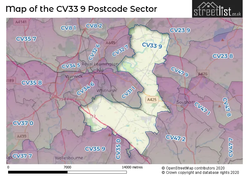
The CV33 9 Postcode shares a border with CV8 3 (Wolston, Ryton On Dunsmore, Baginton), CV23 9 (Long Lawford, Stretton On Dunsmore, Princethorpe), CV31 1 (LEAMINGTON SPA, Radford Semele, Sydenham), CV31 2 (Whitnash, LEAMINGTON SPA), CV31 3 (LEAMINGTON SPA), CV32 4 (LEAMINGTON SPA), CV32 6 (LEAMINGTON SPA, Blackdown, Old Milverton), CV32 7 (LEAMINGTON SPA, Cubbington, Lillington), CV34 6 (WARWICK, Heathcote, Tachbrook Park), CV35 0 (Kineton, Lighthorne, Gaydon), CV35 8 (Barford, Hampton Magna, Claverdon), CV35 9 (Wellesbourne, Moreton Morrell, Loxley), CV47 2 (Bishops Itchington, Fenny Compton, Temple Herdewyke) and CV47 9 (Long Itchington).
Map of the CV33 9 Postcode Sector
Explore the CV33 9 postcode sector by using our interactive map.
The sector is within the post town of LEAMINGTON SPA.
CV33 9 is a postcode sector within the CV33 postcode district which is within the CV Coventry postcode area.
The Royal Mail delivery office for the CV33 9 postal sector is the Leamington Spa Delivery Office and Harbury Scale Payment Delivery Office and Lighthorne Heath Scale Payment Delivery Office.
The area of the CV33 9 postcode sector is 26.38 square miles which is 68.33 square kilometres or 16,885.92 square acres.
The CV33 9 postcode sector is crossed by the M40 motorway.
Waterways within the CV33 9 postcode sector include the River Leam, Grand Union Canal.
Your support helps keep this site running!
If you enjoy using this website, consider buying me a coffee to help cover hosting costs.


| C | V | 3 | 3 | - | 9 | X | X |
| C | V | 3 | 3 | Space | 9 | Letter | Letter |
Official List of Streets
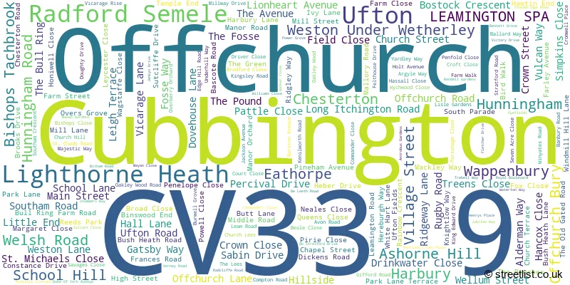
Weston Under Wetherley (9 Streets)
Bishops Tachbrook (69 Streets)
(23 Streets)
Lighthorne Heath (23 Streets)
Ufton (9 Streets)
Harbury (62 Streets)
Chesterton (5 Streets)
Hunningham (8 Streets)
Offchurch (8 Streets)
LEAMINGTON SPA (2 Streets)
Radford Semele (1 Streets)
Cubbington (1 Streets)
Unofficial Streets or Alternative Spellings
Gaydon
BANBURY ROADLong Itchington
STONEBRIDGE LANE ANTICHEL GREEN ANTROBUS CLOSE AVIS WAY BENNETT DRIVE BIFFIN WAY DEFINITIVE PATH, BUT NOT VISIBLE ON GROUND? EDGEHILL ROAD HANCOCK CLOSE HANCOCKS CLOSE HS2 ACCESS LONGHOLE BRIDGE OAKLEY WOOD FARM ROAD PARK GATES POWER CLOSE RYE FIELDS SNOWFORD HILL THE HARRY GREEN WAY THE OFFCHURCH GREENWAY THE OLD COURTYARD THE OLD HALL UFTON HILL WEEDON TO MARTON JUNCTION LINEWhitnash
BONEHAM ROAD GOLF LANE MANN PLACE ODONNELL ROADLEAMINGTON SPA
TACHBROOK ROADCubbington
RUGBY ROADBubbenhall
WESTON LANEPrincethorpe
LEAMINGTON ROADBretford
FOSSE WAYBarford
HAREWAY LANE WASPERTON LANEBishops Itchington
PLOUGH LANEAshorne
NEWBOLD ROADWeather Forecast for CV33 9
Weather Forecast for
Schools and Places of Education Within the CV33 9 Postcode Sector
Bishops Tachbrook CofE Primary School
Voluntary controlled school
Kingsley Road, Leamington Spa, Warwickshire, CV33 9RY
Head: Mrs Cathryn Kilbey
Ofsted Rating: Good
Inspection: 2019-02-07 (2187 days ago)
Website: Visit Bishops Tachbrook CofE Primary School Website
Phone: 01926426020
Number of Pupils: 210
Brickyard Barn Outdoor Learning Centre
Other independent special school
Brickyard Barn, , , CV33 9QD
Head: Mrs Sunita Evans
Ofsted Rating: Outstanding
Inspection: 2023-02-02 (731 days ago)
Website: Visit Brickyard Barn Outdoor Learning Centre Website
Phone: 01509415474
Number of Pupils: 8
Lighthorne Heath Primary School
Community school
Stratford Road, Leamington Spa, Warwickshire, CV33 9TW
Head: Mrs Juliette Westwood
Ofsted Rating: Good
Inspection: 2022-10-18 (838 days ago)
Website: Visit Lighthorne Heath Primary School Website
Phone: 01926640326
Number of Pupils: 77

House Prices in the CV33 9 Postcode Sector
| Type of Property | 2018 Average | 2018 Sales | 2017 Average | 2017 Sales | 2016 Average | 2016 Sales | 2015 Average | 2015 Sales |
|---|---|---|---|---|---|---|---|---|
| Detached | £507,932 | 95 | £451,462 | 93 | £525,255 | 32 | £538,636 | 29 |
| Semi-Detached | £314,046 | 53 | £294,840 | 75 | £298,525 | 34 | £265,647 | 41 |
| Terraced | £262,006 | 32 | £263,938 | 36 | £214,554 | 25 | £230,700 | 26 |
| Flats | £354,875 | 4 | £182,500 | 2 | £185,252 | 3 | £202,500 | 1 |
Important Postcodes CV33 9 in the Postcode Sector
CV33 9HR is the postcode for MAIN BUILDING, Harbury C of E Primary School, Mill Street
CV33 9QB is the postcode for Warwickshire District Council, Harbury Lane Sports Pavilion
CV33 9QP is the postcode for Mid Warwicks Crematorium, Oakley Wood
CV33 9RY is the postcode for Bishops Tachbrook C of E School, Kingsley Road, and Bishops Tachbrook C of E School, Kingsley Road, Bishops Tachbrook
CV33 9TW is the postcode for MAIN BUILDING, Lighthorne Heath Primary School, Stratford Road, and Lighthorne Heath Primary School, Stratford Road
| The CV33 9 Sector is within these Local Authorities |
|
|---|---|
| The CV33 9 Sector is within these Counties |
|
| The CV33 9 Sector is within these Water Company Areas |
|