A wide range of spatial data has been analysed to present this overview of the CR0 9 Postcode sector. If you would like anything added, please contact us.
The CR0 9 London (Selsdon) Postcode Sector
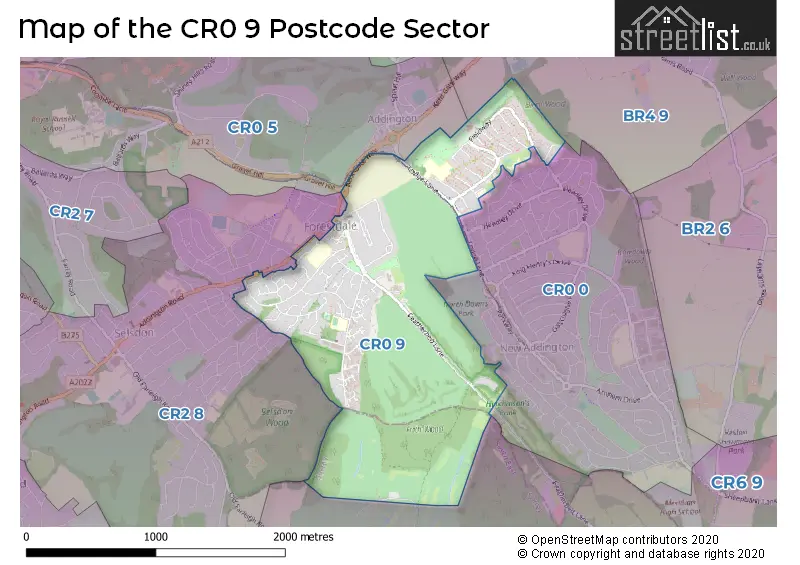
The CR0 9 postcode sector stands on the Greater London and Surrey border.
Did you know? According to the 2021 Census, the CR0 9 postcode sector is home to a bustling 11,743 residents!
Given that each sector allows for 400 unique postcode combinations. Letters C, I, K, M, O and V are not allowed in the last two letters of a postcode. With 137 postcodes already in use, this leaves 263 units available.
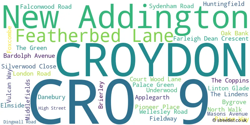
The largest settlements in the CR0 9 postal code are CROYDON and FIELD WAY .
The CR0 9 Postcode shares a border with BR4 9 (WEST WICKHAM ), CR0 5 (CROYDON ), CR2 8 (SOUTH CROYDON ), CR6 9 (WARLINGHAM , CHELSHAM ) and CR0 0 (CROYDON ).
Map of the CR0 9 Postcode Sector
Explore the CR0 9 postcode sector by using our interactive map.
The sector is within the post town of CROYDON.
CR0 9 is a postcode sector within the CR0 postcode district which is within the CR Croydon postcode area.
The Royal Mail delivery office for the CR0 9 postal sector is the unknown.
The area of the CR0 9 postcode sector is 1.47 square miles which is 3.82 square kilometres or 943.02 square acres.
Your support helps keep this site running!
If you enjoy using this website, consider buying me a coffee to help cover hosting costs.

| C | R | 0 | - | 9 | X | X |
| C | R | 0 | Space | 9 | Letter | Letter |
Official List of Streets
New Addington (13 Streets)
CROYDON (19 Streets)
Unofficial Streets or Alternative Spellings
New Addington
DUNLEY DRIVE IVERS WAY LODGE LANE MERROW WAY ADDINGTON BORDER AVIS GROVE BAKER BOY LANE CASCADES COURT WOOD GROVE COURTWOOD LANE FRIARS WOOD LANGFORDS WAY NEWLANDS WOODS PENNYCROFT THE BRIDLE WAY WATERWORKS COTTAGESCROYDON
GRAVEL HILL KENT GATE WAYCROYDON,
FEATHERBED LANESOUTH CROYDON
FARNBOROUGH AVENUE PEACOCK GARDENS SELSDON PARK ROADWeather Forecast for CR0 9
Weather Forecast for New Addington
| Time Period | Icon | Description | Temperature | Rain Probability | Wind |
|---|---|---|---|---|---|
| 06:00 to 09:00 | Overcast | 9.0°C (feels like 5.0°C) | 20.00% | S 13 mph | |
| 09:00 to 12:00 | Cloudy | 10.0°C (feels like 6.0°C) | 47.00% | SSW 16 mph | |
| 12:00 to 15:00 | Light rain | 11.0°C (feels like 7.0°C) | 49.00% | SSW 18 mph | |
| 15:00 to 18:00 | Light rain | 11.0°C (feels like 8.0°C) | 47.00% | SSW 18 mph | |
| 18:00 to 21:00 | Overcast | 11.0°C (feels like 8.0°C) | 19.00% | SSW 16 mph | |
| 21:00 to 00:00 | Overcast | 11.0°C (feels like 8.0°C) | 44.00% | SSW 13 mph |
| Time Period | Icon | Description | Temperature | Rain Probability | Wind |
|---|---|---|---|---|---|
| 00:00 to 03:00 | Overcast | 11.0°C (feels like 8.0°C) | 19.00% | SSW 11 mph | |
| 03:00 to 06:00 | Overcast | 10.0°C (feels like 8.0°C) | 47.00% | S 13 mph | |
| 06:00 to 09:00 | Light rain | 10.0°C (feels like 8.0°C) | 45.00% | S 13 mph | |
| 09:00 to 12:00 | Cloudy | 11.0°C (feels like 8.0°C) | 11.00% | S 16 mph | |
| 12:00 to 15:00 | Cloudy | 13.0°C (feels like 10.0°C) | 6.00% | S 18 mph | |
| 15:00 to 18:00 | Cloudy | 13.0°C (feels like 10.0°C) | 8.00% | S 16 mph | |
| 18:00 to 21:00 | Cloudy | 12.0°C (feels like 9.0°C) | 13.00% | S 16 mph | |
| 21:00 to 00:00 | Light rain | 11.0°C (feels like 8.0°C) | 50.00% | SSW 11 mph |
| Time Period | Icon | Description | Temperature | Rain Probability | Wind |
|---|---|---|---|---|---|
| 00:00 to 03:00 | Light rain | 10.0°C (feels like 8.0°C) | 52.00% | SSW 9 mph | |
| 03:00 to 06:00 | Cloudy | 9.0°C (feels like 7.0°C) | 21.00% | SSW 7 mph | |
| 06:00 to 09:00 | Overcast | 9.0°C (feels like 7.0°C) | 23.00% | SSW 4 mph | |
| 09:00 to 12:00 | Cloudy | 9.0°C (feels like 7.0°C) | 16.00% | WSW 4 mph | |
| 12:00 to 15:00 | Cloudy | 10.0°C (feels like 9.0°C) | 15.00% | WSW 7 mph | |
| 15:00 to 18:00 | Cloudy | 11.0°C (feels like 10.0°C) | 10.00% | WSW 7 mph | |
| 18:00 to 21:00 | Clear night | 9.0°C (feels like 7.0°C) | 3.00% | SW 7 mph | |
| 21:00 to 00:00 | Clear night | 7.0°C (feels like 5.0°C) | 4.00% | SW 7 mph |
| Time Period | Icon | Description | Temperature | Rain Probability | Wind |
|---|---|---|---|---|---|
| 00:00 to 03:00 | Clear night | 7.0°C (feels like 4.0°C) | 6.00% | SSW 9 mph | |
| 03:00 to 06:00 | Cloudy | 7.0°C (feels like 4.0°C) | 8.00% | SSW 9 mph | |
| 06:00 to 09:00 | Cloudy | 7.0°C (feels like 4.0°C) | 11.00% | SSW 13 mph | |
| 09:00 to 12:00 | Cloudy | 8.0°C (feels like 5.0°C) | 14.00% | SSW 16 mph | |
| 12:00 to 15:00 | Cloudy | 10.0°C (feels like 6.0°C) | 19.00% | SSW 20 mph | |
| 15:00 to 18:00 | Light rain | 10.0°C (feels like 7.0°C) | 53.00% | SSW 20 mph | |
| 18:00 to 21:00 | Cloudy | 10.0°C (feels like 7.0°C) | 24.00% | SSW 20 mph | |
| 21:00 to 00:00 | Light rain | 10.0°C (feels like 7.0°C) | 53.00% | SSW 18 mph |
Schools and Places of Education Within the CR0 9 Postcode Sector
Addington Valley Academy
Free schools special
Fieldway, Croydon, , CR0 9AZ
Head: Mr John Reilly
Ofsted Rating: Good
Inspection: 2023-01-26 (756 days ago)
Website: Visit Addington Valley Academy Website
Phone: 02045112949
Number of Pupils: 113
Applegarth Academy
Academy sponsor led
Bygrove Fieldway, Croydon, Surrey, CR0 9DL
Head: Miss Cherene Joseph
Ofsted Rating: Good
Inspection: 2021-09-16 (1253 days ago)
Website: Visit Applegarth Academy Website
Phone: 01689841528
Number of Pupils: 448
Courtwood Primary School
Academy converter
Courtwood Lane, Croydon, Surrey, CR0 9HX
Head: Natasha Grant
Ofsted Rating: Good
Inspection: 2022-12-14 (799 days ago)
Website: Visit Courtwood Primary School Website
Phone: 02086578454
Number of Pupils: 215
Forestdale Primary School
Community school
Pixton Way, Croydon, Surrey, CR0 9JE
Head: Mrs Sarah Aburrow
Ofsted Rating: Good
Inspection: 2022-05-05 (1022 days ago)
Website: Visit Forestdale Primary School Website
Phone: 02086570924
Number of Pupils: 418
House Prices in the CR0 9 Postcode Sector
| Type of Property | 2018 Average | 2018 Sales | 2017 Average | 2017 Sales | 2016 Average | 2016 Sales | 2015 Average | 2015 Sales |
|---|---|---|---|---|---|---|---|---|
| Detached | £475,000 | 1 | £0 | 0 | £0 | 0 | £510,000 | 2 |
| Semi-Detached | £429,250 | 8 | £446,950 | 10 | £407,800 | 7 | £418,450 | 10 |
| Terraced | £331,888 | 87 | £328,802 | 66 | £318,532 | 79 | £276,945 | 83 |
| Flats | £241,371 | 53 | £244,134 | 86 | £265,810 | 114 | £207,521 | 94 |
Important Postcodes CR0 9 in the Postcode Sector
CR0 9AZ is the postcode for Timebridge Centre, Fieldway
CR0 9DL is the postcode for Applegarth Academy The Step Trust, Bygrove, Field Way, and Applegarth Academy, Bygrove
CR0 9EU is the postcode for Fieldway Medical Centre, 15a Danebury
CR0 9HX is the postcode for Courtwood Primary School, Court Wood Lane, Courtwood Primary School, Courtwood Lane, and COURTWOOD PRIMARY SCHOOL, COURT WOOD LANE, CROYDON
CR0 9JE is the postcode for BLOCK 2, Forestdale Primary School, Pixton Way, Woodpecker Mount, MAIN BUILDING, Forestdale Primary School, Pixton Way, Woodpecker Mount, and Forestdale Primary School, Pixton Way, Woodpecker Mount
CR0 9XT is the postcode for Croydon Primary Care Trust, Leon House, 233 High Street
| The CR0 9 Sector is within these Local Authorities |
|
|---|---|
| The CR0 9 Sector is within these Counties |
|
| The CR0 9 Sector is within these Water Company Areas |
|