CB2 0QG is a postal code used within the United Kingdom for delivering mail.
Postcodes are made up of two parts. The part before the space (CB2) is called the outward code. The part after the space (0QG) is called the inward code. The letters C, I, K, M, O and V are not allowed in the inward code. In addition to the inward and outward code, the postcode can be broken up into four parts:
- Postal Area. In our case CB which means Cambridge.
- Postal District. In our case CB2.
- Postal Sector. In our case CB2 1.
- Postcode Unit. The last two letters. In our case QG.
The regional mail center for the post area CB is the National Distribution Centre, which is located at Danes Way, NORTHAMPTON, NN6 7DD.
The final port of call for any post addressed to the CB2 0QG postcode is the local delivery office (DO) which is . Here the post will be sorted ready for delivery.
The properties in the CB2 0QG postcode have the street address of Hills Road
Did you know? According to the 2021 Census, the CB2 0QG postcode is home to a bustling 39 residents!
CB2 0QG is within the city of CAMBRIDGE.
The CB2 0QG postcode area is composed of 100% residential properties, 0% commercial properties, and 0% public properties.
According to our data. Most dwellings in CB2 0QG are flats. The remainder of residential properties consist of bungalows. Of these flats, most are end-terraced. The remainder are mid-terraced. Of these bungalows, most are detached. Of these houses, most are detached.
Most properties in CB2 0QG are owned by the occupiers with the rest being unknown tenure.


Interactive Mapping Showing UPRNs within the boundary of the postcode
Use the search box to search for other postcodes or places.
Your support helps keep this site running!
If you enjoy using this website, consider making a donation to help me cover hosting costs.
Moving to CB2 0QG?
I can help you uncover potential pitfalls and provide key questions to ask about your new property. With decades of experience as a Local Land Charges Manager, I offer confidential insights to make your move informed and stress-free.
This service is free, but you may make wish to make an optional donation to support it. Please include the property name and address in your request as well as anything you wish to focus on.
Contact Me| Property Type | Percentage |
|---|---|
| Residential | 100% |
| Commercial | 0% |
| Public | 0% |
Telephone Area Code for CB2 0QG
The telephone area code for CB2 0QG is 01223 Cambridge.
Map Coordinates
| Latitude | 52.1778456607 |
|---|---|
| Longitude | 0.142821857753 |
Retail and Shopping near CB2 0QG
Street
Town
Locality
Distance (Miles)
Central Postcode
Directions on Google Maps
WULFSTAN WAY
CAMBRIDGE
0.45
CB1 8QJ
View on Google Maps
CHERRY HINTON ROAD
CAMBRIDGE
0.70
CB1 7AJ
View on Google Maps
CLIFTON WAY
CAMBRIDGE
0.88
CB1 7DY
View on Google Maps
STATION ROAD
CAMBRIDGE
1.20
CB1 2GA
View on Google Maps
Nearest Town
Distance (Miles)
Direction
Bearing
Cambridge
2.11
NNW
332.31
Royston
11.33
SW
217.71
Saffron Walden
11.50
SSE
158.32
Newmarket
12.04
ENE
67.65
Soham
13.50
NE
37.85
Haverhill
14.16
ESE
117.44
Potton
15.55
WSW
257.26
Ely
16.15
NNE
18.22
Godmanchester
16.66
NW
306.15
Buntingford
17.47
SSW
203.05
Sandy
18.65
W
259.75
Stansted Mountfitchet
19.08
S
173.50
Weather Forecast
Weather Forecast for Cambridge University Botanic Garden
Time Period Icon Description Temperature Rain Probability Wind 06:00 to 09:00 
Overcast 2.0°C (feels like 0.0°C) 10.00% S 4 mph 09:00 to 12:00 Overcast 2.0°C (feels like -1.0°C) 10.00% S 4 mph 12:00 to 15:00 Overcast 2.0°C (feels like 0.0°C) 9.00% S 4 mph 15:00 to 18:00 Overcast 3.0°C (feels like 1.0°C) 8.00% SSE 4 mph 18:00 to 21:00 Overcast 2.0°C (feels like 0.0°C) 10.00% SE 4 mph 21:00 to 00:00 Overcast 1.0°C (feels like -1.0°C) 11.00% S 4 mph
Time Period Icon Description Temperature Rain Probability Wind 00:00 to 03:00 Overcast 1.0°C (feels like -2.0°C) 12.00% SE 4 mph 03:00 to 06:00 Overcast 1.0°C (feels like -2.0°C) 14.00% WSW 4 mph 06:00 to 09:00 Overcast 1.0°C (feels like -2.0°C) 14.00% SSE 4 mph 09:00 to 12:00 Overcast 1.0°C (feels like -2.0°C) 13.00% SSW 7 mph 12:00 to 15:00 Overcast 2.0°C (feels like -1.0°C) 14.00% SSW 9 mph 15:00 to 18:00 Overcast 3.0°C (feels like 0.0°C) 11.00% SW 7 mph 18:00 to 21:00 Overcast 2.0°C (feels like 0.0°C) 10.00% S 4 mph 21:00 to 00:00 Overcast 3.0°C (feels like 0.0°C) 10.00% SSW 7 mph
Time Period Icon Description Temperature Rain Probability Wind 00:00 to 03:00 Overcast 3.0°C (feels like 0.0°C) 10.00% SSW 7 mph 03:00 to 06:00 Overcast 3.0°C (feels like 0.0°C) 10.00% SSW 7 mph 06:00 to 09:00 Overcast 4.0°C (feels like 1.0°C) 12.00% SSW 7 mph 09:00 to 12:00 Overcast 4.0°C (feels like 2.0°C) 11.00% SSW 7 mph 12:00 to 15:00 Overcast 6.0°C (feels like 4.0°C) 11.00% SSW 7 mph 15:00 to 18:00 Overcast 7.0°C (feels like 5.0°C) 8.00% SSW 7 mph 18:00 to 21:00 Overcast 5.0°C (feels like 3.0°C) 9.00% SSW 7 mph 21:00 to 00:00 Overcast 5.0°C (feels like 2.0°C) 9.00% SSW 7 mph
Time Period Icon Description Temperature Rain Probability Wind 00:00 to 03:00 Overcast 4.0°C (feels like 2.0°C) 10.00% S 7 mph 03:00 to 06:00 Overcast 4.0°C (feels like 1.0°C) 10.00% S 7 mph 06:00 to 09:00 
Cloudy 3.0°C (feels like 0.0°C) 8.00% S 7 mph 09:00 to 12:00 Cloudy 3.0°C (feels like 0.0°C) 8.00% SSE 7 mph 12:00 to 15:00 Cloudy 5.0°C (feels like 3.0°C) 6.00% SSE 7 mph 15:00 to 18:00 Cloudy 6.0°C (feels like 4.0°C) 7.00% SSE 7 mph 18:00 to 21:00 Cloudy 4.0°C (feels like 1.0°C) 7.00% SE 7 mph 21:00 to 00:00 Cloudy 3.0°C (feels like 1.0°C) 8.00% SSE 7 mph
What are the Broadband Speeds like?
Download Speeds

Average Mbps 56.400 Median Mbps 49.400 Maximum Mbps 107.000
CB2 0QG has an average download speed of 56.4 Megabits per second (Mbps).
1,503 other postcode units have the same broadband speed.
34% of postcodes (407,341) have slower broadband speeds.
65% of postcodes (775,797) have faster broadband speeds.
Upload Speeds
Average Mbps 11.700 Median Mbps 10.500 Maximum Mbps 20.000
CB2 0QG has an average upload speed of 11.7 Megabits per second (Mbps).
8,953 other postcode units have the same upload speed.
34% of postcodes (405,527) have slower upload speeds.
65% of postcodes (770,161) have faster upload speeds.
Schools within a five minute Drive
England Secondary Schools
St Bede's Inter-Church School
Address: St Bede's Inter-Church School, Birdwood Road, Cambridge, Cambridgeshire, CB1 3TD
Distance: 1.21 miles
Contact: 01223568816
Coleridge Community College
Address: Coleridge Community College, Radegund Road, Cambridge, Cambridgeshire, CB1 3RJ
Distance: 1.10 miles
Contact: 01223712300
Parkside Community College
Address: Parkside Community College, Parkside, Cambridge, Cambridgeshire, CB1 1EH
Distance: 1.93 miles
Contact: 01223712600
The Netherhall School
Address: The Netherhall School, Queen Edith's Way, Cambridge, Cambridgeshire, CB1 8NN
Distance: 0.95 miles
Contact: 01223242931
The Netherhall School
Address: The Netherhall School, Queen Edith's Way, Cambridge, Cambridgeshire, CB1 8NN
Distance: 0.95 miles
Contact:
Trumpington Community College
Address: Trumpington Community College, Lime Avenue, Cambridge, Cambridgeshire, CB2 9FD
Distance: 0.83 miles
Contact: 01223551600
Cambridge Academy for Science and Technology
Address: Cambridge Academy for Science and Technology, Robinson Way, Cambridge, Cambridgeshire, CB2 0SZ
Distance: 0.32 miles
Contact: 01223724300
England Primary Schools
Queen Emma Primary School
Address: Queen Emma Primary School, Gunhild Way, Cambridge, Cambridgeshire, CB1 8QY
Distance: 0.83 miles
Contact: 01223714300
Ridgefield Primary School
Address: Ridgefield Primary School, Radegund Road, Cambridge, CB1 3RL
Distance: 1.04 miles
Contact: 01223712418
St Philip's CofE Aided Primary School
Address: St Philip's CofE Aided Primary School, 2 Vinery Way, Cambridge, Cambridgeshire, CB1 3DR
Distance: 1.71 miles
Contact: 01223508707
Queen Edith Primary School
Address: Queen Edith Primary School, Godwin Way, Cambridge, Cambridgeshire, CB1 8QP
Distance: 0.56 miles
Contact: 01223712200
Morley Memorial Primary School
Address: Morley Memorial Primary School, Blinco Grove, Cambridge, Cambridgeshire, CB1 7TX
Distance: 0.61 miles
Contact: 01223508786
St Pauls CofE VA Primary School
Address: St Pauls CofE VA Primary School, Coronation Street, Cambridge, Cambridgeshire, CB2 1HJ
Distance: 1.46 miles
Contact: 01223568840
Trumpington Park Primary School
Address: Trumpington Park Primary School, Hobson Avenue, Trumpington, Trumpington, Cambridge, Cambridgeshire, CB2 9EG
Distance: 0.97 miles
Contact: 01223491660
Fawcett Primary School
Address: Fawcett Primary School, Alpha Terrace, Trumpington, Cambridge, Cambridgeshire, CB2 9FS
Distance: 1.04 miles
Contact: 01223840299
St Alban's Catholic Primary School
Address: St Alban's Catholic Primary School, Lensfield Road, Cambridge, Cambridgeshire, CB2 1EN
Distance: 1.60 miles
Contact: 01223712148
England Higher Schools
Hills Road Sixth Form College
Address: Hills Road Sixth Form College, Hills Road, Cambridge, Cambridgeshire, CB2 8PE
Distance: 0.77 miles
Contact: 01223247251
Long Road Sixth Form College
Address: Long Road Sixth Form College, Long Road, Cambridge, Cambridgeshire, CB2 8PX
Distance: 0.43 miles
Contact: 01223631100
Nearest Dentists
DEVONSHIRE HOUSE DENTAL PRACTICE
Address: 2 QUEEN EDITHS WAY, CAMBRIDGE, CAMBRIDGESHIRE, CB1 7PN
Distance: 0.15 miles
Contact: :
CAMBRIDGE ORTHODONTIC PRACTICE
Address: 43 LONG ROAD, CAMBRIDGE, CAMBRIDGESHIRE, CB2 8PP
Distance: 0.25 miles
Contact: :
THE GABLES DENTAL PRACTICE
Address: 332 CHERRY HINTON ROAD, CAMBRIDGE, CAMBRIDGESHIRE, CB1 8AZ
Distance: 0.74 miles
Contact: :
HOMERTON STREET (DENTAL SURGERY)
Address: 6 HOMERTON STREET, CAMBRIDGE, CB2 8NX
Distance: 0.85 miles
Contact: :
28 PORSON ROAD (DENTAL SURGERY)
Address: 28 PORSON ROAD, CAMBRIDGE, CAMBRIDGESHIRE, CB2 8EU
Distance: 0.92 miles
Contact: :
DENTAL SURGERY
Address: 97-99 BURNSIDE, CAMBRIDGE, CAMBRIDGESHIRE, CB1 3PA
Distance: 1.36 miles
Contact: :
Nearest Chemists
POLARIS PHARMACY
Address: 39 WULFSTAN COURT, WULFSTAN WAY, CAMBRIDGE, CB1 8RE
Distance: 0.47 miles
Contact: tel: 01223 242687
NUMARK PHARMACY
Address: 102 CHERRY HINTON ROAD, CAMBRIDGE, CB1 7AJ
Distance: 0.70 miles
Contact: tel: 01223 517073
WELFARE PHARMACY
Address: UNIT 1 HOBSON SQUARE, HOBSON AVENUE, TRUMPINGTON, CAMBRIDGE, CB2 9FN
Distance: 0.91 miles
Contact: tel: 01223 841109
WELL
Address: 183 MILL ROAD, CAMBRIDGE, CB1 3AN
Distance: 1.36 miles
Contact: tel: 01223 210662
CHERRY HINTON PHARMACY
Address: 39A HIGH STREET, CHERRY HINTON, CAMBRIDGE, CB1 9HX
Distance: 1.42 miles
Contact: tel: 01223 246535
GFT DAVIES & CO.
Address: 50 HILLS ROAD, CAMBRIDGE, CAMBRIDGESHIRE, CB2 1LA
Distance: 1.43 miles
Contact: tel: 01223 352086
Nearest Opticians
D H THOMAS OPTOMETRISTS
Address: 162 HILLS ROAD, CAMBRIDGE, CAMBRIDGESHIRE, CB2 8PB
Distance: 0.83 miles
Contact: :
CAMBRIDGE EYE CARE OPTICIANS - CHERRY HINTON
Address: 102 HIGH STREET, CHERRY HINTON, CAMBRIDGE, CAMBRIDGESHIRE, CB1 9HT
Distance: 1.50 miles
Contact: :
TAANK OPTOMETRISTS (MILL ROAD)
Address: 92A MILL ROAD, CAMBRIDGE, CAMBRIDGESHIRE, CB1 2BD
Distance: 1.52 miles
Contact: :
ANGLIA RUSKIN UNIVERSITY OPTOMETRY CLINIC
Address: EAST ROAD, CAMBRIDGE, CAMBRIDGESHIRE, CB1 1PT
Distance: 1.80 miles
Contact: :
CLAMP OPTOMETRISTS
Address: 7 ST. ANDREWS STREET, CAMBRIDGE, CAMBRIDGESHIRE, CB2 3AX
Distance: 2.03 miles
Contact: :
VISION EXPRESS (CAMBRIDGE)
Address: THE LION YARD SHOPPING CENTRE, ST. TIBBS ROW, CAMBRIDGE, CAMBRIDGESHIRE, CB2 3ET
Distance: 2.07 miles
Contact: :
Nearest GP Surgeries
STAFF HEALTH CENTRE - BRANCH OF PETERSFIELD MEDICAL PRACTICE
Address: DUXFORD HOUSE, ADRIAN WAY, ADDENBROOKES HOSPITAL, CAMBRIDGE, CAMBRIDGESHIRE, CB2 0SE
Distance: 0.19 miles
Contact: :
QUEEN EDITH MEDICAL PRACTICE
Address: QUEEN EDITH MEDICAL CENTRE, 59 QUEEN EDITHS WAY, CAMBRIDGE, CAMBRIDGESHIRE, CB1 8PJ
Distance: 0.35 miles
Contact: tel: 01223 247288
CORNFORD HOUSE SURGERY - COVID LOCAL VACCINATION SERVICE 3
Address: 364 CHERRY HINTON ROAD, CAMBRIDGE, CB1 8BA
Distance: 0.81 miles
Contact: :
CORNFORD HOUSE SURGERY
Address: 364 CHERRY HINTON ROAD, CAMBRIDGE, CAMBRIDGESHIRE, CB1 8BA
Distance: 0.81 miles
Contact: tel: 01223 247505
TRUMPINGTON MEDICAL PRACTICE AT CLAY FARM
Address: THE CLAY FARM CENTRE, HOBSON SQUARE, HOBSON AVENUE, TRUMPINGTON, CAMBRIDGE, CAMBRIDGESHIRE, CB2 9FN
Distance: 0.91 miles
Contact: :
CHERRY HINTON
Address: 204 HIGH STREET, CAMBRIDGE, CAMBRIDGESHIRE, CB1 9JB
Distance: 1.24 miles
Contact: tel: 01223 414444
Transport Links
Train Stations
Shelford (Cambs)
Address: Shelford station, Station Road, Shelford, Cambridgeshire, CB22 5LR
Postcode: CB22 5LR
Line: West Anglia Main Line
Company: Greater Anglia
Time: within five minutes drive
Distance: 2.01 miles
Cambridge
Address: Cambridge station, Station Road, Cambridge, Cambridgeshire, CB1 2JW
Postcode: CB1 2JW
Line: West Anglia Main Line|Cambridge line|Ipswich to Ely Line|Fen Line
Company: Greater Anglia
Time: within five minutes drive
Distance: 1.18 miles
Cambridge North
Address: Cambridge North Station, Cowley Road, Cambridge, Cambridgeshire, CB4 0WZ
Postcode: CB4 0WZ
Line: Ipswich to Ely Line|Fen Line
Company: Greater Anglia
Time: within fifteen minutes drive
Distance: 3.48 miles
Whittlesford Parkway
Address: Whittlesford Parkway station, Station Road, Whittlesford, Cambridgeshire, CB22 4NL
Postcode: CB22 4NL
Line: West Anglia Main Line
Company: Greater Anglia
Time: within fifteen minutes drive
Distance: 5.22 miles
Waterbeach
Address: Waterbeach station, Station Road, Waterbeach, Cambridgeshire, CB25 9HT
Postcode: CB25 9HT
Line: Ipswich to Ely Line|Fen Line
Company: Govia Thameslink Railway (Great Northern)
Time: within fifteen minutes drive
Distance: 6.29 miles
Foxton
Address: Foxton station, Royston Road, Foxton, Cambridgeshire, CB22 6SE
Postcode: CB22 6SE
Line: Cambridge line
Company: Govia Thameslink Railway (Great Northern)
Time: within fifteen minutes drive
Distance: 5.46 miles
Shepreth
Address: Shepreth station, Station Road, Shepreth, Cambridgeshire, SG8 6JP
Postcode: SG8 6JP
Line: Cambridge line
Company: Govia Thameslink Railway (Great Northern)
Time: within fifteen minutes drive
Distance: 6.46 miles
Great Chesterford
Address: Great Chesterford station, Station Road, Great Chesterford, Essex, CB10 1NY
Postcode: CB10 1NY
Line: West Anglia Main Line
Company: Greater Anglia
Time: within fifteen minutes drive
Distance: 8.43 miles
Distances are as the crow flies.
Motorway Junctions
M11 J11Distance: 2.73 milesDriving Time: 5.40 minutesM11 J12Distance: 4.21 milesDriving Time: 8.30 minutesM11 J13Distance: 4.62 milesDriving Time: 9.70 minutesM11 J14Distance: 5.80 milesDriving Time: 11.68 minutesM11 J10Distance: 7.10 milesDriving Time: 9.64 minutes Distances represent the quickest route by car.
Who are my Elected Representatives?
Westminster Constituency South Cambridgeshire Member or Parliament 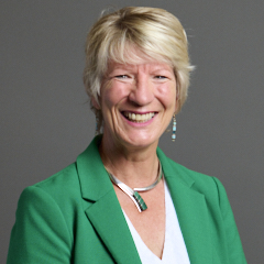
Pippa Heylings Contact Details Contact Pippa Heylings Political Party Liberal Democrat
Where can I find out where the nearest Library is?
Libraries are the responsibility of Cambridgeshire County Council
Visit the link for more information. Please note that some councils outsource library services to private companies and community groups ran by volunteers.
Libraries - Cambridgeshire County Council
House Sales
Yearly House Sales
Year High Low Average Sales 2016 £1,750,000 £1,750,000 £1,750,000 1 2018 £975,000 £975,000 £975,000 1 2021 £1,400,000 £1,400,000 £1,400,000 1
Contains HM Land Registry data © Crown copyright and database right 2025. This data is licensed under the Open Government Licence v3.0.
Local Postcodes
What Popular Supermarkets are near?
Popular Supermarkets near CB2 0QG Supermarket Distance Directions Sainsburys, Brooks Road, CAMBRIDGE, CB1 3HP 2.42 miles Directions to Sainsburys Waitrose, Hauxton Road, Trumpington, CAMBRIDGE, CB2 9FT 2.55 miles Directions to Waitrose Asda, Beehive Centre, Coldhams Lane, CAMBRIDGE, CB1 3ER 3.12 miles Directions to Asda Tesco, Yarrow Road, CAMBRIDGE, CB1 9BF 3.24 miles Directions to Tesco Lidl, Cambridge Retail Park, Newmarket Road, CAMBRIDGE, CB5 8WR 3.53 miles Directions to Lidl
What Popular Restaurants are near?
Burger King Restaurants near CB2 0QG Burger King Distance Directions Food Court, Hospital Main Concourse, Cambridge, CB2 0QQ 0.22 miles Directions to Food Court, Hospital Main Concourse Unit 3-4 Restwell House, Cambridge, CB1 3EW 2.13 miles Directions to Unit 3-4 Restwell House Fourwentways, A11, Fourwent Ways, Abington, CB21 6AP 4.88 miles Directions to Fourwentways, A11, Fourwent Ways Oaks Drive, Fordham Road, Newmarket, CB8 7SX 12.27 miles Directions to Oaks Drive, Fordham Road
Mcdonald's Restaurants near CB2 0QG Mcdonald's Distance Directions McDonald's, Rose Crescent, CAMBRIDGE, CB2 3LL 2.21 miles Directions to McDonald's, Rose Crescent, CAMBRIDGE, CB2 3LL McDonald's, Newmarket Road, CAMBRIDGE, CB5 8WL 2.56 miles Directions to McDonald's, Newmarket Road, CAMBRIDGE, CB5 8WL McDonald's, Pampisford, CAMBRIDGE, CB22 3HD 5.27 miles Directions to McDonald's, Pampisford, CAMBRIDGE, CB22 3HD McDonald's, Boxworth, CAMBRIDGE, CB23 4WU 8.98 miles Directions to McDonald's, Boxworth, CAMBRIDGE, CB23 4WU
KFC Restaurants near CB2 0QG Restaurant Distance Directions KFC, East Road, CAMBRIDGE, CB1 1BG 1.89 miles Directions to KFC Cambridge - East Road KFC, Boxworth, CAMBRIDGE, CB23 4WU 8.98 miles Directions to KFC Cambridge - A14 Services KFC, Lordscroft Lane, HAVERHILL, CB9 0ER 14.16 miles Directions to KFC Haverhill - Ehringhausen Way KFC, Downham Road, ELY, CB6 2SH 16.68 miles Directions to KFC Ely - Leisure Village KFC, Tower Fields, HUNTINGDON, PE29 7EG 18.15 miles Directions to KFC Huntingdon - Tower Field
| Street | Town | Locality | Distance (Miles) | Central Postcode | Directions on Google Maps |
|---|---|---|---|---|---|
| WULFSTAN WAY | CAMBRIDGE | 0.45 | CB1 8QJ | View on Google Maps | |
| CHERRY HINTON ROAD | CAMBRIDGE | 0.70 | CB1 7AJ | View on Google Maps | |
| CLIFTON WAY | CAMBRIDGE | 0.88 | CB1 7DY | View on Google Maps | |
| STATION ROAD | CAMBRIDGE | 1.20 | CB1 2GA | View on Google Maps |
| Nearest Town | Distance (Miles) | Direction | Bearing |
|---|---|---|---|
| Cambridge | 2.11 | NNW | 332.31 |
| Royston | 11.33 | SW | 217.71 |
| Saffron Walden | 11.50 | SSE | 158.32 |
| Newmarket | 12.04 | ENE | 67.65 |
| Soham | 13.50 | NE | 37.85 |
| Haverhill | 14.16 | ESE | 117.44 |
| Potton | 15.55 | WSW | 257.26 |
| Ely | 16.15 | NNE | 18.22 |
| Godmanchester | 16.66 | NW | 306.15 |
| Buntingford | 17.47 | SSW | 203.05 |
| Sandy | 18.65 | W | 259.75 |
| Stansted Mountfitchet | 19.08 | S | 173.50 |
Weather Forecast
Weather Forecast for Cambridge University Botanic Garden
| Time Period | Icon | Description | Temperature | Rain Probability | Wind |
|---|---|---|---|---|---|
| 06:00 to 09:00 | Overcast | 2.0°C (feels like 0.0°C) | 10.00% | S 4 mph | |
| 09:00 to 12:00 | Overcast | 2.0°C (feels like -1.0°C) | 10.00% | S 4 mph | |
| 12:00 to 15:00 | Overcast | 2.0°C (feels like 0.0°C) | 9.00% | S 4 mph | |
| 15:00 to 18:00 | Overcast | 3.0°C (feels like 1.0°C) | 8.00% | SSE 4 mph | |
| 18:00 to 21:00 | Overcast | 2.0°C (feels like 0.0°C) | 10.00% | SE 4 mph | |
| 21:00 to 00:00 | Overcast | 1.0°C (feels like -1.0°C) | 11.00% | S 4 mph |
| Time Period | Icon | Description | Temperature | Rain Probability | Wind |
|---|---|---|---|---|---|
| 00:00 to 03:00 | Overcast | 1.0°C (feels like -2.0°C) | 12.00% | SE 4 mph | |
| 03:00 to 06:00 | Overcast | 1.0°C (feels like -2.0°C) | 14.00% | WSW 4 mph | |
| 06:00 to 09:00 | Overcast | 1.0°C (feels like -2.0°C) | 14.00% | SSE 4 mph | |
| 09:00 to 12:00 | Overcast | 1.0°C (feels like -2.0°C) | 13.00% | SSW 7 mph | |
| 12:00 to 15:00 | Overcast | 2.0°C (feels like -1.0°C) | 14.00% | SSW 9 mph | |
| 15:00 to 18:00 | Overcast | 3.0°C (feels like 0.0°C) | 11.00% | SW 7 mph | |
| 18:00 to 21:00 | Overcast | 2.0°C (feels like 0.0°C) | 10.00% | S 4 mph | |
| 21:00 to 00:00 | Overcast | 3.0°C (feels like 0.0°C) | 10.00% | SSW 7 mph |
| Time Period | Icon | Description | Temperature | Rain Probability | Wind |
|---|---|---|---|---|---|
| 00:00 to 03:00 | Overcast | 3.0°C (feels like 0.0°C) | 10.00% | SSW 7 mph | |
| 03:00 to 06:00 | Overcast | 3.0°C (feels like 0.0°C) | 10.00% | SSW 7 mph | |
| 06:00 to 09:00 | Overcast | 4.0°C (feels like 1.0°C) | 12.00% | SSW 7 mph | |
| 09:00 to 12:00 | Overcast | 4.0°C (feels like 2.0°C) | 11.00% | SSW 7 mph | |
| 12:00 to 15:00 | Overcast | 6.0°C (feels like 4.0°C) | 11.00% | SSW 7 mph | |
| 15:00 to 18:00 | Overcast | 7.0°C (feels like 5.0°C) | 8.00% | SSW 7 mph | |
| 18:00 to 21:00 | Overcast | 5.0°C (feels like 3.0°C) | 9.00% | SSW 7 mph | |
| 21:00 to 00:00 | Overcast | 5.0°C (feels like 2.0°C) | 9.00% | SSW 7 mph |
| Time Period | Icon | Description | Temperature | Rain Probability | Wind |
|---|---|---|---|---|---|
| 00:00 to 03:00 | Overcast | 4.0°C (feels like 2.0°C) | 10.00% | S 7 mph | |
| 03:00 to 06:00 | Overcast | 4.0°C (feels like 1.0°C) | 10.00% | S 7 mph | |
| 06:00 to 09:00 | Cloudy | 3.0°C (feels like 0.0°C) | 8.00% | S 7 mph | |
| 09:00 to 12:00 | Cloudy | 3.0°C (feels like 0.0°C) | 8.00% | SSE 7 mph | |
| 12:00 to 15:00 | Cloudy | 5.0°C (feels like 3.0°C) | 6.00% | SSE 7 mph | |
| 15:00 to 18:00 | Cloudy | 6.0°C (feels like 4.0°C) | 7.00% | SSE 7 mph | |
| 18:00 to 21:00 | Cloudy | 4.0°C (feels like 1.0°C) | 7.00% | SE 7 mph | |
| 21:00 to 00:00 | Cloudy | 3.0°C (feels like 1.0°C) | 8.00% | SSE 7 mph |
What are the Broadband Speeds like?
Download Speeds
| Average Mbps | 56.400 |
|---|---|
| Median Mbps | 49.400 |
| Maximum Mbps | 107.000 |
CB2 0QG has an average download speed of 56.4 Megabits per second (Mbps).
1,503 other postcode units have the same broadband speed.
34% of postcodes (407,341) have slower broadband speeds.
65% of postcodes (775,797) have faster broadband speeds.
Upload Speeds
| Average Mbps | 11.700 |
|---|---|
| Median Mbps | 10.500 |
| Maximum Mbps | 20.000 |
CB2 0QG has an average upload speed of 11.7 Megabits per second (Mbps).
8,953 other postcode units have the same upload speed.
34% of postcodes (405,527) have slower upload speeds.
65% of postcodes (770,161) have faster upload speeds.
Schools within a five minute Drive
England Secondary Schools
St Bede's Inter-Church School
Address: St Bede's Inter-Church School, Birdwood Road, Cambridge, Cambridgeshire, CB1 3TD
Distance: 1.21 miles
Contact: 01223568816
Coleridge Community College
Address: Coleridge Community College, Radegund Road, Cambridge, Cambridgeshire, CB1 3RJ
Distance: 1.10 miles
Contact: 01223712300
Parkside Community College
Address: Parkside Community College, Parkside, Cambridge, Cambridgeshire, CB1 1EH
Distance: 1.93 miles
Contact: 01223712600
The Netherhall School
Address: The Netherhall School, Queen Edith's Way, Cambridge, Cambridgeshire, CB1 8NN
Distance: 0.95 miles
Contact: 01223242931
The Netherhall School
Address: The Netherhall School, Queen Edith's Way, Cambridge, Cambridgeshire, CB1 8NN
Distance: 0.95 miles
Contact:
Trumpington Community College
Address: Trumpington Community College, Lime Avenue, Cambridge, Cambridgeshire, CB2 9FD
Distance: 0.83 miles
Contact: 01223551600
Cambridge Academy for Science and Technology
Address: Cambridge Academy for Science and Technology, Robinson Way, Cambridge, Cambridgeshire, CB2 0SZ
Distance: 0.32 miles
Contact: 01223724300
England Primary Schools
Queen Emma Primary School
Address: Queen Emma Primary School, Gunhild Way, Cambridge, Cambridgeshire, CB1 8QY
Distance: 0.83 miles
Contact: 01223714300
Ridgefield Primary School
Address: Ridgefield Primary School, Radegund Road, Cambridge, CB1 3RL
Distance: 1.04 miles
Contact: 01223712418
St Philip's CofE Aided Primary School
Address: St Philip's CofE Aided Primary School, 2 Vinery Way, Cambridge, Cambridgeshire, CB1 3DR
Distance: 1.71 miles
Contact: 01223508707
Queen Edith Primary School
Address: Queen Edith Primary School, Godwin Way, Cambridge, Cambridgeshire, CB1 8QP
Distance: 0.56 miles
Contact: 01223712200
Morley Memorial Primary School
Address: Morley Memorial Primary School, Blinco Grove, Cambridge, Cambridgeshire, CB1 7TX
Distance: 0.61 miles
Contact: 01223508786
St Pauls CofE VA Primary School
Address: St Pauls CofE VA Primary School, Coronation Street, Cambridge, Cambridgeshire, CB2 1HJ
Distance: 1.46 miles
Contact: 01223568840
Trumpington Park Primary School
Address: Trumpington Park Primary School, Hobson Avenue, Trumpington, Trumpington, Cambridge, Cambridgeshire, CB2 9EG
Distance: 0.97 miles
Contact: 01223491660
Fawcett Primary School
Address: Fawcett Primary School, Alpha Terrace, Trumpington, Cambridge, Cambridgeshire, CB2 9FS
Distance: 1.04 miles
Contact: 01223840299
St Alban's Catholic Primary School
Address: St Alban's Catholic Primary School, Lensfield Road, Cambridge, Cambridgeshire, CB2 1EN
Distance: 1.60 miles
Contact: 01223712148
England Higher Schools
Hills Road Sixth Form College
Address: Hills Road Sixth Form College, Hills Road, Cambridge, Cambridgeshire, CB2 8PE
Distance: 0.77 miles
Contact: 01223247251
Long Road Sixth Form College
Address: Long Road Sixth Form College, Long Road, Cambridge, Cambridgeshire, CB2 8PX
Distance: 0.43 miles
Contact: 01223631100
Nearest Dentists
DEVONSHIRE HOUSE DENTAL PRACTICE
Address: 2 QUEEN EDITHS WAY, CAMBRIDGE, CAMBRIDGESHIRE, CB1 7PN
Distance: 0.15 miles
Contact: :
CAMBRIDGE ORTHODONTIC PRACTICE
Address: 43 LONG ROAD, CAMBRIDGE, CAMBRIDGESHIRE, CB2 8PP
Distance: 0.25 miles
Contact: :
THE GABLES DENTAL PRACTICE
Address: 332 CHERRY HINTON ROAD, CAMBRIDGE, CAMBRIDGESHIRE, CB1 8AZ
Distance: 0.74 miles
Contact: :
HOMERTON STREET (DENTAL SURGERY)
Address: 6 HOMERTON STREET, CAMBRIDGE, CB2 8NX
Distance: 0.85 miles
Contact: :
28 PORSON ROAD (DENTAL SURGERY)
Address: 28 PORSON ROAD, CAMBRIDGE, CAMBRIDGESHIRE, CB2 8EU
Distance: 0.92 miles
Contact: :
DENTAL SURGERY
Address: 97-99 BURNSIDE, CAMBRIDGE, CAMBRIDGESHIRE, CB1 3PA
Distance: 1.36 miles
Contact: :
Nearest Chemists
POLARIS PHARMACY
Address: 39 WULFSTAN COURT, WULFSTAN WAY, CAMBRIDGE, CB1 8RE
Distance: 0.47 miles
Contact: tel: 01223 242687
NUMARK PHARMACY
Address: 102 CHERRY HINTON ROAD, CAMBRIDGE, CB1 7AJ
Distance: 0.70 miles
Contact: tel: 01223 517073
WELFARE PHARMACY
Address: UNIT 1 HOBSON SQUARE, HOBSON AVENUE, TRUMPINGTON, CAMBRIDGE, CB2 9FN
Distance: 0.91 miles
Contact: tel: 01223 841109
WELL
Address: 183 MILL ROAD, CAMBRIDGE, CB1 3AN
Distance: 1.36 miles
Contact: tel: 01223 210662
CHERRY HINTON PHARMACY
Address: 39A HIGH STREET, CHERRY HINTON, CAMBRIDGE, CB1 9HX
Distance: 1.42 miles
Contact: tel: 01223 246535
GFT DAVIES & CO.
Address: 50 HILLS ROAD, CAMBRIDGE, CAMBRIDGESHIRE, CB2 1LA
Distance: 1.43 miles
Contact: tel: 01223 352086
Nearest Opticians
D H THOMAS OPTOMETRISTS
Address: 162 HILLS ROAD, CAMBRIDGE, CAMBRIDGESHIRE, CB2 8PB
Distance: 0.83 miles
Contact: :
CAMBRIDGE EYE CARE OPTICIANS - CHERRY HINTON
Address: 102 HIGH STREET, CHERRY HINTON, CAMBRIDGE, CAMBRIDGESHIRE, CB1 9HT
Distance: 1.50 miles
Contact: :
TAANK OPTOMETRISTS (MILL ROAD)
Address: 92A MILL ROAD, CAMBRIDGE, CAMBRIDGESHIRE, CB1 2BD
Distance: 1.52 miles
Contact: :
ANGLIA RUSKIN UNIVERSITY OPTOMETRY CLINIC
Address: EAST ROAD, CAMBRIDGE, CAMBRIDGESHIRE, CB1 1PT
Distance: 1.80 miles
Contact: :
CLAMP OPTOMETRISTS
Address: 7 ST. ANDREWS STREET, CAMBRIDGE, CAMBRIDGESHIRE, CB2 3AX
Distance: 2.03 miles
Contact: :
VISION EXPRESS (CAMBRIDGE)
Address: THE LION YARD SHOPPING CENTRE, ST. TIBBS ROW, CAMBRIDGE, CAMBRIDGESHIRE, CB2 3ET
Distance: 2.07 miles
Contact: :
Nearest GP Surgeries
STAFF HEALTH CENTRE - BRANCH OF PETERSFIELD MEDICAL PRACTICE
Address: DUXFORD HOUSE, ADRIAN WAY, ADDENBROOKES HOSPITAL, CAMBRIDGE, CAMBRIDGESHIRE, CB2 0SE
Distance: 0.19 miles
Contact: :
QUEEN EDITH MEDICAL PRACTICE
Address: QUEEN EDITH MEDICAL CENTRE, 59 QUEEN EDITHS WAY, CAMBRIDGE, CAMBRIDGESHIRE, CB1 8PJ
Distance: 0.35 miles
Contact: tel: 01223 247288
CORNFORD HOUSE SURGERY - COVID LOCAL VACCINATION SERVICE 3
Address: 364 CHERRY HINTON ROAD, CAMBRIDGE, CB1 8BA
Distance: 0.81 miles
Contact: :
CORNFORD HOUSE SURGERY
Address: 364 CHERRY HINTON ROAD, CAMBRIDGE, CAMBRIDGESHIRE, CB1 8BA
Distance: 0.81 miles
Contact: tel: 01223 247505
TRUMPINGTON MEDICAL PRACTICE AT CLAY FARM
Address: THE CLAY FARM CENTRE, HOBSON SQUARE, HOBSON AVENUE, TRUMPINGTON, CAMBRIDGE, CAMBRIDGESHIRE, CB2 9FN
Distance: 0.91 miles
Contact: :
CHERRY HINTON
Address: 204 HIGH STREET, CAMBRIDGE, CAMBRIDGESHIRE, CB1 9JB
Distance: 1.24 miles
Contact: tel: 01223 414444
Transport Links
Train Stations
Shelford (Cambs)
Address: Shelford station, Station Road, Shelford, Cambridgeshire, CB22 5LR
Postcode: CB22 5LR
Line: West Anglia Main Line
Company: Greater Anglia
Time: within five minutes drive
Distance: 2.01 miles
Cambridge
Address: Cambridge station, Station Road, Cambridge, Cambridgeshire, CB1 2JW
Postcode: CB1 2JW
Line: West Anglia Main Line|Cambridge line|Ipswich to Ely Line|Fen Line
Company: Greater Anglia
Time: within five minutes drive
Distance: 1.18 miles
Cambridge North
Address: Cambridge North Station, Cowley Road, Cambridge, Cambridgeshire, CB4 0WZ
Postcode: CB4 0WZ
Line: Ipswich to Ely Line|Fen Line
Company: Greater Anglia
Time: within fifteen minutes drive
Distance: 3.48 miles
Whittlesford Parkway
Address: Whittlesford Parkway station, Station Road, Whittlesford, Cambridgeshire, CB22 4NL
Postcode: CB22 4NL
Line: West Anglia Main Line
Company: Greater Anglia
Time: within fifteen minutes drive
Distance: 5.22 miles
Waterbeach
Address: Waterbeach station, Station Road, Waterbeach, Cambridgeshire, CB25 9HT
Postcode: CB25 9HT
Line: Ipswich to Ely Line|Fen Line
Company: Govia Thameslink Railway (Great Northern)
Time: within fifteen minutes drive
Distance: 6.29 miles
Foxton
Address: Foxton station, Royston Road, Foxton, Cambridgeshire, CB22 6SE
Postcode: CB22 6SE
Line: Cambridge line
Company: Govia Thameslink Railway (Great Northern)
Time: within fifteen minutes drive
Distance: 5.46 miles
Shepreth
Address: Shepreth station, Station Road, Shepreth, Cambridgeshire, SG8 6JP
Postcode: SG8 6JP
Line: Cambridge line
Company: Govia Thameslink Railway (Great Northern)
Time: within fifteen minutes drive
Distance: 6.46 miles
Great Chesterford
Address: Great Chesterford station, Station Road, Great Chesterford, Essex, CB10 1NY
Postcode: CB10 1NY
Line: West Anglia Main Line
Company: Greater Anglia
Time: within fifteen minutes drive
Distance: 8.43 miles
Distances are as the crow flies.
Motorway Junctions
Distances represent the quickest route by car.
Who are my Elected Representatives?
| Westminster Constituency | South Cambridgeshire |
|---|---|
| Member or Parliament | |
| Contact Details | Contact Pippa Heylings |
| Political Party | Liberal Democrat |
Where can I find out where the nearest Library is?
Libraries are the responsibility of Cambridgeshire County Council
Visit the link for more information. Please note that some councils outsource library services to private companies and community groups ran by volunteers.
Libraries - Cambridgeshire County CouncilHouse Sales
| Year | High | Low | Average | Sales |
|---|---|---|---|---|
| 2016 | £1,750,000 | £1,750,000 | £1,750,000 | 1 |
| 2018 | £975,000 | £975,000 | £975,000 | 1 |
| 2021 | £1,400,000 | £1,400,000 | £1,400,000 | 1 |
Contains HM Land Registry data © Crown copyright and database right 2025. This data is licensed under the Open Government Licence v3.0.
Local Postcodes
What Popular Supermarkets are near?
| Supermarket | Distance | Directions |
|---|---|---|
| Sainsburys, Brooks Road, CAMBRIDGE, CB1 3HP | 2.42 miles | Directions to Sainsburys |
| Waitrose, Hauxton Road, Trumpington, CAMBRIDGE, CB2 9FT | 2.55 miles | Directions to Waitrose |
| Asda, Beehive Centre, Coldhams Lane, CAMBRIDGE, CB1 3ER | 3.12 miles | Directions to Asda |
| Tesco, Yarrow Road, CAMBRIDGE, CB1 9BF | 3.24 miles | Directions to Tesco |
| Lidl, Cambridge Retail Park, Newmarket Road, CAMBRIDGE, CB5 8WR | 3.53 miles | Directions to Lidl |
What Popular Restaurants are near?
| Burger King | Distance | Directions |
|---|---|---|
| Food Court, Hospital Main Concourse, Cambridge, CB2 0QQ | 0.22 miles | Directions to Food Court, Hospital Main Concourse |
| Unit 3-4 Restwell House, Cambridge, CB1 3EW | 2.13 miles | Directions to Unit 3-4 Restwell House |
| Fourwentways, A11, Fourwent Ways, Abington, CB21 6AP | 4.88 miles | Directions to Fourwentways, A11, Fourwent Ways |
| Oaks Drive, Fordham Road, Newmarket, CB8 7SX | 12.27 miles | Directions to Oaks Drive, Fordham Road |
| Mcdonald's | Distance | Directions |
|---|---|---|
| McDonald's, Rose Crescent, CAMBRIDGE, CB2 3LL | 2.21 miles | Directions to McDonald's, Rose Crescent, CAMBRIDGE, CB2 3LL |
| McDonald's, Newmarket Road, CAMBRIDGE, CB5 8WL | 2.56 miles | Directions to McDonald's, Newmarket Road, CAMBRIDGE, CB5 8WL |
| McDonald's, Pampisford, CAMBRIDGE, CB22 3HD | 5.27 miles | Directions to McDonald's, Pampisford, CAMBRIDGE, CB22 3HD |
| McDonald's, Boxworth, CAMBRIDGE, CB23 4WU | 8.98 miles | Directions to McDonald's, Boxworth, CAMBRIDGE, CB23 4WU |
| Restaurant | Distance | Directions |
|---|---|---|
| KFC, East Road, CAMBRIDGE, CB1 1BG | 1.89 miles | Directions to KFC Cambridge - East Road |
| KFC, Boxworth, CAMBRIDGE, CB23 4WU | 8.98 miles | Directions to KFC Cambridge - A14 Services |
| KFC, Lordscroft Lane, HAVERHILL, CB9 0ER | 14.16 miles | Directions to KFC Haverhill - Ehringhausen Way |
| KFC, Downham Road, ELY, CB6 2SH | 16.68 miles | Directions to KFC Ely - Leisure Village |
| KFC, Tower Fields, HUNTINGDON, PE29 7EG | 18.15 miles | Directions to KFC Huntingdon - Tower Field |