A wide range of spatial data has been analysed to present this overview of the BS15 3 Postcode sector. If you would like anything added, please contact us.
The BS15 3 postcode sector lies where the three counties of Gloucestershire, Somerset, and Bristol meet.
Did you know? According to the 2021 Census, the BS15 3 postcode sector is home to a bustling 9,552 residents!
Given that each sector allows for 400 unique postcode combinations. Letters C, I, K, M, O and V are not allowed in the last two letters of a postcode. With 230 postcodes already in use, this leaves 170 units available.
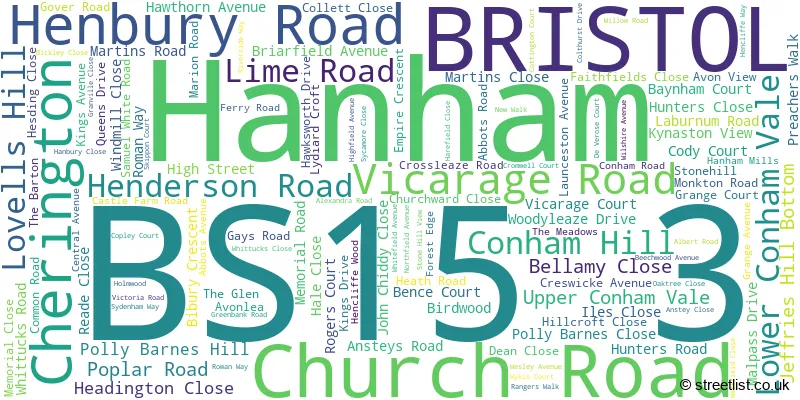
The largest settlements in the BS15 3 postal code are Hanham and BRISTOL.
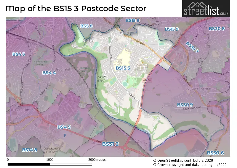
The BS15 3 Postcode shares a border with BS4 4 (BRISTOL, St. Annes Park, Brislington), BS30 9 (Longwell Green, Oldland Common, BRISTOL), BS31 2 (Keynsham), BS5 8 (BRISTOL, St. George), BS15 8 (BRISTOL, Kingswood, Hanham), BS15 9 (BRISTOL, Kingswood, Hanham) and BS30 7 (Barrs Court, Longwell Green, BRISTOL).
Map of the BS15 3 Postcode Sector
Explore the BS15 3 postcode sector by using our interactive map.
The sector is within the post town of BRISTOL.
BS15 3 is a postcode sector within the BS15 postcode district which is within the BS Bristol postcode area.
The Royal Mail delivery office for the BS15 3 postal sector is the Kingswood Delivery Office.
The area of the BS15 3 postcode sector is 1.44 square miles which is 3.72 square kilometres or 920.41 square acres.
Waterways within the BS15 3 postcode sector include the River Avon.
Your support helps keep this site running!
If you enjoy using this website, consider buying me a coffee to help cover hosting costs.

| B | S | 1 | 5 | - | 3 | X | X |
| B | S | 1 | 5 | Space | 3 | Letter | Letter |
Official List of Streets
Hanham (110 Streets)
BRISTOL (12 Streets)
(7 Streets)
Unofficial Streets or Alternative Spellings
Hanham
CHAPEL ROAD KINGSFIELD LANE LOWER CHAPEL ROAD LOWER HANHAM ROAD TABERNACLE ROAD TUDOR ROAD AVON VALLEY WOODLANDS LNR BRYANTS HILL CONHAM VALE CREWS HOLE ROAD DANESBURY HUNDRED STEPS JEFFERIES HILL BOTTOM MAYPOLE COURT OAK TREE CLOSE OLD SMITHS YARD RING ROAD PATH RIVERSIDE COTTAGES SHIP HILLLongwell Green
ALDERMOOR WAY COURT FARM ROADBRISTOL
BULL LANEWeather Forecast for BS15 3
Weather Forecast for Crew's Hole
| Time Period | Icon | Description | Temperature | Rain Probability | Wind |
|---|---|---|---|---|---|
| 09:00 to 12:00 | Cloudy | 4.0°C (feels like 1.0°C) | 5.00% | SSE 9 mph | |
| 12:00 to 15:00 | Cloudy | 7.0°C (feels like 4.0°C) | 5.00% | S 9 mph | |
| 15:00 to 18:00 | Partly cloudy (day) | 8.0°C (feels like 5.0°C) | 2.00% | S 7 mph | |
| 18:00 to 21:00 | Cloudy | 6.0°C (feels like 4.0°C) | 6.00% | S 4 mph | |
| 21:00 to 00:00 | Partly cloudy (night) | 5.0°C (feels like 3.0°C) | 3.00% | SSE 7 mph |
| Time Period | Icon | Description | Temperature | Rain Probability | Wind |
|---|---|---|---|---|---|
| 00:00 to 03:00 | Overcast | 5.0°C (feels like 3.0°C) | 9.00% | S 4 mph | |
| 03:00 to 06:00 | Overcast | 5.0°C (feels like 3.0°C) | 9.00% | S 7 mph | |
| 06:00 to 09:00 | Overcast | 5.0°C (feels like 3.0°C) | 9.00% | S 7 mph | |
| 09:00 to 12:00 | Overcast | 6.0°C (feels like 3.0°C) | 9.00% | S 7 mph | |
| 12:00 to 15:00 | Cloudy | 9.0°C (feels like 6.0°C) | 5.00% | S 9 mph | |
| 15:00 to 18:00 | Cloudy | 9.0°C (feels like 7.0°C) | 6.00% | SSW 11 mph | |
| 18:00 to 21:00 | Cloudy | 8.0°C (feels like 5.0°C) | 5.00% | S 11 mph | |
| 21:00 to 00:00 | Cloudy | 7.0°C (feels like 4.0°C) | 5.00% | S 11 mph |
| Time Period | Icon | Description | Temperature | Rain Probability | Wind |
|---|---|---|---|---|---|
| 00:00 to 03:00 | Cloudy | 7.0°C (feels like 4.0°C) | 5.00% | S 11 mph | |
| 03:00 to 06:00 | Cloudy | 7.0°C (feels like 4.0°C) | 6.00% | S 11 mph | |
| 06:00 to 09:00 | Cloudy | 7.0°C (feels like 4.0°C) | 7.00% | S 11 mph | |
| 09:00 to 12:00 | Cloudy | 8.0°C (feels like 5.0°C) | 11.00% | S 13 mph | |
| 12:00 to 15:00 | Light rain | 10.0°C (feels like 7.0°C) | 53.00% | SSW 16 mph | |
| 15:00 to 18:00 | Heavy rain | 10.0°C (feels like 7.0°C) | 81.00% | SW 13 mph | |
| 18:00 to 21:00 | Light rain shower (night) | 9.0°C (feels like 6.0°C) | 39.00% | WSW 11 mph | |
| 21:00 to 00:00 | Clear night | 7.0°C (feels like 5.0°C) | 8.00% | WSW 9 mph |
| Time Period | Icon | Description | Temperature | Rain Probability | Wind |
|---|---|---|---|---|---|
| 00:00 to 03:00 | Clear night | 6.0°C (feels like 3.0°C) | 3.00% | W 7 mph | |
| 03:00 to 06:00 | Clear night | 4.0°C (feels like 2.0°C) | 2.00% | W 7 mph | |
| 06:00 to 09:00 | Clear night | 3.0°C (feels like 1.0°C) | 1.00% | WNW 4 mph | |
| 09:00 to 12:00 | Cloudy | 4.0°C (feels like 2.0°C) | 5.00% | NW 4 mph | |
| 12:00 to 15:00 | Cloudy | 7.0°C (feels like 6.0°C) | 4.00% | NW 4 mph | |
| 15:00 to 18:00 | Cloudy | 8.0°C (feels like 7.0°C) | 4.00% | NNW 4 mph | |
| 18:00 to 21:00 | Cloudy | 5.0°C (feels like 4.0°C) | 5.00% | N 4 mph | |
| 21:00 to 00:00 | Partly cloudy (night) | 4.0°C (feels like 2.0°C) | 2.00% | E 4 mph |
Schools and Places of Education Within the BS15 3 Postcode Sector
Christ Church Hanham CofE Primary School
Voluntary controlled school
Memorial Road, Bristol, , BS15 3LA
Head: Mr Neil McKellar-Turner
Ofsted Rating: Good
Inspection: 2023-06-07 (606 days ago)
Website: Visit Christ Church Hanham CofE Primary School Website
Phone: 01454867145
Number of Pupils: 287
Hanham Woods Academy
Academy sponsor led
Memorial Road, Bristol, Bristol, BS15 3LA
Head: Mr Steve O'Callaghan
Ofsted Rating: Good
Inspection: 2019-11-14 (1907 days ago)
Website: Visit Hanham Woods Academy Website
Phone: 01174408900
Number of Pupils: 803
House Prices in the BS15 3 Postcode Sector
| Type of Property | 2018 Average | 2018 Sales | 2017 Average | 2017 Sales | 2016 Average | 2016 Sales | 2015 Average | 2015 Sales |
|---|---|---|---|---|---|---|---|---|
| Detached | £376,770 | 23 | £379,020 | 25 | £336,981 | 27 | £377,896 | 24 |
| Semi-Detached | £298,623 | 59 | £289,268 | 49 | £262,469 | 46 | £267,863 | 43 |
| Terraced | £266,310 | 47 | £263,706 | 41 | £234,943 | 50 | £257,396 | 56 |
| Flats | £159,192 | 13 | £178,270 | 20 | £142,310 | 25 | £148,063 | 35 |
Important Postcodes BS15 3 in the Postcode Sector
BS15 3EJ is the postcode for South Gloucestershire Council, Hanham Library, High Street
BS15 3HY is the postcode for Hanham Surgery, 33 Whittucks Road
BS15 3LA is the postcode for HUMANITIES, Hanham Woods Academy, Memorial Road, SCIENCE BLOCK, Hanham Woods Academy, Memorial Road, ADMIN BLOCK, Hanham Woods Academy, Memorial Road, POST 16 CENTRE, Hanham Woods Academy, Memorial Road, Christ Church Hanham C of E Primary School, Memorial Road, and SPORTS HALL, Hanham Woods Academy, Memorial Road
BS15 3PN is the postcode for GROMT BLOCK, Hanham Abbots Junior School, Abbots Avenue, Samuel White's Infant School, Abbots Avenue, and Hanham Abbots Junior School, Abbots Avenue
BS15 3QA is the postcode for Avon & Wiltshire Mental Health Partnership NHS Trust, 37 Whittucks Road, Avon and Wiltshire Mental Health Partnership NHS Trust, and Avon and Wiltshire Mental Health Partnership NHS Trust, 37 Whittucks Road
| The BS15 3 Sector is within these Local Authorities |
|
|---|---|
| The BS15 3 Sector is within these Counties |
|
| The BS15 3 Sector is within these Water Company Areas |
|