Clayton Hill is a street located in the village of Clayton and near the village of Pyecombe. The street has a length of approximately 1,459 metres.
The street is publicly maintained which means that the road is adopted and West Sussex is responsible for the repair and upkeep of the highway.
The street is located within the Mid Sussex District Council's jurisdiction. They provide various services, like refuse collection, and manage council tax collection. It's situated in the South East region of the UK.
The road has been assigned the Unique Street Reference Number of 25600110 and 25600109 in the National Street Gazetteer.
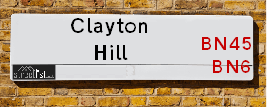
The street has the postcodes of BN6 9PQ and BN45 7FF.
It is located within the county of West Sussex, situated in the South East region of the UK. It's 41.22 miles South from central London., 5.75 miles North from Brighton, 7.86 miles West from Lewes and 27.57 miles East from Chichester.
CLAYTON HILL is within the Post Town of HASSOCKS
Moving to Clayton Hill?
I can help you uncover potential pitfalls and provide key questions to ask about your new property. With decades of experience as a Local Land Charges Manager, I offer confidential insights to make your move informed and stress-free.
This service is free, but you may wish to make an optional donation to support it. Please include the property name and address in your request as well as anything you wish to focus on.
Contact Me
Do you know why this road is called Clayton Hill?
What's it like to live here?
Ask the community a question.
Do you have any questions, memories to share or know any facts? We'd love to know more.
Map of Clayton Hill
| Street Crime (updated 02/11/2024) | ||
|---|---|---|
| Location Note | Central Point of Street - Not Actual Location | |
| MSOA Info | For MSOAs E02006619, E02006620 (Statistical Neighbourhood) | |
| Click Hint | Click on a Circle for a detailed breakdown below map. | |
| Crime Levels |
Green = Very Low Yellow = Low Orange = High Red = Very High |
|
| Postcodes | ||
| Icon | Postcodes for Clayton Hill | |
| Walking Distances | ||
| Distance Info | Green Circle = 10 Minutes Walk (800 metres) | |
Street Crime Data accessed from data.police.uk on 06/10/2024.
Budget Friendly Hotels near Clayton Hill
| Budget Hotel Name | Distance (miles) |
|---|---|
|
1: Name:Premier Inn Burgess Hill Address: Charles Avenue, Burgess Hill Telephone: Visit Hotel Page |
3.26 |
|
2: Name:Travelodge Hickstead Address: A23, Jobs Lane, Nr Burgess Hill Hickstead, RH17 5NZ Telephone: 0871 984 6038 Visit Hotel Page |
4.60 |
|
3: Name:Travelodge Brighton Address: 165-167 Preston Rd, Brighton, BN1 6AU Telephone: 0871 984 6017 Visit Hotel Page |
4.62 |
|
4: Name:Premier Inn Brighton City Centre Address: 144 North Street Telephone: Visit Hotel Page |
5.64 |
|
5: Name:Travelodge Brighton Seafront Address: West St, Brighton, BN1 2RE Telephone: 0871 984 6405 Visit Hotel Page |
5.75 |
Hotel Options
Your support helps keep this site running!
If you enjoy using this website, consider buying me a coffee to help cover hosting costs.
EPC (Energy Performance Certificate) Information for Clayton Hill
UPRN: 100061858607
EPC Current: G
EPC Potential: F
Habitable Rooms: 7
Property Type: House
Tenure: Owner-occupied
Built Form: Detached
Age Band: 1950-1966
Mains Gas: No
UPRN: 100061858607
EPC Current: G
EPC Potential: F
Habitable Rooms: 7
Property Type: House
Tenure: Owner-occupied
Built Form: Detached
Age Band: 1950-1966
Mains Gas: No
UPRN: 10070643768
EPC Current: D
EPC Potential: B
Habitable Rooms: 6
Property Type: House
Tenure: Owner-occupied
Built Form: Detached
Age Band: 1950-1966
Mains Gas: No
UPRN: 10070643768
EPC Current: D
EPC Potential: B
Habitable Rooms: 6
Property Type: House
Tenure: Owner-occupied
Built Form: Detached
Age Band: 1950-1966
Mains Gas: No
UPRN: 100061858611
EPC Current: F
EPC Potential: B
Habitable Rooms: 4
Property Type: House
Tenure: Owner-occupied
Built Form: Detached
Age Band: before 1900
Mains Gas: No
UPRN: 100061858611
EPC Current: F
EPC Potential: B
Habitable Rooms: 4
Property Type: House
Tenure: Owner-occupied
Built Form: Detached
Age Band: before 1900
Mains Gas: No
Nearby Estate Agents
| Name | Address | Website |
|---|---|---|
| Marchants | 1 Keymer Road, Hassocks, BN6 8AE | Visit Website |
| Stuart & Partners | 38 Keymer Road, Hassocks, West Sussex BN6 8AJ | Visit Website |
| Mansell McTaggart | 29 Keymer Road, Hassocks, BN6 8AB | Visit Website |
| Mishon Mackay | 106 High Street, Hurstpierpoint, BN6 9PX | Visit Website |
| Chatt Estates | 133 High Street, Hurstpierpoint, BN6 9PU | Visit Website |
Neighbourhood Policing |
| Police Force: Sussex |
 View Neighbourhood Crime and Policing View Neighbourhood Crime and Policing |
| Find a Local Neighbourhood Watch Scheme |
Location Details
| Clayton Hill | |
|---|---|

| |
| Latitude | 50.904345 |
| Longitude | -0.156418 |
| OS Easting (X): | 529612 |
| OS Northing (Y): | 113332 |
| OS Grid Reference: | TQ296133 |
Roads that have a Junction with Clayton Hill
| Street | Junction Type |
|---|---|
| Mill Lane | junction |
| Underhill Lane | junction |
| New Road (B2112) | junction |
Sunset and Sunrise times
| Sunrise | 07:57 |
|---|---|
| Sunset | 15:57 |
Latest Weather Conditions
| Observed at Weather Station: | Shoreham 18 December 2024 at 23:00 (7.57 miles away) |
|---|---|
| Current Weather: | Clear night |
| Temperature and Humidity: | 12.9°C (94.9%) |
| Wind Direction and Speed: | SW (24 mph) |
Population Statistics
| ONS Area Code | E00162005 & E00161868 |
|---|---|
| ONS Area Name | Rural White-Collar Workers & Established Farming Communities |
| Average Age | 43.55 & 46.64 |
| Area Population | 1666.00 & 1329.00 |
| Male Population | 805.00 & 652.00 (49%) |
| Female Population | 861.00 & 677.00 (51%) |
| Benefit Claimants | 9 & 5 (0%) |
| LSOA Code: | E01031770 &E01031748 |
|---|---|
| LSOA Name: | Mid Sussex 016D &Mid Sussex 017E |
| SOA Code: | 2b &8a |
| SOA Name: | |
| MSOA Code: | E02006619 &E02006620 |
| MSOA Name: | Mid Sussex 016 &Mid Sussex 017 |
Nearest Supermarkets
| Sainsburys Hassocks Keymer Road Local |
|---|
| 22 - 24 Keymer Road, Hassocks, England, BN6 8AN |
| 1273842430 |
| Distance: 1.49 Miles |
| Directions to Sainsburys Hassocks Keymer Road Local |
| Asda Brighton Hollingbury |
|---|
| Unit 1 Crowhurst Road, off Carden Avenue, Brighton, BN1 8AS |
| 01273 541166 |
| Distance: 2.87 Miles |
| Directions to Asda Brighton Hollingbury |
| Sainsburys Brighton Carden Avenue Local |
|---|
| 189 Carden Avenue, Brighton, England, BN1 8LE |
| 1273559954 |
| Distance: 3.05 Miles |
| Directions to Sainsburys Brighton Carden Avenue Local |
| Tesco Burgess Hill Superstore |
|---|
| Hammonds Farm, Jane Murray Way, Burgess Hill, RH15 9QT |
| 0345 677 9093 |
| Distance: 3.21 Miles |
| Directions to Tesco Burgess Hill Superstore |
Telephone Information
| Area Code |
|---|
| Area Code: 01273 - Brighton |
| Area Code: 01444 - Haywards Heath |
Local Government
| Local Council Details |
|---|
| Within the area of Mid Sussex |
| Visit the Council's Website |
| Oaklands, Oaklands Road, Haywards Heath, West Sussex &RH16 1SS |
| Send email |
| Telephone Number: 01444 458 166 |
| Local Member of Parliament |
|---|
| Within the Westminster Parliamentary Constituency of Arundel and South Downs |
| The Member of Parliament is Alison Bennett |
| Details for the MP Alison Bennett on parliament.uk |
| Details for the MP Alison Bennett on theyworkforyou.com |
| In the 2024 General Election Alison Bennett won with a majority of 6,662 the result was LD gain from Con. The total electorate was 75,969 |
Nearest Schools
England Primary Schools
Ditchling (St Margaret's) Church of England Primary School
Address: Ditchling (St Margaret's) Church of England Primary School, Lewes Road, Ditchling, East Sussex, BN6 8TU
Distance: 2.22 miles
Contact:
The Windmills Junior School
Address: The Windmills Junior School, Dale Avenue, Hassocks, West Sussex, BN6 8LS
Distance: 1.42 miles
Contact: 01273842421
Hassocks Infant School
Address: Hassocks Infant School, Chancellors Park, Hassocks, West Sussex, BN6 8EY
Distance: 1.63 miles
Contact: 01273842549
Patcham Junior School
Address: Patcham Junior School, Ladies Mile Road, Patcham, Brighton, East Sussex, BN1 8TA
Distance: 2.83 miles
Contact: 01273087513
England Secondary Schools
Downlands Community School
Address: Downlands Community School, Dale Avenue, Hassocks, West Sussex, BN6 8LP
Distance: 1.46 miles
Contact: 01273845892
Nearest Hospitals
| Mill View Hospital |
|---|
| Address: Nevill Avenue, Hove, |
| NHS Sector |
| Sussex Partnership NHS Foundation Trust |
| Telephone: 01273 621984 |
| Visit Hospital Website |
| Distance: 7.31 (miles) |
| Directions from to Mill View Hospital |
| The Montefiore Hospital |
|---|
| Address: 2 Montefiore Road, Hove, BN3 1RD, |
| Independent Sector |
| Spire Healthcare |
| Telephone: 01273 828 120 |
| Visit Hospital Website |
| Distance: 8.06 (miles) |
| Directions from to The Montefiore Hospital |
| Aldrington Centre |
|---|
| Address: 35 New Church Road, Aldrington Centre, Hove, BN3 4AG, |
| NHS Sector |
| Sussex Partnership NHS Foundation Trust |
| Telephone: 01273 718680 |
| Visit Hospital Website |
| Distance: 8.47 (miles) |
| Directions from to Aldrington Centre |
Nearest Dentists
Dentists
DENTAL SURGERY
Address: 54A KEYMER ROAD, HASSOCKS, WEST SUSSEX, BN6 8AR
Distance: 1.52 miles
Contact: :
DENTAL SURGERY
Address: 74 OLD LONDON ROAD, BRIGHTON, EAST SUSSEX, BN1 8XQ
Distance: 2.94 miles
Contact: :
DENTAL SURGERY
Address: 54 ELDRED AVENUE, BRIGHTON, EAST SUSSEX, BN1 5EG
Distance: 3.21 miles
Contact: :
BURGESS HILL DENTAL CARE CENTRE
Address: 75 STATION ROAD, BURGESS HILL, WEST SUSSEX, RH15 9DY
Distance: 3.59 miles
Contact: :
DR SACHIN ANAND AND ASSOCIATES
Address: 69 STATION ROAD, BURGESS HILL, WEST SUSSEX, RH15 9DY
Distance: 3.59 miles
Contact: :
THE DENTAL SURGERY
Address: 73 STATION ROAD, BURGESS HILL, WEST SUSSEX, RH15 9DY
Distance: 3.59 miles
Contact: :
Nearest GP Surgeries
Doctors
HASSOCKS HEALTH CENTRE
Address: HASSOCKS HEALTH CENTRE, WINDMILL AVENUE, HASSOCKS, WEST SUSSEX, BN6 8LY
Distance: 1.42 miles
Contact: tel: 01273 844242
DITCHLING HEALTH CENTRE
Address: LEWES ROAD, DITCHLING, HASSOCKS, WEST SUSSEX, BN6 8TT
Distance: 2.18 miles
Contact: :
MID SUSSEX HEALTH CARE
Address: THE HEALTH CENTRE, TRINITY ROAD, HURSTPIERPOINT, HASSOCKS, WEST SUSSEX, BN6 9UQ
Distance: 2.19 miles
Contact: tel: 01273 834388
CARDEN SURGERY
Address: COUNTY OAK MEDICAL CENTRE, CARDEN HILL, BRIGHTON, EAST SUSSEX, BN1 8DD
Distance: 3.19 miles
Contact: tel: 01273 500155
WARMDENE SURGERY
Address: COUNTY OAK MEDICAL CENTRE, CARDEN HILL, BRIGHTON, EAST SUSSEX, BN1 8DD
Distance: 3.19 miles
Contact: tel: 01273 508811
THE DENEWAY SURGERY
Address: LIONSDENE, 11 THE DENEWAY, BRIGHTON, EAST SUSSEX, BN1 8QR
Distance: 3.30 miles
Contact: tel: 01273 540490
Nearest Dispensing Chemists
Pharmacies
DAY LEWIS PHARMACY
Address: 12 ORION PARADE, HASSOCKS, WEST SUSSEX, BN6 8QA
Distance: 1.51 miles
Contact: tel: 01273 844254
BOOTS
Address: 35 KEYMER ROAD, HASSOCKS, WEST SUSSEX, BN6 8AG
Distance: 1.54 miles
Contact: tel: 01273 843168
HURST PHARMACY
Address: 86-88 HIGH STREET, HURSTPIERPOINT, HASSOCKS, BN6 9PX
Distance: 2.10 miles
Contact: tel: 01273 832244
DITCHLING PHARMACY
Address: 2 SOUTH STREET, DITCHLING, HASSOCKS, BN6 8UQ
Distance: 2.12 miles
Contact: tel: 01273 842660
PATCHAM PHARMACY
Address: 37 LADIES MILE ROAD, PATCHAM, BRIGHTON, EAST SUSSEX, BN1 8TA
Distance: 2.83 miles
Contact: tel: 01273 553628
ASDA PHARMACY
Address: CROWHURST ROAD, BRIGHTON, EAST SUSSEX, BN1 8AS
Distance: 2.89 miles
Contact: tel: 01273 560310
Nearest Opticians
Opticians
HASSOCKS (KEYMER ROAD)
Address: 17 KEYMER ROAD, HASSOCKS, BN6 8AD
Distance: 1.51 miles
Contact: :
4646 BRIGHTON HOLLINGBURY
Address: ASDA STORES LTD, 1 CROWHURST ROAD, HOLLINGBURY, BRIGHTON, EAST SUSSEX, BN1 8AS
Distance: 2.89 miles
Contact: :
HASSAM LTD T/A EARLY AND EDMONDS
Address: 7 KEYMER PARADE, KEYMER ROAD, BURGESS HILL, WEST SUSSEX, RH15 0AB
Distance: 3.62 miles
Contact: :
EYES AT HOME (HOVE)
Address: 87 WOODLAND AVENUE, HOVE, EAST SUSSEX, BN3 6BJ
Distance: 3.65 miles
Contact: :
BOOTS OPTICIANS (BURGESS HILL)
Address: 22-22A MARKET PLACE, THE MARTLETS, BURGESS HILL, WEST SUSSEX, RH15 9NP
Distance: 3.67 miles
Contact: :
VISION EXPRESS (BURGESS HILL)
Address: 35 CHURCH ROAD, BURGESS HILL, RH15 9BB
Distance: 3.69 miles
Contact: :
Transport
Nearest Rail Stations
Hassocks Station is 1.47 miles away.
Address: Hassocks station, Station Approach West, Hassocks, West Sussex, BN6 8JD
Hassocks is situated on the Brighton Main Line and is managed by Southern.
Hassocks Station is staffed on a part time basis.
Burgess Hill Station is 3.63 miles away.
Address: Burgess Hill station, Station Road, Burgess Hill, West Sussex, RH15 9DG
Burgess Hill is situated on the Brighton Main Line and is managed by Southern.
Burgess Hill Station is staffed on a part time basis.