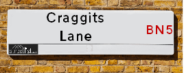
Craggits Lane is a street located in the village of Henfield. It uses the postcode BN5 9EE. The street has a length of approximately 104 metres.
The street is not publicly maintained and is unadopted which means that a private body or even the householder could be responsible for the repair and upkeep of the highway. Check the status with your local council or enquire if the street is covered by a PUSWA (public utilities street works act).
The street is located within the Horsham District Council's jurisdiction. They provide various services, like refuse collection, and manage council tax collection. It's situated in the South East region of the UK.
The road has been assigned the Unique Street Reference Number of 17602176 in the National Street Gazetteer.
It is located within the county of West Sussex, situated in the South East region of the UK. It's 39.94 miles South from central London., 9.52 miles North West from Brighton, 13.31 miles West from Lewes and 23 miles East from Chichester.
CRAGGITS LANE is within the Post Town of HENFIELD
Map of Craggits Lane
| Street Crime (updated 14/01/2025) | ||
|---|---|---|
| Location Note | Central Point of Street - Not Actual Location | |
| MSOA Info | For MSOA E02006601 (Statistical Neighbourhood) | |
| Click Hint | Click on a Circle for a detailed breakdown below map. | |
| Crime Levels |
Green = Very Low Yellow = Low Orange = High Red = Very High |
|
| Postcodes | ||
| Icon | Postcodes for Craggits Lane | |
| Walking Distances | ||
| Distance Info | Green Circle = 10 Minutes Walk (800 metres) | |
Street Crime Data accessed from data.police.uk on 06/10/2024.
Moving to Craggits Lane?
I can help you uncover potential pitfalls and provide key questions to ask about your new property. With decades of experience as a Local Land Charges Manager, I offer confidential insights to make your move informed and stress-free.
This service is free, but you may wish to make an optional donation to support it. Please include the property name and address in your request as well as anything you wish to focus on.
Contact Me
Do you know why this road is called Craggits Lane?
What's it like to live here?
Share a Photo of Craggits Lane
Ask the community a question.
Do you have any questions, memories to share, have any photos or know any facts? We'd love to know more.
Submit Your Comment

Budget Friendly Hotels near Craggits Lane
| Budget Hotel Name | Distance (miles) |
|---|---|
|
1: Name:Travelodge Hickstead Address: A23, Jobs Lane, Nr Burgess Hill Hickstead, RH17 5NZ Telephone: 0871 984 6038 Visit Hotel Page |
4.33 |
|
2: Name:Premier Inn Burgess Hill Address: Charles Avenue, Burgess Hill Telephone: Visit Hotel Page |
5.54 |
|
3: Name:Travelodge Brighton Address: 165-167 Preston Rd, Brighton, BN1 6AU Telephone: 0871 984 6017 Visit Hotel Page |
8.51 |
|
4: Name:Premier Inn Haywards Heath Address: Perrymount Heath Telephone: Visit Hotel Page |
8.95 |
|
5: Name:Premier Inn Horsham Town Centre Address: Piries Place Telephone: Visit Hotel Page |
9.33 |
Hotel Options
Your support helps keep this site running!
If you enjoy using this website, consider making a donation to help me cover hosting costs.
EPC (Energy Performance Certificate) Information for Craggits Lane
UPRN: 100061801140
EPC Current: D
EPC Potential: C
Habitable Rooms: 5
Property Type: House
Tenure: Owner-occupied
Built Form: Detached
Age Band: 1983-1990
Mains Gas: Yes
UPRN: 100061801141
EPC Current: E
EPC Potential: C
Habitable Rooms: 7
Property Type: House
Tenure: Owner-occupied
Built Form: Detached
Age Band: 1930-1949
Mains Gas: Yes
House Sales
| Year | High | Low | Average | Sales |
|---|---|---|---|---|
| 2021 | £770,000 | £655,555 | £731,852 | 3 |
Contains HM Land Registry data © Crown copyright and database right 2025. This data is licensed under the Open Government Licence v3.0.
Nearby Estate Agents
| Name | Address | Website |
|---|---|---|
| Marcus Grimes | Thorndene High Street Henfield BN5 9DA | Visit Website |
| Stevens | 1 Bishop Croft, High Street, Henfield, BN5 9DA | Visit Website |
| Richwards Estate Agents Ltd | Coopers House Coopers Way, Henfield, BN5 9EQ | Visit Website |
| H J Burt | Euston House High Street, Henfield, BN5 9DD | Visit Website |
| H J Burt | 53 High Street, Steyning, BN44 3RE | Visit Website |
We have found 1 postcode
Neighbourhood Policing |
| Police Force: Sussex |
 View Neighbourhood Crime and Policing View Neighbourhood Crime and Policing |
| Find a Local Neighbourhood Watch Scheme |
Location Details
| Craggits Lane | |
|---|---|

| |
| Latitude | 50.931543 |
| Longitude | -0.273688 |
| OS Easting (X): | 521297 |
| OS Northing (Y): | 116156 |
| OS Grid Reference: | TQ213162 |
Known Residential Addresses for Craggits Lane
- MAYCROFT
- CRAGGITS LODGE
Roads that have a Junction with Craggits Lane
| Street | Junction Type |
|---|---|
| Church Street | junction |
Sunset and Sunrise times
| Sunrise | 07:35 |
|---|---|
| Sunset | 16:54 |
Latest Weather Conditions
| Observed at Weather Station: | Shoreham 1 February 2025 at 14:00 (6.65 miles away) |
|---|---|
| Current Weather: | Clear night |
| Temperature and Humidity: | 6.0°C (84.9%) |
| Wind Direction and Speed: | SSE (7 mph) |
Population Statistics
| ONS Area Code | E00161371 |
|---|---|
| ONS Area Name | Detached Rural Retirement |
| Average Age | 52.09 |
| Area Population | 1638.00 |
| Male Population | 720.00 (44%) |
| Female Population | 918.00 (56%) |
| Benefit Claimants | 4 (0%) |
| LSOA Code: | E01031641 |
|---|---|
| LSOA Name: | Horsham 014B |
| SOA Code: | 2a |
| SOA Name: | |
| MSOA Code: | E02006601 |
| MSOA Name: | Horsham 014 |
Nearest Supermarkets
| Tesco Burgess Hill Superstore |
|---|
| Hammonds Farm, Jane Murray Way, Burgess Hill, RH15 9QT |
| 0345 677 9093 |
| Distance: 5.59 Miles |
| Directions to Tesco Burgess Hill Superstore |
| Sainsburys Hassocks Keymer Road Local |
|---|
| 22 - 24 Keymer Road, Hassocks, England, BN6 8AN |
| 1273842430 |
| Distance: 5.71 Miles |
| Directions to Sainsburys Hassocks Keymer Road Local |
| Tesco Burgess Hill Gatehouse Express |
|---|
| Gatehouse Ln, Burgess Hill, RH15 9XB |
| 0345 026 9375 |
| Distance: 5.75 Miles |
| Directions to Tesco Burgess Hill Gatehouse Express |
| Tesco Shoreham-by-sea Extra |
|---|
| Holmbush Centre, Upper Shoreham Rd, Shoreham-By-Sea, BN43 6TD |
| 0345 677 9618 |
| Distance: 6.08 Miles |
| Directions to Tesco Shoreham-by-sea Extra |
Telephone Information
| Area Code |
|---|
| Area Code: 01273 - Brighton |
| Area Code: 01444 - Haywards Heath |
| Area Code: 01903 - Worthing |
| Area Code: 01403 - Horsham |
Broadband Information
| Speed | Average Speed | Median Speed | Maximum Speed | Next-generation access (NGA) | Number of Connections |
|---|---|---|---|---|---|
| Greater than 2 Mbps | 5.7 | 6.3 | 7.4 | Y | 4 |
Local Government
| Local Council Details |
|---|
| Within the area of Horsham |
| Visit the Council's Website |
| Park North, North Street, Horsham, West Sussex &RH12 1RL |
| Send email |
| Telephone Number: 01403 215 100 |
| Local Member of Parliament |
|---|
| Within the Westminster Parliamentary Constituency of Arundel and South Downs |
| The Member of Parliament is Andrew Griffith |
| Details for the MP Andrew Griffith on parliament.uk |
| Details for the MP Andrew Griffith on theyworkforyou.com |
| In the 2024 General Election Andrew Griffith won with a majority of 12,134 the result was Con hold. The total electorate was 77,969 |
| Wards, Parish Councils and County Councils |
|---|
| Ward: Henfield Ward |
| Parish: Henfield Parish Council |
| Ceremonial County: West Sussex |
Nearest Schools
England Primary Schools
St Peter's CofE Primary School
Address: St Peter's CofE Primary School, Fabians Way, Henfield, West Sussex, BN5 9PU
Distance: 0.38 miles
Contact: 01273492447
Nearest Hospitals
| Southlands Hospital |
|---|
| Address: Upper Shoreham Road, Shoreham-By-Sea, BN43 6TQ, |
| NHS Sector |
| Western Sussex Hospitals NHS Foundation Trust |
| Telephone: 01903 205111 |
| Visit Hospital Website |
| Distance: 10.16 (miles) |
| Directions from to Southlands Hospital |
| Mill View Hospital |
|---|
| Address: Nevill Avenue, Hove, |
| NHS Sector |
| Sussex Partnership NHS Foundation Trust |
| Telephone: 01273 621984 |
| Visit Hospital Website |
| Distance: 11.55 (miles) |
| Directions from to Mill View Hospital |
| Aldrington Centre |
|---|
| Address: 35 New Church Road, Aldrington Centre, Hove, BN3 4AG, |
| NHS Sector |
| Sussex Partnership NHS Foundation Trust |
| Telephone: 01273 718680 |
| Visit Hospital Website |
| Distance: 12.89 (miles) |
| Directions from to Aldrington Centre |
Nearest Dentists
Dentists
HIGHDENE (DENTAL SURGERY)
Address: HIGHDENE, HIGH STREET, HENFIELD, WEST SUSSEX, BN5 9DA
Distance: 0.09 miles
Contact: :
MALLARD WAY (DENTAL SURGERY)
Address: 2 MALLARD WAY, HENFIELD, WEST SUSSEX, BN5 9HF
Distance: 0.45 miles
Contact: :
STEYNING DENTAL CARE LTD
Address: 2ND FLOOR, STEYNING HEALTH CENTRE, TANYARD LANE, STEYNING, WEST SUSSEX, BN44 3RJ
Distance: 3.74 miles
Contact: :
DENTAL SURGERY
Address: 17 CHURCH STREET, STEYNING, WEST SUSSEX, BN44 3YB
Distance: 3.77 miles
Contact: :
DENTAL SURGERY
Address: 4 HIGH STREET, STEYNING, WEST SUSSEX, BN44 3GG
Distance: 3.83 miles
Contact: :
DENTAL SURGERY
Address: 54A KEYMER ROAD, HASSOCKS, WEST SUSSEX, BN6 8AR
Distance: 5.81 miles
Contact: :
Nearest GP Surgeries
Doctors
HENFIELD MEDICAL CENTRE- COVID LOCAL VACCINATION SERVICE 2
Address: DEER PARK, HENFIELD, BN5 9JQ
Distance: 0.33 miles
Contact: :
HENFIELD MEDICAL CENTRE - COVID LOCAL VACCINATION SERVICE 3
Address: DEER PARK, HENFIELD, BN5 9JQ
Distance: 0.33 miles
Contact: :
HENFIELD MEDICAL CENTRE
Address: DEER PARK, HENFIELD, WEST SUSSEX, BN5 9JQ
Distance: 0.33 miles
Contact: tel: 01273 492255
WOODLAWN SURGERY
Address: WOODLAWN SURGERY, HIGH STREET, PARTRIDGE GREEN, WEST SUSSEX, RH13 8HR
Distance: 2.38 miles
Contact: tel: 01403 711577
OAKLEIGH, HIGH STREET
Address: OAKLEIGH, HIGH STREET, PARTRIDGE GREEN, WEST SUSSEX, RH13 8HX
Distance: 2.39 miles
Contact: tel: 01403 710880
14 DAWN CLOSE, UPPER BEEDING
Address: 14 DAWN CLOSE, UPPER BEEDING, STEYNING, WEST SUSSEX, BN44 3WG
Distance: 3.68 miles
Contact: tel: 01903 816107
Nearest Dispensing Chemists
Pharmacies
HENFIELD PHARMACY
Address: HIGH STREET, HENFIELD, BN5 9DB
Distance: 0.11 miles
Contact: tel: 01273 492030
UPPER BEEDING PHARMACY
Address: HIGH STREET, UPPER BEEDING, STEYNING, WEST SUSSEX, BN44 3HZ
Distance: 3.67 miles
Contact: tel: 01903 813218
PAYDENS PHARMACY
Address: STEYNING HEALTH CENTRE, TANYARD LANE, STEYNING, WEST SUSSEX, BN44 3RJ
Distance: 3.74 miles
Contact: tel: 01903 815615
HURST PHARMACY
Address: 86-88 HIGH STREET, HURSTPIERPOINT, HASSOCKS, BN6 9PX
Distance: 4.29 miles
Contact: tel: 01273 832244
ASHINGTON PHARMACY
Address: UNIT 1, CLEARVIEW HOUSE, LONDON ROAD, ASHINGTON, PULBOROUGH, WEST SUSSEX, RH20 3DD
Distance: 5.11 miles
Contact: :
TESCO INSTORE PHARMACY
Address: HAMMONDS FARM, JANE MURRAY WAY, BURGESS HILL, WEST SUSSEX, RH15 9QT
Distance: 5.58 miles
Contact: tel: 01444 316847
Nearest Opticians
Opticians
HENFIELD EYECARE
Address: 3 BISHOP CROFT, HIGH STREET, HENFIELD, WEST SUSSEX, BN5 9DA
Distance: 0.09 miles
Contact: :
ROBINSON OPTICIANS
Address: 78 HIGH STREET, STEYNING, WEST SUSSEX, BN44 3RD
Distance: 3.81 miles
Contact: :
HASSOCKS (KEYMER ROAD)
Address: 17 KEYMER ROAD, HASSOCKS, BN6 8AD
Distance: 5.72 miles
Contact: :
SHOREHAM EXTRA
Address: HOLMBUSH CENTRE, UPPER SHOREHAM ROAD, SHOREHAM-BY-SEA, WEST SUSSEX, BN43 6TD
Distance: 6.25 miles
Contact: :
M&S OPTICIANS - SHOREHAM-BY-SEA
Address: HOLMBUSH CENTRE, UPPER SHOREHAM ROAD, SHOREHAM-BY-SEA, BN43 6TD
Distance: 6.25 miles
Contact: :
BOOTS OPTICIANS (BURGESS HILL)
Address: 22-22A MARKET PLACE, THE MARTLETS, BURGESS HILL, WEST SUSSEX, RH15 9NP
Distance: 6.41 miles
Contact: :
Transport
Nearest Rail Stations
Hassocks Station is 5.58 miles away.
Address: Hassocks station, Station Approach West, Hassocks, West Sussex, BN6 8JD
Hassocks is situated on the Brighton Main Line and is managed by Southern.
Hassocks Station is staffed on a part time basis.
Burgess Hill Station is 6.53 miles away.
Address: Burgess Hill station, Station Road, Burgess Hill, West Sussex, RH15 9DG
Burgess Hill is situated on the Brighton Main Line and is managed by Southern.
Burgess Hill Station is staffed on a part time basis.