Holmbush Lane is a street located near the village of Woodmancote. The street has a length of approximately 544 metres.
The street is located within the Horsham District Council's jurisdiction. They provide various services, like refuse collection, and manage council tax collection. It's situated in the South East region of the UK.
The road has been assigned the Unique Street Reference Number of 17601517 in the National Street Gazetteer.
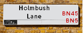
The street has the postcodes of BN5 9TJ and BN5 9TL.
It is located within the county of West Sussex, situated in the South East region of the UK. It's 41 miles South from central London., 7.26 miles North West from Brighton, 11.02 miles West from Lewes and 24.58 miles East from Chichester.
Map of Holmbush Lane
| Postcodes | ||
|---|---|---|
| Icon | Postcodes for Holmbush Lane | |
| Walking Distances | ||
| Distance Info | Green Circle = 10 Minutes Walk (800 metres) | |
Street Crime Data accessed from data.police.uk on 06/10/2024.
Moving to Holmbush Lane?
I can help you uncover potential pitfalls and provide key questions to ask about your new property. With decades of experience as a Local Land Charges Manager, I offer confidential insights to make your move informed and stress-free.
This service is free, but you may wish to make an optional donation to support it. Please include the property name and address in your request as well as anything you wish to focus on.
Contact Me
Do you know why this road is called Holmbush Lane?
What's it like to live here?
Share a Photo of Holmbush Lane
Ask the community a question.
Do you have any questions, memories to share, have any photos or know any facts? We'd love to know more.
Submit Your Comment

Budget Friendly Hotels near Holmbush Lane
| Budget Hotel Name | Distance (miles) |
|---|---|
|
1: Name:Travelodge Hickstead Address: A23, Jobs Lane, Nr Burgess Hill Hickstead, RH17 5NZ Telephone: 0871 984 6038 Visit Hotel Page |
4.16 |
|
2: Name:Premier Inn Burgess Hill Address: Charles Avenue, Burgess Hill Telephone: Visit Hotel Page |
4.36 |
|
3: Name:Travelodge Brighton Address: 165-167 Preston Rd, Brighton, BN1 6AU Telephone: 0871 984 6017 Visit Hotel Page |
6.21 |
|
4: Name:Premier Inn Brighton City Centre Address: 144 North Street Telephone: Visit Hotel Page |
7.18 |
|
5: Name:Travelodge Brighton Seafront Address: West St, Brighton, BN1 2RE Telephone: 0871 984 6405 Visit Hotel Page |
7.21 |
Hotel Options
Your support helps keep this site running!
If you enjoy using this website, consider making a donation to help me cover hosting costs.
Nearby Estate Agents
| Name | Address | Website |
|---|---|---|
| H J Burt | Euston House High Street, Henfield, BN5 9DD | Visit Website |
| Richwards Estate Agents Ltd | Coopers House Coopers Way, Henfield, BN5 9EQ | Visit Website |
| Marcus Grimes | Thorndene High Street Henfield BN5 9DA | Visit Website |
| Stevens | 1 Bishop Croft, High Street, Henfield, BN5 9DA | Visit Website |
| Mishon Mackay | 106 High Street, Hurstpierpoint, BN6 9PX | Visit Website |
Neighbourhood Policing |
| Police Force: Sussex |
 View Neighbourhood Crime and Policing View Neighbourhood Crime and Policing |
| Find a Local Neighbourhood Watch Scheme |
Location Details
| Holmbush Lane | |
|---|---|

| |
| Latitude | 50.911554 |
| Longitude | -0.228192 |
| OS Easting (X): | 524547 |
| OS Northing (Y): | 114010 |
| OS Grid Reference: | TQ245140 |
Roads that have a Junction with Holmbush Lane
| Street | Junction Type |
|---|---|
| Bramlands Lane | pseudo node |
| Clappers Lane | junction |
Sunset and Sunrise times
| Sunrise | 07:34 |
|---|---|
| Sunset | 16:54 |
Latest Weather Conditions
| Observed at Weather Station: | Shoreham 1 February 2025 at 17:00 (5.92 miles away) |
|---|---|
| Current Weather: | Clear night |
| Temperature and Humidity: | 5.1°C (83.5%) |
| Wind Direction and Speed: | S (6 mph) |
Population Statistics
| ONS Area Code | E00161983 & E00161245 |
|---|---|
| ONS Area Name | Rural White-Collar Workers & Renting Rural Retirement |
| Average Age | 43.55 & 45.72 |
| Area Population | 1666.00 & 1339.00 |
| Male Population | 805.00 & 650.00 (48%) |
| Female Population | 861.00 & 689.00 (52%) |
| Benefit Claimants | 9 & 5 (0%) |
| LSOA Code: | E01031770 &E01031618 |
|---|---|
| LSOA Name: | Mid Sussex 016D &Horsham 014A |
| SOA Code: | 2b |
| SOA Name: | |
| MSOA Code: | E02006619 &E02006601 |
| MSOA Name: | Mid Sussex 016 &Horsham 014 |
Nearest Supermarkets
| Sainsburys Hassocks Keymer Road Local |
|---|
| 22 - 24 Keymer Road, Hassocks, England, BN6 8AN |
| 1273842430 |
| Distance: 3.81 Miles |
| Directions to Sainsburys Hassocks Keymer Road Local |
| Tesco Burgess Hill Superstore |
|---|
| Hammonds Farm, Jane Murray Way, Burgess Hill, RH15 9QT |
| 0345 677 9093 |
| Distance: 4.38 Miles |
| Directions to Tesco Burgess Hill Superstore |
| Tesco Shoreham-by-sea Extra |
|---|
| Holmbush Centre, Upper Shoreham Rd, Shoreham-By-Sea, BN43 6TD |
| 0345 677 9618 |
| Distance: 4.69 Miles |
| Directions to Tesco Shoreham-by-sea Extra |
| Tesco Westway Hove Express |
|---|
| 3-5 W Way, Hove, The City Of Brighton And Hove, BN3 8LD |
| 0345 610 2807 |
| Distance: 4.82 Miles |
| Directions to Tesco Westway Hove Express |
Telephone Information
| Area Code |
|---|
| Area Code: 01273 - Brighton |
| Area Code: 01444 - Haywards Heath |
| Area Code: 01903 - Worthing |
Broadband Information
| Speed | Average Speed | Median Speed | Maximum Speed | Next-generation access (NGA) | Number of Connections |
|---|---|---|---|---|---|
| Less than 2 Mbps | 1.3 | 1.6 | 1.9 | N | 6 |
Local Government
| Local Council Details |
|---|
| Within the area of Mid Sussex &Horsham |
| Visit the Council's Website |
| Visit the Council's Website |
| Oaklands, Oaklands Road, Haywards Heath, West Sussex, RH16 1SS, Park North, North Street, Horsham, West Sussex &RH12 1RL |
| Send email |
| Telephone Number: 01444 458 166 &01403 215 100 |
| Local Member of Parliament |
|---|
| Within the Westminster Parliamentary Constituency of Arundel and South Downs |
| The Member of Parliament is Alison Bennett &Andrew Griffith |
| Details for the MP Alison Bennett &Andrew Griffith on parliament.uk |
| Details for the MP Alison Bennett &Andrew Griffith on theyworkforyou.com |
| In the 2024 General Election Alison Bennett &Andrew Griffith won with a majority of 6,662 the result was LD gain from Con &Con hold. The total electorate was 75,969 |
| Wards, Parish Councils and County Councils |
|---|
| Ward: Hurstpierpoint and Downs, Bramber &Upper Beeding & Woodmancote Ward |
| Ceremonial County: West Sussex |
Nearest Schools
England Primary Schools
Albourne CofE Primary School
Address: Albourne CofE Primary School, The Street, Albourne, Hassocks, West Sussex, BN6 9DH
Distance: 2.01 miles
Contact:
Nearest Hospitals
| Name | Address | Postcode | Distance | Map |
|---|
Nearest Dentists
Dentists
| Name | Address | Postcode | Distance | Map |
|---|
Nearest GP Surgeries
Doctors
HENFIELD MEDICAL CENTRE- COVID LOCAL VACCINATION SERVICE 2
Address: DEER PARK, HENFIELD, BN5 9JQ
Distance: 2.67 miles
Contact: :
HENFIELD MEDICAL CENTRE - COVID LOCAL VACCINATION SERVICE 3
Address: DEER PARK, HENFIELD, BN5 9JQ
Distance: 2.67 miles
Contact: :
HENFIELD MEDICAL CENTRE
Address: DEER PARK, HENFIELD, WEST SUSSEX, BN5 9JQ
Distance: 2.67 miles
Contact: tel: 01273 492255
MID SUSSEX HEALTH CARE
Address: THE HEALTH CENTRE, TRINITY ROAD, HURSTPIERPOINT, HASSOCKS, WEST SUSSEX, BN6 9UQ
Distance: 2.77 miles
Contact: tel: 01273 834388
14 DAWN CLOSE, UPPER BEEDING
Address: 14 DAWN CLOSE, UPPER BEEDING, STEYNING, WEST SUSSEX, BN44 3WG
Distance: 3.83 miles
Contact: tel: 01903 816107
HASSOCKS HEALTH CENTRE
Address: HASSOCKS HEALTH CENTRE, WINDMILL AVENUE, HASSOCKS, WEST SUSSEX, BN6 8LY
Distance: 3.91 miles
Contact: tel: 01273 844242
Nearest Dispensing Chemists
Pharmacies
| Name | Address | Postcode | Telephone | Map | Distance in Km |
|---|
Nearest Opticians
Opticians
HENFIELD EYECARE
Address: 3 BISHOP CROFT, HIGH STREET, HENFIELD, WEST SUSSEX, BN5 9DA
Distance: 2.33 miles
Contact: :
HASSOCKS (KEYMER ROAD)
Address: 17 KEYMER ROAD, HASSOCKS, BN6 8AD
Distance: 3.82 miles
Contact: :
EYES AT HOME (HOVE)
Address: 87 WOODLAND AVENUE, HOVE, EAST SUSSEX, BN3 6BJ
Distance: 4.65 miles
Contact: :
ROBINSON OPTICIANS
Address: 78 HIGH STREET, STEYNING, WEST SUSSEX, BN44 3RD
Distance: 4.70 miles
Contact: :
SHOREHAM EXTRA
Address: HOLMBUSH CENTRE, UPPER SHOREHAM ROAD, SHOREHAM-BY-SEA, WEST SUSSEX, BN43 6TD
Distance: 4.91 miles
Contact: :
M&S OPTICIANS - SHOREHAM-BY-SEA
Address: HOLMBUSH CENTRE, UPPER SHOREHAM ROAD, SHOREHAM-BY-SEA, BN43 6TD
Distance: 4.91 miles
Contact: :
Transport
Nearest Rail Stations
Hassocks Station is 3.69 miles away.
Address: Hassocks station, Station Approach West, Hassocks, West Sussex, BN6 8JD
Hassocks is situated on the Brighton Main Line and is managed by Southern.
Hassocks Station is staffed on a part time basis.
Burgess Hill Station is 5.25 miles away.
Address: Burgess Hill station, Station Road, Burgess Hill, West Sussex, RH15 9DG
Burgess Hill is situated on the Brighton Main Line and is managed by Southern.
Burgess Hill Station is staffed on a part time basis.