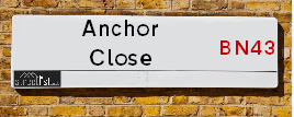
Anchor Close is a street located in the town of Shoreham-by-Sea. The street has a length of approximately 199 metres.
The street is publicly maintained which means that the road is adopted and West Sussex is responsible for the repair and upkeep of the highway.
The street is located within the Adur District Council's jurisdiction. They provide various services, like refuse collection, and manage council tax collection. It's situated in the South East region of the UK.
The road has been assigned the Unique Street Reference Number of 200889 in the National Street Gazetteer.
The street has the postcodes of BN43 5BZ and BN43 5BY.
It is located within the county of West Sussex, situated in the South East region of the UK. It's 46.74 miles South from central London., 5.31 miles West from Brighton, 12.59 miles West from Lewes and 22.52 miles East from Chichester.
ANCHOR CLOSE is within the Post Town of SHOREHAM-BY-SEA
Map of Anchor Close
| Street Crime (updated 14/01/2025) | ||
|---|---|---|
| Location Note | Central Point of Street - Not Actual Location | |
| MSOA Info | For MSOA E02006538 (Statistical Neighbourhood) | |
| Click Hint | Click on a Circle for a detailed breakdown below map. | |
| Crime Levels |
Green = Very Low Yellow = Low Orange = High Red = Very High |
|
| Postcodes | ||
| Icon | Postcodes for Anchor Close | |
| Walking Distances | ||
| Distance Info | Green Circle = 10 Minutes Walk (800 metres) | |
Street Crime Data accessed from data.police.uk on 06/10/2024.
Moving to Anchor Close?
I can help you uncover potential pitfalls and provide key questions to ask about your new property. With decades of experience as a Local Land Charges Manager, I offer confidential insights to make your move informed and stress-free.
This service is free, but you may wish to make an optional donation to support it. Please include the property name and address in your request as well as anything you wish to focus on.
Contact Me
Do you know why this road is called Anchor Close?
What's it like to live here?
Share a Photo of Anchor Close
Ask the community a question.
Do you have any questions, memories to share, have any photos or know any facts? We'd love to know more.
Submit Your Comment

Budget Friendly Hotels near Anchor Close
| Budget Hotel Name | Distance (miles) |
|---|---|
|
1: Name:Travelodge Brighton Address: 165-167 Preston Rd, Brighton, BN1 6AU Telephone: 0871 984 6017 Visit Hotel Page |
5.09 |
|
2: Name:Travelodge Worthing Seafront Address: 86-95 Marine Parade, Worthing, BN11 3QD Telephone: 0871 984 6409 Visit Hotel Page |
5.19 |
|
3: Name:Travelodge Brighton Seafront Address: West St, Brighton, BN1 2RE Telephone: 0871 984 6405 Visit Hotel Page |
5.20 |
|
4: Name:Premier Inn Brighton City Centre Address: 144 North Street Telephone: Visit Hotel Page |
5.34 |
|
5: Name:Premier Inn Worthing Seafront Address: 127 Marine Parade Telephone: Visit Hotel Page |
5.41 |
Hotel Options
Your support helps keep this site running!
If you enjoy using this website, consider making a donation to help me cover hosting costs.
Flats and Apartments in Anchor Close
FLAT 3
FLAT 5
FLAT 6
FLAT 7
FLAT 8
FLAT 9
FLAT 10
FLAT 11
FLAT 12
FLAT 13
FLAT 15
FLAT 16
FLAT 17
FLAT 18
FLAT 19
FLAT 20
FLAT 21
FLAT 23
FLAT 24
FLAT 25
FLAT 26
FLAT 27
FLAT 28
FLAT 29
FLAT 30
FLAT 32
FLAT 33
FLAT 34
FLAT 35
FLAT 36
FLAT 37
EPC (Energy Performance Certificate) Information for Anchor Close
UPRN: 60009045
EPC Current: D
EPC Potential: B
Habitable Rooms: 5
Property Type: House
Tenure: Owner-occupied
Built Form: Semi-Detached
Age Band: 1996-2002
Mains Gas: Yes
UPRN: 60009047
EPC Current: D
EPC Potential: B
Habitable Rooms: 4
Property Type: House
Tenure: Owner-occupied
Built Form: Mid-Terrace
Age Band: 1996-2002
Mains Gas: Yes
UPRN: 60009048
EPC Current: C
EPC Potential: C
Habitable Rooms: 4
Property Type: House
Tenure: Owner-occupied
Built Form: End-Terrace
Age Band: 1996-2002
Mains Gas: Yes
UPRN: 60009050
EPC Current: D
EPC Potential: B
Habitable Rooms: 4
Property Type: House
Tenure: Owner-occupied
Built Form: Mid-Terrace
Age Band: 1996-2002
Mains Gas: Yes
UPRN: 60009052
EPC Current: D
EPC Potential: B
Habitable Rooms: 4
Property Type: House
Tenure: Owner-occupied
Built Form: Semi-Detached
Age Band: 1991-1995
Mains Gas: Yes
UPRN: 60009054
EPC Current: C
EPC Potential: B
Habitable Rooms: 4
Property Type: House
Tenure: Owner-occupied
Built Form: End-Terrace
Age Band: 1996-2002
Mains Gas: Yes
UPRN: 60009055
EPC Current: C
EPC Potential: B
Habitable Rooms: 4
Property Type: House
Tenure: Owner-occupied
Built Form: Mid-Terrace
Age Band: 1996-2002
Mains Gas: Yes
UPRN: 60009056
EPC Current: D
EPC Potential: B
Habitable Rooms: 4
Property Type: House
Tenure: Owner-occupied
Built Form: Mid-Terrace
Age Band: 1996-2002
Mains Gas: Yes
UPRN: 60009057
EPC Current: C
EPC Potential: B
Habitable Rooms: 5
Property Type: House
Tenure: Owner-occupied
Built Form: Mid-Terrace
Age Band: 2003-2006
Mains Gas: Yes
UPRN: 60009058
EPC Current: C
EPC Potential: B
Habitable Rooms: 6
Property Type: House
Tenure: Owner-occupied
Built Form: Mid-Terrace
Age Band: 1996-2002
Mains Gas: Yes
UPRN: 60009059
EPC Current: D
EPC Potential: B
Habitable Rooms: 6
Property Type: House
Tenure: Owner-occupied
Built Form: Mid-Terrace
Age Band: 1996-2002
Mains Gas: Yes
UPRN: 60009060
EPC Current: C
EPC Potential: B
Habitable Rooms: 6
Property Type: House
Tenure: Owner-occupied
Built Form: Mid-Terrace
Age Band: 1996-2002
Mains Gas: Yes
UPRN: 60009061
EPC Current: C
EPC Potential: B
Habitable Rooms: 6
Property Type: House
Tenure: Rented (private)
Built Form: Mid-Terrace
Age Band: 2003-2006
Mains Gas: Yes
UPRN: 60009062
EPC Current: D
EPC Potential: B
Habitable Rooms: 6
Property Type: House
Tenure: Owner-occupied
Built Form: Mid-Terrace
Age Band: 1996-2002
Mains Gas: Yes
UPRN: 60009063
EPC Current: C
EPC Potential: B
Habitable Rooms: 5
Property Type: House
Tenure: Owner-occupied
Built Form: Mid-Terrace
Age Band: 1996-2002
Mains Gas: Yes
UPRN: 60009064
EPC Current: D
EPC Potential: C
Habitable Rooms: 5
Property Type: House
Tenure: Owner-occupied
Built Form: Mid-Terrace
Age Band: 1996-2002
Mains Gas: Yes
UPRN: 60009066
EPC Current: C
EPC Potential: B
Habitable Rooms: 5
Property Type: House
Tenure: Owner-occupied
Built Form: Mid-Terrace
Age Band: 2003-2006
Mains Gas: Yes
UPRN: 60009067
EPC Current: C
EPC Potential: B
Habitable Rooms: 5
Property Type: House
Tenure: Owner-occupied
Built Form: Mid-Terrace
Age Band: 2003-2006
Mains Gas: Yes
UPRN: 60009068
EPC Current: C
EPC Potential: B
Habitable Rooms: 5
Property Type: House
Tenure: Owner-occupied
Built Form: Mid-Terrace
Age Band: 1991-1995
Mains Gas: Yes
UPRN: 60009069
EPC Current: C
EPC Potential: B
Habitable Rooms: 5
Property Type: House
Tenure: Owner-occupied
Built Form: Mid-Terrace
Age Band: 1996-2002
Mains Gas: Yes
UPRN: 60009070
EPC Current: C
EPC Potential: B
Habitable Rooms: 6
Property Type: House
Tenure: Owner-occupied
Built Form: Mid-Terrace
Age Band: 1991-1995
Mains Gas: Yes
UPRN: 60009072
EPC Current: C
EPC Potential: B
Habitable Rooms: 4
Property Type: House
Tenure: Owner-occupied
Built Form: Mid-Terrace
Age Band: 1996-2002
Mains Gas: Yes
UPRN: 60009073
EPC Current: C
EPC Potential: B
Habitable Rooms: 4
Property Type: House
Tenure: Owner-occupied
Built Form: End-Terrace
Age Band: 1996-2002
Mains Gas: Yes
UPRN: 60009074
EPC Current: C
EPC Potential: C
Habitable Rooms: 5
Property Type: House
Tenure: Owner-occupied
Built Form: Semi-Detached
Age Band: 1996-2002
Mains Gas: Yes
UPRN: 60009075
EPC Current: C
EPC Potential: C
Habitable Rooms: 5
Property Type: House
Tenure: Owner-occupied
Built Form: Mid-Terrace
Age Band: 1996-2002
Mains Gas: Yes
UPRN: 60009076
EPC Current: D
EPC Potential: B
Habitable Rooms: 4
Property Type: House
Tenure: Rented (social)
Built Form: Mid-Terrace
Age Band: 1983-1990
Mains Gas: Yes
UPRN: 60009077
EPC Current: D
EPC Potential: B
Habitable Rooms: 4
Property Type: House
Tenure: Rented (social)
Built Form: End-Terrace
Age Band: 1983-1990
Mains Gas: Yes
UPRN: 60009078
EPC Current: D
EPC Potential: B
Habitable Rooms: 4
Property Type: House
Tenure: Rented (social)
Built Form: End-Terrace
Age Band: 1983-1990
Mains Gas: Yes
UPRN: 60009079
EPC Current: D
EPC Potential: B
Habitable Rooms: 4
Property Type: House
Tenure: Rented (social)
Built Form: Mid-Terrace
Age Band: 1983-1990
Mains Gas: Yes
UPRN: 60009080
EPC Current: D
EPC Potential: B
Habitable Rooms: 4
Property Type: House
Tenure: Rented (social)
Built Form: Mid-Terrace
Age Band: 1983-1990
Mains Gas: Yes
UPRN: 60009081
EPC Current: D
EPC Potential: B
Habitable Rooms: 4
Property Type: House
Tenure: Rented (social)
Built Form: Mid-Terrace
Age Band: 1983-1990
Mains Gas: Yes
UPRN: 60009082
EPC Current: D
EPC Potential: B
Habitable Rooms: 4
Property Type: House
Tenure: Rented (social)
Built Form: End-Terrace
Age Band: 1983-1990
Mains Gas: Yes
UPRN: 60009083
EPC Current: D
EPC Potential: B
Habitable Rooms: 4
Property Type: House
Tenure: Owner-occupied
Built Form: End-Terrace
Age Band: 1996-2002
Mains Gas: Yes
UPRN: 60009084
EPC Current: C
EPC Potential: B
Habitable Rooms: 4
Property Type: House
Tenure: Owner-occupied
Built Form: Mid-Terrace
Age Band: 1996-2002
Mains Gas: Yes
UPRN: 60009085
EPC Current: C
EPC Potential: B
Habitable Rooms: 4
Property Type: House
Tenure: Owner-occupied
Built Form: Mid-Terrace
Age Band: 1996-2002
Mains Gas: Yes
UPRN: 60009086
EPC Current: C
EPC Potential: B
Habitable Rooms: 5
Property Type: House
Tenure: Rented (private)
Built Form: Mid-Terrace
Age Band: 1996-2002
Mains Gas: Yes
UPRN: 60009088
EPC Current: C
EPC Potential: C
Habitable Rooms: 4
Property Type: House
Tenure: Owner-occupied
Built Form: End-Terrace
Age Band: 1996-2002
Mains Gas: Yes
UPRN: 60009089
EPC Current: C
EPC Potential: C
Habitable Rooms: 4
Property Type: House
Tenure: Owner-occupied
Built Form: Mid-Terrace
Age Band: 1996-2002
Mains Gas: Yes
UPRN: 60009090
EPC Current: C
EPC Potential: B
Habitable Rooms: 4
Property Type: House
Tenure: Owner-occupied
Built Form: End-Terrace
Age Band: 1996-2002
Mains Gas: Yes
UPRN: 60009091
EPC Current: C
EPC Potential: B
Habitable Rooms: 4
Property Type: House
Tenure: rental (private)
Built Form: End-Terrace
Age Band: 1996-2002
Mains Gas: Yes
UPRN: 60009092
EPC Current: C
EPC Potential: B
Habitable Rooms: 5
Property Type: House
Tenure: Owner-occupied
Built Form: Mid-Terrace
Age Band: 1996-2002
Mains Gas: Yes
UPRN: 60009093
EPC Current: C
EPC Potential: B
Habitable Rooms: 5
Property Type: House
Tenure: Owner-occupied
Built Form: Mid-Terrace
Age Band: 1996-2002
Mains Gas: Yes
UPRN: 60009094
EPC Current: C
EPC Potential: B
Habitable Rooms: 4
Property Type: House
Tenure: Owner-occupied
Built Form: End-Terrace
Age Band: 1996-2002
Mains Gas: Yes
UPRN: 60009098
EPC Current: C
EPC Potential: C
Habitable Rooms: 3
Property Type: Flat
Tenure: rental (private)
Built Form: Semi-Detached
Age Band: 1996-2002
Mains Gas: Yes
UPRN: 60009100
EPC Current: C
EPC Potential: C
Habitable Rooms: 3
Property Type: Flat
Tenure: rental (private)
Built Form: Mid-Terrace
Age Band: 1991-1995
Mains Gas: Yes
UPRN: 60009101
EPC Current: C
EPC Potential: C
Habitable Rooms: 3
Property Type: Flat
Tenure: Owner-occupied
Built Form: Mid-Terrace
Age Band: 1996-2002
Mains Gas: Yes
UPRN: 60009102
EPC Current: C
EPC Potential: C
Habitable Rooms: 3
Property Type: Flat
Tenure: Rented (private)
Built Form: End-Terrace
Age Band: 1996-2002
Mains Gas: Yes
UPRN: 60009103
EPC Current: C
EPC Potential: C
Habitable Rooms: 3
Property Type: Flat
Tenure: Owner-occupied
Built Form: Mid-Terrace
Age Band: 1996-2002
Mains Gas: Yes
UPRN: 60009104
EPC Current: C
EPC Potential: B
Habitable Rooms: 3
Property Type: Flat
Tenure: Owner-occupied
Built Form: Mid-Terrace
Age Band: 1991-1995
Mains Gas: Yes
UPRN: 60009105
EPC Current: B
EPC Potential: B
Habitable Rooms: 3
Property Type: Flat
Tenure: Owner-occupied
Built Form: Mid-Terrace
Age Band: 2007-2011
Mains Gas: Yes
UPRN: 60009106
EPC Current: C
EPC Potential: C
Habitable Rooms: 3
Property Type: Flat
Tenure: Owner-occupied
Built Form: Mid-Terrace
Age Band: 2003-2006
Mains Gas: Yes
UPRN: 60009107
EPC Current: C
EPC Potential: C
Habitable Rooms: 3
Property Type: Flat
Tenure: Owner-occupied
Built Form: Mid-Terrace
Age Band: 1991-1995
Mains Gas: Yes
UPRN: 60009108
EPC Current: C
EPC Potential: C
Habitable Rooms: 3
Property Type: Flat
Tenure: Owner-occupied
Built Form: End-Terrace
Age Band: 1996-2002
Mains Gas: Yes
UPRN: 60009110
EPC Current: C
EPC Potential: C
Habitable Rooms: 3
Property Type: Flat
Tenure: Rented (private)
Built Form: Enclosed Mid-Terrace
Age Band: 1983-1990
Mains Gas: Yes
UPRN: 60009111
EPC Current: C
EPC Potential: B
Habitable Rooms: 3
Property Type: Flat
Tenure: Owner-occupied
Built Form: End-Terrace
Age Band: 1996-2002
Mains Gas: Yes
UPRN: 60009112
EPC Current: C
EPC Potential: B
Habitable Rooms: 3
Property Type: Flat
Tenure: Owner-occupied
Built Form: Enclosed Mid-Terrace
Age Band: 1991-1995
Mains Gas: Yes
UPRN: 60009113
EPC Current: C
EPC Potential: C
Habitable Rooms: 3
Property Type: Flat
Tenure: rental (private)
Built Form: End-Terrace
Age Band: 1991-1995
Mains Gas: Yes
UPRN: 60009114
EPC Current: C
EPC Potential: B
Habitable Rooms: 3
Property Type: Flat
Tenure: Owner-occupied
Built Form: Enclosed Mid-Terrace
Age Band: 1991-1995
Mains Gas: Yes
UPRN: 60009115
EPC Current: C
EPC Potential: B
Habitable Rooms: 3
Property Type: Flat
Tenure: Rented (private)
Built Form: Semi-Detached
Age Band: 2007-2011
Mains Gas: Yes
UPRN: 60009116
EPC Current: C
EPC Potential: B
Habitable Rooms: 3
Property Type: Flat
Tenure: rental (private)
Built Form: End-Terrace
Age Band: 1996-2002
Mains Gas: Yes
UPRN: 60009118
EPC Current: C
EPC Potential: B
Habitable Rooms: 3
Property Type: Flat
Tenure: Owner-occupied
Built Form: Semi-Detached
Age Band: 2003-2006
Mains Gas: Yes
UPRN: 60009119
EPC Current: B
EPC Potential: B
Habitable Rooms: 3
Property Type: Flat
Tenure: Owner-occupied
Built Form: Semi-Detached
Age Band: 1996-2002
Mains Gas: Yes
UPRN: 60009120
EPC Current: C
EPC Potential: C
Habitable Rooms: 3
Property Type: Flat
Tenure: Rented (private)
Built Form: Detached
Age Band: 1996-2002
Mains Gas: Yes
UPRN: 60009121
EPC Current: C
EPC Potential: C
Habitable Rooms: 3
Property Type: Flat
Tenure: Rented (private)
Built Form: Enclosed Mid-Terrace
Age Band: 1996-2002
Mains Gas: Yes
UPRN: 60009122
EPC Current: E
EPC Potential: B
Habitable Rooms: 3
Property Type: Flat
Tenure: rental (private)
Built Form: Enclosed Mid-Terrace
Age Band: 1996-2002
Mains Gas: Yes
UPRN: 60009123
EPC Current: C
EPC Potential: C
Habitable Rooms: 3
Property Type: Flat
Tenure: Owner-occupied
Built Form: Enclosed Mid-Terrace
Age Band: 2003-2006
Mains Gas: Yes
UPRN: 60009124
EPC Current: C
EPC Potential: C
Habitable Rooms: 3
Property Type: Flat
Tenure: Owner-occupied
Built Form: Mid-Terrace
Age Band: 1996-2002
Mains Gas: Yes
UPRN: 60009125
EPC Current: C
EPC Potential: C
Habitable Rooms: 3
Property Type: Flat
Tenure: Owner-occupied
Built Form: Mid-Terrace
Age Band: 1996-2002
Mains Gas: Yes
UPRN: 60009127
EPC Current: C
EPC Potential: C
Habitable Rooms: 3
Property Type: Flat
Tenure: Owner-occupied
Built Form: Mid-Terrace
Age Band: 1996-2002
Mains Gas: Yes
UPRN: 60009128
EPC Current: C
EPC Potential: C
Habitable Rooms: 3
Property Type: Flat
Tenure: Owner-occupied
Built Form: Mid-Terrace
Age Band: 1996-2002
Mains Gas: Yes
UPRN: 60009129
EPC Current: C
EPC Potential: C
Habitable Rooms: 3
Property Type: Flat
Tenure: Owner-occupied
Built Form: Mid-Terrace
Age Band: 1996-2002
Mains Gas: Yes
UPRN: 60009130
EPC Current: D
EPC Potential: C
Habitable Rooms: 3
Property Type: Flat
Tenure: Owner-occupied
Built Form: End-Terrace
Age Band: 1996-2002
Mains Gas: Yes
UPRN: 60009131
EPC Current: C
EPC Potential: C
Habitable Rooms: 3
Property Type: Flat
Tenure: rental (private)
Built Form: End-Terrace
Age Band: 1996-2002
Mains Gas: Yes
UPRN: 60009132
EPC Current: C
EPC Potential: C
Habitable Rooms: 3
Property Type: Flat
Tenure: rental (private)
Built Form: End-Terrace
Age Band: 1991-1995
Mains Gas: Yes
House Sales
| Year | High | Low | Average | Sales |
|---|---|---|---|---|
| 2014 | £274,950 | £216,000 | £267,817 | 3 |
| 2015 | £250,000 | £326,100 | £288,050 | 2 |
| 2016 | £390,000 | £259,000 | £332,400 | 5 |
| 2017 | £380,000 | £240,000 | £311,500 | 5 |
| 2019 | £300,000 | £244,000 | £289,750 | 4 |
| 2020 | £403,250 | £438,000 | £395,083 | 3 |
| 2021 | £450,000 | £260,000 | £324,333 | 6 |
| 2022 | £460,000 | £440,000 | £461,667 | 3 |
| 2023 | £380,000 | £270,000 | £370,000 | 3 |
Contains HM Land Registry data © Crown copyright and database right 2025. This data is licensed under the Open Government Licence v3.0.
Nearby Estate Agents
| Name | Address | Website |
|---|---|---|
| Oakley Property | 380 Brighton Road, Shoreham-By-Sea, BN43 6RE | Visit Website |
| Harrison Brant | 6 Brunswick Road, Shoreham-by-Sea, West Sussex, BN43 5WB | Visit Website |
| Osborn Humphreys | 32/34 Brunswick Road, Shoreham-By-Sea, BN43 5WB | Visit Website |
| Fox & Sons | 3 The Vinery, St Marys Road, Shoreham - By - Sea, West Sussex, BN43 5ZA | |
| Jacobs Steel | 31 Brunswick Road, Shoreham-By-Sea, BN43 5WA | Visit Website |
Neighbourhood Policing |
| Police Force: Sussex |
 View Neighbourhood Crime and Policing View Neighbourhood Crime and Policing |
| Find a Local Neighbourhood Watch Scheme |
Location Details
| Anchor Close | |
|---|---|

| |
| Latitude | 50.830707 |
| Longitude | -0.263048 |
| OS Easting (X): | 522308 |
| OS Northing (Y): | 104963 |
| OS Grid Reference: | TQ223050 |
Known Residential Addresses for Anchor Close
- WATERS EDGE FLAT 30
- WATERS EDGE FLAT 13
- WATERS EDGE FLAT 11
- WATERS EDGE FLAT 37
- WATERS EDGE FLAT 23
- WATERS EDGE FLAT 27
- WATERS EDGE FLAT 3
- WATERS EDGE FLAT 12
- 8
- 46
- 42
- 18
- 12
- 1
- 22
- 48
- 13
- 24
- 39
- 50
- 49
- 10
- 45
- 3
- 14
- 29
- 20
- 16
Roads that have a Junction with Anchor Close
| Street | Junction Type |
|---|---|
| Harbour Way | junction |
Sunset and Sunrise times
| Sunrise | 07:37 |
|---|---|
| Sunset | 16:51 |
Latest Weather Conditions
| Observed at Weather Station: | Shoreham 30 January 2025 at 00:00 (1.32 miles away) |
|---|---|
| Current Weather: | Clear night |
| Temperature and Humidity: | 6.3°C (85.1%) |
| Wind Direction and Speed: | NNE (11 mph) |
Population Statistics
| ONS Area Code | E00159878 |
|---|---|
| ONS Area Name | Families in Terraces and Flats |
| Average Age | 40.77 |
| Area Population | 2241.00 |
| Male Population | 1132.00 (51%) |
| Female Population | 1109.00 (49%) |
| Benefit Claimants | 19 (1%) |
| LSOA Code: | E01031357 |
|---|---|
| LSOA Name: | Adur 005B |
| SOA Code: | 3a |
| SOA Name: | |
| MSOA Code: | E02006538 |
| MSOA Name: | Adur 005 |
Nearest Supermarkets
| Tesco Upper Shoreham Express |
|---|
| 225 Upper Shoreham Rd, Shoreham By Sea, Shoreham, BN43 6BE |
| 0345 671 9631 |
| Distance: 0.62 Miles |
| Directions to Tesco Upper Shoreham Express |
| Tesco Shoreham-by-sea Extra |
|---|
| Holmbush Centre, Upper Shoreham Rd, Shoreham-By-Sea, BN43 6TD |
| 0345 677 9618 |
| Distance: 1.16 Miles |
| Directions to Tesco Shoreham-by-sea Extra |
| Tesco Portslade Metro |
|---|
| 19-20 Boundary Road, Portslade, Brighton, BN41 1GB |
| 0345 677 9558 |
| Distance: 2.46 Miles |
| Directions to Tesco Portslade Metro |
| Iceland Portslade |
|---|
| 73/74a Boundary Road, Portslade, Hove, BN3 5TD |
| 01273413709 |
| Distance: 2.5 Miles |
| Directions to Iceland Portslade |
Telephone Information
| Area Code |
|---|
| Area Code: 01903 - Worthing |
| Area Code: 01273 - Brighton |
Broadband Information
| Speed | Average Speed | Median Speed | Maximum Speed | Next-generation access (NGA) | Number of Connections |
|---|---|---|---|---|---|
| Less than 2 Mbps | >=30 | >=30 | >=30 | Y | 24 |
Local Government
| Local Council Details |
|---|
| Within the area of Adur |
| Visit the Council's Website |
| Adur Civic Centre, Ham Road, Shoreham-by-Sea, West Sussex &BN43 6PR |
| Send email |
| Telephone Number: 01273 263 000 |
| Local Member of Parliament |
|---|
| Within the Westminster Parliamentary Constituency of East Worthing and Shoreham |
| The Member of Parliament is Tom Rutland |
| Details for the MP Tom Rutland on parliament.uk |
| Details for the MP Tom Rutland on theyworkforyou.com |
| In the 2024 General Election Tom Rutland won with a majority of 9,519 the result was Lab gain from Con. The total electorate was 74,738 |
| Wards, Parish Councils and County Councils |
|---|
| Ward: Marine Ward |
| Parish: Unparished area |
| Ceremonial County: West Sussex |
Nearest Schools
England Primary Schools
Eastbrook Primary Academy
Address: Eastbrook Primary Academy, Manor Hall Road, Southwick, Brighton, West Sussex, BN42 4NF
Distance: 1.54 miles
Contact: 01273874050
Holmbush Primary Academy
Address: Holmbush Primary Academy, Hawkins Crescent, Shoreham-by-Sea, West Sussex, BN43 6TN
Distance: 1.32 miles
Contact: 01273592471
Shoreham Beach Primary School
Address: Shoreham Beach Primary School, Shingle Road, Shoreham-by-Sea, West Sussex, BN43 5RH
Distance: 0.16 miles
Contact: 01273462688
Swiss Gardens Primary School
Address: Swiss Gardens Primary School, Swiss Gardens, Shoreham-by-Sea, West Sussex, BN43 5WH
Distance: 0.78 miles
Contact: 01273453176
England Secondary Schools
Shoreham Academy
Address: Shoreham Academy, Kingston Lane, Shoreham-by-Sea, West Sussex, BN43 6YT
Distance: 0.77 miles
Contact: 01273274100
Nearest Hospitals
| Southlands Hospital |
|---|
| Address: Upper Shoreham Road, Shoreham-By-Sea, BN43 6TQ, |
| NHS Sector |
| Western Sussex Hospitals NHS Foundation Trust |
| Telephone: 01903 205111 |
| Visit Hospital Website |
| Distance: 1.22 (miles) |
| Directions from to Southlands Hospital |
| Mill View Hospital |
|---|
| Address: Nevill Avenue, Hove, |
| NHS Sector |
| Sussex Partnership NHS Foundation Trust |
| Telephone: 01273 621984 |
| Visit Hospital Website |
| Distance: 5.3 (miles) |
| Directions from to Mill View Hospital |
| Aldrington Centre |
|---|
| Address: 35 New Church Road, Aldrington Centre, Hove, BN3 4AG, |
| NHS Sector |
| Sussex Partnership NHS Foundation Trust |
| Telephone: 01273 718680 |
| Visit Hospital Website |
| Distance: 5.53 (miles) |
| Directions from to Aldrington Centre |
Nearest Dentists
Dentists
BRUNSWICK ROAD (DENTAL SURGERY)
Address: 30 BRUNSWICK ROAD, SHOREHAM-BY-SEA, WEST SUSSEX, BN43 5WB
Distance: 0.46 miles
Contact: :
2ND FLOOR
Address: 29 EAST STREET, SHOREHAM-BY-SEA, WEST SUSSEX, BN43 5ZD
Distance: 0.48 miles
Contact: :
ALPHA DENTAL CARE
Address: 39 BUCKINGHAM ROAD, SHOREHAM-BY-SEA, WEST SUSSEX, BN43 5UA
Distance: 0.51 miles
Contact: :
CHURCH HOUSE DENTAL PRACTICE
Address: 4-8 CHURCH STREET, SHOREHAM-BY-SEA, WEST SUSSEX, BN43 5DQ
Distance: 0.55 miles
Contact: :
DENTAL SURGERY
Address: 46 THE GREEN, SOUTHWICK, BRIGHTON, EAST SUSSEX, BN42 4FR
Distance: 1.16 miles
Contact: :
WINDMILL DENTAL PRACTICE
Address: 202 OLD SHOREHAM ROAD, SOUTHWICK, BRIGHTON, BN42 4TR
Distance: 1.44 miles
Contact: :
Nearest GP Surgeries
Doctors
ADUR HEALTH PARTNERSHIP
Address: THE HEALTH CENTRE, POND ROAD, SHOREHAM-BY-SEA, WEST SUSSEX, BN43 5US
Distance: 0.54 miles
Contact: tel: 01273 466052
NORTHBOURNE MEDICAL CENTRE
Address: 193A UPPER SHOREHAM ROAD, SHOREHAM-BY-SEA, BN43 6BT
Distance: 0.72 miles
Contact: :
NORTHBOURNE MEDICAL CENTRE - COVID LOCAL VACCINATION SERVICE 3
Address: 193A UPPER SHOREHAM ROAD, SHOREHAM-BY-SEA, BN43 6BT
Distance: 0.72 miles
Contact: :
THE MANOR PRACTICE
Address: SOUTHWICK STREET, SOUTHWICK, BRIGHTON, BN42 4TA
Distance: 1.26 miles
Contact: :
3 DOWNSWAY, SOUTHWICK
Address: 3 DOWNSWAY, SOUTHWICK, EAST SUSSEX, BN42 4WA
Distance: 1.56 miles
Contact: tel: 01273 592764
LANCING COLLEGE SANATORIUM
Address: LANCING COLLEGE, LANCING, WEST SUSSEX, BN15 0RW
Distance: 2.10 miles
Contact: :
Nearest Dispensing Chemists
Pharmacies
PHARMACY2DOOR
Address: C5 DOLPHIN ENTERPRISE CTR, EVERSHED WAY, SHOREHAM-BY-SEA, WEST SUSSEX, BN43 6QB
Distance: 0.30 miles
Contact: tel: 01273 465601
SHOREHAM PHARMACY
Address: 10 BRUNSWICK ROAD, SHOREHAM-BY-SEA, BN43 5WB
Distance: 0.46 miles
Contact: tel: 01273 453309
GREENS PHARMACY
Address: 1-3 ST. MARYS ROAD, SHOREHAM-BY-SEA, WEST SUSSEX, BN43 5ZA
Distance: 0.48 miles
Contact: tel: 01273 464139
BAKHAI PHARMACY
Address: 11 EAST STREET, SHOREHAM-BY-SEA, WEST SUSSEX, BN43 5ZE
Distance: 0.51 miles
Contact: tel: 01273 461951
BOOTS
Address: 40-44 HIGH STREET, SHOREHAM-BY-SEA, WEST SUSSEX, BN43 5DA
Distance: 0.56 miles
Contact: tel: 01273 453067
PARK PHARMACY
Address: NORTHBOURNE MEDICAL CTR, 193B UPPER SHOREHAM ROAD, SHOREHAM-BY-SEA, WEST SUSSEX, BN43 6BT
Distance: 0.72 miles
Contact: tel: 01273 454030
Nearest Opticians
Opticians
THOMAS H COLLISON LTD (SHOREHAM)
Address: 33 BRUNSWICK ROAD, SHOREHAM-BY-SEA, WEST SUSSEX, BN43 5WA
Distance: 0.48 miles
Contact: :
EDMINSON BUTLER DISPENSING OPTICIAN
Address: 2 THE VINERY, ST. MARYS ROAD, SHOREHAM-BY-SEA, WEST SUSSEX, BN43 5ZA
Distance: 0.48 miles
Contact: :
EDMINSON BUTLER
Address: 2 THE VINERY, ST. MARYS ROAD, SHOREHAM-BY-SEA, WEST SUSSEX, BN43 5ZA
Distance: 0.48 miles
Contact: :
THE EYE COMPANY
Address: 48 HIGH STREET, SHOREHAM-BY-SEA, WEST SUSSEX, BN43 5DA
Distance: 0.56 miles
Contact: :
SHOREHAM EXTRA
Address: HOLMBUSH CENTRE, UPPER SHOREHAM ROAD, SHOREHAM-BY-SEA, WEST SUSSEX, BN43 6TD
Distance: 0.93 miles
Contact: :
M&S OPTICIANS - SHOREHAM-BY-SEA
Address: HOLMBUSH CENTRE, UPPER SHOREHAM ROAD, SHOREHAM-BY-SEA, BN43 6TD
Distance: 0.93 miles
Contact: :
Transport
Nearest Rail Stations
Shoreham-by-Sea Station is 0.46 miles away.
Address: Shoreham-by-sea station, Station Approach, Shoreham-by-sea, West Sussex, BN43 5WX
Shoreham-by-Sea is situated on the West Coastway Line and is managed by Southern.
Shoreham-by-Sea Station is staffed on a part time basis.
Southwick Station is 1.14 miles away.
Address: Southwick station, Station Road, Southwick, West Sussex, BN42 4AE
Southwick is situated on the West Coastway Line and is managed by Southern.
Southwick Station is staffed on a part time basis.