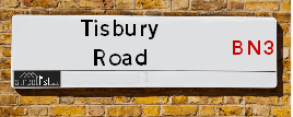
Tisbury Road is a street located in Brighton and Hove. The street has a length of approximately 316 metres.
The street is publicly maintained which means that the road is adopted and Brighton & Hove is responsible for the repair and upkeep of the highway.
The street is located within the The City of Brighton and Hove (B) Council's jurisdiction. They provide various services, like refuse collection, and manage council tax collection. It's situated in the South East region of the UK.
The road has been assigned the Unique Street Reference Number of 4401900 in the National Street Gazetteer.
The street has the postcodes of BN3 3BL, BN3 3BJ, BN3 3BB and BN3 3BA.
It is located within the county of East Sussex, situated in the South East region of the UK. It's 46.43 miles South from central London., 1.29 miles North West from Brighton, 8.7 miles West from Lewes and 26.62 miles East from Chichester.
TISBURY ROAD is within the Post Town of HOVE
Map of Tisbury Road
| Street Crime (updated 14/01/2025) | ||
|---|---|---|
| Location Note | Central Point of Street - Not Actual Location | |
| MSOA Info | For MSOA E02003516 (Statistical Neighbourhood) | |
| Click Hint | Click on a Circle for a detailed breakdown below map. | |
| Crime Levels |
Green = Very Low Yellow = Low Orange = High Red = Very High |
|
| Postcodes | ||
| Icon | Postcodes for Tisbury Road | |
| Walking Distances | ||
| Distance Info | Green Circle = 10 Minutes Walk (800 metres) | |
Street Crime Data accessed from data.police.uk on 06/10/2024.
Moving to Tisbury Road?
I can help you uncover potential pitfalls and provide key questions to ask about your new property. With decades of experience as a Local Land Charges Manager, I offer confidential insights to make your move informed and stress-free.
This service is free, but you may wish to make an optional donation to support it. Please include the property name and address in your request as well as anything you wish to focus on.
Contact Me
Do you know why this road is called Tisbury Road?
What's it like to live here?
Share a Photo of Tisbury Road
Ask the community a question.
Do you have any questions, memories to share, have any photos or know any facts? We'd love to know more.
Submit Your Comment
Find Homes to Rent in Hove

Budget Friendly Hotels near Tisbury Road
| Budget Hotel Name | Distance (miles) |
|---|---|
|
1: Name:Travelodge Brighton Address: 165-167 Preston Rd, Brighton, BN1 6AU Telephone: 0871 984 6017 Visit Hotel Page |
1.14 |
|
2: Name:Travelodge Brighton Seafront Address: West St, Brighton, BN1 2RE Telephone: 0871 984 6405 Visit Hotel Page |
1.20 |
|
3: Name:Premier Inn Brighton City Centre Address: 144 North Street Telephone: Visit Hotel Page |
1.29 |
|
4: Name:Premier Inn Burgess Hill Address: Charles Avenue, Burgess Hill Telephone: Visit Hotel Page |
8.48 |
|
5: Name:Premier Inn Lewes Town Centre Address: The Old Courtroom Telephone: Visit Hotel Page |
8.60 |
Hotel Options
Your support helps keep this site running!
If you enjoy using this website, consider making a donation to help me cover hosting costs.
Flats and Apartments in Tisbury Road
FLAT 1
FLAT 2
FLAT 3
FLAT 4
FLAT 5
FLAT 1
FLAT 2
FLAT 3
FLAT 4
FLAT 5
FLAT 6
FLAT 7
FLAT 8
FLAT 9
FLAT 2
FLAT 3
FLAT 4
FLAT 5
FLAT 1
FLAT 2
FLAT 3
FLAT 4
FLAT 5
FLAT 6
FLAT 7
FLAT 8
FLAT 3
FLAT 4
FLAT 5
FLAT 2
FLAT 4
FLAT 5
FLAT 6
FLAT 1
FLAT 2
FLAT 4
FLAT 1
FLAT 3B
FLAT 5
FLAT 10
FLAT 14
FLAT 20
FLAT 21
FLAT 1
FLAT 2
FLAT 3
FLAT 4
FLAT 1
FLAT 2
FLAT 3
FLAT 4
FLAT 1
FLAT 2
FLAT 3
FLAT 4
FLAT 1
FLAT 2
FLAT 3
FLAT 4
FLAT 6
FLAT 7
FLAT 1
FLAT 2
FLAT 7
FLAT 10
FLAT 2
FLAT 3
FLAT 1
FLAT 2
FLAT 3
FLAT 4
FLAT 1
FLAT 3
FLAT 4
FLAT 5
FLAT 6
FLAT 1
FLAT 2
FLAT 3
FLAT 4
FLAT 5
FLAT 6
FLAT 7
FLAT 8
FLAT 9
FLAT 10
FLAT 1
FLAT 2
FLAT 3
FLAT 4
FLAT 5
FLAT 6
FLAT 7
FLAT 1
FLAT 2
FLAT 3
FLAT 4
FLAT 5
FLAT 1
FLAT 3
FLAT 4
FLAT 5
FLAT 6
BASEMENT FLAT 1, 50
BASEMENT FLAT 2, 50
FLAT 1
FLAT 2
FLAT 3
FLAT 4
FLAT 7
FLAT 3
FLAT 5
FLAT 1
FLAT 2
FLAT 3
FLAT 4
FLAT 5
FLAT 6
FLAT 7
FLAT 1
FLAT 2
FLAT 3
FLAT 4
FLAT 5
FLAT 6
FLAT 7
FLAT 1
FLAT 2
FLAT 3
FLAT 1
FLAT 2
FLAT 4
FLAT 5
FLAT 6
FLAT 2
FLAT 3
FLAT 4
FLAT 5
FLAT 1
FLAT 2
FLAT 3
FLAT 4
FLAT 5
FLAT 6
FLAT 7
FLAT 8
FLAT 2
FLAT 4
FLAT 1
FLAT 2
FLAT 3
FLAT 3
FLAT 1
FLAT 2
FLAT 3
FLAT 3
FLAT 5
FLAT 1
FLAT 2
FLAT 3
FLAT 1
FLAT 2
FLAT 3
FLAT 2
FLAT 3
FLAT 4
FLAT 1
FLAT 2
FLAT 3
FLAT 4
FLAT 1
FLAT 2
FLAT 3
FLAT
FLAT 1
EPC (Energy Performance Certificate) Information for Tisbury Road
UPRN: 22199691
EPC Current: D
EPC Potential: D
Habitable Rooms: 2
Property Type: Flat
Tenure: Owner-occupied
Built Form: Mid-Terrace
Age Band: before 1900
Mains Gas: Yes
UPRN: 22142281
EPC Current: C
EPC Potential: C
Habitable Rooms: 3
Property Type: Flat
Tenure: Rented (private)
Built Form: Mid-Terrace
Age Band: before 1900
Mains Gas: Yes
UPRN: 22216282
EPC Current: C
EPC Potential: C
Habitable Rooms: 2
Property Type: Flat
Tenure: Rented (private)
Built Form: Mid-Terrace
Age Band: before 1900
Mains Gas: Yes
UPRN: 22164621
EPC Current: C
EPC Potential: C
Habitable Rooms: 2
Property Type: Flat
Tenure: Owner-occupied
Built Form: Mid-Terrace
Age Band: before 1900
Mains Gas: Yes
UPRN: 22164622
EPC Current: C
EPC Potential: C
Habitable Rooms: 2
Property Type: Flat
Tenure: Owner-occupied
Built Form: Mid-Terrace
Age Band: before 1900
Mains Gas: Yes
UPRN: 22216286
EPC Current: C
EPC Potential: C
Habitable Rooms: 4
Property Type: Flat
Tenure: rental (private)
Built Form: Mid-Terrace
Age Band: before 1900
Mains Gas: Yes
UPRN: 22023542
EPC Current: C
EPC Potential: C
Habitable Rooms: 3
Property Type: Flat
Tenure: Rented (private)
Built Form: Mid-Terrace
Age Band: before 1900
Mains Gas: Yes
UPRN: 22036127
EPC Current: C
EPC Potential: C
Habitable Rooms: 3
Property Type: Flat
Tenure: Rented (private)
Built Form: Mid-Terrace
Age Band: before 1900
Mains Gas: No
UPRN: 22142371
EPC Current: D
EPC Potential: D
Habitable Rooms: 3
Property Type: Flat
Tenure: Owner-occupied
Built Form: Semi-Detached
Age Band: before 1900
Mains Gas: Yes
UPRN: 22164650
EPC Current: C
EPC Potential: C
Habitable Rooms: 2
Property Type: Flat
Tenure: Rented (private)
Built Form: Mid-Terrace
Age Band: before 1900
Mains Gas: Yes
UPRN: 22216290
EPC Current: C
EPC Potential: C
Habitable Rooms: 1
Property Type: Flat
Tenure: Rented (social)
Built Form: Enclosed End-Terrace
Age Band: 1900-1929
Mains Gas: Yes
UPRN: 22187269
EPC Current: D
EPC Potential: C
Habitable Rooms: 2
Property Type: Flat
Tenure: Owner-occupied
Built Form: Enclosed End-Terrace
Age Band: 1900-1929
Mains Gas: Yes
UPRN: 22035815
EPC Current: D
EPC Potential: C
Habitable Rooms: 3
Property Type: Flat
Tenure: Owner-occupied
Built Form: Semi-Detached
Age Band: before 1900
Mains Gas: Yes
UPRN: 22188034
EPC Current: C
EPC Potential: C
Habitable Rooms: 3
Property Type: Flat
Tenure: rental (social)
Built Form: Mid-Terrace
Age Band: 1900-1929
Mains Gas: Yes
UPRN: 22226406
EPC Current: C
EPC Potential: C
Habitable Rooms: 2
Property Type: Flat
Tenure: rental (social)
Built Form: Mid-Terrace
Age Band: 1900-1929
Mains Gas: Yes
UPRN: 22036152
EPC Current: E
EPC Potential: C
Habitable Rooms: 2
Property Type: Flat
Tenure: Rented (social)
Built Form: Mid-Terrace
Age Band: 1900-1929
Mains Gas: No
UPRN: 22226407
EPC Current: F
EPC Potential: C
Habitable Rooms: 2
Property Type: Flat
Tenure: rental (private)
Built Form: Mid-Terrace
Age Band: before 1900
Mains Gas: No
UPRN: 22226408
EPC Current: C
EPC Potential: C
Habitable Rooms: 3
Property Type: Flat
Tenure: rental (social)
Built Form: Mid-Terrace
Age Band: before 1900
Mains Gas: Yes
UPRN: 22035804
EPC Current: D
EPC Potential: C
Habitable Rooms: 2
Property Type: Flat
Tenure: unknown
Built Form: Semi-Detached
Age Band: before 1900
Mains Gas: No
UPRN: 22036179
EPC Current: D
EPC Potential: C
Habitable Rooms: 3
Property Type: Flat
Tenure: Rented (private)
Built Form: Semi-Detached
Age Band: before 1900
Mains Gas: Yes
UPRN: 22199673
EPC Current: D
EPC Potential: C
Habitable Rooms: 2
Property Type: Flat
Tenure: Owner-occupied
Built Form: Mid-Terrace
Age Band: before 1900
Mains Gas: Yes
UPRN: 22037677
EPC Current: E
EPC Potential: E
Habitable Rooms: 4
Property Type: Maisonette
Tenure: Owner-occupied
Built Form: Semi-Detached
Age Band: 1900-1929
Mains Gas: Yes
UPRN: 22035808
EPC Current: D
EPC Potential: B
Habitable Rooms: 9
Property Type: House
Tenure: Owner-occupied
Built Form: Mid-Terrace
Age Band: before 1900
Mains Gas: No
UPRN: 22164667
EPC Current: C
EPC Potential: C
Habitable Rooms: 2
Property Type: Flat
Tenure: Rented (private)
Built Form: Mid-Terrace
Age Band: before 1900
Mains Gas: Yes
UPRN: 22142461
EPC Current: C
EPC Potential: C
Habitable Rooms: 3
Property Type: Flat
Tenure: Rented (private)
Built Form: Mid-Terrace
Age Band: before 1900
Mains Gas: Yes
UPRN: 22164682
EPC Current: C
EPC Potential: C
Habitable Rooms: 3
Property Type: Flat
Tenure: rental (private)
Built Form: Mid-Terrace
Age Band: before 1900
Mains Gas: Yes
UPRN: 22036157
EPC Current: D
EPC Potential: C
Habitable Rooms: 5
Property Type: Maisonette
Tenure: Owner-occupied
Built Form: NO DATA!
Age Band: before 1900
Mains Gas: Yes
UPRN: 22036158
EPC Current: D
EPC Potential: C
Habitable Rooms: 3
Property Type: Flat
Tenure: rental (private)
Built Form: Mid-Terrace
Age Band: before 1900
Mains Gas: Yes
UPRN: 22036159
EPC Current: C
EPC Potential: C
Habitable Rooms: 2
Property Type: Flat
Tenure: Rented (social)
Built Form: Mid-Terrace
Age Band: 1900-1929
Mains Gas: Yes
UPRN: 22036160
EPC Current: C
EPC Potential: C
Habitable Rooms: 1
Property Type: Flat
Tenure: rental (social)
Built Form: Mid-Terrace
Age Band: before 1900
Mains Gas: Yes
UPRN: 22035810
EPC Current: C
EPC Potential: C
Habitable Rooms: 2
Property Type: Flat
Tenure: Rented (social)
Built Form: Mid-Terrace
Age Band: 1900-1929
Mains Gas: Yes
UPRN: 22036161
EPC Current: C
EPC Potential: C
Habitable Rooms: 3
Property Type: Flat
Tenure: Owner-occupied
Built Form: Mid-Terrace
Age Band: before 1900
Mains Gas: Yes
UPRN: 22035811
EPC Current: C
EPC Potential: B
Habitable Rooms: 2
Property Type: Flat
Tenure: rental (private)
Built Form: Semi-Detached
Age Band: before 1900
Mains Gas: Yes
UPRN: 22036162
EPC Current: D
EPC Potential: C
Habitable Rooms: 3
Property Type: Flat
Tenure: Owner-occupied
Built Form: Mid-Terrace
Age Band: before 1900
Mains Gas: Yes
UPRN: 22036164
EPC Current: C
EPC Potential: C
Habitable Rooms: 4
Property Type: Flat
Tenure: Owner-occupied
Built Form: End-Terrace
Age Band: before 1900
Mains Gas: Yes
UPRN: 22199695
EPC Current: C
EPC Potential: C
Habitable Rooms: 3
Property Type: Flat
Tenure: Owner-occupied
Built Form: Mid-Terrace
Age Band: before 1900
Mains Gas: Yes
UPRN: 22216283
EPC Current: C
EPC Potential: C
Habitable Rooms: 2
Property Type: Flat
Tenure: Owner-occupied
Built Form: Mid-Terrace
Age Band: before 1900
Mains Gas: Yes
UPRN: 22199674
EPC Current: C
EPC Potential: C
Habitable Rooms: 2
Property Type: Flat
Tenure: Rented (private)
Built Form: Mid-Terrace
Age Band: 1900-1929
Mains Gas: Yes
UPRN: 22226402
EPC Current: C
EPC Potential: B
Habitable Rooms: 3
Property Type: Flat
Tenure: rental (social)
Built Form: Mid-Terrace
Age Band: before 1900
Mains Gas: Yes
UPRN: 22209582
EPC Current: D
EPC Potential: C
Habitable Rooms: 3
Property Type: Flat
Tenure: rental (private)
Built Form: Mid-Terrace
Age Band: before 1900
Mains Gas: Yes
UPRN: 22035793
EPC Current: C
EPC Potential: C
Habitable Rooms: 3
Property Type: Flat
Tenure: Rented (private)
Built Form: Mid-Terrace
Age Band: before 1900
Mains Gas: Yes
UPRN: 22208803
EPC Current: D
EPC Potential: D
Habitable Rooms: 2
Property Type: Flat
Tenure: Owner-occupied
Built Form: Mid-Terrace
Age Band: before 1900
Mains Gas: Yes
UPRN: 22142342
EPC Current: D
EPC Potential: C
Habitable Rooms: 3
Property Type: Maisonette
Tenure: Owner-occupied
Built Form: Mid-Terrace
Age Band: before 1900
Mains Gas: No
UPRN: 22164543
EPC Current: D
EPC Potential: C
Habitable Rooms: 2
Property Type: Flat
Tenure: rental (private)
Built Form: Semi-Detached
Age Band: before 1900
Mains Gas: Yes
UPRN: 22220039
EPC Current: D
EPC Potential: C
Habitable Rooms: 3
Property Type: Flat
Tenure: Owner-occupied
Built Form: Mid-Terrace
Age Band: before 1900
Mains Gas: No
UPRN: 22142391
EPC Current: E
EPC Potential: C
Habitable Rooms: 3
Property Type: Flat
Tenure: Owner-occupied
Built Form: Mid-Terrace
Age Band: 1900-1929
Mains Gas: No
UPRN: 22036989
EPC Current: D
EPC Potential: C
Habitable Rooms: 3
Property Type: Flat
Tenure: Owner-occupied
Built Form: Semi-Detached
Age Band: before 1900
Mains Gas: Yes
UPRN: 22251324
EPC Current: C
EPC Potential: C
Habitable Rooms: 3
Property Type: Flat
Tenure: rental (private)
Built Form: Mid-Terrace
Age Band: before 1900
Mains Gas: Yes
UPRN: 22189852
EPC Current: E
EPC Potential: C
Habitable Rooms: 3
Property Type: Flat
Tenure: rental (private)
Built Form: Mid-Terrace
Age Band: before 1900
Mains Gas: No
UPRN: 22142454
EPC Current: C
EPC Potential: C
Habitable Rooms: 3
Property Type: Flat
Tenure: Rented (private)
Built Form: Mid-Terrace
Age Band: before 1900
Mains Gas: Yes
UPRN: 22035807
EPC Current: C
EPC Potential: C
Habitable Rooms: 3
Property Type: Flat
Tenure: Owner-occupied
Built Form: Mid-Terrace
Age Band: before 1900
Mains Gas: Yes
UPRN: 22164651
EPC Current: D
EPC Potential: B
Habitable Rooms: 1
Property Type: Flat
Tenure: rental (private)
Built Form: Mid-Terrace
Age Band: before 1900
Mains Gas: No
UPRN: 22164652
EPC Current: C
EPC Potential: B
Habitable Rooms: 2
Property Type: Flat
Tenure: Owner-occupied
Built Form: Mid-Terrace
Age Band: 1900-1929
Mains Gas: No
UPRN: 22229223
EPC Current: F
EPC Potential: D
Habitable Rooms: 2
Property Type: Flat
Tenure: Owner-occupied
Built Form: Detached
Age Band: before 1900
Mains Gas: No
UPRN: 22142288
EPC Current: D
EPC Potential: B
Habitable Rooms: 2
Property Type: Flat
Tenure: Rented (private)
Built Form: Mid-Terrace
Age Band: before 1900
Mains Gas: Yes
UPRN: 22142313
EPC Current: C
EPC Potential: B
Habitable Rooms: 3
Property Type: Flat
Tenure: rental (private)
Built Form: Mid-Terrace
Age Band: before 1900
Mains Gas: Yes
UPRN: 22142319
EPC Current: C
EPC Potential: B
Habitable Rooms: 3
Property Type: Flat
Tenure: Owner-occupied
Built Form: Mid-Terrace
Age Band: before 1900
Mains Gas: Yes
UPRN: 22142339
EPC Current: D
EPC Potential: C
Habitable Rooms: 3
Property Type: Flat
Tenure: Rented (private)
Built Form: Mid-Terrace
Age Band: before 1900
Mains Gas: No
UPRN: 22164533
EPC Current: F
EPC Potential: F
Habitable Rooms: 3
Property Type: Flat
Tenure: Owner-occupied
Built Form: NO DATA!
Age Band: before 1900
Mains Gas: Yes
UPRN: 22142384
EPC Current: E
EPC Potential: B
Habitable Rooms: 2
Property Type: Flat
Tenure: Owner-occupied
Built Form: Mid-Terrace
Age Band: before 1900
Mains Gas: No
UPRN: 22142455
EPC Current: C
EPC Potential: B
Habitable Rooms: 3
Property Type: Flat
Tenure: Rented (private)
Built Form: Mid-Terrace
Age Band: 1900-1929
Mains Gas: Yes
UPRN: 22037051
EPC Current: C
EPC Potential: C
Habitable Rooms: N/A
Property Type: Flat
Tenure: unknown
Built Form: Mid-Terrace
Age Band: U
Mains Gas: Unknown
UPRN: 22142471
EPC Current: D
EPC Potential: C
Habitable Rooms: 3
Property Type: Flat
Tenure: rental (private)
Built Form: Mid-Terrace
Age Band: before 1900
Mains Gas: Yes
UPRN: 22142276
EPC Current: E
EPC Potential: E
Habitable Rooms: 4
Property Type: Maisonette
Tenure: rental (private)
Built Form: End-Terrace
Age Band: 1976-1982
Mains Gas: Yes
UPRN: 22036963
EPC Current: C
EPC Potential: C
Habitable Rooms: 3
Property Type: Flat
Tenure: Owner-occupied
Built Form: Mid-Terrace
Age Band: 1900-1929
Mains Gas: Yes
UPRN: 22164616
EPC Current: E
EPC Potential: B
Habitable Rooms: 1
Property Type: Flat
Tenure: Owner-occupied
Built Form: Mid-Terrace
Age Band: before 1900
Mains Gas: No
UPRN: 22036098
EPC Current: D
EPC Potential: C
Habitable Rooms: 2
Property Type: Flat
Tenure: rental (private)
Built Form: Mid-Terrace
Age Band: 1900-1929
Mains Gas: Yes
UPRN: 22164521
EPC Current: C
EPC Potential: C
Habitable Rooms: 2
Property Type: Flat
Tenure: rental (private)
Built Form: Semi-Detached
Age Band: before 1900
Mains Gas: Yes
UPRN: 22164525
EPC Current: E
EPC Potential: C
Habitable Rooms: 1
Property Type: Flat
Tenure: Owner-occupied
Built Form: Mid-Terrace
Age Band: 1900-1929
Mains Gas: No
UPRN: 22142337
EPC Current: D
EPC Potential: C
Habitable Rooms: 2
Property Type: Flat
Tenure: Owner-occupied
Built Form: Detached
Age Band: before 1900
Mains Gas: Yes
UPRN: 22036101
EPC Current: C
EPC Potential: C
Habitable Rooms: 2
Property Type: Flat
Tenure: rental (private)
Built Form: Mid-Terrace
Age Band: before 1900
Mains Gas: Yes
UPRN: 22142351
EPC Current: E
EPC Potential: B
Habitable Rooms: 1
Property Type: Flat
Tenure: rental (private)
Built Form: Mid-Terrace
Age Band: before 1900
Mains Gas: No
UPRN: 22036102
EPC Current: D
EPC Potential: C
Habitable Rooms: 3
Property Type: Flat
Tenure: rental (private)
Built Form: Mid-Terrace
Age Band: before 1900
Mains Gas: Yes
UPRN: 22164537
EPC Current: E
EPC Potential: C
Habitable Rooms: 1
Property Type: Flat
Tenure: rental (private)
Built Form: End-Terrace
Age Band: before 1900
Mains Gas: No
UPRN: 22164544
EPC Current: D
EPC Potential: C
Habitable Rooms: 2
Property Type: Flat
Tenure: Rented (private)
Built Form: Semi-Detached
Age Band: before 1900
Mains Gas: Yes
UPRN: 22023699
EPC Current: C
EPC Potential: C
Habitable Rooms: 2
Property Type: Flat
Tenure: Owner-occupied
Built Form: Semi-Detached
Age Band: before 1900
Mains Gas: Yes
UPRN: 22036981
EPC Current: D
EPC Potential: C
Habitable Rooms: 3
Property Type: Maisonette
Tenure: Owner-occupied
Built Form: Semi-Detached
Age Band: 1900-1929
Mains Gas: Yes
UPRN: 22036133
EPC Current: C
EPC Potential: C
Habitable Rooms: 2
Property Type: Flat
Tenure: Owner-occupied
Built Form: Mid-Terrace
Age Band: 1900-1929
Mains Gas: Yes
UPRN: 22037082
EPC Current: C
EPC Potential: C
Habitable Rooms: 2
Property Type: Flat
Tenure: Owner-occupied
Built Form: Mid-Terrace
Age Band: before 1900
Mains Gas: Yes
UPRN: 22036165
EPC Current: C
EPC Potential: C
Habitable Rooms: 2
Property Type: Flat
Tenure: Owner-occupied
Built Form: Semi-Detached
Age Band: before 1900
Mains Gas: Yes
UPRN: 22036134
EPC Current: D
EPC Potential: C
Habitable Rooms: 2
Property Type: Flat
Tenure: rental (private)
Built Form: Mid-Terrace
Age Band: before 1900
Mains Gas: Yes
UPRN: 22164557
EPC Current: D
EPC Potential: B
Habitable Rooms: 1
Property Type: Flat
Tenure: Owner-occupied
Built Form: End-Terrace
Age Band: 1900-1929
Mains Gas: No
UPRN: 22164566
EPC Current: D
EPC Potential: C
Habitable Rooms: 2
Property Type: Flat
Tenure: Owner-occupied
Built Form: Semi-Detached
Age Band: before 1900
Mains Gas: Yes
UPRN: 22142411
EPC Current: D
EPC Potential: C
Habitable Rooms: 2
Property Type: Flat
Tenure: Owner-occupied
Built Form: Enclosed End-Terrace
Age Band: before 1900
Mains Gas: Yes
UPRN: 22199679
EPC Current: E
EPC Potential: C
Habitable Rooms: 1
Property Type: Flat
Tenure: Rented (private)
Built Form: Semi-Detached
Age Band: before 1900
Mains Gas: No
UPRN: 22142439
EPC Current: D
EPC Potential: C
Habitable Rooms: 1
Property Type: Flat
Tenure: Rented (private)
Built Form: End-Terrace
Age Band: before 1900
Mains Gas: Yes
UPRN: 22036135
EPC Current: D
EPC Potential: C
Habitable Rooms: 3
Property Type: Flat
Tenure: Owner-occupied
Built Form: Mid-Terrace
Age Band: before 1900
Mains Gas: Yes
UPRN: 22164583
EPC Current: E
EPC Potential: C
Habitable Rooms: 1
Property Type: Flat
Tenure: Owner-occupied
Built Form: Semi-Detached
Age Band: before 1900
Mains Gas: No
UPRN: 22037675
EPC Current: D
EPC Potential: C
Habitable Rooms: 3
Property Type: Flat
Tenure: rental (private)
Built Form: Semi-Detached
Age Band: before 1900
Mains Gas: Yes
UPRN: 22164680
EPC Current: C
EPC Potential: C
Habitable Rooms: 1
Property Type: Flat
Tenure: Rented (private)
Built Form: Semi-Detached
Age Band: before 1900
Mains Gas: Yes
UPRN: 22036137
EPC Current: C
EPC Potential: C
Habitable Rooms: 2
Property Type: Flat
Tenure: rental (private)
Built Form: Detached
Age Band: 1900-1929
Mains Gas: Yes
UPRN: 22164691
EPC Current: E
EPC Potential: C
Habitable Rooms: 2
Property Type: Flat
Tenure: Owner-occupied
Built Form: End-Terrace
Age Band: before 1900
Mains Gas: Yes
UPRN: 22142482
EPC Current: F
EPC Potential: E
Habitable Rooms: 2
Property Type: Flat
Tenure: rental (social)
Built Form: Detached
Age Band: 1900-1929
Mains Gas: No
UPRN: 22142277
EPC Current: D
EPC Potential: B
Habitable Rooms: 4
Property Type: Maisonette
Tenure: Owner-occupied
Built Form: Mid-Terrace
Age Band: before 1900
Mains Gas: Yes
UPRN: 22235375
EPC Current: C
EPC Potential: C
Habitable Rooms: 1
Property Type: Flat
Tenure: Owner-occupied
Built Form: Mid-Terrace
Age Band: before 1900
Mains Gas: Yes
UPRN: 22036964
EPC Current: C
EPC Potential: C
Habitable Rooms: 2
Property Type: Flat
Tenure: rental (private)
Built Form: Semi-Detached
Age Band: before 1900
Mains Gas: Yes
UPRN: 22142292
EPC Current: C
EPC Potential: B
Habitable Rooms: 3
Property Type: Flat
Tenure: Owner-occupied
Built Form: Mid-Terrace
Age Band: before 1900
Mains Gas: Yes
UPRN: 22164613
EPC Current: D
EPC Potential: D
Habitable Rooms: 2
Property Type: Flat
Tenure: Owner-occupied
Built Form: Mid-Terrace
Age Band: before 1900
Mains Gas: Yes
UPRN: 22164617
EPC Current: D
EPC Potential: C
Habitable Rooms: 1
Property Type: Flat
Tenure: Rented (private)
Built Form: Mid-Terrace
Age Band: before 1900
Mains Gas: No
UPRN: 22036103
EPC Current: D
EPC Potential: C
Habitable Rooms: 3
Property Type: Flat
Tenure: Rented (private)
Built Form: Mid-Terrace
Age Band: 1900-1929
Mains Gas: Yes
UPRN: 22142303
EPC Current: E
EPC Potential: E
Habitable Rooms: 1
Property Type: Flat
Tenure: Owner-occupied
Built Form: Mid-Terrace
Age Band: before 1900
Mains Gas: Yes
UPRN: 22164623
EPC Current: D
EPC Potential: C
Habitable Rooms: 2
Property Type: Flat
Tenure: Owner-occupied
Built Form: Mid-Terrace
Age Band: before 1900
Mains Gas: Yes
UPRN: 22023539
EPC Current: E
EPC Potential: C
Habitable Rooms: 3
Property Type: Flat
Tenure: Owner-occupied
Built Form: End-Terrace
Age Band: before 1900
Mains Gas: Yes
UPRN: 22164522
EPC Current: C
EPC Potential: C
Habitable Rooms: 3
Property Type: Flat
Tenure: rental (private)
Built Form: Detached
Age Band: before 1900
Mains Gas: Yes
UPRN: 22036105
EPC Current: D
EPC Potential: C
Habitable Rooms: 2
Property Type: Flat
Tenure: Owner-occupied
Built Form: Mid-Terrace
Age Band: before 1900
Mains Gas: Yes
UPRN: 22164526
EPC Current: D
EPC Potential: C
Habitable Rooms: 2
Property Type: Flat
Tenure: rental (private)
Built Form: Mid-Terrace
Age Band: before 1900
Mains Gas: No
UPRN: 22182687
EPC Current: D
EPC Potential: C
Habitable Rooms: 1
Property Type: Flat
Tenure: Owner-occupied
Built Form: Enclosed Mid-Terrace
Age Band: before 1900
Mains Gas: Yes
UPRN: 22036106
EPC Current: C
EPC Potential: B
Habitable Rooms: 3
Property Type: Flat
Tenure: Owner-occupied
Built Form: Mid-Terrace
Age Band: before 1900
Mains Gas: Yes
UPRN: 22142352
EPC Current: D
EPC Potential: B
Habitable Rooms: 1
Property Type: Flat
Tenure: Rented (private)
Built Form: Mid-Terrace
Age Band: before 1900
Mains Gas: No
UPRN: 22036107
EPC Current: C
EPC Potential: C
Habitable Rooms: 3
Property Type: Flat
Tenure: Rented (private)
Built Form: Mid-Terrace
Age Band: before 1900
Mains Gas: Yes
UPRN: 22229231
EPC Current: E
EPC Potential: C
Habitable Rooms: 2
Property Type: Flat
Tenure: Rented (private)
Built Form: Enclosed End-Terrace
Age Band: before 1900
Mains Gas: No
UPRN: 22164545
EPC Current: D
EPC Potential: C
Habitable Rooms: 4
Property Type: Flat
Tenure: rental (private)
Built Form: Semi-Detached
Age Band: before 1900
Mains Gas: Yes
UPRN: 22023700
EPC Current: D
EPC Potential: C
Habitable Rooms: 1
Property Type: Flat
Tenure: rental (private)
Built Form: Detached
Age Band: before 1900
Mains Gas: Yes
UPRN: 22036138
EPC Current: C
EPC Potential: B
Habitable Rooms: 4
Property Type: Flat
Tenure: Owner-occupied
Built Form: Mid-Terrace
Age Band: 1900-1929
Mains Gas: Yes
UPRN: 22037083
EPC Current: D
EPC Potential: C
Habitable Rooms: 3
Property Type: Flat
Tenure: rental (private)
Built Form: Mid-Terrace
Age Band: before 1900
Mains Gas: Yes
UPRN: 22036166
EPC Current: C
EPC Potential: C
Habitable Rooms: 2
Property Type: Flat
Tenure: Rented (private)
Built Form: Enclosed End-Terrace
Age Band: before 1900
Mains Gas: Yes
UPRN: 22036139
EPC Current: D
EPC Potential: D
Habitable Rooms: 3
Property Type: Flat
Tenure: rental (private)
Built Form: Mid-Terrace
Age Band: 1900-1929
Mains Gas: Yes
UPRN: 22164558
EPC Current: C
EPC Potential: C
Habitable Rooms: 2
Property Type: Flat
Tenure: Rented (social)
Built Form: Semi-Detached
Age Band: 1900-1929
Mains Gas: No
UPRN: 22164567
EPC Current: D
EPC Potential: B
Habitable Rooms: 3
Property Type: Flat
Tenure: Owner-occupied
Built Form: Semi-Detached
Age Band: before 1900
Mains Gas: Yes
UPRN: 22142412
EPC Current: D
EPC Potential: B
Habitable Rooms: 1
Property Type: Flat
Tenure: Rented (private)
Built Form: Semi-Detached
Age Band: before 1900
Mains Gas: No
UPRN: 22142425
EPC Current: C
EPC Potential: B
Habitable Rooms: 2
Property Type: Flat
Tenure: Owner-occupied
Built Form: Semi-Detached
Age Band: before 1900
Mains Gas: No
UPRN: 22142434
EPC Current: C
EPC Potential: C
Habitable Rooms: 2
Property Type: Flat
Tenure: Rented (private)
Built Form: Mid-Terrace
Age Band: before 1900
Mains Gas: Yes
UPRN: 22142440
EPC Current: D
EPC Potential: C
Habitable Rooms: 2
Property Type: Flat
Tenure: Rented (private)
Built Form: End-Terrace
Age Band: before 1900
Mains Gas: Yes
UPRN: 22036140
EPC Current: D
EPC Potential: C
Habitable Rooms: 2
Property Type: Flat
Tenure: Owner-occupied
Built Form: Mid-Terrace
Age Band: before 1900
Mains Gas: Yes
UPRN: 22164584
EPC Current: E
EPC Potential: C
Habitable Rooms: 2
Property Type: Flat
Tenure: Owner-occupied
Built Form: Semi-Detached
Age Band: 1900-1929
Mains Gas: No
UPRN: 22164659
EPC Current: D
EPC Potential: C
Habitable Rooms: 3
Property Type: Flat
Tenure: Owner-occupied
Built Form: Detached
Age Band: before 1900
Mains Gas: Yes
UPRN: 22164676
EPC Current: C
EPC Potential: C
Habitable Rooms: 2
Property Type: Flat
Tenure: Owner-occupied
Built Form: Mid-Terrace
Age Band: before 1900
Mains Gas: Yes
UPRN: 22036142
EPC Current: D
EPC Potential: B
Habitable Rooms: 3
Property Type: Flat
Tenure: rental (private)
Built Form: Mid-Terrace
Age Band: before 1900
Mains Gas: Yes
UPRN: 22142483
EPC Current: C
EPC Potential: C
Habitable Rooms: 1
Property Type: Flat
Tenure: rental (private)
Built Form: Detached
Age Band: 1900-1929
Mains Gas: Yes
UPRN: 22164596
EPC Current: F
EPC Potential: D
Habitable Rooms: 2
Property Type: Flat
Tenure: Owner-occupied
Built Form: End-Terrace
Age Band: before 1900
Mains Gas: No
UPRN: 22036965
EPC Current: C
EPC Potential: B
Habitable Rooms: 2
Property Type: Flat
Tenure: rental (private)
Built Form: Detached
Age Band: 1900-1929
Mains Gas: Yes
UPRN: 22164618
EPC Current: D
EPC Potential: C
Habitable Rooms: 1
Property Type: Flat
Tenure: Rented (private)
Built Form: Mid-Terrace
Age Band: before 1900
Mains Gas: No
UPRN: 22036108
EPC Current: E
EPC Potential: D
Habitable Rooms: 3
Property Type: Flat
Tenure: rental (private)
Built Form: Mid-Terrace
Age Band: 1900-1929
Mains Gas: Yes
UPRN: 22164624
EPC Current: C
EPC Potential: C
Habitable Rooms: 2
Property Type: Flat
Tenure: rental (private)
Built Form: Mid-Terrace
Age Band: before 1900
Mains Gas: Yes
UPRN: 22023541
EPC Current: D
EPC Potential: C
Habitable Rooms: 4
Property Type: Flat
Tenure: Rented (private)
Built Form: Semi-Detached
Age Band: before 1900
Mains Gas: Yes
UPRN: 22164523
EPC Current: D
EPC Potential: C
Habitable Rooms: 3
Property Type: Flat
Tenure: Owner-occupied
Built Form: Mid-Terrace
Age Band: before 1900
Mains Gas: Yes
UPRN: 22023652
EPC Current: E
EPC Potential: C
Habitable Rooms: 1
Property Type: Flat
Tenure: rental (private)
Built Form: Mid-Terrace
Age Band: before 1900
Mains Gas: No
UPRN: 22182690
EPC Current: C
EPC Potential: C
Habitable Rooms: 2
Property Type: Flat
Tenure: rental (private)
Built Form: Mid-Terrace
Age Band: 1900-1929
Mains Gas: Yes
UPRN: 22021139
EPC Current: D
EPC Potential: C
Habitable Rooms: 4
Property Type: Flat
Tenure: Owner-occupied
Built Form: Mid-Terrace
Age Band: 1900-1929
Mains Gas: Yes
UPRN: 22036112
EPC Current: C
EPC Potential: B
Habitable Rooms: 3
Property Type: Flat
Tenure: Owner-occupied
Built Form: Mid-Terrace
Age Band: 1900-1929
Mains Gas: Yes
UPRN: 22182703
EPC Current: E
EPC Potential: C
Habitable Rooms: 1
Property Type: Flat
Tenure: Rented (private)
Built Form: Enclosed Mid-Terrace
Age Band: before 1900
Mains Gas: No
UPRN: 22164546
EPC Current: D
EPC Potential: C
Habitable Rooms: 3
Property Type: Flat
Tenure: rental (private)
Built Form: Semi-Detached
Age Band: before 1900
Mains Gas: Yes
UPRN: 22142379
EPC Current: C
EPC Potential: B
Habitable Rooms: 3
Property Type: Flat
Tenure: rental (private)
Built Form: Mid-Terrace
Age Band: before 1900
Mains Gas: Yes
UPRN: 22023701
EPC Current: D
EPC Potential: C
Habitable Rooms: 2
Property Type: Flat
Tenure: Rented (private)
Built Form: Semi-Detached
Age Band: before 1900
Mains Gas: Yes
UPRN: 22036143
EPC Current: D
EPC Potential: C
Habitable Rooms: 5
Property Type: Maisonette
Tenure: Owner-occupied
Built Form: Mid-Terrace
Age Band: 1900-1929
Mains Gas: Yes
UPRN: 22036991
EPC Current: D
EPC Potential: C
Habitable Rooms: 3
Property Type: Flat
Tenure: Rented (private)
Built Form: Semi-Detached
Age Band: 1900-1929
Mains Gas: Yes
UPRN: 22037084
EPC Current: D
EPC Potential: B
Habitable Rooms: 5
Property Type: Maisonette
Tenure: Rented (private)
Built Form: Mid-Terrace
Age Band: before 1900
Mains Gas: Yes
UPRN: 22036167
EPC Current: E
EPC Potential: C
Habitable Rooms: 1
Property Type: Flat
Tenure: Rented (private)
Built Form: Semi-Detached
Age Band: before 1900
Mains Gas: No
UPRN: 22036144
EPC Current: C
EPC Potential: B
Habitable Rooms: 2
Property Type: Flat
Tenure: rental (private)
Built Form: Mid-Terrace
Age Band: before 1900
Mains Gas: Yes
UPRN: 22164559
EPC Current: C
EPC Potential: B
Habitable Rooms: 2
Property Type: Flat
Tenure: Rented (social)
Built Form: Semi-Detached
Age Band: 1900-1929
Mains Gas: No
UPRN: 22199661
EPC Current: E
EPC Potential: C
Habitable Rooms: 2
Property Type: Flat
Tenure: rental (private)
Built Form: Mid-Terrace
Age Band: before 1900
Mains Gas: No
UPRN: 22142413
EPC Current: E
EPC Potential: C
Habitable Rooms: 2
Property Type: Flat
Tenure: Rented (private)
Built Form: Mid-Terrace
Age Band: before 1900
Mains Gas: No
UPRN: 22249329
EPC Current: D
EPC Potential: C
Habitable Rooms: 2
Property Type: Flat
Tenure: rental (private)
Built Form: Mid-Terrace
Age Band: before 1900
Mains Gas: No
UPRN: 22164571
EPC Current: C
EPC Potential: C
Habitable Rooms: 2
Property Type: Flat
Tenure: rental (private)
Built Form: End-Terrace
Age Band: 1900-1929
Mains Gas: Yes
UPRN: 22142441
EPC Current: D
EPC Potential: C
Habitable Rooms: 1
Property Type: Flat
Tenure: rental (private)
Built Form: Semi-Detached
Age Band: before 1900
Mains Gas: Yes
UPRN: 22036145
EPC Current: D
EPC Potential: C
Habitable Rooms: 3
Property Type: Flat
Tenure: Owner-occupied
Built Form: Mid-Terrace
Age Band: before 1900
Mains Gas: Yes
UPRN: 22164660
EPC Current: C
EPC Potential: C
Habitable Rooms: 2
Property Type: Flat
Tenure: rental (private)
Built Form: Detached
Age Band: before 1900
Mains Gas: Yes
UPRN: 22164677
EPC Current: C
EPC Potential: C
Habitable Rooms: 2
Property Type: Flat
Tenure: Rented (private)
Built Form: Mid-Terrace
Age Band: before 1900
Mains Gas: Yes
UPRN: 22036146
EPC Current: C
EPC Potential: C
Habitable Rooms: 3
Property Type: Flat
Tenure: Owner-occupied
Built Form: Mid-Terrace
Age Band: 1900-1929
Mains Gas: Yes
UPRN: 22036147
EPC Current: C
EPC Potential: B
Habitable Rooms: 3
Property Type: Flat
Tenure: Owner-occupied
Built Form: Mid-Terrace
Age Band: 1900-1929
Mains Gas: Yes
UPRN: 22142472
EPC Current: D
EPC Potential: C
Habitable Rooms: 3
Property Type: Flat
Tenure: rental (private)
Built Form: Mid-Terrace
Age Band: before 1900
Mains Gas: Yes
UPRN: 22142480
EPC Current: E
EPC Potential: C
Habitable Rooms: 3
Property Type: Flat
Tenure: Owner-occupied
Built Form: End-Terrace
Age Band: before 1900
Mains Gas: Yes
UPRN: 22142484
EPC Current: F
EPC Potential: C
Habitable Rooms: 2
Property Type: Flat
Tenure: rental (private)
Built Form: End-Terrace
Age Band: before 1900
Mains Gas: No
UPRN: 22036983
EPC Current: D
EPC Potential: C
Habitable Rooms: 1
Property Type: Flat
Tenure: Rented (private)
Built Form: Semi-Detached
Age Band: before 1900
Mains Gas: No
UPRN: 22036966
EPC Current: D
EPC Potential: D
Habitable Rooms: 2
Property Type: Flat
Tenure: Owner-occupied
Built Form: Enclosed Mid-Terrace
Age Band: before 1900
Mains Gas: Yes
UPRN: 22164619
EPC Current: D
EPC Potential: B
Habitable Rooms: 2
Property Type: Flat
Tenure: Rented (private)
Built Form: Mid-Terrace
Age Band: before 1900
Mains Gas: No
UPRN: 22142305
EPC Current: F
EPC Potential: F
Habitable Rooms: 1
Property Type: Flat
Tenure: rental (private)
Built Form: Mid-Terrace
Age Band: before 1900
Mains Gas: Yes
UPRN: 22164625
EPC Current: D
EPC Potential: D
Habitable Rooms: 3
Property Type: Flat
Tenure: Owner-occupied
Built Form: Mid-Terrace
Age Band: before 1900
Mains Gas: Yes
UPRN: 22142316
EPC Current: D
EPC Potential: C
Habitable Rooms: 3
Property Type: Flat
Tenure: Owner-occupied
Built Form: Semi-Detached
Age Band: before 1900
Mains Gas: Yes
UPRN: 22164524
EPC Current: C
EPC Potential: C
Habitable Rooms: 2
Property Type: Flat
Tenure: Owner-occupied
Built Form: Mid-Terrace
Age Band: 1976-1982
Mains Gas: Yes
UPRN: 22023653
EPC Current: C
EPC Potential: C
Habitable Rooms: 1
Property Type: Flat
Tenure: Rented (private)
Built Form: Mid-Terrace
Age Band: before 1900
Mains Gas: Yes
UPRN: 22142336
EPC Current: E
EPC Potential: C
Habitable Rooms: 3
Property Type: Flat
Tenure: Owner-occupied
Built Form: Mid-Terrace
Age Band: before 1900
Mains Gas: Yes
UPRN: 22142354
EPC Current: E
EPC Potential: B
Habitable Rooms: 1
Property Type: Flat
Tenure: rental (private)
Built Form: Mid-Terrace
Age Band: before 1900
Mains Gas: No
UPRN: 22036114
EPC Current: E
EPC Potential: D
Habitable Rooms: 4
Property Type: Flat
Tenure: Owner-occupied
Built Form: Mid-Terrace
Age Band: before 1900
Mains Gas: Yes
UPRN: 22164540
EPC Current: E
EPC Potential: C
Habitable Rooms: 1
Property Type: Flat
Tenure: Rented (private)
Built Form: End-Terrace
Age Band: before 1900
Mains Gas: No
UPRN: 22142380
EPC Current: D
EPC Potential: D
Habitable Rooms: 3
Property Type: Flat
Tenure: Owner-occupied
Built Form: Mid-Terrace
Age Band: before 1900
Mains Gas: Yes
UPRN: 22023702
EPC Current: D
EPC Potential: C
Habitable Rooms: 2
Property Type: Flat
Tenure: Owner-occupied
Built Form: Mid-Terrace
Age Band: before 1900
Mains Gas: No
UPRN: 22036168
EPC Current: E
EPC Potential: B
Habitable Rooms: 1
Property Type: Flat
Tenure: Rented (private)
Built Form: Mid-Terrace
Age Band: before 1900
Mains Gas: No
UPRN: 22036148
EPC Current: G
EPC Potential: G
Habitable Rooms: 2
Property Type: Flat
Tenure: Rented (private)
Built Form: Mid-Terrace
Age Band: before 1900
Mains Gas: No
UPRN: 22164560
EPC Current: D
EPC Potential: B
Habitable Rooms: 2
Property Type: Flat
Tenure: Owner-occupied
Built Form: End-Terrace
Age Band: 1900-1929
Mains Gas: No
UPRN: 22164569
EPC Current: E
EPC Potential: E
Habitable Rooms: 3
Property Type: Flat
Tenure: rental (private)
Built Form: Semi-Detached
Age Band: before 1900
Mains Gas: Yes
UPRN: 22142414
EPC Current: C
EPC Potential: B
Habitable Rooms: 1
Property Type: Flat
Tenure: Not defined - use in the case of a new dwelling fo
Built Form: Semi-Detached
Age Band: 1900-1929
Mains Gas: No
UPRN: 22164572
EPC Current: E
EPC Potential: C
Habitable Rooms: 2
Property Type: Flat
Tenure: Owner-occupied
Built Form: Semi-Detached
Age Band: before 1900
Mains Gas: No
UPRN: 22142436
EPC Current: D
EPC Potential: D
Habitable Rooms: 3
Property Type: Flat
Tenure: Owner-occupied
Built Form: Semi-Detached
Age Band: before 1900
Mains Gas: Yes
UPRN: 22142442
EPC Current: D
EPC Potential: C
Habitable Rooms: 1
Property Type: Flat
Tenure: Rented (private)
Built Form: Semi-Detached
Age Band: before 1900
Mains Gas: Yes
UPRN: 22164661
EPC Current: C
EPC Potential: C
Habitable Rooms: 2
Property Type: Flat
Tenure: rental (private)
Built Form: Mid-Terrace
Age Band: 1900-1929
Mains Gas: Yes
UPRN: 22199696
EPC Current: C
EPC Potential: B
Habitable Rooms: 2
Property Type: Flat
Tenure: rental (private)
Built Form: Mid-Terrace
Age Band: before 1900
Mains Gas: Yes
UPRN: 22256285
EPC Current: B
EPC Potential: B
Habitable Rooms: N/A
Property Type: Flat
Tenure: NO DATA!
Built Form: Detached
Age Band: U
Mains Gas: Unknown
UPRN: 22142477
EPC Current: D
EPC Potential: C
Habitable Rooms: 3
Property Type: Flat
Tenure: rental (private)
Built Form: End-Terrace
Age Band: before 1900
Mains Gas: Yes
UPRN: 22142485
EPC Current: F
EPC Potential: C
Habitable Rooms: 2
Property Type: Flat
Tenure: rental (private)
Built Form: End-Terrace
Age Band: before 1900
Mains Gas: No
UPRN: 22036967
EPC Current: D
EPC Potential: D
Habitable Rooms: 2
Property Type: Flat
Tenure: Owner-occupied
Built Form: Mid-Terrace
Age Band: before 1900
Mains Gas: Yes
UPRN: 22164620
EPC Current: D
EPC Potential: B
Habitable Rooms: 2
Property Type: Flat
Tenure: Rented (private)
Built Form: Mid-Terrace
Age Band: before 1900
Mains Gas: No
UPRN: 22142306
EPC Current: E
EPC Potential: B
Habitable Rooms: 2
Property Type: Flat
Tenure: Owner-occupied
Built Form: Mid-Terrace
Age Band: before 1900
Mains Gas: No
UPRN: 22142317
EPC Current: D
EPC Potential: C
Habitable Rooms: 2
Property Type: Flat
Tenure: rental (private)
Built Form: Mid-Terrace
Age Band: 1967-1975
Mains Gas: Yes
UPRN: 22142355
EPC Current: E
EPC Potential: B
Habitable Rooms: 2
Property Type: Flat
Tenure: rental (private)
Built Form: Enclosed Mid-Terrace
Age Band: before 1900
Mains Gas: No
UPRN: 22164541
EPC Current: E
EPC Potential: C
Habitable Rooms: 1
Property Type: Flat
Tenure: rental (private)
Built Form: Enclosed End-Terrace
Age Band: before 1900
Mains Gas: No
UPRN: 22164645
EPC Current: D
EPC Potential: C
Habitable Rooms: 3
Property Type: Flat
Tenure: Owner-occupied
Built Form: Mid-Terrace
Age Band: 1900-1929
Mains Gas: No
UPRN: 22023703
EPC Current: C
EPC Potential: C
Habitable Rooms: 2
Property Type: Flat
Tenure: Rented (private)
Built Form: Semi-Detached
Age Band: 1900-1929
Mains Gas: Yes
UPRN: 22036985
EPC Current: C
EPC Potential: C
Habitable Rooms: 3
Property Type: Flat
Tenure: Owner-occupied
Built Form: Semi-Detached
Age Band: 1976-1982
Mains Gas: Yes
UPRN: 22036993
EPC Current: D
EPC Potential: C
Habitable Rooms: 3
Property Type: Flat
Tenure: rental (private)
Built Form: End-Terrace
Age Band: 1967-1975
Mains Gas: Yes
UPRN: 22036169
EPC Current: E
EPC Potential: D
Habitable Rooms: 2
Property Type: Flat
Tenure: rental (private)
Built Form: Semi-Detached
Age Band: before 1900
Mains Gas: No
UPRN: 22164561
EPC Current: D
EPC Potential: C
Habitable Rooms: 2
Property Type: Flat
Tenure: rental (private)
Built Form: Semi-Detached
Age Band: 1900-1929
Mains Gas: No
UPRN: 22142403
EPC Current: D
EPC Potential: B
Habitable Rooms: 3
Property Type: Flat
Tenure: Rented (private)
Built Form: Mid-Terrace
Age Band: before 1900
Mains Gas: No
UPRN: 22142415
EPC Current: E
EPC Potential: C
Habitable Rooms: 2
Property Type: Flat
Tenure: Rented (private)
Built Form: Semi-Detached
Age Band: before 1900
Mains Gas: No
UPRN: 22164573
EPC Current: E
EPC Potential: D
Habitable Rooms: 2
Property Type: Flat
Tenure: rental (private)
Built Form: Detached
Age Band: 1900-1929
Mains Gas: No
UPRN: 22142453
EPC Current: C
EPC Potential: C
Habitable Rooms: 3
Property Type: Flat
Tenure: rental (private)
Built Form: Mid-Terrace
Age Band: 1983-1990
Mains Gas: Yes
UPRN: 22164678
EPC Current: C
EPC Potential: C
Habitable Rooms: 2
Property Type: Flat
Tenure: Rented (private)
Built Form: Mid-Terrace
Age Band: before 1900
Mains Gas: Yes
UPRN: 22142478
EPC Current: C
EPC Potential: B
Habitable Rooms: 3
Property Type: Flat
Tenure: rental (private)
Built Form: End-Terrace
Age Band: before 1900
Mains Gas: Yes
UPRN: 22142486
EPC Current: F
EPC Potential: C
Habitable Rooms: 2
Property Type: Flat
Tenure: rental (private)
Built Form: End-Terrace
Age Band: before 1900
Mains Gas: Yes
UPRN: 22142307
EPC Current: E
EPC Potential: B
Habitable Rooms: 1
Property Type: Flat
Tenure: rental (private)
Built Form: Mid-Terrace
Age Band: before 1900
Mains Gas: No
UPRN: 22023655
EPC Current: C
EPC Potential: B
Habitable Rooms: 3
Property Type: Flat
Tenure: rental (private)
Built Form: Mid-Terrace
Age Band: before 1900
Mains Gas: Yes
UPRN: 22142356
EPC Current: E
EPC Potential: C
Habitable Rooms: 1
Property Type: Flat
Tenure: rental (private)
Built Form: Mid-Terrace
Age Band: before 1900
Mains Gas: No
UPRN: 22164539
EPC Current: D
EPC Potential: C
Habitable Rooms: 2
Property Type: Flat
Tenure: Rented (private)
Built Form: End-Terrace
Age Band: before 1900
Mains Gas: No
UPRN: 22023704
EPC Current: C
EPC Potential: B
Habitable Rooms: 2
Property Type: Flat
Tenure: Owner-occupied
Built Form: Mid-Terrace
Age Band: 1900-1929
Mains Gas: Yes
UPRN: 22036170
EPC Current: E
EPC Potential: B
Habitable Rooms: 1
Property Type: Flat
Tenure: Owner-occupied
Built Form: Semi-Detached
Age Band: before 1900
Mains Gas: No
UPRN: 22164562
EPC Current: C
EPC Potential: B
Habitable Rooms: 2
Property Type: Flat
Tenure: Rented (social)
Built Form: Semi-Detached
Age Band: 1900-1929
Mains Gas: No
UPRN: 22142416
EPC Current: D
EPC Potential: C
Habitable Rooms: 2
Property Type: Flat
Tenure: Rented (private)
Built Form: Mid-Terrace
Age Band: before 1900
Mains Gas: No
UPRN: 22164574
EPC Current: E
EPC Potential: C
Habitable Rooms: 2
Property Type: Flat
Tenure: Owner-occupied
Built Form: Semi-Detached
Age Band: before 1900
Mains Gas: No
UPRN: 22164679
EPC Current: C
EPC Potential: C
Habitable Rooms: 2
Property Type: Flat
Tenure: rental (private)
Built Form: Mid-Terrace
Age Band: before 1900
Mains Gas: Yes
UPRN: 22199670
EPC Current: D
EPC Potential: D
Habitable Rooms: 3
Property Type: Flat
Tenure: rental (private)
Built Form: End-Terrace
Age Band: before 1900
Mains Gas: Yes
UPRN: 22142487
EPC Current: D
EPC Potential: C
Habitable Rooms: 2
Property Type: Flat
Tenure: rental (private)
Built Form: End-Terrace
Age Band: before 1900
Mains Gas: Yes
UPRN: 22023656
EPC Current: C
EPC Potential: C
Habitable Rooms: 2
Property Type: Flat
Tenure: Owner-occupied
Built Form: Mid-Terrace
Age Band: 1967-1975
Mains Gas: Yes
UPRN: 22164542
EPC Current: E
EPC Potential: C
Habitable Rooms: 2
Property Type: Flat
Tenure: Rented (private)
Built Form: Mid-Terrace
Age Band: before 1900
Mains Gas: No
UPRN: 22227956
EPC Current: D
EPC Potential: C
Habitable Rooms: 3
Property Type: Flat
Tenure: rental (private)
Built Form: Detached
Age Band: before 1900
Mains Gas: Yes
UPRN: 22036171
EPC Current: E
EPC Potential: E
Habitable Rooms: 2
Property Type: Flat
Tenure: Owner-occupied
Built Form: End-Terrace
Age Band: 1900-1929
Mains Gas: No
UPRN: 22164563
EPC Current: E
EPC Potential: C
Habitable Rooms: 2
Property Type: Flat
Tenure: Owner-occupied
Built Form: End-Terrace
Age Band: 1900-1929
Mains Gas: No
UPRN: 22142417
EPC Current: E
EPC Potential: B
Habitable Rooms: 2
Property Type: Flat
Tenure: Owner-occupied
Built Form: Enclosed End-Terrace
Age Band: before 1900
Mains Gas: No
UPRN: 22164575
EPC Current: E
EPC Potential: C
Habitable Rooms: 2
Property Type: Flat
Tenure: rental (private)
Built Form: Semi-Detached
Age Band: before 1900
Mains Gas: No
UPRN: 22142443
EPC Current: D
EPC Potential: D
Habitable Rooms: 3
Property Type: Flat
Tenure: Rented (private)
Built Form: Semi-Detached
Age Band: before 1900
Mains Gas: Yes
UPRN: 22164589
EPC Current: D
EPC Potential: B
Habitable Rooms: 1
Property Type: Flat
Tenure: rental (private)
Built Form: Semi-Detached
Age Band: 1900-1929
Mains Gas: No
UPRN: 22247782
EPC Current: C
EPC Potential: C
Habitable Rooms: 2
Property Type: Flat
Tenure: Rented (private)
Built Form: Mid-Terrace
Age Band: before 1900
Mains Gas: Yes
UPRN: 22142488
EPC Current: E
EPC Potential: C
Habitable Rooms: 3
Property Type: Flat
Tenure: rental (private)
Built Form: Semi-Detached
Age Band: before 1900
Mains Gas: Yes
UPRN: 22036172
EPC Current: E
EPC Potential: D
Habitable Rooms: 1
Property Type: Flat
Tenure: Owner-occupied
Built Form: Detached
Age Band: U
Mains Gas: No
UPRN: 22164564
EPC Current: D
EPC Potential: C
Habitable Rooms: 2
Property Type: Flat
Tenure: Owner-occupied
Built Form: End-Terrace
Age Band: 1900-1929
Mains Gas: No
UPRN: 22142418
EPC Current: D
EPC Potential: B
Habitable Rooms: 3
Property Type: Flat
Tenure: Owner-occupied
Built Form: Semi-Detached
Age Band: 1950-1966
Mains Gas: No
UPRN: 22164576
EPC Current: E
EPC Potential: D
Habitable Rooms: 1
Property Type: Flat
Tenure: Owner-occupied
Built Form: Semi-Detached
Age Band: 1900-1929
Mains Gas: No
UPRN: 22036173
EPC Current: E
EPC Potential: D
Habitable Rooms: 3
Property Type: Flat
Tenure: rental (private)
Built Form: Semi-Detached
Age Band: before 1900
Mains Gas: Yes
UPRN: 22142419
EPC Current: D
EPC Potential: D
Habitable Rooms: 1
Property Type: Flat
Tenure: Not defined - use in the case of a new dwelling fo
Built Form: Semi-Detached
Age Band: before 1900
Mains Gas: No
UPRN: 22031439
EPC Current: D
EPC Potential: C
Habitable Rooms: 1
Property Type: Flat
Tenure: Rented (private)
Built Form: End-Terrace
Age Band: before 1900
Mains Gas: Yes
UPRN: 22142420
EPC Current: E
EPC Potential: D
Habitable Rooms: 1
Property Type: Flat
Tenure: Rented (private)
Built Form: Enclosed Mid-Terrace
Age Band: 1900-1929
Mains Gas: No
UPRN: 22164592
EPC Current: E
EPC Potential: B
Habitable Rooms: 2
Property Type: Flat
Tenure: Owner-occupied
Built Form: Mid-Terrace
Age Band: before 1900
Mains Gas: No
UPRN: 22142389
EPC Current: C
EPC Potential: C
Habitable Rooms: 2
Property Type: Flat
Tenure: rental (private)
Built Form: Semi-Detached
Age Band: before 1900
Mains Gas: Yes
UPRN: 22182713
EPC Current: C
EPC Potential: C
Habitable Rooms: 2
Property Type: Flat
Tenure: Rented (private)
Built Form: Semi-Detached
Age Band: before 1900
Mains Gas: Yes
UPRN: 22142390
EPC Current: C
EPC Potential: C
Habitable Rooms: 2
Property Type: Flat
Tenure: rental (private)
Built Form: End-Terrace
Age Band: before 1900
Mains Gas: Yes
UPRN: 22249755
EPC Current: D
EPC Potential: B
Habitable Rooms: 2
Property Type: Flat
Tenure: rental (private)
Built Form: Mid-Terrace
Age Band: before 1900
Mains Gas: No
UPRN: 22182667
EPC Current: E
EPC Potential: D
Habitable Rooms: 3
Property Type: Flat
Tenure: rental (private)
Built Form: End-Terrace
Age Band: before 1900
Mains Gas: Yes
UPRN: 22142444
EPC Current: C
EPC Potential: C
Habitable Rooms: 3
Property Type: Flat
Tenure: Rented (private)
Built Form: Semi-Detached
Age Band: before 1900
Mains Gas: Yes
UPRN: 22036125
EPC Current: C
EPC Potential: C
Habitable Rooms: 3
Property Type: Flat
Tenure: Owner-occupied
Built Form: Mid-Terrace
Age Band: before 1900
Mains Gas: Yes
UPRN: 22191578
EPC Current: D
EPC Potential: C
Habitable Rooms: 3
Property Type: Flat
Tenure: rental (private)
Built Form: Semi-Detached
Age Band: before 1900
Mains Gas: Yes
UPRN: 22142406
EPC Current: D
EPC Potential: C
Habitable Rooms: 3
Property Type: Flat
Tenure: rental (private)
Built Form: Semi-Detached
Age Band: before 1900
Mains Gas: Yes
UPRN: 22037678
EPC Current: F
EPC Potential: C
Habitable Rooms: 3
Property Type: Flat
Tenure: Owner-occupied
Built Form: Semi-Detached
Age Band: before 1900
Mains Gas: Yes
UPRN: 22142290
EPC Current: C
EPC Potential: B
Habitable Rooms: 2
Property Type: Flat
Tenure: Rented (private)
Built Form: Mid-Terrace
Age Band: before 1900
Mains Gas: Yes
UPRN: 22189863
EPC Current: C
EPC Potential: C
Habitable Rooms: 3
Property Type: Flat
Tenure: rental (private)
Built Form: Semi-Detached
Age Band: before 1900
Mains Gas: Yes
UPRN: 22164612
EPC Current: D
EPC Potential: C
Habitable Rooms: 3
Property Type: Flat
Tenure: Owner-occupied
Built Form: Mid-Terrace
Age Band: before 1900
Mains Gas: Yes
UPRN: 22142315
EPC Current: D
EPC Potential: B
Habitable Rooms: 2
Property Type: Flat
Tenure: rental (private)
Built Form: Mid-Terrace
Age Band: before 1900
Mains Gas: Yes
UPRN: 22142321
EPC Current: C
EPC Potential: C
Habitable Rooms: 3
Property Type: Flat
Tenure: Rented (private)
Built Form: Mid-Terrace
Age Band: before 1900
Mains Gas: Yes
UPRN: 22164532
EPC Current: F
EPC Potential: F
Habitable Rooms: 2
Property Type: Flat
Tenure: Owner-occupied
Built Form: NO DATA!
Age Band: before 1900
Mains Gas: Yes
UPRN: 22023320
EPC Current: F
EPC Potential: E
Habitable Rooms: 2
Property Type: Flat
Tenure: Rented (private)
Built Form: Mid-Terrace
Age Band: 1900-1929
Mains Gas: Yes
UPRN: 22037053
EPC Current: C
EPC Potential: C
Habitable Rooms: 3
Property Type: Flat
Tenure: Owner-occupied
Built Form: Mid-Terrace
Age Band: before 1900
Mains Gas: Yes
UPRN: 22182736
EPC Current: C
EPC Potential: B
Habitable Rooms: 3
Property Type: Flat
Tenure: rental (private)
Built Form: Mid-Terrace
Age Band: before 1900
Mains Gas: Yes
UPRN: 22037050
EPC Current: C
EPC Potential: C
Habitable Rooms: N/A
Property Type: Flat
Tenure: unknown
Built Form: Mid-Terrace
Age Band: U
Mains Gas: Unknown
UPRN: 22036136
EPC Current: C
EPC Potential: B
Habitable Rooms: 2
Property Type: Flat
Tenure: rental (private)
Built Form: Mid-Terrace
Age Band: before 1900
Mains Gas: Yes
UPRN: 22199640
EPC Current: D
EPC Potential: C
Habitable Rooms: 2
Property Type: Flat
Tenure: Rented (private)
Built Form: Mid-Terrace
Age Band: before 1900
Mains Gas: Yes
UPRN: 22142474
EPC Current: C
EPC Potential: C
Habitable Rooms: 2
Property Type: Flat
Tenure: Rented (private)
Built Form: Mid-Terrace
Age Band: before 1900
Mains Gas: Yes
UPRN: 22035792
EPC Current: D
EPC Potential: C
Habitable Rooms: 4
Property Type: Maisonette
Tenure: Owner-occupied
Built Form: Mid-Terrace
Age Band: before 1900
Mains Gas: Yes
UPRN: 22164658
EPC Current: D
EPC Potential: C
Habitable Rooms: 2
Property Type: Flat
Tenure: Owner-occupied
Built Form: NO DATA!
Age Band: before 1900
Mains Gas: Yes
UPRN: 22035817
EPC Current: E
EPC Potential: C
Habitable Rooms: 2
Property Type: Flat
Tenure: rental (private)
Built Form: Semi-Detached
Age Band: before 1900
Mains Gas: No
UPRN: 22142289
EPC Current: D
EPC Potential: D
Habitable Rooms: 3
Property Type: Flat
Tenure: Rented (private)
Built Form: Mid-Terrace
Age Band: before 1900
Mains Gas: Yes
UPRN: 22182739
EPC Current: C
EPC Potential: C
Habitable Rooms: 2
Property Type: Flat
Tenure: rental (private)
Built Form: Mid-Terrace
Age Band: 1900-1929
Mains Gas: Yes
UPRN: 22037052
EPC Current: C
EPC Potential: C
Habitable Rooms: N/A
Property Type: Flat
Tenure: unknown
Built Form: Mid-Terrace
Age Band: U
Mains Gas: Unknown
UPRN: 22265853
EPC Current: C
EPC Potential: C
Habitable Rooms: N/A
Property Type: Flat
Tenure: unknown
Built Form: Mid-Terrace
Age Band: U
Mains Gas: Unknown
UPRN: 22142473
EPC Current: D
EPC Potential: C
Habitable Rooms: 3
Property Type: Flat
Tenure: Owner-occupied
Built Form: Mid-Terrace
Age Band: 1900-1929
Mains Gas: Yes
UPRN: 22035784
EPC Current: D
EPC Potential: C
Habitable Rooms: 3
Property Type: Flat
Tenure: Owner-occupied
Built Form: Mid-Terrace
Age Band: before 1900
Mains Gas: Yes
UPRN: 22164626
EPC Current: D
EPC Potential: D
Habitable Rooms: 3
Property Type: Flat
Tenure: Owner-occupied
Built Form: Mid-Terrace
Age Band: before 1900
Mains Gas: Yes
UPRN: 22164629
EPC Current: D
EPC Potential: C
Habitable Rooms: 3
Property Type: Flat
Tenure: Rented (private)
Built Form: Mid-Terrace
Age Band: before 1900
Mains Gas: Yes
UPRN: 22036100
EPC Current: E
EPC Potential: D
Habitable Rooms: 3
Property Type: Flat
Tenure: rental (private)
Built Form: Mid-Terrace
Age Band: before 1900
Mains Gas: Yes
UPRN: 22142383
EPC Current: D
EPC Potential: C
Habitable Rooms: 5
Property Type: Maisonette
Tenure: rental (private)
Built Form: Mid-Terrace
Age Band: before 1900
Mains Gas: Yes
UPRN: 22035806
EPC Current: G
EPC Potential: E
Habitable Rooms: 2
Property Type: Flat
Tenure: rental (private)
Built Form: Mid-Terrace
Age Band: 1900-1929
Mains Gas: No
House Sales
| Year | High | Low | Average | Sales |
|---|---|---|---|---|
| 2014 | £249,999 | £140,000 | £218,372 | 20 |
| 2015 | £295,000 | £285,000 | £225,438 | 17 |
| 2016 | £172,500 | £187,500 | £193,269 | 13 |
| 2017 | £44,393 | £315,000 | £256,314 | 14 |
| 2018 | £36,000 | £240,000 | £197,000 | 3 |
| 2019 | £320,000 | £175,000 | £244,389 | 9 |
| 2020 | £180,000 | £295,000 | £257,500 | 6 |
| 2021 | £1,350,000 | £347,500 | £305,975 | 20 |
| 2022 | £52,500 | £175,000 | £347,954 | 14 |
| 2023 | £515,000 | £355,000 | £326,438 | 8 |
Contains HM Land Registry data © Crown copyright and database right 2025. This data is licensed under the Open Government Licence v3.0.
Nearby Estate Agents
| Name | Address | Website |
|---|---|---|
| Foster & Co | Ground Floor, 10 The Drive, Hove, BN3 3JA | Visit Website |
| Nicholas James | 8 The Drive, Hove, East Sussex, BN3 3JT | Visit Website |
| Hamlyn Smith | 1 Hova Villas, Hove, BN3 3DH | |
| Houseen Lettings & Property Services | 62 Church Road, Hove, BN3 2FP | Visit Website |
| Property Moves | 109 Church Road, Hove, BN3 2AF | Visit Website |
Neighbourhood Policing |
| Police Force: Sussex |
 View Neighbourhood Crime and Policing View Neighbourhood Crime and Policing |
| Find a Local Neighbourhood Watch Scheme |
Location Details
| Tisbury Road | |
|---|---|

| |
| Latitude | 50.829227 |
| Longitude | -0.169388 |
| OS Easting (X): | 528907 |
| OS Northing (Y): | 104958 |
| OS Grid Reference: | TQ289050 |
Known Residential Addresses for Tisbury Road
- 30 FIRST FLOOR FLAT
- 38 SECOND FLOOR FLAT 8
- 10 LOWER GROUND FLOOR FLAT
- 12 FIRST FLOOR FLAT 3
- 40 FLAT 4
- 4 FLAT 3
- 20A
- 22 GROUND FLOOR FLAT 2
- 38 BASEMENT FLAT 5
- 38 FLAT 6
- 36 FLAT 3
- 32 FLAT 2
- 20 FLAT 5
- 6 FLAT 4
- 20 FLAT 1
- 22 FIRST FLOOR FLAT
- 24A
- 32
- 28 FLAT 1
- 20 FLAT 6
- 36 FLAT 4
- 22 GROUND FLOOR FLAT
- 2 FLAT 1
- 20 FLAT 4
- 28 FIRST FLOOR FLAT
- 2 FLAT A
- 2 FLAT 2
- 20 FLAT 3
- 28 SECOND FLOOR FLAT
- 38 FLAT 7
- 6 FLAT 5
- 40 FLAT 5
- 12 SECOND FLOOR FLAT 4
- 24 SECOND FLOOR FLAT
- 22 SECOND FLOOR FLAT 4
- 22A LOWER GROUND FLOOR FLAT
- 32 LOWER GROUND FLOOR FLAT
- 62 BASEMENT FLAT
- 78 BASEMENT FLAT
- 72 FLAT 3
- 82A
- 66 GROUND FLOOR FLAT
- 50 BASEMENT FLAT 2
- 62 FLAT 5
- THIRD FLOOR FLAT, 76
- 76 FLAT 3
- 66 SECOND FLOOR FLAT
- 66 FIRST FLOOR FLAT
- 62 FLAT 1
- 78 THIRD FLOOR FLAT
- 66 LOWER GROUND FLOOR FLAT
- 76A
- 60 FLAT 2
- 78 SECOND FLOOR FLAT
- 62 FIRST FLOOR FLAT
- 74B
- 80 FLAT 1
- 62 GROUND FLOOR FLAT
- 62 TOP FLOOR FLAT (FRONT)
- 48 FLAT 1
- 50 BASEMENT FLAT 1
- 29 FLAT 1
- 25 FLAT 1
- 29 FLAT 2
- 27 FLAT 3
- 33 FLAT 3
- 29 FLAT 3
- 27 FLAT 2
- 25 FLAT 2
- 29 FLAT 6
- 57 FLAT 1
- 55 FLAT 3
- 43 FLAT 1
- 45 FLAT 3
- 55 FLAT 7
- FLAT 1, 55
- 51 GARDEN FLAT
- 55 FLAT 6
- 55 FLAT 8
- 41 FLAT 3
- 45 FLAT 1
- 47 FLAT 1
- 51 GROUND FLOOR FLAT
- 55 REAR LOWER GROUND FLOOR FLAT
- 41 1A
- 63D
- 57 FLAT 4
- 51
- 55 FLAT 2
- 41 FLAT 6
- 55 FIRST FLOOR FRONT FLAT 3
- 55 GROUND FLOOR FRONT FLAT
- 57 FLAT 3
- 55 LOWER GROUND FLOOR FLAT FRONT
- 55 FLAT 4
- 55 FLAT 5
- 45 FLAT 5
- 29
- 27A
- 55
- 30A GARDEN FLAT
- 70
Roads that have a Junction with Tisbury Road
| Street | Junction Type |
|---|---|
| Church Road (B2066) | junction |
| Eaton Road | junction |
Sunset and Sunrise times
| Sunrise | 07:35 |
|---|---|
| Sunset | 16:52 |
Latest Weather Conditions
| Observed at Weather Station: | Shoreham 31 January 2025 at 23:00 (5.37 miles away) |
|---|---|
| Current Weather: | Clear night |
| Temperature and Humidity: | 5.3°C (97.2%) |
| Wind Direction and Speed: | E (7 mph) |
Population Statistics
| ONS Area Code | E00085080, E00085075, E00085074 & E00172906 |
|---|---|
| ONS Area Name | Professional Service Cosmopolitans, Migrant Families & Urban Cultural Mix |
| Average Age | 42.74 & 37.33 |
| Area Population | 1629.00 & 1733.00 |
| Male Population | 832.00 & 957.00 (53%) |
| Female Population | 797.00 & 776.00 (47%) |
| Benefit Claimants | 31 & 38 (2%) |
| LSOA Code: | E01016856 &E01016855 |
|---|---|
| LSOA Name: | Brighton and Hove 026E &Brighton and Hove 026D |
| SOA Code: | 1a |
| SOA Name: | |
| MSOA Code: | E02003516 |
| MSOA Name: | Brighton and Hove 026 |
Nearest Supermarkets
| Iceland Hove |
|---|
| 54 Blatchington Road, Hove, Brighton, BN3 3YH |
| 01273327388 |
| Distance: 0.27 Miles |
| Directions to Iceland Hove |
| Tesco Hove Superstore |
|---|
| Church Rd, Hove, BN3 2DL |
| 0345 677 9796 |
| Distance: 0.29 Miles |
| Directions to Tesco Hove Superstore |
| Tesco Hove Denmark Villas Express |
|---|
| 84-86 Denmark Villas, Hove, BN3 3TJ |
| 0345 026 9018 |
| Distance: 0.36 Miles |
| Directions to Tesco Hove Denmark Villas Express |
| Tesco Hove Western Rd Express |
|---|
| 83 Western Rd, Hove, BN3 1JB |
| 0345 026 9155 |
| Distance: 0.39 Miles |
| Directions to Tesco Hove Western Rd Express |
Telephone Information
| Area Code |
|---|
| Area Code: 01273 - Brighton |
| Area Code: 01903 - Worthing |
Broadband Information
| Speed | Average Speed | Median Speed | Maximum Speed | Next-generation access (NGA) | Number of Connections |
|---|---|---|---|---|---|
| Greater than 2 Mbps | 23.2 | 19.5 | >=30 | Y | 71 |
Local Government
| Local Council Details |
|---|
| Within the area of Brighton and Hove |
| Visit the Council's Website |
| Kings House, Grand Avenue, Hove, East Sussex &BN3 2LS |
| Send email |
| Telephone Number: 01273 290000 |
| Local Member of Parliament |
|---|
| Within the Westminster Parliamentary Constituency of Hove |
| The Member of Parliament is Peter Kyle |
| Details for the MP Peter Kyle on parliament.uk |
| Details for the MP Peter Kyle on theyworkforyou.com |
| In the 2024 General Election Peter Kyle won with a majority of 19,791 the result was Lab hold. The total electorate was 74,063 |
| Wards, Parish Councils and County Councils |
|---|
| Ward: Central Hove Ward |
| Parish: Unparished area |
| Ceremonial County: East Sussex |
Nearest Schools
England Primary Schools
Stanford Junior School
Address: Stanford Junior School, Stanford Road, Brighton, East Sussex, BN1 5PR
Distance: 1.05 miles
Contact: 01273565570
Stanford Infant School
Address: Stanford Infant School, Highcroft Villas, Brighton, East Sussex, BN1 5PS
Distance: 0.99 miles
Contact: 01273555240
St Paul's CofE Primary School
Address: St Paul's CofE Primary School, St Nicholas Road, Brighton, East Sussex, BN1 3LP
Distance: 1.11 miles
Contact: 01273721001
St Mary Magdalen Catholic Primary School
Address: St Mary Magdalen Catholic Primary School, Spring Street, Brighton, East Sussex, BN1 3EF
Distance: 0.93 miles
Contact: 01273327533
Brunswick Primary School
Address: Brunswick Primary School, Somerhill Road, Hove, East Sussex, BN3 1RP
Distance: 0.50 miles
Contact: 01273711816
Cottesmore St Mary's Catholic Primary School
Address: Cottesmore St Mary's Catholic Primary School, The Upper Drive, Hove, East Sussex, BN3 6NB
Distance: 0.75 miles
Contact: 01273555811
Aldrington CofE Primary School
Address: Aldrington CofE Primary School, Eridge Road, Hove, East Sussex, BN3 7QD
Distance: 1.13 miles
Contact: 01273542656
Bilingual Primary School - Brighton & Hove
Address: Bilingual Primary School - Brighton & Hove, The Droveway, Hove, Brighton and Hove, East Sussex, BN3 7QA
Distance: 1.07 miles
Contact: 01273916212
St Andrew's CofE (Aided) Primary School
Address: St Andrew's CofE (Aided) Primary School, Belfast Street, Hove, East Sussex, BN3 3YT
Distance: 0.24 miles
Contact: 01273770082
West Hove Infant School
Address: West Hove Infant School, Portland Road, Hove, East Sussex, BN3 5JA
Distance: 0.95 miles
Contact: 01273733386
Hove Junior School
Address: Hove Junior School, Portland Road, Hove, East Sussex, BN3 5JA
Distance: 0.95 miles
Contact: 01273916609
England Higher Schools
Brighton Hove and Sussex Sixth Form College
Address: Brighton Hove and Sussex Sixth Form College, 205 Dyke Road, Hove, East Sussex, BN3 6EG
Distance: 0.88 miles
Contact: 01273552200
England Secondary Schools
Cardinal Newman Catholic School
Address: Cardinal Newman Catholic School, The Upper Drive, Hove, East Sussex, BN3 6ND
Distance: 0.71 miles
Contact: 01273558551
Hove Park School and Sixth Form Centre
Address: Hove Park School and Sixth Form Centre, Nevill Road, Hove, East Sussex, BN3 7BN
Distance: 0.92 miles
Contact: 01273082870
Nearest Hospitals
| Aldrington Centre |
|---|
| Address: 35 New Church Road, Aldrington Centre, Hove, BN3 4AG, |
| NHS Sector |
| Sussex Partnership NHS Foundation Trust |
| Telephone: 01273 718680 |
| Visit Hospital Website |
| Distance: 1.05 (miles) |
| Directions from to Aldrington Centre |
| The Montefiore Hospital |
|---|
| Address: 2 Montefiore Road, Hove, BN3 1RD, |
| Independent Sector |
| Spire Healthcare |
| Telephone: 01273 828 120 |
| Visit Hospital Website |
| Distance: 1.06 (miles) |
| Directions from to The Montefiore Hospital |
| Mill View Hospital |
|---|
| Address: Nevill Avenue, Hove, |
| NHS Sector |
| Sussex Partnership NHS Foundation Trust |
| Telephone: 01273 621984 |
| Visit Hospital Website |
| Distance: 2.02 (miles) |
| Directions from to Mill View Hospital |
Nearest Dentists
Dentists
DENTAL SURGERY
Address: 83 CHURCH ROAD, HOVE, EAST SUSSEX, BN3 2BB
Distance: 0.15 miles
Contact: :
FOURTH AVENUE (DENTAL SURGERY)
Address: 41 FOURTH AVENUE, HOVE, BN3 2PN
Distance: 0.18 miles
Contact: :
EATON ROAD DENTAL PRACTICE
Address: 30 EATON ROAD, HOVE, EAST SUSSEX, BN3 3QA
Distance: 0.23 miles
Contact: :
HOVE DENTAL CLINIC LTD
Address: 39A SALISBURY ROAD, HOVE, BN3 3AA
Distance: 0.26 miles
Contact: :
BLATCHINGTON ROAD DENTAL PRACTICE
Address: 49 BLATCHINGTON ROAD, HOVE, EAST SUSSEX, BN3 3YJ
Distance: 0.30 miles
Contact: :
GOODWOOD COURT DENTAL SURGERY
Address: 52-54 CROMWELL ROAD, HOVE, EAST SUSSEX, BN3 3ER
Distance: 0.39 miles
Contact: :
Nearest GP Surgeries
Doctors
TRINITY MEDICAL CENTRE
Address: 1 GOLDSTONE VILLAS, HOVE, EAST SUSSEX, BN3 3AT
Distance: 0.18 miles
Contact: tel: 01273 724648
CHARTER MEDICAL CENTRE - ADMIN BUILDING
Address: GROUND FLOOR SUITE, 125 DAVIGDOR ROAD, HOVE, EAST SUSSEX, BN3 1RE
Distance: 0.54 miles
Contact: :
CHARTER MEDICAL CENTRE
Address: 88 DAVIGDOR ROAD, HOVE, EAST SUSSEX, BN3 1RF
Distance: 0.57 miles
Contact: tel: 01273 770555
WELLBN HEALTHCARE
Address: 18-19 WESTERN ROAD, HOVE, EAST SUSSEX, BN3 1AE
Distance: 0.64 miles
Contact: tel: 01273 772020
MONTPELIER SURGERY
Address: 2 VICTORIA ROAD, BRIGHTON, EAST SUSSEX, BN1 3FS
Distance: 0.90 miles
Contact: tel: 01273 328950
SEVEN DIALS MEDICAL CENTRE
Address: 24 MONTPELIER CRESCENT, BRIGHTON, EAST SUSSEX, BN1 3JJ
Distance: 0.95 miles
Contact: tel: 01273 773089
Nearest Dispensing Chemists
Pharmacies
OSBON PHARMACY
Address: 105 CHURCH ROAD, HOVE, EAST SUSSEX, BN3 2AF
Distance: 0.13 miles
Contact: tel: 01273 732216
TRINITY PHARMACY
Address: 3 GOLDSTONE VILLAS, HOVE, EAST SUSSEX, BN3 3AT
Distance: 0.18 miles
Contact: tel: 01273 730330
BOOTS
Address: 59-61 GEORGE STREET, HOVE, BN3 3YD
Distance: 0.19 miles
Contact: tel: 01273 731591
TRAHERNE PHARMACY
Address: 13 HOVE PARK VILLAS, HOVE, BN3 6HP
Distance: 0.45 miles
Contact: tel: 01273 735933
LANE AND STEDMAN
Address: 100 WESTERN ROAD, HOVE, EAST SUSSEX, BN3 1GA
Distance: 0.49 miles
Contact: tel: 01273 734919
CHARTER PHARMACY
Address: 88 DAVIGDOR ROAD, HOVE, EAST SUSSEX, BN3 1RF
Distance: 0.57 miles
Contact: tel: 01273 208233
Nearest Opticians
Opticians
BOOTS OPTICIANS (HOVE)
Address: 25 GEORGE STREET, HOVE, EAST SUSSEX, BN3 3YA
Distance: 0.18 miles
Contact: :
SPECSAVERS (HOVE)
Address: 84 GEORGE STREET, HOVE, EAST SUSSEX, BN3 3YE
Distance: 0.19 miles
Contact: :
THE EYECARE CENTRE
Address: 156 CHURCH ROAD, HOVE, EAST SUSSEX, BN3 2DL
Distance: 0.25 miles
Contact: :
PETER MARSON OPTOMETRIST
Address: 188 CHURCH ROAD, HOVE, EAST SUSSEX, BN3 2DJ
Distance: 0.36 miles
Contact: :
VISION CARE FOR HOMELESS PEOPLE (BHT DAY CENTRE)
Address: FIRST BASE DAY CENTRE, ST STEPHENS HALL, MONTPELIER PLACE, BRIGHTON, EAST SUSSEX, BN1 3BF
Distance: 0.73 miles
Contact: :
VISION EXPRESS (CHURCHILL SQ, BRIGHTON)
Address: UNIT 60, CHURCHILL SQUARE, BRIGHTON, EAST SUSSEX, BN1 2TE
Distance: 1.12 miles
Contact: :
Transport
Nearest Rail Stations
Hove Station is 0.42 miles away.
Address: Hove station, Goldstone Villas, Hove, East Sussex, BN3 3RU
Hove is situated on the West Coastway Line and is managed by Southern.
Hove Station is staffed on a full time basis.
Aldrington Station is 0.71 miles away.
Address: Aldrington station, Amhurst Crescent, Aldrington, East Sussex, BN3 5AE
Aldrington is situated on the West Coastway Line and is managed by Southern.
Aldrington Station is an unstaffed station.