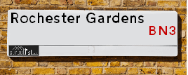
Rochester Gardens is a street located in Brighton and Hove. The street has a length of approximately 194 metres.
The street is publicly maintained which means that the road is adopted and Brighton & Hove is responsible for the repair and upkeep of the highway.
The street is located within the The City of Brighton and Hove (B) Council's jurisdiction. They provide various services, like refuse collection, and manage council tax collection. It's situated in the South East region of the UK.
The road has been assigned the Unique Street Reference Number of 4401935 in the National Street Gazetteer.
The street has the postcodes of BN3 3HT, BN3 3AY, BN3 3AX and BN3 3AW.
It is located within the county of East Sussex, situated in the South East region of the UK. It's 46.52 miles South from central London., 0.95 miles North West from Brighton, 8.43 miles South West from Lewes and 26.95 miles East from Chichester.
ROCHESTER GARDENS is within the Post Town of HOVE
Map of Rochester Gardens
| Street Crime (updated 03/12/2024) | ||
|---|---|---|
| Location Note | Central Point of Street - Not Actual Location | |
| MSOA Info | For MSOA E02003516 (Statistical Neighbourhood) | |
| Click Hint | Click on a Circle for a detailed breakdown below map. | |
| Crime Levels |
Green = Very Low Yellow = Low Orange = High Red = Very High |
|
| Postcodes | ||
| Icon | Postcodes for Rochester Gardens | |
| Walking Distances | ||
| Distance Info | Green Circle = 10 Minutes Walk (800 metres) | |
Street Crime Data accessed from data.police.uk on 06/10/2024.
Moving to Rochester Gardens?
I can help you uncover potential pitfalls and provide key questions to ask about your new property. With decades of experience as a Local Land Charges Manager, I offer confidential insights to make your move informed and stress-free.
This service is free, but you may wish to make an optional donation to support it. Please include the property name and address in your request as well as anything you wish to focus on.
Contact Me
Do you know why this road is called Rochester Gardens?
What's it like to live here?
Share a Photo of Rochester Gardens
Ask the community a question.
Do you have any questions, memories to share, have any photos or know any facts? We'd love to know more.
Submit Your Comment
Budget Friendly Hotels near Rochester Gardens
| Budget Hotel Name | Distance (miles) |
|---|---|
|
1: Name:Travelodge Brighton Seafront Address: West St, Brighton, BN1 2RE Telephone: 0871 984 6405 Visit Hotel Page |
0.86 |
|
2: Name:Travelodge Brighton Address: 165-167 Preston Rd, Brighton, BN1 6AU Telephone: 0871 984 6017 Visit Hotel Page |
0.95 |
|
3: Name:Premier Inn Brighton City Centre Address: 144 North Street Telephone: Visit Hotel Page |
0.95 |
|
4: Name:Premier Inn Lewes Town Centre Address: The Old Courtroom Telephone: Visit Hotel Page |
8.33 |
|
5: Name:Premier Inn Burgess Hill Address: Charles Avenue, Burgess Hill Telephone: Visit Hotel Page |
8.55 |
Hotel Options
Your support helps keep this site running!
If you enjoy using this website, consider making a donation to help me cover hosting costs.
Flats and Apartments in Rochester Gardens
FLAT 1
FLAT 2
FLAT 3
FLAT 4
FLAT 6
FLAT 9
FLAT 10
FLAT 11
FLAT 12
FLAT 13
FLAT 15
FLAT 16
FLAT 17
FLAT 18
FLAT 19
FLAT 1
FLAT 2
FLAT 3
FLAT 20
FLAT 5
FLAT 14
FLAT
FLAT 1
FLAT 1
FLAT 3
EPC (Energy Performance Certificate) Information for Rochester Gardens
UPRN: 22036078
EPC Current: E
EPC Potential: C
Habitable Rooms: 3
Property Type: Flat
Tenure: unknown
Built Form: Semi-Detached
Age Band: 1950-1966
Mains Gas: No
UPRN: 22036088
EPC Current: C
EPC Potential: C
Habitable Rooms: 3
Property Type: Flat
Tenure: Rented (private)
Built Form: Mid-Terrace
Age Band: 1976-1982
Mains Gas: Yes
UPRN: 22036091
EPC Current: D
EPC Potential: C
Habitable Rooms: 2
Property Type: Flat
Tenure: Rented (private)
Built Form: Mid-Terrace
Age Band: 1950-1966
Mains Gas: No
UPRN: 22036092
EPC Current: E
EPC Potential: C
Habitable Rooms: 3
Property Type: Flat
Tenure: Rented (private)
Built Form: Semi-Detached
Age Band: 1976-1982
Mains Gas: No
UPRN: 22035782
EPC Current: E
EPC Potential: C
Habitable Rooms: 7
Property Type: House
Tenure: rental (private)
Built Form: Mid-Terrace
Age Band: 1930-1949
Mains Gas: Yes
UPRN: 22036093
EPC Current: D
EPC Potential: C
Habitable Rooms: 3
Property Type: Flat
Tenure: Rented (private)
Built Form: End-Terrace
Age Band: 1950-1966
Mains Gas: No
UPRN: 22036094
EPC Current: C
EPC Potential: B
Habitable Rooms: 2
Property Type: Flat
Tenure: Rented (private)
Built Form: Mid-Terrace
Age Band: 1950-1966
Mains Gas: No
UPRN: 22036095
EPC Current: C
EPC Potential: B
Habitable Rooms: 2
Property Type: Flat
Tenure: Rented (private)
Built Form: Mid-Terrace
Age Band: 1950-1966
Mains Gas: No
UPRN: 22036096
EPC Current: C
EPC Potential: B
Habitable Rooms: 3
Property Type: Flat
Tenure: unknown
Built Form: Semi-Detached
Age Band: 1950-1966
Mains Gas: No
UPRN: 22036077
EPC Current: D
EPC Potential: C
Habitable Rooms: 3
Property Type: Flat
Tenure: Owner-occupied
Built Form: Semi-Detached
Age Band: 1900-1929
Mains Gas: Yes
UPRN: 22036097
EPC Current: C
EPC Potential: B
Habitable Rooms: 3
Property Type: Flat
Tenure: unknown
Built Form: Semi-Detached
Age Band: 1950-1966
Mains Gas: No
UPRN: 22035773
EPC Current: D
EPC Potential: B
Habitable Rooms: 4
Property Type: House
Tenure: Owner-occupied
Built Form: End-Terrace
Age Band: 1967-1975
Mains Gas: Yes
UPRN: 22036079
EPC Current: C
EPC Potential: B
Habitable Rooms: 2
Property Type: Flat
Tenure: unknown
Built Form: Semi-Detached
Age Band: 1950-1966
Mains Gas: No
UPRN: 22036058
EPC Current: C
EPC Potential: B
Habitable Rooms: 3
Property Type: Flat
Tenure: Owner-occupied
Built Form: End-Terrace
Age Band: before 1900
Mains Gas: Yes
UPRN: 22036080
EPC Current: C
EPC Potential: B
Habitable Rooms: 2
Property Type: Flat
Tenure: unknown
Built Form: Semi-Detached
Age Band: 1950-1966
Mains Gas: No
UPRN: 22036081
EPC Current: C
EPC Potential: B
Habitable Rooms: 3
Property Type: Flat
Tenure: unknown
Built Form: Semi-Detached
Age Band: 1950-1966
Mains Gas: No
UPRN: 22036059
EPC Current: D
EPC Potential: B
Habitable Rooms: 3
Property Type: Flat
Tenure: rental (private)
Built Form: End-Terrace
Age Band: before 1900
Mains Gas: Yes
UPRN: 22035775
EPC Current: C
EPC Potential: B
Habitable Rooms: 3
Property Type: House
Tenure: Owner-occupied
Built Form: Mid-Terrace
Age Band: 1976-1982
Mains Gas: Yes
UPRN: 22036082
EPC Current: C
EPC Potential: B
Habitable Rooms: 3
Property Type: Flat
Tenure: unknown
Built Form: Semi-Detached
Age Band: 1950-1966
Mains Gas: No
UPRN: 22036060
EPC Current: E
EPC Potential: E
Habitable Rooms: 3
Property Type: Flat
Tenure: Owner-occupied
Built Form: Semi-Detached
Age Band: before 1900
Mains Gas: Yes
UPRN: 22036083
EPC Current: C
EPC Potential: C
Habitable Rooms: 2
Property Type: Flat
Tenure: Rented (private)
Built Form: Mid-Terrace
Age Band: 1976-1982
Mains Gas: Yes
UPRN: 22036084
EPC Current: C
EPC Potential: B
Habitable Rooms: 2
Property Type: Flat
Tenure: Owner-occupied
Built Form: Enclosed Mid-Terrace
Age Band: 1991-1995
Mains Gas: No
UPRN: 22036061
EPC Current: D
EPC Potential: C
Habitable Rooms: 3
Property Type: Flat
Tenure: rental (private)
Built Form: Mid-Terrace
Age Band: before 1900
Mains Gas: Yes
UPRN: 22036085
EPC Current: C
EPC Potential: B
Habitable Rooms: 3
Property Type: Flat
Tenure: unknown
Built Form: Semi-Detached
Age Band: 1950-1966
Mains Gas: No
UPRN: 22036086
EPC Current: E
EPC Potential: C
Habitable Rooms: 4
Property Type: Flat
Tenure: Rented (private)
Built Form: Enclosed End-Terrace
Age Band: 1967-1975
Mains Gas: No
UPRN: 22036062
EPC Current: C
EPC Potential: B
Habitable Rooms: 3
Property Type: Flat
Tenure: Owner-occupied
Built Form: Mid-Terrace
Age Band: 1930-1949
Mains Gas: Yes
UPRN: 22036087
EPC Current: E
EPC Potential: C
Habitable Rooms: 2
Property Type: Flat
Tenure: Owner-occupied
Built Form: Mid-Terrace
Age Band: 1967-1975
Mains Gas: Yes
UPRN: 22035779
EPC Current: D
EPC Potential: C
Habitable Rooms: 4
Property Type: House
Tenure: Owner-occupied
Built Form: Mid-Terrace
Age Band: 1950-1966
Mains Gas: Yes
UPRN: 22036063
EPC Current: D
EPC Potential: B
Habitable Rooms: 4
Property Type: Flat
Tenure: Rented (private)
Built Form: Mid-Terrace
Age Band: before 1900
Mains Gas: Yes
UPRN: 22036090
EPC Current: F
EPC Potential: D
Habitable Rooms: 3
Property Type: Flat
Tenure: rental (private)
Built Form: Semi-Detached
Age Band: 1930-1949
Mains Gas: No
UPRN: 22036064
EPC Current: E
EPC Potential: D
Habitable Rooms: 4
Property Type: Flat
Tenure: Owner-occupied
Built Form: Mid-Terrace
Age Band: before 1900
Mains Gas: Yes
UPRN: 22036065
EPC Current: C
EPC Potential: C
Habitable Rooms: 3
Property Type: Flat
Tenure: Rented (private)
Built Form: Mid-Terrace
Age Band: before 1900
Mains Gas: Yes
UPRN: 22036066
EPC Current: D
EPC Potential: D
Habitable Rooms: 3
Property Type: Flat
Tenure: Owner-occupied
Built Form: Detached
Age Band: 1900-1929
Mains Gas: Yes
UPRN: 22036067
EPC Current: C
EPC Potential: B
Habitable Rooms: 3
Property Type: Flat
Tenure: Owner-occupied
Built Form: Mid-Terrace
Age Band: 1900-1929
Mains Gas: Yes
UPRN: 22036068
EPC Current: C
EPC Potential: C
Habitable Rooms: 5
Property Type: Flat
Tenure: Owner-occupied
Built Form: Mid-Terrace
Age Band: before 1900
Mains Gas: Yes
UPRN: 22036069
EPC Current: D
EPC Potential: C
Habitable Rooms: 3
Property Type: Flat
Tenure: Owner-occupied
Built Form: Enclosed Mid-Terrace
Age Band: before 1900
Mains Gas: Yes
UPRN: 22036070
EPC Current: C
EPC Potential: B
Habitable Rooms: 3
Property Type: Flat
Tenure: Rented (private)
Built Form: Mid-Terrace
Age Band: before 1900
Mains Gas: Yes
UPRN: 22036071
EPC Current: E
EPC Potential: E
Habitable Rooms: 3
Property Type: Flat
Tenure: Owner-occupied
Built Form: NO DATA!
Age Band: before 1900
Mains Gas: Yes
UPRN: 22036072
EPC Current: D
EPC Potential: B
Habitable Rooms: 4
Property Type: Flat
Tenure: Rented (private)
Built Form: Mid-Terrace
Age Band: before 1900
Mains Gas: Yes
UPRN: 22036073
EPC Current: E
EPC Potential: C
Habitable Rooms: 3
Property Type: Flat
Tenure: rental (private)
Built Form: Semi-Detached
Age Band: 1900-1929
Mains Gas: No
UPRN: 22036074
EPC Current: C
EPC Potential: B
Habitable Rooms: 3
Property Type: Flat
Tenure: Owner-occupied
Built Form: Mid-Terrace
Age Band: 1900-1929
Mains Gas: Yes
UPRN: 22036075
EPC Current: C
EPC Potential: B
Habitable Rooms: 3
Property Type: Flat
Tenure: Rented (private)
Built Form: Mid-Terrace
Age Band: 1930-1949
Mains Gas: Yes
UPRN: 22036076
EPC Current: D
EPC Potential: C
Habitable Rooms: 4
Property Type: Flat
Tenure: rental (private)
Built Form: Mid-Terrace
Age Band: before 1900
Mains Gas: Yes
UPRN: 22140283
EPC Current: D
EPC Potential: C
Habitable Rooms: 3
Property Type: Flat
Tenure: rental (private)
Built Form: Mid-Terrace
Age Band: 1930-1949
Mains Gas: Yes
UPRN: 22036053
EPC Current: D
EPC Potential: C
Habitable Rooms: 2
Property Type: Flat
Tenure: rental (private)
Built Form: Mid-Terrace
Age Band: 1900-1929
Mains Gas: Yes
UPRN: 22037087
EPC Current: F
EPC Potential: C
Habitable Rooms: 2
Property Type: Flat
Tenure: Owner-occupied
Built Form: Semi-Detached
Age Band: 1900-1929
Mains Gas: No
UPRN: 22036052
EPC Current: C
EPC Potential: C
Habitable Rooms: 5
Property Type: Flat
Tenure: Rented (private)
Built Form: Mid-Terrace
Age Band: before 1900
Mains Gas: Yes
UPRN: 22037088
EPC Current: D
EPC Potential: B
Habitable Rooms: 2
Property Type: Flat
Tenure: Rented (private)
Built Form: Enclosed Mid-Terrace
Age Band: 1930-1949
Mains Gas: No
UPRN: 22036054
EPC Current: C
EPC Potential: B
Habitable Rooms: 4
Property Type: Flat
Tenure: Rented (private)
Built Form: Mid-Terrace
Age Band: before 1900
Mains Gas: Yes
UPRN: 22140285
EPC Current: E
EPC Potential: C
Habitable Rooms: 3
Property Type: Flat
Tenure: rental (private)
Built Form: Mid-Terrace
Age Band: 1900-1929
Mains Gas: Yes
UPRN: 22036057
EPC Current: D
EPC Potential: C
Habitable Rooms: 3
Property Type: Flat
Tenure: Owner-occupied
Built Form: Semi-Detached
Age Band: 1930-1949
Mains Gas: Yes
UPRN: 22037089
EPC Current: E
EPC Potential: B
Habitable Rooms: 2
Property Type: Flat
Tenure: rental (private)
Built Form: Semi-Detached
Age Band: 1900-1929
Mains Gas: No
UPRN: 22140308
EPC Current: D
EPC Potential: C
Habitable Rooms: 4
Property Type: Flat
Tenure: Rented (private)
Built Form: Mid-Terrace
Age Band: before 1900
Mains Gas: Yes
UPRN: 22037090
EPC Current: E
EPC Potential: B
Habitable Rooms: 2
Property Type: Flat
Tenure: Rented (private)
Built Form: Semi-Detached
Age Band: before 1900
Mains Gas: No
UPRN: 22037091
EPC Current: D
EPC Potential: C
Habitable Rooms: 3
Property Type: Flat
Tenure: Owner-occupied
Built Form: End-Terrace
Age Band: before 1900
Mains Gas: Yes
UPRN: 22037092
EPC Current: D
EPC Potential: D
Habitable Rooms: 3
Property Type: Flat
Tenure: rental (private)
Built Form: Detached
Age Band: 1930-1949
Mains Gas: Yes
UPRN: 22037095
EPC Current: D
EPC Potential: C
Habitable Rooms: 3
Property Type: Flat
Tenure: Owner-occupied
Built Form: Semi-Detached
Age Band: 1930-1949
Mains Gas: Yes
UPRN: 22037096
EPC Current: D
EPC Potential: C
Habitable Rooms: 2
Property Type: Flat
Tenure: Owner-occupied
Built Form: NO DATA!
Age Band: 1930-1949
Mains Gas: Yes
UPRN: 22037097
EPC Current: C
EPC Potential: C
Habitable Rooms: 2
Property Type: Flat
Tenure: Owner-occupied
Built Form: Detached
Age Band: 1900-1929
Mains Gas: Yes
UPRN: 22037098
EPC Current: C
EPC Potential: C
Habitable Rooms: 2
Property Type: Flat
Tenure: rental (private)
Built Form: Mid-Terrace
Age Band: 1900-1929
Mains Gas: Yes
UPRN: 22037099
EPC Current: D
EPC Potential: C
Habitable Rooms: 3
Property Type: Flat
Tenure: rental (private)
Built Form: Semi-Detached
Age Band: 1900-1929
Mains Gas: Yes
UPRN: 22037100
EPC Current: D
EPC Potential: B
Habitable Rooms: 3
Property Type: Flat
Tenure: rental (private)
Built Form: End-Terrace
Age Band: 1930-1949
Mains Gas: Yes
UPRN: 22037101
EPC Current: C
EPC Potential: C
Habitable Rooms: 2
Property Type: Flat
Tenure: Rented (private)
Built Form: Mid-Terrace
Age Band: before 1900
Mains Gas: Yes
UPRN: 22037102
EPC Current: D
EPC Potential: C
Habitable Rooms: 2
Property Type: Flat
Tenure: rental (private)
Built Form: Detached
Age Band: before 1900
Mains Gas: Yes
UPRN: 22037103
EPC Current: C
EPC Potential: B
Habitable Rooms: 3
Property Type: Flat
Tenure: Rented (private)
Built Form: Mid-Terrace
Age Band: before 1900
Mains Gas: Yes
UPRN: 22037104
EPC Current: C
EPC Potential: C
Habitable Rooms: 3
Property Type: Flat
Tenure: Owner-occupied
Built Form: Detached
Age Band: 1991-1995
Mains Gas: Yes
UPRN: 22037105
EPC Current: C
EPC Potential: C
Habitable Rooms: 3
Property Type: Flat
Tenure: rental (private)
Built Form: Mid-Terrace
Age Band: before 1900
Mains Gas: Yes
UPRN: 22036089
EPC Current: D
EPC Potential: C
Habitable Rooms: 2
Property Type: Flat
Tenure: rental (private)
Built Form: Enclosed End-Terrace
Age Band: 1950-1966
Mains Gas: No
UPRN: 22253846
EPC Current: B
EPC Potential: B
Habitable Rooms: N/A
Property Type: Flat
Tenure: U
Built Form: NO DATA!
Age Band: U
Mains Gas: Unknown
UPRN: 22199334
EPC Current: E
EPC Potential: C
Habitable Rooms: 2
Property Type: Flat
Tenure: Owner-occupied
Built Form: Mid-Terrace
Age Band: 1967-1975
Mains Gas: Yes
House Sales
| Year | High | Low | Average | Sales |
|---|---|---|---|---|
| 2014 | £670,000 | £275,000 | £268,500 | 4 |
| 2015 | £715,000 | £370,000 | £542,500 | 2 |
| 2016 | £377,500 | £377,500 | £377,500 | 1 |
| 2017 | £251,000 | £295,000 | £273,000 | 2 |
| 2018 | £240,000 | £368,000 | £304,000 | 2 |
| 2020 | £255,000 | £220,000 | £237,500 | 2 |
| 2021 | £368,500 | £368,500 | £368,500 | 1 |
| 2022 | £110,000 | £385,000 | £247,500 | 2 |
| 2023 | £226,250 | £226,250 | £226,250 | 1 |
Contains HM Land Registry data © Crown copyright and database right 2024. This data is licensed under the Open Government Licence v3.0.
Nearby Estate Agents
| Name | Address | Website |
|---|---|---|
| Priors | 90 Western Road, Hove, BN3 1GG | |
| Spark and Sons | 45 Western Road, Hove, BN3 1JD | Visit Website |
| The Property Pod | 53a Western Road, Hove, BN3 1JD | |
| Ellmans | 43 Church Road, Hove, BN3 2BE | Visit Website |
| Property Plus Lettings | 45 Church Road, Hove, BN3 2BE | Visit Website |
Neighbourhood Policing |
| Police Force: Sussex |
 View Neighbourhood Crime and Policing View Neighbourhood Crime and Policing |
| Find a Local Neighbourhood Watch Scheme |
Location Details
| Rochester Gardens | |
|---|---|

| |
| Latitude | 50.827769 |
| Longitude | -0.161875 |
| OS Easting (X): | 529440 |
| OS Northing (Y): | 104809 |
| OS Grid Reference: | TQ294048 |
Known Residential Addresses for Rochester Gardens
- ROCHESTER HOUSE, 48 TOP FLOOR FLAT
- 18
- 32
- 42
- 16
- ROCHESTER COURT, 50
- ROCHESTER COURT, 50 FLAT 1
- ROCHESTER COURT, 50 FLAT 5
- ROCHESTER COURT, 50 FLAT 12
- ROCHESTER COURT FLAT 13
- ROCHESTER COURT FLAT 2
- ROCHESTER COURT FLAT 6
- ROCHESTER COURT FLAT 11
- ROCHESTER COURT, 50 FLAT 16
- 10
- 20
Roads that have a Junction with Rochester Gardens
| Street | Junction Type |
|---|---|
| Lansdowne Road | junction |
| Church Road (B2066) | junction |
Sunset and Sunrise times
| Sunrise | 08:00 |
|---|---|
| Sunset | 16:06 |
Latest Weather Conditions
| Observed at Weather Station: | Shoreham 31 December 2024 at 02:00 (5.71 miles away) |
|---|---|
| Current Weather: | Clear night |
| Temperature and Humidity: | 8.8°C (95.9%) |
| Wind Direction and Speed: | WSW (11 mph) |
Population Statistics
| ONS Area Code | E00085006 & E00085034 |
|---|---|
| ONS Area Name | Migrant Families & Professional Service Cosmopolitans |
| Average Age | 37.75 |
| Area Population | 1872.00 |
| Male Population | 975.00 (52%) |
| Female Population | 897.00 (48%) |
| Benefit Claimants | 26 (1%) |
| LSOA Code: | E01016853 |
|---|---|
| LSOA Name: | Brighton and Hove 026C |
| SOA Code: | 1a |
| SOA Name: | |
| MSOA Code: | E02003516 |
| MSOA Name: | Brighton and Hove 026 |
Nearest Supermarkets
| Tesco Hove Western Rd Express |
|---|
| 83 Western Rd, Hove, BN3 1JB |
| 0345 026 9155 |
| Distance: 0.1 Miles |
| Directions to Tesco Hove Western Rd Express |
| Sainsburys Hove Western Road Local |
|---|
| 55-56 Western Road, Hove, England, BN3 1JD |
| 1273728894 |
| Distance: 0.13 Miles |
| Directions to Sainsburys Hove Western Road Local |
| Waitrose Brighton |
|---|
| 130-134 Western Road, Brighton, East Sussex, BN1 2LA |
| 01273 326549 |
| Distance: 0.5 Miles |
| Directions to Waitrose Brighton |
| Sainsburys Brighton Western Road Local |
|---|
| 147-148 Western Road, Brighton, England, BN1 2DA |
| 01273 719830 |
| Distance: 0.55 Miles |
| Directions to Sainsburys Brighton Western Road Local |
Telephone Information
| Dialling Code | Telephone Exchange | Telephone Cabinet | Fibre to the Cabinet or Fibre to the Premises |
|---|---|---|---|
| 01273 | BRIGHTON HOVE - SDHV | P90 | FTTC |
Local Government
| Local Council Details |
|---|
| Within the area of Brighton and Hove |
| Visit the Council's Website |
| Kings House, Grand Avenue, Hove, East Sussex &BN3 2LS |
| Send email |
| Telephone Number: 01273 290000 |
| Local Member of Parliament |
|---|
| Within the Westminster Parliamentary Constituency of Hove |
| The Member of Parliament is Peter Kyle |
| Details for the MP Peter Kyle on parliament.uk |
| Details for the MP Peter Kyle on theyworkforyou.com |
| In the 2024 General Election Peter Kyle won with a majority of 19,791 the result was Lab hold. The total electorate was 74,063 |
| Wards, Parish Councils and County Councils |
|---|
| Ward: Brunswick and Adelaide Ward |
| Parish: Unparished area |
| Ceremonial County: East Sussex |
Nearest Schools
England Primary Schools
Stanford Junior School
Address: Stanford Junior School, Stanford Road, Brighton, East Sussex, BN1 5PR
Distance: 0.84 miles
Contact: 01273565570
Stanford Infant School
Address: Stanford Infant School, Highcroft Villas, Brighton, East Sussex, BN1 5PS
Distance: 0.86 miles
Contact: 01273555240
St Paul's CofE Primary School
Address: St Paul's CofE Primary School, St Nicholas Road, Brighton, East Sussex, BN1 3LP
Distance: 0.77 miles
Contact: 01273721001
St Mary Magdalen Catholic Primary School
Address: St Mary Magdalen Catholic Primary School, Spring Street, Brighton, East Sussex, BN1 3EF
Distance: 0.58 miles
Contact: 01273327533
Middle Street Primary School
Address: Middle Street Primary School, 37 Middle Street, Middle Street Primary School, Brighton, East Sussex, BN1 1AL
Distance: 0.94 miles
Contact: 01273323184
Brunswick Primary School
Address: Brunswick Primary School, Somerhill Road, Hove, East Sussex, BN3 1RP
Distance: 0.28 miles
Contact: 01273711816
Cottesmore St Mary's Catholic Primary School
Address: Cottesmore St Mary's Catholic Primary School, The Upper Drive, Hove, East Sussex, BN3 6NB
Distance: 0.68 miles
Contact: 01273555811
St Andrew's CofE (Aided) Primary School
Address: St Andrew's CofE (Aided) Primary School, Belfast Street, Hove, East Sussex, BN3 3YT
Distance: 0.59 miles
Contact: 01273770082
West Hove Infant School
Address: West Hove Infant School, Portland Road, Hove, East Sussex, BN3 5JA
Distance: 1.29 miles
Contact: 01273733386
Hove Junior School
Address: Hove Junior School, Portland Road, Hove, East Sussex, BN3 5JA
Distance: 1.29 miles
Contact: 01273916609
England Higher Schools
Brighton Hove and Sussex Sixth Form College
Address: Brighton Hove and Sussex Sixth Form College, 205 Dyke Road, Hove, East Sussex, BN3 6EG
Distance: 0.78 miles
Contact: 01273552200
England Secondary Schools
Cardinal Newman Catholic School
Address: Cardinal Newman Catholic School, The Upper Drive, Hove, East Sussex, BN3 6ND
Distance: 0.64 miles
Contact: 01273558551
Hove Park School and Sixth Form Centre
Address: Hove Park School and Sixth Form Centre, Nevill Road, Hove, East Sussex, BN3 7BN
Distance: 1.19 miles
Contact: 01273082870
Nearest Hospitals
| The Montefiore Hospital |
|---|
| Address: 2 Montefiore Road, Hove, BN3 1RD, |
| Independent Sector |
| Spire Healthcare |
| Telephone: 01273 828 120 |
| Visit Hospital Website |
| Distance: 0.67 (miles) |
| Directions from to The Montefiore Hospital |
| Aldrington Centre |
|---|
| Address: 35 New Church Road, Aldrington Centre, Hove, BN3 4AG, |
| NHS Sector |
| Sussex Partnership NHS Foundation Trust |
| Telephone: 01273 718680 |
| Visit Hospital Website |
| Distance: 1.59 (miles) |
| Directions from to Aldrington Centre |
| Mill View Hospital |
|---|
| Address: Nevill Avenue, Hove, |
| NHS Sector |
| Sussex Partnership NHS Foundation Trust |
| Telephone: 01273 621984 |
| Visit Hospital Website |
| Distance: 2.52 (miles) |
| Directions from to Mill View Hospital |
Nearest Dentists
Dentists
HOVE DENTAL CLINIC LTD
Address: 39A SALISBURY ROAD, HOVE, BN3 3AA
Distance: 0.08 miles
Contact: :
THE DENTAL PRACTICE (26 FARM ROAD)
Address: 26 FARM ROAD, HOVE, EAST SUSSEX, BN3 1FD
Distance: 0.15 miles
Contact: :
EATON ROAD DENTAL PRACTICE
Address: 30 EATON ROAD, HOVE, EAST SUSSEX, BN3 3QA
Distance: 0.15 miles
Contact: :
DENTAL SURGERY
Address: 83 CHURCH ROAD, HOVE, EAST SUSSEX, BN3 2BB
Distance: 0.24 miles
Contact: :
DENTAL SURGERY
Address: 2 BRUNSWICK ROAD, HOVE, EAST SUSSEX, BN3 1DG
Distance: 0.26 miles
Contact: :
GOODWOOD COURT DENTAL SURGERY
Address: 52-54 CROMWELL ROAD, HOVE, EAST SUSSEX, BN3 3ER
Distance: 0.33 miles
Contact: :
Nearest GP Surgeries
Doctors
WELLBN HEALTHCARE
Address: 18-19 WESTERN ROAD, HOVE, EAST SUSSEX, BN3 1AE
Distance: 0.31 miles
Contact: tel: 01273 772020
CHARTER MEDICAL CENTRE
Address: 88 DAVIGDOR ROAD, HOVE, EAST SUSSEX, BN3 1RF
Distance: 0.33 miles
Contact: tel: 01273 770555
CHARTER MEDICAL CENTRE - ADMIN BUILDING
Address: GROUND FLOOR SUITE, 125 DAVIGDOR ROAD, HOVE, EAST SUSSEX, BN3 1RE
Distance: 0.35 miles
Contact: :
TRINITY MEDICAL CENTRE
Address: 1 GOLDSTONE VILLAS, HOVE, EAST SUSSEX, BN3 3AT
Distance: 0.50 miles
Contact: tel: 01273 724648
MONTPELIER SURGERY
Address: 2 VICTORIA ROAD, BRIGHTON, EAST SUSSEX, BN1 3FS
Distance: 0.56 miles
Contact: tel: 01273 328950
SEVEN DIALS MEDICAL CENTRE
Address: 24 MONTPELIER CRESCENT, BRIGHTON, EAST SUSSEX, BN1 3JJ
Distance: 0.63 miles
Contact: tel: 01273 773089
Nearest Dispensing Chemists
Pharmacies
LANE AND STEDMAN
Address: 100 WESTERN ROAD, HOVE, EAST SUSSEX, BN3 1GA
Distance: 0.16 miles
Contact: tel: 01273 734919
CHARTER PHARMACY
Address: 88 DAVIGDOR ROAD, HOVE, EAST SUSSEX, BN3 1RF
Distance: 0.33 miles
Contact: tel: 01273 208233
GUNNS PHARMACY
Address: 108 WESTERN ROAD, BRIGHTON, EAST SUSSEX, BN1 2AA
Distance: 0.40 miles
Contact: tel: 01273 734227
OSBON PHARMACY
Address: 105 CHURCH ROAD, HOVE, EAST SUSSEX, BN3 2AF
Distance: 0.43 miles
Contact: tel: 01273 732216
TRINITY PHARMACY
Address: 3 GOLDSTONE VILLAS, HOVE, EAST SUSSEX, BN3 3AT
Distance: 0.50 miles
Contact: tel: 01273 730330
BOOTS
Address: 59-61 GEORGE STREET, HOVE, BN3 3YD
Distance: 0.53 miles
Contact: tel: 01273 731591
Nearest Opticians
Opticians
VISION CARE FOR HOMELESS PEOPLE (BHT DAY CENTRE)
Address: FIRST BASE DAY CENTRE, ST STEPHENS HALL, MONTPELIER PLACE, BRIGHTON, EAST SUSSEX, BN1 3BF
Distance: 0.39 miles
Contact: :
BOOTS OPTICIANS (HOVE)
Address: 25 GEORGE STREET, HOVE, EAST SUSSEX, BN3 3YA
Distance: 0.52 miles
Contact: :
SPECSAVERS (HOVE)
Address: 84 GEORGE STREET, HOVE, EAST SUSSEX, BN3 3YE
Distance: 0.54 miles
Contact: :
THE EYECARE CENTRE
Address: 156 CHURCH ROAD, HOVE, EAST SUSSEX, BN3 2DL
Distance: 0.57 miles
Contact: :
PETER MARSON OPTOMETRIST
Address: 188 CHURCH ROAD, HOVE, EAST SUSSEX, BN3 2DJ
Distance: 0.69 miles
Contact: :
VISION EXPRESS (CHURCHILL SQ, BRIGHTON)
Address: UNIT 60, CHURCHILL SQUARE, BRIGHTON, EAST SUSSEX, BN1 2TE
Distance: 0.78 miles
Contact: :
Transport
Nearest Rail Stations
Hove Station is 0.64 miles away.
Address: Hove station, Goldstone Villas, Hove, East Sussex, BN3 3RU
Hove is situated on the West Coastway Line and is managed by Southern.
Hove Station is staffed on a full time basis.
Brighton Station is 0.90 miles away.
Address: Brighton station, Queens Road, Brighton, East Sussex, BN1 3XP
Brighton is situated on the West Coastway Line|East Coastway Line|Brighton Main Line and is managed by Southern.
Brighton Station is staffed on a full time basis.