Deanland Road Golden Cross is a street located near the village of Golden Cross
About Deanland Road
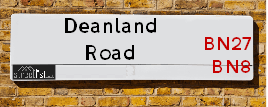
Deanland Road is a street located near the village of Golden Cross. The street has a length of approximately 2,271 metres.
The street is located within the Wealden District Council's jurisdiction. They provide various services, like refuse collection, and manage council tax collection. It's situated in the South East region of the UK.
The road has been assigned the Unique Street Reference Numbers of 42701636, 42701637 and 42701635 in the National Street Gazetteer.
The street has the postcodes of BN27 3RP and BN27 3RJ.
It is located within the county of East Sussex, situated in the South East region of the UK. It's 44.22 miles South from central London., 6.84 miles East from Lewes, 14.44 miles East from Brighton and 30.88 miles South West from Maidstone.

Do you know why this road is called Deanland Road?
What's it like to live here?
Ask the community a question.
Do you have any questions, memories to share or know any facts? We'd love to know more.
Map of Deanland Road
| Postcodes | ||
|---|---|---|
| Icon | Postcodes for Deanland Road | |
| Walking Distances | ||
| Distance Info | Green Circle = 10 Minutes Walk (800 metres) | |
Street Crime Data accessed from data.police.uk on 06/10/2024.
Budget Friendly Hotels near Deanland Road
| Budget Hotel Name | Distance (miles) |
|---|---|
|
1: Name:Travelodge Hellingly Eastbourne Address: A22 Boship Farm Roundabout, Hellingly, Lower Dicker, Hailsham, BN27 4DP Telephone: 0871 984 6035 Visit Hotel Page |
2.56 |
|
2: Name:Premier Inn Eastbourne Polegate Address: Hailsham Road Telephone: Visit Hotel Page |
4.78 |
|
3: Name:Premier Inn Lewes Town Centre Address: The Old Courtroom Telephone: Visit Hotel Page |
6.91 |
|
4: Name:Premier Inn Newhaven Address: Avis Road Telephone: Visit Hotel Page |
7.66 |
|
5: Name:Premier Inn Eastbourne Address: Willingdon Drove Telephone: Visit Hotel Page |
7.83 |
Your support helps keep this site running!
If you enjoy using this website, consider buying me a coffee to help cover hosting costs.
Nearby Estate Agents
| Name | Address | Website |
|---|---|---|
| KLA Properties | 3B & 3C Burfield Park, South Road, Hailsham,BN27 3JL | Visit Website |
| Wealden Estates | 30-34 North Street, Hailsham, BN27 1DW | Visit Website |
| Stevens & Carter | 47 High Street, Hailsham, East Sussex, BN27 1AN | Visit Website |
| Crane & Co Estate Agents | 2 The Quintins, High Street, Hailsham, BN27 1DP | Visit Website |
| Roland Dunn Property Rentals | 13 Station Road, Hailsham, BN27 2BE |
Neighbourhood Policing |
| Police Force: Sussex |
 View Neighbourhood Crime and Policing View Neighbourhood Crime and Policing |
| Find a Local Neighbourhood Watch Scheme |
Location Details
| Deanland Road | |
|---|---|

| |
| Latitude | 50.884866 |
| Longitude | 0.172161 |
| OS Easting (X): | 552774 |
| OS Northing (Y): | 111795 |
| OS Grid Reference: | TQ528118 |
Roads that have a Junction with Deanland Road
| Street | Junction Type |
|---|---|
| Ripe Lane | junction |
Sunset and Sunrise times
| Sunrise | 07:17 |
|---|---|
| Sunset | 16:11 |
Latest Weather Conditions
| Observed at Weather Station: | Herstmonceux West End 17 November 2024 at 21:00 (6.41 miles away) |
|---|---|
| Current Weather: | Overcast |
| Temperature and Humidity: | 9.5°C (82.0%) |
| Wind Direction and Speed: | W (7 mph) |
Population Statistics
| ONS Area Code | E00107423 & E00170894 |
|---|---|
| ONS Area Name | Established Farming Communities & Detached Retirement Living |
| Average Age | 44.14 & 61.15 |
| Area Population | 1654.00 & 1112.00 |
| Male Population | 843.00 & 517.00 (49%) |
| Female Population | 811.00 & 595.00 (51%) |
| Benefit Claimants | 5 & # (0%) |
| LSOA Code: | E01021147 &E01021142 |
|---|---|
| LSOA Name: | Wealden 013B &Wealden 018A |
| SOA Code: | 2b &2c |
| SOA Name: | |
| MSOA Code: | E02004415 &E02004420 |
| MSOA Name: | Wealden 013 &Wealden 018 |
Nearest Supermarkets
| Tesco Hailsham South Rd Express |
|---|
| South Rd, Hailsham, BN27 3JJ |
| 0345 610 2861 |
| Distance: 3.92 Miles |
| Directions to Tesco Hailsham South Rd Express |
| Tesco Hailsham Superstore |
|---|
| North St, Hailsham, BN27 1DN |
| 0345 026 9537 |
| Distance: 3.95 Miles |
| Directions to Tesco Hailsham Superstore |
| Asda Hailsham |
|---|
| 3 The Quintins, North Street, Hailsham, BN27 1DP |
| 01323 534500 |
| Distance: 4.03 Miles |
| Directions to Asda Hailsham |
| Waitrose Hailsham |
|---|
| Vicarage Field, Hailsham, East Sussex, BN27 1BE |
| 01323 846708 |
| Distance: 4.08 Miles |
| Directions to Waitrose Hailsham |
Telephone Information
| Area Code |
|---|
| Area Code: 01825 - Uckfield |
| Area Code: 01435 - Heathfield |
Broadband Information
| Speed | Average Speed | Median Speed | Maximum Speed | Next-generation access (NGA) | Number of Connections |
|---|---|---|---|---|---|
| Less than 2 Mbps | 6.4 | 7.4 | 8.1 | N | 7 |
Local Government
| Local Council Details |
|---|
| Within the area of Wealden |
| Visit the Council's Website |
| Vicarage Lane, Hailsham, East Sussex &BN27 2AX |
| Send email |
| Telephone Number: 01323 443 322 or 01892 653 311 |
| Local Member of Parliament |
|---|
| Within the Westminster Parliamentary Constituency of Wealden &Lewes |
| The Member of Parliament is Nusrat Ghani &James MacCleary |
| Details for the MP Nusrat Ghani &James MacCleary on parliament.uk |
| Details for the MP Nusrat Ghani &James MacCleary on theyworkforyou.com |
| In the 2024 General Election Nusrat Ghani &James MacCleary won with a majority of 6,842 the result was Con hold &LD gain from Con. The total electorate was 72,885 |
| Wards, Parish Councils and County Councils |
|---|
| Ward: Chiddingly, East Hoathly & Waldron &Arlington Ward |
| Ceremonial County: East Sussex |
Nearest Schools
England Primary Schools
Park Mead Primary School
Address: Park Mead Primary School, Michelham Priory Road, Upper Dicker, Hailsham, East Sussex, BN27 3QP
Distance: 2.04 miles
Contact: 01323844247
Chiddingly Primary School
Address: Chiddingly Primary School, Muddles Green, Chiddingly, Lewes, East Sussex, BN8 6HN
Distance: 1.39 miles
Contact: 01825872307
Nearest Hospitals
| Name | Address | Postcode | Distance | Map |
|---|
Nearest Dentists
Dentists
| Name | Address | Postcode | Distance | Map |
|---|
Nearest GP Surgeries
Doctors
DEANLAND WOOD BRANCH SURGERY
Address: QUINTIN MEDICAL CENTRE, GOLDEN CROSS, HAILSHAM, EAST SUSSEX, BN27 3RN
Distance: 0.19 miles
Contact: tel: 01323 845669
EAST HOATHLY MEDICAL CENTRE
Address: JUZIERS DRIVE, EAST HOATHLY, LEWES, EAST SUSSEX, BN8 6AE
Distance: 2.67 miles
Contact: tel: 01825 840943
QUINTINS MEDICAL CENTRE
Address: HAWKSWOOD ROAD, HAILSHAM, BN27 1UG
Distance: 3.98 miles
Contact: tel: 01323 845669
BRIDGESIDE SURGERY
Address: 1 WESTERN ROAD, HAILSHAM, EAST SUSSEX, BN27 3DG
Distance: 3.99 miles
Contact: tel: 01323 441234
BATTLE ROAD MEDICAL CENTRE
Address: 85 BATTLE ROAD, HAILSHAM, BN27 1UA
Distance: 4.02 miles
Contact: :
VICARAGE FIELD SURGERY
Address: VICARAGE FIELD, HAILSHAM, EAST SUSSEX, BN27 1BE
Distance: 4.09 miles
Contact: :
Nearest Dispensing Chemists
Pharmacies
| Name | Address | Postcode | Telephone | Map | Distance in Km |
|---|
Nearest Opticians
Opticians
Transport
Nearest Rail Stations
Berwick (Sussex) Station is 3.09 miles away.
Address: Berwick station, Berwick Station Approach, Berwick, East Sussex, BN26 6TB
Berwick (Sussex) is situated on the East Coastway Line and is managed by Southern.
Berwick (Sussex) Station is staffed on a part time basis.
Glynde Station is 4.79 miles away.
Address: Glynde station, Lacys Hill, Glynde, East Sussex, BN8 6RU
Glynde is situated on the East Coastway Line and is managed by Southern.
Glynde Station is an unstaffed station.