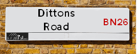
Dittons Road is a street located in the town of Polegate and in the village of Stone Cross. The street has a length of approximately 2,359 metres.
The street is publicly maintained which means that the road is adopted and East Sussex is responsible for the repair and upkeep of the highway.
The street is located within the Wealden District Council's jurisdiction. They provide various services, like refuse collection, and manage council tax collection. It's situated in the South East region of the UK.
The road has been assigned the Unique Street Reference Numbers of 42702743, 42701322 and 42701432 in the National Street Gazetteer.
The street has the postcodes of BN26 6JQ, BN26 6JG, BN26 6JF, BN26 6JB, BN26 6JA, BN26 6HX, BN26 6HU, BN26 6HT, BN26 6HS, BN24 5ET, BN24 5ES, BN24 5ER, BN24 5EP, BN24 5EL, BN26 6QH and BN26 6HY.
It is located within the county of East Sussex, situated in the South East region of the UK. It's 49.8 miles South from central London., 11.64 miles East from Lewes, 18 miles East from Brighton and 33.27 miles South from Maidstone.
DITTONS ROAD is within the Post Town of POLEGATE
Map of Dittons Road
| Street Crime (updated 14/01/2025) | ||
|---|---|---|
| Location Note | Central Point of Street - Not Actual Location | |
| MSOA Info | For MSOAs E02004422, E02004421 (Statistical Neighbourhood) | |
| Click Hint | Click on a Circle for a detailed breakdown below map. | |
| Crime Levels |
Green = Very Low Yellow = Low Orange = High Red = Very High |
|
| Postcodes | ||
| Icon | Postcodes for Dittons Road | |
| Walking Distances | ||
| Distance Info | Green Circle = 10 Minutes Walk (800 metres) | |
Street Crime Data accessed from data.police.uk on 06/10/2024.
Moving to Dittons Road?
I can help you uncover potential pitfalls and provide key questions to ask about your new property. With decades of experience as a Local Land Charges Manager, I offer confidential insights to make your move informed and stress-free.
This service is free, but you may wish to make an optional donation to support it. Please include the property name and address in your request as well as anything you wish to focus on.
Contact Me
Do you know why this road is called Dittons Road?
What's it like to live here?
Share a Photo of Dittons Road
Ask the community a question.
Do you have any questions, memories to share, have any photos or know any facts? We'd love to know more.
Submit Your Comment

Budget Friendly Hotels near Dittons Road
| Budget Hotel Name | Distance (miles) |
|---|---|
|
1: Name:Premier Inn Eastbourne Polegate Address: Hailsham Road Telephone: Visit Hotel Page |
1.53 |
|
2: Name:Premier Inn Eastbourne Address: Willingdon Drove Telephone: Visit Hotel Page |
1.66 |
|
3: Name:Travelodge Eastbourne Willingdon Drove Address: Highfield Park, Willingdon Drove, Eastbourne, BN23 8AL Telephone: 0871 559 1820 Visit Hotel Page |
1.74 |
|
4: Name:Premier Inn Eastbourne Town Centre Address: Terminus Road Telephone: Visit Hotel Page |
3.69 |
|
5: Name:Travelodge Hellingly Eastbourne Address: A22 Boship Farm Roundabout, Hellingly, Lower Dicker, Hailsham, BN27 4DP Telephone: 0871 984 6035 Visit Hotel Page |
4.49 |
Hotel Options
Your support helps keep this site running!
If you enjoy using this website, consider making a donation to help me cover hosting costs.
EPC (Energy Performance Certificate) Information for Dittons Road
UPRN: 100061944621
EPC Current: D
EPC Potential: B
Habitable Rooms: 3
Property Type: House
Tenure: rental (private)
Built Form: Semi-Detached
Age Band: before 1900
Mains Gas: Yes
UPRN: 100061944622
EPC Current: G
EPC Potential: B
Habitable Rooms: 4
Property Type: House
Tenure: Rented (private)
Built Form: Semi-Detached
Age Band: before 1900
Mains Gas: Yes
UPRN: 100062257548
EPC Current: D
EPC Potential: C
Habitable Rooms: 8
Property Type: Bungalow
Tenure: Owner-occupied
Built Form: Detached
Age Band: 1900-1929
Mains Gas: Yes
UPRN: 100060131771
EPC Current: D
EPC Potential: A
Habitable Rooms: 6
Property Type: Bungalow
Tenure: Owner-occupied
Built Form: Detached
Age Band: 1967-1975
Mains Gas: Yes
UPRN: 100060131772
EPC Current: E
EPC Potential: C
Habitable Rooms: 8
Property Type: Bungalow
Tenure: Owner-occupied
Built Form: Detached
Age Band: 1950-1966
Mains Gas: Yes
UPRN: 100060131774
EPC Current: G
EPC Potential: B
Habitable Rooms: 8
Property Type: House
Tenure: Owner-occupied
Built Form: Detached
Age Band: 1930-1949
Mains Gas: Yes
UPRN: 100060131775
EPC Current: D
EPC Potential: B
Habitable Rooms: 4
Property Type: Bungalow
Tenure: Owner-occupied
Built Form: Detached
Age Band: 1930-1949
Mains Gas: Yes
UPRN: 100060131778
EPC Current: E
EPC Potential: C
Habitable Rooms: 6
Property Type: House
Tenure: Owner-occupied
Built Form: Detached
Age Band: 1900-1929
Mains Gas: Yes
UPRN: 100060131780
EPC Current: E
EPC Potential: D
Habitable Rooms: 9
Property Type: House
Tenure: Owner-occupied
Built Form: Detached
Age Band: before 1900
Mains Gas: Yes
UPRN: 100060131781
EPC Current: E
EPC Potential: B
Habitable Rooms: 3
Property Type: House
Tenure: rental (private)
Built Form: Semi-Detached
Age Band: 1930-1949
Mains Gas: Yes
UPRN: 100060131783
EPC Current: F
EPC Potential: C
Habitable Rooms: 7
Property Type: House
Tenure: Owner-occupied
Built Form: Detached
Age Band: 1900-1929
Mains Gas: Yes
UPRN: 100060131784
EPC Current: E
EPC Potential: C
Habitable Rooms: 7
Property Type: Bungalow
Tenure: Owner-occupied
Built Form: Detached
Age Band: 1950-1966
Mains Gas: Yes
UPRN: 100060131786
EPC Current: G
EPC Potential: C
Habitable Rooms: 5
Property Type: House
Tenure: Owner-occupied
Built Form: Detached
Age Band: 1930-1949
Mains Gas: Yes
UPRN: 100060131788
EPC Current: B
EPC Potential: B
Habitable Rooms: 6
Property Type: Bungalow
Tenure: Owner-occupied
Built Form: Detached
Age Band: 1950-1966
Mains Gas: Yes
UPRN: 100060131789
EPC Current: C
EPC Potential: B
Habitable Rooms: 6
Property Type: House
Tenure: Owner-occupied
Built Form: Detached
Age Band: 1976-1982
Mains Gas: Yes
UPRN: 100060131790
EPC Current: D
EPC Potential: C
Habitable Rooms: 9
Property Type: Bungalow
Tenure: Owner-occupied
Built Form: Detached
Age Band: 1976-1982
Mains Gas: Yes
UPRN: 100060131791
EPC Current: D
EPC Potential: C
Habitable Rooms: 8
Property Type: Bungalow
Tenure: Owner-occupied
Built Form: Detached
Age Band: 1930-1949
Mains Gas: Yes
UPRN: 100060131795
EPC Current: D
EPC Potential: D
Habitable Rooms: 5
Property Type: House
Tenure: Owner-occupied
Built Form: Semi-Detached
Age Band: 1930-1949
Mains Gas: Yes
UPRN: 100060131796
EPC Current: D
EPC Potential: B
Habitable Rooms: 6
Property Type: Bungalow
Tenure: Owner-occupied
Built Form: Detached
Age Band: 1930-1949
Mains Gas: Yes
UPRN: 100060131797
EPC Current: D
EPC Potential: B
Habitable Rooms: 6
Property Type: Bungalow
Tenure: Owner-occupied
Built Form: Detached
Age Band: 1930-1949
Mains Gas: Yes
UPRN: 100060131798
EPC Current: D
EPC Potential: C
Habitable Rooms: 5
Property Type: Bungalow
Tenure: Owner-occupied
Built Form: Detached
Age Band: 1930-1949
Mains Gas: Yes
UPRN: 100060131776
EPC Current: C
EPC Potential: B
Habitable Rooms: 5
Property Type: House
Tenure: Owner-occupied
Built Form: Detached
Age Band: 1950-1966
Mains Gas: Yes
UPRN: 100060131802
EPC Current: D
EPC Potential: C
Habitable Rooms: 4
Property Type: Bungalow
Tenure: Owner-occupied
Built Form: Detached
Age Band: 1950-1966
Mains Gas: Yes
UPRN: 100060131805
EPC Current: F
EPC Potential: E
Habitable Rooms: 5
Property Type: Bungalow
Tenure: rental (social)
Built Form: Detached
Age Band: 1967-1975
Mains Gas: Yes
UPRN: 200002881031
EPC Current: D
EPC Potential: C
Habitable Rooms: 8
Property Type: House
Tenure: Owner-occupied
Built Form: Detached
Age Band: 1996-2002
Mains Gas: Yes
UPRN: 100060131810
EPC Current: D
EPC Potential: B
Habitable Rooms: 5
Property Type: House
Tenure: Owner-occupied
Built Form: Detached
Age Band: 1976-1982
Mains Gas: Yes
UPRN: 100060131811
EPC Current: E
EPC Potential: D
Habitable Rooms: 6
Property Type: House
Tenure: Owner-occupied
Built Form: Detached
Age Band: 1900-1929
Mains Gas: Yes
UPRN: 100060131813
EPC Current: D
EPC Potential: C
Habitable Rooms: 7
Property Type: House
Tenure: Owner-occupied
Built Form: Detached
Age Band: 1967-1975
Mains Gas: Yes
UPRN: 100060131814
EPC Current: E
EPC Potential: B
Habitable Rooms: 4
Property Type: Bungalow
Tenure: Owner-occupied
Built Form: Detached
Age Band: 1950-1966
Mains Gas: Yes
UPRN: 100060131815
EPC Current: E
EPC Potential: D
Habitable Rooms: 5
Property Type: House
Tenure: Owner-occupied
Built Form: Semi-Detached
Age Band: 1900-1929
Mains Gas: No
UPRN: 100060131817
EPC Current: F
EPC Potential: C
Habitable Rooms: 5
Property Type: House
Tenure: Rented (private)
Built Form: Detached
Age Band: 1900-1929
Mains Gas: Yes
UPRN: 10093177804
EPC Current: B
EPC Potential: A
Habitable Rooms: N/A
Property Type: House
Tenure: unknown
Built Form: Detached
Age Band: U
Mains Gas: Unknown
UPRN: 100060131820
EPC Current: D
EPC Potential: B
Habitable Rooms: 5
Property Type: Bungalow
Tenure: Owner-occupied
Built Form: Detached
Age Band: 1950-1966
Mains Gas: Yes
UPRN: 10024379425
EPC Current: B
EPC Potential: A
Habitable Rooms: N/A
Property Type: House
Tenure: unknown
Built Form: Detached
Age Band: U
Mains Gas: Unknown
UPRN: 10033407991
EPC Current: E
EPC Potential: C
Habitable Rooms: 6
Property Type: House
Tenure: Owner-occupied
Built Form: Detached
Age Band: 1950-1966
Mains Gas: Yes
UPRN: 100060131825
EPC Current: C
EPC Potential: B
Habitable Rooms: 8
Property Type: House
Tenure: Owner-occupied
Built Form: Detached
Age Band: 1996-2002
Mains Gas: Yes
UPRN: 10024379426
EPC Current: C
EPC Potential: B
Habitable Rooms: 9
Property Type: House
Tenure: Owner-occupied
Built Form: Detached
Age Band: 2007-2011
Mains Gas: Yes
UPRN: 100060131831
EPC Current: D
EPC Potential: C
Habitable Rooms: 6
Property Type: Bungalow
Tenure: Owner-occupied
Built Form: Detached
Age Band: U
Mains Gas: Yes
UPRN: 100060131834
EPC Current: D
EPC Potential: C
Habitable Rooms: 4
Property Type: House
Tenure: Owner-occupied
Built Form: Semi-Detached
Age Band: 1900-1929
Mains Gas: Yes
UPRN: 100060131835
EPC Current: D
EPC Potential: C
Habitable Rooms: 5
Property Type: House
Tenure: Owner-occupied
Built Form: Detached
Age Band: 1930-1949
Mains Gas: Yes
House Sales
| Year | High | Low | Average | Sales |
|---|---|---|---|---|
| 2014 | £245,000 | £355,000 | £395,000 | 5 |
| 2015 | £240,000 | £310,000 | £361,563 | 8 |
| 2016 | £395,000 | £340,000 | £302,517 | 8 |
| 2017 | £260,000 | £469,000 | £285,250 | 4 |
| 2018 | £235,000 | £405,000 | £396,667 | 3 |
| 2019 | £192,500 | £450,000 | £231,214 | 7 |
| 2020 | £470,000 | £365,000 | £338,500 | 8 |
| 2021 | £415,000 | £700,000 | £455,328 | 9 |
| 2022 | £330,000 | £575,000 | £645,707 | 7 |
| 2023 | £520,800 | £290,000 | £443,950 | 4 |
| 2024 | £320,000 | £320,000 | £320,000 | 1 |
Contains HM Land Registry data © Crown copyright and database right 2025. This data is licensed under the Open Government Licence v3.0.
Nearby Estate Agents
| Name | Address | Website |
|---|---|---|
| Eastbourne Property Shop | 7 Mimram Road, Stone Cross, Pevensey, Eastbourne, BN24 5DZ | Visit Website |
| Archer & Partners | 48 High Street, Polegate, BN26 6AG | Visit Website |
| Home & Castle | 4 Millfields, Station Road, Polegate, East Sussex BN26 6AS | |
| Fox & Sons | 56a High Street, Polegate, East Sussex, BN26 6AD | |
| Your Move | 91 High Street, Polegate, BN26 6AE | Visit Website |
We have found 16 postcodes
Neighbourhood Policing |
| Police Force: Sussex |
 View Neighbourhood Crime and Policing View Neighbourhood Crime and Policing |
| Find a Local Neighbourhood Watch Scheme |
Location Details
| Dittons Road | |
|---|---|

| |
| Latitude | 50.819374 |
| Longitude | 0.268625 |
| OS Easting (X): | 559782 |
| OS Northing (Y): | 104718 |
| OS Grid Reference: | TQ598047 |
Known Residential Addresses for Dittons Road
- BYGOT HOUSE
- PINE GABLES
- HANKHAM PLACE EAST LODGE
- THE BIRCHES
- APPLEWOOD
- ONESTACK
- THE OAKS
- OAKHURST
- THE HAWTHORNS
- DITFOORD
- GREENWAYS
- LLAMEDOS
- PRIMROSE COTTAGE
- CROWHURST
- GULLFOSS
- GLENGORSE
- CRANBROOK
- THE LABURNUMS
- BALLENBERG
- WYVERN
- THE HOBBIT
- ELSINORE
- SHIRALEE
- KINELLAR
- ROISEL
- JASMINE COTTAGE
- BRAMLEY LODGE
- TREETOPS
- BRAMLEY DOWNS
- UPCOUNTRY STONE CROSS NURSERY
- MARIGOLD COTTAGE
- DITTONS BUSINESS PARK UNIT D
- DITTONS VILLA
- UNIT C3
- UNIT 10
- CHAUCER BUSINESS PARK UNIT D1
- UNIT 7
- UNIT 5
- CHAUCER BUSINESS PARK UNITS J1 & J2
- UNIT E4 CHAUCER BUSINESS PARK
- UNIT 13
- D3 UNIT
- UNIT G3
- UNIT G1
- UNIT G6
- UNIT G5
- BELGRAVE HOUSE
- MAPLE LEAF LODGE
- NORTH COTTAGES 1
- WHITE LODGE
- RED DYKE COTTAGES 3
- RED DYKE COTTAGES 4
- BRENCHLEYS
- WOODFIELD
- WENTON
- BOYLES COTTAGES 3
- NORTH COTTAGES 2
- ELFRAN
Roads that have a Junction with Dittons Road
| Street | Junction Type |
|---|---|
| Pevensey Road (B2247) | junction |
| Dittons Wood Close | junction |
| Bluebell Way | junction |
| Twin Oaks Drive | junction |
| Golden Jubilee Way (A22) | roundabout |
| Lilac Lane | junction |
| Arun Way | junction |
| Townsend Road | junction |
| Barn Close | junction |
| Adur Drive | roundabout |
| Hailsham Road (B2104) | junction |
| Lion Hill (B2104) | junction |
Sunset and Sunrise times
| Sunrise | 07:29 |
|---|---|
| Sunset | 16:56 |
Latest Weather Conditions
| Observed at Weather Station: | Herstmonceux West End 3 February 2025 at 02:00 (5.35 miles away) |
|---|---|
| Current Weather: | Mist |
| Temperature and Humidity: | 0.1°C (97.9%) |
| Wind Direction and Speed: | E (3 mph) |
Population Statistics
| ONS Area Code | E00107739, E00107729, E00107747 & E00107746 |
|---|---|
| ONS Area Name | Self-Sufficient Retirement, Comfortable Suburbia, Ageing in Suburbia & Agricultural Communities |
| Average Age | 39.94, 37.89 & 50.39 |
| Area Population | 1942.00, 1598.00 & 1822.00 |
| Male Population | 922.00, 820.00 & 861.00 (49%) |
| Female Population | 1020.00, 778.00 & 961.00 (51%) |
| Benefit Claimants | 6 & 13 (1%) |
| LSOA Code: | E01021208, E01021210 &E01021212 |
|---|---|
| LSOA Name: | Wealden 020C, Wealden 020E &Wealden 019A |
| SOA Code: | 2b, 8c &8b |
| SOA Name: | |
| MSOA Code: | E02004422 &E02004421 |
| MSOA Name: | Wealden 020 &Wealden 019 |
Nearest Supermarkets
| Tesco Stone Cross Express |
|---|
| 2 Mimram Rd, Stone Cross, Pevensey, BN24 5DZ |
| 0345 026 9057 |
| Distance: 0.95 Miles |
| Directions to Tesco Stone Cross Express |
| Tesco Polegate Esso Express |
|---|
| 94 Eastbourne Rd, Polegate, BN26 5DD |
| 0345 677 9549 |
| Distance: 1.05 Miles |
| Directions to Tesco Polegate Esso Express |
| Tesco Willingdon Freshwater Square Express |
|---|
| 11-15 Freshwater Square, Eastbourne, BN22 0PS |
| 0345 674 6521 |
| Distance: 1.1 Miles |
| Directions to Tesco Willingdon Freshwater Square Express |
| Tesco Eastbourne Hampden Park Metro |
|---|
| 9 Brassey Ave, Hampden Park, Eastbourne, BN22 9NG |
| 0345 026 9960 |
| Distance: 1.59 Miles |
| Directions to Tesco Eastbourne Hampden Park Metro |
Telephone Information
| Area Code |
|---|
| Area Code: 01323 - Eastbourne |
Broadband Information
| Speed | Average Speed | Median Speed | Maximum Speed | Next-generation access (NGA) | Number of Connections |
|---|---|---|---|---|---|
| Greater than 2 Mbps | 7.5 | 7.2 | 11.3 | N | 5 |
Local Government
| Local Council Details |
|---|
| Within the area of Wealden |
| Visit the Council's Website |
| Vicarage Lane, Hailsham, East Sussex &BN27 2AX |
| Send email |
| Telephone Number: 01323 443 322 or 01892 653 311 |
| Local Member of Parliament |
|---|
| Within the Westminster Parliamentary Constituency of Bexhill and Battle &Lewes |
| The Member of Parliament is James MacCleary |
| Details for the MP James MacCleary on parliament.uk |
| Details for the MP James MacCleary on theyworkforyou.com |
| In the 2024 General Election James MacCleary won with a majority of 12,624 the result was LD gain from Con. The total electorate was 76,166 |
| Wards, Parish Councils and County Councils |
|---|
| Ward: Polegate Central &Stone Cross Ward |
| Parish: Polegate Parish Council |
| Ceremonial County: East Sussex |
Nearest Schools
England Primary Schools
Shinewater Primary School
Address: Shinewater Primary School, Milfoil Drive, Langney, Eastbourne, East Sussex, BN23 8ED
Distance: 1.41 miles
Contact: 01323762129
Shinewater Primary School
Address: Shinewater Primary School, Milfoil Drive, Langney, Eastbourne, East Sussex, BN23 8ED
Distance: 1.41 miles
Contact:
Hankham Primary School
Address: Hankham Primary School, Hankham Road, Hankham, Pevensey, East Sussex, BN24 5AY
Distance: 1.35 miles
Contact: 01323763265
West Rise Junior School
Address: West Rise Junior School, Chaffinch Road, Langney, Eastbourne, East Sussex, BN23 7SL
Distance: 1.98 miles
Contact: 01323764037
West Rise Community Infant School
Address: West Rise Community Infant School, Chaffinch Road, Langney, Eastbourne, East Sussex, BN23 7SL
Distance: 1.98 miles
Contact: 01323764062
Heron Park Primary Academy
Address: Heron Park Primary Academy, Dallington Road, Hampden Park, Eastbourne, East Sussex, BN22 9EE
Distance: 1.62 miles
Contact: 01323502525
Stone Cross School
Address: Stone Cross School, Adur Drive, Stone Cross, Pevensey, East Sussex, BN24 5EF
Distance: 0.99 miles
Contact: 01323461002
Polegate Primary School
Address: Polegate Primary School, Oakleaf Drive, East Sussex, Polegate, East Sussex, BN26 6PT
Distance: 1.00 miles
Contact: 01323482404
England Secondary Schools
Causeway School
Address: Causeway School, Larkspur Drive, Eastbourne, East Sussex, BN23 8EJ
Distance: 1.17 miles
Contact:
England Higher Schools
East Sussex College Group
Address: East Sussex College Group, Cross Levels Way, Eastbourne, East Sussex, BN21 2UF
Distance: 2.11 miles
Contact: 03030039400
Nearest Hospitals
| Eastbourne District General Hospital |
|---|
| Address: Kings Drive, Eastbourne, BN21 2UD, |
| NHS Sector |
| East Sussex Healthcare NHS Trust |
| Telephone: 0300 131 4500 |
| Visit Hospital Website |
| Distance: 3.6 (miles) |
| Directions from to Eastbourne District General Hospital |
| BMI The Esperance Hospital |
|---|
| Address: 1 Hartington Place, Eastbourne, |
| Independent Sector |
| BMI Healthcare |
| Telephone: 01323 411188 |
| Visit Hospital Website |
| Distance: 6.06 (miles) |
| Directions from to BMI The Esperance Hospital |
| Amberstone Hospital |
|---|
| Address: Carters Corner, Amberstone Hospital, Hailsham, BN27 4HU, |
| NHS Sector |
| Sussex Partnership NHS Foundation Trust |
| Telephone: 01323 440022 |
| Visit Hospital Website |
| Distance: 6.96 (miles) |
| Directions from to Amberstone Hospital |
Nearest Dentists
Dentists
COLOSSEUM DENTAL (STONE CROSS)
Address: 1 MIMRAM ROAD, STONE CROSS, PEVENSEY, EAST SUSSEX, BN24 5DZ
Distance: 0.95 miles
Contact: :
POLEGATE DENTAL SURGERY
Address: HIGH STREET, POLEGATE, EAST SUSSEX, BN26 5DH
Distance: 1.14 miles
Contact: :
PURE DENTAL SURGERY LIMITED
Address: 70 BROAD ROAD, EASTBOURNE, EAST SUSSEX, BN20 9QX
Distance: 1.30 miles
Contact: :
BROAD ROAD DENTAL SURGERY
Address: 70 BROAD ROAD, EASTBOURNE, BN20 9QX
Distance: 1.30 miles
Contact: :
DENTAL SURGERY
Address: 52 BRASSEY AVENUE, EASTBOURNE, EAST SUSSEX, BN22 9QH
Distance: 1.48 miles
Contact: :
PCT DENTAL CLINIC
Address: IAN GOW MEMORIAL CENTRE, MILFOIL DRIVE, EASTBOURNE, EAST SUSSEX, BN23 8BR
Distance: 1.51 miles
Contact: :
Nearest GP Surgeries
Doctors
STONE CROSS SURGERY
Address: MIMRAM ROAD, STONE CROSS, PEVENSEY, EAST SUSSEX, BN24 5DZ
Distance: 0.95 miles
Contact: tel: 01323 761461
DOWNLANDS MEDICAL CENTRE
Address: 77 HIGH STREET, POLEGATE, EAST SUSSEX, BN26 6AE
Distance: 1.10 miles
Contact: tel: 01323 482323
MANOR PARK MEDICAL CENTRE
Address: HIGH STREET, POLEGATE, EAST SUSSEX, BN26 5DJ
Distance: 1.14 miles
Contact: tel: 01323 482301
HAMPDEN PARK HEALTH CENTRE - COVID LOCAL VACCINATION SERVICE 2
Address: 12 BRODRICK CLOSE, HAMPDEN PARK, EASTBOURNE, BN22 9NR
Distance: 1.49 miles
Contact: :
HAMPDEN PARK HEALTH CENTRE - COVID LOCAL VACCINATION SERVICE
Address: 12 BRODRICK CLOSE, HAMPDEN PARK, EASTBOURNE, BN22 9NR
Distance: 1.49 miles
Contact: :
PROSSER
Address: IAN GOW MEMORIAL HEALTH CENTRE, MILFOIL DRIVE, LANGNEY, EASTBOURNE, EAST SUSSEX, BN23 8BR
Distance: 1.51 miles
Contact: tel: 01323 766358
Nearest Dispensing Chemists
Pharmacies
KAMSONS PHARMACY
Address: MIMRAM ROAD, STONE CROSS, PEVENSEY, EAST SUSSEX, BN24 5DZ
Distance: 0.95 miles
Contact: :
PROCTER HEALTH CARE PHARMACY
Address: 69 HIGH STREET, POLEGATE, EAST SUSSEX, BN26 6AH
Distance: 1.09 miles
Contact: tel: 01323 482141
KAMSONS PHARMACY
Address: 43 HIGH STREET, POLEGATE, BN26 5AB
Distance: 1.10 miles
Contact: tel: 01323 482474
DAY LEWIS PHARMACY
Address: 10 FRESHWATER SQUARE, HAMLANDS EST, WILLINGDON, EASTBOURNE, EAST SUSSEX, BN22 0PS
Distance: 1.10 miles
Contact: tel: 01323 504442
KAMSONS PHARMACY
Address: 1-2 ORCHARD PARADE, LOWER WILLINGDON, EASTBOURNE, EAST SUSSEX, BN20 9PL
Distance: 1.20 miles
Contact: tel: 01323 484448
KAMSONS PHARMACY
Address: MILFOIL DRIVE, NORTH LANGNEY, EASTBOURNE, EAST SUSSEX, BN23 8ED
Distance: 1.41 miles
Contact: tel: 01323 760522
Nearest Opticians
Opticians
BARRACLOUGH & STILES OPTICIANS (POLEGATE)
Address: 58A HIGH STREET, POLEGATE, EAST SUSSEX, BN26 6AD
Distance: 1.08 miles
Contact: :
EASTBOURNE EXTRA
Address: LOTTBRIDGE DROVE, EASTBOURNE, BN23 6QD
Distance: 2.69 miles
Contact: :
4931 EASTBOURNE
Address: ASDA STORES LTD, THE CRUMBLES, PEVENSEY BAY ROAD, EASTBOURNE, EAST SUSSEX, BN23 6JH
Distance: 2.89 miles
Contact: :
THE SPECTACLE SHOWROOM
Address: UNIT A3, ROPEMAKER PARK, DIPLOCKS WAY, HAILSHAM, BN27 3GU
Distance: 2.93 miles
Contact: :
GREEN & ELLIOTT OPTOMETRISTS (EASTBOURNE)
Address: 10 ALBERT PARADE, GREEN STREET, EASTBOURNE, EAST SUSSEX, BN21 1SD
Distance: 2.94 miles
Contact: :
FOCUS MEDICAL EYE CENTRE
Address: 18 HIGH STREET, HAILSHAM, EAST SUSSEX, BN27 1BJ
Distance: 3.04 miles
Contact: :
Transport
Nearest Rail Stations
Polegate Station is 1.01 miles away.
Address: Polegate station, High Street, Polegate, East Sussex, BN26 6EH
Polegate is situated on the East Coastway Line and is managed by Southern.
Polegate Station is staffed on a part time basis.
Hampden Park (Sussex) Station is 1.66 miles away.
Address: Hampden Park station, Station Approach, Eastbourne, East Sussex, BN22 9ND
Hampden Park (Sussex) is situated on the East Coastway Line and is managed by Southern.
Hampden Park (Sussex) Station is staffed on a part time basis.