London Road in Patcham
About London Road
London Road is a street located in the City of Brighton and near the City of Brighton and near the village of Hurstpierpoint and in the village of Pyecombe and near the village of Pyecombe. The street has a length of approximately 9,644 metres.
The street is publicly maintained which means that the road is adopted and Brighton & Hove is responsible for the repair and upkeep of the highway.
Crime & Historic Map of London Road
This interactive map displays both historic mapping and street crime data. Click on a circle to view crime statistics, and use the button above to toggle the 1900s historic map.
This interactive map allows you to **zoom and pan** for a better view of the data.
- Use the + and - buttons on the map to zoom in and out.
- Scroll with your **middle mouse wheel** to zoom in and out.
- On a **mobile device**, use **pinch and zoom gestures** to navigate the map.
- Click on crime markers for more details.


| Street Crime (updated 07/02/2025) | ||
|---|---|---|
| Location Note | Central Point of Street - Not Actual Location | |
| MSOA Info | For MSOAs E02003501, E02003494, E02003493, E02006619 (Statistical Neighbourhood) | |
| Click Hint | Click on a Circle for a detailed breakdown below map. | |
| Crime Levels |
Green = Very Low Yellow = Low Orange = High Red = Very High |
|
| Postcodes | ||
| Icon | Postcodes for London Road | |
| Walking Distances | ||
| Distance Info | Green Circle = 10 Minutes Walk (800 metres) | |
Street Crime Data accessed from data.police.uk on 07/02/2025.
The street is located within the Mid Sussex District and The City of Brighton and Hove (B) Council's jurisdiction. They provide various services, like refuse collection, and manage council tax collection. It's situated in the South East region of the UK.
The road has been assigned the Unique Street Reference Numbers of 25602184, 4402037, 4402822, 4405126, 25600403, 25600020, 25600013, 25600008, 4404327, 25600019, 25609068, 4402032, 4404328, 25600012, 25600009 and 25602185 in the National Street Gazetteer.
The street has the postcodes of BN6 9FT, BN45 7FN, BN45 7FJ, BN45 7ED, BN1 8YQ, BN1 8YD, BN1 8QX, BN1 8QW, BN1 8QU, BN1 8QS, BN1 8QQ, BN1 8QA, BN1 8PZ, BN1 8PU, BN1 6YP, BN1 6YL, BN1 6YJ, BN1 6YA, BN1 6UX, BN1 6UW, BN1 6UF, BN1 6UA, BN1 6RN, BN6 9BQ, BN45 7FH, BN1 8QT, BN1 6YQ, BN1 6XP, BN1 6UY, BN1 6UT and BN1 6RP.
It is located within the county of East Sussex, situated in the South East region of the UK. It's 44.45 miles South from central London., 2.52 miles North from Brighton, 7.51 miles West from Lewes and 27.36 miles East from Chichester.
LONDON ROAD is within the Post Town of BRIGHTON
Moving to London Road?
I can help you uncover potential pitfalls and provide key questions to ask about your new property. With decades of experience as a Local Land Charges Manager, I offer confidential insights to make your move informed and stress-free.
This service is free, but you may wish to make an optional donation to support it. Please include the property name and address in your request as well as anything you wish to focus on.
Contact Me
Do you know why this road is called London Road?
What's it like to live here?
Share a Photo of London Road
Ask the community a question.
Do you have any questions, memories to share, have any photos or know any facts? We'd love to know more.
Submit Your Comment

Budget Friendly Hotels near London Road
| Budget Hotel Name | Distance (miles) |
|---|---|
|
1: Name:Travelodge Brighton Address: 165-167 Preston Rd, Brighton, BN1 6AU Telephone: 0871 984 6017 Visit Hotel Page |
1.38 |
|
2: Name:Premier Inn Brighton City Centre Address: 144 North Street Telephone: Visit Hotel Page |
2.41 |
|
3: Name:Travelodge Brighton Seafront Address: West St, Brighton, BN1 2RE Telephone: 0871 984 6405 Visit Hotel Page |
2.51 |
|
4: Name:Premier Inn Burgess Hill Address: Charles Avenue, Burgess Hill Telephone: Visit Hotel Page |
6.49 |
|
5: Name:Premier Inn Lewes Town Centre Address: The Old Courtroom Telephone: Visit Hotel Page |
7.41 |
Hotel Options
Your support helps keep this site running!
If you enjoy using this website, consider making a donation to help me cover hosting costs.

Flats and Apartments in London Road
FLAT 2
FLAT 2
FLAT 3
FLAT 3
FLAT 5
FLAT 5
FLAT 1
FLAT 1
FLAT 2
FLAT 2
FLAT 3
FLAT 3
FLAT 4
FLAT 4
FLAT 6
FLAT 6
FLAT 7
FLAT 7
FLAT 8
FLAT 8
FLAT 9
FLAT 9
FLAT 11
FLAT 11
FLAT 12
FLAT 12
FLAT 14
FLAT 14
FLAT 15
FLAT 15
FLAT 16
FLAT 16
FLAT 17
FLAT 17
FLAT 18
FLAT 18
FLAT 19
FLAT 19
FLAT 20
FLAT 20
FLAT 21
FLAT 21
FLAT 22
FLAT 22
FLAT 23
FLAT 23
FLAT 24
FLAT 24
FLAT 25
FLAT 25
FLAT 26
FLAT 26
FLAT 27
FLAT 27
FLAT 28
FLAT 28
FLAT 29
FLAT 29
FLAT 30
FLAT 30
FLAT 31
FLAT 31
FLAT 34
FLAT 34
FLAT 37
FLAT 37
FLAT 38
FLAT 38
FLAT 39
FLAT 39
FLAT 40
FLAT 40
FLAT 41
FLAT 41
FLAT 42
FLAT 42
FLAT 44
FLAT 44
FLAT 46
FLAT 46
FLAT 47
FLAT 47
FLAT 48
FLAT 48
FLAT 49
FLAT 49
FLAT 50
FLAT 50
FLAT 51
FLAT 51
FLAT 52
FLAT 52
FLAT 53
FLAT 53
FLAT 54
FLAT 54
FLAT 55
FLAT 55
FLAT 56
FLAT 56
FLAT 57
FLAT 57
FLAT 1
FLAT 1
FLAT 2
FLAT 2
FLAT 3
FLAT 3
FLAT 4
FLAT 4
FLAT 6
FLAT 6
FLAT 7
FLAT 7
FLAT 9
FLAT 9
FLAT 10
FLAT 10
FLAT 11
FLAT 11
FLAT 12
FLAT 12
FLAT 14
FLAT 14
FLAT 15
FLAT 15
FLAT 16
FLAT 16
FLAT 17
FLAT 17
FLAT 18
FLAT 18
FLAT 20
FLAT 20
FLAT 21
FLAT 21
FLAT 22
FLAT 22
FLAT 23
FLAT 23
FLAT 24
FLAT 24
FLAT 25
FLAT 25
FLAT 26
FLAT 26
FLAT 29
FLAT 29
FLAT 31
FLAT 31
FLAT 33
FLAT 33
FLAT 34
FLAT 34
FLAT 35
FLAT 35
FLAT 36
FLAT 36
FLAT 37
FLAT 37
FLAT 39
FLAT 39
FLAT 40
FLAT 40
FLAT 41
FLAT 41
FLAT 42
FLAT 42
FLAT 43
FLAT 43
FLAT 44
FLAT 44
FLAT 1
FLAT 1
FLAT 4
FLAT 4
FLAT 1
FLAT 1
FLAT 5
FLAT 5
FLAT 7
FLAT 7
EPC (Energy Performance Certificate) Information for London Road
UPRN: 22043078
EPC Current: D
EPC Potential: C
Habitable Rooms: 3
Property Type: Flat
Tenure: Rented (social)
Built Form: Detached
Age Band: 1967-1975
Mains Gas: No
UPRN: 22043078
EPC Current: D
EPC Potential: C
Habitable Rooms: 3
Property Type: Flat
Tenure: Rented (social)
Built Form: Detached
Age Band: 1967-1975
Mains Gas: No
UPRN: 22043130
EPC Current: C
EPC Potential: C
Habitable Rooms: 4
Property Type: Flat
Tenure: Owner-occupied
Built Form: End-Terrace
Age Band: 1967-1975
Mains Gas: Yes
UPRN: 22043130
EPC Current: C
EPC Potential: C
Habitable Rooms: 4
Property Type: Flat
Tenure: Owner-occupied
Built Form: End-Terrace
Age Band: 1967-1975
Mains Gas: Yes
UPRN: 22059740
EPC Current: E
EPC Potential: C
Habitable Rooms: 5
Property Type: Bungalow
Tenure: Owner-occupied
Built Form: Detached
Age Band: 1950-1966
Mains Gas: Yes
UPRN: 22059740
EPC Current: E
EPC Potential: C
Habitable Rooms: 5
Property Type: Bungalow
Tenure: Owner-occupied
Built Form: Detached
Age Band: 1950-1966
Mains Gas: Yes
UPRN: 22059752
EPC Current: D
EPC Potential: C
Habitable Rooms: 3
Property Type: Flat
Tenure: rental (private)
Built Form: End-Terrace
Age Band: 1950-1966
Mains Gas: Yes
UPRN: 22059752
EPC Current: D
EPC Potential: C
Habitable Rooms: 3
Property Type: Flat
Tenure: rental (private)
Built Form: End-Terrace
Age Band: 1950-1966
Mains Gas: Yes
UPRN: 22060202
EPC Current: D
EPC Potential: D
Habitable Rooms: 6
Property Type: House
Tenure: Owner-occupied
Built Form: Semi-Detached
Age Band: 1991-1995
Mains Gas: Yes
UPRN: 22060202
EPC Current: D
EPC Potential: D
Habitable Rooms: 6
Property Type: House
Tenure: Owner-occupied
Built Form: Semi-Detached
Age Band: 1991-1995
Mains Gas: Yes
UPRN: 22043229
EPC Current: D
EPC Potential: C
Habitable Rooms: 2
Property Type: Flat
Tenure: Owner-occupied
Built Form: Enclosed End-Terrace
Age Band: 1967-1975
Mains Gas: Yes
UPRN: 22043229
EPC Current: D
EPC Potential: C
Habitable Rooms: 2
Property Type: Flat
Tenure: Owner-occupied
Built Form: Enclosed End-Terrace
Age Band: 1967-1975
Mains Gas: Yes
UPRN: 22059875
EPC Current: C
EPC Potential: C
Habitable Rooms: 3
Property Type: Flat
Tenure: Owner-occupied
Built Form: Semi-Detached
Age Band: 1967-1975
Mains Gas: Yes
UPRN: 22059875
EPC Current: C
EPC Potential: C
Habitable Rooms: 3
Property Type: Flat
Tenure: Owner-occupied
Built Form: Semi-Detached
Age Band: 1967-1975
Mains Gas: Yes
UPRN: 22060155
EPC Current: D
EPC Potential: B
Habitable Rooms: 3
Property Type: House
Tenure: Owner-occupied
Built Form: Semi-Detached
Age Band: before 1900
Mains Gas: Yes
UPRN: 22060155
EPC Current: D
EPC Potential: B
Habitable Rooms: 3
Property Type: House
Tenure: Owner-occupied
Built Form: Semi-Detached
Age Band: before 1900
Mains Gas: Yes
UPRN: 22043089
EPC Current: D
EPC Potential: C
Habitable Rooms: 2
Property Type: Flat
Tenure: rental (social)
Built Form: Semi-Detached
Age Band: 1967-1975
Mains Gas: No
UPRN: 22043089
EPC Current: D
EPC Potential: C
Habitable Rooms: 2
Property Type: Flat
Tenure: rental (social)
Built Form: Semi-Detached
Age Band: 1967-1975
Mains Gas: No
UPRN: 22043140
EPC Current: D
EPC Potential: C
Habitable Rooms: 3
Property Type: Flat
Tenure: unknown
Built Form: Mid-Terrace
Age Band: 1967-1975
Mains Gas: Yes
UPRN: 22043140
EPC Current: D
EPC Potential: C
Habitable Rooms: 3
Property Type: Flat
Tenure: unknown
Built Form: Mid-Terrace
Age Band: 1967-1975
Mains Gas: Yes
UPRN: 22059763
EPC Current: C
EPC Potential: C
Habitable Rooms: 3
Property Type: Flat
Tenure: Owner-occupied
Built Form: Mid-Terrace
Age Band: 1967-1975
Mains Gas: Yes
UPRN: 22059763
EPC Current: C
EPC Potential: C
Habitable Rooms: 3
Property Type: Flat
Tenure: Owner-occupied
Built Form: Mid-Terrace
Age Band: 1967-1975
Mains Gas: Yes
UPRN: 22060203
EPC Current: D
EPC Potential: C
Habitable Rooms: 5
Property Type: House
Tenure: Owner-occupied
Built Form: Semi-Detached
Age Band: 1996-2002
Mains Gas: Yes
UPRN: 22060203
EPC Current: D
EPC Potential: C
Habitable Rooms: 5
Property Type: House
Tenure: Owner-occupied
Built Form: Semi-Detached
Age Band: 1996-2002
Mains Gas: Yes
UPRN: 22060156
EPC Current: D
EPC Potential: B
Habitable Rooms: 4
Property Type: House
Tenure: Owner-occupied
Built Form: Semi-Detached
Age Band: before 1900
Mains Gas: Yes
UPRN: 22060156
EPC Current: D
EPC Potential: B
Habitable Rooms: 4
Property Type: House
Tenure: Owner-occupied
Built Form: Semi-Detached
Age Band: before 1900
Mains Gas: Yes
UPRN: 22059705
EPC Current: E
EPC Potential: B
Habitable Rooms: 5
Property Type: Bungalow
Tenure: Owner-occupied
Built Form: Detached
Age Band: 1950-1966
Mains Gas: Yes
UPRN: 22059705
EPC Current: E
EPC Potential: B
Habitable Rooms: 5
Property Type: Bungalow
Tenure: Owner-occupied
Built Form: Detached
Age Band: 1950-1966
Mains Gas: Yes
UPRN: 22043238
EPC Current: D
EPC Potential: C
Habitable Rooms: 3
Property Type: Flat
Tenure: Owner-occupied
Built Form: End-Terrace
Age Band: 1950-1966
Mains Gas: Yes
UPRN: 22043238
EPC Current: D
EPC Potential: C
Habitable Rooms: 3
Property Type: Flat
Tenure: Owner-occupied
Built Form: End-Terrace
Age Band: 1950-1966
Mains Gas: Yes
UPRN: 22043100
EPC Current: C
EPC Potential: C
Habitable Rooms: 2
Property Type: Flat
Tenure: rental (social)
Built Form: Detached
Age Band: 1967-1975
Mains Gas: Yes
UPRN: 22043100
EPC Current: C
EPC Potential: C
Habitable Rooms: 2
Property Type: Flat
Tenure: rental (social)
Built Form: Detached
Age Band: 1967-1975
Mains Gas: Yes
UPRN: 22237977
EPC Current: C
EPC Potential: B
Habitable Rooms: 5
Property Type: House
Tenure: rental (private)
Built Form: Mid-Terrace
Age Band: 2003-2006
Mains Gas: Yes
UPRN: 22237977
EPC Current: C
EPC Potential: B
Habitable Rooms: 5
Property Type: House
Tenure: rental (private)
Built Form: Mid-Terrace
Age Band: 2003-2006
Mains Gas: Yes
UPRN: 22043151
EPC Current: C
EPC Potential: B
Habitable Rooms: 3
Property Type: Flat
Tenure: rental (private)
Built Form: End-Terrace
Age Band: 1967-1975
Mains Gas: Yes
UPRN: 22043151
EPC Current: C
EPC Potential: B
Habitable Rooms: 3
Property Type: Flat
Tenure: rental (private)
Built Form: End-Terrace
Age Band: 1967-1975
Mains Gas: Yes
UPRN: 22059774
EPC Current: C
EPC Potential: C
Habitable Rooms: 3
Property Type: Flat
Tenure: Owner-occupied
Built Form: End-Terrace
Age Band: 1967-1975
Mains Gas: Yes
UPRN: 22059774
EPC Current: C
EPC Potential: C
Habitable Rooms: 3
Property Type: Flat
Tenure: Owner-occupied
Built Form: End-Terrace
Age Band: 1967-1975
Mains Gas: Yes
UPRN: 22043239
EPC Current: C
EPC Potential: C
Habitable Rooms: 2
Property Type: Flat
Tenure: Rented (private)
Built Form: Detached
Age Band: 1976-1982
Mains Gas: Yes
UPRN: 22043239
EPC Current: C
EPC Potential: C
Habitable Rooms: 2
Property Type: Flat
Tenure: Rented (private)
Built Form: Detached
Age Band: 1976-1982
Mains Gas: Yes
UPRN: 22059888
EPC Current: C
EPC Potential: C
Habitable Rooms: 2
Property Type: Flat
Tenure: Rented (private)
Built Form: Mid-Terrace
Age Band: 1967-1975
Mains Gas: Yes
UPRN: 22059888
EPC Current: C
EPC Potential: C
Habitable Rooms: 2
Property Type: Flat
Tenure: Rented (private)
Built Form: Mid-Terrace
Age Band: 1967-1975
Mains Gas: Yes
UPRN: 22043111
EPC Current: C
EPC Potential: C
Habitable Rooms: 3
Property Type: Flat
Tenure: Rented (social)
Built Form: Mid-Terrace
Age Band: 1967-1975
Mains Gas: No
UPRN: 22043111
EPC Current: C
EPC Potential: C
Habitable Rooms: 3
Property Type: Flat
Tenure: Rented (social)
Built Form: Mid-Terrace
Age Band: 1967-1975
Mains Gas: No
UPRN: 22237978
EPC Current: C
EPC Potential: B
Habitable Rooms: 5
Property Type: House
Tenure: Owner-occupied
Built Form: Mid-Terrace
Age Band: 2003-2006
Mains Gas: Yes
UPRN: 22237978
EPC Current: C
EPC Potential: B
Habitable Rooms: 5
Property Type: House
Tenure: Owner-occupied
Built Form: Mid-Terrace
Age Band: 2003-2006
Mains Gas: Yes
UPRN: 22043162
EPC Current: C
EPC Potential: C
Habitable Rooms: 3
Property Type: Flat
Tenure: unknown
Built Form: Detached
Age Band: 1950-1966
Mains Gas: Yes
UPRN: 22043162
EPC Current: C
EPC Potential: C
Habitable Rooms: 3
Property Type: Flat
Tenure: unknown
Built Form: Detached
Age Band: 1950-1966
Mains Gas: Yes
UPRN: 22059782
EPC Current: C
EPC Potential: C
Habitable Rooms: 3
Property Type: Flat
Tenure: Rented (private)
Built Form: Enclosed Mid-Terrace
Age Band: 1967-1975
Mains Gas: Yes
UPRN: 22059782
EPC Current: C
EPC Potential: C
Habitable Rooms: 3
Property Type: Flat
Tenure: Rented (private)
Built Form: Enclosed Mid-Terrace
Age Band: 1967-1975
Mains Gas: Yes
UPRN: 22059889
EPC Current: C
EPC Potential: C
Habitable Rooms: 3
Property Type: Flat
Tenure: Owner-occupied
Built Form: Enclosed Mid-Terrace
Age Band: 1967-1975
Mains Gas: Yes
UPRN: 22059889
EPC Current: C
EPC Potential: C
Habitable Rooms: 3
Property Type: Flat
Tenure: Owner-occupied
Built Form: Enclosed Mid-Terrace
Age Band: 1967-1975
Mains Gas: Yes
UPRN: 22059706
EPC Current: D
EPC Potential: B
Habitable Rooms: 6
Property Type: Bungalow
Tenure: Owner-occupied
Built Form: Detached
Age Band: 1930-1949
Mains Gas: Yes
UPRN: 22059706
EPC Current: D
EPC Potential: B
Habitable Rooms: 6
Property Type: Bungalow
Tenure: Owner-occupied
Built Form: Detached
Age Band: 1930-1949
Mains Gas: Yes
UPRN: 22043240
EPC Current: D
EPC Potential: C
Habitable Rooms: 3
Property Type: Flat
Tenure: Owner-occupied
Built Form: Semi-Detached
Age Band: 1976-1982
Mains Gas: Yes
UPRN: 22043240
EPC Current: D
EPC Potential: C
Habitable Rooms: 3
Property Type: Flat
Tenure: Owner-occupied
Built Form: Semi-Detached
Age Band: 1976-1982
Mains Gas: Yes
UPRN: 22043121
EPC Current: D
EPC Potential: C
Habitable Rooms: 2
Property Type: Flat
Tenure: rental (social)
Built Form: Semi-Detached
Age Band: 1967-1975
Mains Gas: No
UPRN: 22043121
EPC Current: D
EPC Potential: C
Habitable Rooms: 2
Property Type: Flat
Tenure: rental (social)
Built Form: Semi-Detached
Age Band: 1967-1975
Mains Gas: No
UPRN: 22237979
EPC Current: C
EPC Potential: B
Habitable Rooms: 5
Property Type: House
Tenure: Rented (private)
Built Form: Mid-Terrace
Age Band: 2003-2006
Mains Gas: Yes
UPRN: 22237979
EPC Current: C
EPC Potential: B
Habitable Rooms: 5
Property Type: House
Tenure: Rented (private)
Built Form: Mid-Terrace
Age Band: 2003-2006
Mains Gas: Yes
UPRN: 22043164
EPC Current: C
EPC Potential: B
Habitable Rooms: 3
Property Type: Flat
Tenure: unknown
Built Form: Mid-Terrace
Age Band: 1967-1975
Mains Gas: Yes
UPRN: 22043164
EPC Current: C
EPC Potential: B
Habitable Rooms: 3
Property Type: Flat
Tenure: unknown
Built Form: Mid-Terrace
Age Band: 1967-1975
Mains Gas: Yes
UPRN: 22059783
EPC Current: D
EPC Potential: D
Habitable Rooms: 3
Property Type: Flat
Tenure: rental (private)
Built Form: End-Terrace
Age Band: 1967-1975
Mains Gas: Yes
UPRN: 22059783
EPC Current: D
EPC Potential: D
Habitable Rooms: 3
Property Type: Flat
Tenure: rental (private)
Built Form: End-Terrace
Age Band: 1967-1975
Mains Gas: Yes
UPRN: 22043241
EPC Current: C
EPC Potential: C
Habitable Rooms: 3
Property Type: Flat
Tenure: Owner-occupied
Built Form: Semi-Detached
Age Band: 1976-1982
Mains Gas: Yes
UPRN: 22043241
EPC Current: C
EPC Potential: C
Habitable Rooms: 3
Property Type: Flat
Tenure: Owner-occupied
Built Form: Semi-Detached
Age Band: 1976-1982
Mains Gas: Yes
UPRN: 22059890
EPC Current: C
EPC Potential: C
Habitable Rooms: 3
Property Type: Flat
Tenure: Owner-occupied
Built Form: Enclosed End-Terrace
Age Band: 1950-1966
Mains Gas: Yes
UPRN: 22059890
EPC Current: C
EPC Potential: C
Habitable Rooms: 3
Property Type: Flat
Tenure: Owner-occupied
Built Form: Enclosed End-Terrace
Age Band: 1950-1966
Mains Gas: Yes
UPRN: 22043122
EPC Current: C
EPC Potential: C
Habitable Rooms: 3
Property Type: Flat
Tenure: Rented (social)
Built Form: End-Terrace
Age Band: 1967-1975
Mains Gas: No
UPRN: 22043122
EPC Current: C
EPC Potential: C
Habitable Rooms: 3
Property Type: Flat
Tenure: Rented (social)
Built Form: End-Terrace
Age Band: 1967-1975
Mains Gas: No
UPRN: 22043165
EPC Current: C
EPC Potential: C
Habitable Rooms: 3
Property Type: Flat
Tenure: unknown
Built Form: Mid-Terrace
Age Band: 1967-1975
Mains Gas: Yes
UPRN: 22043165
EPC Current: C
EPC Potential: C
Habitable Rooms: 3
Property Type: Flat
Tenure: unknown
Built Form: Mid-Terrace
Age Band: 1967-1975
Mains Gas: Yes
UPRN: 22059707
EPC Current: C
EPC Potential: B
Habitable Rooms: 8
Property Type: House
Tenure: Owner-occupied
Built Form: Detached
Age Band: 1967-1975
Mains Gas: Yes
UPRN: 22059707
EPC Current: C
EPC Potential: B
Habitable Rooms: 8
Property Type: House
Tenure: Owner-occupied
Built Form: Detached
Age Band: 1967-1975
Mains Gas: Yes
UPRN: 22059784
EPC Current: E
EPC Potential: D
Habitable Rooms: 3
Property Type: Flat
Tenure: Rented (private)
Built Form: Mid-Terrace
Age Band: 1967-1975
Mains Gas: No
UPRN: 22059784
EPC Current: E
EPC Potential: D
Habitable Rooms: 3
Property Type: Flat
Tenure: Rented (private)
Built Form: Mid-Terrace
Age Band: 1967-1975
Mains Gas: No
UPRN: 22043242
EPC Current: C
EPC Potential: C
Habitable Rooms: 3
Property Type: Flat
Tenure: Rented (private)
Built Form: Detached
Age Band: 1976-1982
Mains Gas: Yes
UPRN: 22043242
EPC Current: C
EPC Potential: C
Habitable Rooms: 3
Property Type: Flat
Tenure: Rented (private)
Built Form: Detached
Age Band: 1976-1982
Mains Gas: Yes
UPRN: 22059891
EPC Current: C
EPC Potential: B
Habitable Rooms: 3
Property Type: Flat
Tenure: rental (private)
Built Form: Semi-Detached
Age Band: 1967-1975
Mains Gas: Yes
UPRN: 22059891
EPC Current: C
EPC Potential: B
Habitable Rooms: 3
Property Type: Flat
Tenure: rental (private)
Built Form: Semi-Detached
Age Band: 1967-1975
Mains Gas: Yes
UPRN: 22043123
EPC Current: D
EPC Potential: C
Habitable Rooms: 3
Property Type: Flat
Tenure: Owner-occupied
Built Form: Detached
Age Band: 1967-1975
Mains Gas: Yes
UPRN: 22043123
EPC Current: D
EPC Potential: C
Habitable Rooms: 3
Property Type: Flat
Tenure: Owner-occupied
Built Form: Detached
Age Band: 1967-1975
Mains Gas: Yes
UPRN: 22043166
EPC Current: C
EPC Potential: B
Habitable Rooms: 3
Property Type: Flat
Tenure: Owner-occupied
Built Form: Mid-Terrace
Age Band: 1967-1975
Mains Gas: Yes
UPRN: 22043166
EPC Current: C
EPC Potential: B
Habitable Rooms: 3
Property Type: Flat
Tenure: Owner-occupied
Built Form: Mid-Terrace
Age Band: 1967-1975
Mains Gas: Yes
UPRN: 22059785
EPC Current: D
EPC Potential: C
Habitable Rooms: 3
Property Type: Flat
Tenure: rental (private)
Built Form: Semi-Detached
Age Band: 1950-1966
Mains Gas: Yes
UPRN: 22059785
EPC Current: D
EPC Potential: C
Habitable Rooms: 3
Property Type: Flat
Tenure: rental (private)
Built Form: Semi-Detached
Age Band: 1950-1966
Mains Gas: Yes
UPRN: 22043243
EPC Current: D
EPC Potential: C
Habitable Rooms: 3
Property Type: Flat
Tenure: Owner-occupied
Built Form: Semi-Detached
Age Band: 1976-1982
Mains Gas: Yes
UPRN: 22043243
EPC Current: D
EPC Potential: C
Habitable Rooms: 3
Property Type: Flat
Tenure: Owner-occupied
Built Form: Semi-Detached
Age Band: 1976-1982
Mains Gas: Yes
UPRN: 22059892
EPC Current: C
EPC Potential: B
Habitable Rooms: 3
Property Type: Flat
Tenure: rental (private)
Built Form: Semi-Detached
Age Band: 1967-1975
Mains Gas: Yes
UPRN: 22059892
EPC Current: C
EPC Potential: B
Habitable Rooms: 3
Property Type: Flat
Tenure: rental (private)
Built Form: Semi-Detached
Age Band: 1967-1975
Mains Gas: Yes
UPRN: 22043124
EPC Current: C
EPC Potential: C
Habitable Rooms: 2
Property Type: Flat
Tenure: Rented (social)
Built Form: End-Terrace
Age Band: 1967-1975
Mains Gas: No
UPRN: 22043124
EPC Current: C
EPC Potential: C
Habitable Rooms: 2
Property Type: Flat
Tenure: Rented (social)
Built Form: End-Terrace
Age Band: 1967-1975
Mains Gas: No
UPRN: 22043167
EPC Current: C
EPC Potential: B
Habitable Rooms: 3
Property Type: Flat
Tenure: Owner-occupied
Built Form: Enclosed End-Terrace
Age Band: 1967-1975
Mains Gas: Yes
UPRN: 22043167
EPC Current: C
EPC Potential: B
Habitable Rooms: 3
Property Type: Flat
Tenure: Owner-occupied
Built Form: Enclosed End-Terrace
Age Band: 1967-1975
Mains Gas: Yes
UPRN: 22059786
EPC Current: C
EPC Potential: C
Habitable Rooms: 3
Property Type: Flat
Tenure: rental (private)
Built Form: Semi-Detached
Age Band: 1950-1966
Mains Gas: Yes
UPRN: 22059786
EPC Current: C
EPC Potential: C
Habitable Rooms: 3
Property Type: Flat
Tenure: rental (private)
Built Form: Semi-Detached
Age Band: 1950-1966
Mains Gas: Yes
UPRN: 22043244
EPC Current: C
EPC Potential: C
Habitable Rooms: 3
Property Type: Flat
Tenure: Owner-occupied
Built Form: End-Terrace
Age Band: 1976-1982
Mains Gas: Yes
UPRN: 22043244
EPC Current: C
EPC Potential: C
Habitable Rooms: 3
Property Type: Flat
Tenure: Owner-occupied
Built Form: End-Terrace
Age Band: 1976-1982
Mains Gas: Yes
UPRN: 22059893
EPC Current: C
EPC Potential: B
Habitable Rooms: 2
Property Type: Flat
Tenure: rental (private)
Built Form: Mid-Terrace
Age Band: 1976-1982
Mains Gas: Yes
UPRN: 22059893
EPC Current: C
EPC Potential: B
Habitable Rooms: 2
Property Type: Flat
Tenure: rental (private)
Built Form: Mid-Terrace
Age Band: 1976-1982
Mains Gas: Yes
UPRN: 22043125
EPC Current: C
EPC Potential: C
Habitable Rooms: 3
Property Type: Flat
Tenure: rental (social)
Built Form: Semi-Detached
Age Band: 1967-1975
Mains Gas: No
UPRN: 22043125
EPC Current: C
EPC Potential: C
Habitable Rooms: 3
Property Type: Flat
Tenure: rental (social)
Built Form: Semi-Detached
Age Band: 1967-1975
Mains Gas: No
UPRN: 22043168
EPC Current: C
EPC Potential: C
Habitable Rooms: 2
Property Type: Flat
Tenure: unknown
Built Form: Mid-Terrace
Age Band: 1967-1975
Mains Gas: Yes
UPRN: 22043168
EPC Current: C
EPC Potential: C
Habitable Rooms: 2
Property Type: Flat
Tenure: unknown
Built Form: Mid-Terrace
Age Band: 1967-1975
Mains Gas: Yes
UPRN: 22059787
EPC Current: C
EPC Potential: C
Habitable Rooms: 3
Property Type: Flat
Tenure: rental (private)
Built Form: Mid-Terrace
Age Band: 1967-1975
Mains Gas: Yes
UPRN: 22059787
EPC Current: C
EPC Potential: C
Habitable Rooms: 3
Property Type: Flat
Tenure: rental (private)
Built Form: Mid-Terrace
Age Band: 1967-1975
Mains Gas: Yes
UPRN: 22043245
EPC Current: B
EPC Potential: B
Habitable Rooms: 3
Property Type: Flat
Tenure: Rented (private)
Built Form: Enclosed End-Terrace
Age Band: 1976-1982
Mains Gas: Yes
UPRN: 22043245
EPC Current: B
EPC Potential: B
Habitable Rooms: 3
Property Type: Flat
Tenure: Rented (private)
Built Form: Enclosed End-Terrace
Age Band: 1976-1982
Mains Gas: Yes
UPRN: 22043079
EPC Current: C
EPC Potential: C
Habitable Rooms: 3
Property Type: Flat
Tenure: Owner-occupied
Built Form: Semi-Detached
Age Band: 1967-1975
Mains Gas: Yes
UPRN: 22043079
EPC Current: C
EPC Potential: C
Habitable Rooms: 3
Property Type: Flat
Tenure: Owner-occupied
Built Form: Semi-Detached
Age Band: 1967-1975
Mains Gas: Yes
UPRN: 22043131
EPC Current: C
EPC Potential: C
Habitable Rooms: 3
Property Type: Flat
Tenure: Rented (private)
Built Form: Semi-Detached
Age Band: 1967-1975
Mains Gas: Yes
UPRN: 22043131
EPC Current: C
EPC Potential: C
Habitable Rooms: 3
Property Type: Flat
Tenure: Rented (private)
Built Form: Semi-Detached
Age Band: 1967-1975
Mains Gas: Yes
UPRN: 22059703
EPC Current: C
EPC Potential: B
Habitable Rooms: 6
Property Type: House
Tenure: Owner-occupied
Built Form: Detached
Age Band: 1950-1966
Mains Gas: Yes
UPRN: 22059703
EPC Current: C
EPC Potential: B
Habitable Rooms: 6
Property Type: House
Tenure: Owner-occupied
Built Form: Detached
Age Band: 1950-1966
Mains Gas: Yes
UPRN: 22059753
EPC Current: D
EPC Potential: B
Habitable Rooms: 3
Property Type: Flat
Tenure: Owner-occupied
Built Form: Mid-Terrace
Age Band: 1976-1982
Mains Gas: No
UPRN: 22059753
EPC Current: D
EPC Potential: B
Habitable Rooms: 3
Property Type: Flat
Tenure: Owner-occupied
Built Form: Mid-Terrace
Age Band: 1976-1982
Mains Gas: No
UPRN: 22043230
EPC Current: C
EPC Potential: B
Habitable Rooms: 4
Property Type: Flat
Tenure: Owner-occupied
Built Form: End-Terrace
Age Band: 1976-1982
Mains Gas: Yes
UPRN: 22043230
EPC Current: C
EPC Potential: B
Habitable Rooms: 4
Property Type: Flat
Tenure: Owner-occupied
Built Form: End-Terrace
Age Band: 1976-1982
Mains Gas: Yes
UPRN: 22059876
EPC Current: C
EPC Potential: B
Habitable Rooms: 3
Property Type: Flat
Tenure: Rented (private)
Built Form: Semi-Detached
Age Band: 1967-1975
Mains Gas: Yes
UPRN: 22059876
EPC Current: C
EPC Potential: B
Habitable Rooms: 3
Property Type: Flat
Tenure: Rented (private)
Built Form: Semi-Detached
Age Band: 1967-1975
Mains Gas: Yes
UPRN: 22043080
EPC Current: C
EPC Potential: C
Habitable Rooms: 2
Property Type: Flat
Tenure: Rented (social)
Built Form: End-Terrace
Age Band: 1930-1949
Mains Gas: No
UPRN: 22043080
EPC Current: C
EPC Potential: C
Habitable Rooms: 2
Property Type: Flat
Tenure: Rented (social)
Built Form: End-Terrace
Age Band: 1930-1949
Mains Gas: No
UPRN: 22043132
EPC Current: C
EPC Potential: C
Habitable Rooms: 3
Property Type: Flat
Tenure: unknown
Built Form: Mid-Terrace
Age Band: 1967-1975
Mains Gas: Yes
UPRN: 22043132
EPC Current: C
EPC Potential: C
Habitable Rooms: 3
Property Type: Flat
Tenure: unknown
Built Form: Mid-Terrace
Age Band: 1967-1975
Mains Gas: Yes
UPRN: 22059754
EPC Current: E
EPC Potential: D
Habitable Rooms: 3
Property Type: Flat
Tenure: Rented (private)
Built Form: Mid-Terrace
Age Band: 1967-1975
Mains Gas: No
UPRN: 22059754
EPC Current: E
EPC Potential: D
Habitable Rooms: 3
Property Type: Flat
Tenure: Rented (private)
Built Form: Mid-Terrace
Age Band: 1967-1975
Mains Gas: No
UPRN: 22043231
EPC Current: D
EPC Potential: C
Habitable Rooms: 3
Property Type: Flat
Tenure: Owner-occupied
Built Form: Semi-Detached
Age Band: 1976-1982
Mains Gas: Yes
UPRN: 22043231
EPC Current: D
EPC Potential: C
Habitable Rooms: 3
Property Type: Flat
Tenure: Owner-occupied
Built Form: Semi-Detached
Age Band: 1976-1982
Mains Gas: Yes
UPRN: 22043081
EPC Current: C
EPC Potential: C
Habitable Rooms: 3
Property Type: Flat
Tenure: Owner-occupied
Built Form: Enclosed End-Terrace
Age Band: 1967-1975
Mains Gas: No
UPRN: 22043081
EPC Current: C
EPC Potential: C
Habitable Rooms: 3
Property Type: Flat
Tenure: Owner-occupied
Built Form: Enclosed End-Terrace
Age Band: 1967-1975
Mains Gas: No
UPRN: 22043133
EPC Current: C
EPC Potential: C
Habitable Rooms: 3
Property Type: Flat
Tenure: Owner-occupied
Built Form: Enclosed End-Terrace
Age Band: 1967-1975
Mains Gas: Yes
UPRN: 22043133
EPC Current: C
EPC Potential: C
Habitable Rooms: 3
Property Type: Flat
Tenure: Owner-occupied
Built Form: Enclosed End-Terrace
Age Band: 1967-1975
Mains Gas: Yes
UPRN: 22059755
EPC Current: D
EPC Potential: C
Habitable Rooms: 3
Property Type: Flat
Tenure: Rented (private)
Built Form: Mid-Terrace
Age Band: 1950-1966
Mains Gas: Yes
UPRN: 22059755
EPC Current: D
EPC Potential: C
Habitable Rooms: 3
Property Type: Flat
Tenure: Rented (private)
Built Form: Mid-Terrace
Age Band: 1950-1966
Mains Gas: Yes
UPRN: 22059704
EPC Current: F
EPC Potential: E
Habitable Rooms: 5
Property Type: Bungalow
Tenure: Owner-occupied
Built Form: Detached
Age Band: 1950-1966
Mains Gas: Yes
UPRN: 22059704
EPC Current: F
EPC Potential: E
Habitable Rooms: 5
Property Type: Bungalow
Tenure: Owner-occupied
Built Form: Detached
Age Band: 1950-1966
Mains Gas: Yes
UPRN: 22043232
EPC Current: C
EPC Potential: B
Habitable Rooms: 3
Property Type: Flat
Tenure: Owner-occupied
Built Form: Semi-Detached
Age Band: 1976-1982
Mains Gas: Yes
UPRN: 22043232
EPC Current: C
EPC Potential: B
Habitable Rooms: 3
Property Type: Flat
Tenure: Owner-occupied
Built Form: Semi-Detached
Age Band: 1976-1982
Mains Gas: Yes
UPRN: 22059878
EPC Current: C
EPC Potential: B
Habitable Rooms: 3
Property Type: Flat
Tenure: Owner-occupied
Built Form: Enclosed End-Terrace
Age Band: 1967-1975
Mains Gas: Yes
UPRN: 22059878
EPC Current: C
EPC Potential: B
Habitable Rooms: 3
Property Type: Flat
Tenure: Owner-occupied
Built Form: Enclosed End-Terrace
Age Band: 1967-1975
Mains Gas: Yes
UPRN: 22043208
EPC Current: D
EPC Potential: B
Habitable Rooms: 4
Property Type: Flat
Tenure: Owner-occupied
Built Form: Semi-Detached
Age Band: 1967-1975
Mains Gas: Yes
UPRN: 22043208
EPC Current: D
EPC Potential: B
Habitable Rooms: 4
Property Type: Flat
Tenure: Owner-occupied
Built Form: Semi-Detached
Age Band: 1967-1975
Mains Gas: Yes
UPRN: 22059879
EPC Current: C
EPC Potential: B
Habitable Rooms: 2
Property Type: Flat
Tenure: Rented (private)
Built Form: Enclosed Mid-Terrace
Age Band: 1967-1975
Mains Gas: Yes
UPRN: 22059879
EPC Current: C
EPC Potential: B
Habitable Rooms: 2
Property Type: Flat
Tenure: Rented (private)
Built Form: Enclosed Mid-Terrace
Age Band: 1967-1975
Mains Gas: Yes
UPRN: 22043082
EPC Current: C
EPC Potential: C
Habitable Rooms: 3
Property Type: Flat
Tenure: Owner-occupied
Built Form: Semi-Detached
Age Band: 1950-1966
Mains Gas: No
UPRN: 22043082
EPC Current: C
EPC Potential: C
Habitable Rooms: 3
Property Type: Flat
Tenure: Owner-occupied
Built Form: Semi-Detached
Age Band: 1950-1966
Mains Gas: No
UPRN: 22059756
EPC Current: D
EPC Potential: C
Habitable Rooms: 3
Property Type: Flat
Tenure: Owner-occupied
Built Form: Semi-Detached
Age Band: 1967-1975
Mains Gas: Yes
UPRN: 22059756
EPC Current: D
EPC Potential: C
Habitable Rooms: 3
Property Type: Flat
Tenure: Owner-occupied
Built Form: Semi-Detached
Age Band: 1967-1975
Mains Gas: Yes
UPRN: 22043083
EPC Current: E
EPC Potential: C
Habitable Rooms: 2
Property Type: Flat
Tenure: rental (social)
Built Form: Semi-Detached
Age Band: 1967-1975
Mains Gas: No
UPRN: 22043083
EPC Current: E
EPC Potential: C
Habitable Rooms: 2
Property Type: Flat
Tenure: rental (social)
Built Form: Semi-Detached
Age Band: 1967-1975
Mains Gas: No
UPRN: 22043134
EPC Current: B
EPC Potential: B
Habitable Rooms: 3
Property Type: Flat
Tenure: Rented (private)
Built Form: Enclosed End-Terrace
Age Band: 1967-1975
Mains Gas: Yes
UPRN: 22043134
EPC Current: B
EPC Potential: B
Habitable Rooms: 3
Property Type: Flat
Tenure: Rented (private)
Built Form: Enclosed End-Terrace
Age Band: 1967-1975
Mains Gas: Yes
UPRN: 22059757
EPC Current: C
EPC Potential: C
Habitable Rooms: 3
Property Type: Flat
Tenure: rental (private)
Built Form: Mid-Terrace
Age Band: 1967-1975
Mains Gas: Yes
UPRN: 22059757
EPC Current: C
EPC Potential: C
Habitable Rooms: 3
Property Type: Flat
Tenure: rental (private)
Built Form: Mid-Terrace
Age Band: 1967-1975
Mains Gas: Yes
UPRN: 22059718
EPC Current: D
EPC Potential: C
Habitable Rooms: 4
Property Type: Bungalow
Tenure: Owner-occupied
Built Form: Detached
Age Band: 1950-1966
Mains Gas: Yes
UPRN: 22059718
EPC Current: D
EPC Potential: C
Habitable Rooms: 4
Property Type: Bungalow
Tenure: Owner-occupied
Built Form: Detached
Age Band: 1950-1966
Mains Gas: Yes
UPRN: 22043233
EPC Current: D
EPC Potential: C
Habitable Rooms: 3
Property Type: Flat
Tenure: Owner-occupied
Built Form: Semi-Detached
Age Band: 1976-1982
Mains Gas: Yes
UPRN: 22043233
EPC Current: D
EPC Potential: C
Habitable Rooms: 3
Property Type: Flat
Tenure: Owner-occupied
Built Form: Semi-Detached
Age Band: 1976-1982
Mains Gas: Yes
UPRN: 22043084
EPC Current: C
EPC Potential: B
Habitable Rooms: 3
Property Type: Flat
Tenure: Rented (social)
Built Form: End-Terrace
Age Band: 1967-1975
Mains Gas: No
UPRN: 22043084
EPC Current: C
EPC Potential: B
Habitable Rooms: 3
Property Type: Flat
Tenure: Rented (social)
Built Form: End-Terrace
Age Band: 1967-1975
Mains Gas: No
UPRN: 22043135
EPC Current: C
EPC Potential: C
Habitable Rooms: 2
Property Type: Flat
Tenure: rental (private)
Built Form: Mid-Terrace
Age Band: 1950-1966
Mains Gas: Yes
UPRN: 22043135
EPC Current: C
EPC Potential: C
Habitable Rooms: 2
Property Type: Flat
Tenure: rental (private)
Built Form: Mid-Terrace
Age Band: 1950-1966
Mains Gas: Yes
UPRN: 22059758
EPC Current: C
EPC Potential: C
Habitable Rooms: 3
Property Type: Flat
Tenure: rental (private)
Built Form: End-Terrace
Age Band: 1976-1982
Mains Gas: Yes
UPRN: 22059758
EPC Current: C
EPC Potential: C
Habitable Rooms: 3
Property Type: Flat
Tenure: rental (private)
Built Form: End-Terrace
Age Band: 1976-1982
Mains Gas: Yes
UPRN: 22059742
EPC Current: E
EPC Potential: C
Habitable Rooms: 3
Property Type: Bungalow
Tenure: Owner-occupied
Built Form: Detached
Age Band: 1900-1929
Mains Gas: Yes
UPRN: 22059742
EPC Current: E
EPC Potential: C
Habitable Rooms: 3
Property Type: Bungalow
Tenure: Owner-occupied
Built Form: Detached
Age Band: 1900-1929
Mains Gas: Yes
UPRN: 22043234
EPC Current: D
EPC Potential: C
Habitable Rooms: 3
Property Type: Flat
Tenure: Owner-occupied
Built Form: Semi-Detached
Age Band: 1976-1982
Mains Gas: Yes
UPRN: 22043234
EPC Current: D
EPC Potential: C
Habitable Rooms: 3
Property Type: Flat
Tenure: Owner-occupied
Built Form: Semi-Detached
Age Band: 1976-1982
Mains Gas: Yes
UPRN: 22043085
EPC Current: E
EPC Potential: C
Habitable Rooms: 3
Property Type: Flat
Tenure: rental (social)
Built Form: Semi-Detached
Age Band: 1967-1975
Mains Gas: No
UPRN: 22043085
EPC Current: E
EPC Potential: C
Habitable Rooms: 3
Property Type: Flat
Tenure: rental (social)
Built Form: Semi-Detached
Age Band: 1967-1975
Mains Gas: No
UPRN: 22043136
EPC Current: C
EPC Potential: B
Habitable Rooms: 3
Property Type: Flat
Tenure: Rented (private)
Built Form: Semi-Detached
Age Band: 1967-1975
Mains Gas: Yes
UPRN: 22043136
EPC Current: C
EPC Potential: B
Habitable Rooms: 3
Property Type: Flat
Tenure: Rented (private)
Built Form: Semi-Detached
Age Band: 1967-1975
Mains Gas: Yes
UPRN: 22059759
EPC Current: D
EPC Potential: C
Habitable Rooms: 3
Property Type: Flat
Tenure: rental (private)
Built Form: End-Terrace
Age Band: 1967-1975
Mains Gas: Yes
UPRN: 22059759
EPC Current: D
EPC Potential: C
Habitable Rooms: 3
Property Type: Flat
Tenure: rental (private)
Built Form: End-Terrace
Age Band: 1967-1975
Mains Gas: Yes
UPRN: 22043235
EPC Current: C
EPC Potential: C
Habitable Rooms: 3
Property Type: Flat
Tenure: Rented (private)
Built Form: Enclosed End-Terrace
Age Band: 1976-1982
Mains Gas: Yes
UPRN: 22043235
EPC Current: C
EPC Potential: C
Habitable Rooms: 3
Property Type: Flat
Tenure: Rented (private)
Built Form: Enclosed End-Terrace
Age Band: 1976-1982
Mains Gas: Yes
UPRN: 22059882
EPC Current: C
EPC Potential: C
Habitable Rooms: 3
Property Type: Flat
Tenure: rental (private)
Built Form: Enclosed End-Terrace
Age Band: 1976-1982
Mains Gas: Yes
UPRN: 22059882
EPC Current: C
EPC Potential: C
Habitable Rooms: 3
Property Type: Flat
Tenure: rental (private)
Built Form: Enclosed End-Terrace
Age Band: 1976-1982
Mains Gas: Yes
UPRN: 22043086
EPC Current: C
EPC Potential: C
Habitable Rooms: 2
Property Type: Flat
Tenure: Rented (social)
Built Form: End-Terrace
Age Band: 1967-1975
Mains Gas: No
UPRN: 22043086
EPC Current: C
EPC Potential: C
Habitable Rooms: 2
Property Type: Flat
Tenure: Rented (social)
Built Form: End-Terrace
Age Band: 1967-1975
Mains Gas: No
UPRN: 22043137
EPC Current: C
EPC Potential: C
Habitable Rooms: 2
Property Type: Flat
Tenure: unknown
Built Form: Mid-Terrace
Age Band: 1967-1975
Mains Gas: Yes
UPRN: 22043137
EPC Current: C
EPC Potential: C
Habitable Rooms: 2
Property Type: Flat
Tenure: unknown
Built Form: Mid-Terrace
Age Band: 1967-1975
Mains Gas: Yes
UPRN: 22059760
EPC Current: C
EPC Potential: B
Habitable Rooms: 3
Property Type: Flat
Tenure: rental (private)
Built Form: Enclosed Mid-Terrace
Age Band: 1967-1975
Mains Gas: No
UPRN: 22059760
EPC Current: C
EPC Potential: B
Habitable Rooms: 3
Property Type: Flat
Tenure: rental (private)
Built Form: Enclosed Mid-Terrace
Age Band: 1967-1975
Mains Gas: No
UPRN: 22043236
EPC Current: D
EPC Potential: C
Habitable Rooms: 4
Property Type: Flat
Tenure: Owner-occupied
Built Form: Enclosed End-Terrace
Age Band: 1967-1975
Mains Gas: Yes
UPRN: 22043236
EPC Current: D
EPC Potential: C
Habitable Rooms: 4
Property Type: Flat
Tenure: Owner-occupied
Built Form: Enclosed End-Terrace
Age Band: 1967-1975
Mains Gas: Yes
UPRN: 22059883
EPC Current: E
EPC Potential: D
Habitable Rooms: 3
Property Type: Flat
Tenure: rental (private)
Built Form: Enclosed End-Terrace
Age Band: 1967-1975
Mains Gas: Yes
UPRN: 22059883
EPC Current: E
EPC Potential: D
Habitable Rooms: 3
Property Type: Flat
Tenure: rental (private)
Built Form: Enclosed End-Terrace
Age Band: 1967-1975
Mains Gas: Yes
UPRN: 22043087
EPC Current: C
EPC Potential: C
Habitable Rooms: 3
Property Type: Flat
Tenure: rental (social)
Built Form: Semi-Detached
Age Band: 1967-1975
Mains Gas: No
UPRN: 22043087
EPC Current: C
EPC Potential: C
Habitable Rooms: 3
Property Type: Flat
Tenure: rental (social)
Built Form: Semi-Detached
Age Band: 1967-1975
Mains Gas: No
UPRN: 22043138
EPC Current: C
EPC Potential: C
Habitable Rooms: 2
Property Type: Flat
Tenure: unknown
Built Form: Mid-Terrace
Age Band: 1967-1975
Mains Gas: Yes
UPRN: 22043138
EPC Current: C
EPC Potential: C
Habitable Rooms: 2
Property Type: Flat
Tenure: unknown
Built Form: Mid-Terrace
Age Band: 1967-1975
Mains Gas: Yes
UPRN: 22059761
EPC Current: C
EPC Potential: C
Habitable Rooms: 3
Property Type: Flat
Tenure: rental (private)
Built Form: Mid-Terrace
Age Band: 1976-1982
Mains Gas: Yes
UPRN: 22059761
EPC Current: C
EPC Potential: C
Habitable Rooms: 3
Property Type: Flat
Tenure: rental (private)
Built Form: Mid-Terrace
Age Band: 1976-1982
Mains Gas: Yes
UPRN: 22059884
EPC Current: D
EPC Potential: C
Habitable Rooms: 2
Property Type: Flat
Tenure: Rented (private)
Built Form: Mid-Terrace
Age Band: 1967-1975
Mains Gas: Yes
UPRN: 22059884
EPC Current: D
EPC Potential: C
Habitable Rooms: 2
Property Type: Flat
Tenure: Rented (private)
Built Form: Mid-Terrace
Age Band: 1967-1975
Mains Gas: Yes
UPRN: 22043237
EPC Current: D
EPC Potential: C
Habitable Rooms: 3
Property Type: Flat
Tenure: Owner-occupied
Built Form: Semi-Detached
Age Band: 1976-1982
Mains Gas: Yes
UPRN: 22043237
EPC Current: D
EPC Potential: C
Habitable Rooms: 3
Property Type: Flat
Tenure: Owner-occupied
Built Form: Semi-Detached
Age Band: 1976-1982
Mains Gas: Yes
UPRN: 22043088
EPC Current: C
EPC Potential: C
Habitable Rooms: 3
Property Type: Flat
Tenure: Owner-occupied
Built Form: Semi-Detached
Age Band: 1967-1975
Mains Gas: Yes
UPRN: 22043088
EPC Current: C
EPC Potential: C
Habitable Rooms: 3
Property Type: Flat
Tenure: Owner-occupied
Built Form: Semi-Detached
Age Band: 1967-1975
Mains Gas: Yes
UPRN: 22043139
EPC Current: C
EPC Potential: C
Habitable Rooms: 3
Property Type: Flat
Tenure: unknown
Built Form: Mid-Terrace
Age Band: 1967-1975
Mains Gas: Yes
UPRN: 22043139
EPC Current: C
EPC Potential: C
Habitable Rooms: 3
Property Type: Flat
Tenure: unknown
Built Form: Mid-Terrace
Age Band: 1967-1975
Mains Gas: Yes
UPRN: 22059885
EPC Current: D
EPC Potential: C
Habitable Rooms: 3
Property Type: Flat
Tenure: Owner-occupied
Built Form: Enclosed Mid-Terrace
Age Band: 1967-1975
Mains Gas: Yes
UPRN: 22059885
EPC Current: D
EPC Potential: C
Habitable Rooms: 3
Property Type: Flat
Tenure: Owner-occupied
Built Form: Enclosed Mid-Terrace
Age Band: 1967-1975
Mains Gas: Yes
UPRN: 22043090
EPC Current: C
EPC Potential: C
Habitable Rooms: 2
Property Type: Flat
Tenure: Rented (social)
Built Form: Semi-Detached
Age Band: 1967-1975
Mains Gas: No
UPRN: 22043090
EPC Current: C
EPC Potential: C
Habitable Rooms: 2
Property Type: Flat
Tenure: Rented (social)
Built Form: Semi-Detached
Age Band: 1967-1975
Mains Gas: No
UPRN: 22043141
EPC Current: D
EPC Potential: B
Habitable Rooms: 2
Property Type: Flat
Tenure: Owner-occupied
Built Form: Enclosed Mid-Terrace
Age Band: 1967-1975
Mains Gas: No
UPRN: 22043141
EPC Current: D
EPC Potential: B
Habitable Rooms: 2
Property Type: Flat
Tenure: Owner-occupied
Built Form: Enclosed Mid-Terrace
Age Band: 1967-1975
Mains Gas: No
UPRN: 22059721
EPC Current: E
EPC Potential: C
Habitable Rooms: 7
Property Type: House
Tenure: Rented (private)
Built Form: Detached
Age Band: before 1900
Mains Gas: Yes
UPRN: 22059721
EPC Current: E
EPC Potential: C
Habitable Rooms: 7
Property Type: House
Tenure: Rented (private)
Built Form: Detached
Age Band: before 1900
Mains Gas: Yes
UPRN: 22059764
EPC Current: C
EPC Potential: C
Habitable Rooms: 3
Property Type: Flat
Tenure: rental (private)
Built Form: Semi-Detached
Age Band: 1950-1966
Mains Gas: Yes
UPRN: 22059764
EPC Current: C
EPC Potential: C
Habitable Rooms: 3
Property Type: Flat
Tenure: rental (private)
Built Form: Semi-Detached
Age Band: 1950-1966
Mains Gas: Yes
UPRN: 22059887
EPC Current: D
EPC Potential: C
Habitable Rooms: 3
Property Type: Flat
Tenure: Owner-occupied
Built Form: Mid-Terrace
Age Band: 1967-1975
Mains Gas: Yes
UPRN: 22059887
EPC Current: D
EPC Potential: C
Habitable Rooms: 3
Property Type: Flat
Tenure: Owner-occupied
Built Form: Mid-Terrace
Age Band: 1967-1975
Mains Gas: Yes
UPRN: 22251246
EPC Current: B
EPC Potential: B
Habitable Rooms: N/A
Property Type: House
Tenure: NO DATA!
Built Form: Detached
Age Band: U
Mains Gas: Unknown
UPRN: 22251246
EPC Current: B
EPC Potential: B
Habitable Rooms: N/A
Property Type: House
Tenure: NO DATA!
Built Form: Detached
Age Band: U
Mains Gas: Unknown
UPRN: 22043091
EPC Current: E
EPC Potential: C
Habitable Rooms: 3
Property Type: Flat
Tenure: rental (social)
Built Form: Semi-Detached
Age Band: 1967-1975
Mains Gas: No
UPRN: 22043091
EPC Current: E
EPC Potential: C
Habitable Rooms: 3
Property Type: Flat
Tenure: rental (social)
Built Form: Semi-Detached
Age Band: 1967-1975
Mains Gas: No
UPRN: 22043142
EPC Current: C
EPC Potential: B
Habitable Rooms: 3
Property Type: Flat
Tenure: unknown
Built Form: Mid-Terrace
Age Band: 1967-1975
Mains Gas: Yes
UPRN: 22043142
EPC Current: C
EPC Potential: B
Habitable Rooms: 3
Property Type: Flat
Tenure: unknown
Built Form: Mid-Terrace
Age Band: 1967-1975
Mains Gas: Yes
UPRN: 22059765
EPC Current: D
EPC Potential: C
Habitable Rooms: 3
Property Type: Flat
Tenure: rental (private)
Built Form: Enclosed End-Terrace
Age Band: 1967-1975
Mains Gas: Yes
UPRN: 22059765
EPC Current: D
EPC Potential: C
Habitable Rooms: 3
Property Type: Flat
Tenure: rental (private)
Built Form: Enclosed End-Terrace
Age Band: 1967-1975
Mains Gas: Yes
UPRN: 22043092
EPC Current: F
EPC Potential: C
Habitable Rooms: 3
Property Type: Flat
Tenure: rental (social)
Built Form: Semi-Detached
Age Band: 1967-1975
Mains Gas: No
UPRN: 22043092
EPC Current: F
EPC Potential: C
Habitable Rooms: 3
Property Type: Flat
Tenure: rental (social)
Built Form: Semi-Detached
Age Band: 1967-1975
Mains Gas: No
UPRN: 22043143
EPC Current: C
EPC Potential: C
Habitable Rooms: 3
Property Type: Flat
Tenure: Rented (private)
Built Form: Mid-Terrace
Age Band: 1967-1975
Mains Gas: Yes
UPRN: 22043143
EPC Current: C
EPC Potential: C
Habitable Rooms: 3
Property Type: Flat
Tenure: Rented (private)
Built Form: Mid-Terrace
Age Band: 1967-1975
Mains Gas: Yes
UPRN: 22059766
EPC Current: C
EPC Potential: C
Habitable Rooms: 3
Property Type: Flat
Tenure: Rented (private)
Built Form: Enclosed End-Terrace
Age Band: 1967-1975
Mains Gas: Yes
UPRN: 22059766
EPC Current: C
EPC Potential: C
Habitable Rooms: 3
Property Type: Flat
Tenure: Rented (private)
Built Form: Enclosed End-Terrace
Age Band: 1967-1975
Mains Gas: Yes
UPRN: 22059722
EPC Current: D
EPC Potential: B
Habitable Rooms: 8
Property Type: House
Tenure: Owner-occupied
Built Form: Semi-Detached
Age Band: before 1900
Mains Gas: Yes
UPRN: 22059722
EPC Current: D
EPC Potential: B
Habitable Rooms: 8
Property Type: House
Tenure: Owner-occupied
Built Form: Semi-Detached
Age Band: before 1900
Mains Gas: Yes
UPRN: 22043210
EPC Current: C
EPC Potential: C
Habitable Rooms: 3
Property Type: Flat
Tenure: rental (private)
Built Form: Detached
Age Band: 1950-1966
Mains Gas: Yes
UPRN: 22043210
EPC Current: C
EPC Potential: C
Habitable Rooms: 3
Property Type: Flat
Tenure: rental (private)
Built Form: Detached
Age Band: 1950-1966
Mains Gas: Yes
UPRN: 22043093
EPC Current: D
EPC Potential: C
Habitable Rooms: 2
Property Type: Flat
Tenure: Rented (social)
Built Form: Semi-Detached
Age Band: 1967-1975
Mains Gas: No
UPRN: 22043093
EPC Current: D
EPC Potential: C
Habitable Rooms: 2
Property Type: Flat
Tenure: Rented (social)
Built Form: Semi-Detached
Age Band: 1967-1975
Mains Gas: No
UPRN: 22043144
EPC Current: C
EPC Potential: C
Habitable Rooms: 3
Property Type: Flat
Tenure: Owner-occupied
Built Form: Enclosed End-Terrace
Age Band: 1967-1975
Mains Gas: Yes
UPRN: 22043144
EPC Current: C
EPC Potential: C
Habitable Rooms: 3
Property Type: Flat
Tenure: Owner-occupied
Built Form: Enclosed End-Terrace
Age Band: 1967-1975
Mains Gas: Yes
UPRN: 22059767
EPC Current: D
EPC Potential: D
Habitable Rooms: 3
Property Type: Flat
Tenure: rental (private)
Built Form: Mid-Terrace
Age Band: 1967-1975
Mains Gas: Yes
UPRN: 22059767
EPC Current: D
EPC Potential: D
Habitable Rooms: 3
Property Type: Flat
Tenure: rental (private)
Built Form: Mid-Terrace
Age Band: 1967-1975
Mains Gas: Yes
UPRN: 22043211
EPC Current: C
EPC Potential: C
Habitable Rooms: 1
Property Type: Flat
Tenure: Rented (private)
Built Form: Mid-Terrace
Age Band: 1967-1975
Mains Gas: Yes
UPRN: 22043211
EPC Current: C
EPC Potential: C
Habitable Rooms: 1
Property Type: Flat
Tenure: Rented (private)
Built Form: Mid-Terrace
Age Band: 1967-1975
Mains Gas: Yes
UPRN: 22043094
EPC Current: D
EPC Potential: D
Habitable Rooms: 3
Property Type: Flat
Tenure: Rented (social)
Built Form: Detached
Age Band: 1967-1975
Mains Gas: No
UPRN: 22043094
EPC Current: D
EPC Potential: D
Habitable Rooms: 3
Property Type: Flat
Tenure: Rented (social)
Built Form: Detached
Age Band: 1967-1975
Mains Gas: No
UPRN: 22043145
EPC Current: C
EPC Potential: C
Habitable Rooms: 3
Property Type: Flat
Tenure: Rented (private)
Built Form: Enclosed End-Terrace
Age Band: 1950-1966
Mains Gas: Yes
UPRN: 22043145
EPC Current: C
EPC Potential: C
Habitable Rooms: 3
Property Type: Flat
Tenure: Rented (private)
Built Form: Enclosed End-Terrace
Age Band: 1950-1966
Mains Gas: Yes
UPRN: 22059768
EPC Current: D
EPC Potential: C
Habitable Rooms: 3
Property Type: Flat
Tenure: Owner-occupied
Built Form: Semi-Detached
Age Band: 1976-1982
Mains Gas: No
UPRN: 22059768
EPC Current: D
EPC Potential: C
Habitable Rooms: 3
Property Type: Flat
Tenure: Owner-occupied
Built Form: Semi-Detached
Age Band: 1976-1982
Mains Gas: No
UPRN: 22043212
EPC Current: D
EPC Potential: C
Habitable Rooms: 3
Property Type: Flat
Tenure: Owner-occupied
Built Form: Semi-Detached
Age Band: 1967-1975
Mains Gas: Yes
UPRN: 22043212
EPC Current: D
EPC Potential: C
Habitable Rooms: 3
Property Type: Flat
Tenure: Owner-occupied
Built Form: Semi-Detached
Age Band: 1967-1975
Mains Gas: Yes
UPRN: 22043095
EPC Current: D
EPC Potential: C
Habitable Rooms: 3
Property Type: Flat
Tenure: rental (social)
Built Form: Mid-Terrace
Age Band: 1967-1975
Mains Gas: No
UPRN: 22043095
EPC Current: D
EPC Potential: C
Habitable Rooms: 3
Property Type: Flat
Tenure: rental (social)
Built Form: Mid-Terrace
Age Band: 1967-1975
Mains Gas: No
UPRN: 22043146
EPC Current: C
EPC Potential: B
Habitable Rooms: 2
Property Type: Flat
Tenure: Rented (private)
Built Form: Mid-Terrace
Age Band: 1967-1975
Mains Gas: No
UPRN: 22043146
EPC Current: C
EPC Potential: B
Habitable Rooms: 2
Property Type: Flat
Tenure: Rented (private)
Built Form: Mid-Terrace
Age Band: 1967-1975
Mains Gas: No
UPRN: 22059769
EPC Current: C
EPC Potential: B
Habitable Rooms: 3
Property Type: Flat
Tenure: Owner-occupied
Built Form: Mid-Terrace
Age Band: 1976-1982
Mains Gas: Yes
UPRN: 22059769
EPC Current: C
EPC Potential: B
Habitable Rooms: 3
Property Type: Flat
Tenure: Owner-occupied
Built Form: Mid-Terrace
Age Band: 1976-1982
Mains Gas: Yes
UPRN: 22059745
EPC Current: D
EPC Potential: C
Habitable Rooms: 4
Property Type: Maisonette
Tenure: Owner-occupied
Built Form: End-Terrace
Age Band: 1967-1975
Mains Gas: Yes
UPRN: 22059745
EPC Current: D
EPC Potential: C
Habitable Rooms: 4
Property Type: Maisonette
Tenure: Owner-occupied
Built Form: End-Terrace
Age Band: 1967-1975
Mains Gas: Yes
UPRN: 22043213
EPC Current: C
EPC Potential: C
Habitable Rooms: 3
Property Type: Flat
Tenure: rental (private)
Built Form: Enclosed End-Terrace
Age Band: 1976-1982
Mains Gas: Yes
UPRN: 22043213
EPC Current: C
EPC Potential: C
Habitable Rooms: 3
Property Type: Flat
Tenure: rental (private)
Built Form: Enclosed End-Terrace
Age Band: 1976-1982
Mains Gas: Yes
UPRN: 22043096
EPC Current: C
EPC Potential: C
Habitable Rooms: 2
Property Type: Flat
Tenure: Owner-occupied
Built Form: Mid-Terrace
Age Band: 1967-1975
Mains Gas: Yes
UPRN: 22043096
EPC Current: C
EPC Potential: C
Habitable Rooms: 2
Property Type: Flat
Tenure: Owner-occupied
Built Form: Mid-Terrace
Age Band: 1967-1975
Mains Gas: Yes
UPRN: 22043147
EPC Current: C
EPC Potential: C
Habitable Rooms: 3
Property Type: Flat
Tenure: unknown
Built Form: Mid-Terrace
Age Band: 1967-1975
Mains Gas: Yes
UPRN: 22043147
EPC Current: C
EPC Potential: C
Habitable Rooms: 3
Property Type: Flat
Tenure: unknown
Built Form: Mid-Terrace
Age Band: 1967-1975
Mains Gas: Yes
UPRN: 22059770
EPC Current: E
EPC Potential: C
Habitable Rooms: 3
Property Type: Flat
Tenure: Owner-occupied
Built Form: Semi-Detached
Age Band: 1976-1982
Mains Gas: No
UPRN: 22059770
EPC Current: E
EPC Potential: C
Habitable Rooms: 3
Property Type: Flat
Tenure: Owner-occupied
Built Form: Semi-Detached
Age Band: 1976-1982
Mains Gas: No
UPRN: 22043214
EPC Current: C
EPC Potential: B
Habitable Rooms: 3
Property Type: Flat
Tenure: Owner-occupied
Built Form: Mid-Terrace
Age Band: 1967-1975
Mains Gas: Yes
UPRN: 22043214
EPC Current: C
EPC Potential: B
Habitable Rooms: 3
Property Type: Flat
Tenure: Owner-occupied
Built Form: Mid-Terrace
Age Band: 1967-1975
Mains Gas: Yes
UPRN: 22043097
EPC Current: D
EPC Potential: C
Habitable Rooms: 2
Property Type: Flat
Tenure: Rented (social)
Built Form: Detached
Age Band: 1967-1975
Mains Gas: No
UPRN: 22043097
EPC Current: D
EPC Potential: C
Habitable Rooms: 2
Property Type: Flat
Tenure: Rented (social)
Built Form: Detached
Age Band: 1967-1975
Mains Gas: No
UPRN: 22043148
EPC Current: D
EPC Potential: C
Habitable Rooms: 3
Property Type: Flat
Tenure: unknown
Built Form: Mid-Terrace
Age Band: 1967-1975
Mains Gas: Yes
UPRN: 22043148
EPC Current: D
EPC Potential: C
Habitable Rooms: 3
Property Type: Flat
Tenure: unknown
Built Form: Mid-Terrace
Age Band: 1967-1975
Mains Gas: Yes
UPRN: 22059746
EPC Current: D
EPC Potential: C
Habitable Rooms: 4
Property Type: Maisonette
Tenure: Owner-occupied
Built Form: Mid-Terrace
Age Band: 1950-1966
Mains Gas: Yes
UPRN: 22059746
EPC Current: D
EPC Potential: C
Habitable Rooms: 4
Property Type: Maisonette
Tenure: Owner-occupied
Built Form: Mid-Terrace
Age Band: 1950-1966
Mains Gas: Yes
UPRN: 22059771
EPC Current: D
EPC Potential: C
Habitable Rooms: 3
Property Type: Flat
Tenure: rental (private)
Built Form: Mid-Terrace
Age Band: 1967-1975
Mains Gas: Yes
UPRN: 22059771
EPC Current: D
EPC Potential: C
Habitable Rooms: 3
Property Type: Flat
Tenure: rental (private)
Built Form: Mid-Terrace
Age Band: 1967-1975
Mains Gas: Yes
UPRN: 22043215
EPC Current: C
EPC Potential: B
Habitable Rooms: 3
Property Type: Flat
Tenure: Owner-occupied
Built Form: Enclosed Mid-Terrace
Age Band: 1967-1975
Mains Gas: Yes
UPRN: 22043215
EPC Current: C
EPC Potential: B
Habitable Rooms: 3
Property Type: Flat
Tenure: Owner-occupied
Built Form: Enclosed Mid-Terrace
Age Band: 1967-1975
Mains Gas: Yes
UPRN: 22043098
EPC Current: C
EPC Potential: C
Habitable Rooms: 3
Property Type: Flat
Tenure: Rented (social)
Built Form: Detached
Age Band: 1967-1975
Mains Gas: No
UPRN: 22043098
EPC Current: C
EPC Potential: C
Habitable Rooms: 3
Property Type: Flat
Tenure: Rented (social)
Built Form: Detached
Age Band: 1967-1975
Mains Gas: No
UPRN: 22043149
EPC Current: D
EPC Potential: C
Habitable Rooms: 3
Property Type: Flat
Tenure: rental (private)
Built Form: Enclosed End-Terrace
Age Band: 1967-1975
Mains Gas: Yes
UPRN: 22043149
EPC Current: D
EPC Potential: C
Habitable Rooms: 3
Property Type: Flat
Tenure: rental (private)
Built Form: Enclosed End-Terrace
Age Band: 1967-1975
Mains Gas: Yes
UPRN: 22059772
EPC Current: C
EPC Potential: C
Habitable Rooms: 3
Property Type: Flat
Tenure: rental (private)
Built Form: Semi-Detached
Age Band: 1967-1975
Mains Gas: Yes
UPRN: 22059772
EPC Current: C
EPC Potential: C
Habitable Rooms: 3
Property Type: Flat
Tenure: rental (private)
Built Form: Semi-Detached
Age Band: 1967-1975
Mains Gas: Yes
UPRN: 22043216
EPC Current: C
EPC Potential: B
Habitable Rooms: 2
Property Type: Flat
Tenure: rental (private)
Built Form: Detached
Age Band: 1950-1966
Mains Gas: Yes
UPRN: 22043216
EPC Current: C
EPC Potential: B
Habitable Rooms: 2
Property Type: Flat
Tenure: rental (private)
Built Form: Detached
Age Band: 1950-1966
Mains Gas: Yes
UPRN: 22043099
EPC Current: F
EPC Potential: C
Habitable Rooms: 2
Property Type: Flat
Tenure: rental (social)
Built Form: Semi-Detached
Age Band: 1967-1975
Mains Gas: Yes
UPRN: 22043099
EPC Current: F
EPC Potential: C
Habitable Rooms: 2
Property Type: Flat
Tenure: rental (social)
Built Form: Semi-Detached
Age Band: 1967-1975
Mains Gas: Yes
UPRN: 22043150
EPC Current: C
EPC Potential: C
Habitable Rooms: 3
Property Type: Flat
Tenure: unknown
Built Form: Mid-Terrace
Age Band: 1967-1975
Mains Gas: Yes
UPRN: 22043150
EPC Current: C
EPC Potential: C
Habitable Rooms: 3
Property Type: Flat
Tenure: unknown
Built Form: Mid-Terrace
Age Band: 1967-1975
Mains Gas: Yes
UPRN: 22059747
EPC Current: D
EPC Potential: C
Habitable Rooms: 4
Property Type: Maisonette
Tenure: Owner-occupied
Built Form: Mid-Terrace
Age Band: 1950-1966
Mains Gas: Yes
UPRN: 22059747
EPC Current: D
EPC Potential: C
Habitable Rooms: 4
Property Type: Maisonette
Tenure: Owner-occupied
Built Form: Mid-Terrace
Age Band: 1950-1966
Mains Gas: Yes
UPRN: 22059773
EPC Current: C
EPC Potential: C
Habitable Rooms: 3
Property Type: Flat
Tenure: Owner-occupied
Built Form: Mid-Terrace
Age Band: 1967-1975
Mains Gas: Yes
UPRN: 22059773
EPC Current: C
EPC Potential: C
Habitable Rooms: 3
Property Type: Flat
Tenure: Owner-occupied
Built Form: Mid-Terrace
Age Band: 1967-1975
Mains Gas: Yes
UPRN: 22043217
EPC Current: C
EPC Potential: B
Habitable Rooms: 3
Property Type: Flat
Tenure: Owner-occupied
Built Form: Enclosed End-Terrace
Age Band: 1976-1982
Mains Gas: Yes
UPRN: 22043217
EPC Current: C
EPC Potential: B
Habitable Rooms: 3
Property Type: Flat
Tenure: Owner-occupied
Built Form: Enclosed End-Terrace
Age Band: 1976-1982
Mains Gas: Yes
UPRN: 22043101
EPC Current: D
EPC Potential: C
Habitable Rooms: 2
Property Type: Flat
Tenure: rental (social)
Built Form: Detached
Age Band: 1967-1975
Mains Gas: No
UPRN: 22043101
EPC Current: D
EPC Potential: C
Habitable Rooms: 2
Property Type: Flat
Tenure: rental (social)
Built Form: Detached
Age Band: 1967-1975
Mains Gas: No
UPRN: 22043152
EPC Current: C
EPC Potential: B
Habitable Rooms: 2
Property Type: Flat
Tenure: Owner-occupied
Built Form: Mid-Terrace
Age Band: 1950-1966
Mains Gas: No
UPRN: 22043152
EPC Current: C
EPC Potential: B
Habitable Rooms: 2
Property Type: Flat
Tenure: Owner-occupied
Built Form: Mid-Terrace
Age Band: 1950-1966
Mains Gas: No
UPRN: 22043218
EPC Current: C
EPC Potential: C
Habitable Rooms: 3
Property Type: Flat
Tenure: Owner-occupied
Built Form: Semi-Detached
Age Band: 1950-1966
Mains Gas: Yes
UPRN: 22043218
EPC Current: C
EPC Potential: C
Habitable Rooms: 3
Property Type: Flat
Tenure: Owner-occupied
Built Form: Semi-Detached
Age Band: 1950-1966
Mains Gas: Yes
UPRN: 22043102
EPC Current: D
EPC Potential: C
Habitable Rooms: 3
Property Type: Flat
Tenure: rental (social)
Built Form: Mid-Terrace
Age Band: 1967-1975
Mains Gas: No
UPRN: 22043102
EPC Current: D
EPC Potential: C
Habitable Rooms: 3
Property Type: Flat
Tenure: rental (social)
Built Form: Mid-Terrace
Age Band: 1967-1975
Mains Gas: No
UPRN: 22043153
EPC Current: C
EPC Potential: B
Habitable Rooms: 2
Property Type: Flat
Tenure: unknown
Built Form: Mid-Terrace
Age Band: 1967-1975
Mains Gas: Yes
UPRN: 22043153
EPC Current: C
EPC Potential: B
Habitable Rooms: 2
Property Type: Flat
Tenure: unknown
Built Form: Mid-Terrace
Age Band: 1967-1975
Mains Gas: Yes
UPRN: 22059749
EPC Current: D
EPC Potential: C
Habitable Rooms: 4
Property Type: Maisonette
Tenure: Owner-occupied
Built Form: End-Terrace
Age Band: 1967-1975
Mains Gas: Yes
UPRN: 22059749
EPC Current: D
EPC Potential: C
Habitable Rooms: 4
Property Type: Maisonette
Tenure: Owner-occupied
Built Form: End-Terrace
Age Band: 1967-1975
Mains Gas: Yes
UPRN: 22059776
EPC Current: D
EPC Potential: D
Habitable Rooms: 3
Property Type: Flat
Tenure: rental (private)
Built Form: Detached
Age Band: 1950-1966
Mains Gas: No
UPRN: 22059776
EPC Current: D
EPC Potential: D
Habitable Rooms: 3
Property Type: Flat
Tenure: rental (private)
Built Form: Detached
Age Band: 1950-1966
Mains Gas: No
UPRN: 22043219
EPC Current: C
EPC Potential: B
Habitable Rooms: 4
Property Type: Flat
Tenure: Rented (social)
Built Form: Semi-Detached
Age Band: 1967-1975
Mains Gas: Yes
UPRN: 22043219
EPC Current: C
EPC Potential: B
Habitable Rooms: 4
Property Type: Flat
Tenure: Rented (social)
Built Form: Semi-Detached
Age Band: 1967-1975
Mains Gas: Yes
UPRN: 22043103
EPC Current: C
EPC Potential: B
Habitable Rooms: 2
Property Type: Flat
Tenure: rental (social)
Built Form: Semi-Detached
Age Band: 1967-1975
Mains Gas: No
UPRN: 22043103
EPC Current: C
EPC Potential: B
Habitable Rooms: 2
Property Type: Flat
Tenure: rental (social)
Built Form: Semi-Detached
Age Band: 1967-1975
Mains Gas: No
UPRN: 22043154
EPC Current: C
EPC Potential: C
Habitable Rooms: 3
Property Type: Flat
Tenure: Owner-occupied
Built Form: Enclosed End-Terrace
Age Band: 1976-1982
Mains Gas: Yes
UPRN: 22043154
EPC Current: C
EPC Potential: C
Habitable Rooms: 3
Property Type: Flat
Tenure: Owner-occupied
Built Form: Enclosed End-Terrace
Age Band: 1976-1982
Mains Gas: Yes
UPRN: 22059777
EPC Current: D
EPC Potential: B
Habitable Rooms: 3
Property Type: Flat
Tenure: Owner-occupied
Built Form: Mid-Terrace
Age Band: 1950-1966
Mains Gas: No
UPRN: 22059777
EPC Current: D
EPC Potential: B
Habitable Rooms: 3
Property Type: Flat
Tenure: Owner-occupied
Built Form: Mid-Terrace
Age Band: 1950-1966
Mains Gas: No
UPRN: 22043220
EPC Current: C
EPC Potential: B
Habitable Rooms: 3
Property Type: Flat
Tenure: Owner-occupied
Built Form: Enclosed Mid-Terrace
Age Band: 1967-1975
Mains Gas: Yes
UPRN: 22043220
EPC Current: C
EPC Potential: B
Habitable Rooms: 3
Property Type: Flat
Tenure: Owner-occupied
Built Form: Enclosed Mid-Terrace
Age Band: 1967-1975
Mains Gas: Yes
UPRN: 22043104
EPC Current: C
EPC Potential: C
Habitable Rooms: 2
Property Type: Flat
Tenure: Rented (social)
Built Form: Detached
Age Band: 1967-1975
Mains Gas: No
UPRN: 22043104
EPC Current: C
EPC Potential: C
Habitable Rooms: 2
Property Type: Flat
Tenure: Rented (social)
Built Form: Detached
Age Band: 1967-1975
Mains Gas: No
UPRN: 22043155
EPC Current: C
EPC Potential: C
Habitable Rooms: 3
Property Type: Flat
Tenure: unknown
Built Form: Mid-Terrace
Age Band: 1967-1975
Mains Gas: Yes
UPRN: 22043155
EPC Current: C
EPC Potential: C
Habitable Rooms: 3
Property Type: Flat
Tenure: unknown
Built Form: Mid-Terrace
Age Band: 1967-1975
Mains Gas: Yes
UPRN: 22059778
EPC Current: C
EPC Potential: C
Habitable Rooms: 3
Property Type: Flat
Tenure: Owner-occupied
Built Form: Mid-Terrace
Age Band: 1967-1975
Mains Gas: Yes
UPRN: 22059778
EPC Current: C
EPC Potential: C
Habitable Rooms: 3
Property Type: Flat
Tenure: Owner-occupied
Built Form: Mid-Terrace
Age Band: 1967-1975
Mains Gas: Yes
UPRN: 22043221
EPC Current: C
EPC Potential: B
Habitable Rooms: 3
Property Type: Flat
Tenure: Owner-occupied
Built Form: Mid-Terrace
Age Band: 1967-1975
Mains Gas: Yes
UPRN: 22043221
EPC Current: C
EPC Potential: B
Habitable Rooms: 3
Property Type: Flat
Tenure: Owner-occupied
Built Form: Mid-Terrace
Age Band: 1967-1975
Mains Gas: Yes
UPRN: 22043105
EPC Current: C
EPC Potential: C
Habitable Rooms: 3
Property Type: Flat
Tenure: Rented (social)
Built Form: Detached
Age Band: 1967-1975
Mains Gas: No
UPRN: 22043105
EPC Current: C
EPC Potential: C
Habitable Rooms: 3
Property Type: Flat
Tenure: Rented (social)
Built Form: Detached
Age Band: 1967-1975
Mains Gas: No
UPRN: 22043156
EPC Current: C
EPC Potential: C
Habitable Rooms: 3
Property Type: Flat
Tenure: Rented (private)
Built Form: Semi-Detached
Age Band: 1967-1975
Mains Gas: Yes
UPRN: 22043156
EPC Current: C
EPC Potential: C
Habitable Rooms: 3
Property Type: Flat
Tenure: Rented (private)
Built Form: Semi-Detached
Age Band: 1967-1975
Mains Gas: Yes
UPRN: 22043222
EPC Current: C
EPC Potential: B
Habitable Rooms: 3
Property Type: Flat
Tenure: Owner-occupied
Built Form: End-Terrace
Age Band: 1950-1966
Mains Gas: Yes
UPRN: 22043222
EPC Current: C
EPC Potential: B
Habitable Rooms: 3
Property Type: Flat
Tenure: Owner-occupied
Built Form: End-Terrace
Age Band: 1950-1966
Mains Gas: Yes
UPRN: 22043106
EPC Current: D
EPC Potential: B
Habitable Rooms: 2
Property Type: Flat
Tenure: Owner-occupied
Built Form: Mid-Terrace
Age Band: 1996-2002
Mains Gas: No
UPRN: 22043106
EPC Current: D
EPC Potential: B
Habitable Rooms: 2
Property Type: Flat
Tenure: Owner-occupied
Built Form: Mid-Terrace
Age Band: 1996-2002
Mains Gas: No
UPRN: 22043157
EPC Current: C
EPC Potential: C
Habitable Rooms: 2
Property Type: Flat
Tenure: unknown
Built Form: Mid-Terrace
Age Band: 1967-1975
Mains Gas: Yes
UPRN: 22043157
EPC Current: C
EPC Potential: C
Habitable Rooms: 2
Property Type: Flat
Tenure: unknown
Built Form: Mid-Terrace
Age Band: 1967-1975
Mains Gas: Yes
UPRN: 22059780
EPC Current: C
EPC Potential: B
Habitable Rooms: 3
Property Type: Flat
Tenure: Owner-occupied
Built Form: Semi-Detached
Age Band: 1967-1975
Mains Gas: Yes
UPRN: 22059780
EPC Current: C
EPC Potential: B
Habitable Rooms: 3
Property Type: Flat
Tenure: Owner-occupied
Built Form: Semi-Detached
Age Band: 1967-1975
Mains Gas: Yes
UPRN: 22043223
EPC Current: C
EPC Potential: B
Habitable Rooms: 3
Property Type: Flat
Tenure: Owner-occupied
Built Form: End-Terrace
Age Band: 1976-1982
Mains Gas: Yes
UPRN: 22043223
EPC Current: C
EPC Potential: B
Habitable Rooms: 3
Property Type: Flat
Tenure: Owner-occupied
Built Form: End-Terrace
Age Band: 1976-1982
Mains Gas: Yes
UPRN: 22043107
EPC Current: D
EPC Potential: C
Habitable Rooms: 2
Property Type: Flat
Tenure: Rented (social)
Built Form: Detached
Age Band: 1967-1975
Mains Gas: Yes
UPRN: 22043107
EPC Current: D
EPC Potential: C
Habitable Rooms: 2
Property Type: Flat
Tenure: Rented (social)
Built Form: Detached
Age Band: 1967-1975
Mains Gas: Yes
UPRN: 22043158
EPC Current: D
EPC Potential: C
Habitable Rooms: 2
Property Type: Flat
Tenure: unknown
Built Form: Mid-Terrace
Age Band: 1967-1975
Mains Gas: Yes
UPRN: 22043158
EPC Current: D
EPC Potential: C
Habitable Rooms: 2
Property Type: Flat
Tenure: unknown
Built Form: Mid-Terrace
Age Band: 1967-1975
Mains Gas: Yes
UPRN: 22059781
EPC Current: D
EPC Potential: C
Habitable Rooms: 3
Property Type: Flat
Tenure: rental (private)
Built Form: Mid-Terrace
Age Band: 1967-1975
Mains Gas: Yes
UPRN: 22059781
EPC Current: D
EPC Potential: C
Habitable Rooms: 3
Property Type: Flat
Tenure: rental (private)
Built Form: Mid-Terrace
Age Band: 1967-1975
Mains Gas: Yes
UPRN: 22043224
EPC Current: E
EPC Potential: D
Habitable Rooms: 3
Property Type: Flat
Tenure: Owner-occupied
Built Form: Enclosed Mid-Terrace
Age Band: 1967-1975
Mains Gas: Yes
UPRN: 22043224
EPC Current: E
EPC Potential: D
Habitable Rooms: 3
Property Type: Flat
Tenure: Owner-occupied
Built Form: Enclosed Mid-Terrace
Age Band: 1967-1975
Mains Gas: Yes
UPRN: 22043108
EPC Current: C
EPC Potential: C
Habitable Rooms: 3
Property Type: Flat
Tenure: Rented (social)
Built Form: Detached
Age Band: 1967-1975
Mains Gas: No
UPRN: 22043108
EPC Current: C
EPC Potential: C
Habitable Rooms: 3
Property Type: Flat
Tenure: Rented (social)
Built Form: Detached
Age Band: 1967-1975
Mains Gas: No
UPRN: 22043159
EPC Current: D
EPC Potential: C
Habitable Rooms: 3
Property Type: Flat
Tenure: Owner-occupied
Built Form: Enclosed End-Terrace
Age Band: 1967-1975
Mains Gas: Yes
UPRN: 22043159
EPC Current: D
EPC Potential: C
Habitable Rooms: 3
Property Type: Flat
Tenure: Owner-occupied
Built Form: Enclosed End-Terrace
Age Band: 1967-1975
Mains Gas: Yes
UPRN: 22043225
EPC Current: C
EPC Potential: C
Habitable Rooms: 3
Property Type: Flat
Tenure: Owner-occupied
Built Form: Enclosed Mid-Terrace
Age Band: 1967-1975
Mains Gas: Yes
UPRN: 22043225
EPC Current: C
EPC Potential: C
Habitable Rooms: 3
Property Type: Flat
Tenure: Owner-occupied
Built Form: Enclosed Mid-Terrace
Age Band: 1967-1975
Mains Gas: Yes
UPRN: 22043109
EPC Current: C
EPC Potential: C
Habitable Rooms: 3
Property Type: Flat
Tenure: Rented (social)
Built Form: Semi-Detached
Age Band: 1967-1975
Mains Gas: No
UPRN: 22043109
EPC Current: C
EPC Potential: C
Habitable Rooms: 3
Property Type: Flat
Tenure: Rented (social)
Built Form: Semi-Detached
Age Band: 1967-1975
Mains Gas: No
UPRN: 22043160
EPC Current: D
EPC Potential: D
Habitable Rooms: 3
Property Type: Flat
Tenure: unknown
Built Form: Mid-Terrace
Age Band: 1967-1975
Mains Gas: Yes
UPRN: 22043160
EPC Current: D
EPC Potential: D
Habitable Rooms: 3
Property Type: Flat
Tenure: unknown
Built Form: Mid-Terrace
Age Band: 1967-1975
Mains Gas: Yes
UPRN: 22059724
EPC Current: D
EPC Potential: B
Habitable Rooms: 8
Property Type: House
Tenure: Owner-occupied
Built Form: Detached
Age Band: before 1900
Mains Gas: Yes
UPRN: 22059724
EPC Current: D
EPC Potential: B
Habitable Rooms: 8
Property Type: House
Tenure: Owner-occupied
Built Form: Detached
Age Band: before 1900
Mains Gas: Yes
UPRN: 22043226
EPC Current: D
EPC Potential: C
Habitable Rooms: 2
Property Type: Flat
Tenure: Owner-occupied
Built Form: Enclosed Mid-Terrace
Age Band: 1967-1975
Mains Gas: Yes
UPRN: 22043226
EPC Current: D
EPC Potential: C
Habitable Rooms: 2
Property Type: Flat
Tenure: Owner-occupied
Built Form: Enclosed Mid-Terrace
Age Band: 1967-1975
Mains Gas: Yes
UPRN: 22043110
EPC Current: E
EPC Potential: C
Habitable Rooms: 2
Property Type: Flat
Tenure: rental (social)
Built Form: Detached
Age Band: 1967-1975
Mains Gas: No
UPRN: 22043110
EPC Current: E
EPC Potential: C
Habitable Rooms: 2
Property Type: Flat
Tenure: rental (social)
Built Form: Detached
Age Band: 1967-1975
Mains Gas: No
UPRN: 22043161
EPC Current: D
EPC Potential: C
Habitable Rooms: 2
Property Type: Flat
Tenure: unknown
Built Form: Mid-Terrace
Age Band: 1967-1975
Mains Gas: Yes
UPRN: 22043161
EPC Current: D
EPC Potential: C
Habitable Rooms: 2
Property Type: Flat
Tenure: unknown
Built Form: Mid-Terrace
Age Band: 1967-1975
Mains Gas: Yes
UPRN: 22043227
EPC Current: D
EPC Potential: C
Habitable Rooms: 3
Property Type: Flat
Tenure: Rented (private)
Built Form: Enclosed End-Terrace
Age Band: 1967-1975
Mains Gas: Yes
UPRN: 22043227
EPC Current: D
EPC Potential: C
Habitable Rooms: 3
Property Type: Flat
Tenure: Rented (private)
Built Form: Enclosed End-Terrace
Age Band: 1967-1975
Mains Gas: Yes
UPRN: 22043112
EPC Current: C
EPC Potential: C
Habitable Rooms: 3
Property Type: Flat
Tenure: Rented (social)
Built Form: Detached
Age Band: 1967-1975
Mains Gas: No
UPRN: 22043112
EPC Current: C
EPC Potential: C
Habitable Rooms: 3
Property Type: Flat
Tenure: Rented (social)
Built Form: Detached
Age Band: 1967-1975
Mains Gas: No
UPRN: 22043163
EPC Current: D
EPC Potential: C
Habitable Rooms: 2
Property Type: Flat
Tenure: Rented (private)
Built Form: Mid-Terrace
Age Band: 1967-1975
Mains Gas: Yes
UPRN: 22043163
EPC Current: D
EPC Potential: C
Habitable Rooms: 2
Property Type: Flat
Tenure: Rented (private)
Built Form: Mid-Terrace
Age Band: 1967-1975
Mains Gas: Yes
UPRN: 22043228
EPC Current: D
EPC Potential: C
Habitable Rooms: 3
Property Type: Flat
Tenure: Owner-occupied
Built Form: End-Terrace
Age Band: 1976-1982
Mains Gas: Yes
UPRN: 22043228
EPC Current: D
EPC Potential: C
Habitable Rooms: 3
Property Type: Flat
Tenure: Owner-occupied
Built Form: End-Terrace
Age Band: 1976-1982
Mains Gas: Yes
UPRN: 22043113
EPC Current: C
EPC Potential: C
Habitable Rooms: 2
Property Type: Flat
Tenure: Rented (social)
Built Form: Mid-Terrace
Age Band: 1967-1975
Mains Gas: No
UPRN: 22043113
EPC Current: C
EPC Potential: C
Habitable Rooms: 2
Property Type: Flat
Tenure: Rented (social)
Built Form: Mid-Terrace
Age Band: 1967-1975
Mains Gas: No
UPRN: 22043169
EPC Current: C
EPC Potential: C
Habitable Rooms: 3
Property Type: Flat
Tenure: Owner-occupied
Built Form: Semi-Detached
Age Band: 1976-1982
Mains Gas: Yes
UPRN: 22043169
EPC Current: C
EPC Potential: C
Habitable Rooms: 3
Property Type: Flat
Tenure: Owner-occupied
Built Form: Semi-Detached
Age Band: 1976-1982
Mains Gas: Yes
UPRN: 22044364
EPC Current: D
EPC Potential: C
Habitable Rooms: 4
Property Type: Flat
Tenure: Owner-occupied
Built Form: Semi-Detached
Age Band: 1967-1975
Mains Gas: Yes
UPRN: 22044364
EPC Current: D
EPC Potential: C
Habitable Rooms: 4
Property Type: Flat
Tenure: Owner-occupied
Built Form: Semi-Detached
Age Band: 1967-1975
Mains Gas: Yes
UPRN: 22043114
EPC Current: D
EPC Potential: C
Habitable Rooms: 2
Property Type: Flat
Tenure: rental (social)
Built Form: Detached
Age Band: 1967-1975
Mains Gas: No
UPRN: 22043114
EPC Current: D
EPC Potential: C
Habitable Rooms: 2
Property Type: Flat
Tenure: rental (social)
Built Form: Detached
Age Band: 1967-1975
Mains Gas: No
UPRN: 22043170
EPC Current: D
EPC Potential: C
Habitable Rooms: 3
Property Type: Flat
Tenure: unknown
Built Form: Mid-Terrace
Age Band: 1967-1975
Mains Gas: No
UPRN: 22043170
EPC Current: D
EPC Potential: C
Habitable Rooms: 3
Property Type: Flat
Tenure: unknown
Built Form: Mid-Terrace
Age Band: 1967-1975
Mains Gas: No
UPRN: 22044365
EPC Current: C
EPC Potential: C
Habitable Rooms: 3
Property Type: Flat
Tenure: rental (private)
Built Form: Enclosed End-Terrace
Age Band: 1976-1982
Mains Gas: Yes
UPRN: 22044365
EPC Current: C
EPC Potential: C
Habitable Rooms: 3
Property Type: Flat
Tenure: rental (private)
Built Form: Enclosed End-Terrace
Age Band: 1976-1982
Mains Gas: Yes
UPRN: 22043115
EPC Current: C
EPC Potential: C
Habitable Rooms: 3
Property Type: Flat
Tenure: rental (private)
Built Form: End-Terrace
Age Band: 1967-1975
Mains Gas: Yes
UPRN: 22043115
EPC Current: C
EPC Potential: C
Habitable Rooms: 3
Property Type: Flat
Tenure: rental (private)
Built Form: End-Terrace
Age Band: 1967-1975
Mains Gas: Yes
UPRN: 22043171
EPC Current: D
EPC Potential: C
Habitable Rooms: 3
Property Type: Flat
Tenure: unknown
Built Form: Mid-Terrace
Age Band: 1967-1975
Mains Gas: Yes
UPRN: 22043171
EPC Current: D
EPC Potential: C
Habitable Rooms: 3
Property Type: Flat
Tenure: unknown
Built Form: Mid-Terrace
Age Band: 1967-1975
Mains Gas: Yes
UPRN: 22043116
EPC Current: C
EPC Potential: C
Habitable Rooms: 3
Property Type: Flat
Tenure: Rented (social)
Built Form: End-Terrace
Age Band: 1950-1966
Mains Gas: No
UPRN: 22043116
EPC Current: C
EPC Potential: C
Habitable Rooms: 3
Property Type: Flat
Tenure: Rented (social)
Built Form: End-Terrace
Age Band: 1950-1966
Mains Gas: No
UPRN: 22043172
EPC Current: C
EPC Potential: C
Habitable Rooms: 3
Property Type: Flat
Tenure: Owner-occupied
Built Form: Semi-Detached
Age Band: 1967-1975
Mains Gas: Yes
UPRN: 22043172
EPC Current: C
EPC Potential: C
Habitable Rooms: 3
Property Type: Flat
Tenure: Owner-occupied
Built Form: Semi-Detached
Age Band: 1967-1975
Mains Gas: Yes
UPRN: 22059728
EPC Current: D
EPC Potential: C
Habitable Rooms: 7
Property Type: House
Tenure: Owner-occupied
Built Form: Detached
Age Band: 1930-1949
Mains Gas: Yes
UPRN: 22059728
EPC Current: D
EPC Potential: C
Habitable Rooms: 7
Property Type: House
Tenure: Owner-occupied
Built Form: Detached
Age Band: 1930-1949
Mains Gas: Yes
UPRN: 22044367
EPC Current: C
EPC Potential: C
Habitable Rooms: 3
Property Type: Flat
Tenure: rental (private)
Built Form: Enclosed End-Terrace
Age Band: 1967-1975
Mains Gas: Yes
UPRN: 22044367
EPC Current: C
EPC Potential: C
Habitable Rooms: 3
Property Type: Flat
Tenure: rental (private)
Built Form: Enclosed End-Terrace
Age Band: 1967-1975
Mains Gas: Yes
UPRN: 22043117
EPC Current: D
EPC Potential: C
Habitable Rooms: 2
Property Type: Flat
Tenure: rental (social)
Built Form: Detached
Age Band: 1967-1975
Mains Gas: No
UPRN: 22043117
EPC Current: D
EPC Potential: C
Habitable Rooms: 2
Property Type: Flat
Tenure: rental (social)
Built Form: Detached
Age Band: 1967-1975
Mains Gas: No
UPRN: 22043173
EPC Current: C
EPC Potential: C
Habitable Rooms: 3
Property Type: Flat
Tenure: Rented (private)
Built Form: Semi-Detached
Age Band: 1967-1975
Mains Gas: Yes
UPRN: 22043173
EPC Current: C
EPC Potential: C
Habitable Rooms: 3
Property Type: Flat
Tenure: Rented (private)
Built Form: Semi-Detached
Age Band: 1967-1975
Mains Gas: Yes
UPRN: 22044368
EPC Current: B
EPC Potential: B
Habitable Rooms: 3
Property Type: Flat
Tenure: Owner-occupied
Built Form: Enclosed End-Terrace
Age Band: 1976-1982
Mains Gas: Yes
UPRN: 22044368
EPC Current: B
EPC Potential: B
Habitable Rooms: 3
Property Type: Flat
Tenure: Owner-occupied
Built Form: Enclosed End-Terrace
Age Band: 1976-1982
Mains Gas: Yes
UPRN: 22059816
EPC Current: D
EPC Potential: B
Habitable Rooms: 3
Property Type: House
Tenure: Owner-occupied
Built Form: Mid-Terrace
Age Band: before 1900
Mains Gas: Yes
UPRN: 22059816
EPC Current: D
EPC Potential: B
Habitable Rooms: 3
Property Type: House
Tenure: Owner-occupied
Built Form: Mid-Terrace
Age Band: before 1900
Mains Gas: Yes
UPRN: 22043118
EPC Current: C
EPC Potential: C
Habitable Rooms: 3
Property Type: Flat
Tenure: Rented (social)
Built Form: Detached
Age Band: 1976-1982
Mains Gas: No
UPRN: 22043118
EPC Current: C
EPC Potential: C
Habitable Rooms: 3
Property Type: Flat
Tenure: Rented (social)
Built Form: Detached
Age Band: 1976-1982
Mains Gas: No
UPRN: 22043174
EPC Current: C
EPC Potential: C
Habitable Rooms: 3
Property Type: Flat
Tenure: Owner-occupied
Built Form: End-Terrace
Age Band: 1967-1975
Mains Gas: Yes
UPRN: 22043174
EPC Current: C
EPC Potential: C
Habitable Rooms: 3
Property Type: Flat
Tenure: Owner-occupied
Built Form: End-Terrace
Age Band: 1967-1975
Mains Gas: Yes
UPRN: 22043119
EPC Current: C
EPC Potential: B
Habitable Rooms: 2
Property Type: Flat
Tenure: Owner-occupied
Built Form: Mid-Terrace
Age Band: 1976-1982
Mains Gas: No
UPRN: 22043119
EPC Current: C
EPC Potential: B
Habitable Rooms: 2
Property Type: Flat
Tenure: Owner-occupied
Built Form: Mid-Terrace
Age Band: 1976-1982
Mains Gas: No
UPRN: 22043175
EPC Current: D
EPC Potential: C
Habitable Rooms: 3
Property Type: Flat
Tenure: rental (private)
Built Form: Semi-Detached
Age Band: 1967-1975
Mains Gas: No
UPRN: 22043175
EPC Current: D
EPC Potential: C
Habitable Rooms: 3
Property Type: Flat
Tenure: rental (private)
Built Form: Semi-Detached
Age Band: 1967-1975
Mains Gas: No
UPRN: 22059817
EPC Current: C
EPC Potential: C
Habitable Rooms: 3
Property Type: House
Tenure: Owner-occupied
Built Form: Mid-Terrace
Age Band: before 1900
Mains Gas: Yes
UPRN: 22059817
EPC Current: C
EPC Potential: C
Habitable Rooms: 3
Property Type: House
Tenure: Owner-occupied
Built Form: Mid-Terrace
Age Band: before 1900
Mains Gas: Yes
UPRN: 22044370
EPC Current: C
EPC Potential: B
Habitable Rooms: 3
Property Type: Flat
Tenure: Owner-occupied
Built Form: Detached
Age Band: 1967-1975
Mains Gas: Yes
UPRN: 22044370
EPC Current: C
EPC Potential: B
Habitable Rooms: 3
Property Type: Flat
Tenure: Owner-occupied
Built Form: Detached
Age Band: 1967-1975
Mains Gas: Yes
UPRN: 22043120
EPC Current: D
EPC Potential: C
Habitable Rooms: 2
Property Type: Flat
Tenure: Rented (social)
Built Form: Detached
Age Band: 1967-1975
Mains Gas: No
UPRN: 22043120
EPC Current: D
EPC Potential: C
Habitable Rooms: 2
Property Type: Flat
Tenure: Rented (social)
Built Form: Detached
Age Band: 1967-1975
Mains Gas: No
UPRN: 22043176
EPC Current: C
EPC Potential: B
Habitable Rooms: 2
Property Type: Flat
Tenure: unknown
Built Form: Mid-Terrace
Age Band: 1967-1975
Mains Gas: No
UPRN: 22043176
EPC Current: C
EPC Potential: B
Habitable Rooms: 2
Property Type: Flat
Tenure: unknown
Built Form: Mid-Terrace
Age Band: 1967-1975
Mains Gas: No
UPRN: 22059730
EPC Current: D
EPC Potential: C
Habitable Rooms: 5
Property Type: House
Tenure: Owner-occupied
Built Form: Detached
Age Band: 1930-1949
Mains Gas: Yes
UPRN: 22059730
EPC Current: D
EPC Potential: C
Habitable Rooms: 5
Property Type: House
Tenure: Owner-occupied
Built Form: Detached
Age Band: 1930-1949
Mains Gas: Yes
UPRN: 22043177
EPC Current: C
EPC Potential: C
Habitable Rooms: 2
Property Type: Flat
Tenure: Owner-occupied
Built Form: Mid-Terrace
Age Band: 1967-1975
Mains Gas: Yes
UPRN: 22043177
EPC Current: C
EPC Potential: C
Habitable Rooms: 2
Property Type: Flat
Tenure: Owner-occupied
Built Form: Mid-Terrace
Age Band: 1967-1975
Mains Gas: Yes
UPRN: 22044372
EPC Current: C
EPC Potential: B
Habitable Rooms: 3
Property Type: Flat
Tenure: Owner-occupied
Built Form: End-Terrace
Age Band: 1967-1975
Mains Gas: Yes
UPRN: 22044372
EPC Current: C
EPC Potential: B
Habitable Rooms: 3
Property Type: Flat
Tenure: Owner-occupied
Built Form: End-Terrace
Age Band: 1967-1975
Mains Gas: Yes
UPRN: 22043178
EPC Current: B
EPC Potential: B
Habitable Rooms: 3
Property Type: Flat
Tenure: Rented (private)
Built Form: Mid-Terrace
Age Band: 1950-1966
Mains Gas: Yes
UPRN: 22043178
EPC Current: B
EPC Potential: B
Habitable Rooms: 3
Property Type: Flat
Tenure: Rented (private)
Built Form: Mid-Terrace
Age Band: 1950-1966
Mains Gas: Yes
UPRN: 22059731
EPC Current: D
EPC Potential: B
Habitable Rooms: 7
Property Type: Bungalow
Tenure: Owner-occupied
Built Form: Detached
Age Band: 1950-1966
Mains Gas: Yes
UPRN: 22059731
EPC Current: D
EPC Potential: B
Habitable Rooms: 7
Property Type: Bungalow
Tenure: Owner-occupied
Built Form: Detached
Age Band: 1950-1966
Mains Gas: Yes
UPRN: 22044373
EPC Current: C
EPC Potential: B
Habitable Rooms: 3
Property Type: Flat
Tenure: Owner-occupied
Built Form: Detached
Age Band: 1950-1966
Mains Gas: Yes
UPRN: 22044373
EPC Current: C
EPC Potential: B
Habitable Rooms: 3
Property Type: Flat
Tenure: Owner-occupied
Built Form: Detached
Age Band: 1950-1966
Mains Gas: Yes
UPRN: 22043179
EPC Current: D
EPC Potential: C
Habitable Rooms: 3
Property Type: Flat
Tenure: Rented (private)
Built Form: Enclosed End-Terrace
Age Band: 1967-1975
Mains Gas: No
UPRN: 22043179
EPC Current: D
EPC Potential: C
Habitable Rooms: 3
Property Type: Flat
Tenure: Rented (private)
Built Form: Enclosed End-Terrace
Age Band: 1967-1975
Mains Gas: No
UPRN: 22043180
EPC Current: C
EPC Potential: C
Habitable Rooms: 3
Property Type: Flat
Tenure: unknown
Built Form: Mid-Terrace
Age Band: 1967-1975
Mains Gas: No
UPRN: 22043180
EPC Current: C
EPC Potential: C
Habitable Rooms: 3
Property Type: Flat
Tenure: unknown
Built Form: Mid-Terrace
Age Band: 1967-1975
Mains Gas: No
UPRN: 22044375
EPC Current: C
EPC Potential: C
Habitable Rooms: 3
Property Type: Flat
Tenure: rental (private)
Built Form: Semi-Detached
Age Band: 1967-1975
Mains Gas: Yes
UPRN: 22044375
EPC Current: C
EPC Potential: C
Habitable Rooms: 3
Property Type: Flat
Tenure: rental (private)
Built Form: Semi-Detached
Age Band: 1967-1975
Mains Gas: Yes
UPRN: 22043181
EPC Current: C
EPC Potential: C
Habitable Rooms: 3
Property Type: Flat
Tenure: unknown
Built Form: Mid-Terrace
Age Band: 1967-1975
Mains Gas: Yes
UPRN: 22043181
EPC Current: C
EPC Potential: C
Habitable Rooms: 3
Property Type: Flat
Tenure: unknown
Built Form: Mid-Terrace
Age Band: 1967-1975
Mains Gas: Yes
UPRN: 22059820
EPC Current: D
EPC Potential: B
Habitable Rooms: 4
Property Type: House
Tenure: Owner-occupied
Built Form: Semi-Detached
Age Band: before 1900
Mains Gas: Yes
UPRN: 22059820
EPC Current: D
EPC Potential: B
Habitable Rooms: 4
Property Type: House
Tenure: Owner-occupied
Built Form: Semi-Detached
Age Band: before 1900
Mains Gas: Yes
UPRN: 22044376
EPC Current: D
EPC Potential: C
Habitable Rooms: 2
Property Type: Flat
Tenure: Rented (private)
Built Form: Enclosed Mid-Terrace
Age Band: 1967-1975
Mains Gas: Yes
UPRN: 22044376
EPC Current: D
EPC Potential: C
Habitable Rooms: 2
Property Type: Flat
Tenure: Rented (private)
Built Form: Enclosed Mid-Terrace
Age Band: 1967-1975
Mains Gas: Yes
UPRN: 22043182
EPC Current: C
EPC Potential: C
Habitable Rooms: 2
Property Type: Flat
Tenure: unknown
Built Form: Mid-Terrace
Age Band: 1967-1975
Mains Gas: Yes
UPRN: 22043182
EPC Current: C
EPC Potential: C
Habitable Rooms: 2
Property Type: Flat
Tenure: unknown
Built Form: Mid-Terrace
Age Band: 1967-1975
Mains Gas: Yes
UPRN: 22043183
EPC Current: C
EPC Potential: C
Habitable Rooms: 3
Property Type: Flat
Tenure: Owner-occupied
Built Form: Enclosed End-Terrace
Age Band: 1976-1982
Mains Gas: Yes
UPRN: 22043183
EPC Current: C
EPC Potential: C
Habitable Rooms: 3
Property Type: Flat
Tenure: Owner-occupied
Built Form: Enclosed End-Terrace
Age Band: 1976-1982
Mains Gas: Yes
UPRN: 22059821
EPC Current: D
EPC Potential: D
Habitable Rooms: 3
Property Type: House
Tenure: Owner-occupied
Built Form: Mid-Terrace
Age Band: before 1900
Mains Gas: Yes
UPRN: 22059821
EPC Current: D
EPC Potential: D
Habitable Rooms: 3
Property Type: House
Tenure: Owner-occupied
Built Form: Mid-Terrace
Age Band: before 1900
Mains Gas: Yes
UPRN: 22043184
EPC Current: C
EPC Potential: B
Habitable Rooms: 3
Property Type: Flat
Tenure: Rented (private)
Built Form: Semi-Detached
Age Band: 1967-1975
Mains Gas: Yes
UPRN: 22043184
EPC Current: C
EPC Potential: B
Habitable Rooms: 3
Property Type: Flat
Tenure: Rented (private)
Built Form: Semi-Detached
Age Band: 1967-1975
Mains Gas: Yes
UPRN: 22044379
EPC Current: D
EPC Potential: C
Habitable Rooms: 3
Property Type: Flat
Tenure: Owner-occupied
Built Form: Enclosed End-Terrace
Age Band: 1967-1975
Mains Gas: Yes
UPRN: 22044379
EPC Current: D
EPC Potential: C
Habitable Rooms: 3
Property Type: Flat
Tenure: Owner-occupied
Built Form: Enclosed End-Terrace
Age Band: 1967-1975
Mains Gas: Yes
UPRN: 22043185
EPC Current: C
EPC Potential: C
Habitable Rooms: 2
Property Type: Flat
Tenure: unknown
Built Form: Mid-Terrace
Age Band: 1967-1975
Mains Gas: No
UPRN: 22043185
EPC Current: C
EPC Potential: C
Habitable Rooms: 2
Property Type: Flat
Tenure: unknown
Built Form: Mid-Terrace
Age Band: 1967-1975
Mains Gas: No
UPRN: 22059822
EPC Current: E
EPC Potential: E
Habitable Rooms: 3
Property Type: House
Tenure: Owner-occupied
Built Form: Semi-Detached
Age Band: before 1900
Mains Gas: Yes
UPRN: 22059822
EPC Current: E
EPC Potential: E
Habitable Rooms: 3
Property Type: House
Tenure: Owner-occupied
Built Form: Semi-Detached
Age Band: before 1900
Mains Gas: Yes
UPRN: 22044380
EPC Current: D
EPC Potential: C
Habitable Rooms: 3
Property Type: Flat
Tenure: rental (private)
Built Form: Detached
Age Band: 1967-1975
Mains Gas: Yes
UPRN: 22044380
EPC Current: D
EPC Potential: C
Habitable Rooms: 3
Property Type: Flat
Tenure: rental (private)
Built Form: Detached
Age Band: 1967-1975
Mains Gas: Yes
UPRN: 22043186
EPC Current: C
EPC Potential: C
Habitable Rooms: 3
Property Type: Flat
Tenure: unknown
Built Form: Mid-Terrace
Age Band: 1967-1975
Mains Gas: Yes
UPRN: 22043186
EPC Current: C
EPC Potential: C
Habitable Rooms: 3
Property Type: Flat
Tenure: unknown
Built Form: Mid-Terrace
Age Band: 1967-1975
Mains Gas: Yes
UPRN: 22044381
EPC Current: C
EPC Potential: C
Habitable Rooms: 2
Property Type: Flat
Tenure: unknown
Built Form: Mid-Terrace
Age Band: 1967-1975
Mains Gas: Yes
UPRN: 22044381
EPC Current: C
EPC Potential: C
Habitable Rooms: 2
Property Type: Flat
Tenure: unknown
Built Form: Mid-Terrace
Age Band: 1967-1975
Mains Gas: Yes
UPRN: 22043187
EPC Current: C
EPC Potential: B
Habitable Rooms: 2
Property Type: Flat
Tenure: Owner-occupied
Built Form: Mid-Terrace
Age Band: 1967-1975
Mains Gas: No
UPRN: 22043187
EPC Current: C
EPC Potential: B
Habitable Rooms: 2
Property Type: Flat
Tenure: Owner-occupied
Built Form: Mid-Terrace
Age Band: 1967-1975
Mains Gas: No
UPRN: 22044382
EPC Current: D
EPC Potential: C
Habitable Rooms: 3
Property Type: Flat
Tenure: Owner-occupied
Built Form: Enclosed Mid-Terrace
Age Band: 1950-1966
Mains Gas: Yes
UPRN: 22044382
EPC Current: D
EPC Potential: C
Habitable Rooms: 3
Property Type: Flat
Tenure: Owner-occupied
Built Form: Enclosed Mid-Terrace
Age Band: 1950-1966
Mains Gas: Yes
UPRN: 22043188
EPC Current: C
EPC Potential: C
Habitable Rooms: 2
Property Type: Flat
Tenure: unknown
Built Form: Mid-Terrace
Age Band: 1967-1975
Mains Gas: No
UPRN: 22043188
EPC Current: C
EPC Potential: C
Habitable Rooms: 2
Property Type: Flat
Tenure: unknown
Built Form: Mid-Terrace
Age Band: 1967-1975
Mains Gas: No
UPRN: 22044383
EPC Current: D
EPC Potential: C
Habitable Rooms: 3
Property Type: Flat
Tenure: Owner-occupied
Built Form: Mid-Terrace
Age Band: 1967-1975
Mains Gas: Yes
UPRN: 22044383
EPC Current: D
EPC Potential: C
Habitable Rooms: 3
Property Type: Flat
Tenure: Owner-occupied
Built Form: Mid-Terrace
Age Band: 1967-1975
Mains Gas: Yes
UPRN: 22043189
EPC Current: C
EPC Potential: C
Habitable Rooms: 3
Property Type: Flat
Tenure: Owner-occupied
Built Form: Mid-Terrace
Age Band: 1967-1975
Mains Gas: Yes
UPRN: 22043189
EPC Current: C
EPC Potential: C
Habitable Rooms: 3
Property Type: Flat
Tenure: Owner-occupied
Built Form: Mid-Terrace
Age Band: 1967-1975
Mains Gas: Yes
UPRN: 22043190
EPC Current: C
EPC Potential: B
Habitable Rooms: 3
Property Type: Flat
Tenure: unknown
Built Form: Mid-Terrace
Age Band: 1967-1975
Mains Gas: Yes
UPRN: 22043190
EPC Current: C
EPC Potential: B
Habitable Rooms: 3
Property Type: Flat
Tenure: unknown
Built Form: Mid-Terrace
Age Band: 1967-1975
Mains Gas: Yes
UPRN: 22044385
EPC Current: C
EPC Potential: C
Habitable Rooms: 3
Property Type: Flat
Tenure: Rented (private)
Built Form: Semi-Detached
Age Band: 1967-1975
Mains Gas: Yes
UPRN: 22044385
EPC Current: C
EPC Potential: C
Habitable Rooms: 3
Property Type: Flat
Tenure: Rented (private)
Built Form: Semi-Detached
Age Band: 1967-1975
Mains Gas: Yes
UPRN: 22176764
EPC Current: D
EPC Potential: C
Habitable Rooms: 3
Property Type: Flat
Tenure: Owner-occupied
Built Form: Detached
Age Band: 1950-1966
Mains Gas: Yes
UPRN: 22176764
EPC Current: D
EPC Potential: C
Habitable Rooms: 3
Property Type: Flat
Tenure: Owner-occupied
Built Form: Detached
Age Band: 1950-1966
Mains Gas: Yes
UPRN: 22043191
EPC Current: C
EPC Potential: C
Habitable Rooms: 3
Property Type: Flat
Tenure: unknown
Built Form: Mid-Terrace
Age Band: 1967-1975
Mains Gas: Yes
UPRN: 22043191
EPC Current: C
EPC Potential: C
Habitable Rooms: 3
Property Type: Flat
Tenure: unknown
Built Form: Mid-Terrace
Age Band: 1967-1975
Mains Gas: Yes
UPRN: 22044386
EPC Current: C
EPC Potential: C
Habitable Rooms: 2
Property Type: Flat
Tenure: Owner-occupied
Built Form: Enclosed Mid-Terrace
Age Band: 1976-1982
Mains Gas: Yes
UPRN: 22044386
EPC Current: C
EPC Potential: C
Habitable Rooms: 2
Property Type: Flat
Tenure: Owner-occupied
Built Form: Enclosed Mid-Terrace
Age Band: 1976-1982
Mains Gas: Yes
UPRN: 22043192
EPC Current: C
EPC Potential: C
Habitable Rooms: 2
Property Type: Flat
Tenure: unknown
Built Form: Mid-Terrace
Age Band: 1967-1975
Mains Gas: Yes
UPRN: 22043192
EPC Current: C
EPC Potential: C
Habitable Rooms: 2
Property Type: Flat
Tenure: unknown
Built Form: Mid-Terrace
Age Band: 1967-1975
Mains Gas: Yes
UPRN: 22044387
EPC Current: C
EPC Potential: C
Habitable Rooms: 3
Property Type: Flat
Tenure: Owner-occupied
Built Form: Enclosed End-Terrace
Age Band: 1950-1966
Mains Gas: Yes
UPRN: 22044387
EPC Current: C
EPC Potential: C
Habitable Rooms: 3
Property Type: Flat
Tenure: Owner-occupied
Built Form: Enclosed End-Terrace
Age Band: 1950-1966
Mains Gas: Yes
UPRN: 22043193
EPC Current: C
EPC Potential: B
Habitable Rooms: 3
Property Type: Flat
Tenure: unknown
Built Form: Mid-Terrace
Age Band: 1967-1975
Mains Gas: Yes
UPRN: 22043193
EPC Current: C
EPC Potential: B
Habitable Rooms: 3
Property Type: Flat
Tenure: unknown
Built Form: Mid-Terrace
Age Band: 1967-1975
Mains Gas: Yes
UPRN: 22044388
EPC Current: C
EPC Potential: C
Habitable Rooms: 3
Property Type: Flat
Tenure: Owner-occupied
Built Form: Enclosed End-Terrace
Age Band: 1950-1966
Mains Gas: Yes
UPRN: 22044388
EPC Current: C
EPC Potential: C
Habitable Rooms: 3
Property Type: Flat
Tenure: Owner-occupied
Built Form: Enclosed End-Terrace
Age Band: 1950-1966
Mains Gas: Yes
UPRN: 22043194
EPC Current: D
EPC Potential: C
Habitable Rooms: 3
Property Type: Flat
Tenure: Owner-occupied
Built Form: End-Terrace
Age Band: 1950-1966
Mains Gas: No
UPRN: 22043194
EPC Current: D
EPC Potential: C
Habitable Rooms: 3
Property Type: Flat
Tenure: Owner-occupied
Built Form: End-Terrace
Age Band: 1950-1966
Mains Gas: No
UPRN: 22043195
EPC Current: D
EPC Potential: B
Habitable Rooms: 4
Property Type: Flat
Tenure: Rented (private)
Built Form: Enclosed End-Terrace
Age Band: 1967-1975
Mains Gas: No
UPRN: 22043195
EPC Current: D
EPC Potential: B
Habitable Rooms: 4
Property Type: Flat
Tenure: Rented (private)
Built Form: Enclosed End-Terrace
Age Band: 1967-1975
Mains Gas: No
UPRN: 22044390
EPC Current: C
EPC Potential: B
Habitable Rooms: 3
Property Type: Flat
Tenure: rental (private)
Built Form: Enclosed End-Terrace
Age Band: 1976-1982
Mains Gas: Yes
UPRN: 22044390
EPC Current: C
EPC Potential: B
Habitable Rooms: 3
Property Type: Flat
Tenure: rental (private)
Built Form: Enclosed End-Terrace
Age Band: 1976-1982
Mains Gas: Yes
UPRN: 22043196
EPC Current: D
EPC Potential: C
Habitable Rooms: 3
Property Type: Flat
Tenure: Owner-occupied
Built Form: Enclosed End-Terrace
Age Band: 1967-1975
Mains Gas: No
UPRN: 22043196
EPC Current: D
EPC Potential: C
Habitable Rooms: 3
Property Type: Flat
Tenure: Owner-occupied
Built Form: Enclosed End-Terrace
Age Band: 1967-1975
Mains Gas: No
UPRN: 22044391
EPC Current: B
EPC Potential: B
Habitable Rooms: 2
Property Type: Flat
Tenure: Owner-occupied
Built Form: End-Terrace
Age Band: 1976-1982
Mains Gas: Yes
UPRN: 22044391
EPC Current: B
EPC Potential: B
Habitable Rooms: 2
Property Type: Flat
Tenure: Owner-occupied
Built Form: End-Terrace
Age Band: 1976-1982
Mains Gas: Yes
UPRN: 22059736
EPC Current: D
EPC Potential: C
Habitable Rooms: 4
Property Type: Maisonette
Tenure: Owner-occupied
Built Form: Mid-Terrace
Age Band: 1967-1975
Mains Gas: Yes
UPRN: 22059736
EPC Current: D
EPC Potential: C
Habitable Rooms: 4
Property Type: Maisonette
Tenure: Owner-occupied
Built Form: Mid-Terrace
Age Band: 1967-1975
Mains Gas: Yes
UPRN: 22043197
EPC Current: C
EPC Potential: B
Habitable Rooms: 2
Property Type: Flat
Tenure: unknown
Built Form: Mid-Terrace
Age Band: 1967-1975
Mains Gas: No
UPRN: 22043197
EPC Current: C
EPC Potential: B
Habitable Rooms: 2
Property Type: Flat
Tenure: unknown
Built Form: Mid-Terrace
Age Band: 1967-1975
Mains Gas: No
UPRN: 22044392
EPC Current: C
EPC Potential: B
Habitable Rooms: 3
Property Type: Flat
Tenure: Owner-occupied
Built Form: Mid-Terrace
Age Band: 1967-1975
Mains Gas: Yes
UPRN: 22044392
EPC Current: C
EPC Potential: B
Habitable Rooms: 3
Property Type: Flat
Tenure: Owner-occupied
Built Form: Mid-Terrace
Age Band: 1967-1975
Mains Gas: Yes
UPRN: 22043198
EPC Current: C
EPC Potential: C
Habitable Rooms: 2
Property Type: Flat
Tenure: Owner-occupied
Built Form: Mid-Terrace
Age Band: 1967-1975
Mains Gas: Yes
UPRN: 22043198
EPC Current: C
EPC Potential: C
Habitable Rooms: 2
Property Type: Flat
Tenure: Owner-occupied
Built Form: Mid-Terrace
Age Band: 1967-1975
Mains Gas: Yes
UPRN: 22044393
EPC Current: C
EPC Potential: B
Habitable Rooms: 3
Property Type: Flat
Tenure: Rented (private)
Built Form: Semi-Detached
Age Band: 1967-1975
Mains Gas: Yes
UPRN: 22044393
EPC Current: C
EPC Potential: B
Habitable Rooms: 3
Property Type: Flat
Tenure: Rented (private)
Built Form: Semi-Detached
Age Band: 1967-1975
Mains Gas: Yes
UPRN: 22043199
EPC Current: C
EPC Potential: C
Habitable Rooms: 3
Property Type: Flat
Tenure: Rented (private)
Built Form: End-Terrace
Age Band: 1967-1975
Mains Gas: No
UPRN: 22043199
EPC Current: C
EPC Potential: C
Habitable Rooms: 3
Property Type: Flat
Tenure: Rented (private)
Built Form: End-Terrace
Age Band: 1967-1975
Mains Gas: No
UPRN: 22044394
EPC Current: C
EPC Potential: C
Habitable Rooms: 3
Property Type: Flat
Tenure: Rented (private)
Built Form: Semi-Detached
Age Band: 1967-1975
Mains Gas: Yes
UPRN: 22044394
EPC Current: C
EPC Potential: C
Habitable Rooms: 3
Property Type: Flat
Tenure: Rented (private)
Built Form: Semi-Detached
Age Band: 1967-1975
Mains Gas: Yes
UPRN: 22043200
EPC Current: C
EPC Potential: C
Habitable Rooms: 2
Property Type: Flat
Tenure: Owner-occupied
Built Form: Enclosed End-Terrace
Age Band: 1967-1975
Mains Gas: No
UPRN: 22043200
EPC Current: C
EPC Potential: C
Habitable Rooms: 2
Property Type: Flat
Tenure: Owner-occupied
Built Form: Enclosed End-Terrace
Age Band: 1967-1975
Mains Gas: No
UPRN: 22044395
EPC Current: C
EPC Potential: B
Habitable Rooms: 3
Property Type: Flat
Tenure: Owner-occupied
Built Form: Enclosed End-Terrace
Age Band: 1967-1975
Mains Gas: Yes
UPRN: 22044395
EPC Current: C
EPC Potential: B
Habitable Rooms: 3
Property Type: Flat
Tenure: Owner-occupied
Built Form: Enclosed End-Terrace
Age Band: 1967-1975
Mains Gas: Yes
UPRN: 22059737
EPC Current: D
EPC Potential: C
Habitable Rooms: 5
Property Type: Maisonette
Tenure: rental (private)
Built Form: Mid-Terrace
Age Band: 1930-1949
Mains Gas: Yes
UPRN: 22059737
EPC Current: D
EPC Potential: C
Habitable Rooms: 5
Property Type: Maisonette
Tenure: rental (private)
Built Form: Mid-Terrace
Age Band: 1930-1949
Mains Gas: Yes
UPRN: 22043201
EPC Current: C
EPC Potential: C
Habitable Rooms: 2
Property Type: Flat
Tenure: Owner-occupied
Built Form: End-Terrace
Age Band: 1967-1975
Mains Gas: Yes
UPRN: 22043201
EPC Current: C
EPC Potential: C
Habitable Rooms: 2
Property Type: Flat
Tenure: Owner-occupied
Built Form: End-Terrace
Age Band: 1967-1975
Mains Gas: Yes
UPRN: 22044396
EPC Current: C
EPC Potential: B
Habitable Rooms: 2
Property Type: Flat
Tenure: Owner-occupied
Built Form: End-Terrace
Age Band: 1967-1975
Mains Gas: Yes
UPRN: 22044396
EPC Current: C
EPC Potential: B
Habitable Rooms: 2
Property Type: Flat
Tenure: Owner-occupied
Built Form: End-Terrace
Age Band: 1967-1975
Mains Gas: Yes
UPRN: 22043202
EPC Current: C
EPC Potential: C
Habitable Rooms: 2
Property Type: Flat
Tenure: Rented (private)
Built Form: Detached
Age Band: 1967-1975
Mains Gas: Yes
UPRN: 22043202
EPC Current: C
EPC Potential: C
Habitable Rooms: 2
Property Type: Flat
Tenure: Rented (private)
Built Form: Detached
Age Band: 1967-1975
Mains Gas: Yes
UPRN: 22044397
EPC Current: C
EPC Potential: B
Habitable Rooms: 3
Property Type: Flat
Tenure: Owner-occupied
Built Form: Semi-Detached
Age Band: 1967-1975
Mains Gas: Yes
UPRN: 22044397
EPC Current: C
EPC Potential: B
Habitable Rooms: 3
Property Type: Flat
Tenure: Owner-occupied
Built Form: Semi-Detached
Age Band: 1967-1975
Mains Gas: Yes
UPRN: 22043203
EPC Current: D
EPC Potential: D
Habitable Rooms: 3
Property Type: Flat
Tenure: unknown
Built Form: Mid-Terrace
Age Band: 1967-1975
Mains Gas: Yes
UPRN: 22043203
EPC Current: D
EPC Potential: D
Habitable Rooms: 3
Property Type: Flat
Tenure: unknown
Built Form: Mid-Terrace
Age Band: 1967-1975
Mains Gas: Yes
UPRN: 22044398
EPC Current: C
EPC Potential: C
Habitable Rooms: 3
Property Type: Flat
Tenure: Owner-occupied
Built Form: Semi-Detached
Age Band: 1950-1966
Mains Gas: Yes
UPRN: 22044398
EPC Current: C
EPC Potential: C
Habitable Rooms: 3
Property Type: Flat
Tenure: Owner-occupied
Built Form: Semi-Detached
Age Band: 1950-1966
Mains Gas: Yes
UPRN: 22043204
EPC Current: E
EPC Potential: D
Habitable Rooms: 3
Property Type: Flat
Tenure: unknown
Built Form: Mid-Terrace
Age Band: 1967-1975
Mains Gas: No
UPRN: 22043204
EPC Current: E
EPC Potential: D
Habitable Rooms: 3
Property Type: Flat
Tenure: unknown
Built Form: Mid-Terrace
Age Band: 1967-1975
Mains Gas: No
UPRN: 22059738
EPC Current: E
EPC Potential: D
Habitable Rooms: 5
Property Type: Maisonette
Tenure: rental (private)
Built Form: Mid-Terrace
Age Band: 1950-1966
Mains Gas: Yes
UPRN: 22059738
EPC Current: E
EPC Potential: D
Habitable Rooms: 5
Property Type: Maisonette
Tenure: rental (private)
Built Form: Mid-Terrace
Age Band: 1950-1966
Mains Gas: Yes
UPRN: 22043205
EPC Current: D
EPC Potential: C
Habitable Rooms: 3
Property Type: Flat
Tenure: Rented (private)
Built Form: Semi-Detached
Age Band: 1967-1975
Mains Gas: Yes
UPRN: 22043205
EPC Current: D
EPC Potential: C
Habitable Rooms: 3
Property Type: Flat
Tenure: Rented (private)
Built Form: Semi-Detached
Age Band: 1967-1975
Mains Gas: Yes
UPRN: 22044400
EPC Current: C
EPC Potential: C
Habitable Rooms: 3
Property Type: Flat
Tenure: Owner-occupied
Built Form: Mid-Terrace
Age Band: 1976-1982
Mains Gas: Yes
UPRN: 22044400
EPC Current: C
EPC Potential: C
Habitable Rooms: 3
Property Type: Flat
Tenure: Owner-occupied
Built Form: Mid-Terrace
Age Band: 1976-1982
Mains Gas: Yes
UPRN: 22043206
EPC Current: D
EPC Potential: D
Habitable Rooms: 3
Property Type: Flat
Tenure: unknown
Built Form: Mid-Terrace
Age Band: 1967-1975
Mains Gas: Yes
UPRN: 22043206
EPC Current: D
EPC Potential: D
Habitable Rooms: 3
Property Type: Flat
Tenure: unknown
Built Form: Mid-Terrace
Age Band: 1967-1975
Mains Gas: Yes
UPRN: 22044401
EPC Current: C
EPC Potential: C
Habitable Rooms: 2
Property Type: Flat
Tenure: rental (private)
Built Form: Enclosed Mid-Terrace
Age Band: 1976-1982
Mains Gas: Yes
UPRN: 22044401
EPC Current: C
EPC Potential: C
Habitable Rooms: 2
Property Type: Flat
Tenure: rental (private)
Built Form: Enclosed Mid-Terrace
Age Band: 1976-1982
Mains Gas: Yes
UPRN: 22043207
EPC Current: D
EPC Potential: C
Habitable Rooms: 2
Property Type: Flat
Tenure: Rented (private)
Built Form: Detached
Age Band: 1967-1975
Mains Gas: Yes
UPRN: 22043207
EPC Current: D
EPC Potential: C
Habitable Rooms: 2
Property Type: Flat
Tenure: Rented (private)
Built Form: Detached
Age Band: 1967-1975
Mains Gas: Yes
UPRN: 22044402
EPC Current: D
EPC Potential: C
Habitable Rooms: 3
Property Type: Flat
Tenure: Owner-occupied
Built Form: Enclosed End-Terrace
Age Band: 1967-1975
Mains Gas: Yes
UPRN: 22044402
EPC Current: D
EPC Potential: C
Habitable Rooms: 3
Property Type: Flat
Tenure: Owner-occupied
Built Form: Enclosed End-Terrace
Age Band: 1967-1975
Mains Gas: Yes
UPRN: 22044403
EPC Current: D
EPC Potential: C
Habitable Rooms: 4
Property Type: Flat
Tenure: Rented (private)
Built Form: Semi-Detached
Age Band: 1967-1975
Mains Gas: Yes
UPRN: 22044403
EPC Current: D
EPC Potential: C
Habitable Rooms: 4
Property Type: Flat
Tenure: Rented (private)
Built Form: Semi-Detached
Age Band: 1967-1975
Mains Gas: Yes
UPRN: 22060182
EPC Current: E
EPC Potential: D
Habitable Rooms: 4
Property Type: Maisonette
Tenure: Owner-occupied
Built Form: End-Terrace
Age Band: 1930-1949
Mains Gas: Yes
UPRN: 22060182
EPC Current: E
EPC Potential: D
Habitable Rooms: 4
Property Type: Maisonette
Tenure: Owner-occupied
Built Form: End-Terrace
Age Band: 1930-1949
Mains Gas: Yes
UPRN: 22059824
EPC Current: C
EPC Potential: B
Habitable Rooms: 4
Property Type: House
Tenure: Owner-occupied
Built Form: End-Terrace
Age Band: 1976-1982
Mains Gas: Yes
UPRN: 22059824
EPC Current: C
EPC Potential: B
Habitable Rooms: 4
Property Type: House
Tenure: Owner-occupied
Built Form: End-Terrace
Age Band: 1976-1982
Mains Gas: Yes
UPRN: 22059805
EPC Current: D
EPC Potential: C
Habitable Rooms: 5
Property Type: House
Tenure: Owner-occupied
Built Form: Mid-Terrace
Age Band: 1967-1975
Mains Gas: Yes
UPRN: 22059805
EPC Current: D
EPC Potential: C
Habitable Rooms: 5
Property Type: House
Tenure: Owner-occupied
Built Form: Mid-Terrace
Age Band: 1967-1975
Mains Gas: Yes
UPRN: 22059807
EPC Current: D
EPC Potential: B
Habitable Rooms: 5
Property Type: House
Tenure: Owner-occupied
Built Form: Mid-Terrace
Age Band: 1950-1966
Mains Gas: Yes
UPRN: 22059807
EPC Current: D
EPC Potential: B
Habitable Rooms: 5
Property Type: House
Tenure: Owner-occupied
Built Form: Mid-Terrace
Age Band: 1950-1966
Mains Gas: Yes
UPRN: 22059808
EPC Current: D
EPC Potential: B
Habitable Rooms: 5
Property Type: House
Tenure: rental (private)
Built Form: End-Terrace
Age Band: 1967-1975
Mains Gas: Yes
UPRN: 22059808
EPC Current: D
EPC Potential: B
Habitable Rooms: 5
Property Type: House
Tenure: rental (private)
Built Form: End-Terrace
Age Band: 1967-1975
Mains Gas: Yes
UPRN: 22059985
EPC Current: C
EPC Potential: B
Habitable Rooms: 3
Property Type: House
Tenure: Owner-occupied
Built Form: Semi-Detached
Age Band: 1991-1995
Mains Gas: Yes
UPRN: 22059985
EPC Current: C
EPC Potential: B
Habitable Rooms: 3
Property Type: House
Tenure: Owner-occupied
Built Form: Semi-Detached
Age Band: 1991-1995
Mains Gas: Yes
UPRN: 22059809
EPC Current: D
EPC Potential: B
Habitable Rooms: 4
Property Type: House
Tenure: Owner-occupied
Built Form: Semi-Detached
Age Band: 1983-1990
Mains Gas: Yes
UPRN: 22059809
EPC Current: D
EPC Potential: B
Habitable Rooms: 4
Property Type: House
Tenure: Owner-occupied
Built Form: Semi-Detached
Age Band: 1983-1990
Mains Gas: Yes
UPRN: 22059810
EPC Current: C
EPC Potential: C
Habitable Rooms: 3
Property Type: House
Tenure: rental (private)
Built Form: Mid-Terrace
Age Band: 1900-1929
Mains Gas: Yes
UPRN: 22059810
EPC Current: C
EPC Potential: C
Habitable Rooms: 3
Property Type: House
Tenure: rental (private)
Built Form: Mid-Terrace
Age Band: 1900-1929
Mains Gas: Yes
UPRN: 22059811
EPC Current: F
EPC Potential: F
Habitable Rooms: 2
Property Type: House
Tenure: Owner-occupied
Built Form: Mid-Terrace
Age Band: before 1900
Mains Gas: Yes
UPRN: 22059811
EPC Current: F
EPC Potential: F
Habitable Rooms: 2
Property Type: House
Tenure: Owner-occupied
Built Form: Mid-Terrace
Age Band: before 1900
Mains Gas: Yes
UPRN: 22059812
EPC Current: D
EPC Potential: B
Habitable Rooms: 3
Property Type: House
Tenure: Owner-occupied
Built Form: Mid-Terrace
Age Band: before 1900
Mains Gas: Yes
UPRN: 22059812
EPC Current: D
EPC Potential: B
Habitable Rooms: 3
Property Type: House
Tenure: Owner-occupied
Built Form: Mid-Terrace
Age Band: before 1900
Mains Gas: Yes
UPRN: 22060181
EPC Current: D
EPC Potential: C
Habitable Rooms: 5
Property Type: Maisonette
Tenure: Owner-occupied
Built Form: Mid-Terrace
Age Band: 1950-1966
Mains Gas: Yes
UPRN: 22060181
EPC Current: D
EPC Potential: C
Habitable Rooms: 5
Property Type: Maisonette
Tenure: Owner-occupied
Built Form: Mid-Terrace
Age Band: 1950-1966
Mains Gas: Yes
UPRN: 22059939
EPC Current: C
EPC Potential: C
Habitable Rooms: 3
Property Type: Flat
Tenure: rental (social)
Built Form: Detached
Age Band: 1967-1975
Mains Gas: Yes
UPRN: 22059939
EPC Current: C
EPC Potential: C
Habitable Rooms: 3
Property Type: Flat
Tenure: rental (social)
Built Form: Detached
Age Band: 1967-1975
Mains Gas: Yes
UPRN: 22213666
EPC Current: E
EPC Potential: C
Habitable Rooms: 2
Property Type: Flat
Tenure: Owner-occupied
Built Form: Detached
Age Band: 1950-1966
Mains Gas: No
UPRN: 22213666
EPC Current: E
EPC Potential: C
Habitable Rooms: 2
Property Type: Flat
Tenure: Owner-occupied
Built Form: Detached
Age Band: 1950-1966
Mains Gas: No
UPRN: 22222100
EPC Current: C
EPC Potential: C
Habitable Rooms: 3
Property Type: Flat
Tenure: Owner-occupied
Built Form: Enclosed End-Terrace
Age Band: 1991-1995
Mains Gas: No
UPRN: 22222100
EPC Current: C
EPC Potential: C
Habitable Rooms: 3
Property Type: Flat
Tenure: Owner-occupied
Built Form: Enclosed End-Terrace
Age Band: 1991-1995
Mains Gas: No
UPRN: 22211602
EPC Current: E
EPC Potential: D
Habitable Rooms: 4
Property Type: Maisonette
Tenure: Owner-occupied
Built Form: Semi-Detached
Age Band: before 1900
Mains Gas: Yes
UPRN: 22211602
EPC Current: E
EPC Potential: D
Habitable Rooms: 4
Property Type: Maisonette
Tenure: Owner-occupied
Built Form: Semi-Detached
Age Band: before 1900
Mains Gas: Yes
UPRN: 22060000
EPC Current: E
EPC Potential: C
Habitable Rooms: 2
Property Type: Flat
Tenure: Owner-occupied
Built Form: Enclosed End-Terrace
Age Band: 1983-1990
Mains Gas: No
UPRN: 22060000
EPC Current: E
EPC Potential: C
Habitable Rooms: 2
Property Type: Flat
Tenure: Owner-occupied
Built Form: Enclosed End-Terrace
Age Band: 1983-1990
Mains Gas: No
UPRN: 22222101
EPC Current: C
EPC Potential: C
Habitable Rooms: 2
Property Type: Flat
Tenure: Owner-occupied
Built Form: Enclosed End-Terrace
Age Band: 1996-2002
Mains Gas: No
UPRN: 22222101
EPC Current: C
EPC Potential: C
Habitable Rooms: 2
Property Type: Flat
Tenure: Owner-occupied
Built Form: Enclosed End-Terrace
Age Band: 1996-2002
Mains Gas: No
UPRN: 22060147
EPC Current: E
EPC Potential: C
Habitable Rooms: 2
Property Type: Flat
Tenure: Owner-occupied
Built Form: Semi-Detached
Age Band: before 1900
Mains Gas: Yes
UPRN: 22060147
EPC Current: E
EPC Potential: C
Habitable Rooms: 2
Property Type: Flat
Tenure: Owner-occupied
Built Form: Semi-Detached
Age Band: before 1900
Mains Gas: Yes
UPRN: 22203312
EPC Current: D
EPC Potential: C
Habitable Rooms: 3
Property Type: Flat
Tenure: Owner-occupied
Built Form: Mid-Terrace
Age Band: before 1900
Mains Gas: Yes
UPRN: 22203312
EPC Current: D
EPC Potential: C
Habitable Rooms: 3
Property Type: Flat
Tenure: Owner-occupied
Built Form: Mid-Terrace
Age Band: before 1900
Mains Gas: Yes
UPRN: 22060001
EPC Current: D
EPC Potential: C
Habitable Rooms: 2
Property Type: Flat
Tenure: Rented (private)
Built Form: End-Terrace
Age Band: 1996-2002
Mains Gas: No
UPRN: 22060001
EPC Current: D
EPC Potential: C
Habitable Rooms: 2
Property Type: Flat
Tenure: Rented (private)
Built Form: End-Terrace
Age Band: 1996-2002
Mains Gas: No
UPRN: 22222102
EPC Current: C
EPC Potential: C
Habitable Rooms: 2
Property Type: Flat
Tenure: Owner-occupied
Built Form: End-Terrace
Age Band: 1991-1995
Mains Gas: No
UPRN: 22222102
EPC Current: C
EPC Potential: C
Habitable Rooms: 2
Property Type: Flat
Tenure: Owner-occupied
Built Form: End-Terrace
Age Band: 1991-1995
Mains Gas: No
UPRN: 22203313
EPC Current: D
EPC Potential: C
Habitable Rooms: 2
Property Type: Flat
Tenure: Owner-occupied
Built Form: End-Terrace
Age Band: before 1900
Mains Gas: Yes
UPRN: 22203313
EPC Current: D
EPC Potential: C
Habitable Rooms: 2
Property Type: Flat
Tenure: Owner-occupied
Built Form: End-Terrace
Age Band: before 1900
Mains Gas: Yes
UPRN: 22060149
EPC Current: D
EPC Potential: C
Habitable Rooms: 3
Property Type: Flat
Tenure: Owner-occupied
Built Form: Semi-Detached
Age Band: 1900-1929
Mains Gas: Yes
UPRN: 22060149
EPC Current: D
EPC Potential: C
Habitable Rooms: 3
Property Type: Flat
Tenure: Owner-occupied
Built Form: Semi-Detached
Age Band: 1900-1929
Mains Gas: Yes
UPRN: 22222103
EPC Current: B
EPC Potential: B
Habitable Rooms: 2
Property Type: Flat
Tenure: Owner-occupied
Built Form: Enclosed End-Terrace
Age Band: 1996-2002
Mains Gas: No
UPRN: 22222103
EPC Current: B
EPC Potential: B
Habitable Rooms: 2
Property Type: Flat
Tenure: Owner-occupied
Built Form: Enclosed End-Terrace
Age Band: 1996-2002
Mains Gas: No
UPRN: 22203314
EPC Current: D
EPC Potential: C
Habitable Rooms: 3
Property Type: Flat
Tenure: Owner-occupied
Built Form: Semi-Detached
Age Band: before 1900
Mains Gas: Yes
UPRN: 22203314
EPC Current: D
EPC Potential: C
Habitable Rooms: 3
Property Type: Flat
Tenure: Owner-occupied
Built Form: Semi-Detached
Age Band: before 1900
Mains Gas: Yes
UPRN: 22060002
EPC Current: D
EPC Potential: C
Habitable Rooms: 2
Property Type: Flat
Tenure: Rented (private)
Built Form: Enclosed Mid-Terrace
Age Band: 1991-1995
Mains Gas: No
UPRN: 22060002
EPC Current: D
EPC Potential: C
Habitable Rooms: 2
Property Type: Flat
Tenure: Rented (private)
Built Form: Enclosed Mid-Terrace
Age Band: 1991-1995
Mains Gas: No
UPRN: 22059943
EPC Current: C
EPC Potential: C
Habitable Rooms: 3
Property Type: Flat
Tenure: rental (social)
Built Form: End-Terrace
Age Band: 1967-1975
Mains Gas: Yes
UPRN: 22059943
EPC Current: C
EPC Potential: C
Habitable Rooms: 3
Property Type: Flat
Tenure: rental (social)
Built Form: End-Terrace
Age Band: 1967-1975
Mains Gas: Yes
UPRN: 22060190
EPC Current: D
EPC Potential: D
Habitable Rooms: 4
Property Type: Flat
Tenure: rental (private)
Built Form: Semi-Detached
Age Band: 1967-1975
Mains Gas: Yes
UPRN: 22060190
EPC Current: D
EPC Potential: D
Habitable Rooms: 4
Property Type: Flat
Tenure: rental (private)
Built Form: Semi-Detached
Age Band: 1967-1975
Mains Gas: Yes
UPRN: 22204317
EPC Current: D
EPC Potential: D
Habitable Rooms: 3
Property Type: Flat
Tenure: Rented (private)
Built Form: Detached
Age Band: before 1900
Mains Gas: Yes
UPRN: 22204317
EPC Current: D
EPC Potential: D
Habitable Rooms: 3
Property Type: Flat
Tenure: Rented (private)
Built Form: Detached
Age Band: before 1900
Mains Gas: Yes
UPRN: 22060004
EPC Current: D
EPC Potential: C
Habitable Rooms: 3
Property Type: Flat
Tenure: Owner-occupied
Built Form: Mid-Terrace
Age Band: 1983-1990
Mains Gas: No
UPRN: 22060004
EPC Current: D
EPC Potential: C
Habitable Rooms: 3
Property Type: Flat
Tenure: Owner-occupied
Built Form: Mid-Terrace
Age Band: 1983-1990
Mains Gas: No
UPRN: 22222105
EPC Current: B
EPC Potential: B
Habitable Rooms: 2
Property Type: Flat
Tenure: Owner-occupied
Built Form: Mid-Terrace
Age Band: 1967-1975
Mains Gas: No
UPRN: 22222105
EPC Current: B
EPC Potential: B
Habitable Rooms: 2
Property Type: Flat
Tenure: Owner-occupied
Built Form: Mid-Terrace
Age Band: 1967-1975
Mains Gas: No
UPRN: 22059945
EPC Current: C
EPC Potential: C
Habitable Rooms: 3
Property Type: Flat
Tenure: rental (social)
Built Form: Detached
Age Band: 1967-1975
Mains Gas: Yes
UPRN: 22059945
EPC Current: C
EPC Potential: C
Habitable Rooms: 3
Property Type: Flat
Tenure: rental (social)
Built Form: Detached
Age Band: 1967-1975
Mains Gas: Yes
UPRN: 22060005
EPC Current: E
EPC Potential: D
Habitable Rooms: 2
Property Type: Flat
Tenure: rental (private)
Built Form: Mid-Terrace
Age Band: 1967-1975
Mains Gas: No
UPRN: 22060005
EPC Current: E
EPC Potential: D
Habitable Rooms: 2
Property Type: Flat
Tenure: rental (private)
Built Form: Mid-Terrace
Age Band: 1967-1975
Mains Gas: No
UPRN: 22222106
EPC Current: D
EPC Potential: C
Habitable Rooms: 2
Property Type: Flat
Tenure: Owner-occupied
Built Form: Semi-Detached
Age Band: 1950-1966
Mains Gas: No
UPRN: 22222106
EPC Current: D
EPC Potential: C
Habitable Rooms: 2
Property Type: Flat
Tenure: Owner-occupied
Built Form: Semi-Detached
Age Band: 1950-1966
Mains Gas: No
UPRN: 22060006
EPC Current: D
EPC Potential: B
Habitable Rooms: 2
Property Type: Flat
Tenure: Owner-occupied
Built Form: Enclosed Mid-Terrace
Age Band: 1976-1982
Mains Gas: No
UPRN: 22060006
EPC Current: D
EPC Potential: B
Habitable Rooms: 2
Property Type: Flat
Tenure: Owner-occupied
Built Form: Enclosed Mid-Terrace
Age Band: 1976-1982
Mains Gas: No
UPRN: 22059946
EPC Current: C
EPC Potential: C
Habitable Rooms: 3
Property Type: Flat
Tenure: Owner-occupied
Built Form: Enclosed End-Terrace
Age Band: 1967-1975
Mains Gas: Yes
UPRN: 22059946
EPC Current: C
EPC Potential: C
Habitable Rooms: 3
Property Type: Flat
Tenure: Owner-occupied
Built Form: Enclosed End-Terrace
Age Band: 1967-1975
Mains Gas: Yes
UPRN: 22060007
EPC Current: C
EPC Potential: C
Habitable Rooms: 2
Property Type: Flat
Tenure: rental (private)
Built Form: Enclosed End-Terrace
Age Band: 1983-1990
Mains Gas: No
UPRN: 22060007
EPC Current: C
EPC Potential: C
Habitable Rooms: 2
Property Type: Flat
Tenure: rental (private)
Built Form: Enclosed End-Terrace
Age Band: 1983-1990
Mains Gas: No
UPRN: 22222108
EPC Current: B
EPC Potential: B
Habitable Rooms: 3
Property Type: Flat
Tenure: Owner-occupied
Built Form: Enclosed Mid-Terrace
Age Band: 1996-2002
Mains Gas: No
UPRN: 22222108
EPC Current: B
EPC Potential: B
Habitable Rooms: 3
Property Type: Flat
Tenure: Owner-occupied
Built Form: Enclosed Mid-Terrace
Age Band: 1996-2002
Mains Gas: No
UPRN: 22222109
EPC Current: C
EPC Potential: B
Habitable Rooms: 3
Property Type: Flat
Tenure: Owner-occupied
Built Form: End-Terrace
Age Band: 1996-2002
Mains Gas: No
UPRN: 22222109
EPC Current: C
EPC Potential: B
Habitable Rooms: 3
Property Type: Flat
Tenure: Owner-occupied
Built Form: End-Terrace
Age Band: 1996-2002
Mains Gas: No
UPRN: 22060009
EPC Current: C
EPC Potential: B
Habitable Rooms: 2
Property Type: Flat
Tenure: rental (private)
Built Form: Semi-Detached
Age Band: 1976-1982
Mains Gas: No
UPRN: 22060009
EPC Current: C
EPC Potential: B
Habitable Rooms: 2
Property Type: Flat
Tenure: rental (private)
Built Form: Semi-Detached
Age Band: 1976-1982
Mains Gas: No
UPRN: 22222110
EPC Current: D
EPC Potential: D
Habitable Rooms: 2
Property Type: Flat
Tenure: Owner-occupied
Built Form: End-Terrace
Age Band: 1996-2002
Mains Gas: No
UPRN: 22222110
EPC Current: D
EPC Potential: D
Habitable Rooms: 2
Property Type: Flat
Tenure: Owner-occupied
Built Form: End-Terrace
Age Band: 1996-2002
Mains Gas: No
UPRN: 22222111
EPC Current: B
EPC Potential: B
Habitable Rooms: 2
Property Type: Flat
Tenure: Owner-occupied
Built Form: Enclosed Mid-Terrace
Age Band: 1996-2002
Mains Gas: No
UPRN: 22222111
EPC Current: B
EPC Potential: B
Habitable Rooms: 2
Property Type: Flat
Tenure: Owner-occupied
Built Form: Enclosed Mid-Terrace
Age Band: 1996-2002
Mains Gas: No
UPRN: 22060010
EPC Current: C
EPC Potential: C
Habitable Rooms: 2
Property Type: Flat
Tenure: Rented (social)
Built Form: Mid-Terrace
Age Band: 1983-1990
Mains Gas: No
UPRN: 22060010
EPC Current: C
EPC Potential: C
Habitable Rooms: 2
Property Type: Flat
Tenure: Rented (social)
Built Form: Mid-Terrace
Age Band: 1983-1990
Mains Gas: No
UPRN: 22060011
EPC Current: D
EPC Potential: C
Habitable Rooms: 3
Property Type: Flat
Tenure: Owner-occupied
Built Form: End-Terrace
Age Band: 1983-1990
Mains Gas: No
UPRN: 22060011
EPC Current: D
EPC Potential: C
Habitable Rooms: 3
Property Type: Flat
Tenure: Owner-occupied
Built Form: End-Terrace
Age Band: 1983-1990
Mains Gas: No
UPRN: 22222113
EPC Current: B
EPC Potential: B
Habitable Rooms: 2
Property Type: Flat
Tenure: Rented (private)
Built Form: Enclosed Mid-Terrace
Age Band: 1996-2002
Mains Gas: No
UPRN: 22222113
EPC Current: B
EPC Potential: B
Habitable Rooms: 2
Property Type: Flat
Tenure: Rented (private)
Built Form: Enclosed Mid-Terrace
Age Band: 1996-2002
Mains Gas: No
UPRN: 22222114
EPC Current: C
EPC Potential: B
Habitable Rooms: 2
Property Type: Flat
Tenure: Owner-occupied
Built Form: Enclosed End-Terrace
Age Band: 1991-1995
Mains Gas: No
UPRN: 22222114
EPC Current: C
EPC Potential: B
Habitable Rooms: 2
Property Type: Flat
Tenure: Owner-occupied
Built Form: Enclosed End-Terrace
Age Band: 1991-1995
Mains Gas: No
UPRN: 22060012
EPC Current: C
EPC Potential: B
Habitable Rooms: 2
Property Type: Flat
Tenure: Owner-occupied
Built Form: Mid-Terrace
Age Band: 1991-1995
Mains Gas: No
UPRN: 22060012
EPC Current: C
EPC Potential: B
Habitable Rooms: 2
Property Type: Flat
Tenure: Owner-occupied
Built Form: Mid-Terrace
Age Band: 1991-1995
Mains Gas: No
UPRN: 22060013
EPC Current: C
EPC Potential: B
Habitable Rooms: 2
Property Type: Flat
Tenure: Owner-occupied
Built Form: Mid-Terrace
Age Band: 1950-1966
Mains Gas: No
UPRN: 22060013
EPC Current: C
EPC Potential: B
Habitable Rooms: 2
Property Type: Flat
Tenure: Owner-occupied
Built Form: Mid-Terrace
Age Band: 1950-1966
Mains Gas: No
UPRN: 22222115
EPC Current: C
EPC Potential: B
Habitable Rooms: 3
Property Type: Flat
Tenure: Owner-occupied
Built Form: Enclosed End-Terrace
Age Band: 1991-1995
Mains Gas: No
UPRN: 22222115
EPC Current: C
EPC Potential: B
Habitable Rooms: 3
Property Type: Flat
Tenure: Owner-occupied
Built Form: Enclosed End-Terrace
Age Band: 1991-1995
Mains Gas: No
UPRN: 22060014
EPC Current: D
EPC Potential: B
Habitable Rooms: 2
Property Type: Flat
Tenure: rental (private)
Built Form: Detached
Age Band: 1950-1966
Mains Gas: No
UPRN: 22060014
EPC Current: D
EPC Potential: B
Habitable Rooms: 2
Property Type: Flat
Tenure: rental (private)
Built Form: Detached
Age Band: 1950-1966
Mains Gas: No
UPRN: 22222117
EPC Current: C
EPC Potential: B
Habitable Rooms: 3
Property Type: Flat
Tenure: Owner-occupied
Built Form: Enclosed Mid-Terrace
Age Band: 1991-1995
Mains Gas: No
UPRN: 22222117
EPC Current: C
EPC Potential: B
Habitable Rooms: 3
Property Type: Flat
Tenure: Owner-occupied
Built Form: Enclosed Mid-Terrace
Age Band: 1991-1995
Mains Gas: No
UPRN: 22060015
EPC Current: C
EPC Potential: B
Habitable Rooms: 3
Property Type: Flat
Tenure: rental (private)
Built Form: End-Terrace
Age Band: 1967-1975
Mains Gas: Yes
UPRN: 22060015
EPC Current: C
EPC Potential: B
Habitable Rooms: 3
Property Type: Flat
Tenure: rental (private)
Built Form: End-Terrace
Age Band: 1967-1975
Mains Gas: Yes
UPRN: 22222118
EPC Current: B
EPC Potential: B
Habitable Rooms: 3
Property Type: Flat
Tenure: Owner-occupied
Built Form: Enclosed End-Terrace
Age Band: 1996-2002
Mains Gas: No
UPRN: 22222118
EPC Current: B
EPC Potential: B
Habitable Rooms: 3
Property Type: Flat
Tenure: Owner-occupied
Built Form: Enclosed End-Terrace
Age Band: 1996-2002
Mains Gas: No
UPRN: 22060016
EPC Current: D
EPC Potential: B
Habitable Rooms: 2
Property Type: Flat
Tenure: rental (private)
Built Form: Detached
Age Band: 1950-1966
Mains Gas: No
UPRN: 22060016
EPC Current: D
EPC Potential: B
Habitable Rooms: 2
Property Type: Flat
Tenure: rental (private)
Built Form: Detached
Age Band: 1950-1966
Mains Gas: No
UPRN: 22222120
EPC Current: B
EPC Potential: B
Habitable Rooms: 2
Property Type: Flat
Tenure: Owner-occupied
Built Form: Enclosed Mid-Terrace
Age Band: 1996-2002
Mains Gas: No
UPRN: 22222120
EPC Current: B
EPC Potential: B
Habitable Rooms: 2
Property Type: Flat
Tenure: Owner-occupied
Built Form: Enclosed Mid-Terrace
Age Band: 1996-2002
Mains Gas: No
UPRN: 22060017
EPC Current: D
EPC Potential: B
Habitable Rooms: 2
Property Type: Flat
Tenure: Rented (private)
Built Form: Mid-Terrace
Age Band: 1983-1990
Mains Gas: No
UPRN: 22060017
EPC Current: D
EPC Potential: B
Habitable Rooms: 2
Property Type: Flat
Tenure: Rented (private)
Built Form: Mid-Terrace
Age Band: 1983-1990
Mains Gas: No
UPRN: 22060018
EPC Current: D
EPC Potential: B
Habitable Rooms: 3
Property Type: Flat
Tenure: rental (social)
Built Form: Enclosed Mid-Terrace
Age Band: 1976-1982
Mains Gas: No
UPRN: 22060018
EPC Current: D
EPC Potential: B
Habitable Rooms: 3
Property Type: Flat
Tenure: rental (social)
Built Form: Enclosed Mid-Terrace
Age Band: 1976-1982
Mains Gas: No
UPRN: 22222121
EPC Current: B
EPC Potential: B
Habitable Rooms: 2
Property Type: Flat
Tenure: Owner-occupied
Built Form: Detached
Age Band: 1996-2002
Mains Gas: No
UPRN: 22222121
EPC Current: B
EPC Potential: B
Habitable Rooms: 2
Property Type: Flat
Tenure: Owner-occupied
Built Form: Detached
Age Band: 1996-2002
Mains Gas: No
UPRN: 22060019
EPC Current: C
EPC Potential: B
Habitable Rooms: 2
Property Type: Flat
Tenure: Owner-occupied
Built Form: Mid-Terrace
Age Band: 1983-1990
Mains Gas: No
UPRN: 22060019
EPC Current: C
EPC Potential: B
Habitable Rooms: 2
Property Type: Flat
Tenure: Owner-occupied
Built Form: Mid-Terrace
Age Band: 1983-1990
Mains Gas: No
UPRN: 22222122
EPC Current: G
EPC Potential: G
Habitable Rooms: 2
Property Type: Flat
Tenure: Owner-occupied
Built Form: End-Terrace
Age Band: 1996-2002
Mains Gas: No
UPRN: 22222122
EPC Current: G
EPC Potential: G
Habitable Rooms: 2
Property Type: Flat
Tenure: Owner-occupied
Built Form: End-Terrace
Age Band: 1996-2002
Mains Gas: No
UPRN: 22060020
EPC Current: C
EPC Potential: C
Habitable Rooms: 2
Property Type: Flat
Tenure: Owner-occupied
Built Form: Mid-Terrace
Age Band: 1996-2002
Mains Gas: No
UPRN: 22060020
EPC Current: C
EPC Potential: C
Habitable Rooms: 2
Property Type: Flat
Tenure: Owner-occupied
Built Form: Mid-Terrace
Age Band: 1996-2002
Mains Gas: No
UPRN: 22222123
EPC Current: B
EPC Potential: B
Habitable Rooms: 3
Property Type: Flat
Tenure: Owner-occupied
Built Form: Semi-Detached
Age Band: 2003-2006
Mains Gas: No
UPRN: 22222123
EPC Current: B
EPC Potential: B
Habitable Rooms: 3
Property Type: Flat
Tenure: Owner-occupied
Built Form: Semi-Detached
Age Band: 2003-2006
Mains Gas: No
UPRN: 22060021
EPC Current: D
EPC Potential: C
Habitable Rooms: 2
Property Type: Flat
Tenure: Owner-occupied
Built Form: Mid-Terrace
Age Band: 1976-1982
Mains Gas: No
UPRN: 22060021
EPC Current: D
EPC Potential: C
Habitable Rooms: 2
Property Type: Flat
Tenure: Owner-occupied
Built Form: Mid-Terrace
Age Band: 1976-1982
Mains Gas: No
UPRN: 22222125
EPC Current: B
EPC Potential: B
Habitable Rooms: 3
Property Type: Flat
Tenure: Rented (private)
Built Form: Enclosed Mid-Terrace
Age Band: 1996-2002
Mains Gas: No
UPRN: 22222125
EPC Current: B
EPC Potential: B
Habitable Rooms: 3
Property Type: Flat
Tenure: Rented (private)
Built Form: Enclosed Mid-Terrace
Age Band: 1996-2002
Mains Gas: No
UPRN: 22060022
EPC Current: C
EPC Potential: C
Habitable Rooms: 3
Property Type: Flat
Tenure: rental (private)
Built Form: Enclosed End-Terrace
Age Band: 1976-1982
Mains Gas: Yes
UPRN: 22060022
EPC Current: C
EPC Potential: C
Habitable Rooms: 3
Property Type: Flat
Tenure: rental (private)
Built Form: Enclosed End-Terrace
Age Band: 1976-1982
Mains Gas: Yes
UPRN: 22222126
EPC Current: B
EPC Potential: B
Habitable Rooms: 3
Property Type: Flat
Tenure: Owner-occupied
Built Form: Enclosed End-Terrace
Age Band: 1996-2002
Mains Gas: No
UPRN: 22222126
EPC Current: B
EPC Potential: B
Habitable Rooms: 3
Property Type: Flat
Tenure: Owner-occupied
Built Form: Enclosed End-Terrace
Age Band: 1996-2002
Mains Gas: No
UPRN: 22222127
EPC Current: B
EPC Potential: B
Habitable Rooms: 2
Property Type: Flat
Tenure: Owner-occupied
Built Form: Enclosed End-Terrace
Age Band: 1996-2002
Mains Gas: No
UPRN: 22222127
EPC Current: B
EPC Potential: B
Habitable Rooms: 2
Property Type: Flat
Tenure: Owner-occupied
Built Form: Enclosed End-Terrace
Age Band: 1996-2002
Mains Gas: No
UPRN: 22060023
EPC Current: D
EPC Potential: C
Habitable Rooms: 2
Property Type: Flat
Tenure: Owner-occupied
Built Form: Enclosed Mid-Terrace
Age Band: 1976-1982
Mains Gas: No
UPRN: 22060023
EPC Current: D
EPC Potential: C
Habitable Rooms: 2
Property Type: Flat
Tenure: Owner-occupied
Built Form: Enclosed Mid-Terrace
Age Band: 1976-1982
Mains Gas: No
UPRN: 22060024
EPC Current: D
EPC Potential: B
Habitable Rooms: 2
Property Type: Flat
Tenure: Rented (private)
Built Form: Semi-Detached
Age Band: 1976-1982
Mains Gas: No
UPRN: 22060024
EPC Current: D
EPC Potential: B
Habitable Rooms: 2
Property Type: Flat
Tenure: Rented (private)
Built Form: Semi-Detached
Age Band: 1976-1982
Mains Gas: No
UPRN: 22060025
EPC Current: D
EPC Potential: C
Habitable Rooms: 3
Property Type: Flat
Tenure: Rented (private)
Built Form: Mid-Terrace
Age Band: 1976-1982
Mains Gas: No
UPRN: 22060025
EPC Current: D
EPC Potential: C
Habitable Rooms: 3
Property Type: Flat
Tenure: Rented (private)
Built Form: Mid-Terrace
Age Band: 1976-1982
Mains Gas: No
UPRN: 22060026
EPC Current: E
EPC Potential: C
Habitable Rooms: 2
Property Type: Flat
Tenure: rental (private)
Built Form: Semi-Detached
Age Band: 1976-1982
Mains Gas: No
UPRN: 22060026
EPC Current: E
EPC Potential: C
Habitable Rooms: 2
Property Type: Flat
Tenure: rental (private)
Built Form: Semi-Detached
Age Band: 1976-1982
Mains Gas: No
UPRN: 22222130
EPC Current: B
EPC Potential: B
Habitable Rooms: 2
Property Type: Flat
Tenure: Owner-occupied
Built Form: End-Terrace
Age Band: 1996-2002
Mains Gas: No
UPRN: 22222130
EPC Current: B
EPC Potential: B
Habitable Rooms: 2
Property Type: Flat
Tenure: Owner-occupied
Built Form: End-Terrace
Age Band: 1996-2002
Mains Gas: No
UPRN: 22060027
EPC Current: D
EPC Potential: B
Habitable Rooms: 2
Property Type: Flat
Tenure: rental (private)
Built Form: Detached
Age Band: 1976-1982
Mains Gas: No
UPRN: 22060027
EPC Current: D
EPC Potential: B
Habitable Rooms: 2
Property Type: Flat
Tenure: rental (private)
Built Form: Detached
Age Band: 1976-1982
Mains Gas: No
UPRN: 22060028
EPC Current: C
EPC Potential: B
Habitable Rooms: 3
Property Type: Flat
Tenure: Owner-occupied
Built Form: Mid-Terrace
Age Band: 1976-1982
Mains Gas: No
UPRN: 22060028
EPC Current: C
EPC Potential: B
Habitable Rooms: 3
Property Type: Flat
Tenure: Owner-occupied
Built Form: Mid-Terrace
Age Band: 1976-1982
Mains Gas: No
UPRN: 22222132
EPC Current: B
EPC Potential: B
Habitable Rooms: 3
Property Type: Flat
Tenure: Owner-occupied
Built Form: Enclosed Mid-Terrace
Age Band: 1967-1975
Mains Gas: No
UPRN: 22222132
EPC Current: B
EPC Potential: B
Habitable Rooms: 3
Property Type: Flat
Tenure: Owner-occupied
Built Form: Enclosed Mid-Terrace
Age Band: 1967-1975
Mains Gas: No
UPRN: 22222134
EPC Current: B
EPC Potential: B
Habitable Rooms: 2
Property Type: Flat
Tenure: Owner-occupied
Built Form: Semi-Detached
Age Band: 1996-2002
Mains Gas: No
UPRN: 22222134
EPC Current: B
EPC Potential: B
Habitable Rooms: 2
Property Type: Flat
Tenure: Owner-occupied
Built Form: Semi-Detached
Age Band: 1996-2002
Mains Gas: No
UPRN: 22060031
EPC Current: D
EPC Potential: C
Habitable Rooms: 2
Property Type: Flat
Tenure: Owner-occupied
Built Form: Enclosed End-Terrace
Age Band: 1996-2002
Mains Gas: Yes
UPRN: 22060031
EPC Current: D
EPC Potential: C
Habitable Rooms: 2
Property Type: Flat
Tenure: Owner-occupied
Built Form: Enclosed End-Terrace
Age Band: 1996-2002
Mains Gas: Yes
UPRN: 22222136
EPC Current: B
EPC Potential: B
Habitable Rooms: 2
Property Type: Flat
Tenure: Owner-occupied
Built Form: Enclosed Mid-Terrace
Age Band: 1996-2002
Mains Gas: No
UPRN: 22222136
EPC Current: B
EPC Potential: B
Habitable Rooms: 2
Property Type: Flat
Tenure: Owner-occupied
Built Form: Enclosed Mid-Terrace
Age Band: 1996-2002
Mains Gas: No
UPRN: 22222137
EPC Current: B
EPC Potential: B
Habitable Rooms: 2
Property Type: Flat
Tenure: Rented (private)
Built Form: Enclosed Mid-Terrace
Age Band: 1996-2002
Mains Gas: No
UPRN: 22222137
EPC Current: B
EPC Potential: B
Habitable Rooms: 2
Property Type: Flat
Tenure: Rented (private)
Built Form: Enclosed Mid-Terrace
Age Band: 1996-2002
Mains Gas: No
UPRN: 22222138
EPC Current: B
EPC Potential: B
Habitable Rooms: 2
Property Type: Flat
Tenure: Owner-occupied
Built Form: Enclosed End-Terrace
Age Band: 1996-2002
Mains Gas: No
UPRN: 22222138
EPC Current: B
EPC Potential: B
Habitable Rooms: 2
Property Type: Flat
Tenure: Owner-occupied
Built Form: Enclosed End-Terrace
Age Band: 1996-2002
Mains Gas: No
UPRN: 22060034
EPC Current: C
EPC Potential: C
Habitable Rooms: 2
Property Type: Flat
Tenure: Owner-occupied
Built Form: Enclosed Mid-Terrace
Age Band: 1991-1995
Mains Gas: No
UPRN: 22060034
EPC Current: C
EPC Potential: C
Habitable Rooms: 2
Property Type: Flat
Tenure: Owner-occupied
Built Form: Enclosed Mid-Terrace
Age Band: 1991-1995
Mains Gas: No
UPRN: 22222139
EPC Current: B
EPC Potential: B
Habitable Rooms: 3
Property Type: Flat
Tenure: Owner-occupied
Built Form: End-Terrace
Age Band: 1996-2002
Mains Gas: No
UPRN: 22222139
EPC Current: B
EPC Potential: B
Habitable Rooms: 3
Property Type: Flat
Tenure: Owner-occupied
Built Form: End-Terrace
Age Band: 1996-2002
Mains Gas: No
UPRN: 22060035
EPC Current: D
EPC Potential: B
Habitable Rooms: 3
Property Type: Flat
Tenure: Rented (private)
Built Form: Semi-Detached
Age Band: 1976-1982
Mains Gas: No
UPRN: 22060035
EPC Current: D
EPC Potential: B
Habitable Rooms: 3
Property Type: Flat
Tenure: Rented (private)
Built Form: Semi-Detached
Age Band: 1976-1982
Mains Gas: No
UPRN: 22222141
EPC Current: C
EPC Potential: C
Habitable Rooms: 3
Property Type: Flat
Tenure: Owner-occupied
Built Form: Enclosed End-Terrace
Age Band: 1996-2002
Mains Gas: No
UPRN: 22222141
EPC Current: C
EPC Potential: C
Habitable Rooms: 3
Property Type: Flat
Tenure: Owner-occupied
Built Form: Enclosed End-Terrace
Age Band: 1996-2002
Mains Gas: No
UPRN: 22060036
EPC Current: C
EPC Potential: B
Habitable Rooms: 2
Property Type: Flat
Tenure: Owner-occupied
Built Form: Enclosed Mid-Terrace
Age Band: 1967-1975
Mains Gas: No
UPRN: 22060036
EPC Current: C
EPC Potential: B
Habitable Rooms: 2
Property Type: Flat
Tenure: Owner-occupied
Built Form: Enclosed Mid-Terrace
Age Band: 1967-1975
Mains Gas: No
UPRN: 22060037
EPC Current: C
EPC Potential: B
Habitable Rooms: 2
Property Type: Flat
Tenure: Owner-occupied
Built Form: Mid-Terrace
Age Band: 1983-1990
Mains Gas: No
UPRN: 22060037
EPC Current: C
EPC Potential: B
Habitable Rooms: 2
Property Type: Flat
Tenure: Owner-occupied
Built Form: Mid-Terrace
Age Band: 1983-1990
Mains Gas: No
UPRN: 22222142
EPC Current: C
EPC Potential: B
Habitable Rooms: 2
Property Type: Flat
Tenure: Owner-occupied
Built Form: Enclosed End-Terrace
Age Band: 1996-2002
Mains Gas: No
UPRN: 22222142
EPC Current: C
EPC Potential: B
Habitable Rooms: 2
Property Type: Flat
Tenure: Owner-occupied
Built Form: Enclosed End-Terrace
Age Band: 1996-2002
Mains Gas: No
UPRN: 22222143
EPC Current: C
EPC Potential: B
Habitable Rooms: 2
Property Type: Flat
Tenure: Owner-occupied
Built Form: Enclosed Mid-Terrace
Age Band: 1991-1995
Mains Gas: No
UPRN: 22222143
EPC Current: C
EPC Potential: B
Habitable Rooms: 2
Property Type: Flat
Tenure: Owner-occupied
Built Form: Enclosed Mid-Terrace
Age Band: 1991-1995
Mains Gas: No
UPRN: 22060038
EPC Current: C
EPC Potential: B
Habitable Rooms: 3
Property Type: Flat
Tenure: Owner-occupied
Built Form: Enclosed End-Terrace
Age Band: 1967-1975
Mains Gas: No
UPRN: 22060038
EPC Current: C
EPC Potential: B
Habitable Rooms: 3
Property Type: Flat
Tenure: Owner-occupied
Built Form: Enclosed End-Terrace
Age Band: 1967-1975
Mains Gas: No
UPRN: 22060039
EPC Current: C
EPC Potential: B
Habitable Rooms: 2
Property Type: Flat
Tenure: Owner-occupied
Built Form: Enclosed End-Terrace
Age Band: 1983-1990
Mains Gas: Yes
UPRN: 22060039
EPC Current: C
EPC Potential: B
Habitable Rooms: 2
Property Type: Flat
Tenure: Owner-occupied
Built Form: Enclosed End-Terrace
Age Band: 1983-1990
Mains Gas: Yes
UPRN: 22222145
EPC Current: C
EPC Potential: C
Habitable Rooms: 2
Property Type: Flat
Tenure: Owner-occupied
Built Form: Mid-Terrace
Age Band: U
Mains Gas: No
UPRN: 22222145
EPC Current: C
EPC Potential: C
Habitable Rooms: 2
Property Type: Flat
Tenure: Owner-occupied
Built Form: Mid-Terrace
Age Band: U
Mains Gas: No
UPRN: 22222146
EPC Current: C
EPC Potential: C
Habitable Rooms: 2
Property Type: Flat
Tenure: Owner-occupied
Built Form: Enclosed End-Terrace
Age Band: 1996-2002
Mains Gas: No
UPRN: 22222146
EPC Current: C
EPC Potential: C
Habitable Rooms: 2
Property Type: Flat
Tenure: Owner-occupied
Built Form: Enclosed End-Terrace
Age Band: 1996-2002
Mains Gas: No
UPRN: 22060041
EPC Current: C
EPC Potential: B
Habitable Rooms: 2
Property Type: Flat
Tenure: Rented (private)
Built Form: Mid-Terrace
Age Band: 1967-1975
Mains Gas: No
UPRN: 22060041
EPC Current: C
EPC Potential: B
Habitable Rooms: 2
Property Type: Flat
Tenure: Rented (private)
Built Form: Mid-Terrace
Age Band: 1967-1975
Mains Gas: No
UPRN: 22222147
EPC Current: C
EPC Potential: C
Habitable Rooms: 3
Property Type: Flat
Tenure: Not defined - use in the case of a new dwelling fo
Built Form: Mid-Terrace
Age Band: 1996-2002
Mains Gas: No
UPRN: 22222147
EPC Current: C
EPC Potential: C
Habitable Rooms: 3
Property Type: Flat
Tenure: Not defined - use in the case of a new dwelling fo
Built Form: Mid-Terrace
Age Band: 1996-2002
Mains Gas: No
UPRN: 22060043
EPC Current: C
EPC Potential: B
Habitable Rooms: 2
Property Type: Flat
Tenure: Owner-occupied
Built Form: Mid-Terrace
Age Band: 1967-1975
Mains Gas: No
UPRN: 22060043
EPC Current: C
EPC Potential: B
Habitable Rooms: 2
Property Type: Flat
Tenure: Owner-occupied
Built Form: Mid-Terrace
Age Band: 1967-1975
Mains Gas: No
UPRN: 22060044
EPC Current: C
EPC Potential: B
Habitable Rooms: 2
Property Type: Flat
Tenure: Rented (private)
Built Form: Mid-Terrace
Age Band: 1976-1982
Mains Gas: No
UPRN: 22060044
EPC Current: C
EPC Potential: B
Habitable Rooms: 2
Property Type: Flat
Tenure: Rented (private)
Built Form: Mid-Terrace
Age Band: 1976-1982
Mains Gas: No
UPRN: 22060045
EPC Current: C
EPC Potential: C
Habitable Rooms: 3
Property Type: Flat
Tenure: Owner-occupied
Built Form: Mid-Terrace
Age Band: 1976-1982
Mains Gas: Yes
UPRN: 22060045
EPC Current: C
EPC Potential: C
Habitable Rooms: 3
Property Type: Flat
Tenure: Owner-occupied
Built Form: Mid-Terrace
Age Band: 1976-1982
Mains Gas: Yes
UPRN: 22060046
EPC Current: D
EPC Potential: B
Habitable Rooms: 2
Property Type: Flat
Tenure: Owner-occupied
Built Form: Enclosed End-Terrace
Age Band: 1991-1995
Mains Gas: No
UPRN: 22060046
EPC Current: D
EPC Potential: B
Habitable Rooms: 2
Property Type: Flat
Tenure: Owner-occupied
Built Form: Enclosed End-Terrace
Age Band: 1991-1995
Mains Gas: No
UPRN: 22060047
EPC Current: C
EPC Potential: B
Habitable Rooms: 2
Property Type: Flat
Tenure: Rented (private)
Built Form: Mid-Terrace
Age Band: 1967-1975
Mains Gas: No
UPRN: 22060047
EPC Current: C
EPC Potential: B
Habitable Rooms: 2
Property Type: Flat
Tenure: Rented (private)
Built Form: Mid-Terrace
Age Band: 1967-1975
Mains Gas: No
UPRN: 22060048
EPC Current: D
EPC Potential: C
Habitable Rooms: 2
Property Type: Flat
Tenure: Rented (private)
Built Form: End-Terrace
Age Band: 1976-1982
Mains Gas: No
UPRN: 22060048
EPC Current: D
EPC Potential: C
Habitable Rooms: 2
Property Type: Flat
Tenure: Rented (private)
Built Form: End-Terrace
Age Band: 1976-1982
Mains Gas: No
UPRN: 22060049
EPC Current: C
EPC Potential: C
Habitable Rooms: 3
Property Type: Flat
Tenure: Rented (private)
Built Form: Mid-Terrace
Age Band: 1983-1990
Mains Gas: No
UPRN: 22060049
EPC Current: C
EPC Potential: C
Habitable Rooms: 3
Property Type: Flat
Tenure: Rented (private)
Built Form: Mid-Terrace
Age Band: 1983-1990
Mains Gas: No
UPRN: 22060050
EPC Current: E
EPC Potential: B
Habitable Rooms: 2
Property Type: Flat
Tenure: Owner-occupied
Built Form: Enclosed Mid-Terrace
Age Band: 1967-1975
Mains Gas: No
UPRN: 22060050
EPC Current: E
EPC Potential: B
Habitable Rooms: 2
Property Type: Flat
Tenure: Owner-occupied
Built Form: Enclosed Mid-Terrace
Age Band: 1967-1975
Mains Gas: No
UPRN: 22060051
EPC Current: D
EPC Potential: C
Habitable Rooms: 2
Property Type: Flat
Tenure: Rented (private)
Built Form: Enclosed End-Terrace
Age Band: 1991-1995
Mains Gas: No
UPRN: 22060051
EPC Current: D
EPC Potential: C
Habitable Rooms: 2
Property Type: Flat
Tenure: Rented (private)
Built Form: Enclosed End-Terrace
Age Band: 1991-1995
Mains Gas: No
UPRN: 22060052
EPC Current: D
EPC Potential: C
Habitable Rooms: 3
Property Type: Flat
Tenure: Owner-occupied
Built Form: Semi-Detached
Age Band: 1976-1982
Mains Gas: No
UPRN: 22060052
EPC Current: D
EPC Potential: C
Habitable Rooms: 3
Property Type: Flat
Tenure: Owner-occupied
Built Form: Semi-Detached
Age Band: 1976-1982
Mains Gas: No
UPRN: 22060053
EPC Current: C
EPC Potential: C
Habitable Rooms: 2
Property Type: Flat
Tenure: rental (private)
Built Form: Enclosed End-Terrace
Age Band: 1983-1990
Mains Gas: No
UPRN: 22060053
EPC Current: C
EPC Potential: C
Habitable Rooms: 2
Property Type: Flat
Tenure: rental (private)
Built Form: Enclosed End-Terrace
Age Band: 1983-1990
Mains Gas: No
UPRN: 22060054
EPC Current: D
EPC Potential: C
Habitable Rooms: 2
Property Type: Flat
Tenure: Rented (private)
Built Form: Mid-Terrace
Age Band: 1983-1990
Mains Gas: No
UPRN: 22060054
EPC Current: D
EPC Potential: C
Habitable Rooms: 2
Property Type: Flat
Tenure: Rented (private)
Built Form: Mid-Terrace
Age Band: 1983-1990
Mains Gas: No
UPRN: 22043075
EPC Current: D
EPC Potential: B
Habitable Rooms: 7
Property Type: House
Tenure: Owner-occupied
Built Form: Semi-Detached
Age Band: before 1900
Mains Gas: Yes
UPRN: 22043075
EPC Current: D
EPC Potential: B
Habitable Rooms: 7
Property Type: House
Tenure: Owner-occupied
Built Form: Semi-Detached
Age Band: before 1900
Mains Gas: Yes
UPRN: 22058308
EPC Current: E
EPC Potential: C
Habitable Rooms: 8
Property Type: House
Tenure: Owner-occupied
Built Form: Detached
Age Band: 1900-1929
Mains Gas: Yes
UPRN: 22058308
EPC Current: E
EPC Potential: C
Habitable Rooms: 8
Property Type: House
Tenure: Owner-occupied
Built Form: Detached
Age Band: 1900-1929
Mains Gas: Yes
UPRN: 22169246
EPC Current: D
EPC Potential: B
Habitable Rooms: 4
Property Type: House
Tenure: Owner-occupied
Built Form: Detached
Age Band: before 1900
Mains Gas: Yes
UPRN: 22169246
EPC Current: D
EPC Potential: B
Habitable Rooms: 4
Property Type: House
Tenure: Owner-occupied
Built Form: Detached
Age Band: before 1900
Mains Gas: Yes
UPRN: 22060169
EPC Current: E
EPC Potential: B
Habitable Rooms: 1
Property Type: Bungalow
Tenure: Owner-occupied
Built Form: Detached
Age Band: before 1900
Mains Gas: Yes
UPRN: 22060169
EPC Current: E
EPC Potential: B
Habitable Rooms: 1
Property Type: Bungalow
Tenure: Owner-occupied
Built Form: Detached
Age Band: before 1900
Mains Gas: Yes
UPRN: 22237974
EPC Current: F
EPC Potential: C
Habitable Rooms: 7
Property Type: House
Tenure: Owner-occupied
Built Form: Mid-Terrace
Age Band: before 1900
Mains Gas: Yes
UPRN: 22237974
EPC Current: F
EPC Potential: C
Habitable Rooms: 7
Property Type: House
Tenure: Owner-occupied
Built Form: Mid-Terrace
Age Band: before 1900
Mains Gas: Yes
UPRN: 22059726
EPC Current: D
EPC Potential: C
Habitable Rooms: 2
Property Type: Flat
Tenure: rental (private)
Built Form: Semi-Detached
Age Band: 1976-1982
Mains Gas: Yes
UPRN: 22059726
EPC Current: D
EPC Potential: C
Habitable Rooms: 2
Property Type: Flat
Tenure: rental (private)
Built Form: Semi-Detached
Age Band: 1976-1982
Mains Gas: Yes
UPRN: 22059734
EPC Current: D
EPC Potential: C
Habitable Rooms: 3
Property Type: Flat
Tenure: Rented (private)
Built Form: Detached
Age Band: 1967-1975
Mains Gas: Yes
UPRN: 22059734
EPC Current: D
EPC Potential: C
Habitable Rooms: 3
Property Type: Flat
Tenure: Rented (private)
Built Form: Detached
Age Band: 1967-1975
Mains Gas: Yes
UPRN: 22043077
EPC Current: E
EPC Potential: D
Habitable Rooms: 6
Property Type: Flat
Tenure: Rented (private)
Built Form: Detached
Age Band: 1967-1975
Mains Gas: No
UPRN: 22043077
EPC Current: E
EPC Potential: D
Habitable Rooms: 6
Property Type: Flat
Tenure: Rented (private)
Built Form: Detached
Age Band: 1967-1975
Mains Gas: No
House Sales
| Year | High | Low | Average | Sales |
|---|---|---|---|---|
| 2014 | £550,000 | £310,000 | £177,589 | 53 |
| 2015 | £245,000 | £1,000,000 | £225,105 | 55 |
| 2016 | £1,632,000 | £189,950 | £237,274 | 43 |
| 2017 | £469,024 | £307,500 | £242,428 | 36 |
| 2018 | £450,000 | £620,000 | £241,208 | 12 |
| 2019 | £245,000 | £770,000 | £237,185 | 27 |
| 2020 | £692,000 | £265,000 | £195,561 | 22 |
| 2021 | £975,000 | £210,000 | £257,908 | 33 |
| 2022 | £701,500 | £650,000 | £260,347 | 33 |
| 2023 | £800,000 | £320,000 | £248,100 | 32 |
| 2024 | £300,000 | £279,000 | £276,722 | 9 |
Contains HM Land Registry data © Crown copyright and database right 2025. This data is licensed under the Open Government Licence v3.0.
Nearby Estate Agents
| Name | Address | Website |
|---|---|---|
| Mansell McTaggart | 138 Old London Road, Patcham, Brighton. BN1 8YA | Visit Website |
| Spencer & Leigh | 108 Old London Road, Patcham, Brighton, BN1 8YA | Visit Website |
| Cubitt & West | 58 Ladies Mile Road, Patcham, Brighton, East Sussex, BN1 8QF | Visit Website |
| Jack Taggart and Co. | 55 Queen Victoria Avenue Hove BN3 6XA | Visit Website |
| Marchants | 67-69 Queen Victoria Avenue, Hove, BN3 6XA | Visit Website |
We have found 31 postcodes
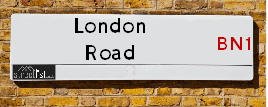
Neighbourhood Policing |
| Police Force: Sussex |
 View Neighbourhood Crime and Policing View Neighbourhood Crime and Policing |
| Find a Local Neighbourhood Watch Scheme |
Location Details
| London Road | |
|---|---|

| |
| Latitude | 50.857400 |
| Longitude | -0.153197 |
| OS Easting (X): | 529969 |
| OS Northing (Y): | 108118 |
| OS Grid Reference: | TQ300081 |
Known Residential Addresses for London Road
- 2
- 236
- DUNROMIN
- WAYFIELDS
- OLD COPPERS
- 3 FRITHMANS
- FRITHMANS 2
- FRITHMANS 1
- WITHDEAN COURT 1
- WITHDEAN COURT 20
- WITHDEAN COURT 14
- WITHDEAN COURT 21
- WITHDEAN COURT 38
- WITHDEAN COURT 37
- WITHDEAN COURT 39
- WITHDEAN COURT 4
- WITHDEAN COURT 17
- WITHDEAN COURT 28
- WITHDEAN COURT 16
- WITHDEAN COURT 3
- WITHDEAN COURT 27
- WITHDEAN COURT 41
- WITHDEAN COURT 65
- WITHDEAN COURT 63
- WITHDEAN COURT 68
- WITHDEAN COURT 69
- WITHDEAN COURT 73
- WITHDEAN COURT 66
- WITHDEAN COURT 81
- WITHDEAN COURT 53
- WITHDEAN COURT 44
- WITHDEAN COURT 60
- WITHDEAN COURT 59
- WITHDEAN COURT 45
- WITHDEAN COURT 78
- WITHDEAN COURT 79
- KINGSMERE FLAT 25
- KINGSMERE FLAT 3
- KINGSMERE FLAT 1
- KINGSMERE FLAT 34
- KINGSMERE FLAT 6
- KINGSMERE FLAT 20
- KINGSMERE FLAT 5
- KINGSMERE FLAT 29
- KINGSMERE 11
- KINGSMERE 9
- KINGSMERE 4
- KINGSMERE FLAT 12
- KINGSMERE FLAT 21
- KINGSMERE FLAT 24
- KINGSMERE FLAT 12A
- KINGSMERE FLAT 39
- KINGSMERE FLAT 40
- KINGSMERE FLAT 33
- KINGSMERE FLAT 17
- KINGSMERE FLAT 27
- KINGSMERE FLAT 36
- KINGSMERE FLAT 31
- KINGSMERE FLAT 51
- KINGSMERE FLAT 55
- KINGSMERE FLAT 44
- KINGSMERE FLAT 73
- KINGSMERE FLAT 77
- KINGSMERE FLAT 63
- KINGSMERE FLAT 69
- KINGSMERE 80A
- KINGSMERE 80C
- KINGSMERE 60B
- KINGSMERE FLAT 64
- KINGSMERE 60A
- KINGSMERE 60C
- KINGSMERE 80B
- KINGSMERE 60D
- KINGSMERE 80D
- KINGSMERE FLAT 47
- KINGSMERE FLAT 74
- KINGSMERE FLAT 78
- KINGSMERE FLAT 76
- KINGSMERE FLAT 45
- KINGSMERE FLAT 79
- KINGSMERE FLAT 41
- KINGSMERE 66
- KINGSMERE FLAT 58
- KINGSMERE FLAT 54
- KINGSMERE 108
- KINGSMERE 85
- KINGSMERE 120C
- KINGSMERE 120D
- KINGSMERE 120B
- KINGSMERE 120
- KINGSMERE 86
- KINGSMERE 103
- KINGSMERE 105
- KINGSMERE 111
- KINGSMERE 92
- KINGSMERE 119
- KINGSMERE 84
- KINGSMERE FLAT 105
- KINGSMERE FLAT 102
- KINGSMERE FLAT 88
- KINGSMERE FLAT 91
- KINGSMERE FLAT 109
- KINGSMERE FLAT 89
- KINGSMERE FLAT 86
- KINGSMERE FLAT 83
- KINGSMERE FLAT 115
- KINGSMERE FLAT 119
- KINGSMERE FLAT 93
- KINGSMERE FLAT 114
- KINGSMERE FLAT 99
- KINGSMERE FLAT 97
- THE PARK APARTMENTS THE SOUTH PENTHOUSE
- THE PARK APARTMENTS 38
- THE PARK APARTMENTS 28
- THE PARK APARTMENTS 35
- THE PARK APARTMENTS 19
- THE PARK APARTMENTS 41
- THE PARK APARTMENTS 26
- THE PARK APARTMENTS 17
- THE PARK APARTMENTS 31
- THE PARK APARTMENTS 11
- THE PARK APARTMENTS 36
- THE PARK APARTMENTS 7
- THE PARK APARTMENTS 5
- THE PARK APARTMENTS 20
- THE PARK APARTMENTS 33
- THE PARK APARTMENTS 23
- THE PARK APARTMENTS 32
- THE PARK APARTMENTS 12
- THE PARK APARTMENTS PENTHOUSE 3
- THE PARK APARTMENTS 27
- THE PARK APARTMENTS 15
- THE PARK APARTMENTS 24
- THE PARK APARTMENTS 48
- THE PARK APARTMENTS 47
- THE PARK APARTMENTS 6
- THE PARK APARTMENTS 34
- 1
- 15
- 40
- 43
- 24
- 30
- 16
- 14
- 18
- 17
- 38
- 22
- 3
- 39
- 46
- 36
- 12A
- 28
- 47
- LILAC COURT FLAT 16
- LILAC COURT FLAT 26
- LILAC COURT FLAT 6
- LILAC COURT FLAT 1
- LILAC COURT FLAT 34
- LILAC COURT FLAT 7
- LILAC COURT FLAT 35
- LILAC COURT FLAT 9
- LILAC COURT FLAT 39
- LILAC COURT FLAT 41
- LILAC COURT FLAT 18
- LILAC COURT FLAT 40
- LILAC COURT FLAT 4
- LILAC COURT FLAT 31
- LILAC COURT FLAT 22
- LILAC COURT FLAT 3
- LILAC COURT FLAT 20
- LILAC COURT FLAT 25
- LILAC COURT FLAT 2
- LILAC COURT FLAT 29
- LILAC COURT FLAT 36
- LILAC COURT FLAT 23
- LILAC COURT FLAT 10
- LILAC COURT FLAT 15
- LILAC COURT FLAT 17
- HOMELEIGH FLAT 15
- HOMELEIGH FLAT 1
- HOMELEIGH FLAT 7
- HOMELEIGH FLAT 24
- HOMELEIGH FLAT 39
- HOMELEIGH FLAT 22
- HOMELEIGH FLAT 46
- HOMELEIGH FLAT 8
- HOMELEIGH FLAT 51
- HOMELEIGH FLAT 42
- HOMELEIGH FLAT 55
- HOMELEIGH FLAT 44
- HOMELEIGH FLAT 12
- HOMELEIGH FLAT 4
- HOMELEIGH FLAT 26
- HOMELEIGH FLAT 52
- HOMELEIGH FLAT 16
- HOMELEIGH FLAT 40
- HOMELEIGH FLAT 47
- HOMELEIGH FLAT 9
- HOMELEIGH FLAT 19
- BOURNE COURT FLAT 16
- BOURNE COURT FLAT 9
- BOURNE COURT FLAT 30
- BOURNE COURT FLAT 12
- BOURNE COURT FLAT 10
- BOURNE COURT FLAT 3
- BOURNE COURT FLAT 19
- BOURNE COURT FLAT 32
- BOURNE COURT FLAT 4
- BOURNE COURT FLAT 7
- THE PRIORY 26
- THE PRIORY 37
- THE PRIORY 8
- THE PRIORY 40
- THE PRIORY 4
- THE PRIORY 29
- THE PRIORY 25
- THE PRIORY 35
- THE PRIORY 3
- THE PRIORY 27
- THE PRIORY 19
- THE PRIORY 24
- THE PRIORY 20
- THE PRIORY 23
- THE PRIORY 28
- THE PRIORY 5
- THE PRIORY 12
- THE PRIORY 22
- THE PRIORY 33
- THE PRIORY 67
- THE PRIORY 64
- THE PRIORY 65
- THE PRIORY 77
- THE PRIORY 75
- THE PRIORY 72
- THE PRIORY 43
- THE PRIORY 56
- THE PRIORY 59
- THE PRIORY 80
- THE PRIORY 44
- THE PRIORY 79
- THE PRIORY 63
- THE PRIORY 41
- THE PRIORY 69
- THE PRIORY 45
- MANDALAY COURT FLAT 23
- MANDALAY COURT FLAT 20
- MANDALAY COURT FLAT 21
- MANDALAY COURT FLAT 39
- MANDALAY COURT FLAT 24
- MANDALAY COURT FLAT 22
- MANDALAY COURT FLAT 8
- MANDALAY COURT FLAT 1
- MANDALAY COURT FLAT 9
- MANDALAY COURT FLAT 30
- MANDALAY COURT FLAT 2
- MANDALAY COURT FLAT 29
- MANDALAY COURT FLAT 17
- MANDALAY COURT FLAT 18
- MANDALAY COURT FLAT 7
- MANDALAY COURT FLAT 35
- MANDALAY COURT FLAT 34
- MANDALAY COURT FLAT 4
- MANDALAY COURT FLAT 46
- MANDALAY COURT FLAT 68
- MANDALAY COURT FLAT 78
- MANDALAY COURT FLAT 70
- MANDALAY COURT FLAT 48
- MANDALAY COURT FLAT 56
- MANDALAY COURT FLAT 59
- MANDALAY COURT FLAT 77
- MANDALAY COURT FLAT 61
- MANDALAY COURT FLAT 73
- MANDALAY COURT FLAT 41
- MANDALAY COURT FLAT 50
- MANDALAY COURT FLAT 72
- 7
- 8
- 228
- KINGSMERE FLAT 100B
- THE PRIORY BLOCK D
- THE PRIORY 58
- THE PRIORY GARAGE 42
- PATCHAM LODGE
- SOUTH HILL FARM TELECOMMUNICATION APPARATUS
- BP SERVICE STATION
- SOUTH HILL BARN
- SOUTH HILL FARM
- KARIBU
- 4
Roads that have a Junction with London Road
| Street | Junction Type |
|---|---|
| Brighton Road (B2117) | junction |
| Dale Hill (A23) | pseudo node |
| Dale Hill (A23) | junction |
| Mill Road | roundabout |
| Mill Road | roundabout |
| Church Hill | junction |
| Patcham By Pass (A23) | junction |
| Brangwyn Drive | junction |
| Carden Avenue | junction |
| Peacock Lane | junction |
| Tongdean Lane | junction |
| Withdean Court Avenue | junction |
| The Approach | junction |
| Cedars Gardens | junction |
| Leahurst Court Road | junction |
| Varndean Road | junction |
| Elms Lea Avenue | junction |
| Cliveden Court | junction |
| Towergate | junction |
| Preston Road (A23) | junction |
Sunset and Sunrise times
| Sunrise | 07:00 |
|---|---|
| Sunset | 17:27 |
Latest Weather Conditions
| Observed at Weather Station: | Shoreham 20 February 2025 at 05:00 (6.23 miles away) |
|---|---|
| Current Weather: | Clear night |
| Temperature and Humidity: | 9.5°C (96.6%) |
| Wind Direction and Speed: | SSW (14 mph) |
Population Statistics
| ONS Area Code | E00085880, E00085852, E00085879, E00085884, E00085883, E00085882, E00085878, E00085850, E00085848, E00085431, E00085872, E00085440, E00162005, E00161632 & E00162004 |
|---|---|
| ONS Area Name | Professional Service Cosmopolitans, Delayed Retirement, Urban Cultural Mix, Families in Terraces and Flats, Migrant Families, Self-Sufficient Retirement, Rural White-Collar Workers & Established Farming Communities |
| Average Age | 42.26, 38.56, 38.19, 44.70, 44.24, 43.45, 44.57, 43.55 & 40.79 |
| Area Population | 1703.00, 1647.00, 1688.00, 1722.00, 1504.00, 1586.00, 1602.00, 1666.00 & 1668.00 |
| Male Population | 838.00, 779.00, 855.00, 833.00, 730.00, 752.00, 775.00, 805.00 & 844.00 (49%) |
| Female Population | 865.00, 868.00, 833.00, 889.00, 774.00, 834.00, 827.00, 861.00 & 824.00 (51%) |
| Benefit Claimants | 18, 7, 21, 10, 4, 11, 8, 9 & 3 (1%) |
| LSOA Code: | E01017002, E01017003, E01017004, E01017000, E01017001, E01016923, E01016928, E01031770 &E01031698 |
|---|---|
| LSOA Name: | Brighton and Hove 011B, Brighton and Hove 004D, Brighton and Hove 011C, Brighton and Hove 003E, Brighton and Hove 004C, Brighton and Hove 003A, Brighton and Hove 003B, Mid Sussex 016D &Mid Sussex 016A |
| SOA Code: | 3c, 8a &2b |
| SOA Name: | |
| MSOA Code: | E02003501, E02003494, E02003493 &E02006619 |
| MSOA Name: | Brighton and Hove 011, Brighton and Hove 004, Brighton and Hove 003 &Mid Sussex 016 |
Nearest Supermarkets
| Sainsburys Brighton Carden Avenue Local |
|---|
| 189 Carden Avenue, Brighton, England, BN1 8LE |
| 1273559954 |
| Distance: 0.83 Miles |
| Directions to Sainsburys Brighton Carden Avenue Local |
| Sainsburys Brighton Preston Road Local |
|---|
| 227-233 Preston Road, Brighton, England, BN1 6SA |
| 01273 560 844 |
| Distance: 0.94 Miles |
| Directions to Sainsburys Brighton Preston Road Local |
| Tesco Hove Droveway Express |
|---|
| 26 The Droveway, Hove, BN3 6LE |
| 0345 026 9294 |
| Distance: 1.16 Miles |
| Directions to Tesco Hove Droveway Express |
| Tesco Hove Dyke Rd Esso Express |
|---|
| 239 Dyke Rd, Hove, BN3 6NF |
| 0345 677 9369 |
| Distance: 1.33 Miles |
| Directions to Tesco Hove Dyke Rd Esso Express |
Telephone Information
| Area Code |
|---|
| Area Code: 01273 - Brighton |
Local Government
| Local Council Details |
|---|
| Within the area of Brighton and Hove &Mid Sussex |
| Visit the Council's Website |
| Visit the Council's Website |
| Kings House, Grand Avenue, Hove, East Sussex, BN3 2LS, Oaklands, Oaklands Road, Haywards Heath, West Sussex &RH16 1SS |
| Send email |
| Telephone Number: 01273 290000 &01444 458 166 |
| Local Member of Parliament |
|---|
| Within the Westminster Parliamentary Constituency of Brighton, Pavilion, Arundel and South Downs &Mid Sussex |
| The Member of Parliament is Si�n Berry &Alison Bennett |
| Details for the MP Si�n Berry &Alison Bennett on parliament.uk |
| Details for the MP Si�n Berry &Alison Bennett on theyworkforyou.com |
| In the 2024 General Election Si�n Berry &Alison Bennett won with a majority of 14,290 the result was Green hold &LD gain from Con. The total electorate was 74,786 |
Nearest Schools
England Primary Schools
Balfour Primary School
Address: Balfour Primary School, Balfour Road, Brighton, East Sussex, BN1 6NE
Distance: 0.93 miles
Contact: 01273507722
Coldean Primary School
Address: Coldean Primary School, Kenwards, Coldean, Brighton, East Sussex, BN1 9EN
Distance: 1.85 miles
Contact: 01273094911
St Bernadette's Catholic Primary School
Address: St Bernadette's Catholic Primary School, Preston Road, Withdean, Brighton, East Sussex, BN1 6UT
Distance: 0.75 miles
Contact: 01273553813
Stanford Infant School
Address: Stanford Infant School, Highcroft Villas, Brighton, East Sussex, BN1 5PS
Distance: 1.30 miles
Contact: 01273555240
Carden Nursery and Primary School
Address: Carden Nursery and Primary School, County Oak Avenue, Brighton, East Sussex, BN1 8LU
Distance: 1.14 miles
Contact: 01273916606
Patcham Junior School
Address: Patcham Junior School, Ladies Mile Road, Patcham, Brighton, East Sussex, BN1 8TA
Distance: 0.59 miles
Contact: 01273087513
Patcham Infant School
Address: Patcham Infant School, Highview Avenue South, Brighton, East Sussex, BN1 8WW
Distance: 0.38 miles
Contact: 01273509766
Westdene Primary School
Address: Westdene Primary School, Bankside, Westdene, Brighton, East Sussex, BN1 5GN
Distance: 0.42 miles
Contact: 01273916618
Cottesmore St Mary's Catholic Primary School
Address: Cottesmore St Mary's Catholic Primary School, The Upper Drive, Hove, East Sussex, BN3 6NB
Distance: 1.40 miles
Contact: 01273555811
Bilingual Primary School - Brighton & Hove
Address: Bilingual Primary School - Brighton & Hove, The Droveway, Hove, Brighton and Hove, East Sussex, BN3 7QA
Distance: 1.34 miles
Contact: 01273916212
England Secondary Schools
Varndean School
Address: Varndean School, Balfour Road, Brighton, East Sussex, BN1 6NP
Distance: 0.86 miles
Contact: 01273561281
Dorothy Stringer School
Address: Dorothy Stringer School, Loder Road, Brighton, East Sussex, BN1 6PZ
Distance: 0.72 miles
Contact: 01273852222
Patcham High School
Address: Patcham High School, Ladies Mile Road, Brighton, East Sussex, BN1 8PB
Distance: 0.52 miles
Contact: 01273503908
Cardinal Newman Catholic School
Address: Cardinal Newman Catholic School, The Upper Drive, Hove, East Sussex, BN3 6ND
Distance: 1.44 miles
Contact: 01273558551
England Higher Schools
Varndean College
Address: Varndean College, Surrenden Road, Brighton, East Sussex, BN1 6WQ
Distance: 0.62 miles
Contact: 01273508011
Brighton Hove and Sussex Sixth Form College
Address: Brighton Hove and Sussex Sixth Form College, 205 Dyke Road, Hove, East Sussex, BN3 6EG
Distance: 1.33 miles
Contact: 01273552200
Nearest Hospitals
| The Montefiore Hospital |
|---|
| Address: 2 Montefiore Road, Hove, BN3 1RD, |
| Independent Sector |
| Spire Healthcare |
| Telephone: 01273 828 120 |
| Visit Hospital Website |
| Distance: 2.84 (miles) |
| Directions from to The Montefiore Hospital |
| Mill View Hospital |
|---|
| Address: Nevill Avenue, Hove, |
| NHS Sector |
| Sussex Partnership NHS Foundation Trust |
| Telephone: 01273 621984 |
| Visit Hospital Website |
| Distance: 3.08 (miles) |
| Directions from to Mill View Hospital |
| Aldrington Centre |
|---|
| Address: 35 New Church Road, Aldrington Centre, Hove, BN3 4AG, |
| NHS Sector |
| Sussex Partnership NHS Foundation Trust |
| Telephone: 01273 718680 |
| Visit Hospital Website |
| Distance: 3.73 (miles) |
| Directions from to Aldrington Centre |
Nearest Dentists
Dentists
DENTAL SURGERY
Address: 54 ELDRED AVENUE, BRIGHTON, EAST SUSSEX, BN1 5EG
Distance: 0.15 miles
Contact: :
DENTAL SURGERY
Address: 74 OLD LONDON ROAD, BRIGHTON, EAST SUSSEX, BN1 8XQ
Distance: 0.34 miles
Contact: :
ELMS LEA DENTAL SURGERY
Address: 17 ELMS LEA AVENUE, BRIGHTON, EAST SUSSEX, BN1 6UG
Distance: 0.67 miles
Contact: :
WHITEHOUSE DENTAL PRACTICE
Address: 2 CLERMONT ROAD, BRIGHTON, EAST SUSSEX, BN1 6SG
Distance: 0.77 miles
Contact: :
SURRENDEN DENTAL PRACTICE
Address: 38 SURRENDEN ROAD, BRIGHTON, BN1 6PP
Distance: 0.88 miles
Contact: :
MATLOCK ROAD DENTAL SURGERY
Address: 10A MATLOCK ROAD, BRIGHTON, EAST SUSSEX, BN1 5BF
Distance: 0.97 miles
Contact: :
Nearest GP Surgeries
Doctors
THE DENEWAY SURGERY
Address: LIONSDENE, 11 THE DENEWAY, BRIGHTON, EAST SUSSEX, BN1 8QR
Distance: 0.09 miles
Contact: tel: 01273 540490
MATLOCK ROAD SURGERY
Address: 10 MATLOCK ROAD, BRIGHTON, BN1 5BF
Distance: 0.97 miles
Contact: :
THE HAVEN PRACTICE
Address: 100 BEACONSFIELD VILLAS, BRIGHTON, EAST SUSSEX, BN1 6HE
Distance: 1.11 miles
Contact: tel: 01273 555999
CARDEN SURGERY
Address: COUNTY OAK MEDICAL CENTRE, CARDEN HILL, BRIGHTON, EAST SUSSEX, BN1 8DD
Distance: 1.21 miles
Contact: tel: 01273 500155
WARMDENE SURGERY
Address: COUNTY OAK MEDICAL CENTRE, CARDEN HILL, BRIGHTON, EAST SUSSEX, BN1 8DD
Distance: 1.21 miles
Contact: tel: 01273 508811
SCHOOL HOUSE SURGERY
Address: SCHOOL HOUSE, HERTFORD ROAD, BRIGHTON, EAST SUSSEX, BN1 7GF
Distance: 1.30 miles
Contact: tel: 01273 551031
Nearest Dispensing Chemists
Pharmacies
FIELDS PHARMACY
Address: 38-40 ELDRED AVENUE, WESTDENE, BRIGHTON, EAST SUSSEX, BN1 5EG
Distance: 0.15 miles
Contact: tel: 01273 502447
PATCHAM PHARMACY
Address: 37 LADIES MILE ROAD, PATCHAM, BRIGHTON, EAST SUSSEX, BN1 8TA
Distance: 0.59 miles
Contact: tel: 01273 553628
MATLOCK PHARMACY
Address: 12 MATLOCK ROAD, BRIGHTON, EAST SUSSEX, BN1 5BF
Distance: 0.97 miles
Contact: tel: 01273 552060
KAMSONS PHARMACY
Address: 94 PRESTON DROVE, BRIGHTON, EAST SUSSEX, BN1 6LB
Distance: 1.01 miles
Contact: tel: 01273 552808
KAMSONS PHARMACY
Address: COUNTY OAK MEDICAL CENTRE, CARDEN HILL, BRIGHTON, BN1 8DD
Distance: 1.21 miles
Contact: tel: 01273 508198
KAMSONS PHARMACY
Address: 175 PRESTON ROAD, BRIGHTON, EAST SUSSEX, BN1 6AG
Distance: 1.33 miles
Contact: tel: 01273 566398
Nearest Opticians
Opticians
EYES AT HOME (HOVE)
Address: 87 WOODLAND AVENUE, HOVE, EAST SUSSEX, BN3 6BJ
Distance: 1.02 miles
Contact: :
4646 BRIGHTON HOLLINGBURY
Address: ASDA STORES LTD, 1 CROWHURST ROAD, HOLLINGBURY, BRIGHTON, EAST SUSSEX, BN1 8AS
Distance: 1.47 miles
Contact: :
THOMAS H COLLISON LTD (BRIGHTON)
Address: 57B LONDON ROAD, BRIGHTON, EAST SUSSEX, BN1 4JE
Distance: 1.81 miles
Contact: :
OM OPTICAL LTD
Address: 39 LONDON ROAD, BRIGHTON, EAST SUSSEX, BN1 4JB
Distance: 1.94 miles
Contact: :
BRIGHTON LONDON ROAD SPECSAVERS LIMITED
Address: 142-143 LONDON ROAD, BRIGHTON, BN1 4JH
Distance: 2.04 miles
Contact: :
SPECSAVERS (HOVE)
Address: 84 GEORGE STREET, HOVE, EAST SUSSEX, BN3 3YE
Distance: 2.13 miles
Contact: :
Transport
Nearest Rail Stations
Preston Park Station is 0.80 miles away.
Address: Preston Park station, Clermont Road, Preston Park, Brighton, BN1 6SG
Preston Park is situated on the Brighton Main Line and is managed by Southern.
Preston Park Station is staffed on a part time basis.
London Road (Brighton) Station is 1.61 miles away.
Address: London Road (Brighton) station, Shaftesbury Place, Brighton, East Sussex, BN1 4QS
London Road (Brighton) is situated on the East Coastway Line and is managed by Southern.
London Road (Brighton) Station is staffed on a part time basis.