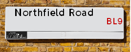
Northfield Road is a street located in the town of Bury. It uses the postcode BL9 6QD. The street has a length of approximately 151 metres.
The street is located within the Bury District (B) Council's jurisdiction. They provide various services, like refuse collection, and manage council tax collection. It's situated in the North West region of the UK.
The road has been assigned the Unique Street Reference Number of 5101568 in the National Street Gazetteer.
It is located within the county of Greater Manchester, situated in the North West region of the UK. It's 172.59 miles North West from central London., 9.46 miles North from Manchester, 31.96 miles North East from Liverpool and 33.33 miles South West from Leeds.
Moving to Northfield Road?
I can help you uncover potential pitfalls and provide key questions to ask about your new property. With decades of experience as a Local Land Charges Manager, I offer confidential insights to make your move informed and stress-free.
This service is free, but you may wish to make an optional donation to support it. Please include the property name and address in your request as well as anything you wish to focus on.
Contact Me
Do you know why this road is called Northfield Road?
What's it like to live here?
Ask the community a question.
Do you have any questions, memories to share or know any facts? We'd love to know more.
Map of Northfield Road
| Postcodes | ||
|---|---|---|
| Icon | Postcodes for Northfield Road | |
| Walking Distances | ||
| Distance Info | Green Circle = 10 Minutes Walk (800 metres) | |
Street Crime Data accessed from data.police.uk on 06/10/2024.
Budget Friendly Hotels near Northfield Road
| Budget Hotel Name | Distance (miles) |
|---|---|
|
1: Name:Premier Inn Manchester Bury Address: 5 Knowsley Place Telephone: Visit Hotel Page |
1.64 |
|
2: Name:Travelodge Bury Address: Leisure park, Pilsworth Rd, Little 66, Bury, BL9 8RS Telephone: 0871 984 6302 Visit Hotel Page |
2.49 |
|
3: Name:Travelodge Manchester Birch M62 Eastbound Address: Moto Service Area, M62, Heywood, OL10 2QH Telephone: 0871 984 6262 Visit Hotel Page |
3.92 |
|
4: Name:Travelodge Manchester Birch M62 Westbound Address: Moto Service Area, M62, Middleton, Heywood, OL10 2QH Telephone: 0871 984 6161 Visit Hotel Page |
4.05 |
|
5: Name:Premier Inn Manchester Prestwich Address: Bury New Road Telephone: Visit Hotel Page |
5.28 |
Hotel Options
Your support helps keep this site running!
If you enjoy using this website, consider buying me a coffee to help cover hosting costs.
Nearby Estate Agents
| Name | Address | Website |
|---|---|---|
| Pearson Ferrier | 435 - 437 Walmersley Road, Bury, BL9 5EU | Visit Website |
| Entwistle Green | 10 The Rock, Bury, BL9 0NT | Visit Website |
| Keenans Estate Agents | 2 The Rock, Bury, BL9 0NT | Visit Website |
| Your Move | 18/20 The Rock, Bury, BL9 0NT | Visit Website |
| Harrison Estate Agents | 10 Bolton Street, Bury, BL9 0LQ | Visit Website |
We have found 1 postcode
Neighbourhood Policing |
| Police Force: Greater Manchester |
 View Neighbourhood Crime and Policing View Neighbourhood Crime and Policing |
| Find a Local Neighbourhood Watch Scheme |
Location Details
| Northfield Road | |
|---|---|

| |
| Latitude | 53.612964 |
| Longitude | -2.292111 |
| OS Easting (X): | 380676 |
| OS Northing (Y): | 413000 |
| OS Grid Reference: | SD807130 |
Roads that have a Junction with Northfield Road
| Street | Junction Type |
|---|---|
| Walmersley Road (A56) | junction |
| Hazelwood Drive | junction |
| Fairlands Road | junction |
Sunset and Sunrise times
| Sunrise | 08:19 |
|---|---|
| Sunset | 15:51 |
Latest Weather Conditions
| Observed at Weather Station: | Rostherne No 2 18 December 2024 at 12:00 (17.87 miles away) |
|---|---|
| Current Weather: | Overcast |
| Temperature and Humidity: | 11.3°C (78.5%) |
| Wind Direction and Speed: | W (13 mph) |
Population Statistics
| ONS Area Code | E00025191 |
|---|---|
| ONS Area Name | Semi-Detached Ageing |
| Average Age | 46.37 |
| Area Population | 1721.00 |
| Male Population | 816.00 (47%) |
| Female Population | 905.00 (53%) |
| Benefit Claimants | 19 (1%) |
| LSOA Code: | E01004977 |
|---|---|
| LSOA Name: | Bury 004B |
| SOA Code: | 5a |
| SOA Name: | |
| MSOA Code: | E02001022 |
| MSOA Name: | Bury 004 |
Nearest Supermarkets
| Tesco Brandlesholme Express |
|---|
| Brandlesholme Rd, Brandlesholme, Bury, BL8 1HS |
| 0345 026 9027 |
| Distance: 0.93 Miles |
| Directions to Tesco Brandlesholme Express |
| Tesco Bury Superstore |
|---|
| Woodfield Retail Park, Peel Way, Bury, BL9 5BY |
| 0345 677 9080 |
| Distance: 1.09 Miles |
| Directions to Tesco Bury Superstore |
| Iceland Bury |
|---|
| 112/126 Rochdale Road, Bury, Lancashire, BL9 7AY |
| 01617645786 |
| Distance: 1.41 Miles |
| Directions to Iceland Bury |
| Tesco Bury Tottington Rd Express |
|---|
| Tottington Rd, Bury, BL8 1TS |
| 0345 675 7070 |
| Distance: 1.41 Miles |
| Directions to Tesco Bury Tottington Rd Express |
Telephone Information
| Dialling Code | Telephone Exchange | Telephone Cabinet | Fibre to the Cabinet or Fibre to the Premises |
|---|---|---|---|
| 0161 | BURY; GREATER MANCHESTER - MRBUR | P12 | FTTC |
Broadband Information
| Speed | Average Speed | Median Speed | Maximum Speed | Next-generation access (NGA) | Number of Connections |
|---|---|---|---|---|---|
| Greater than 2 Mbps | 16.6 | 8 | >=30 | Y | 9 |
Local Government
| Local Council Details |
|---|
| Within the area of Bury |
| Visit the Council's Website |
| Town Hall, Knowsley Street, Bury, Lancashire &BL9 OSW |
| Send email |
| Telephone Number: 01612 535 000 |
| Local Member of Parliament |
|---|
| Within the Westminster Parliamentary Constituency of Bury North |
| The Member of Parliament is James Frith |
| Details for the MP James Frith on parliament.uk |
| Details for the MP James Frith on theyworkforyou.com |
| In the 2024 General Election James Frith won with a majority of 6,944 the result was Lab gain from Con. The total electorate was 77,686 |
| Wards, Parish Councils and County Councils |
|---|
| Ward: Moorside Ward |
| Ceremonial County: Greater Manchester |
Nearest Schools
England Primary Schools
Chesham Primary School
Address: Chesham Primary School, Talbot Grove, Bury, Lancashire, BL9 6PH
Distance: 0.31 miles
Contact: 01617644927
St Joseph and St Bede RC Primary School
Address: St Joseph and St Bede RC Primary School, Danesmoor Drive, Bury, Lancashire, BL9 6ER
Distance: 0.81 miles
Contact: 01617643781
St Paul's Church of England Primary School, Bury
Address: St Paul's Church of England Primary School, Bury, Porritt Street, Via Huntley Mount Road, Bury, Lancashire, BL9 6LJ
Distance: 0.99 miles
Contact: 01617643788
Holy Trinity Primary School
Address: Holy Trinity Primary School, Cecil Street, Bury, Lancashire, BL9 0SB
Distance: 1.58 miles
Contact:
Springside Primary School
Address: Springside Primary School, Springside Road, Bury, Lancashire, BL9 5JB
Distance: 0.38 miles
Contact:
East Ward Community Primary School
Address: East Ward Community Primary School, Willow Street, Bury, Lancashire, BL9 7QZ
Distance: 1.46 miles
Contact: 01617646065
East Ward Community Primary School
Address: East Ward Community Primary School, Willow Street, Bury, Lancashire, BL9 7QZ
Distance: 1.46 miles
Contact:
St John with St Mark CofE Primary School
Address: St John with St Mark CofE Primary School, Athlone Avenue, Bury, Lancashire, BL9 5EE
Distance: 0.67 miles
Contact: 01617645330
St Thomas Church of England Primary School
Address: St Thomas Church of England Primary School, Pimhole Road, Bury, Lancashire, BL9 7EY
Distance: 1.54 miles
Contact:
St Marie's Roman Catholic Primary School, Bury
Address: St Marie's Roman Catholic Primary School, Bury, Edward Street, The Mosses, Bury, Lancashire, BL9 0RZ
Distance: 1.60 miles
Contact: 01617643204
Summerseat Methodist Primary School
Address: Summerseat Methodist Primary School, Rowlands Road, Summerseat, Bury, Lancashire, BL9 5NF
Distance: 1.32 miles
Contact:
England Secondary Schools
Broad Oak Sports College
Address: Broad Oak Sports College, Hazel Avenue, Bury, Lancashire, BL9 7QT
Distance: 1.46 miles
Contact:
Nearest Hospitals
| Name | Address | Postcode | Distance | Map |
|---|
Nearest Dentists
Dentists
| Name | Address | Postcode | Distance | Map |
|---|
Nearest GP Surgeries
Doctors
WOODBANK SURGERY
Address: 2 HUNSTANTON DRIVE, BURY, LANCASHIRE, BL8 1EG
Distance: 0.88 miles
Contact: tel: 0161 7051630
WALMERSLEY ROAD MEDICAL PRACTICE
Address: 110 WALMERSLEY ROAD, BURY, LANCASHIRE, BL9 6DX
Distance: 0.91 miles
Contact: tel: 0161 7646100
HUNTLEY MOUNT MEDICAL CENTRE
Address: HUNTLEY MOUNT ROAD, BURY, LANCASHIRE, BL9 6JA
Distance: 1.04 miles
Contact: tel: 0161 7616677
HUNTLEY MOUNT MEDICAL CENTRE - COVID LOCAL VACCINATION SERVICE
Address: HUNTLEY MOUNT ROAD, BURY, BL9 6JA
Distance: 1.04 miles
Contact: :
TOWER FAMILY HEALTHCARE - MINDEN
Address: 22 DERBY WAY, BURY, BL9 0NJ
Distance: 1.21 miles
Contact: :
MOORGATE PCC - COVID LOCAL VACCINATION SERVICE
Address: 22 DERBY WAY, BURY, LANCASHIRE, BL9 0NJ
Distance: 1.21 miles
Contact: :
Nearest Dispensing Chemists
Pharmacies
| Name | Address | Postcode | Telephone | Map | Distance in Km |
|---|
Nearest Opticians
Opticians
BURY V.E. LTD
Address: 19 CENTRAL STREET, BURY, BL9 0JN
Distance: 1.25 miles
Contact: :
SPECSCART (UNION STREET)
Address: 10 UNION STREET, BURY, BL9 0NY
Distance: 1.34 miles
Contact: :
BOOTS OPTICIANS (UNION ARCADE - BURY)
Address: UNIT 7, UNION ARCADE, BURY, LANCASHIRE, BL9 0QF
Distance: 1.37 miles
Contact: :
ROSE & TARRANT OPTICIANS
Address: 14 CROMPTON STREET, BURY, LANCASHIRE, BL9 0AD
Distance: 1.38 miles
Contact: :
SPECSAVERS (BURY)
Address: UNIT 35, THE HAYMARKET, MILLGATE SHOPPING CENTRE, BURY, LANCASHIRE, BL9 0BX
Distance: 1.39 miles
Contact: :
YATES & SUDDELL OPTICIANS (BURY)
Address: 15-19 MINDEN PARADE, BURY, LANCASHIRE, BL9 0QG
Distance: 1.40 miles
Contact: :
Transport
Nearest Rail Stations
Bromley Cross (Lancs) Station is 4.82 miles away.
Address: Bromley Cross station, Chapeltown Road, Bromley Cross, Lancashire, BL7 9AG
Bromley Cross (Lancs) is situated on the Ribble Valley line and is managed by Northern.
Bromley Cross (Lancs) Station is staffed on a part time basis.
Castleton (Manchester) Station is 4.89 miles away.
Address: Castleton station, Railway Approach, Castleton, Lancashire, OL11 3EB
Castleton (Manchester) is situated on the Calder Valley line and is managed by Northern.
Castleton (Manchester) Station is an unstaffed station.