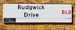
Rudgwick Drive is a street located in the town of Bury. The street has a length of approximately 716 metres.
The street is located within the Bury District (B) Council's jurisdiction. They provide various services, like refuse collection, and manage council tax collection. It's situated in the North West region of the UK.
The road has been assigned the Unique Street Reference Number of 5101893 in the National Street Gazetteer.
The street has the postcodes of BL8 1YE and BL8 1YA.
It is located within the county of Greater Manchester, situated in the North West region of the UK. It's 173.17 miles North West from central London., 9.75 miles North from Manchester, 31.11 miles North East from Liverpool and 34.21 miles West from Leeds.
Map of Rudgwick Drive
| Postcodes | ||
|---|---|---|
| Icon | Postcodes for Rudgwick Drive | |
| Walking Distances | ||
| Distance Info | Green Circle = 10 Minutes Walk (800 metres) | |
Street Crime Data accessed from data.police.uk on 06/10/2024.
Moving to Rudgwick Drive?
I can help you uncover potential pitfalls and provide key questions to ask about your new property. With decades of experience as a Local Land Charges Manager, I offer confidential insights to make your move informed and stress-free.
This service is free, but you may wish to make an optional donation to support it. Please include the property name and address in your request as well as anything you wish to focus on.
Contact Me
Do you know why this road is called Rudgwick Drive?
What's it like to live here?
Share a Photo of Rudgwick Drive
Ask the community a question.
Do you have any questions, memories to share, have any photos or know any facts? We'd love to know more.
Submit Your Comment

Budget Friendly Hotels near Rudgwick Drive
| Budget Hotel Name | Distance (miles) |
|---|---|
|
1: Name:Premier Inn Manchester Bury Address: 5 Knowsley Place Telephone: Visit Hotel Page |
1.79 |
|
2: Name:Travelodge Bury Address: Leisure park, Pilsworth Rd, Little 66, Bury, BL9 8RS Telephone: 0871 984 6302 Visit Hotel Page |
2.96 |
|
3: Name:Travelodge Manchester Birch M62 Eastbound Address: Moto Service Area, M62, Heywood, OL10 2QH Telephone: 0871 984 6262 Visit Hotel Page |
4.62 |
|
4: Name:Travelodge Manchester Birch M62 Westbound Address: Moto Service Area, M62, Middleton, Heywood, OL10 2QH Telephone: 0871 984 6161 Visit Hotel Page |
4.75 |
|
5: Name:Travelodge Bolton Central River Street Address: River St, Bolton, BL2 1BX Telephone: 0871 984 6520 Visit Hotel Page |
5.03 |
Hotel Options
Your support helps keep this site running!
If you enjoy using this website, consider making a donation to help me cover hosting costs.
Nearby Estate Agents
| Name | Address | Website |
|---|---|---|
| Pearson Ferrier | 435 - 437 Walmersley Road, Bury, BL9 5EU | Visit Website |
| JH Sales and Lettings | 10 Market Street, Tottington, Bury, BL8 4AD | Visit Website |
| Kristian Allan | Stoneholme, 42 High Street, Walshaw, Bury, BL8 3AN | Visit Website |
| Weale & Hitchen | 1 Longsight Road Holcombe Brook Bury Lancs BL0 9SL | Visit Website |
| Reeds Rains | 5 Holcombe Mews 407 Bolton Road West, Ramsbottom, Bury, BL0 9RN | Visit Website |
Neighbourhood Policing |
| Police Force: Greater Manchester |
 View Neighbourhood Crime and Policing View Neighbourhood Crime and Policing |
| Find a Local Neighbourhood Watch Scheme |
Location Details
| Rudgwick Drive | |
|---|---|

| |
| Latitude | 53.613645 |
| Longitude | -2.315799 |
| OS Easting (X): | 379110 |
| OS Northing (Y): | 413083 |
| OS Grid Reference: | SD791131 |
Roads that have a Junction with Rudgwick Drive
| Street | Junction Type |
|---|---|
| Newhaven Close | junction |
| Springside View | junction |
| Horsham Close | junction |
| Horley Close | junction |
| Tonbridge Close | junction |
| Winchester Close | junction |
| Willingdon Close | junction |
| Hailsham Close | junction |
| Arundel Close | junction |
| Falmer Close | junction |
| Purbeck Drive | junction |
Sunset and Sunrise times
| Sunrise | 07:43 |
|---|---|
| Sunset | 17:03 |
Latest Weather Conditions
| Observed at Weather Station: | Stonyhurst 6 February 2025 at 04:00 (17.46 miles away) |
|---|---|
| Current Weather: | Clear night |
| Temperature and Humidity: | -1.6°C (96.1%) |
| Wind Direction and Speed: | (0 mph) |
Population Statistics
| ONS Area Code | E00025115 & E00025113 |
|---|---|
| ONS Area Name | Comfortable Suburbia |
| Average Age | 45.28 |
| Area Population | 1227.00 |
| Male Population | 605.00 (49%) |
| Female Population | 622.00 (51%) |
| Benefit Claimants | 6 (0%) |
| LSOA Code: | E01004965 |
|---|---|
| LSOA Name: | Bury 005B |
| SOA Code: | 8a |
| SOA Name: | |
| MSOA Code: | E02001023 |
| MSOA Name: | Bury 005 |
Nearest Supermarkets
| Tesco Brandlesholme Express |
|---|
| Brandlesholme Rd, Brandlesholme, Bury, BL8 1HS |
| 0345 026 9027 |
| Distance: 0.35 Miles |
| Directions to Tesco Brandlesholme Express |
| Tesco Bury Tottington Rd Express |
|---|
| Tottington Rd, Bury, BL8 1TS |
| 0345 675 7070 |
| Distance: 0.79 Miles |
| Directions to Tesco Bury Tottington Rd Express |
| Tesco Bury Superstore |
|---|
| Woodfield Retail Park, Peel Way, Bury, BL9 5BY |
| 0345 677 9080 |
| Distance: 1.41 Miles |
| Directions to Tesco Bury Superstore |
| Tesco Bury Esso Express |
|---|
| Bolton Rd, Bury, BL8 2NZ |
| 0345 677 9774 |
| Distance: 1.7 Miles |
| Directions to Tesco Bury Esso Express |
Telephone Information
| Dialling Code | Telephone Exchange | Telephone Cabinet | Fibre to the Cabinet or Fibre to the Premises |
|---|---|---|---|
| 0161 | BURY; GREATER MANCHESTER - MRBUR | P65 | FTTC |
Broadband Information
| Speed | Average Speed | Median Speed | Maximum Speed | Next-generation access (NGA) | Number of Connections |
|---|---|---|---|---|---|
| Less than 2 Mbps | 14.9 | 7.8 | >=30 | Y | 26 |
Local Government
| Local Council Details |
|---|
| Within the area of Bury |
| Visit the Council's Website |
| Town Hall, Knowsley Street, Bury, Lancashire &BL9 OSW |
| Send email |
| Telephone Number: 01612 535 000 |
| Local Member of Parliament |
|---|
| Within the Westminster Parliamentary Constituency of Bury North |
| The Member of Parliament is James Frith |
| Details for the MP James Frith on parliament.uk |
| Details for the MP James Frith on theyworkforyou.com |
| In the 2024 General Election James Frith won with a majority of 6,944 the result was Lab gain from Con. The total electorate was 77,686 |
| Wards, Parish Councils and County Councils |
|---|
| Ward: Elton Ward |
| Ceremonial County: Greater Manchester |
Nearest Schools
England Primary Schools
Our Lady of Lourdes Roman Catholic Primary School, Bury
Address: Our Lady of Lourdes Roman Catholic Primary School, Bury, Rudgwick Drive, Bury, Lancashire, BL8 1YA
Distance: 0.04 miles
Contact: 01617612026
Woodbank Primary School
Address: Woodbank Primary School, Woodbank Primary School Brandlesholme Road, Bury, Lancashire, BL8 1AX
Distance: 0.82 miles
Contact: 01617611253
Old Hall Primary School
Address: Old Hall Primary School, Springside View, Bury, Lancashire, BL8 4LU
Distance: 0.21 miles
Contact: 01617612051
Elton Community Primary School
Address: Elton Community Primary School, Alston Street, Bury, Lancashire, BL8 1SB
Distance: 0.95 miles
Contact: 01617052674
Guardian Angels Roman Catholic Primary School, Bury
Address: Guardian Angels Roman Catholic Primary School, Bury, Leigh Lane, Elton, Bury, Lancashire, BL8 2RH
Distance: 1.16 miles
Contact: 01617644014
Hazlehurst Community Primary School
Address: Hazlehurst Community Primary School, Geoffrey Street, Ramsbottom, Bury, Lancashire, BL0 9PQ
Distance: 1.82 miles
Contact: 01706822002
Holcombe Brook Primary School
Address: Holcombe Brook Primary School, Longsight Road, Holcombe Brook, Bury, Lancashire, BL0 9TA
Distance: 1.19 miles
Contact: 01204882304
Greenmount Primary School
Address: Greenmount Primary School, Holhouse Lane, Greenmount, Bury, Lancashire, BL8 4HD
Distance: 1.42 miles
Contact: 01204884031
England Secondary Schools
Woodhey High School
Address: Woodhey High School, Bolton Road West, Ramsbottom, Bury, Lancashire, BL0 9QZ
Distance: 1.63 miles
Contact:
Nearest Hospitals
| Name | Address | Postcode | Distance | Map |
|---|
Nearest Dentists
Dentists
| Name | Address | Postcode | Distance | Map |
|---|
Nearest GP Surgeries
Doctors
WOODBANK SURGERY
Address: 2 HUNSTANTON DRIVE, BURY, LANCASHIRE, BL8 1EG
Distance: 0.66 miles
Contact: tel: 0161 7051630
TOWER FAMILY HEALTHCARE
Address: 16 MARKET STREET, TOTTINGTON, BURY, BL8 4AD
Distance: 1.05 miles
Contact: tel: 01204 885106
TOWER FAMILY HEALTHCARE - GREENMOUNT
Address: 9 BRANDLESHOLME ROAD, GREENMOUNT, BURY, LANCASHIRE, BL8 4DR
Distance: 1.09 miles
Contact: :
GARDEN CITY MEDICAL CENTRE
Address: 1A GARDEN CITY, RAMSBOTTOM, BURY, LANCASHIRE, BL0 9TN
Distance: 1.25 miles
Contact: tel: 01204 884710
WALMERSLEY ROAD MEDICAL PRACTICE
Address: 110 WALMERSLEY ROAD, BURY, LANCASHIRE, BL9 6DX
Distance: 1.44 miles
Contact: tel: 0161 7646100
TOWER FAMILY HEALTHCARE - MINDEN
Address: 22 DERBY WAY, BURY, BL9 0NJ
Distance: 1.68 miles
Contact: :
Nearest Dispensing Chemists
Pharmacies
| Name | Address | Postcode | Telephone | Map | Distance in Km |
|---|
Nearest Opticians
Opticians
LEIGHTONS OPTICIANS (BURY)
Address: 7 HOLCOMBE PRECINCT, RAMSBOTTOM, BURY, LANCASHIRE, BL0 9SH
Distance: 1.51 miles
Contact: :
ROSE & TARRANT OPTICIANS
Address: 14 CROMPTON STREET, BURY, LANCASHIRE, BL9 0AD
Distance: 1.61 miles
Contact: :
SPECSCART (UNION STREET)
Address: 10 UNION STREET, BURY, BL9 0NY
Distance: 1.62 miles
Contact: :
BURY V.E. LTD
Address: 19 CENTRAL STREET, BURY, BL9 0JN
Distance: 1.62 miles
Contact: :
SPECSAVERS (BURY)
Address: UNIT 35, THE HAYMARKET, MILLGATE SHOPPING CENTRE, BURY, LANCASHIRE, BL9 0BX
Distance: 1.64 miles
Contact: :
BOOTS OPTICIANS (UNION ARCADE - BURY)
Address: UNIT 7, UNION ARCADE, BURY, LANCASHIRE, BL9 0QF
Distance: 1.66 miles
Contact: :
Transport
Nearest Rail Stations
Bromley Cross (Lancs) Station is 3.84 miles away.
Address: Bromley Cross station, Chapeltown Road, Bromley Cross, Lancashire, BL7 9AG
Bromley Cross (Lancs) is situated on the Ribble Valley line and is managed by Northern.
Bromley Cross (Lancs) Station is staffed on a part time basis.
Hall-i'-th'-Wood Station is 4.18 miles away.
Address: Hall-i'-th'-Wood station, Crompton Way, Hall-i'-th'-Wood, Lancashire, BL1 8UF
Hall-i'-th'-Wood is situated on the Ribble Valley line and is managed by Northern.
Hall-i'-th'-Wood Station is an unstaffed station.