Chorley New Road is a street located in the town of Bolton and near the town of Bolton and in the town of Horwich. The street has a length of approximately 9,245 metres.
The street is publicly maintained which means that the road is adopted and Bolton is responsible for the repair and upkeep of the highway.
The street is located within the Bolton District (B) Council's jurisdiction. They provide various services, like refuse collection, and manage council tax collection. It's situated in the North West region of the UK.
The road has been assigned the Unique Street Reference Numbers of 3406119, 3499763, 3400819 and 3401082 in the National Street Gazetteer.
The street has the postcodes of BL6 7QJ, BL6 7QH, BL6 7QB, BL6 7QA, BL6 7JG, BL6 6LH, BL6 6LA, BL6 6JZ, BL6 6JT, BL6 6HR, BL6 6HN, BL6 6HG, BL6 6HD, BL6 6HA, BL6 6GQ, BL6 6EX, BL6 6EW, BL6 6ES, BL6 6EJ, BL6 6DU, BL6 6DT, BL6 6BE, BL6 5QW, BL6 5QQ, BL6 5QN, BL6 5QJ, BL6 5QF, BL6 5QE, BL6 5PS, BL6 5PP, BL6 5NY, BL6 5NP, BL6 5NN, BL6 5NL, BL6 5LU, BL6 5BF, BL6 4NW, BL6 4NU, BL6 4LW, BL6 4LN, BL6 4LA, BL6 4JY, BL6 4JU, BL6 4JT, BL6 4DW, BL6 4DP, BL6 4DN, BL6 4DL, BL6 4BF, BL6 4BA, BL6 4AZ, BL6 4AT, BL6 4AQ, BL6 4AL, BL6 4AG, BL6 4AA, BL1 5DR, BL1 5DP, BL1 5DH, BL1 5DG, BL1 5DA, BL1 5BR, BL1 5BP, BL1 5BF, BL1 5BA, BL1 5AZ, BL1 5AH, BL1 5AD, BL1 5AA, BL1 4RA, BL1 4QZ, BL1 4QR, BL1 4QP, BL1 4PH, BL1 4PF, BL1 4PE, BL1 4PB, BL1 4PA, BL1 4NX, BL1 4DH, BL1 4DA, BL1 4BY, BL1 4AP, BL6 4AJ, BL1 5DQ, BL1 5BY, BL6 5UE, BL6 5PX, BL6 5NJ, BL1 5DD, BL1 5BJ, BL1 5BB and BL1 5AE.
It is located within the county of Greater Manchester, situated in the North West region of the UK. It's 177.33 miles North West from central London., 14.6 miles North West from Manchester, 22.4 miles North East from Liverpool and 31.36 miles North East from Chester.
CHORLEY NEW ROAD is within the Post Town of BOLTON
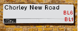
Map of Chorley New Road
| Street Crime (updated 14/01/2025) | ||
|---|---|---|
| Location Note | Central Point of Street - Not Actual Location | |
| MSOA Info | For MSOAs E02000998, E02001001, E02000999, E02001003, E02000995, E02000997, E02000990, E02000987 (Statistical Neighbourhood) | |
| Click Hint | Click on a Circle for a detailed breakdown below map. | |
| Crime Levels |
Green = Very Low Yellow = Low Orange = High Red = Very High |
|
| Postcodes | ||
| Icon | Postcodes for Chorley New Road | |
| Walking Distances | ||
| Distance Info | Green Circle = 10 Minutes Walk (800 metres) | |
Street Crime Data accessed from data.police.uk on 06/10/2024.
Moving to Chorley New Road?
I can help you uncover potential pitfalls and provide key questions to ask about your new property. With decades of experience as a Local Land Charges Manager, I offer confidential insights to make your move informed and stress-free.
This service is free, but you may wish to make an optional donation to support it. Please include the property name and address in your request as well as anything you wish to focus on.
Contact Me
Do you know why this road is called Chorley New Road?
What's it like to live here?
Share a Photo of Chorley New Road
Ask the community a question.
Do you have any questions, memories to share, have any photos or know any facts? We'd love to know more.
Submit Your Comment
Find Homes to Rent in Horwich

Budget Friendly Hotels near Chorley New Road
| Budget Hotel Name | Distance (miles) |
|---|---|
|
1: Name:Premier Inn Bolton Stadium Arena Address: Arena Approach 3 Telephone: Visit Hotel Page |
1.01 |
|
2: Name:Premier Inn Chorley South Address: Bolton Road Telephone: Visit Hotel Page |
4.45 |
|
3: Name:Premier Inn Wigan Town Centre Address: Harrogate Street Telephone: Visit Hotel Page |
4.91 |
|
4: Name:Travelodge Bolton Central River Street Address: River St, Bolton, BL2 1BX Telephone: 0871 984 6520 Visit Hotel Page |
5.13 |
|
5: Name:Premier Inn Wigan M6 Jct 27 Address: Almond Brook Road Telephone: Visit Hotel Page |
5.69 |
Hotel Options
Your support helps keep this site running!
If you enjoy using this website, consider making a donation to help me cover hosting costs.
EPC (Energy Performance Certificate) Information for Chorley New Road
UPRN: 100010862858
EPC Current: B
EPC Potential: B
Habitable Rooms: N/A
Property Type: Flat
Tenure: NO DATA!
Built Form: Detached
Age Band: U
Mains Gas: Unknown
UPRN: 100010862863
EPC Current: D
EPC Potential: B
Habitable Rooms: 6
Property Type: House
Tenure: Rented (private)
Built Form: Mid-Terrace
Age Band: before 1900
Mains Gas: Yes
UPRN: 100010862864
EPC Current: B
EPC Potential: B
Habitable Rooms: N/A
Property Type: Flat
Tenure: NO DATA!
Built Form: Detached
Age Band: U
Mains Gas: Unknown
UPRN: 100010862865
EPC Current: D
EPC Potential: B
Habitable Rooms: 6
Property Type: House
Tenure: Owner-occupied
Built Form: Mid-Terrace
Age Band: before 1900
Mains Gas: Yes
UPRN: 100010862866
EPC Current: B
EPC Potential: B
Habitable Rooms: N/A
Property Type: Flat
Tenure: NO DATA!
Built Form: Detached
Age Band: U
Mains Gas: Unknown
UPRN: 100010862867
EPC Current: D
EPC Potential: B
Habitable Rooms: 6
Property Type: House
Tenure: Owner-occupied
Built Form: Mid-Terrace
Age Band: 1900-1929
Mains Gas: Yes
UPRN: 100010862868
EPC Current: D
EPC Potential: C
Habitable Rooms: 4
Property Type: House
Tenure: Owner-occupied
Built Form: End-Terrace
Age Band: 1900-1929
Mains Gas: Yes
UPRN: 100010862869
EPC Current: D
EPC Potential: B
Habitable Rooms: 6
Property Type: House
Tenure: Owner-occupied
Built Form: Mid-Terrace
Age Band: before 1900
Mains Gas: Yes
UPRN: 100010862870
EPC Current: B
EPC Potential: B
Habitable Rooms: N/A
Property Type: Flat
Tenure: NO DATA!
Built Form: Detached
Age Band: U
Mains Gas: Unknown
UPRN: 100010862871
EPC Current: E
EPC Potential: B
Habitable Rooms: 6
Property Type: House
Tenure: Owner-occupied
Built Form: Mid-Terrace
Age Band: 1900-1929
Mains Gas: Yes
UPRN: 100010862872
EPC Current: D
EPC Potential: B
Habitable Rooms: 5
Property Type: House
Tenure: Owner-occupied
Built Form: End-Terrace
Age Band: before 1900
Mains Gas: Yes
UPRN: 100010862873
EPC Current: B
EPC Potential: B
Habitable Rooms: N/A
Property Type: Flat
Tenure: NO DATA!
Built Form: Detached
Age Band: U
Mains Gas: Unknown
UPRN: 100010862875
EPC Current: D
EPC Potential: B
Habitable Rooms: 4
Property Type: House
Tenure: Owner-occupied
Built Form: Mid-Terrace
Age Band: before 1900
Mains Gas: Yes
UPRN: 100010862877
EPC Current: B
EPC Potential: B
Habitable Rooms: N/A
Property Type: Flat
Tenure: NO DATA!
Built Form: Detached
Age Band: U
Mains Gas: Unknown
UPRN: 100010862882
EPC Current: D
EPC Potential: C
Habitable Rooms: 4
Property Type: House
Tenure: Owner-occupied
Built Form: Mid-Terrace
Age Band: 1900-1929
Mains Gas: Yes
UPRN: 100010862883
EPC Current: D
EPC Potential: C
Habitable Rooms: 3
Property Type: House
Tenure: Owner-occupied
Built Form: Mid-Terrace
Age Band: 1900-1929
Mains Gas: Yes
UPRN: 100010862884
EPC Current: D
EPC Potential: B
Habitable Rooms: 4
Property Type: House
Tenure: Owner-occupied
Built Form: Mid-Terrace
Age Band: 1900-1929
Mains Gas: Yes
UPRN: 100010862885
EPC Current: E
EPC Potential: C
Habitable Rooms: 4
Property Type: Bungalow
Tenure: Owner-occupied
Built Form: End-Terrace
Age Band: 1900-1929
Mains Gas: Yes
UPRN: 100010862886
EPC Current: D
EPC Potential: B
Habitable Rooms: 3
Property Type: House
Tenure: Rented (private)
Built Form: End-Terrace
Age Band: 1950-1966
Mains Gas: Yes
UPRN: 100010862888
EPC Current: E
EPC Potential: B
Habitable Rooms: 4
Property Type: House
Tenure: Owner-occupied
Built Form: End-Terrace
Age Band: 1900-1929
Mains Gas: Yes
UPRN: 10001245193
EPC Current: D
EPC Potential: B
Habitable Rooms: 5
Property Type: House
Tenure: Owner-occupied
Built Form: Mid-Terrace
Age Band: 1930-1949
Mains Gas: Yes
UPRN: 100010862890
EPC Current: D
EPC Potential: B
Habitable Rooms: 5
Property Type: House
Tenure: Owner-occupied
Built Form: Mid-Terrace
Age Band: 1900-1929
Mains Gas: Yes
UPRN: 100010862891
EPC Current: C
EPC Potential: B
Habitable Rooms: 3
Property Type: House
Tenure: rental (private)
Built Form: Mid-Terrace
Age Band: before 1900
Mains Gas: Yes
UPRN: 100010862892
EPC Current: D
EPC Potential: D
Habitable Rooms: 5
Property Type: House
Tenure: rental (private)
Built Form: Mid-Terrace
Age Band: 1900-1929
Mains Gas: Yes
UPRN: 100010862894
EPC Current: F
EPC Potential: D
Habitable Rooms: 6
Property Type: House
Tenure: Owner-occupied
Built Form: Mid-Terrace
Age Band: before 1900
Mains Gas: Yes
UPRN: 100010862895
EPC Current: E
EPC Potential: D
Habitable Rooms: 3
Property Type: House
Tenure: Owner-occupied
Built Form: End-Terrace
Age Band: before 1900
Mains Gas: Yes
UPRN: 100010862896
EPC Current: D
EPC Potential: B
Habitable Rooms: 5
Property Type: House
Tenure: Owner-occupied
Built Form: Mid-Terrace
Age Band: before 1900
Mains Gas: Yes
UPRN: 100010862897
EPC Current: D
EPC Potential: B
Habitable Rooms: 4
Property Type: House
Tenure: Owner-occupied
Built Form: End-Terrace
Age Band: before 1900
Mains Gas: Yes
UPRN: 100010862898
EPC Current: D
EPC Potential: C
Habitable Rooms: 6
Property Type: House
Tenure: Owner-occupied
Built Form: Mid-Terrace
Age Band: 1900-1929
Mains Gas: Yes
UPRN: 100010862901
EPC Current: D
EPC Potential: B
Habitable Rooms: 5
Property Type: House
Tenure: Owner-occupied
Built Form: Mid-Terrace
Age Band: 1900-1929
Mains Gas: Yes
UPRN: 100010862902
EPC Current: D
EPC Potential: C
Habitable Rooms: 5
Property Type: House
Tenure: rental (private)
Built Form: Mid-Terrace
Age Band: 1930-1949
Mains Gas: Yes
UPRN: 100010862903
EPC Current: E
EPC Potential: C
Habitable Rooms: 6
Property Type: House
Tenure: Owner-occupied
Built Form: Mid-Terrace
Age Band: 1900-1929
Mains Gas: Yes
UPRN: 100010862906
EPC Current: F
EPC Potential: C
Habitable Rooms: 3
Property Type: House
Tenure: Owner-occupied
Built Form: Mid-Terrace
Age Band: 1900-1929
Mains Gas: Yes
UPRN: 100010862907
EPC Current: D
EPC Potential: C
Habitable Rooms: 4
Property Type: House
Tenure: rental (private)
Built Form: Mid-Terrace
Age Band: 1900-1929
Mains Gas: Yes
UPRN: 100010862908
EPC Current: D
EPC Potential: B
Habitable Rooms: 5
Property Type: House
Tenure: Owner-occupied
Built Form: Mid-Terrace
Age Band: 1900-1929
Mains Gas: Yes
House Sales
| Year | High | Low | Average | Sales |
|---|---|---|---|---|
| 2014 | £32,000 | £100,000 | £103,359 | 22 |
| 2015 | £127,000 | £410,000 | £131,028 | 39 |
| 2016 | £140,000 | £367,500 | £134,525 | 40 |
| 2017 | £132,500 | £640,000 | £102,463 | 27 |
| 2018 | £100,000 | £140,000 | £144,425 | 20 |
| 2019 | £145,000 | £1,005,000 | £108,102 | 29 |
| 2020 | £154,995 | £308,500 | £224,858 | 32 |
| 2021 | £182,500 | £550,000 | £181,815 | 57 |
| 2022 | £190,000 | £1,162,500 | £146,112 | 36 |
| 2023 | £169,950 | £985,000 | £170,987 | 27 |
| 2024 | £160,000 | £810,000 | £169,833 | 9 |
Contains HM Land Registry data © Crown copyright and database right 2025. This data is licensed under the Open Government Licence v3.0.
Nearby Estate Agents
| Name | Address | Website |
|---|---|---|
| Chris Ball | 651 Chorley Old Road, Smithills, Bolton, BL1 6BJ | Visit Website |
| Karen Ritchie | 623a Chorley Old Road, Heaton, Bolton, BL1 6BJ | Visit Website |
| Edwards | Tudor House, 599 Chorley Old Road, Smithills, Bolton, BL1 6BL | Visit Website |
| MOVUNO LIMITED | 605 Chorley Old Road, Bolton, BL1 6BL | Visit Website |
| Roe & Co Residential Sales | 315 Chorley New Road Bolton BL1 5BP |
We have found 93 postcodes
Neighbourhood Policing |
| Police Force: Greater Manchester |
 View Neighbourhood Crime and Policing View Neighbourhood Crime and Policing |
| Find a Local Neighbourhood Watch Scheme |
Location Details
| Chorley New Road | |
|---|---|

| |
| Latitude | 53.593371 |
| Longitude | -2.542139 |
| OS Easting (X): | 364121 |
| OS Northing (Y): | 410918 |
| OS Grid Reference: | SD641109 |
Known Residential Addresses for Chorley New Road
- 20
- 142A
- 265
- 194
- 188
- 206
- 208
- 382
- 346
- 380
- 364
- KNIGHTSBRIDGE HOUSE, 7
- 2
- PLOT 2
- PLOT 1
- 450
- 458
- 454
- 452
- 446
- 434
- 418
- AUBURN MANOR
- 5
- 6
- 7
- 8
- 9
- 285
- 287
- 331
- 503
- THE SPINNEY
- KNOWSLEY FOLD
- KNOWSLEY MANOR
- 491
- EASINGWOLD, 498
- 496
- CARTREF, 500
- 504
- 506
- 623
- 621
- 625
- 619
- 671
- 669
- 675
- 68
- 80
- 30
- 713
- 705
- 24
- 615
- 588A
- 586
- 551
- 514
- 516
- 560
- 1041
- LEAFY OAK
- 28
- 106 APARTMENT 11
- 106 APARTMENT 7
- HEATON COURT GARDENS FLAT 28
- HEATON COURT GARDENS FLAT 18
- HEATON COURT GARDENS FLAT 8
- HEATON COURT GARDENS FLAT 42
- HEATON COURT GARDENS FLAT 4
- HEATON COURT GARDENS FLAT 25
- HEATON COURT GARDENS FLAT 14
- HEATON COURT GARDENS FLAT 38
- HEATON COURT GARDENS FLAT 26
- HEATON COURT GARDENS FLAT 39
- HEATON COURT GARDENS FLAT 23
- HEATON COURT GARDENS FLAT 10
- HEATON COURT GARDENS FLAT 9
- HEATON COURT GARDENS FLAT 19
- HEATON COURT GARDENS FLAT 34
- HEATON COURT GARDENS FLAT 22
- HEATON COURT GARDENS FLAT 6
- HEATON COURT GARDENS FLAT 31
- HEATON COURT GARDENS FLAT 16
- HEATON COURT GARDENS FLAT 36
- LOWER HOUSE, 559 FLAT 1
- LOWER HOUSE, 559 FLAT 4
- LOWER HOUSE, 559 FLAT 3
- CHARNLEY GRANGE 8
- CHARNLEY GRANGE 10
- CHARNLEY GRANGE 9
- CHARNLEY GRANGE 5
- ROCKHAVEN COURT 18
- ROCKHAVEN COURT 43
- ROCKHAVEN COURT 40
- ROCKHAVEN COURT 14
- ROCKHAVEN COURT 6
- ROCKHAVEN COURT 12
- ROCKHAVEN COURT 19
- ROCKHAVEN COURT 3
- ROCKHAVEN COURT 34
- ROCKHAVEN COURT 21
- ROCKHAVEN COURT 27
- ROCKHAVEN COURT 24
- ROCKHAVEN COURT 4
- ROCKHAVEN COURT 32
- ROCKHAVEN COURT 35
- ROCKHAVEN COURT 39
- ROCKHAVEN COURT 23
- ROCKHAVEN COURT 33
- ROCKHAVEN COURT 5
- ROCKHAVEN COURT 46
- ROCKHAVEN COURT 17
- ROCKHAVEN COURT 2
- ROCKHAVEN COURT 11
- ROCKHAVEN COURT 22
- ROCKHAVEN COURT 45
- ROCKHAVEN COURT 1
- MORTIMER HOUSE, 181 FLAT 17
- MORTIMER HOUSE, 181 FLAT 3
- MORTIMER HOUSE, 181 FLAT 12
- MORTIMER HOUSE, 181 FLAT 10
- MORTIMER HOUSE, 181 FLAT 8
- 167
- MORTIMER HOUSE, 181 FLAT 6
- MORTIMER HOUSE, 181 FLAT 11
- MORTIMER HOUSE, 181 FLAT 14
- MORTIMER HOUSE, 181 FLAT 2
- 14A
- SWALLOWFIELD 17
- SWALLOWFIELD 10
- SWALLOWFIELD 24
- SWALLOWFIELD 27
- SWALLOWFIELD 20
- SWALLOWFIELD 7
- SWALLOWFIELD 6
- SWALLOWFIELD 26
- SWALLOWFIELD 18
- SWALLOWFIELD 9
- SWALLOWFIELD 19
- SWALLOWFIELD 25
- SWALLOWFIELD 16
- SWALLOWFIELD 11
- SWALLOWFIELD 21
- SWALLOWFIELD 2
- SWALLOWFIELD 1
- SWALLOWFIELD 4
- SWALLOWFIELD 5
- SWALLOWFIELD 28
- SWALLOWFIELD 15
- SWALLOWFIELD 12
- SWALLOWFIELD 14
- SWALLOWFIELD 13
- SWALLOWFIELD 22
- SWALLOWFIELD 8
- SWALLOWFIELD 3
- SWALLOWFIELD 23
- 58
- 24 FLAT
- BEDFORD HOUSE, 60
- 96
- 88
- 45 - 53
- 25
- 41
- 37
- CHARTER HOUSE, 175
- 179
- 342
- 456A
- 420
- 315 NEWLANDS MEDICAL CENTRE
- 323
- CAREFREE
- WOODLEA
- 991
- CHRIS TAYLORS GARAGE
- 244
- 190
- 250
- 345
- 347
- 335
- 151 - 153
- 143 - 145
- 147
- 92
- 168
- UNIT 7
- TRAVIS PERKINS TRADING CO LTD
- 349A
- 427
- 14
- SWALLOWFIELD HOTEL
- 541
- 515
- 567
- ROWAN HOUSE, 59A
- 160
- 172
- 174
- 178
- LANCASTER HOUSE, 171
- 499
- 633
- 639
- 681
- 691
- 689
- 679
- 44
- 40
- 64
- 42
- 54
- 709
- 695
- 18
- 4
- 10
- 1025
- 1023
- 1009
- 804
- 361
- 584
- 580
- 582
- 594
- 667
- 517
- 625A
- 627
- 637
- 641
- 643
- 46
- 32 - 36
- 124
- 130
- 148
- 128
- 164
- 162
- 180
- DEVON HOUSE, 1
- 3
- 23
- 997
- 802
- 295
- 299
- 307
- 224
- 196
- 252
- 200
- 248B
- 256
- 226
- 272
- 276
- 333
- 312
- 310
- 318
- 326
- 316
- 324
- 308
- 332
- 334A
- 161
- 157
- 163
- 133
- 105
- 129
- 117
- 107
- 90
- 114
- 116
- 112
- 118
- 136
- 122
- 146
- 142
- 375
- 435
- 459
- 463
- 429
- 433
- 445
- 451
- 471
- 473
- 608
- 610
- 620
- 612
- 606
- 622
- 624
- 513
- 531
- 509
- 555
- 553
- 557
- 593
- 601
- 55
- 49
- 71
- 69
- 43
- 61
- 63
- 53
- 62
- 56
- 16
- 17
- 15
- 19
- 13
Roads that have a Junction with Chorley New Road
Sunset and Sunrise times
| Sunrise | 07:52 |
|---|---|
| Sunset | 16:54 |
Latest Weather Conditions
| Observed at Weather Station: | Rostherne No 2 1 February 2025 at 15:00 (17.45 miles away) |
|---|---|
| Current Weather: | Overcast |
| Temperature and Humidity: | 6.4°C (75.7%) |
| Wind Direction and Speed: | S (9 mph) |
Population Statistics
| ONS Area Code | E00024620, E00024624, E00024628, E00024626, E00024901, E00024535, E00171682, E00171707, E00024482, E00024481, E00024531, E00024530, E00171706, E00024536, E00024488, E00024188, E00024718, E00024211, E00024210, E00024719, E00024189, E00024489, E00024723, E00024745, E00171705, E00024218, E00024754, E00024220, E00024748, E00024744, E00024213, E00024215, E00024711, E00024707, E00024222, E00024221, E00024715, E00171701, E00024720, E00024716, E00024739 & E00024212 |
|---|---|
| ONS Area Name | Pakistani Communities, Social Renting New Arrivals, Inner City Ethnic Mix, Achieving Minorities, Delayed Retirement, Indian Tech Achievers, Communal Retirement, Rural White-Collar Workers, White Suburban Communities, Multi-Ethnic Professionals with Families, Self-Sufficient Retirement, Hampered Aspiration, Multi-Ethnic Hardship, Families in Terraces and Flats, Deprived Blue-Collar Terraces, Industrious Hardship, White Professionals, Ageing Industrious Workers & Multi-Ethnic Suburbia |
| Average Age | 38.30, 34.65, 37.02, 40.23, , 44.06, 44.63, 46.03, 47.37, 43.56, 37.60, 42.37, 41.82, 40.42, 42.58, 47.65, 40.27 & 39.64 |
| Area Population | 1889.00, 1679.00, 1584.00, 1714.00, , 1632.00, 1652.00, 1581.00, 1512.00, 1366.00, 1816.00, 1415.00, 1362.00, 1601.00, 1402.00, 1437.00, 1431.00 & 1383.00 |
| Male Population | 1029.00, 836.00, 814.00, 852.00, , 813.00, 823.00, 781.00, 756.00, 669.00, 897.00, 695.00, 672.00, 755.00, 650.00, 718.00 & 671.00 (50%) |
| Female Population | 860.00, 843.00, 770.00, 862.00, , 819.00, 829.00, 800.00, 756.00, 697.00, 919.00, 720.00, 690.00, 846.00, 733.00, 787.00, 713.00 & 712.00 (50%) |
| Benefit Claimants | 102, 67, 30, 10, , 4, 16, 3, #, 18, 28, 11, 21, 38, 22 & 35 (2%) |
| LSOA Code: | E01004870, E01004868, E01004923, E01004845, E01033217, E01004837, E01004840, E01004844, E01004775, E01004885, E01004781, E01004887, E01004882, E01004777, E01004890, E01004881, E01004883 &E01004886 |
|---|---|
| LSOA Name: | Bolton 015C, Bolton 015A, Bolton 018E, Bolton 018D, Bolton 016E, Bolton 020C, Bolton 012A, Bolton 020D, Bolton 014A, Bolton 014B, Bolton 007B, Bolton 014D, Bolton 007C, Bolton 004A, Bolton 004E, Bolton 004B, Bolton 007D &Bolton 014C |
| SOA Code: | 7b, 7a, 3d, 3b, 1a, 8a, 5c, 2a, 3a, 5a, 5b &4a |
| SOA Name: | |
| MSOA Code: | E02000998, E02001001, E02000999, E02001003, E02000995, E02000997, E02000990 &E02000987 |
| MSOA Name: | Bolton 015, Bolton 018, Bolton 016, Bolton 020, Bolton 012, Bolton 014, Bolton 007 &Bolton 004 |
Nearest Supermarkets
| Iceland Horwich |
|---|
| Chorley New Road, Horwich, Manchester, BL6 5QH |
| 01204669704 |
| Distance: 0.38 Miles |
| Directions to Iceland Horwich |
| Sainsburys Horwich Local |
|---|
| 72-76 Lee Lane, Horwich, Bolton, England, BL6 7AE |
| 1204696630 |
| Distance: 0.52 Miles |
| Directions to Sainsburys Horwich Local |
| Asda Horwich |
|---|
| 43-53 The Linkway Middlebrook Retail Park, Horwich, BL6 6JA |
| 01204 699337 |
| Distance: 0.69 Miles |
| Directions to Asda Horwich |
| Tesco Bolton Horwich Extra |
|---|
| Mansell Way, Horwich, Bolton, BL6 6JS |
| 0345 677 9372 |
| Distance: 0.93 Miles |
| Directions to Tesco Bolton Horwich Extra |
Telephone Information
| Area Code |
|---|
| Area Code: 01942 - Wigan |
| Area Code: 01204 - Bolton |
| Area Code: 01257 - Coppull |
Broadband Information
| Speed | Average Speed | Median Speed | Maximum Speed | Next-generation access (NGA) | Number of Connections |
|---|---|---|---|---|---|
| Greater than 2 Mbps | 14.4 | 16.4 | 21.9 | Y | 9 |
Local Government
| Local Council Details |
|---|
| Within the area of Bolton |
| Visit the Council's Website |
| Town Hall, Victoria Square, Bolton, Lancashire &BL1 1RU |
| Send email |
| Telephone Number: 01204 333 333 |
| Local Member of Parliament |
|---|
| Within the Westminster Parliamentary Constituency of Bolton North East &Bolton West |
| The Member of Parliament is Kirith Entwistle &Phil Brickell |
| Details for the MP Kirith Entwistle &Phil Brickell on parliament.uk |
| Details for the MP Kirith Entwistle &Phil Brickell on theyworkforyou.com |
| In the 2024 General Election Kirith Entwistle &Phil Brickell won with a majority of 6,653 the result was Lab gain from Con. The total electorate was 80,011 |
| Wards, Parish Councils and County Councils |
|---|
| Ward: Halliwell, Smithills, Heaton and Lostock, Horwich North East &Horwich and Blackrod Ward |
| Parish: Horwich Parish Council |
| Ceremonial County: Greater Manchester |
Nearest Schools
England Primary Schools
Claypool Primary School
Address: Claypool Primary School, Salisbury Road, Horwich, Bolton, Lancashire, BL6 6LN
Distance: 0.97 miles
Contact: 01204333426
St Mary's RC Primary School
Address: St Mary's RC Primary School, Victoria Road, Horwich, St Mary's Rc Primary School, Horwich, Bolton, Lancashire, BL6 6EP
Distance: 0.28 miles
Contact: 01204333625
Chorley New Road Primary School
Address: Chorley New Road Primary School, Chorley New Road, Horwich, Bolton, Lancashire, BL6 6EW
Distance: 0.35 miles
Contact:
Horwich Parish CofE Primary School
Address: Horwich Parish CofE Primary School, Church Street, Horwich, Bolton, Lancashire, BL6 6AA
Distance: 0.39 miles
Contact: 01204333147
Beacon Primary School
Address: Beacon Primary School, Lord Street, Horwich, Bolton, Lancashire, BL6 7AL
Distance: 0.67 miles
Contact:
Blackrod Primary School
Address: Blackrod Primary School, Manchester Road, Blackrod, Manchester Road,, Blackrod, BOLTON, Lancashire, BL6 5SY
Distance: 1.35 miles
Contact: 01204333488
St Catherine's CofE Primary School
Address: St Catherine's CofE Primary School, Greenstone Avenue, Horwich, Bolton, Lancashire, BL6 5SJ
Distance: 0.49 miles
Contact: 01204332636
St Catherine's CofE Primary School
Address: St Catherine's CofE Primary School, Greenstone Avenue, Horwich, Bolton, Lancashire, BL6 5SJ
Distance: 0.49 miles
Contact:
England Secondary Schools
St Joseph's RC High School
Address: St Joseph's RC High School, Sefton Lane, Horwich, Bolton, Lancashire, BL6 6HW
Distance: 0.74 miles
Contact: 01204697456
Rivington and Blackrod High School
Address: Rivington and Blackrod High School, Rivington Lane, Horwich, Bolton, Lancashire, BL6 7RU
Distance: 1.21 miles
Contact:
Rivington and Blackrod High School
Address: Rivington and Blackrod High School, Rivington Lane, Horwich, Bolton, Lancashire, BL6 7RU
Distance: 1.21 miles
Contact: 01204333266
Nearest Hospitals
| BMI The Beaumont Hospital |
|---|
| Address: Chorley New Road, Lostock, Bolton, BL6 4LA, |
| Independent Sector |
| BMI Healthcare |
| Telephone: 01204 404404 |
| Visit Hospital Website |
| Distance: 3.21 (miles) |
| Directions from to BMI The Beaumont Hospital |
| Hulton Hospital |
|---|
| Address: Hulton Lane, Bolton, BL3 4JD, |
| Independent Sector |
| Greater Manchester Mental Health NHS Foundation Trust |
| Distance: 6 (miles) |
| Directions from to Hulton Hospital |
| Royal Albert Edward Infirmary |
|---|
| Address: Wigan Lane, Wigan, WN1 2NN, |
| NHS Sector |
| Wrightington, Wigan and Leigh NHS Foundation Trust |
| Telephone: 01942 244000 |
| Visit Hospital Website |
| Distance: 6.97 (miles) |
| Directions from to Royal Albert Edward Infirmary |
Nearest Dentists
Dentists
VICTORIA ROAD (DENTAL SURGERY)
Address: 37 VICTORIA ROAD, HORWICH, BOLTON, LANCASHIRE, BL6 5ND
Distance: 0.18 miles
Contact: :
HORWICH DENTAL PRACTICE
Address: 19-21 WINTER HEY LANE, HORWICH, BOLTON, LANCASHIRE, BL6 7AD
Distance: 0.46 miles
Contact: :
DENTAL SURGERY
Address: 6 SCOT LANE, ASPULL, WIGAN, LANCASHIRE, WN2 1YX
Distance: 2.34 miles
Contact: :
ADLINGTON DENTAL PRACTICE
Address: 7 MARKET STREET, ADLINGTON, CHORLEY, LANCASHIRE, PR7 4HE
Distance: 2.85 miles
Contact: :
THE VILLAGE DENTAL PRACTICE
Address: 173 CHORLEY ROAD, ADLINGTON, CHORLEY, PR6 9LP
Distance: 2.91 miles
Contact: :
DENTAL PARTNERS
Address: 350 CHORLEY NEW ROAD, BOLTON, BL1 5AD
Distance: 3.03 miles
Contact: :
Nearest GP Surgeries
Doctors
KILDONAN HOUSE - COVID LOCAL VACCINATION SERVICE
Address: RAMSBOTTOM ROAD, HORWICH, BOLTON, BL6 5NW
Distance: 0.16 miles
Contact: :
KILDONAN HOUSE
Address: RAMSBOTTOM ROAD, HORWICH, BOLTON, LANCASHIRE, BL6 5NW
Distance: 0.16 miles
Contact: tel: 01204 468161
BOLTON COMMUNITY PRACTICE CIC - THE MARKET SURGERY
Address: MARKET SURGERY, 103 CHORLEY NEW ROAD, HORWICH, BOLTON, LANCASHIRE, BL6 5QF
Distance: 0.54 miles
Contact: :
DR MALHOTRA & PARTNERS
Address: PIKE VIEW MEDICAL CENTRE, ALBERT STREET, HORWICH, BOLTON, LANCASHIRE, BL6 7AS
Distance: 0.60 miles
Contact: tel: 01204 322888
KAMRAN KHAN
Address: BLACKROD HEALTH CENTRE, CHURCH STREET, BLACKROD, BOLTON, LANCASHIRE, BL6 5EQ
Distance: 1.78 miles
Contact: tel: 01204 697229
ASPULL SURGERY
Address: HAIGH ROAD, ASPULL, WIGAN, LANCASHIRE, WN2 1XH
Distance: 2.44 miles
Contact: tel: 01942 831263
Nearest Dispensing Chemists
Pharmacies
KILDONAN PHARMACY
Address: KILDONAN HOUSE, RAMSBOTTOM ROAD, HORWICH, BOLTON, LANCASHIRE, BL6 5NW
Distance: 0.16 miles
Contact: tel: 01204 460011
ROWLANDS PHARMACY
Address: 228 CHORLEY NEW ROAD, HORWICH, BOLTON, LANCASHIRE, BL6 5NP
Distance: 0.17 miles
Contact: tel: 01204 697221
HOOTONS PHARMACY
Address: 119 LEE LANE, HORWICH, BOLTON, LANCASHIRE, BL6 7AR
Distance: 0.58 miles
Contact: tel: 01204 697390
BOOTS
Address: THE LINKWAY, HORWICH, BOLTON, LANCASHIRE, BL6 6JA
Distance: 0.74 miles
Contact: tel: 01204 469831
ASDA PHARMACY
Address: ASDA S/STORE,THE LINKWAY, MIDDLEBROOK RETAIL PARK, HORWICH, BOLTON, LANCASHIRE, BL6 6JA
Distance: 0.74 miles
Contact: tel: 01204 699337
TESCO INSTORE PHARMACY
Address: MANSELL WAY, HORWICH, BOLTON, LANCASHIRE, BL6 6JS
Distance: 0.92 miles
Contact: tel: 01204 517449
Nearest Opticians
Opticians
JUSTIN KELLETT OPTICIANS (HORWICH)
Address: 70 WINTER HEY LANE, HORWICH, BOLTON, BL6 7NZ
Distance: 0.42 miles
Contact: :
EYECARE FOR YOU
Address: 63 LONGWORTH ROAD, HORWICH, BOLTON, BL6 7BL
Distance: 0.48 miles
Contact: :
BOOTS OPTICIANS (HORWICH, BOLTON)
Address: UNIT 2, MIDDLEBROOK RETAIL PARK, HORWICH, BOLTON, LANCASHIRE, BL6 6JA
Distance: 0.74 miles
Contact: :
4652 HORWICH
Address: ASDA STORES LTD, 43-53 THE LINKWAY, HORWICH, BOLTON, LANCASHIRE, BL6 6JA
Distance: 0.74 miles
Contact: :
SPECSAVERS (MIDDLEBROOK RETAIL PK, BOLTON)
Address: 35 THE LINKWAY, MIDDLEBROOK RETAIL PARK, HORWICH, BOLTON, LANCASHIRE, BL6 6JA
Distance: 0.74 miles
Contact: :
HORWICH EXTRA
Address: MANSELL WAY, HORWICH, BOLTON, LANCASHIRE, BL6 6JS
Distance: 0.92 miles
Contact: :
Transport
Nearest Rail Stations
Horwich Parkway Station is 1.06 miles away.
Address: Horwich Parkway station, Off Arena Approach, Horwich, Greater Manchester, BL6 6LB
Horwich Parkway is situated on the Manchester to Preston line and is managed by Northern.
Horwich Parkway Station is staffed on a part time basis.
Blackrod Station is 1.13 miles away.
Address: Blackrod station, Station Road, Blackrod, Lancashire, BL6 5JH
Blackrod is situated on the Manchester to Preston line and is managed by Northern.
Blackrod Station is an unstaffed station.