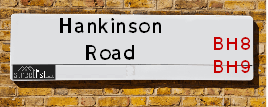
Hankinson Road is a street located in the town of Bournemouth. The street has a length of approximately 771 metres.
The street is publicly maintained which means that the road is adopted and Bournemouth, Christchurch and Poole is responsible for the repair and upkeep of the highway.
The street is located within the Bournemouth, Christchurch and Poole Council's jurisdiction. They provide various services, like refuse collection, and manage council tax collection. It's situated in the South West region of the UK.
The road has been assigned the Unique Street Reference Number of 3727751 and 3705201 in the National Street Gazetteer.
The street has the postcodes of BH9 1HX, BH9 1HW, BH9 1HR, BH9 1HP and BH9 1HJ.
It is located within the county of Dorset, situated in the South West region of the UK. It's 92.77 miles South West from central London., 1.35 miles North from Bournemouth, 22.84 miles South from Salisbury and 23.19 miles South West from Southampton.
HANKINSON ROAD is within the Post Town of BOURNEMOUTH
Map of Hankinson Road
| Street Crime (updated 14/01/2025) | ||
|---|---|---|
| Location Note | Central Point of Street - Not Actual Location | |
| MSOA Info | For MSOAs E02003184, E02003181 (Statistical Neighbourhood) | |
| Click Hint | Click on a Circle for a detailed breakdown below map. | |
| Crime Levels |
Green = Very Low Yellow = Low Orange = High Red = Very High |
|
| Postcodes | ||
| Icon | Postcodes for Hankinson Road | |
| Walking Distances | ||
| Distance Info | Green Circle = 10 Minutes Walk (800 metres) | |
Street Crime Data accessed from data.police.uk on 06/10/2024.
Moving to Hankinson Road?
I can help you uncover potential pitfalls and provide key questions to ask about your new property. With decades of experience as a Local Land Charges Manager, I offer confidential insights to make your move informed and stress-free.
This service is free, but you may wish to make an optional donation to support it. Please include the property name and address in your request as well as anything you wish to focus on.
Contact Me
Do you know why this road is called Hankinson Road?
What's it like to live here?
Share a Photo of Hankinson Road
Ask the community a question.
Do you have any questions, memories to share, have any photos or know any facts? We'd love to know more.
Submit Your Comment
Find Homes to Rent in Bournemouth

Budget Friendly Hotels near Hankinson Road
| Budget Hotel Name | Distance (miles) |
|---|---|
|
1: Name:Premier Inn Bournemouth East Cliff Address: Christchurch Road Telephone: Visit Hotel Page |
1.32 |
|
2: Name:Travelodge Bournemouth Address: 43 Christchurch Rd, Bournemouth, BH1 3PH Telephone: 0871 984 6257 Visit Hotel Page |
1.42 |
|
3: Name:Premier Inn Bournemouth East Lynton Court Address: 47 Christchurch Road Telephone: Visit Hotel Page |
1.51 |
|
4: Name:Premier Inn Bournemouth East Boscombe Address: 47 Christchurch Road Telephone: Visit Hotel Page |
1.51 |
|
5: Name:Premier Inn Bournemouth Central Address: Westover Road Telephone: Visit Hotel Page |
1.63 |
Hotel Options
Your support helps keep this site running!
If you enjoy using this website, consider making a donation to help me cover hosting costs.
Flats and Apartments in Hankinson Road
FLAT 7
FLAT 9
FLAT 10
FLAT 1
FLAT 2
EPC (Energy Performance Certificate) Information for Hankinson Road
UPRN: 100040738909
EPC Current: D
EPC Potential: B
Habitable Rooms: 5
Property Type: House
Tenure: Owner-occupied
Built Form: Detached
Age Band: 1930-1949
Mains Gas: Yes
UPRN: 10090818789
EPC Current: C
EPC Potential: C
Habitable Rooms: 2
Property Type: Flat
Tenure: Rented (private)
Built Form: Semi-Detached
Age Band: 2003-2006
Mains Gas: Yes
UPRN: 100040738908
EPC Current: D
EPC Potential: C
Habitable Rooms: 5
Property Type: House
Tenure: Owner-occupied
Built Form: Detached
Age Band: 1930-1949
Mains Gas: Yes
UPRN: 10090818790
EPC Current: C
EPC Potential: C
Habitable Rooms: 2
Property Type: Flat
Tenure: Rented (private)
Built Form: Semi-Detached
Age Band: 2012 onwards
Mains Gas: Yes
UPRN: 100040738911
EPC Current: D
EPC Potential: B
Habitable Rooms: 5
Property Type: House
Tenure: Owner-occupied
Built Form: Detached
Age Band: 1930-1949
Mains Gas: Yes
UPRN: 10090818791
EPC Current: C
EPC Potential: C
Habitable Rooms: 3
Property Type: Flat
Tenure: Rented (private)
Built Form: Semi-Detached
Age Band: 2012 onwards
Mains Gas: Yes
UPRN: 100040738910
EPC Current: D
EPC Potential: C
Habitable Rooms: 5
Property Type: House
Tenure: Owner-occupied
Built Form: Detached
Age Band: 1930-1949
Mains Gas: Yes
UPRN: 100040738913
EPC Current: D
EPC Potential: C
Habitable Rooms: 4
Property Type: Maisonette
Tenure: Owner-occupied
Built Form: Detached
Age Band: 1930-1949
Mains Gas: Yes
UPRN: 10090818792
EPC Current: C
EPC Potential: C
Habitable Rooms: 3
Property Type: Maisonette
Tenure: Owner-occupied
Built Form: Semi-Detached
Age Band: 2012 onwards
Mains Gas: Yes
UPRN: 100040738912
EPC Current: D
EPC Potential: C
Habitable Rooms: 3
Property Type: Flat
Tenure: Owner-occupied
Built Form: Detached
Age Band: 1930-1949
Mains Gas: Yes
UPRN: 100040738914
EPC Current: D
EPC Potential: B
Habitable Rooms: 5
Property Type: House
Tenure: Owner-occupied
Built Form: Detached
Age Band: 1930-1949
Mains Gas: Yes
UPRN: 10090818793
EPC Current: B
EPC Potential: B
Habitable Rooms: 2
Property Type: Flat
Tenure: Owner-occupied
Built Form: Semi-Detached
Age Band: 2007-2011
Mains Gas: Yes
UPRN: 100041112673
EPC Current: D
EPC Potential: C
Habitable Rooms: 4
Property Type: Flat
Tenure: Owner-occupied
Built Form: Semi-Detached
Age Band: 1950-1966
Mains Gas: Yes
UPRN: 10090818794
EPC Current: B
EPC Potential: B
Habitable Rooms: 2
Property Type: Flat
Tenure: Rented (private)
Built Form: Semi-Detached
Age Band: 2012 onwards
Mains Gas: Yes
UPRN: 100040738918
EPC Current: D
EPC Potential: C
Habitable Rooms: 5
Property Type: House
Tenure: Owner-occupied
Built Form: Detached
Age Band: 1930-1949
Mains Gas: Yes
UPRN: 10090818796
EPC Current: C
EPC Potential: C
Habitable Rooms: 2
Property Type: Flat
Tenure: Owner-occupied
Built Form: Semi-Detached
Age Band: 2012 onwards
Mains Gas: Yes
UPRN: 10090818799
EPC Current: C
EPC Potential: C
Habitable Rooms: 3
Property Type: Flat
Tenure: Owner-occupied
Built Form: Semi-Detached
Age Band: 2012 onwards
Mains Gas: Yes
UPRN: 10090820436
EPC Current: C
EPC Potential: A
Habitable Rooms: 3
Property Type: Bungalow
Tenure: Rented (private)
Built Form: End-Terrace
Age Band: 2012 onwards
Mains Gas: Yes
UPRN: 10090820434
EPC Current: C
EPC Potential: A
Habitable Rooms: 2
Property Type: Bungalow
Tenure: Rented (private)
Built Form: Mid-Terrace
Age Band: 2012 onwards
Mains Gas: Yes
UPRN: 10090820435
EPC Current: C
EPC Potential: A
Habitable Rooms: 3
Property Type: Bungalow
Tenure: Rented (private)
Built Form: End-Terrace
Age Band: 2012 onwards
Mains Gas: Yes
UPRN: 100040738929
EPC Current: D
EPC Potential: C
Habitable Rooms: 6
Property Type: House
Tenure: rental (private)
Built Form: Detached
Age Band: 1900-1929
Mains Gas: Yes
UPRN: 100040738930
EPC Current: D
EPC Potential: C
Habitable Rooms: 4
Property Type: House
Tenure: Owner-occupied
Built Form: Semi-Detached
Age Band: 1930-1949
Mains Gas: Yes
UPRN: 100040738931
EPC Current: C
EPC Potential: B
Habitable Rooms: 7
Property Type: House
Tenure: Owner-occupied
Built Form: Detached
Age Band: 1930-1949
Mains Gas: Yes
UPRN: 100041112588
EPC Current: D
EPC Potential: C
Habitable Rooms: 4
Property Type: House
Tenure: Owner-occupied
Built Form: Detached
Age Band: 1976-1982
Mains Gas: Yes
UPRN: 100040738932
EPC Current: D
EPC Potential: B
Habitable Rooms: 5
Property Type: House
Tenure: rental (private)
Built Form: Semi-Detached
Age Band: 1900-1929
Mains Gas: Yes
UPRN: 10024156200
EPC Current: D
EPC Potential: B
Habitable Rooms: 5
Property Type: House
Tenure: Owner-occupied
Built Form: Detached
Age Band: 1930-1949
Mains Gas: Yes
UPRN: 100040738937
EPC Current: C
EPC Potential: C
Habitable Rooms: 3
Property Type: Flat
Tenure: rental (private)
Built Form: Detached
Age Band: 1900-1929
Mains Gas: Yes
UPRN: 100040738936
EPC Current: D
EPC Potential: C
Habitable Rooms: 3
Property Type: Flat
Tenure: Owner-occupied
Built Form: Detached
Age Band: 1930-1949
Mains Gas: Yes
UPRN: 100040738939
EPC Current: D
EPC Potential: C
Habitable Rooms: 3
Property Type: Flat
Tenure: Rented (private)
Built Form: Detached
Age Band: 1930-1949
Mains Gas: Yes
UPRN: 100040738938
EPC Current: D
EPC Potential: C
Habitable Rooms: 4
Property Type: Maisonette
Tenure: Owner-occupied
Built Form: Detached
Age Band: 1930-1949
Mains Gas: Yes
UPRN: 100040738941
EPC Current: E
EPC Potential: D
Habitable Rooms: 6
Property Type: House
Tenure: Owner-occupied
Built Form: Detached
Age Band: 1900-1929
Mains Gas: Yes
UPRN: 100040738942
EPC Current: D
EPC Potential: B
Habitable Rooms: 5
Property Type: House
Tenure: Owner-occupied
Built Form: Detached
Age Band: 1930-1949
Mains Gas: Yes
UPRN: 100040738943
EPC Current: D
EPC Potential: B
Habitable Rooms: 6
Property Type: House
Tenure: Owner-occupied
Built Form: Detached
Age Band: 1900-1929
Mains Gas: Yes
UPRN: 100040738944
EPC Current: D
EPC Potential: C
Habitable Rooms: 6
Property Type: House
Tenure: Owner-occupied
Built Form: Detached
Age Band: 1900-1929
Mains Gas: Yes
UPRN: 100040738945
EPC Current: D
EPC Potential: B
Habitable Rooms: 5
Property Type: House
Tenure: rental (private)
Built Form: Detached
Age Band: 1930-1949
Mains Gas: Yes
UPRN: 100040738947
EPC Current: E
EPC Potential: C
Habitable Rooms: 7
Property Type: House
Tenure: Owner-occupied
Built Form: Detached
Age Band: 1950-1966
Mains Gas: Yes
UPRN: 100040738948
EPC Current: E
EPC Potential: B
Habitable Rooms: 6
Property Type: House
Tenure: rental (private)
Built Form: Detached
Age Band: 1930-1949
Mains Gas: Yes
UPRN: 100040738951
EPC Current: D
EPC Potential: B
Habitable Rooms: 6
Property Type: House
Tenure: Owner-occupied
Built Form: Detached
Age Band: 1900-1929
Mains Gas: Yes
UPRN: 100040738953
EPC Current: D
EPC Potential: C
Habitable Rooms: 5
Property Type: House
Tenure: rental (private)
Built Form: Detached
Age Band: 1900-1929
Mains Gas: Yes
UPRN: 100040738954
EPC Current: D
EPC Potential: C
Habitable Rooms: 6
Property Type: House
Tenure: Owner-occupied
Built Form: Semi-Detached
Age Band: 1900-1929
Mains Gas: Yes
UPRN: 100040738955
EPC Current: D
EPC Potential: B
Habitable Rooms: 5
Property Type: House
Tenure: Rented (private)
Built Form: Detached
Age Band: 1930-1949
Mains Gas: Yes
UPRN: 100040738956
EPC Current: C
EPC Potential: B
Habitable Rooms: 6
Property Type: House
Tenure: rental (private)
Built Form: Semi-Detached
Age Band: 1930-1949
Mains Gas: Yes
UPRN: 100040738957
EPC Current: D
EPC Potential: C
Habitable Rooms: 9
Property Type: House
Tenure: Owner-occupied
Built Form: Detached
Age Band: 1900-1929
Mains Gas: Yes
UPRN: 100040738958
EPC Current: D
EPC Potential: B
Habitable Rooms: 5
Property Type: House
Tenure: Owner-occupied
Built Form: Semi-Detached
Age Band: 1930-1949
Mains Gas: Yes
UPRN: 100040738960
EPC Current: E
EPC Potential: C
Habitable Rooms: 6
Property Type: House
Tenure: Owner-occupied
Built Form: Semi-Detached
Age Band: 1900-1929
Mains Gas: Yes
UPRN: 100040738962
EPC Current: C
EPC Potential: C
Habitable Rooms: 8
Property Type: House
Tenure: Owner-occupied
Built Form: Detached
Age Band: 1930-1949
Mains Gas: Yes
UPRN: 100040738965
EPC Current: E
EPC Potential: C
Habitable Rooms: 6
Property Type: House
Tenure: rental (private)
Built Form: Detached
Age Band: 1900-1929
Mains Gas: Yes
UPRN: 100040738966
EPC Current: D
EPC Potential: C
Habitable Rooms: 6
Property Type: House
Tenure: Owner-occupied
Built Form: Detached
Age Band: 1900-1929
Mains Gas: Yes
UPRN: 100040738969
EPC Current: D
EPC Potential: C
Habitable Rooms: 2
Property Type: Maisonette
Tenure: rental (private)
Built Form: Detached
Age Band: 1900-1929
Mains Gas: Yes
UPRN: 100040738968
EPC Current: D
EPC Potential: C
Habitable Rooms: 3
Property Type: Flat
Tenure: rental (private)
Built Form: Detached
Age Band: 1930-1949
Mains Gas: Yes
UPRN: 100040738970
EPC Current: D
EPC Potential: B
Habitable Rooms: 5
Property Type: House
Tenure: rental (private)
Built Form: Semi-Detached
Age Band: 1900-1929
Mains Gas: Yes
UPRN: 100040738971
EPC Current: D
EPC Potential: C
Habitable Rooms: 8
Property Type: House
Tenure: rental (private)
Built Form: Detached
Age Band: 1950-1966
Mains Gas: Yes
UPRN: 100040738972
EPC Current: D
EPC Potential: C
Habitable Rooms: 6
Property Type: House
Tenure: Owner-occupied
Built Form: Semi-Detached
Age Band: 1930-1949
Mains Gas: Yes
UPRN: 100040738973
EPC Current: D
EPC Potential: C
Habitable Rooms: 6
Property Type: House
Tenure: rental (private)
Built Form: Detached
Age Band: 1930-1949
Mains Gas: Yes
UPRN: 100040738974
EPC Current: D
EPC Potential: C
Habitable Rooms: 8
Property Type: House
Tenure: rental (private)
Built Form: Detached
Age Band: 1930-1949
Mains Gas: Yes
UPRN: 100040738976
EPC Current: D
EPC Potential: C
Habitable Rooms: 7
Property Type: House
Tenure: Owner-occupied
Built Form: Detached
Age Band: 1900-1929
Mains Gas: Yes
UPRN: 100040738977
EPC Current: D
EPC Potential: C
Habitable Rooms: 6
Property Type: House
Tenure: Rented (private)
Built Form: Semi-Detached
Age Band: 1930-1949
Mains Gas: Yes
UPRN: 100040738979
EPC Current: C
EPC Potential: B
Habitable Rooms: 4
Property Type: House
Tenure: rental (private)
Built Form: Semi-Detached
Age Band: 1930-1949
Mains Gas: Yes
UPRN: 100040738980
EPC Current: C
EPC Potential: C
Habitable Rooms: 3
Property Type: Flat
Tenure: rental (private)
Built Form: Detached
Age Band: 1930-1949
Mains Gas: Yes
UPRN: 100040738981
EPC Current: D
EPC Potential: C
Habitable Rooms: 4
Property Type: Flat
Tenure: rental (private)
Built Form: Detached
Age Band: 1930-1949
Mains Gas: Yes
UPRN: 100040738985
EPC Current: D
EPC Potential: C
Habitable Rooms: 5
Property Type: House
Tenure: Owner-occupied
Built Form: Detached
Age Band: 1930-1949
Mains Gas: Yes
UPRN: 100040738986
EPC Current: C
EPC Potential: B
Habitable Rooms: 8
Property Type: House
Tenure: Owner-occupied
Built Form: Detached
Age Band: before 1900
Mains Gas: Yes
UPRN: 100040738988
EPC Current: D
EPC Potential: C
Habitable Rooms: 5
Property Type: House
Tenure: Owner-occupied
Built Form: Detached
Age Band: 1930-1949
Mains Gas: Yes
UPRN: 100040738987
EPC Current: G
EPC Potential: C
Habitable Rooms: 5
Property Type: House
Tenure: Owner-occupied
Built Form: Detached
Age Band: 1930-1949
Mains Gas: No
UPRN: 100041112675
EPC Current: D
EPC Potential: C
Habitable Rooms: 2
Property Type: Flat
Tenure: Owner-occupied
Built Form: Detached
Age Band: 1930-1949
Mains Gas: Yes
UPRN: 100041113082
EPC Current: D
EPC Potential: C
Habitable Rooms: 4
Property Type: Flat
Tenure: Owner-occupied
Built Form: Detached
Age Band: 1900-1929
Mains Gas: Yes
UPRN: 100040738994
EPC Current: D
EPC Potential: D
Habitable Rooms: 5
Property Type: House
Tenure: Owner-occupied
Built Form: Detached
Age Band: 1930-1949
Mains Gas: Yes
UPRN: 100040738995
EPC Current: D
EPC Potential: B
Habitable Rooms: 7
Property Type: House
Tenure: Owner-occupied
Built Form: Detached
Age Band: 1900-1929
Mains Gas: Yes
UPRN: 100040738999
EPC Current: D
EPC Potential: C
Habitable Rooms: 6
Property Type: House
Tenure: Owner-occupied
Built Form: Detached
Age Band: 1930-1949
Mains Gas: Yes
UPRN: 100040739000
EPC Current: D
EPC Potential: B
Habitable Rooms: 6
Property Type: House
Tenure: rental (private)
Built Form: Detached
Age Band: 1900-1929
Mains Gas: Yes
UPRN: 100040739002
EPC Current: D
EPC Potential: C
Habitable Rooms: 5
Property Type: House
Tenure: Rented (private)
Built Form: Detached
Age Band: 1900-1929
Mains Gas: Yes
UPRN: 10024395470
EPC Current: D
EPC Potential: D
Habitable Rooms: N/A
Property Type: Bungalow
Tenure: U
Built Form: Detached
Age Band: U
Mains Gas: Unknown
UPRN: 100040739003
EPC Current: D
EPC Potential: B
Habitable Rooms: 6
Property Type: House
Tenure: Owner-occupied
Built Form: Detached
Age Band: 1930-1949
Mains Gas: Yes
UPRN: 100040739005
EPC Current: C
EPC Potential: C
Habitable Rooms: 3
Property Type: Flat
Tenure: rental (private)
Built Form: Detached
Age Band: 1930-1949
Mains Gas: Yes
UPRN: 100040739004
EPC Current: D
EPC Potential: D
Habitable Rooms: 4
Property Type: Flat
Tenure: rental (private)
Built Form: Detached
Age Band: 1930-1949
Mains Gas: Yes
UPRN: 10024156087
EPC Current: C
EPC Potential: C
Habitable Rooms: 3
Property Type: Flat
Tenure: Rented (private)
Built Form: Detached
Age Band: 1996-2002
Mains Gas: Yes
UPRN: 100040739006
EPC Current: C
EPC Potential: B
Habitable Rooms: 5
Property Type: House
Tenure: Rented (private)
Built Form: Detached
Age Band: 1930-1949
Mains Gas: Yes
UPRN: 100040739007
EPC Current: D
EPC Potential: C
Habitable Rooms: 7
Property Type: House
Tenure: rental (private)
Built Form: Detached
Age Band: 1930-1949
Mains Gas: Yes
UPRN: 100040739008
EPC Current: D
EPC Potential: B
Habitable Rooms: 6
Property Type: House
Tenure: Owner-occupied
Built Form: Detached
Age Band: 1930-1949
Mains Gas: Yes
UPRN: 100040739009
EPC Current: C
EPC Potential: C
Habitable Rooms: 5
Property Type: House
Tenure: rental (private)
Built Form: Detached
Age Band: 1900-1929
Mains Gas: Yes
UPRN: 100040739010
EPC Current: E
EPC Potential: C
Habitable Rooms: 7
Property Type: House
Tenure: Owner-occupied
Built Form: Detached
Age Band: 1900-1929
Mains Gas: Yes
UPRN: 100041112676
EPC Current: D
EPC Potential: D
Habitable Rooms: 2
Property Type: Flat
Tenure: Owner-occupied
Built Form: Detached
Age Band: 1930-1949
Mains Gas: Yes
UPRN: 100040739015
EPC Current: C
EPC Potential: B
Habitable Rooms: 5
Property Type: House
Tenure: rental (private)
Built Form: Detached
Age Band: 1900-1929
Mains Gas: Yes
UPRN: 100040739019
EPC Current: D
EPC Potential: C
Habitable Rooms: 6
Property Type: House
Tenure: rental (private)
Built Form: Detached
Age Band: 1900-1929
Mains Gas: Yes
UPRN: 100040739020
EPC Current: D
EPC Potential: B
Habitable Rooms: 7
Property Type: House
Tenure: Owner-occupied
Built Form: Detached
Age Band: 1900-1929
Mains Gas: Yes
UPRN: 10090820212
EPC Current: C
EPC Potential: B
Habitable Rooms: 3
Property Type: Bungalow
Tenure: Owner-occupied
Built Form: Semi-Detached
Age Band: 1996-2002
Mains Gas: Yes
UPRN: 100040739021
EPC Current: D
EPC Potential: C
Habitable Rooms: 6
Property Type: House
Tenure: Rented (private)
Built Form: Detached
Age Band: 1930-1949
Mains Gas: Yes
UPRN: 10090820213
EPC Current: C
EPC Potential: B
Habitable Rooms: 3
Property Type: Bungalow
Tenure: Owner-occupied
Built Form: Semi-Detached
Age Band: 1996-2002
Mains Gas: Yes
UPRN: 100040739023
EPC Current: E
EPC Potential: C
Habitable Rooms: 6
Property Type: House
Tenure: rental (private)
Built Form: Detached
Age Band: 1930-1949
Mains Gas: Yes
UPRN: 100040739024
EPC Current: D
EPC Potential: B
Habitable Rooms: 5
Property Type: House
Tenure: Owner-occupied
Built Form: Detached
Age Band: 1900-1929
Mains Gas: Yes
UPRN: 100040739025
EPC Current: D
EPC Potential: C
Habitable Rooms: 8
Property Type: House
Tenure: rental (private)
Built Form: Detached
Age Band: 1930-1949
Mains Gas: Yes
UPRN: 100040739026
EPC Current: D
EPC Potential: C
Habitable Rooms: 6
Property Type: House
Tenure: Owner-occupied
Built Form: Detached
Age Band: 1900-1929
Mains Gas: Yes
UPRN: 100040739028
EPC Current: D
EPC Potential: D
Habitable Rooms: 4
Property Type: Flat
Tenure: rental (social)
Built Form: Detached
Age Band: U
Mains Gas: Yes
UPRN: 100040739027
EPC Current: D
EPC Potential: C
Habitable Rooms: 3
Property Type: Flat
Tenure: rental (social)
Built Form: Detached
Age Band: 1930-1949
Mains Gas: Yes
UPRN: 100040739029
EPC Current: D
EPC Potential: C
Habitable Rooms: 7
Property Type: House
Tenure: Owner-occupied
Built Form: Detached
Age Band: 1900-1929
Mains Gas: Yes
UPRN: 100040739030
EPC Current: D
EPC Potential: C
Habitable Rooms: 7
Property Type: House
Tenure: Owner-occupied
Built Form: Detached
Age Band: 1900-1929
Mains Gas: Yes
UPRN: 100040739031
EPC Current: D
EPC Potential: B
Habitable Rooms: 6
Property Type: House
Tenure: rental (private)
Built Form: Semi-Detached
Age Band: 1900-1929
Mains Gas: Yes
UPRN: 100040739032
EPC Current: D
EPC Potential: C
Habitable Rooms: 5
Property Type: House
Tenure: Owner-occupied
Built Form: Detached
Age Band: 1900-1929
Mains Gas: Yes
UPRN: 100040739033
EPC Current: E
EPC Potential: C
Habitable Rooms: 8
Property Type: House
Tenure: rental (private)
Built Form: Detached
Age Band: 1930-1949
Mains Gas: Yes
UPRN: 100040739034
EPC Current: E
EPC Potential: C
Habitable Rooms: 7
Property Type: House
Tenure: rental (private)
Built Form: Detached
Age Band: 1900-1929
Mains Gas: Yes
UPRN: 100040739035
EPC Current: D
EPC Potential: C
Habitable Rooms: 6
Property Type: House
Tenure: Owner-occupied
Built Form: Detached
Age Band: 1930-1949
Mains Gas: Yes
UPRN: 100041219537
EPC Current: C
EPC Potential: C
Habitable Rooms: 5
Property Type: Flat
Tenure: Owner-occupied
Built Form: Detached
Age Band: 1900-1929
Mains Gas: Yes
UPRN: 100040739039
EPC Current: D
EPC Potential: B
Habitable Rooms: 7
Property Type: House
Tenure: Owner-occupied
Built Form: Detached
Age Band: 1900-1929
Mains Gas: Yes
UPRN: 100040739040
EPC Current: D
EPC Potential: C
Habitable Rooms: 8
Property Type: House
Tenure: rental (private)
Built Form: Detached
Age Band: 1930-1949
Mains Gas: Yes
UPRN: 100040739041
EPC Current: D
EPC Potential: C
Habitable Rooms: 6
Property Type: House
Tenure: rental (private)
Built Form: Detached
Age Band: 1930-1949
Mains Gas: Yes
UPRN: 100040739042
EPC Current: D
EPC Potential: C
Habitable Rooms: 7
Property Type: House
Tenure: Owner-occupied
Built Form: Detached
Age Band: 1900-1929
Mains Gas: Yes
UPRN: 100040739043
EPC Current: C
EPC Potential: C
Habitable Rooms: 6
Property Type: House
Tenure: Rented (private)
Built Form: Detached
Age Band: 1900-1929
Mains Gas: Yes
UPRN: 100040739044
EPC Current: D
EPC Potential: C
Habitable Rooms: 3
Property Type: Maisonette
Tenure: rental (private)
Built Form: Detached
Age Band: 1983-1990
Mains Gas: Yes
UPRN: 10024392829
EPC Current: D
EPC Potential: B
Habitable Rooms: 3
Property Type: Maisonette
Tenure: Owner-occupied
Built Form: Detached
Age Band: 1900-1929
Mains Gas: Yes
UPRN: 100040739046
EPC Current: D
EPC Potential: B
Habitable Rooms: 6
Property Type: House
Tenure: rental (private)
Built Form: Detached
Age Band: 1930-1949
Mains Gas: Yes
UPRN: 100041112677
EPC Current: D
EPC Potential: C
Habitable Rooms: 3
Property Type: Flat
Tenure: rental (private)
Built Form: Detached
Age Band: 1900-1929
Mains Gas: Yes
UPRN: 100041112884
EPC Current: C
EPC Potential: C
Habitable Rooms: 3
Property Type: Flat
Tenure: rental (private)
Built Form: Detached
Age Band: 1900-1929
Mains Gas: Yes
UPRN: 100040739049
EPC Current: C
EPC Potential: B
Habitable Rooms: 5
Property Type: House
Tenure: Owner-occupied
Built Form: Detached
Age Band: 1930-1949
Mains Gas: Yes
UPRN: 100041112679
EPC Current: E
EPC Potential: C
Habitable Rooms: 3
Property Type: Flat
Tenure: Owner-occupied
Built Form: Detached
Age Band: 1900-1929
Mains Gas: Yes
UPRN: 10023870592
EPC Current: C
EPC Potential: C
Habitable Rooms: 2
Property Type: Flat
Tenure: Rented (private)
Built Form: Detached
Age Band: 1930-1949
Mains Gas: Yes
UPRN: 100040739054
EPC Current: F
EPC Potential: C
Habitable Rooms: 6
Property Type: House
Tenure: Owner-occupied
Built Form: Detached
Age Band: before 1900
Mains Gas: Yes
UPRN: 100040739055
EPC Current: D
EPC Potential: C
Habitable Rooms: 3
Property Type: Flat
Tenure: rental (private)
Built Form: Semi-Detached
Age Band: 1930-1949
Mains Gas: Yes
UPRN: 10023870950
EPC Current: D
EPC Potential: D
Habitable Rooms: 3
Property Type: Flat
Tenure: rental (private)
Built Form: Semi-Detached
Age Band: 1930-1949
Mains Gas: Yes
UPRN: 100040739058
EPC Current: E
EPC Potential: C
Habitable Rooms: 6
Property Type: House
Tenure: rental (private)
Built Form: Detached
Age Band: 1900-1929
Mains Gas: Yes
UPRN: 100040739060
EPC Current: D
EPC Potential: C
Habitable Rooms: 7
Property Type: House
Tenure: rental (private)
Built Form: Detached
Age Band: 1950-1966
Mains Gas: Yes
UPRN: 100040739061
EPC Current: D
EPC Potential: C
Habitable Rooms: 6
Property Type: House
Tenure: rental (private)
Built Form: Detached
Age Band: 1900-1929
Mains Gas: Yes
UPRN: 100040739063
EPC Current: D
EPC Potential: B
Habitable Rooms: 7
Property Type: House
Tenure: rental (private)
Built Form: Detached
Age Band: 1950-1966
Mains Gas: Yes
UPRN: 100040739064
EPC Current: D
EPC Potential: C
Habitable Rooms: 6
Property Type: House
Tenure: rental (private)
Built Form: Detached
Age Band: 1930-1949
Mains Gas: Yes
UPRN: 100040739065
EPC Current: D
EPC Potential: C
Habitable Rooms: 5
Property Type: House
Tenure: rental (private)
Built Form: Detached
Age Band: 1930-1949
Mains Gas: Yes
UPRN: 100040739067
EPC Current: E
EPC Potential: C
Habitable Rooms: 6
Property Type: House
Tenure: Owner-occupied
Built Form: Detached
Age Band: 1900-1929
Mains Gas: Yes
UPRN: 100040739068
EPC Current: D
EPC Potential: B
Habitable Rooms: 6
Property Type: House
Tenure: Owner-occupied
Built Form: Detached
Age Band: 1930-1949
Mains Gas: Yes
UPRN: 100040739069
EPC Current: F
EPC Potential: B
Habitable Rooms: 5
Property Type: House
Tenure: Owner-occupied
Built Form: Detached
Age Band: 1900-1929
Mains Gas: Yes
UPRN: 100040739072
EPC Current: C
EPC Potential: C
Habitable Rooms: 3
Property Type: Flat
Tenure: Rented (private)
Built Form: Detached
Age Band: 1900-1929
Mains Gas: Yes
UPRN: 100040739071
EPC Current: D
EPC Potential: C
Habitable Rooms: 3
Property Type: Flat
Tenure: rental (private)
Built Form: Detached
Age Band: 1930-1949
Mains Gas: No
UPRN: 10024392834
EPC Current: C
EPC Potential: C
Habitable Rooms: 2
Property Type: Flat
Tenure: Rented (private)
Built Form: Detached
Age Band: 1950-1966
Mains Gas: Yes
UPRN: 200002345980
EPC Current: C
EPC Potential: C
Habitable Rooms: 4
Property Type: Flat
Tenure: Owner-occupied
Built Form: Detached
Age Band: 1930-1949
Mains Gas: Yes
UPRN: 10023870670
EPC Current: C
EPC Potential: C
Habitable Rooms: 3
Property Type: Flat
Tenure: Rented (private)
Built Form: Detached
Age Band: 1950-1966
Mains Gas: Yes
UPRN: 100041112883
EPC Current: D
EPC Potential: C
Habitable Rooms: 5
Property Type: Maisonette
Tenure: Owner-occupied
Built Form: Detached
Age Band: 1900-1929
Mains Gas: Yes
UPRN: 10024392832
EPC Current: C
EPC Potential: C
Habitable Rooms: 3
Property Type: Flat
Tenure: Owner-occupied
Built Form: Mid-Terrace
Age Band: 1900-1929
Mains Gas: Yes
UPRN: 10090819708
EPC Current: D
EPC Potential: C
Habitable Rooms: 3
Property Type: Maisonette
Tenure: Owner-occupied
Built Form: Detached
Age Band: 1930-1949
Mains Gas: Yes
UPRN: 100041112680
EPC Current: E
EPC Potential: C
Habitable Rooms: 5
Property Type: Maisonette
Tenure: Owner-occupied
Built Form: Semi-Detached
Age Band: 1930-1949
Mains Gas: Yes
UPRN: 100040739057
EPC Current: C
EPC Potential: C
Habitable Rooms: 3
Property Type: Flat
Tenure: Owner-occupied
Built Form: Mid-Terrace
Age Band: 1900-1929
Mains Gas: Yes
UPRN: 100041112974
EPC Current: C
EPC Potential: C
Habitable Rooms: 3
Property Type: Flat
Tenure: Rented (private)
Built Form: Detached
Age Band: 1930-1949
Mains Gas: Yes
UPRN: 100041112879
EPC Current: E
EPC Potential: C
Habitable Rooms: 3
Property Type: Flat
Tenure: Owner-occupied
Built Form: Detached
Age Band: 1930-1949
Mains Gas: Yes
UPRN: 100041112975
EPC Current: C
EPC Potential: C
Habitable Rooms: 3
Property Type: Flat
Tenure: Rented (private)
Built Form: Detached
Age Band: 1930-1949
Mains Gas: Yes
UPRN: 100041113044
EPC Current: C
EPC Potential: C
Habitable Rooms: 3
Property Type: Flat
Tenure: Owner-occupied
Built Form: Semi-Detached
Age Band: 1900-1929
Mains Gas: Yes
UPRN: 10090818795
EPC Current: B
EPC Potential: B
Habitable Rooms: N/A
Property Type: Flat
Tenure: NO DATA!
Built Form: Semi-Detached
Age Band: U
Mains Gas: Unknown
UPRN: 10090818797
EPC Current: B
EPC Potential: B
Habitable Rooms: N/A
Property Type: Flat
Tenure: NO DATA!
Built Form: Semi-Detached
Age Band: U
Mains Gas: Unknown
UPRN: 10090818798
EPC Current: B
EPC Potential: B
Habitable Rooms: N/A
Property Type: Flat
Tenure: NO DATA!
Built Form: Semi-Detached
Age Band: U
Mains Gas: Unknown
UPRN: 10024392833
EPC Current: C
EPC Potential: C
Habitable Rooms: 2
Property Type: Flat
Tenure: Rented (private)
Built Form: Semi-Detached
Age Band: 1950-1966
Mains Gas: Yes
UPRN: 10013442542
EPC Current: D
EPC Potential: C
Habitable Rooms: 3
Property Type: Flat
Tenure: Rented (private)
Built Form: Semi-Detached
Age Band: 1950-1966
Mains Gas: Yes
UPRN: 100041112878
EPC Current: C
EPC Potential: C
Habitable Rooms: 2
Property Type: Flat
Tenure: Rented (private)
Built Form: Detached
Age Band: 1900-1929
Mains Gas: Yes
UPRN: 10024392831
EPC Current: D
EPC Potential: C
Habitable Rooms: 3
Property Type: Flat
Tenure: Rented (private)
Built Form: Mid-Terrace
Age Band: 1900-1929
Mains Gas: Yes
UPRN: 100041058743
EPC Current: D
EPC Potential: C
Habitable Rooms: 2
Property Type: Maisonette
Tenure: Owner-occupied
Built Form: Semi-Detached
Age Band: 1930-1949
Mains Gas: Yes
UPRN: 10024392827
EPC Current: D
EPC Potential: D
Habitable Rooms: 5
Property Type: Flat
Tenure: Owner-occupied
Built Form: Detached
Age Band: 1930-1949
Mains Gas: Yes
UPRN: 10024392828
EPC Current: D
EPC Potential: C
Habitable Rooms: 5
Property Type: Flat
Tenure: rental (private)
Built Form: Detached
Age Band: 1930-1949
Mains Gas: Yes
House Sales
| Year | High | Low | Average | Sales |
|---|---|---|---|---|
| 2014 | £249,000 | £136,000 | £192,150 | 8 |
| 2015 | £265,000 | £257,000 | £214,536 | 11 |
| 2016 | £284,600 | £335,000 | £249,138 | 8 |
| 2017 | £200,000 | £330,000 | £304,500 | 6 |
| 2018 | £190,000 | £340,000 | £226,667 | 3 |
| 2019 | £300,000 | £328,000 | £252,200 | 10 |
| 2020 | £200,000 | £400,000 | £271,833 | 3 |
| 2021 | £307,000 | £389,950 | £301,195 | 10 |
| 2022 | £360,000 | £410,000 | £382,389 | 9 |
| 2023 | £420,000 | £300,000 | £373,750 | 4 |
| 2024 | £367,000 | £367,000 | £367,000 | 1 |
Contains HM Land Registry data © Crown copyright and database right 2025. This data is licensed under the Open Government Licence v3.0.
Nearby Estate Agents
| Name | Address | Website |
|---|---|---|
| Gordon Barker Ltd | 343 Charminster Road, Bournemouth, BH8 9QR | Visit Website |
| Paul Watts Estate Agents | 379-381 Charminster Road, Bournemouth, Dorset, BH8 9QT | Visit Website |
| Quinn & Co | 413-415 Charminster Road Bournemouth Dorset BH8 9QT | Visit Website |
| Bournemouth Properties | 137 Charminster Road, Bournemouth,BH8 8UH | |
| Roberts | 158 Charminster Road, Bournemouth, BH8 8UU | Visit Website |
Neighbourhood Policing |
| Police Force: Dorset |
 View Neighbourhood Crime and Policing View Neighbourhood Crime and Policing |
| Find a Local Neighbourhood Watch Scheme |
Location Details
| Hankinson Road | |
|---|---|

| |
| Latitude | 50.741452 |
| Longitude | -1.867897 |
| OS Easting (X): | 409320 |
| OS Northing (Y): | 93609 |
| OS Grid Reference: | SZ093936 |
Known Residential Addresses for Hankinson Road
- 28
- 1
- 3A
- 1A
- 18
- 25
- 20
- 78
- 82
- 98
- 84
- 104A
- 86
- 89
- 69A
- 61
- 115
- 113
- 105
- 101
- 103
- 37
- 48
- 52
- 33
- 34
- 132
- 148
- 116
- 134
- 118
- 152
- 10
- 10 FIRST FLOOR FLAT
- 6
- 23A
- 91 GROUND FLOOR FLAT
- 91 FIRST FLOOR FLAT
- 72A
- 90 GROUND FLOOR FLAT
- 72
- FLAT 7 HARTSHORNE GRANGE, 141
- FLAT 8 HARTSHORNE GRANGE, 141
- FLAT 4 HARTSHORNE GRANGE, 141
- FLAT 10 HARTSHORNE GRANGE, 141
- FLAT 2 HARTSHORNE GRANGE, 141
- FLAT 5 HARTSHORNE GRANGE, 141
- 133 FLAT 2
- FLAT 11 HARTSHORNE GRANGE, 141
- 126 FIRST FLOOR FLAT
- 126A
- 135
- 26
- 64
- 46
- 42
- 57
- 55
- 44
- 124
Roads that have a Junction with Hankinson Road
| Street | Junction Type |
|---|---|
| Charminster Road (B3063) | junction |
| Brazier Close | junction |
| Brownen Road | junction |
| Abbott Road | junction |
| Somerley Road | junction |
| Bemister Road | junction |
| Wycliffe Road | junction |
Sunset and Sunrise times
| Sunrise | 07:43 |
|---|---|
| Sunset | 16:57 |
Latest Weather Conditions
| Observed at Weather Station: | Bournemouth Airport 30 January 2025 at 16:00 (2.97 miles away) |
|---|---|
| Current Weather: | Partly cloudy (day) |
| Temperature and Humidity: | 7.7°C (65.8%) |
| Wind Direction and Speed: | WNW (9 mph) |
Population Statistics
| ONS Area Code | E00077754, E00077756, E00077731 & E00077757 |
|---|---|
| ONS Area Name | Students and Professionals, Migrant Families & Delayed Retirement |
| Average Age | 33.30, 33.52 & 33.79 |
| Area Population | 1773.00, 1704.00 & 1735.00 |
| Male Population | 893.00, 864.00 & 865.00 (50%) |
| Female Population | 880.00, 840.00 & 870.00 (50%) |
| Benefit Claimants | 21, 25 & 12 (1%) |
| LSOA Code: | E01015376, E01015373 &E01015378 |
|---|---|
| LSOA Name: | Bournemouth 013D, Bournemouth 010D &Bournemouth 010E |
| SOA Code: | 1a &3a |
| SOA Name: | |
| MSOA Code: | E02003184 &E02003181 |
| MSOA Name: | Bournemouth 013 &Bournemouth 010 |
Nearest Supermarkets
| Tesco Bournemouth Charminster Rd Express |
|---|
| 1-13 Charminster Rd, Bournemouth, BH8 8UE |
| 0345 674 6503 |
| Distance: 0.47 Miles |
| Directions to Tesco Bournemouth Charminster Rd Express |
| Iceland Winton B-mouth |
|---|
| 467/471 Wimborne Road, Winton, Bournemouth Dorset, BH9 2AN |
| 01202512118 |
| Distance: 0.48 Miles |
| Directions to Iceland Winton B-mouth |
| Waitrose Winton |
|---|
| 345 Wimborne Road, Winton, Bournemouth, Dorset, BH9 2AD |
| 01202 522200 |
| Distance: 0.49 Miles |
| Directions to Waitrose Winton |
| Sainsburys Winton Local |
|---|
| 501 Wimborne Road, Bournemouth, England, BH9 2AW |
| 1202510825 |
| Distance: 0.51 Miles |
| Directions to Sainsburys Winton Local |
Telephone Information
| Dialling Code | Telephone Exchange | Telephone Cabinet | Fibre to the Cabinet or Fibre to the Premises |
|---|---|---|---|
| 01202 | WINTON - STWINTN | P91 | FTTP |
Broadband Information
| Speed | Average Speed | Median Speed | Maximum Speed | Next-generation access (NGA) | Number of Connections |
|---|---|---|---|---|---|
| Less than 2 Mbps | >=30 | 20.1 | >=30 | Y | 22 |
Local Government
| Local Council Details |
|---|
| Within the area of Bournemouth &Christchurch and Poole |
| Local Member of Parliament |
|---|
| Within the Westminster Parliamentary Constituency of Bournemouth West |
| The Member of Parliament is Jessica Toale |
| Details for the MP Jessica Toale on parliament.uk |
| Details for the MP Jessica Toale on theyworkforyou.com |
| In the 2024 General Election Jessica Toale won with a majority of 3,224 the result was Lab gain from Con. The total electorate was 70,259 |
| Wards, Parish Councils and County Councils |
|---|
| Ward: Winton East Ward |
| Parish: Unparished area |
| Ceremonial County: Dorset |
Nearest Schools
England Primary Schools
Muscliff Primary School
Address: Muscliff Primary School, Broadway Lane, Throop, Bournemouth, Dorset, BH8 0AB
Distance: 1.43 miles
Contact: 01202549654
St Clement's and St John's Church of England Infant School
Address: St Clement's and St John's Church of England Infant School, St Clement's Road, Boscombe, Bournemouth, Dorset, BH1 4DZ
Distance: 1.20 miles
Contact: 01202393570
Bethany Church of England Junior School
Address: Bethany Church of England Junior School, Knole Road, Boscombe, Bournemouth, Dorset, BH1 4DJ
Distance: 1.20 miles
Contact: 01202393570
Queen's Park Infant Academy
Address: Queen's Park Infant Academy, East Way, Bournemouth, Dorset, BH8 9PU
Distance: 0.59 miles
Contact: 01202528805
Queen's Park Academy
Address: Queen's Park Academy, East Way, Bournemouth, Dorset, BH8 9PU
Distance: 0.59 miles
Contact: 01202526079
Malmesbury Park Primary School
Address: Malmesbury Park Primary School, Lowther Road, Bournemouth, Dorset, BH8 8LU
Distance: 0.74 miles
Contact: 01202291227
St. Walburga's Catholic Primary School
Address: St. Walburga's Catholic Primary School, St. Walburga's Catholic Primary School, Malvern Road, Moordown, Bournemouth, Dorset, BH9 3BY
Distance: 0.59 miles
Contact: 01202528811
St Luke's Church of England Primary School
Address: St Luke's Church of England Primary School, Bemister Road, Winton, Bournemouth, Dorset, BH9 1LG
Distance: 0.27 miles
Contact: 01202514396
Hill View Primary School
Address: Hill View Primary School, Hill View Road, Ensbury Park, Bournemouth, Dorset, BH10 5BD
Distance: 1.28 miles
Contact: 01202512813
Moordown St John's Church of England Primary School
Address: Moordown St John's Church of England Primary School, Vicarage Road, Moordown, Bournemouth, Dorset, BH9 2SA
Distance: 0.79 miles
Contact: 01202527683
Winton Primary School
Address: Winton Primary School, Oswald Road, Bournemouth, Dorset, BH9 2TG
Distance: 0.97 miles
Contact: 01202513988
England Secondary Schools
Bournemouth School for Girls
Address: Bournemouth School for Girls, Castle Gate Close, Castle Lane West, Bournemouth, Dorset, BH8 9UJ
Distance: 0.92 miles
Contact: 01202526289
The Bishop of Winchester Academy
Address: The Bishop of Winchester Academy, Mallard Road, Bournemouth, Dorset, BH8 9PW
Distance: 0.91 miles
Contact: 01202512697
Bournemouth School
Address: Bournemouth School, East Way, Bournemouth, Dorset, BH8 9PY
Distance: 0.64 miles
Contact: 01202512609
Winton Academy
Address: Winton Academy, Winton Way, Bournemouth, Dorset, BH10 4HT
Distance: 1.09 miles
Contact: 01202529738
Glenmoor Academy
Address: Glenmoor Academy, Beswick Avenue, Ensbury Park, Bournemouth, Dorset, BH10 4EX
Distance: 1.06 miles
Contact: 01202527818
Nearest Hospitals
| Nuffield Health, Bournemouth Hospital |
|---|
| Address: 67 Landsdowne Road, Bournemouth, BH1 1RW, |
| Independent Sector |
| Nuffield Health |
| Telephone: 0800 015 5020 |
| Visit Hospital Website |
| Distance: 1.24 (miles) |
| Directions from to Nuffield Health, Bournemouth Hospital |
| Bournemouth Nuffield Hospital |
|---|
| Address: 67-71 Lansdowne Road, Bournemouth, BH1 1RW, |
| Independent Sector |
| University Hospital Southampton NHS Foundation Trust |
| Distance: 1.24 (miles) |
| Directions from to Bournemouth Nuffield Hospital |
| Boscombe Community Hospital |
|---|
| Address: 11 Shelley Road, Bournemouth, BH1 4JQ, |
| Independent Sector |
| The Royal Bournemouth and Christchurch Hospitals NHS Foundation Trust |
| Distance: 2.3 (miles) |
| Directions from to Boscombe Community Hospital |
Nearest Dentists
Dentists
BRIGHT BLUE DENTAL PRACTICE
Address: 233 CHARMINSTER ROAD, BOURNEMOUTH, DORSET, BH8 9QJ
Distance: 0.21 miles
Contact: :
WINTON DENTAL CENTRE
Address: 1A PINE ROAD, BOURNEMOUTH, DORSET, BH9 1LT
Distance: 0.47 miles
Contact: :
KNIBBS & DOMAN DENTAL PRACTICE (81)
Address: 81 WIMBORNE ROAD, BOURNEMOUTH, DORSET, BH3 7AN
Distance: 0.59 miles
Contact: :
KNIBBS & DOMAN DENTAL PRACTICE (85)
Address: 85 WIMBORNE ROAD, BOURNEMOUTH, DORSET, BH3 7AN
Distance: 0.59 miles
Contact: :
WEST WAY DENTAL PRACTICE
Address: 2 WEST WAY, BOURNEMOUTH, DORSET, BH9 3EE
Distance: 0.60 miles
Contact: :
CHARMINSTER HOUSE DENTAL
Address: 65 WELLINGTON ROAD, BOURNEMOUTH, DORSET, BH8 8JL
Distance: 0.65 miles
Contact: :
Nearest GP Surgeries
Doctors
ST ALBANS MEDICAL CENTRE
Address: 26-28 ST. ALBANS CRESCENT, CHARMINSTER, BOURNEMOUTH, DORSET, BH8 9EW
Distance: 0.31 miles
Contact: tel: 01202 517333
WINTON HEALTH CENTRE
Address: 31 ALMA ROAD, WINTON, BOURNEMOUTH, BOURNEMOUTH, BH9 1BP
Distance: 0.39 miles
Contact: tel: 01202 519311
ST LEONARDS ROAD SURGERY
Address: 20 ST LEONARDS ROAD, CHARMINSTER, BOURNEMOUTH, DORSET, BH8 8QN
Distance: 0.52 miles
Contact: :
DENMARK ROAD MEDICAL CENTRE
Address: 37 DENMARK ROAD, WINTON, BOURNEMOUTH, DORSET, BH9 1PB
Distance: 0.53 miles
Contact: tel: 01202 521111
BANKS MEDICAL CENTRE
Address: 272 WIMBORNE ROAD, BOURNEMOUTH, DORSET, BH3 7AT
Distance: 0.56 miles
Contact: :
THE BANKS & BEARWOOD MEDICAL CENTRE
Address: 272 WIMBORNE ROAD, WINTON, BOURNEMOUTH, BH3 7AT
Distance: 0.56 miles
Contact: tel: 01202 593444
Nearest Dispensing Chemists
Pharmacies
ROWLANDS PHARMACY
Address: 357 CHARMINSTER ROAD, BOURNEMOUTH, DORSET, BH8 9QR
Distance: 0.24 miles
Contact: tel: 01202 528766
SUPERDRUG PHARMACY
Address: 377 WIMBORNE ROAD, BOURNEMOUTH, DORSET, BH9 2AQ
Distance: 0.48 miles
Contact: tel: 01202 514861
WINTON PHARMACY
Address: 309 WIMBORNE ROAD, BOURNEMOUTH, DORSET, BH9 2AB
Distance: 0.50 miles
Contact: tel: 01202 517097
BOOTS
Address: 358-362 WIMBORNE ROAD, BOURNEMOUTH, DORSET, BH9 2HE
Distance: 0.50 miles
Contact: tel: 01202 518172
WRIGHTS PHARMACY
Address: 88 CHARMINSTER AVENUE, BOURNEMOUTH, DORSET, BH9 1SE
Distance: 0.52 miles
Contact: tel: 01202 510068
QUEENS PARK PHARMACY
Address: 386 HOLDENHURST ROAD, BOURNEMOUTH, DORSET, BH8 8BL
Distance: 0.98 miles
Contact: tel: 01202 395023
Nearest Opticians
Opticians
WINTON SPECSCAVERS
Address: 411 WIMBORNE ROAD, WINTON, BOURNEMOUTH, DORSET, BH9 2AJ
Distance: 0.48 miles
Contact: :
SCRIVENS OPTICIANS (WINTON)
Address: 373 WIMBORNE ROAD, WINTON, BOURNEMOUTH, DORSET, BH9 2AQ
Distance: 0.48 miles
Contact: :
KELLY EYECARE (WINTON)
Address: 369 WIMBORNE ROAD, WINTON, BOURNEMOUTH, DORSET, BH9 2AQ
Distance: 0.48 miles
Contact: :
BOOTS OPTICIANS (WINTON)
Address: 355A WIMBORNE ROAD, WINTON, BOURNEMOUTH, DORSET, BH9 2AD
Distance: 0.50 miles
Contact: :
FORSPEX OPTICAL
Address: 683 WIMBORNE ROAD, BOURNEMOUTH, BH9 2AT
Distance: 0.65 miles
Contact: :
STILL & BEDFORD
Address: 922 WIMBORNE ROAD, BOURNEMOUTH, BH9 2DH
Distance: 0.96 miles
Contact: :
Transport
Nearest Rail Stations
Bournemouth Station is 0.98 miles away.
Address: Bournemouth station, Holdenhurst Road, Bournemouth, Dorset, BH8 8HX
Bournemouth is situated on the Portsmouth Direct line|South Western Main Line and is managed by South Western Railway.
Bournemouth Station is staffed on a full time basis.
Pokesdown Station is 2.00 miles away.
Address: Pokesdown station, Christchurch Road, Pokesdown, Dorset, BH7 6DL
Pokesdown is situated on the Portsmouth Direct line|South Western Main Line and is managed by South Western Railway.
Pokesdown Station is staffed on a part time basis.